 Segment 7-Construction Photos
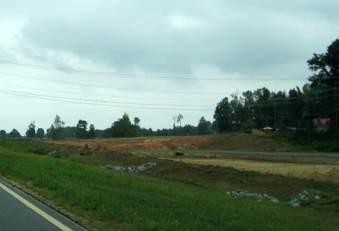
A summary of construction going from west to east:
I. The I-85/I-74 Interchange Flyover Ramp
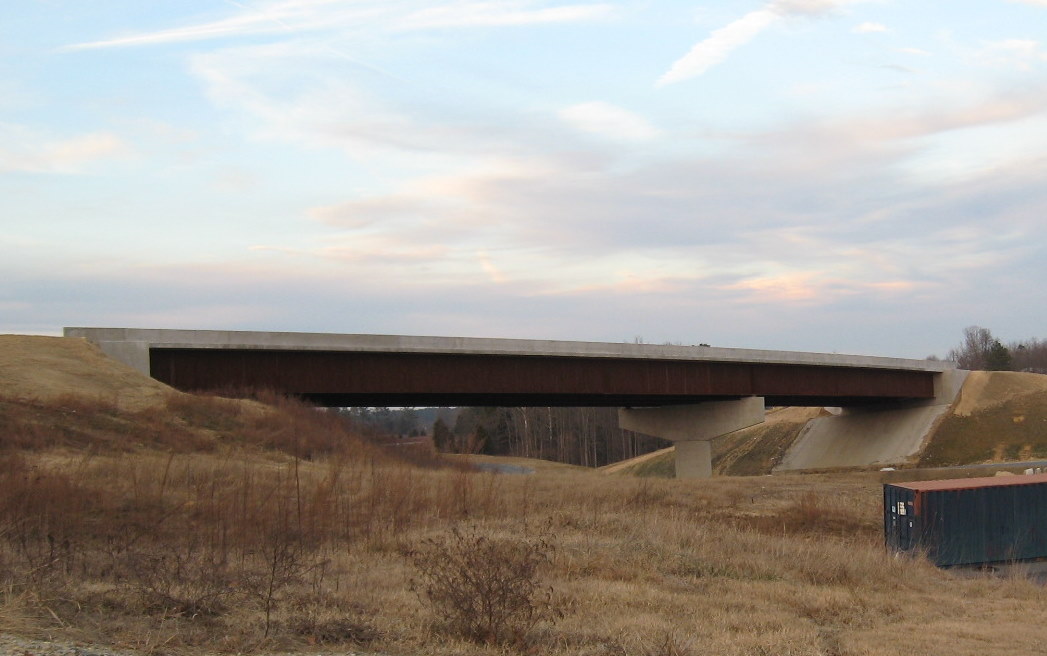
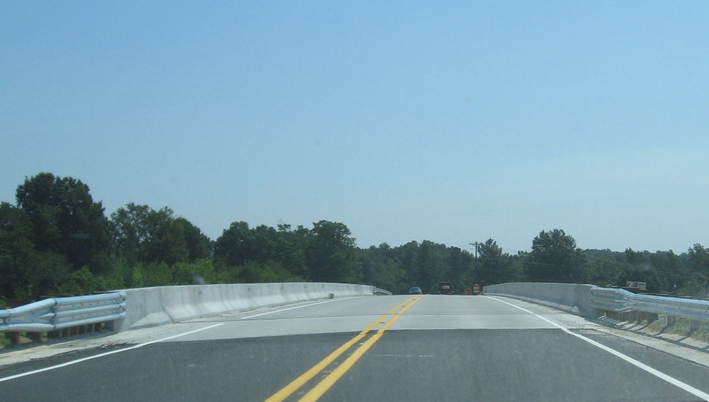
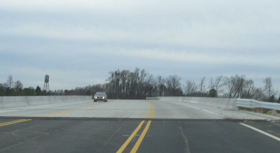
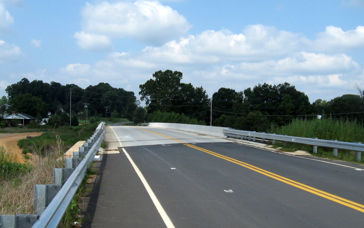
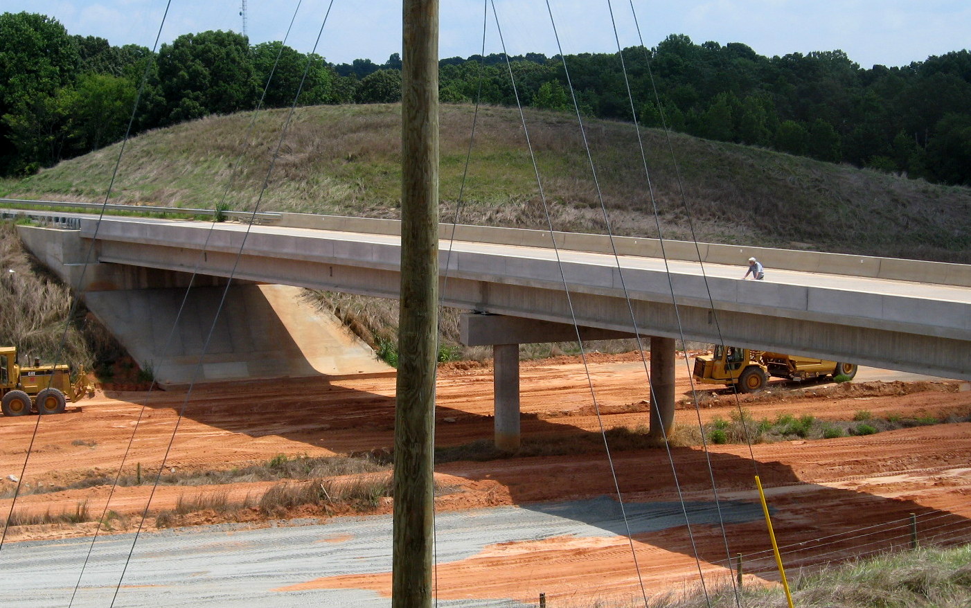
 Probable final completed
appearance of Flyover Ramp in July 2010. Note guardrails put up at
beginning of bridge. (7/25/10)
Probable final completed
appearance of Flyover Ramp in July 2010. Note guardrails put up at
beginning of bridge. (7/25/10)
 Appearance of the Flyover
Ramp in January 2010. Note the lack of a tie in from the ramp on the
left. Guardrails and asphalt needed to be applied to complete the link
to the previous bridge. An asphalt layer had been completed from the
right side of the bridge to I-85. (1/14/10)
Appearance of the Flyover
Ramp in January 2010. Note the lack of a tie in from the ramp on the
left. Guardrails and asphalt needed to be applied to complete the link
to the previous bridge. An asphalt layer had been completed from the
right side of the bridge to I-85. (1/14/10)
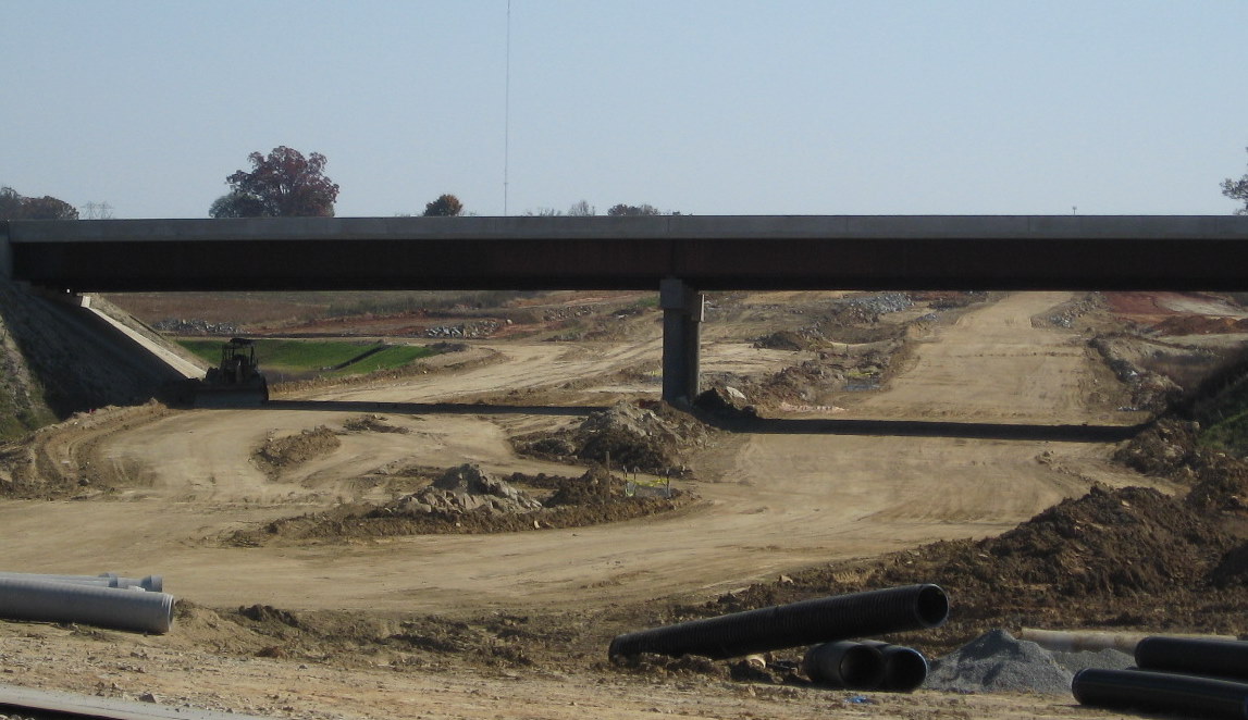
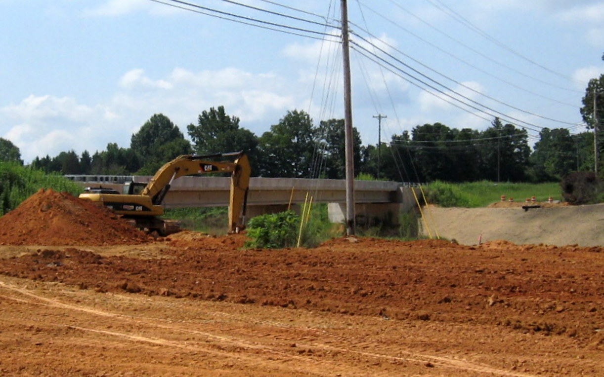
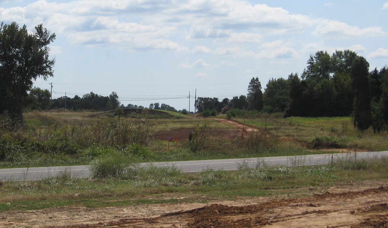
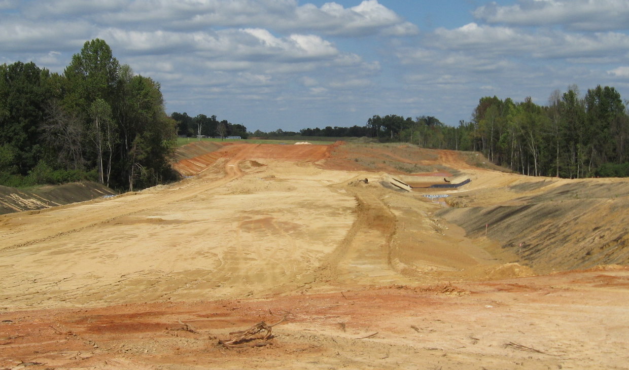
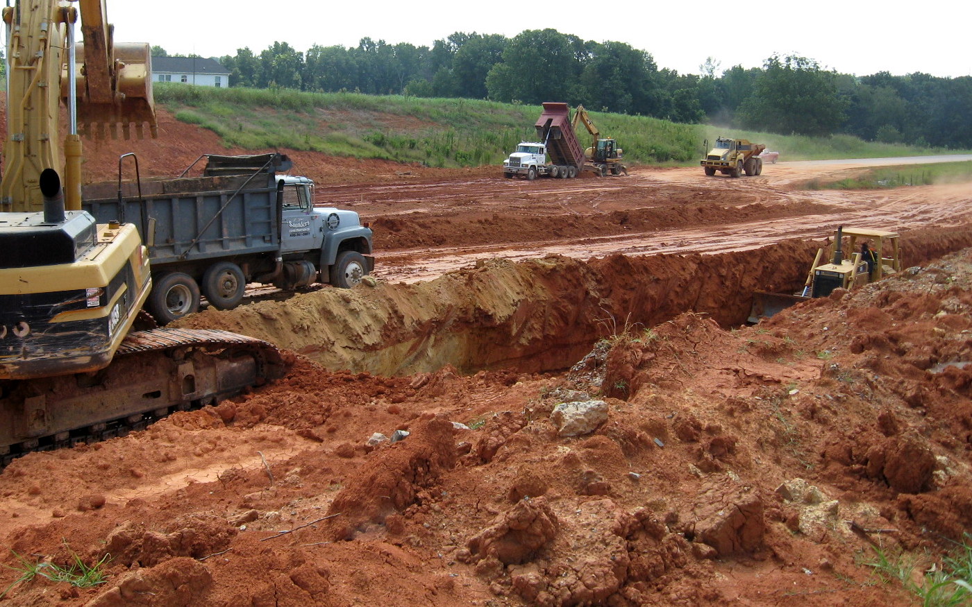
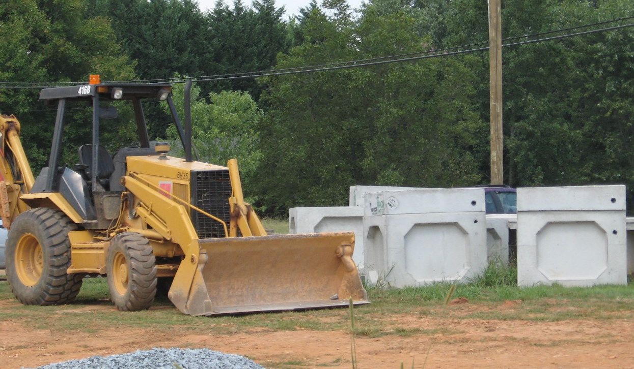
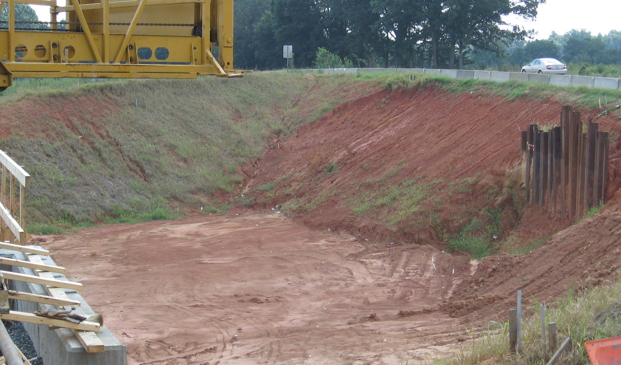
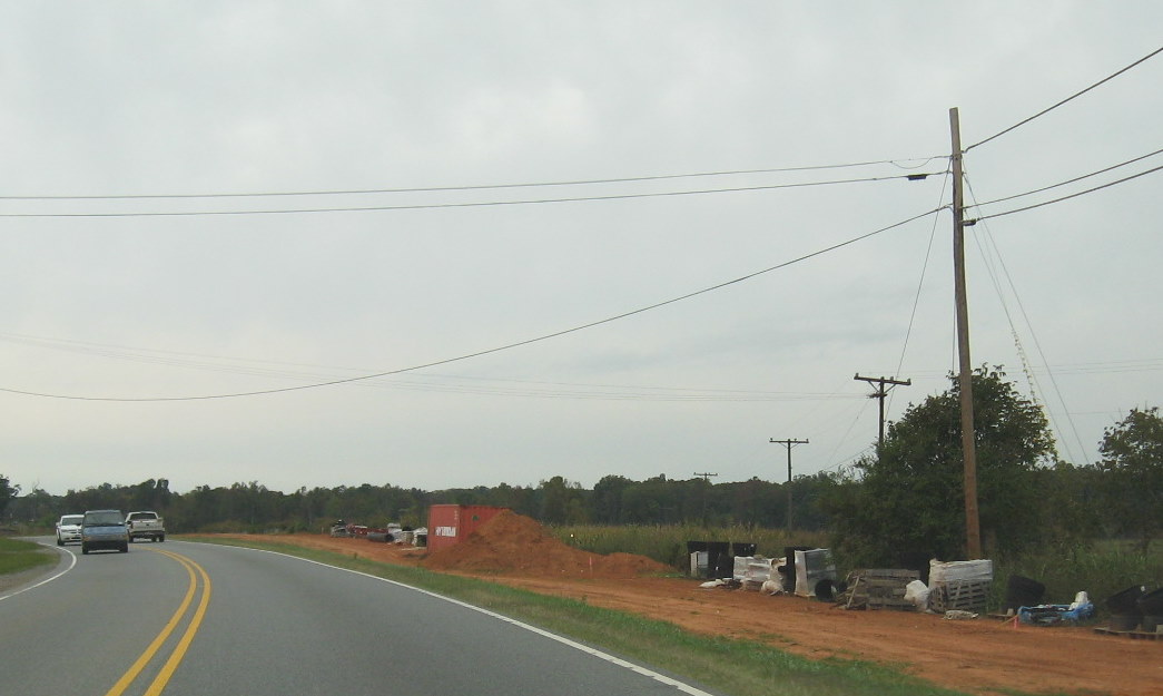
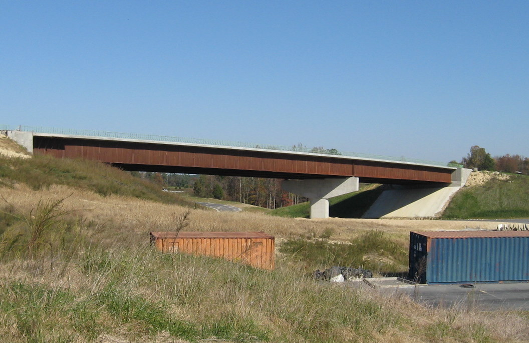 The ramp as it appeared in
November 2009, note still the need to put in concrete walls along the
bridge structure, the container units are on the future on-ramp to I-74
East. (11/8/09)
The ramp as it appeared in
November 2009, note still the need to put in concrete walls along the
bridge structure, the container units are on the future on-ramp to I-74
East. (11/8/09)
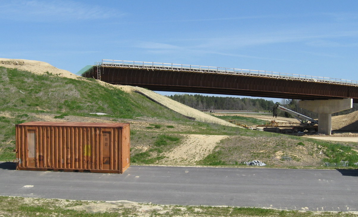
 The ramp leading to the
Flyover in November 2009, showing there has been some progress, but
there remains work needed to finish the bridge and tie it to the
approaching roadway. (11/8/09)
The ramp leading to the
Flyover in November 2009, showing there has been some progress, but
there remains work needed to finish the bridge and tie it to the
approaching roadway. (11/8/09)
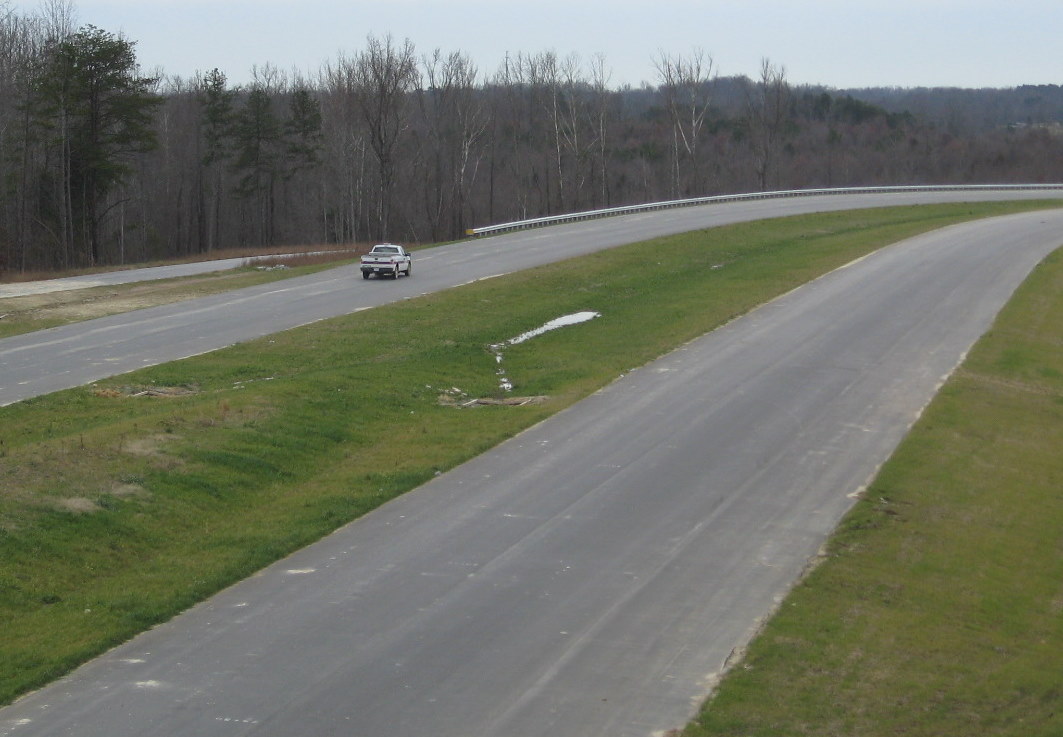
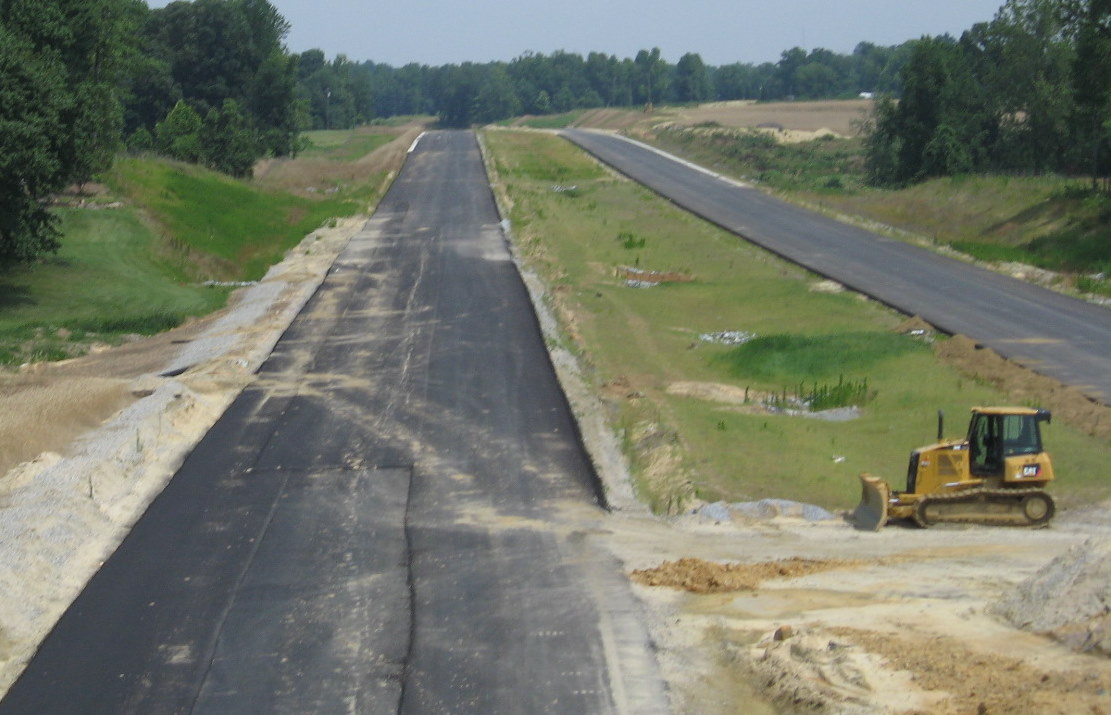
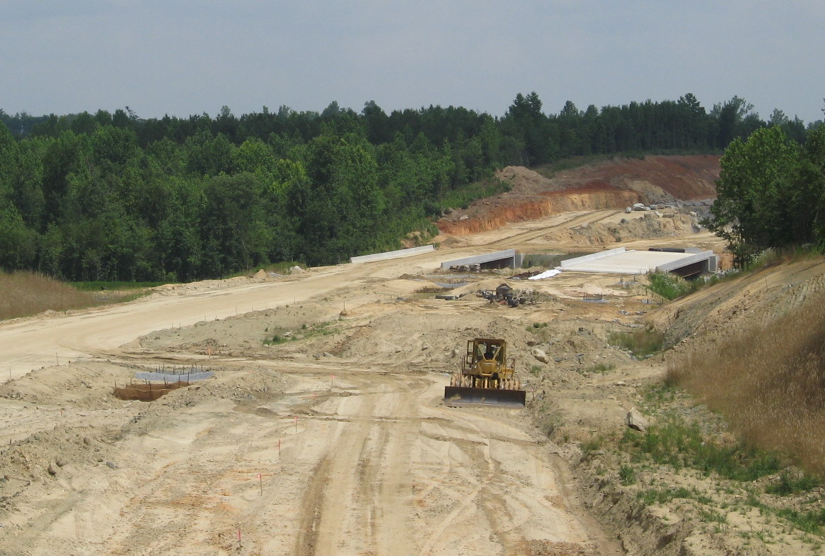
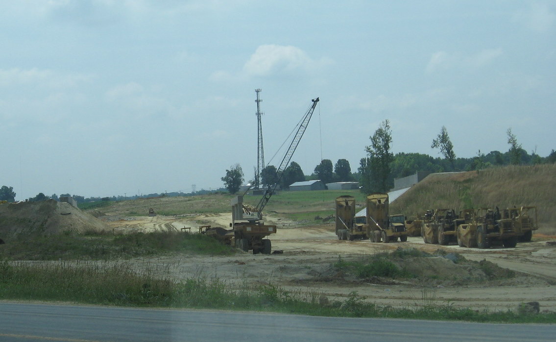
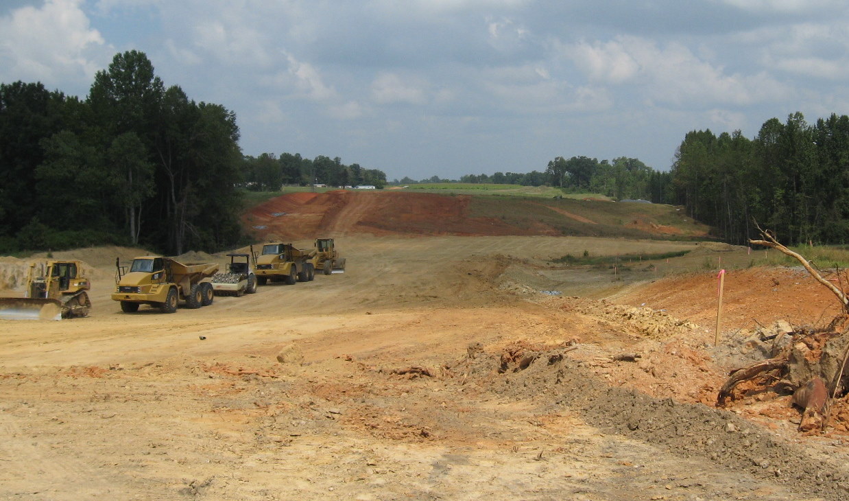
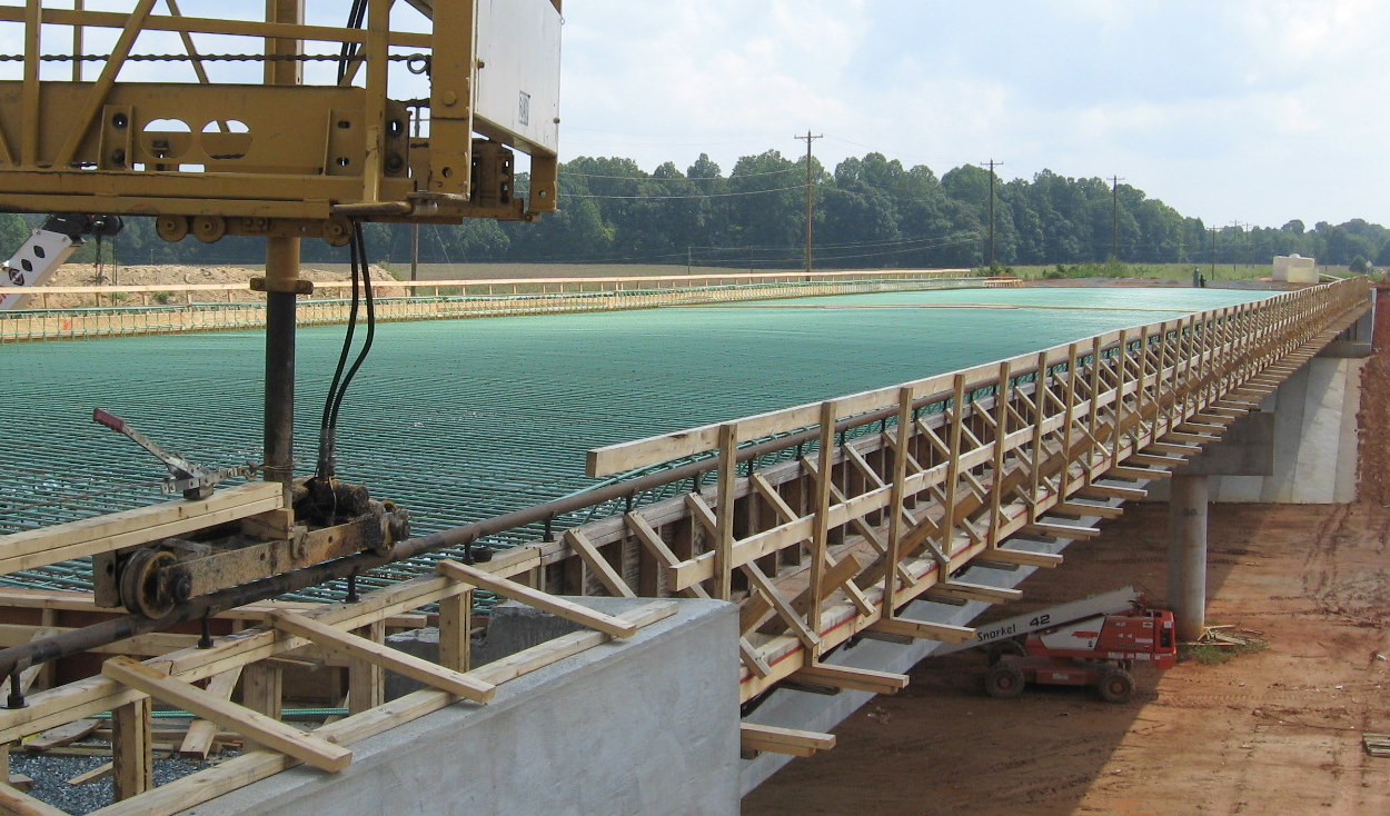
 In mid-June 2009 the
decking needed more attention, the future ramps and I-74 roadway had
received at least one coat of asphalt around the I-85 interchange.
(6/14/09)
In mid-June 2009 the
decking needed more attention, the future ramps and I-74 roadway had
received at least one coat of asphalt around the I-85 interchange.
(6/14/09)
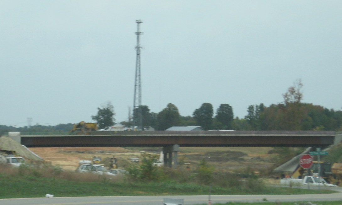
 Here's a view of what was
in place on the bridge pier in April 2009, part of the flyover ramp from
I-74 East. (4/5/09)
Here's a view of what was
in place on the bridge pier in April 2009, part of the flyover ramp from
I-74 East. (4/5/09)
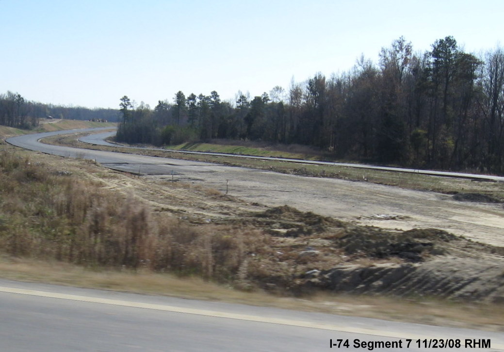
 View of the same bridge
structure about five months earlier, not much progress here, though the
bridge piers in the background appear to be near completion. (11/23/08)
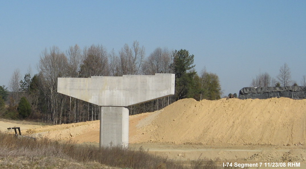
View of the same bridge
structure about five months earlier, not much progress here, though the
bridge piers in the background appear to be near completion. (11/23/08)
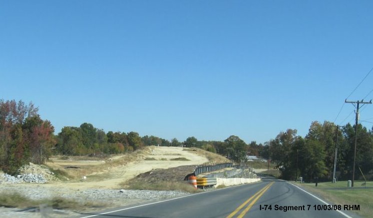
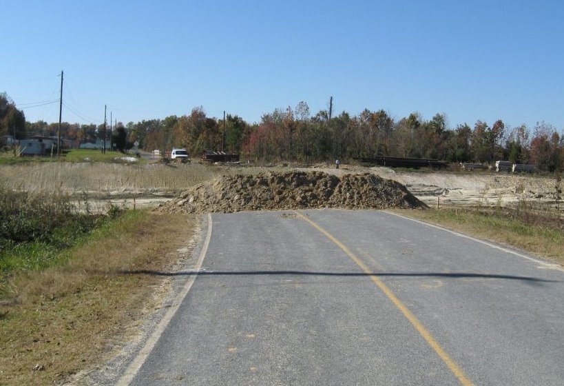
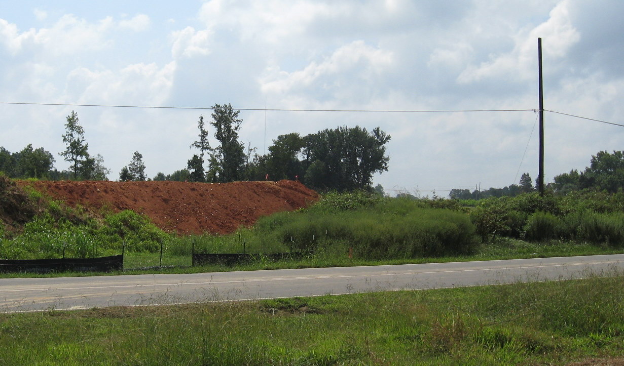
 A completed bridge pier can be
seen in the distance, from the now split Checker Road, now renamed
Modlin Grove Road, due to I-74 construction, in early 2008. (2/23/08)
A completed bridge pier can be
seen in the distance, from the now split Checker Road, now renamed
Modlin Grove Road, due to I-74 construction, in early 2008. (2/23/08)
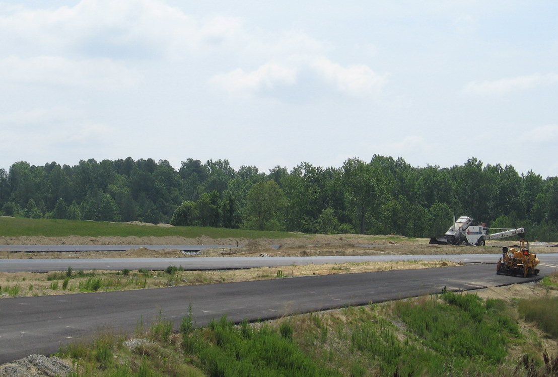
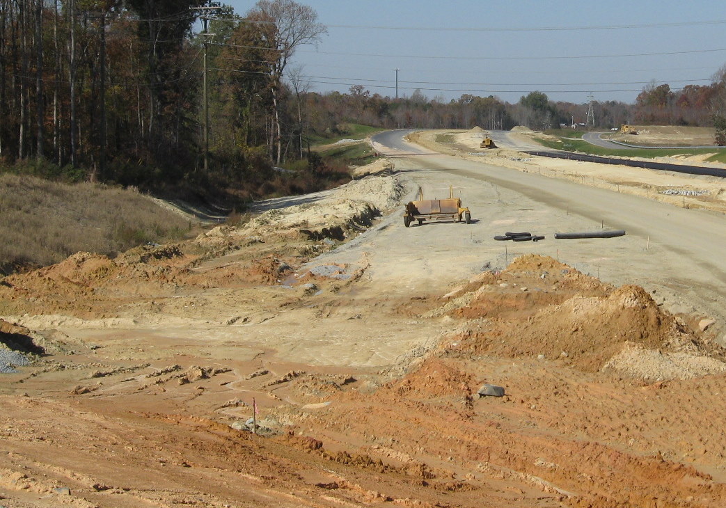
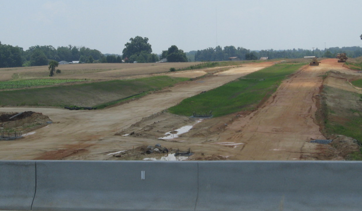
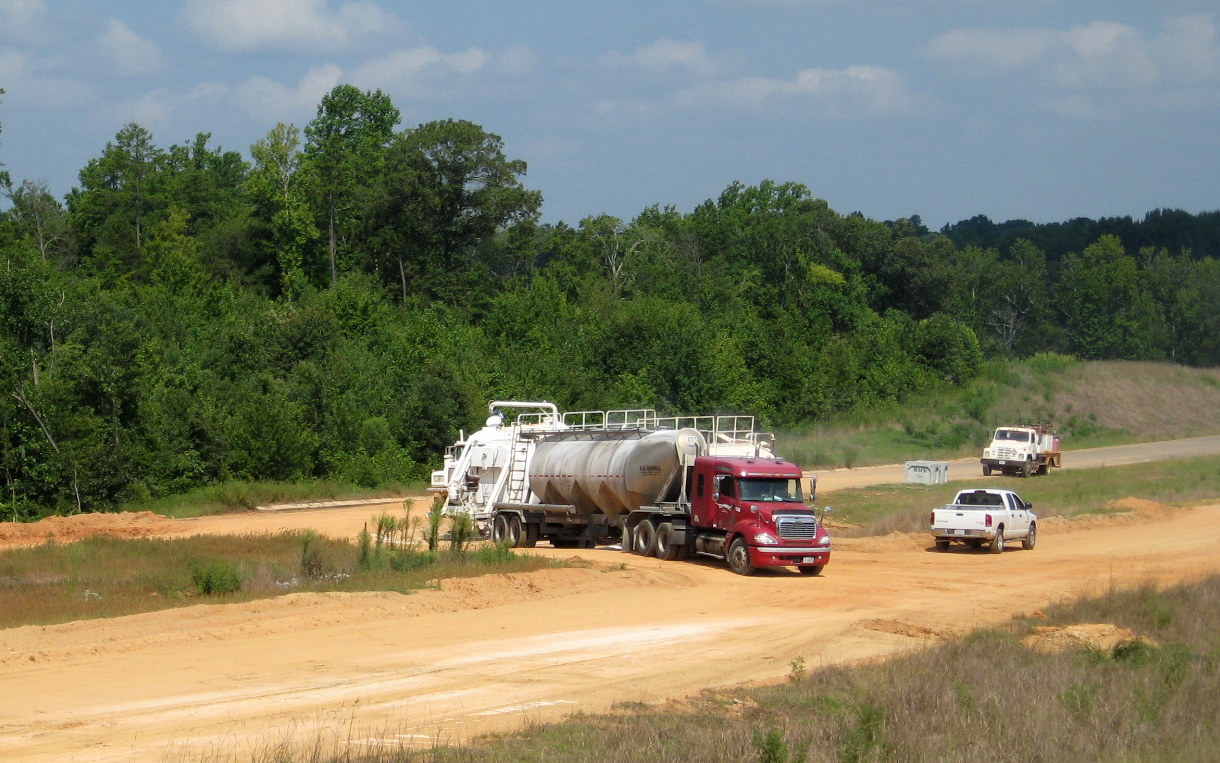
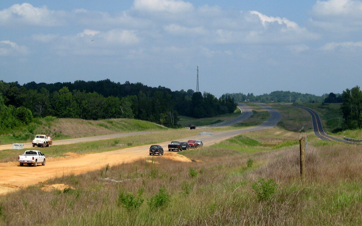
 A look further to the east
shows a contractor truck (in yellow) using the I-85 North off-ramp from
I-74 which has been paved to where it merges with the ramp from the
flyover ramp. (1/14/10)
A look further to the east
shows a contractor truck (in yellow) using the I-85 North off-ramp from
I-74 which has been paved to where it merges with the ramp from the
flyover ramp. (1/14/10)
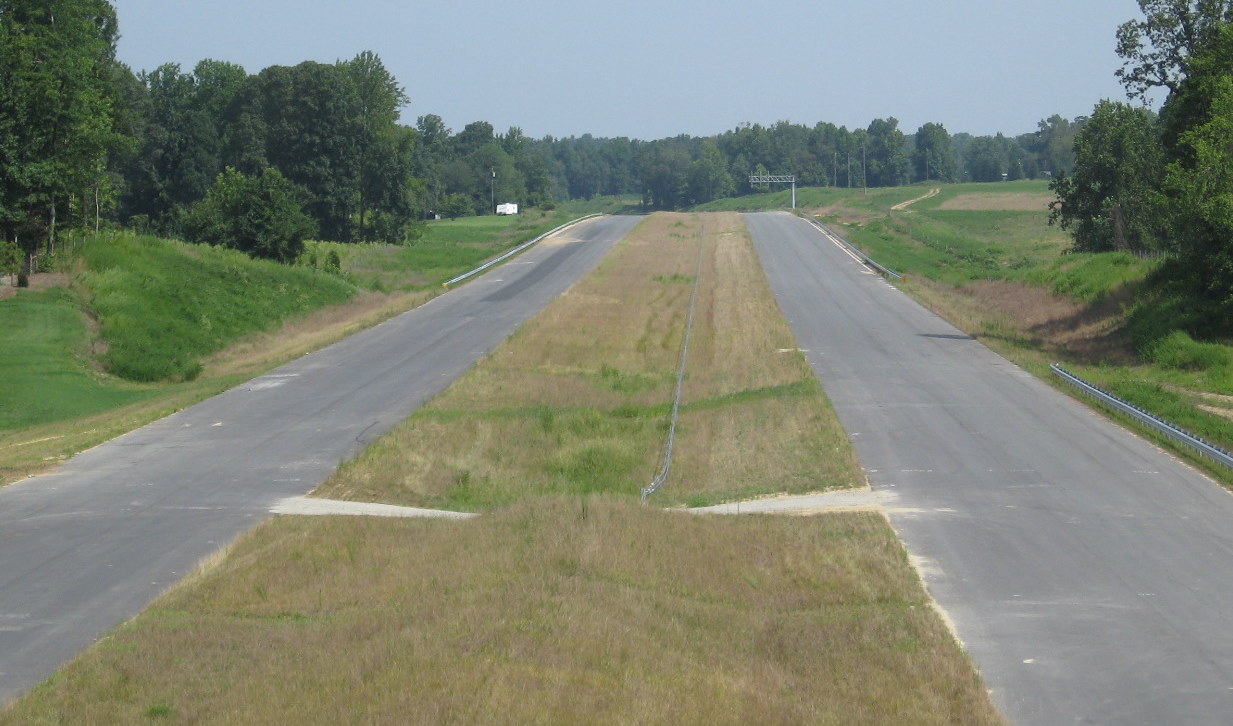
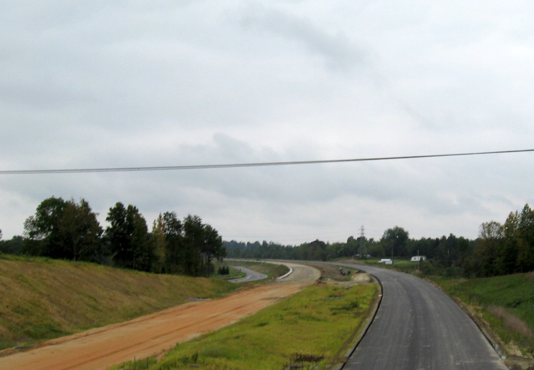
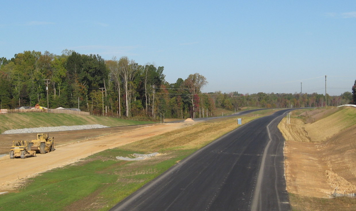
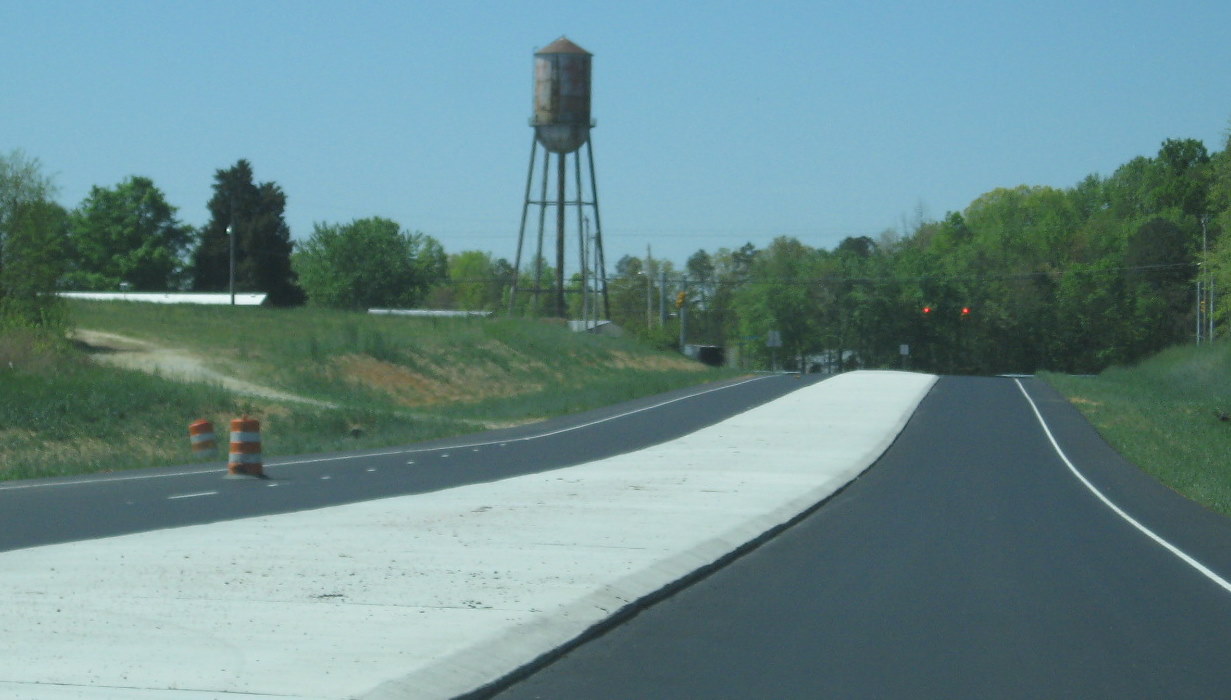
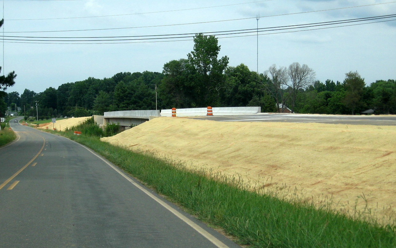
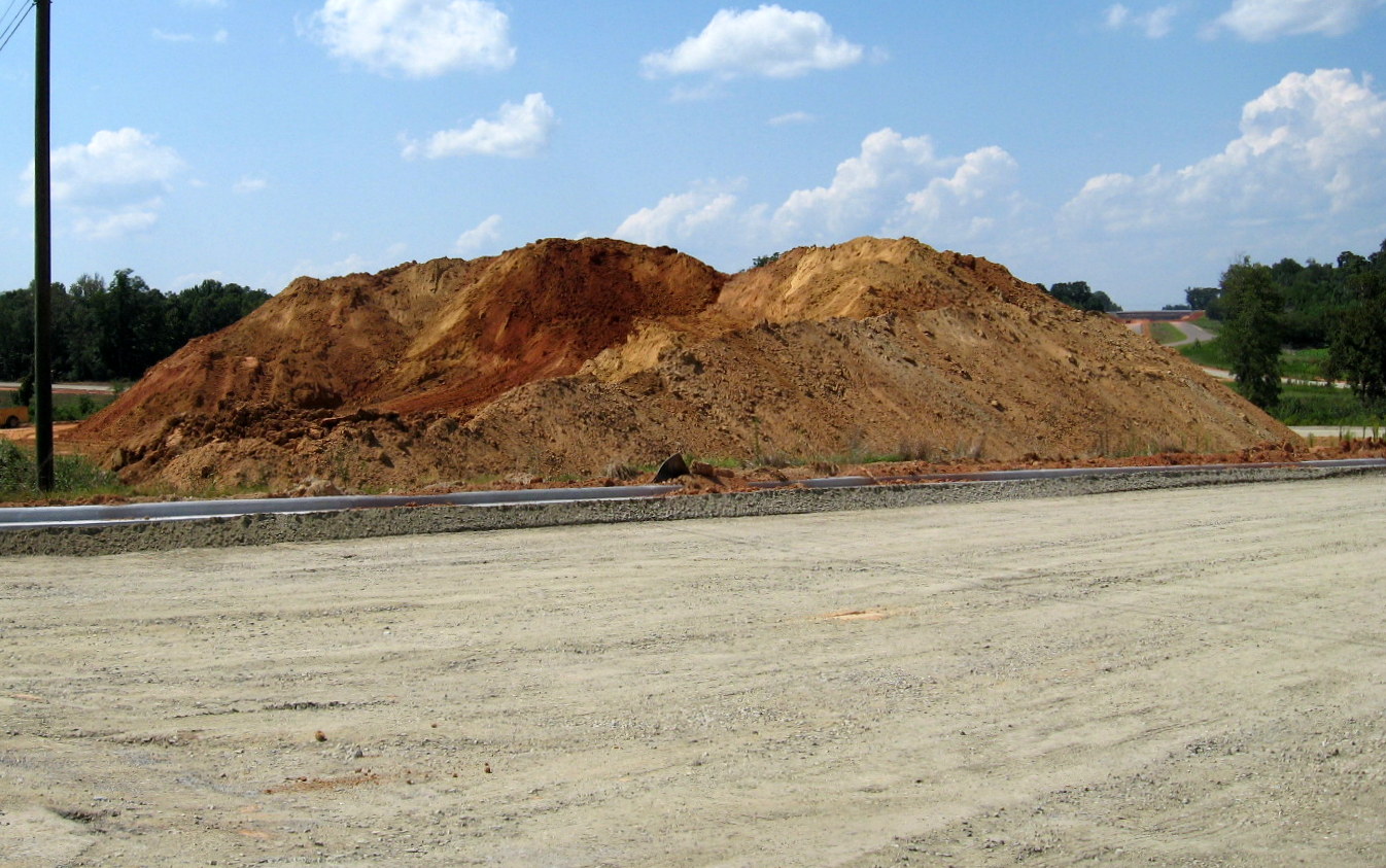
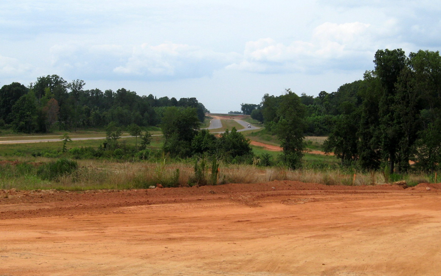
 Progress in landscaping is
seen from this photo looking east of I-85 in April 2010, compare this to
the photo below from 6 months earlier (Mother Nature has helped some).
(4/11/10)
Progress in landscaping is
seen from this photo looking east of I-85 in April 2010, compare this to
the photo below from 6 months earlier (Mother Nature has helped some).
(4/11/10)
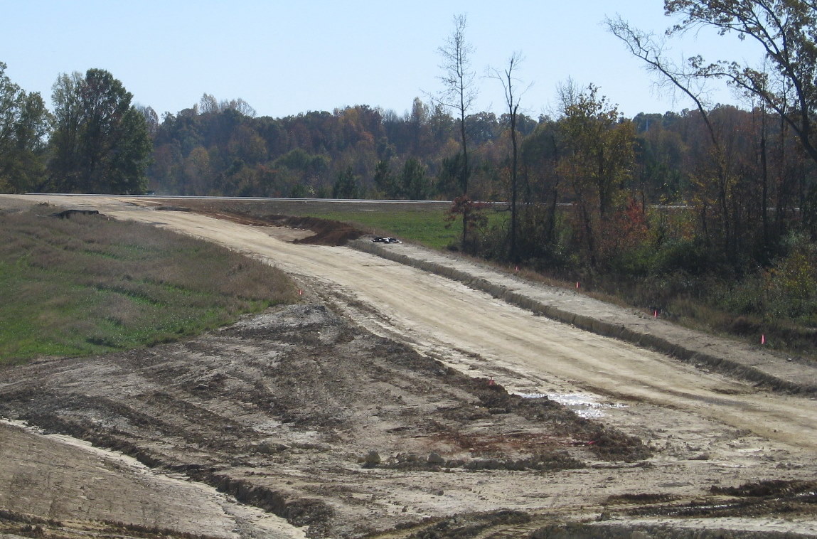
 View of the I-74 roadbed east of
the I-85 interchange showing progress, including the placement of some
guardrail along the westbound roadway and the completed grading of this
section heading toward the NC 62 bridge. (11/8/09)
View of the I-74 roadbed east of
the I-85 interchange showing progress, including the placement of some
guardrail along the westbound roadway and the completed grading of this
section heading toward the NC 62 bridge. (11/8/09)
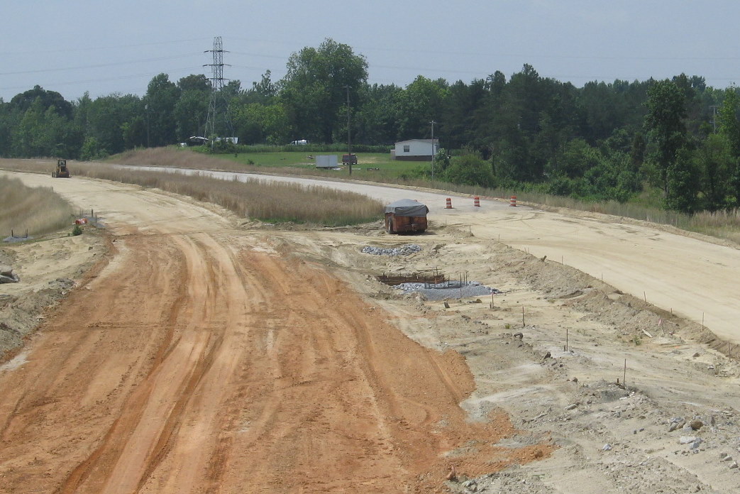
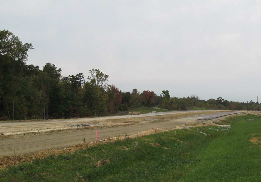
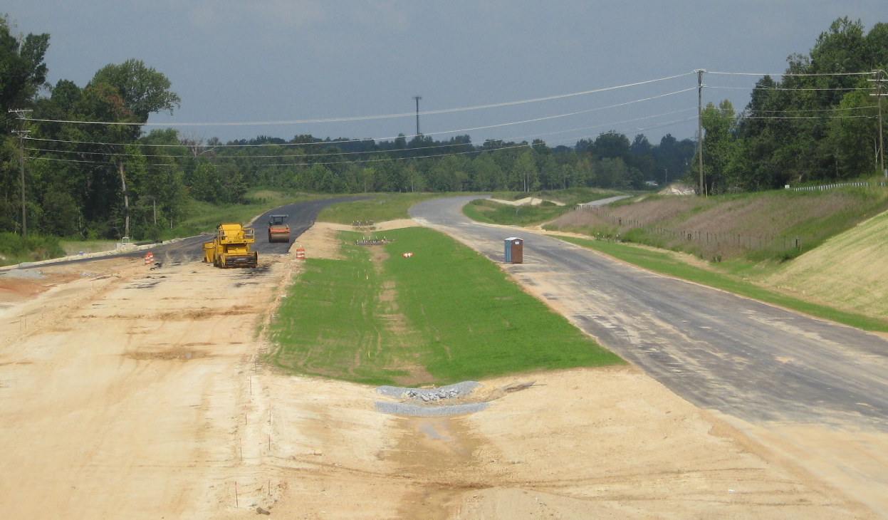
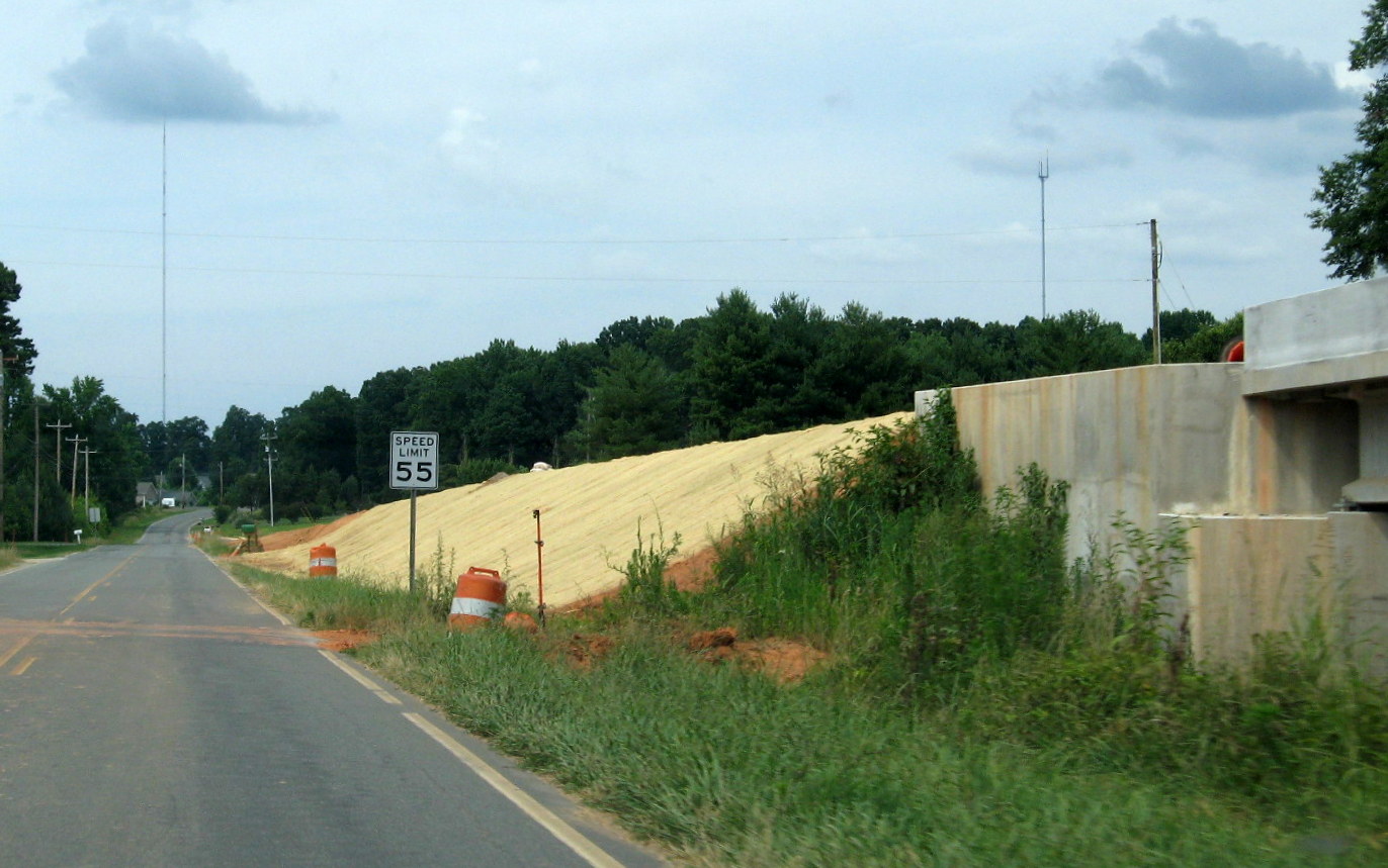
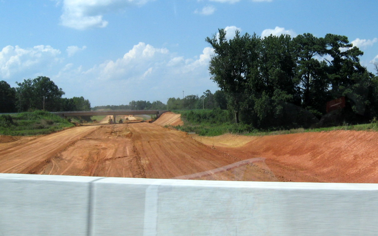
 The view of progress in
constructing this section is shown from looking at the photo below from
early 2008. (6/14/09)
The view of progress in
constructing this section is shown from looking at the photo below from
early 2008. (6/14/09)
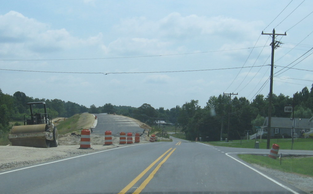
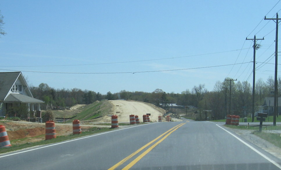
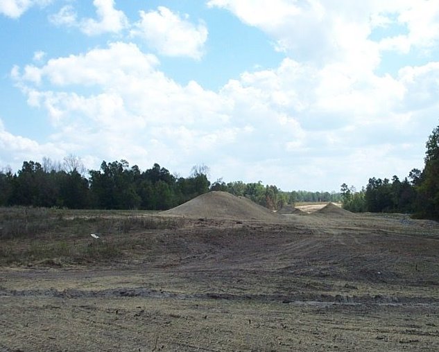
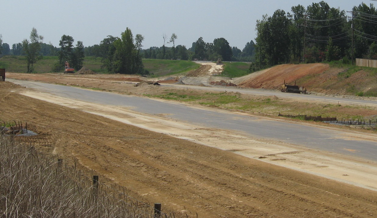
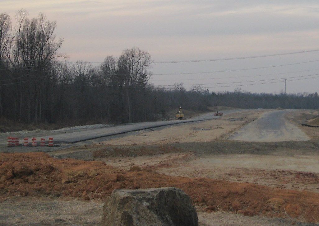
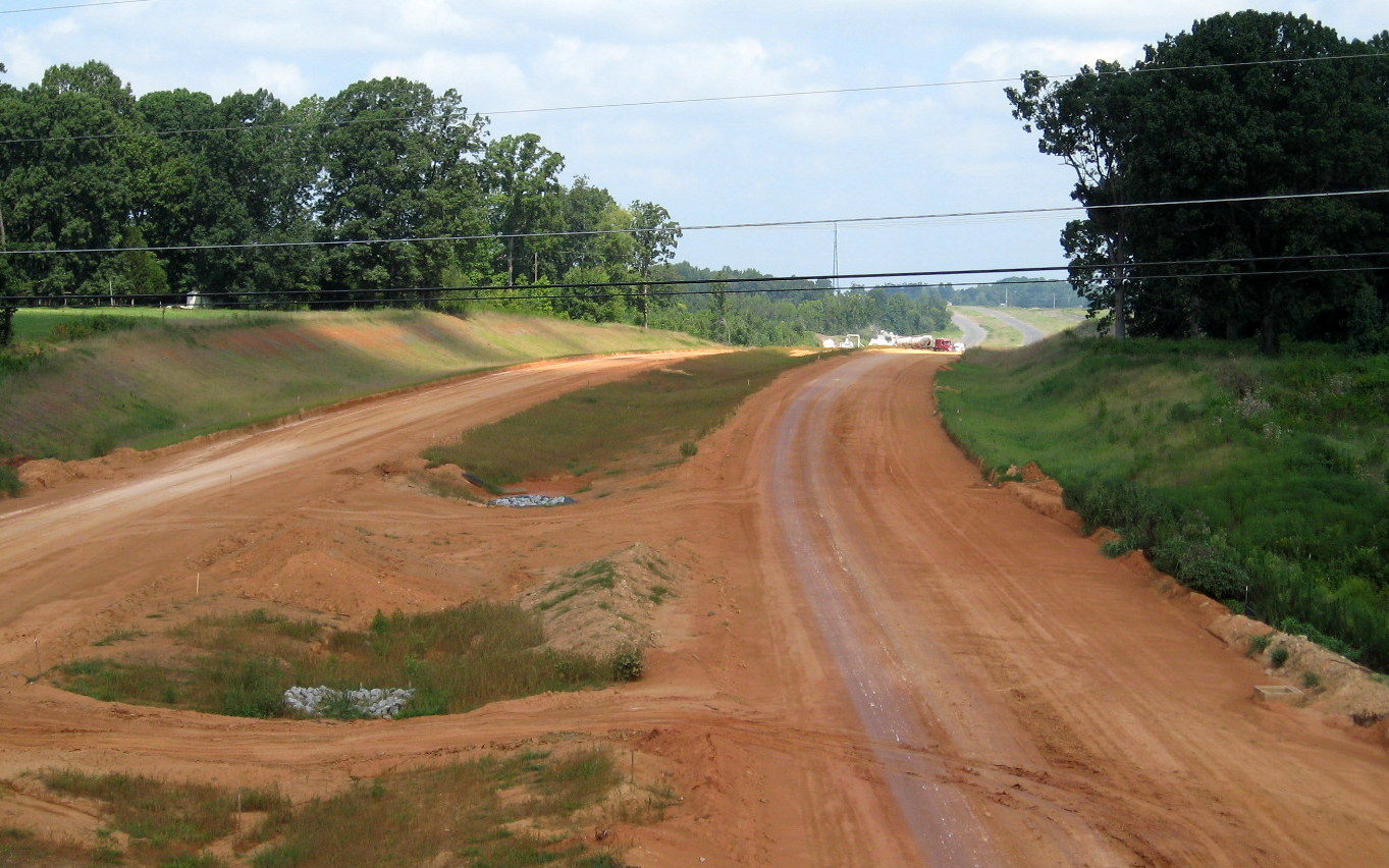
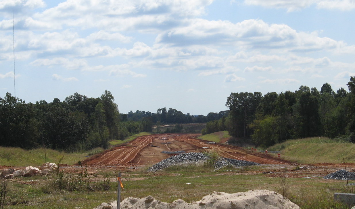
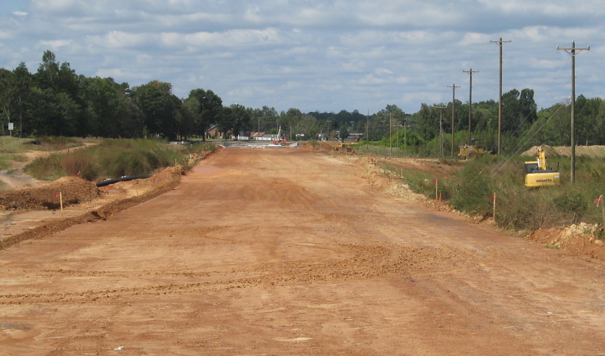
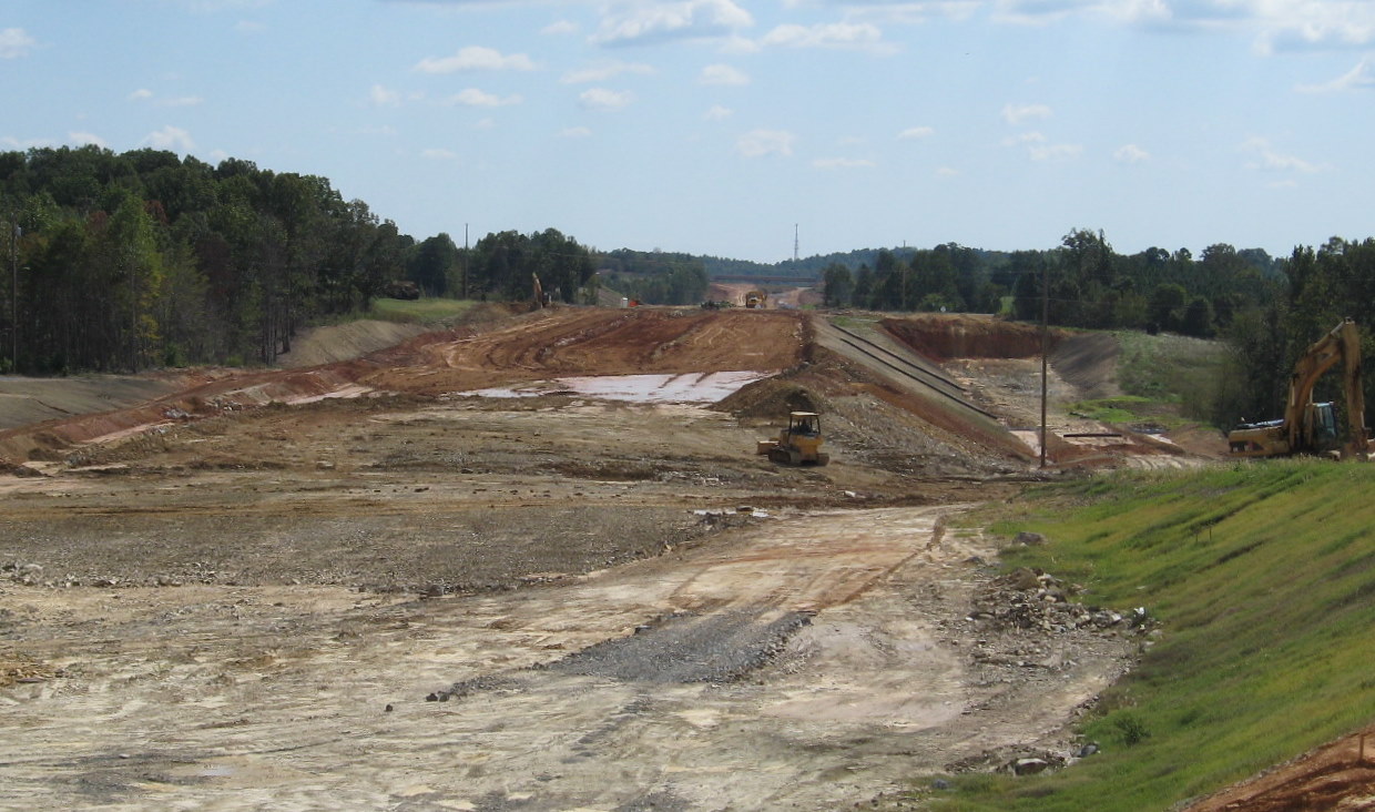
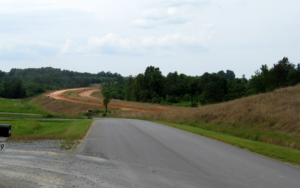
 Road grading was just
starting east of I-85 and west of NC 62 back in Feb. 2008. Taken just
after the split of then Checker Road. (2/23/08)
Road grading was just
starting east of I-85 and west of NC 62 back in Feb. 2008. Taken just
after the split of then Checker Road. (2/23/08)
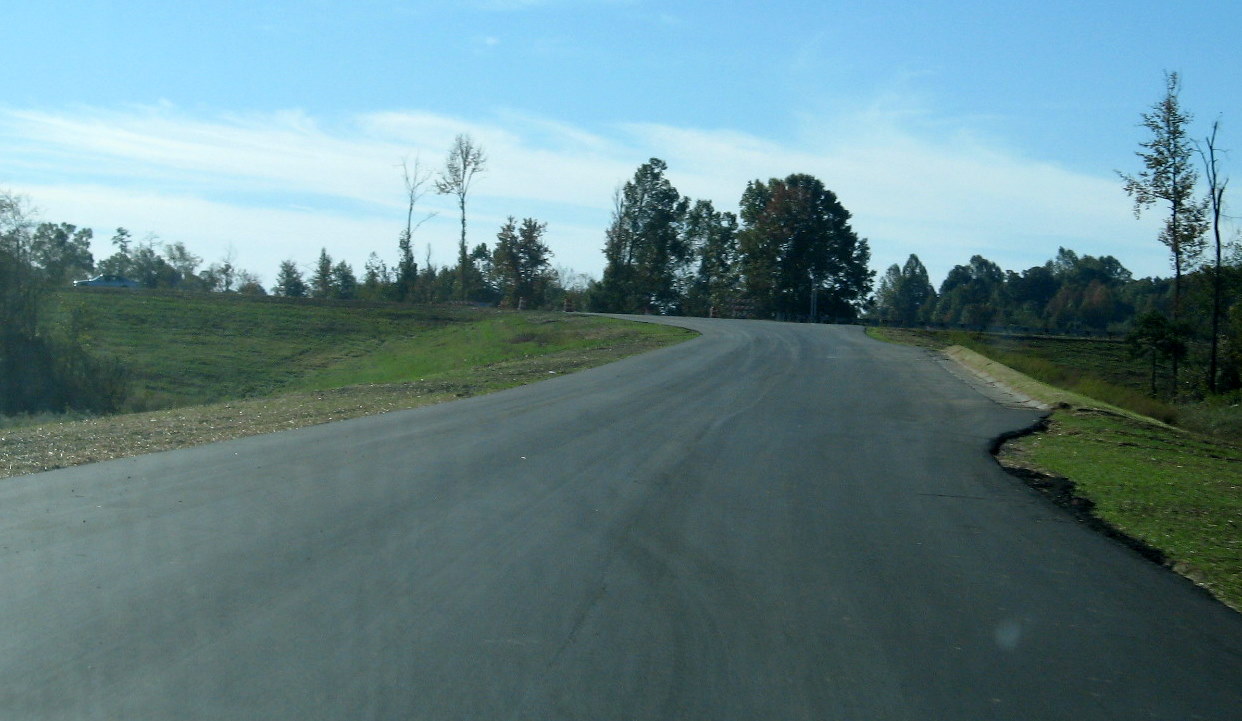
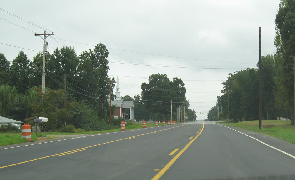
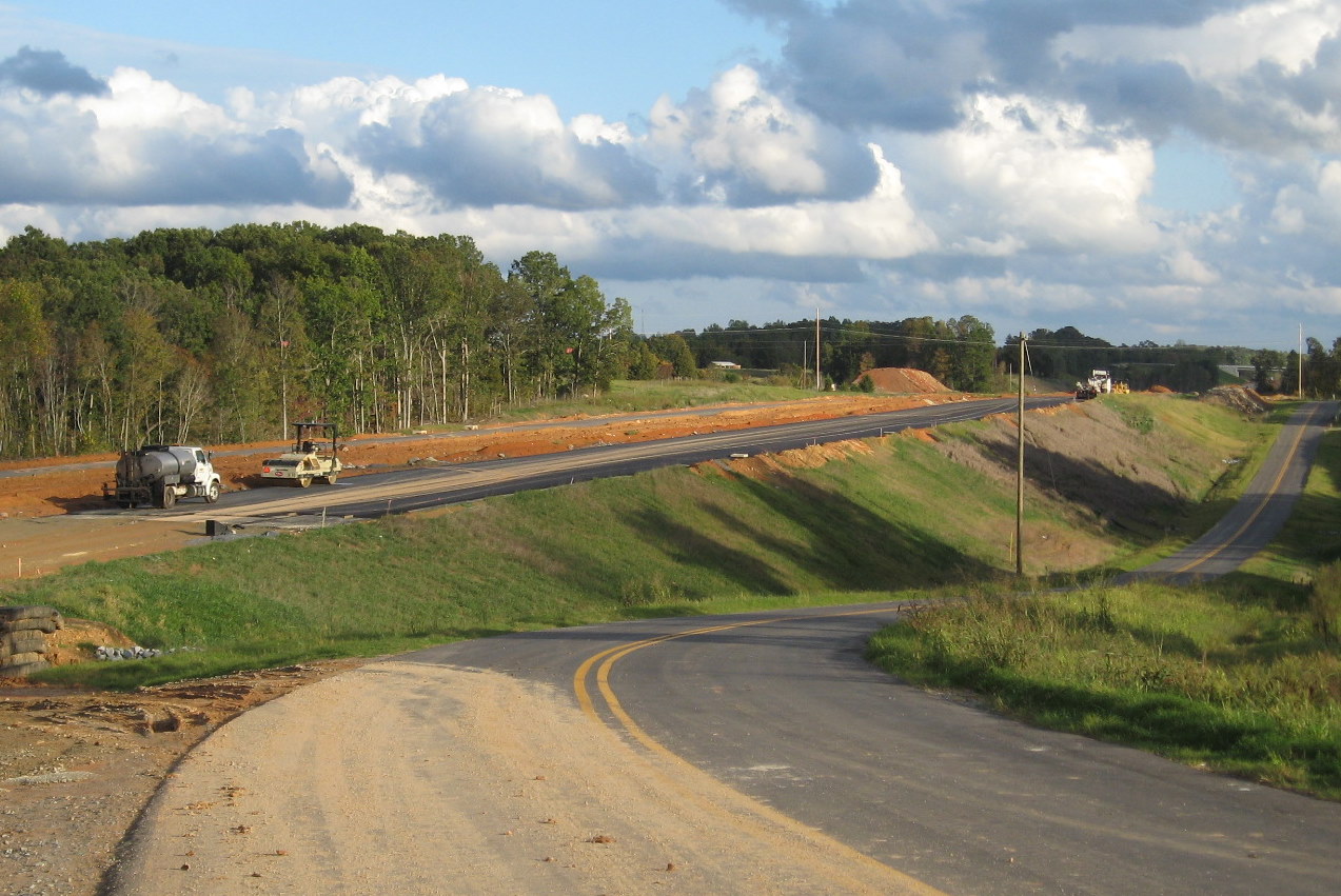
 Here's the view
approaching the construction area on I-85 North, lanes had been
restricted in the area from 3 to 2, for I-74 construction a month
earlier (September 2007).
Here's the view
approaching the construction area on I-85 North, lanes had been
restricted in the area from 3 to 2, for I-74 construction a month
earlier (September 2007).
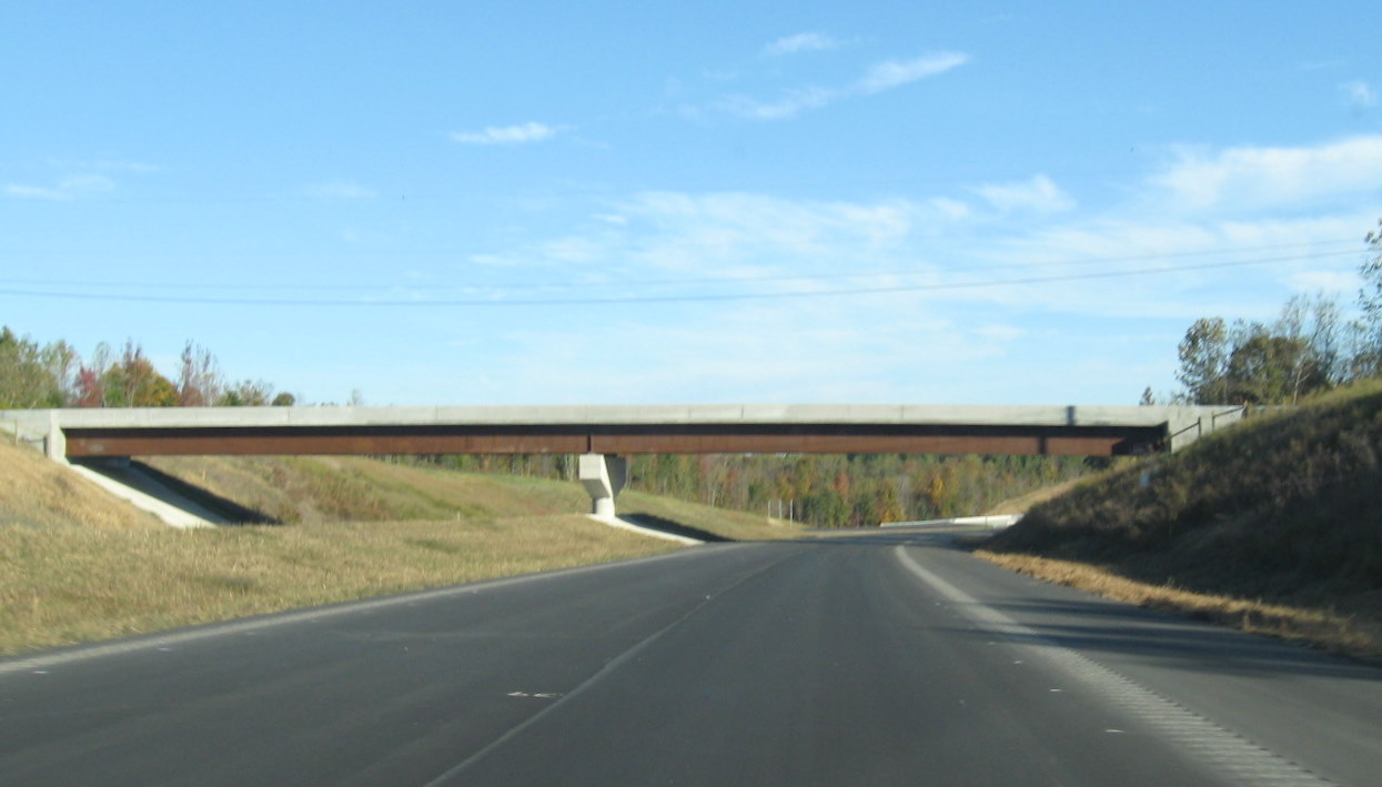
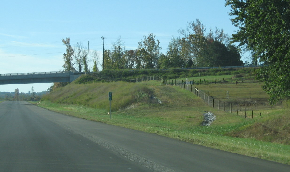
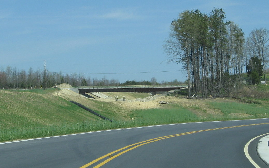
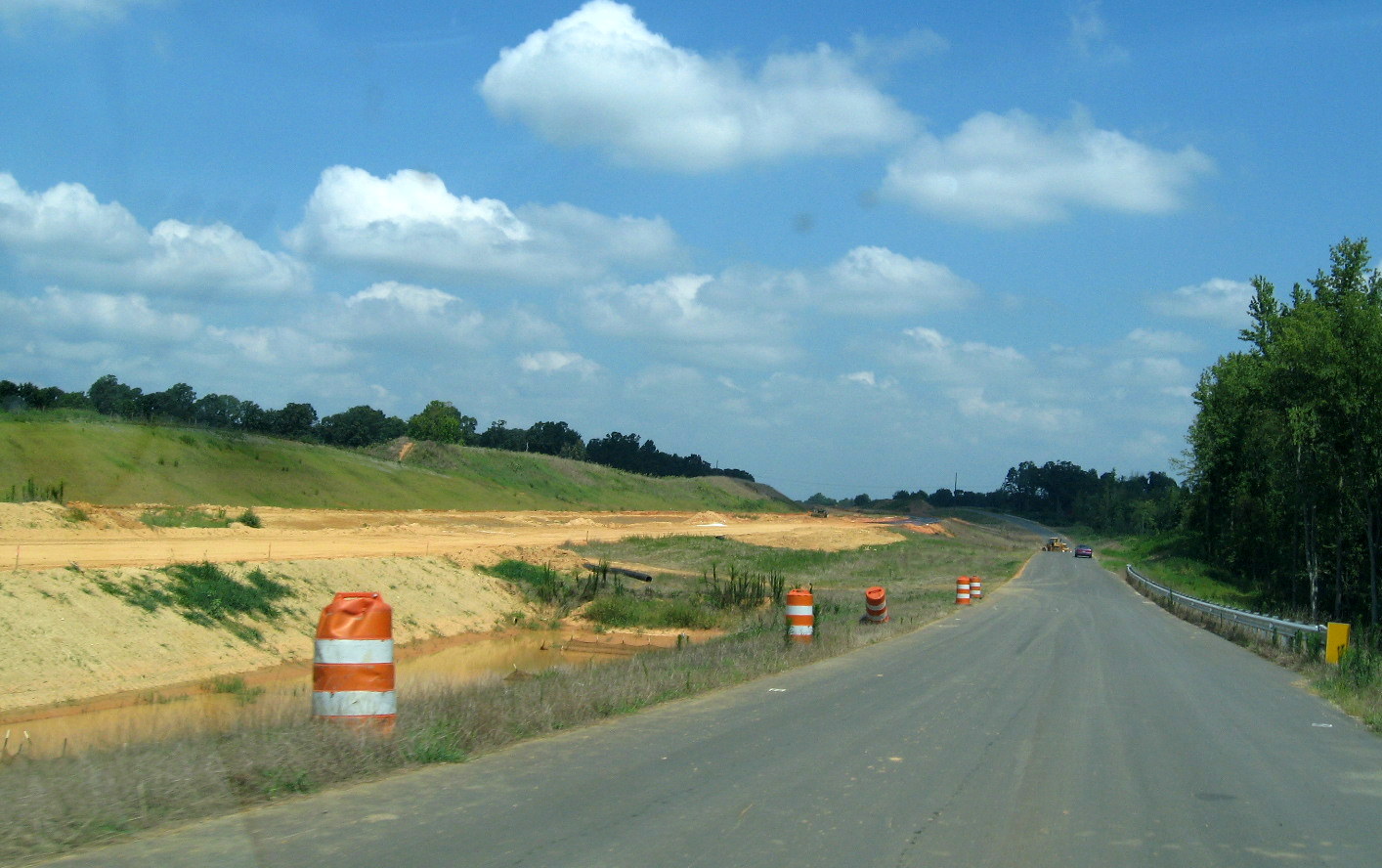
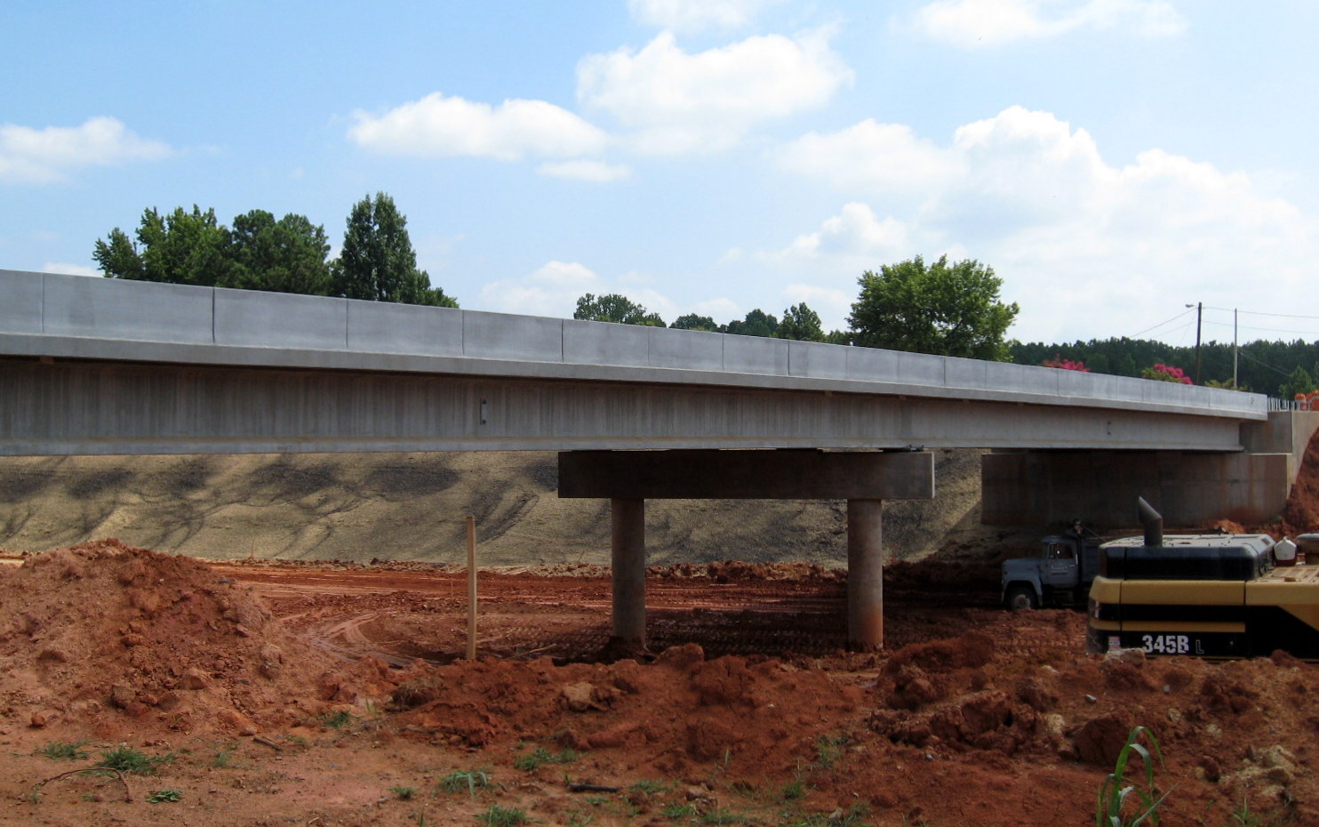
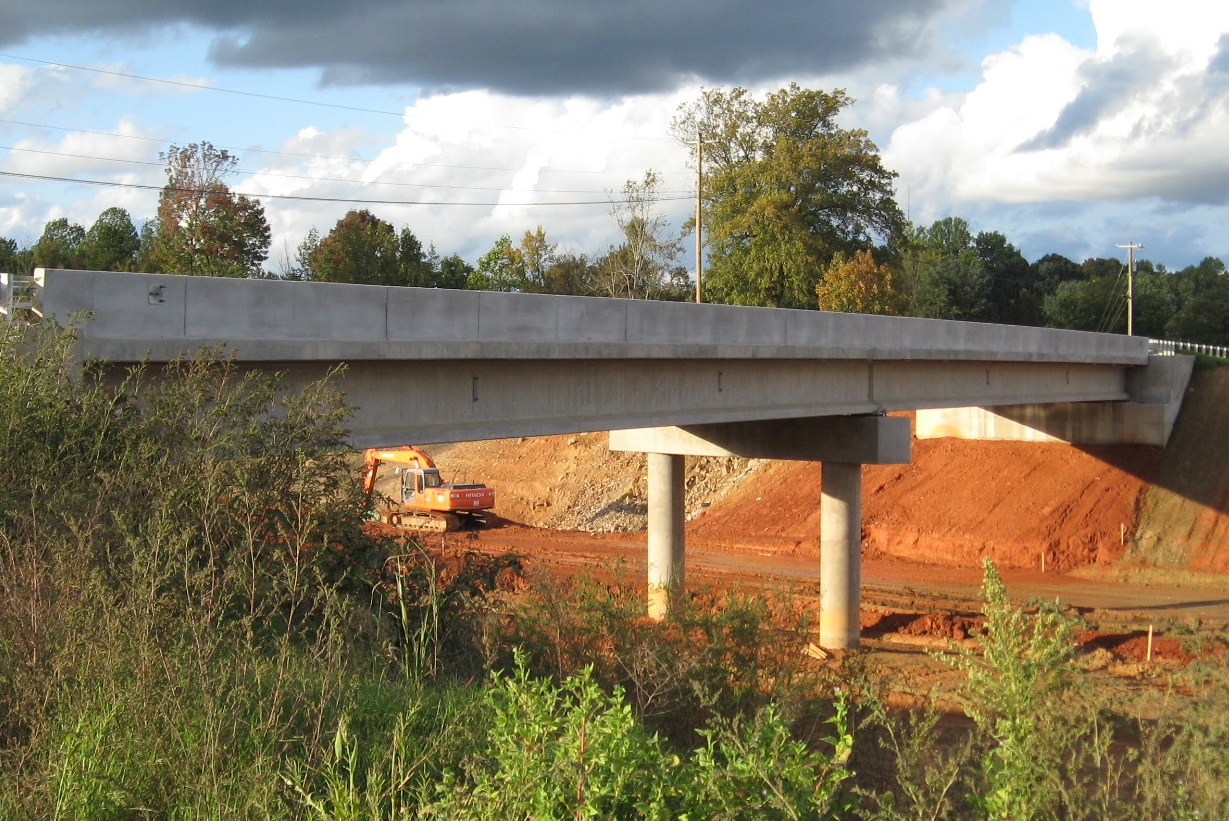
The NC 62 bridge over I-74/US 311 to the east of the I-85 interchange was largely completed in 2009 with the decking completed by February. The only remaining project was to cut down the approaches to the bridge to match the existing NC 62 roadway. This had been largely completed by June. The bridge was opened to traffic in July 2009.
 View of final stages of
landscaping for the bridge occurring in June 2010. (6/20/10)
View of final stages of
landscaping for the bridge occurring in June 2010. (6/20/10)
 Driving over the open NC 62
bridge in July 2009. Some work remained, as seen by the orange barrels
in the distance. (7/26/09)
Driving over the open NC 62
bridge in July 2009. Some work remained, as seen by the orange barrels
in the distance. (7/26/09)
 NC
62 Bridge at left showing what remained to be done to tie the new bridge
approach to existing roadway in June 2009. (6/14/09)
NC
62 Bridge at left showing what remained to be done to tie the new bridge
approach to existing roadway in June 2009. (6/14/09)
 The view
of the bridge heading east as of April 2009, at that time only grading
has been mostly completed, road realignment and paving were still
needed. (4/5/09)
The view
of the bridge heading east as of April 2009, at that time only grading
has been mostly completed, road realignment and paving were still
needed. (4/5/09)
 Compare progress to the
way the bridge appeared in October 2008, only the metal bridge supports
had been placed. (10/31/08)
Compare progress to the
way the bridge appeared in October 2008, only the metal bridge supports
had been placed. (10/31/08)
 View now
looking the other direction on NC 62 toward the bridge in January 2010,
when construction in this area was near completion. (1/28/10)
View now
looking the other direction on NC 62 toward the bridge in January 2010,
when construction in this area was near completion. (1/28/10)
 About 5 months earlier,
the orange barrels are protecting the growing grass surface on either
side of NC 62 after the new bridge was open. (7/26/09)
About 5 months earlier,
the orange barrels are protecting the growing grass surface on either
side of NC 62 after the new bridge was open. (7/26/09)
 The view of the
grading and bridge looking west in April 2009, NC 62 crosses a roadway
here, the intersection was moved back to accommodate the new alignment.
(4/5/09)
The view of the
grading and bridge looking west in April 2009, NC 62 crosses a roadway
here, the intersection was moved back to accommodate the new alignment.
(4/5/09)
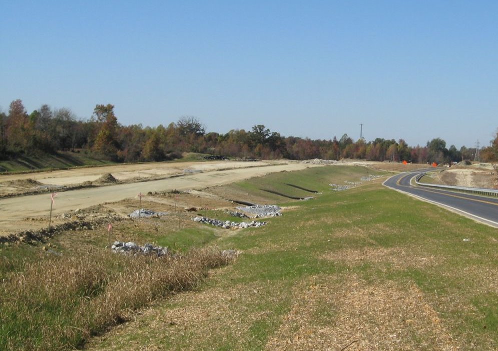
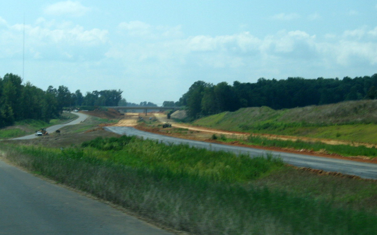
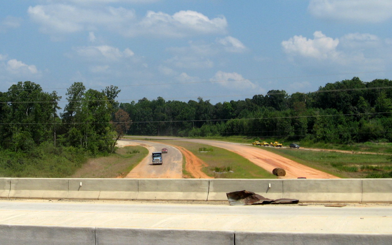
 View from the NC 62 Bridge
looking South/East in June 2010. It appeared most paving and landscaping
had been completed from here to the Tuttle Road Bridge, lack of change
in view a month later tends to confirm this view. (6/20/10)
View from the NC 62 Bridge
looking South/East in June 2010. It appeared most paving and landscaping
had been completed from here to the Tuttle Road Bridge, lack of change
in view a month later tends to confirm this view. (6/20/10)
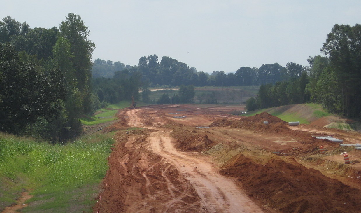
 This view is from
November 2008 showing the roadbed had received its first coat of asphalt
heading east, but it didn't go too far around the corner based on the
photos below. (11/23/08)
This view is from
November 2008 showing the roadbed had received its first coat of asphalt
heading east, but it didn't go too far around the corner based on the
photos below. (11/23/08)
 Here's a view to the
opposite side of the bridge showing the progress of land clearing a
couple miles east of NC 62 in the Fall of 2007. (September 2007)
Here's a view to the
opposite side of the bridge showing the progress of land clearing a
couple miles east of NC 62 in the Fall of 2007. (September 2007)
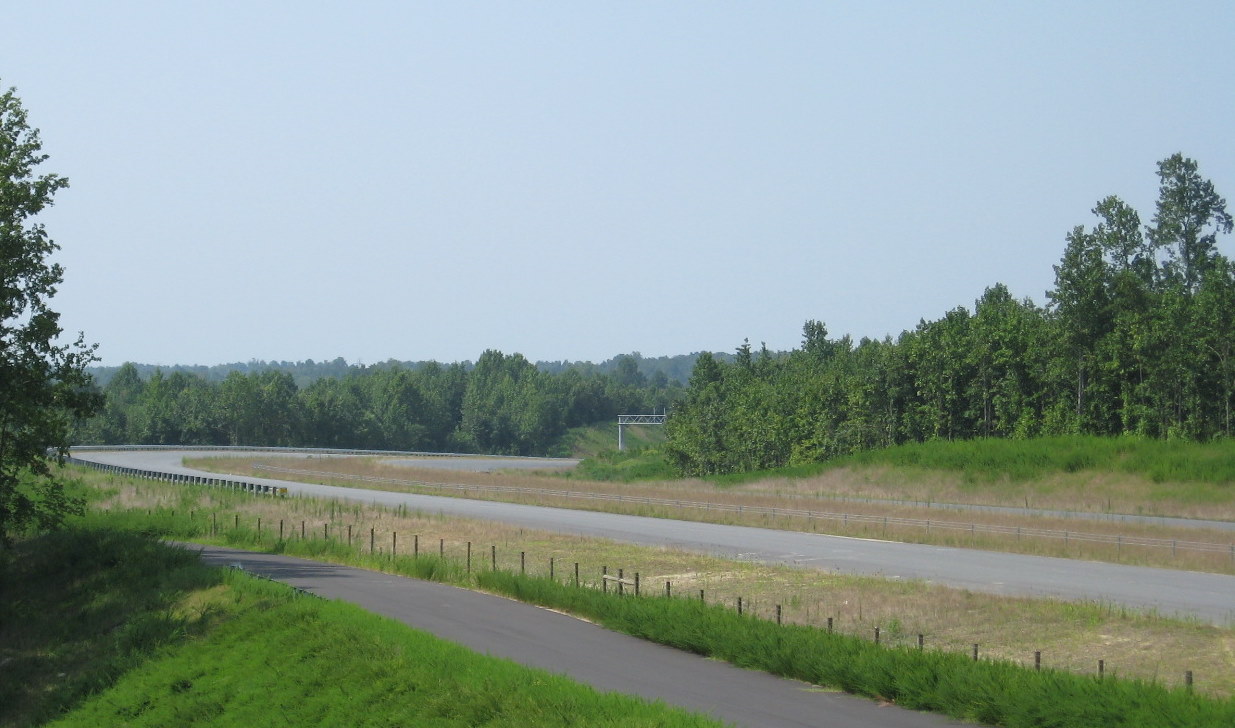
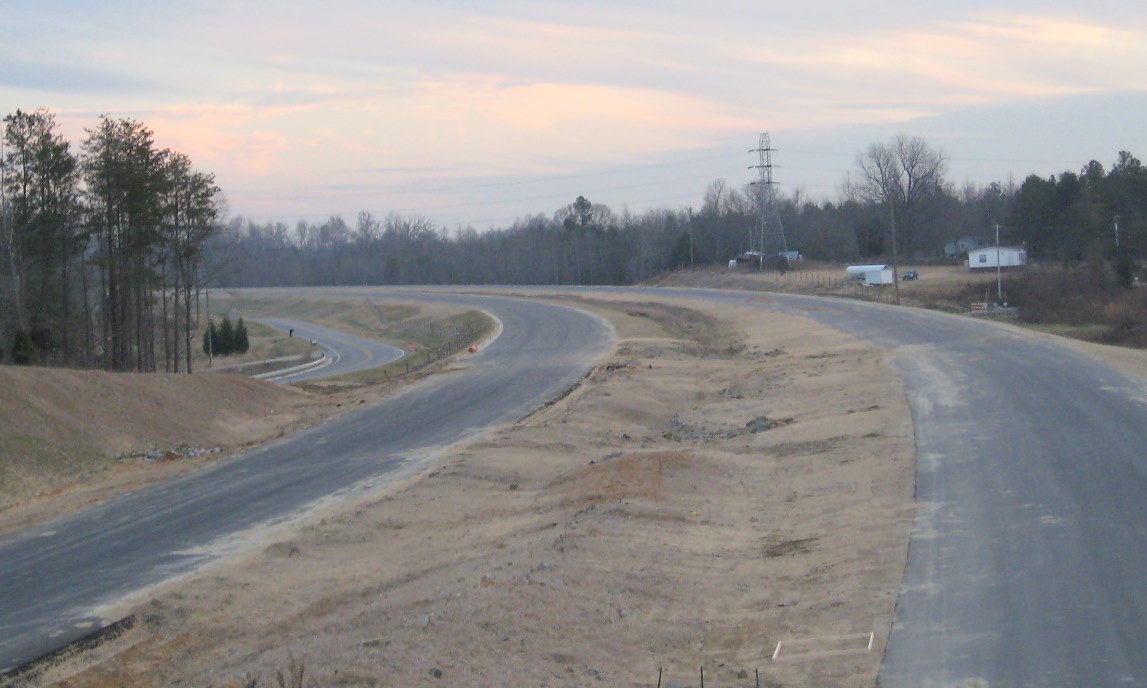
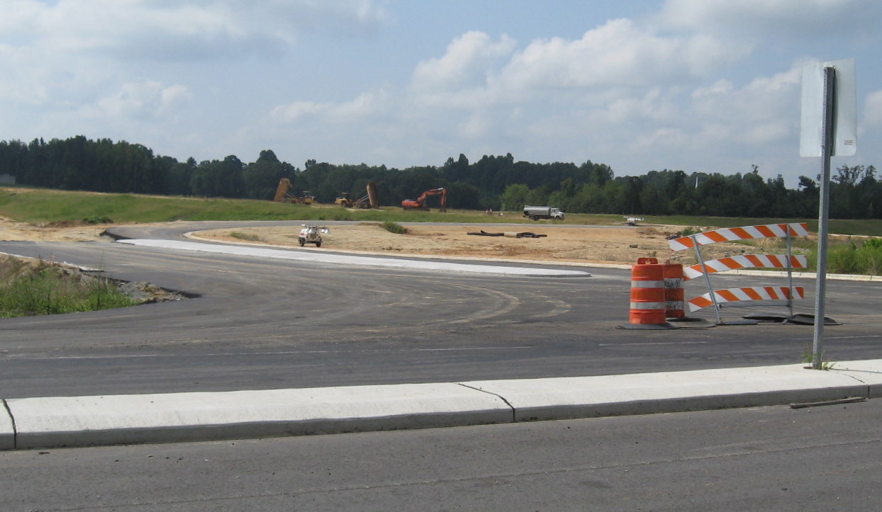
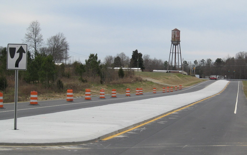
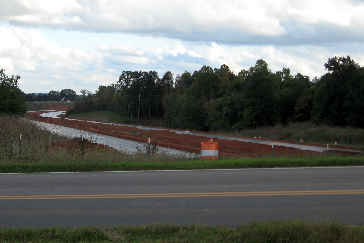
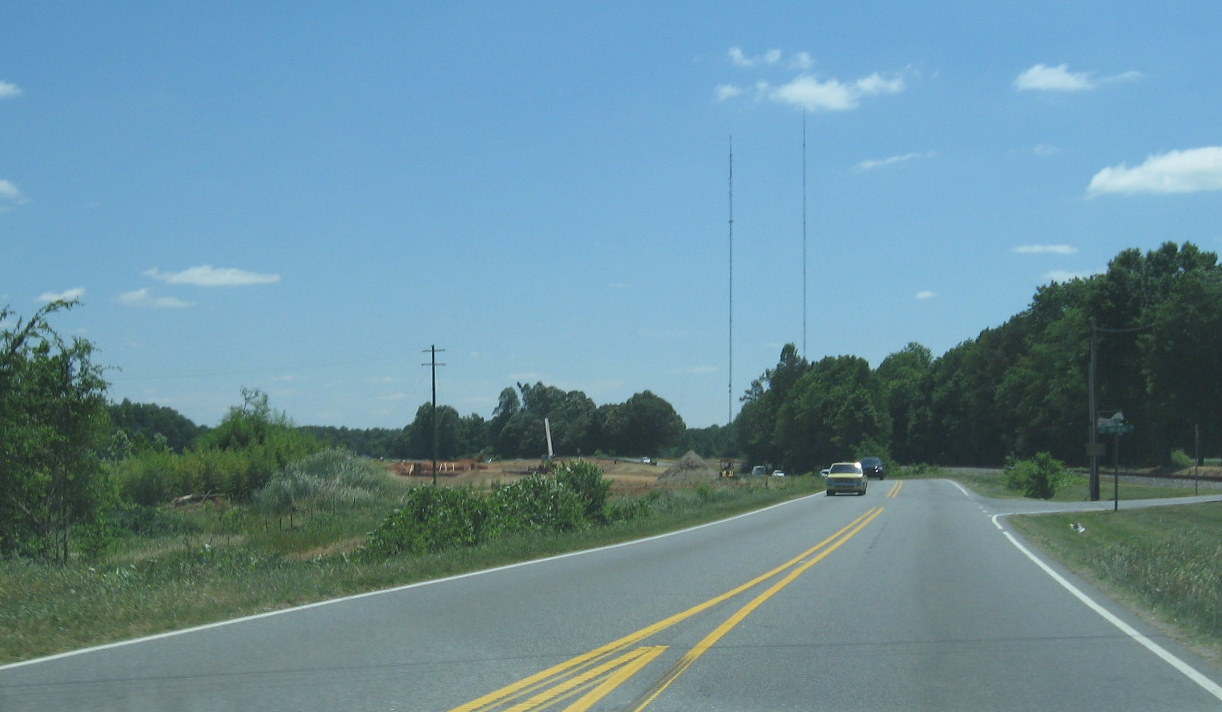
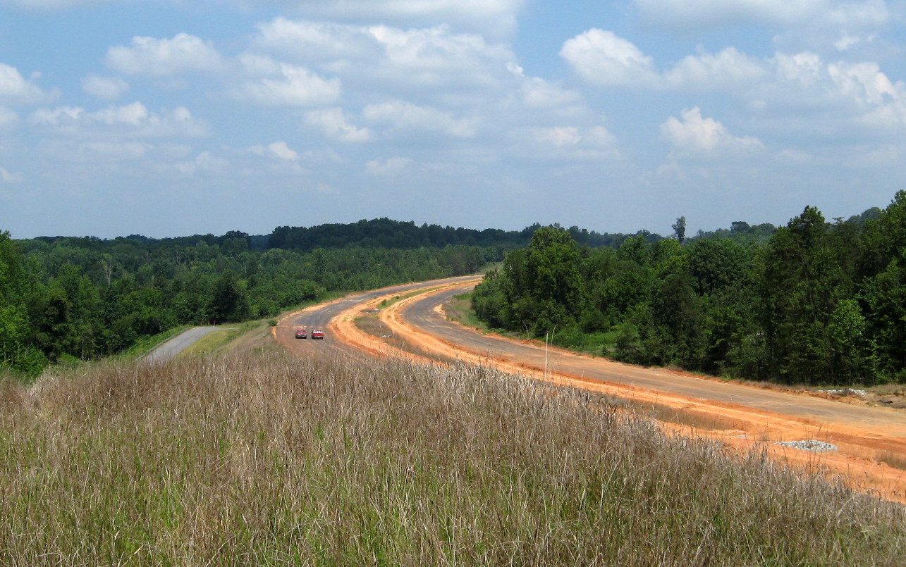
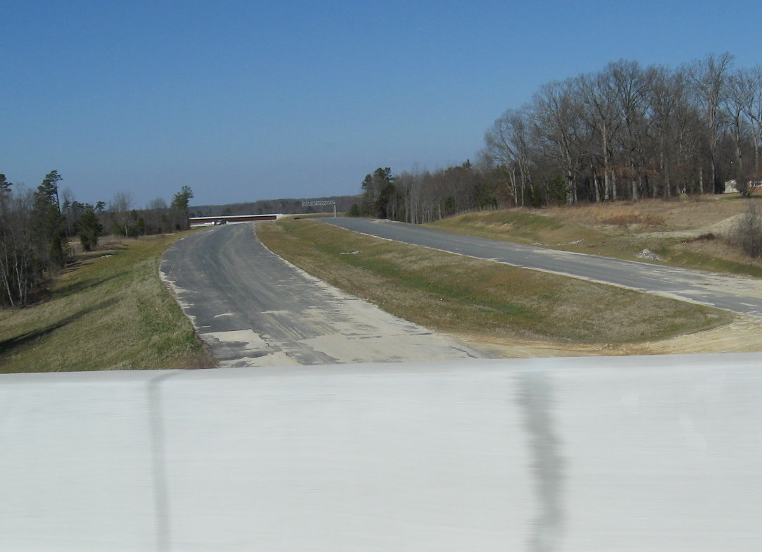 The view looking
westbound (north) toward the I-85 interchange in January 2010. The
gantry for the future I-85 North exit sign can be seen in the distance.
A sign was put up on this cantilevered structure in July 2010. (1/28/10)
The view looking
westbound (north) toward the I-85 interchange in January 2010. The
gantry for the future I-85 North exit sign can be seen in the distance.
A sign was put up on this cantilevered structure in July 2010. (1/28/10)
III. Tuttle Road Bridge
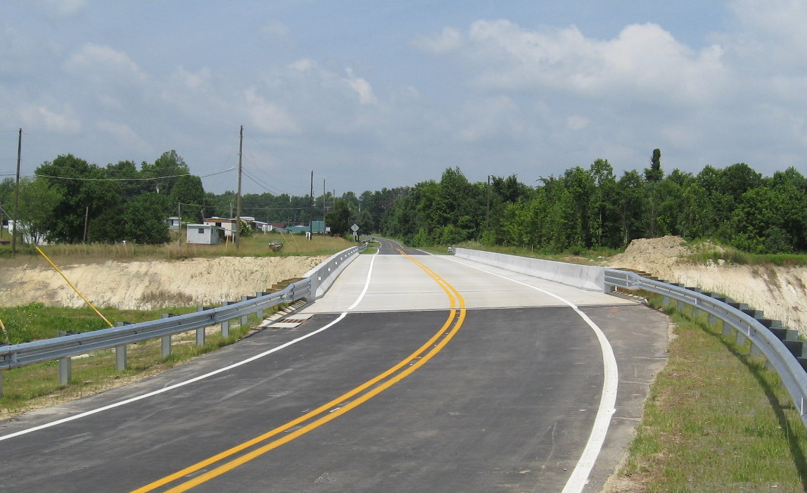
This was the first bridge completed for this segment. Started in the spring of 2007, graded fill was placed up to the western edge of where the completed bridge in May 2008. The bridge was open early in August 2008. The following are photos from June, November, and December 2009, which look similar to the view in January 2010. The first photo is from April 2010 when the last coat of asphalt was placed on the bridge and surrounding roadways. Similar work was done on the bridges and approaches to the south/east:
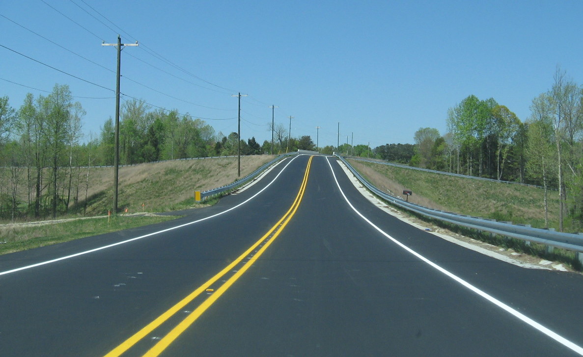 The
'completed' Tuttle Road over I-74 in April 2010. Approaching the bridge
from the east, as you can see Tuttle Road itself was also reconstructed
at the time the bridge was built, several homes now though have steep
driveways, such as the one on the right, just before the bridge.
(4/11/10)
The
'completed' Tuttle Road over I-74 in April 2010. Approaching the bridge
from the east, as you can see Tuttle Road itself was also reconstructed
at the time the bridge was built, several homes now though have steep
driveways, such as the one on the right, just before the bridge.
(4/11/10)
 Here's the view of the bridge looking eastward in 2009,
showing the need to put more asphalt down to make it a smoother
transition onto the bridge. (12/12/09)
Here's the view of the bridge looking eastward in 2009,
showing the need to put more asphalt down to make it a smoother
transition onto the bridge. (12/12/09)
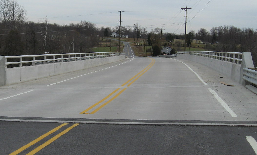
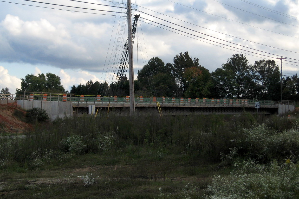
 View from East End of
Tuttle Road Bridge in July 2010 showing basic completion of landscaping
and placing of sign gantry for I-85 exit around corner. (7/25/10)
View from East End of
Tuttle Road Bridge in July 2010 showing basic completion of landscaping
and placing of sign gantry for I-85 exit around corner. (7/25/10)
 Progress at the end of 2009 (from that in the photo below)
can be seen in this view looking east/south toward Poole Road showing
the addition of the possible final asphalt layer, at least good enough
for the contractor to drive on (eventually the wrong way), and seeding
of the median and surrounding surface area, plus guardrails added to the
future westbound roadway. (12/12/09)
Progress at the end of 2009 (from that in the photo below)
can be seen in this view looking east/south toward Poole Road showing
the addition of the possible final asphalt layer, at least good enough
for the contractor to drive on (eventually the wrong way), and seeding
of the median and surrounding surface area, plus guardrails added to the
future westbound roadway. (12/12/09)
 An earlier
view from the top of the bridge from June, the curve ahead is one of the
steepest ones on this segment. (6/14/09)
An earlier
view from the top of the bridge from June, the curve ahead is one of the
steepest ones on this segment. (6/14/09)
 View of nearly completed
freeway looking north from Tuttle Road bridge in July 2010. Notice the
addition of an exit sign gantry and median guide wires since last
photographed. (7/25/10)
View of nearly completed
freeway looking north from Tuttle Road bridge in July 2010. Notice the
addition of an exit sign gantry and median guide wires since last
photographed. (7/25/10)
 This view
looks west/north from the Tuttle Road bridge at the end of 2009 and
shows work being performed at that time and more guardrails along the
highway than the month before. (12/12/09)
This view
looks west/north from the Tuttle Road bridge at the end of 2009 and
shows work being performed at that time and more guardrails along the
highway than the month before. (12/12/09)
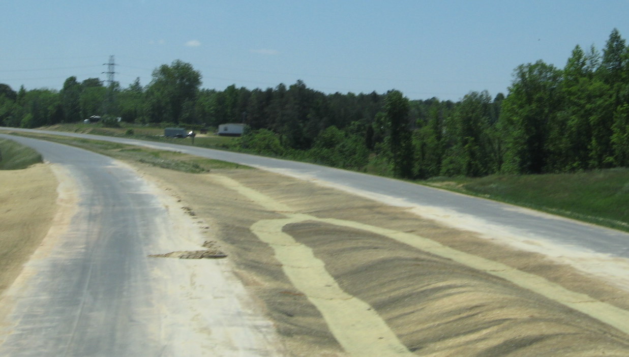
 A similar
view looking toward NC 62 in June 2009, note some of the road surface
has recently received several layers of asphalt. (6/14/09)
A similar
view looking toward NC 62 in June 2009, note some of the road surface
has recently received several layers of asphalt. (6/14/09)
IV. Poole Road Bridge
This bridge was opened in May 2009 a month earlier than projected. By April 2009, all bridge structures were complete and metal re-bar decking had been in place. Concrete pouring was then started on the decking. A final asphalt layer was placed on the bridge in April 2010.
 This is a
view I could not take before the bridge had opened, looking at the Poole
Road Bridge approaching from the west. (6/14/09)
This is a
view I could not take before the bridge had opened, looking at the Poole
Road Bridge approaching from the west. (6/14/09)
 View
from unopened I-74 West freeway in October 2010 approaching the Poole
Road bridge, roadway had been completed except for lane markings.
(10/23/10)
View
from unopened I-74 West freeway in October 2010 approaching the Poole
Road bridge, roadway had been completed except for lane markings.
(10/23/10)
 Here's what the
completed bridge looked like heading west in June 2009, as you can tell,
work was continuing on landscaping of I-74. (6/14/09)
Here's what the
completed bridge looked like heading west in June 2009, as you can tell,
work was continuing on landscaping of I-74. (6/14/09)
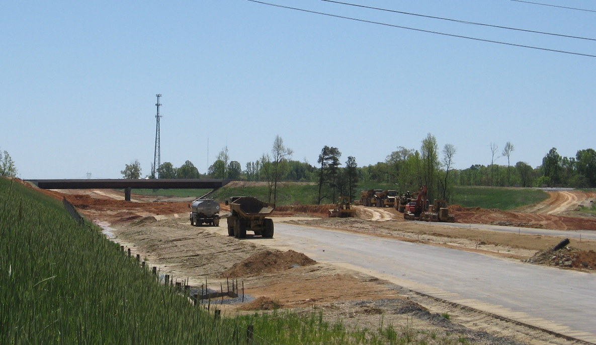
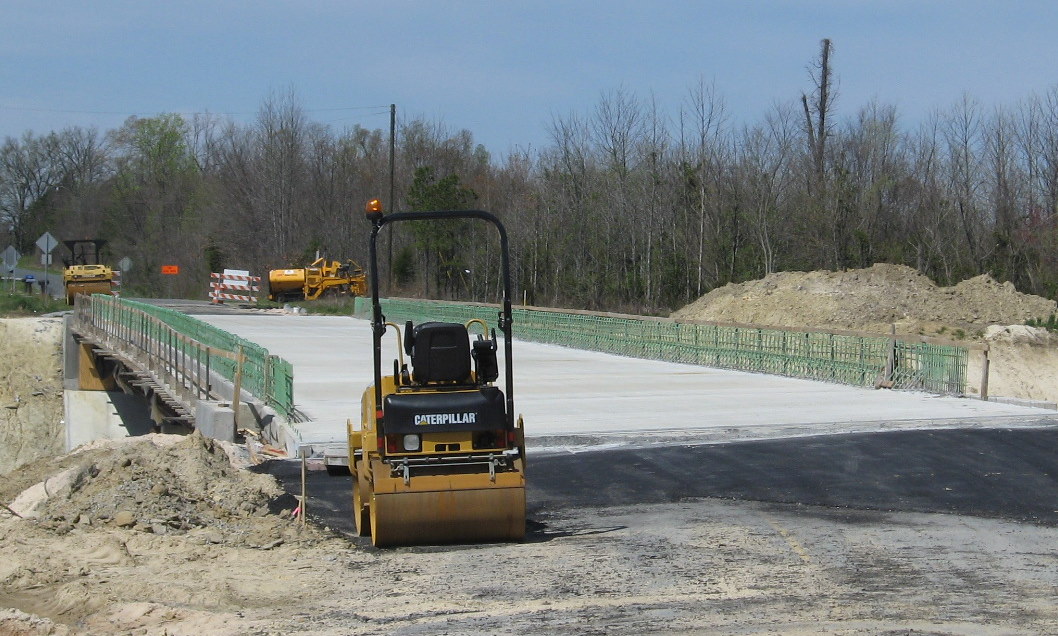 Here's the view in early April
2009 showing the cement has been poured and the re-bar in place to pour
concrete for the side of the bridge. A truck actually crossed the bridge
while I was parking to take this photo. (4/5/09)
Here's the view in early April
2009 showing the cement has been poured and the re-bar in place to pour
concrete for the side of the bridge. A truck actually crossed the bridge
while I was parking to take this photo. (4/5/09)
 This is the view of the Poole
Road before bridge construction but after the roadbed had been cut
through in the Fall of 2008. (10/31/08)
This is the view of the Poole
Road before bridge construction but after the roadbed had been cut
through in the Fall of 2008. (10/31/08)
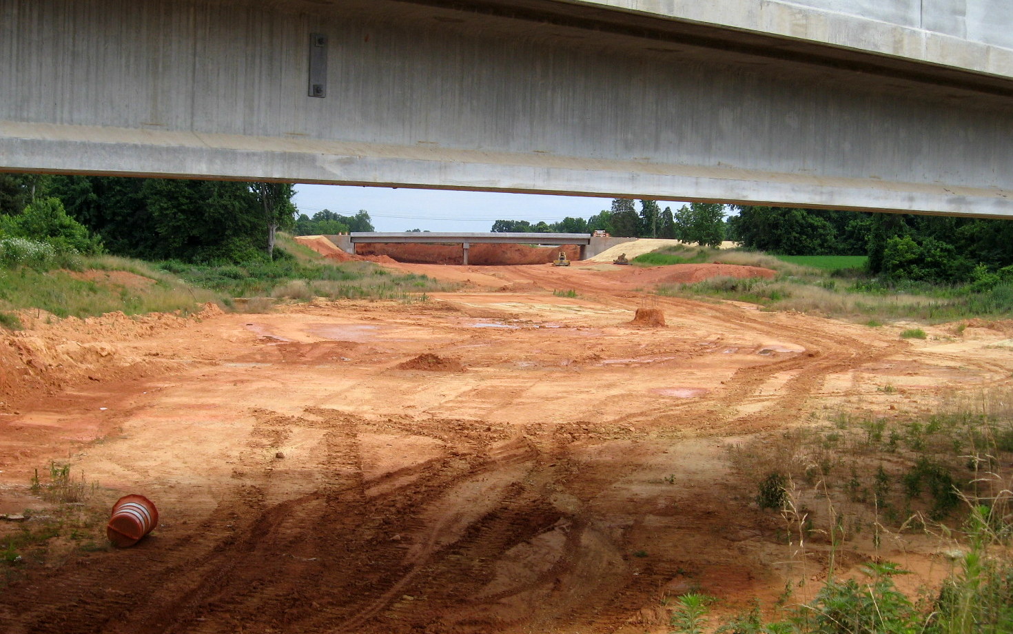
 View along the
unopened (officially) I-74 East freeway in October 2010 awaiting line
markings, showing creek bridges before Poole Road bridge. (10/23/10)
View along the
unopened (officially) I-74 East freeway in October 2010 awaiting line
markings, showing creek bridges before Poole Road bridge. (10/23/10)
 Looking north from the
bridge shows the progress made in paving and landscaping the area around
the creek bridges shown above. In July another paved layer was put down
before the eastbound bridge and the road was blocked off by orange
barrels. (6/20/10)
Looking north from the
bridge shows the progress made in paving and landscaping the area around
the creek bridges shown above. In July another paved layer was put down
before the eastbound bridge and the road was blocked off by orange
barrels. (6/20/10)
 Progress in grading
roadbed to the finished creek bridge could be seen north of the Poole
Road bridge in April 2010. (4/11/10)
Progress in grading
roadbed to the finished creek bridge could be seen north of the Poole
Road bridge in April 2010. (4/11/10)
 View looking North from
to the Poole Road bridge in Sept. 2009 shows progress on grading and
paving at that time, plus the completion of the westbound bridge over
the creek. (9/18/09)
View looking North from
to the Poole Road bridge in Sept. 2009 shows progress on grading and
paving at that time, plus the completion of the westbound bridge over
the creek. (9/18/09)
 The same view from the
bridge in June 2009. Showing the progress in completing the roadbed and
the creek bridges being built about 1/4 mile away. (6/14/09)
The same view from the
bridge in June 2009. Showing the progress in completing the roadbed and
the creek bridges being built about 1/4 mile away. (6/14/09)
 View
along unopened I-74 East freeway in October 2010 showing installation of
mile markers, but no lane markings as of this time. (10/23/10)
View
along unopened I-74 East freeway in October 2010 showing installation of
mile markers, but no lane markings as of this time. (10/23/10)
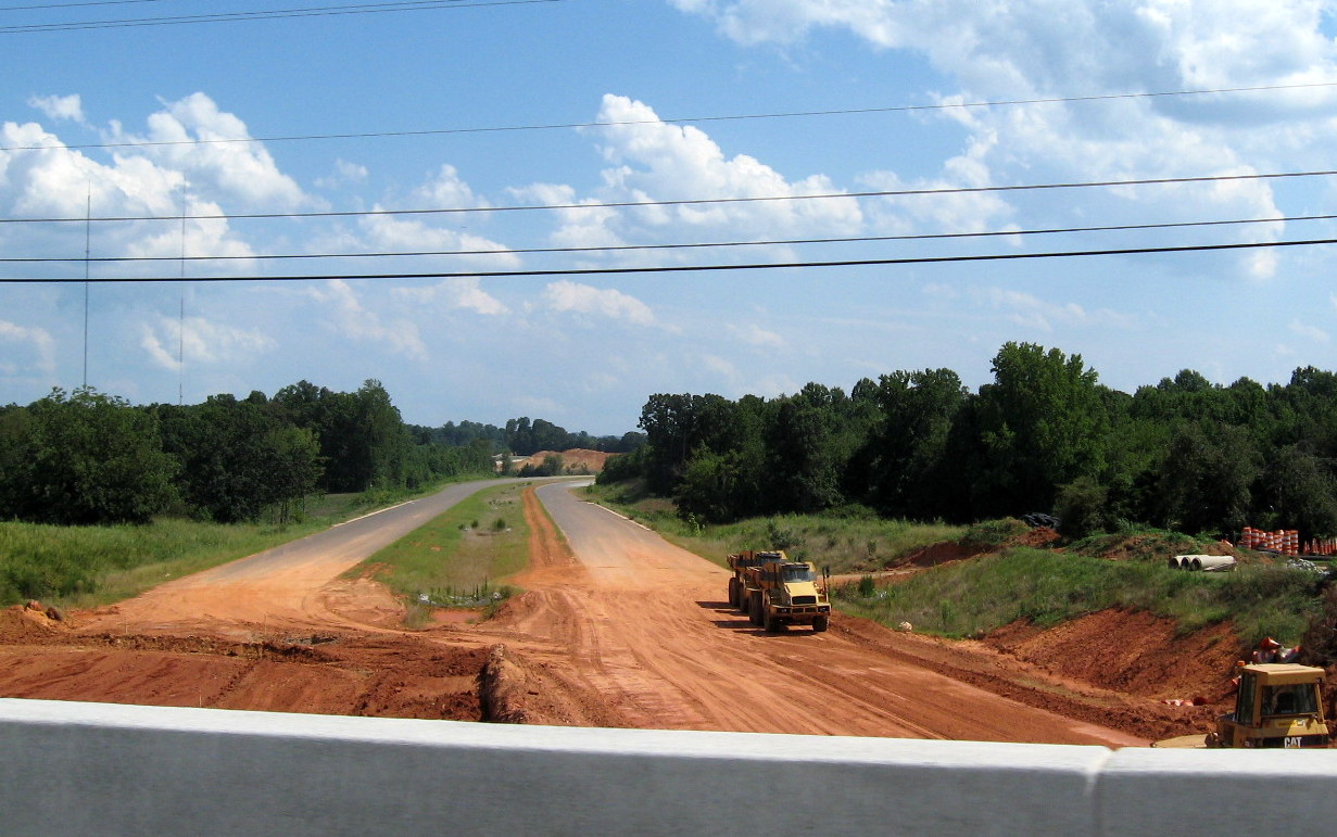
 View showing progress in
median landscaping south of the Poole Road Bridge in May 2010, the
asphalt continues south almost to the Cedar Square Road
interchange.(5/9/10)
View showing progress in
median landscaping south of the Poole Road Bridge in May 2010, the
asphalt continues south almost to the Cedar Square Road
interchange.(5/9/10)
 Looking east, four
months earlier, in January 2010 shows progress in constructing the
eastbound roadway over the winter. Notice the highway looks less
complete with the grass turning brown in this area since the fall (one
photo below). (1/14/10)
Looking east, four
months earlier, in January 2010 shows progress in constructing the
eastbound roadway over the winter. Notice the highway looks less
complete with the grass turning brown in this area since the fall (one
photo below). (1/14/10)
 The
view looking east/southbound toward Cedar Square Road in September 2009
showing the progress in grading and paving the road over the previous
summer. (9/18/09)
The
view looking east/southbound toward Cedar Square Road in September 2009
showing the progress in grading and paving the road over the previous
summer. (9/18/09)
 The view looking
east/southbound in June 2009 of the progress made in grading and paving
the first half of the year. (6/14/09)
The view looking
east/southbound in June 2009 of the progress made in grading and paving
the first half of the year. (6/14/09)
 The
view of the Poole Road Bridge from the new Poole Road alignment in
September 2009. Compare the size of plant growth along side the freeway
to that in the photo below. (9/18/09)
The
view of the Poole Road Bridge from the new Poole Road alignment in
September 2009. Compare the size of plant growth along side the freeway
to that in the photo below. (9/18/09)
 This is the view
approaching the bridge before it opened in April 2009.(4/5/09)
This is the view
approaching the bridge before it opened in April 2009.(4/5/09)
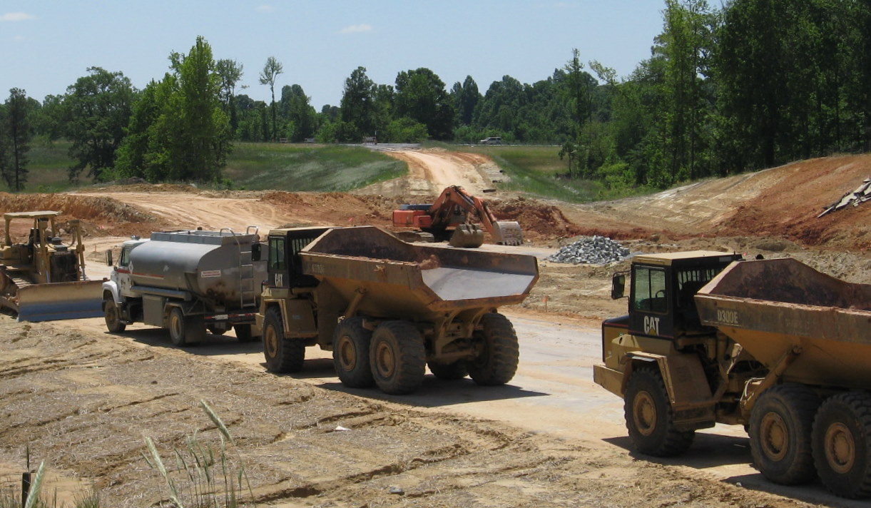
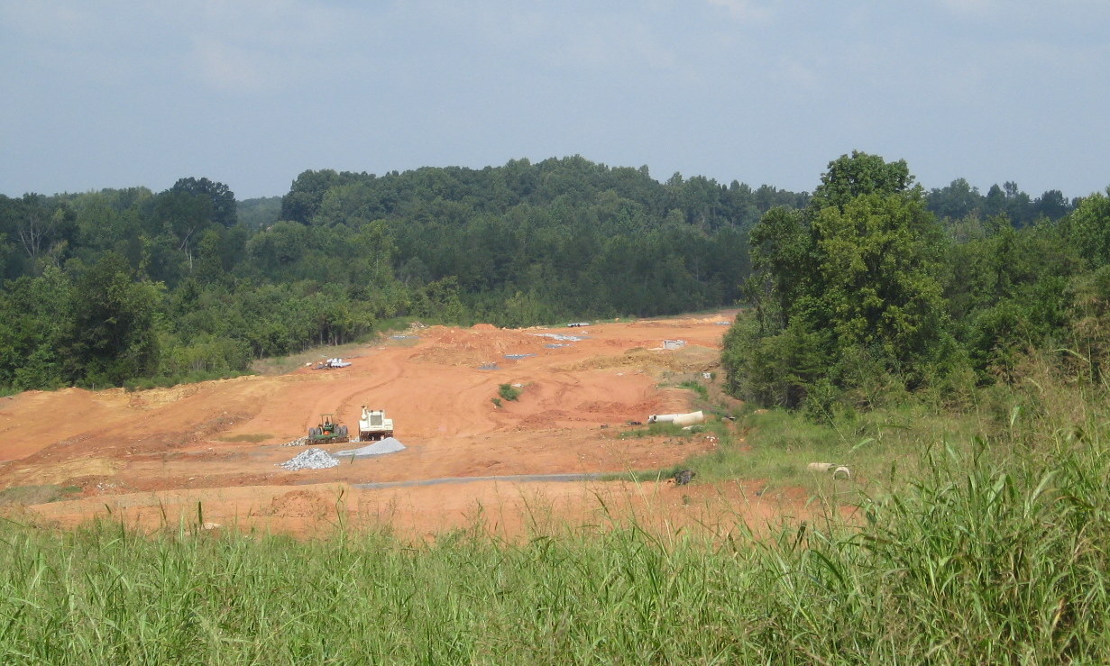
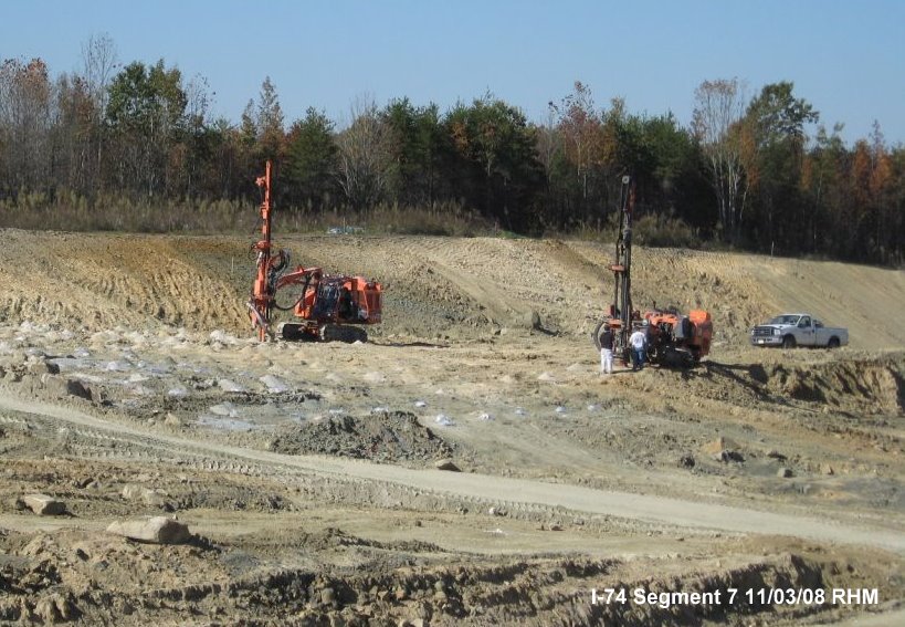 Workers used soil boring
machines for testing in anticipation of construction of the new Poole
Road bridge in the Fall of 2008. (11/03/08)
Workers used soil boring
machines for testing in anticipation of construction of the new Poole
Road bridge in the Fall of 2008. (11/03/08)
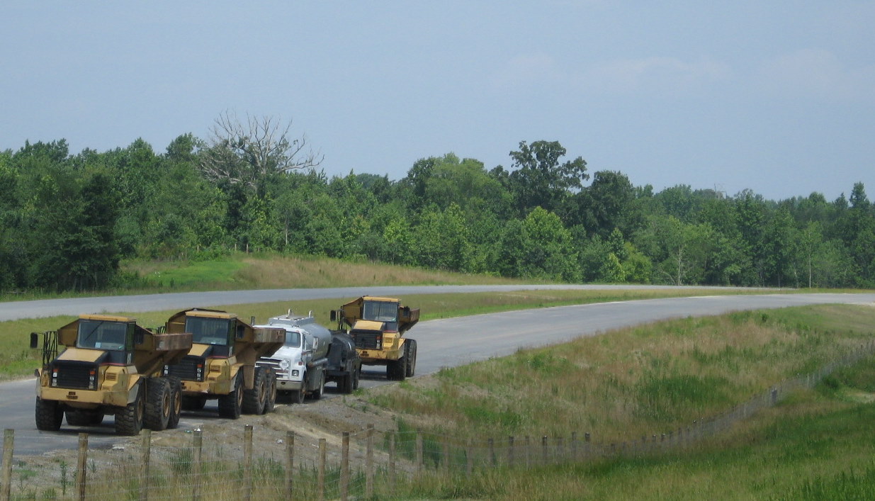 A number of
trucks are parked along the westbound lanes as seen from Poole Road.
Apparently asphalt trucks waiting for another batch, the contractor had
problems getting the quantities of asphalt needed, slowing progress in
May and June 2010. (6/20/10)
A number of
trucks are parked along the westbound lanes as seen from Poole Road.
Apparently asphalt trucks waiting for another batch, the contractor had
problems getting the quantities of asphalt needed, slowing progress in
May and June 2010. (6/20/10)
 A similar view of the
future freeway in October 2009. At this time there was noticeable
progress in grading and placing asphalt as compared to the photo below
that was taken a year earlier. (10/12/09)
A similar view of the
future freeway in October 2009. At this time there was noticeable
progress in grading and placing asphalt as compared to the photo below
that was taken a year earlier. (10/12/09)
 Here's what the graded
freeway looked like from the new section of Poole Road leading to the
bridge in October 2008. The road has been moved out of the freeway
alignment and built south to connect with Cedar Square Road (the
original road intersected with US 311). (10/31/08)
Here's what the graded
freeway looked like from the new section of Poole Road leading to the
bridge in October 2008. The road has been moved out of the freeway
alignment and built south to connect with Cedar Square Road (the
original road intersected with US 311). (10/31/08)
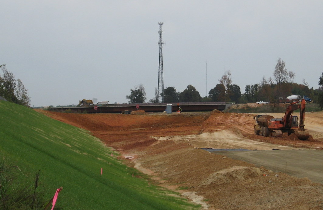
V. Cedar Square Road Bridge and Interchange
Work was completed on the bridge and the new alignment for Cedar Square Road on Nov. 17, 2009. Traffic could thus access US 311 1/2 mile south (east) while the former alignment was excavated to construct the future I-74/US 311 roadbeds and exit ramps. The interchange was opened on November 22, 2010 with the rest of this section of I-74.
 Approaching
Cedar Square exit ramp on unopened I-74 East Freeway in October 2010.
Note poles for exit sign. This will be the temporary end to I-74 until
the next part to US 220 is completed in 2013. (10/23/10)
Approaching
Cedar Square exit ramp on unopened I-74 East Freeway in October 2010.
Note poles for exit sign. This will be the temporary end to I-74 until
the next part to US 220 is completed in 2013. (10/23/10)
 Proceeding up the
yet-to-be completed I-74 East, Cedar Square Road interchange off-ramp.
Note barriers at end of ramp denoting freeway closed, however, the
barriers for the on-ramp, seen below, could be driven around. (10/23/10)
Proceeding up the
yet-to-be completed I-74 East, Cedar Square Road interchange off-ramp.
Note barriers at end of ramp denoting freeway closed, however, the
barriers for the on-ramp, seen below, could be driven around. (10/23/10)
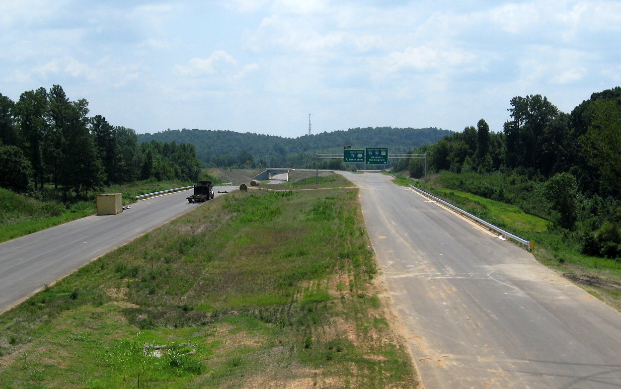
 View of
progress made on constructing the eastbound off-ramp in July 2010,
showing more work completed than in the previous two months. (7/25/10)
View of
progress made on constructing the eastbound off-ramp in July 2010,
showing more work completed than in the previous two months. (7/25/10)
 Most
of the construction activity would occur near Cedar Square Road in May
2010, based on the number of contractor vehicles parked near the
eastbound off-ramp. (5/9/10)
Most
of the construction activity would occur near Cedar Square Road in May
2010, based on the number of contractor vehicles parked near the
eastbound off-ramp. (5/9/10)
 A closer look on
progress in grading under the bridge, there's less grading in the right
lane, but this part of the freeway will not be needed until the second
part to US 220 opens in 2013. (5/9/10)
A closer look on
progress in grading under the bridge, there's less grading in the right
lane, but this part of the freeway will not be needed until the second
part to US 220 opens in 2013. (5/9/10)
 By April 2010 piles of dirt in front of the bridge are all
that is left of the former alignment of Cedar Square Road. Work
continued to bring the freeway down to grade so that the asphalt in the
foreground can continue under the bridge. (4/11/10)
By April 2010 piles of dirt in front of the bridge are all
that is left of the former alignment of Cedar Square Road. Work
continued to bring the freeway down to grade so that the asphalt in the
foreground can continue under the bridge. (4/11/10)
 View heading across the
opened Cedar Square Road Bridge in December 2009, the bridge is 3 lanes
wide to accommodate a left turn lane for the I-74 East on-ramp on the
other side. (12/12/09)
View heading across the
opened Cedar Square Road Bridge in December 2009, the bridge is 3 lanes
wide to accommodate a left turn lane for the I-74 East on-ramp on the
other side. (12/12/09)
 Progress on
building the eastbound off-ramp in April 2010. Work to complete the ramp
had to wait until all the dirt from the former alignment of Cedar Square
Road was removed. (4/11/10)
Progress on
building the eastbound off-ramp in April 2010. Work to complete the ramp
had to wait until all the dirt from the former alignment of Cedar Square
Road was removed. (4/11/10)
 View
under the open Cedar Square Road bridge showing the progress in grading
the future freeway in January 2010, only the westbound lanes need to be
completed at this time. Later in March paving started on the other side
of the bridge and further east/south toward Spencer Road (1/14/10)
View
under the open Cedar Square Road bridge showing the progress in grading
the future freeway in January 2010, only the westbound lanes need to be
completed at this time. Later in March paving started on the other side
of the bridge and further east/south toward Spencer Road (1/14/10)
 The
view of the bridge and roadway progress in early November 2009, nine
days before it opened. (11/8/09)
The
view of the bridge and roadway progress in early November 2009, nine
days before it opened. (11/8/09)
 The bridge as it
appeared in October 2009. Final work was being done on the bridge deck
and the side walls to the bridge were almost complete on the north side.
(10/12/09)
The bridge as it
appeared in October 2009. Final work was being done on the bridge deck
and the side walls to the bridge were almost complete on the north side.
(10/12/09)
 Quite a
difference in comparing this photo from the one 3 months later above, at
that time construction of the center pier appeared to be complete, but
there were no signs of bridge decking materials in the area as of yet.
(6/14/09)
Quite a
difference in comparing this photo from the one 3 months later above, at
that time construction of the center pier appeared to be complete, but
there were no signs of bridge decking materials in the area as of yet.
(6/14/09)
 View of
the end of the graded roadway in December 2009. The now former alignment
of Cedar Square Rd. needed removal before grading (and paving) could
continue. (12/12/09)
View of
the end of the graded roadway in December 2009. The now former alignment
of Cedar Square Rd. needed removal before grading (and paving) could
continue. (12/12/09)
 Looking north back toward the Poole Road bridge in August
2010. Progress is proceeding slowly on grading the new freeway.
(8/29/10)
Looking north back toward the Poole Road bridge in August
2010. Progress is proceeding slowly on grading the new freeway.
(8/29/10)
 Similar
view looking on what remained of the old Cedar Square Road in January
2010. Progress had been made extending asphalt to the eastbound
interchange ramp, but most of the former Cedar Square road embankment
still needed to be removed before more progress to the east could
continue. Poole Road now is extended over the old Cedar Square alignment
back to the east side of the bridge. (1/14/10)
Similar
view looking on what remained of the old Cedar Square Road in January
2010. Progress had been made extending asphalt to the eastbound
interchange ramp, but most of the former Cedar Square road embankment
still needed to be removed before more progress to the east could
continue. Poole Road now is extended over the old Cedar Square alignment
back to the east side of the bridge. (1/14/10)
 View of the completed
section of the eastbound on-ramp a month earlier with final grading to
start after the old Cedar Square Road was removed. (12/12/09)
View of the completed
section of the eastbound on-ramp a month earlier with final grading to
start after the old Cedar Square Road was removed. (12/12/09)
 Looking back toward
the Poole Road Bridge in November 2009, progress had been made in
excavating the eastbound off-ramp and placing asphalt on the future
westbound roadway. (11/8/09)
Looking back toward
the Poole Road Bridge in November 2009, progress had been made in
excavating the eastbound off-ramp and placing asphalt on the future
westbound roadway. (11/8/09)
 Progress
in building the eastbound off-ramp in November 2009 from Poole Road.
(11/8/09)
Progress
in building the eastbound off-ramp in November 2009 from Poole Road.
(11/8/09)
 The
beginning of work on the eastbound off-ramp can be seen in this photo
from September 2009. The high ground with the barrels behind is the
former Cedar Square Road which was removed once the new bridge was
completed. (9/18/09)
The
beginning of work on the eastbound off-ramp can be seen in this photo
from September 2009. The high ground with the barrels behind is the
former Cedar Square Road which was removed once the new bridge was
completed. (9/18/09)
 The view of the opened
new alignment of Cedar Square Road heading west toward the bridge, the
old road to the right will become an extension of Poole Road. (12/12/09)
The view of the opened
new alignment of Cedar Square Road heading west toward the bridge, the
old road to the right will become an extension of Poole Road. (12/12/09)
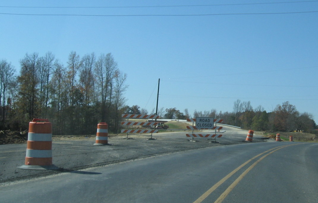 Photo from a month earlier showing the connection between
the existing and new alignment of Cedar Square Road almost complete.
(11/8/09)
Photo from a month earlier showing the connection between
the existing and new alignment of Cedar Square Road almost complete.
(11/8/09)
 View
in early March 2010 showing progress in removing old alignment of Cedar
Square Road. Removing rest is complicated by need to move existing
intersection of Poole Road to the east. This was completed later in
March and the remaining westbound lanes graded. (3/10/10)
View
in early March 2010 showing progress in removing old alignment of Cedar
Square Road. Removing rest is complicated by need to move existing
intersection of Poole Road to the east. This was completed later in
March and the remaining westbound lanes graded. (3/10/10)
 View of progress in
excavating the freeway bed up to Cedar Square Road, the dirt ramp on the
right allows construction trucks to stay in the construction area and
simply cross the current Cedar Square Road when necessary (necessitating
the workers with stop signs seen above. (10/12/09)
View of progress in
excavating the freeway bed up to Cedar Square Road, the dirt ramp on the
right allows construction trucks to stay in the construction area and
simply cross the current Cedar Square Road when necessary (necessitating
the workers with stop signs seen above. (10/12/09)
 The
view in April 2009 from Poole Road to the current Cedar Square Road at
the start of construction beyond for the new bridge. (4/5/09)
The
view in April 2009 from Poole Road to the current Cedar Square Road at
the start of construction beyond for the new bridge. (4/5/09)
 View
approaching completed, but not yet opened to public access, westbound
I-74 on-ramp from Cedar Square Road in October 2010. (10/23/10)
View
approaching completed, but not yet opened to public access, westbound
I-74 on-ramp from Cedar Square Road in October 2010. (10/23/10)
 View of traveling
on yet-to-be opened westbound I-74 on-ramp in October 2010 from Cedar
Square Road. (10/23/10)
View of traveling
on yet-to-be opened westbound I-74 on-ramp in October 2010 from Cedar
Square Road. (10/23/10)
 Progress
on building the westbound off-ramp a couple months earlier in August
2010 as viewed from the end of Poole Road. (8/29/10)
Progress
on building the westbound off-ramp a couple months earlier in August
2010 as viewed from the end of Poole Road. (8/29/10)
 A still
earlier look at the westbound on-ramp in May 2010. This and the
eastbound off-ramp are the only ramps that need to be completed for the
interchange to be opened, given the I-74 freeway is to end here until
April 2013. (5/9/10)
A still
earlier look at the westbound on-ramp in May 2010. This and the
eastbound off-ramp are the only ramps that need to be completed for the
interchange to be opened, given the I-74 freeway is to end here until
April 2013. (5/9/10)
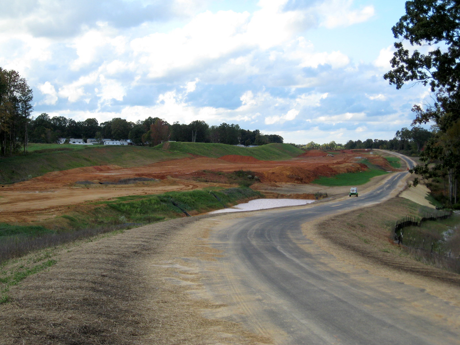
 View from the Cedar Square Rd Bridge looking south toward
the end of the first part of the contract at Spencer Road. (8/29/10)
View from the Cedar Square Rd Bridge looking south toward
the end of the first part of the contract at Spencer Road. (8/29/10)
 Same view as above, looking toward the end of
the first part of the contract at Spencer Road in June 2010. (6/20/10)
Same view as above, looking toward the end of
the first part of the contract at Spencer Road in June 2010. (6/20/10)
 View of progress in
creating the westbound off-ramp and grading the future 2012 on-ramp
across for the end of Poole Road. (5/9/10)
View of progress in
creating the westbound off-ramp and grading the future 2012 on-ramp
across for the end of Poole Road. (5/9/10)
 The same view in
January 2010. The intersection will be controlled by traffic signals
when the westbound on-ramp is open.
The same view in
January 2010. The intersection will be controlled by traffic signals
when the westbound on-ramp is open.
 Both the future
on and off-ramps from the westbound freeway will intersect on the south
side of Cedar Square Road. This photo is of progress where the ramps
meet at the intersection in December 2009. (12/12/09)
Both the future
on and off-ramps from the westbound freeway will intersect on the south
side of Cedar Square Road. This photo is of progress where the ramps
meet at the intersection in December 2009. (12/12/09)
 Photo showing the
progress of connecting the off and on-ramps to the westbound freeway in
December 2009. (12/12/09)
Photo showing the
progress of connecting the off and on-ramps to the westbound freeway in
December 2009. (12/12/09)
VI. The Temporary Routing of US 311 along Cedar Square Road
 The view
of Cedar Square Road from the future freeway to current US 311, with
final paving done in early April 2010. (4/11/10)
The view
of Cedar Square Road from the future freeway to current US 311, with
final paving done in early April 2010. (4/11/10)
 Until
the I-74 freeway is complete to US 220, all traffic to and from the
freeway will use the new Cedar Square Road alignment, seen here in
December 2009, to connect to the existing US 311. Note the large
concrete median, meant to prevent easy U-turns along this stretch?
(12/12/09)
Until
the I-74 freeway is complete to US 220, all traffic to and from the
freeway will use the new Cedar Square Road alignment, seen here in
December 2009, to connect to the existing US 311. Note the large
concrete median, meant to prevent easy U-turns along this stretch?
(12/12/09)
 In November 2009 the new alignment south of
the Cedar Square bridge was complete and traffic signals had been put up
and placed on yellow flash mode in preparation for the opening of the
intersection. US 311 was routed from the freeway to meet its current
alignment at this point when the freeway opened in Nov. 2010. The old
alignment was to be designated US 311 Business according to plans, but
NCDOT successfully petitioned AASHTO to remove that designation along US
311's old route on Main Street through High Point from Business 85 in
2009. New signage put up on I-85 in March 2010 indicated Business 311
would not be signed along this stretch either.(13) (11/8/09)
In November 2009 the new alignment south of
the Cedar Square bridge was complete and traffic signals had been put up
and placed on yellow flash mode in preparation for the opening of the
intersection. US 311 was routed from the freeway to meet its current
alignment at this point when the freeway opened in Nov. 2010. The old
alignment was to be designated US 311 Business according to plans, but
NCDOT successfully petitioned AASHTO to remove that designation along US
311's old route on Main Street through High Point from Business 85 in
2009. New signage put up on I-85 in March 2010 indicated Business 311
would not be signed along this stretch either.(13) (11/8/09)
 This
was the view of the end of the new Cedar Square Road at US 311 in
October 2009 which will temporarily take I-74 traffic to and from US 311
when the freeway first opens. In November 2009 the road appeared
complete with the exception of line striping. Notice the future signal
poles on the right and electronic loops for the signals have already
been placed under the asphalt on the bottom right. (10/12/09)
This
was the view of the end of the new Cedar Square Road at US 311 in
October 2009 which will temporarily take I-74 traffic to and from US 311
when the freeway first opens. In November 2009 the road appeared
complete with the exception of line striping. Notice the future signal
poles on the right and electronic loops for the signals have already
been placed under the asphalt on the bottom right. (10/12/09)
 The
end of the US 311 construction zone, the next traffic light is for
Spencer Road, the end point for the first part of the project. (9/18/09)
The
end of the US 311 construction zone, the next traffic light is for
Spencer Road, the end point for the first part of the project. (9/18/09)
 Here's the view approaching the construction
zone from the opposite direction on US 311 North. (10/12/09)
Here's the view approaching the construction
zone from the opposite direction on US 311 North. (10/12/09)
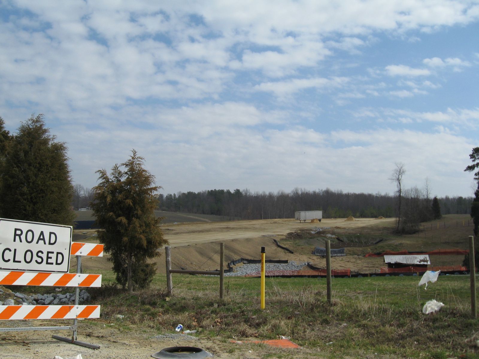
The End of Phase 1 of the Construction Project:
 Some
of the construction equipment as seen from Spencer Road, the official
end to the first phase of the project. (5/9/10)
Some
of the construction equipment as seen from Spencer Road, the official
end to the first phase of the project. (5/9/10)
Here are photos taken in each of the major construction areas for the second contract building I-74 from Spencer Road to I-73/US 220 from 2008 to 2012, going west to east with images proceeding backward chronologically, starting in the Summer of 2012:
I. Spencer Road
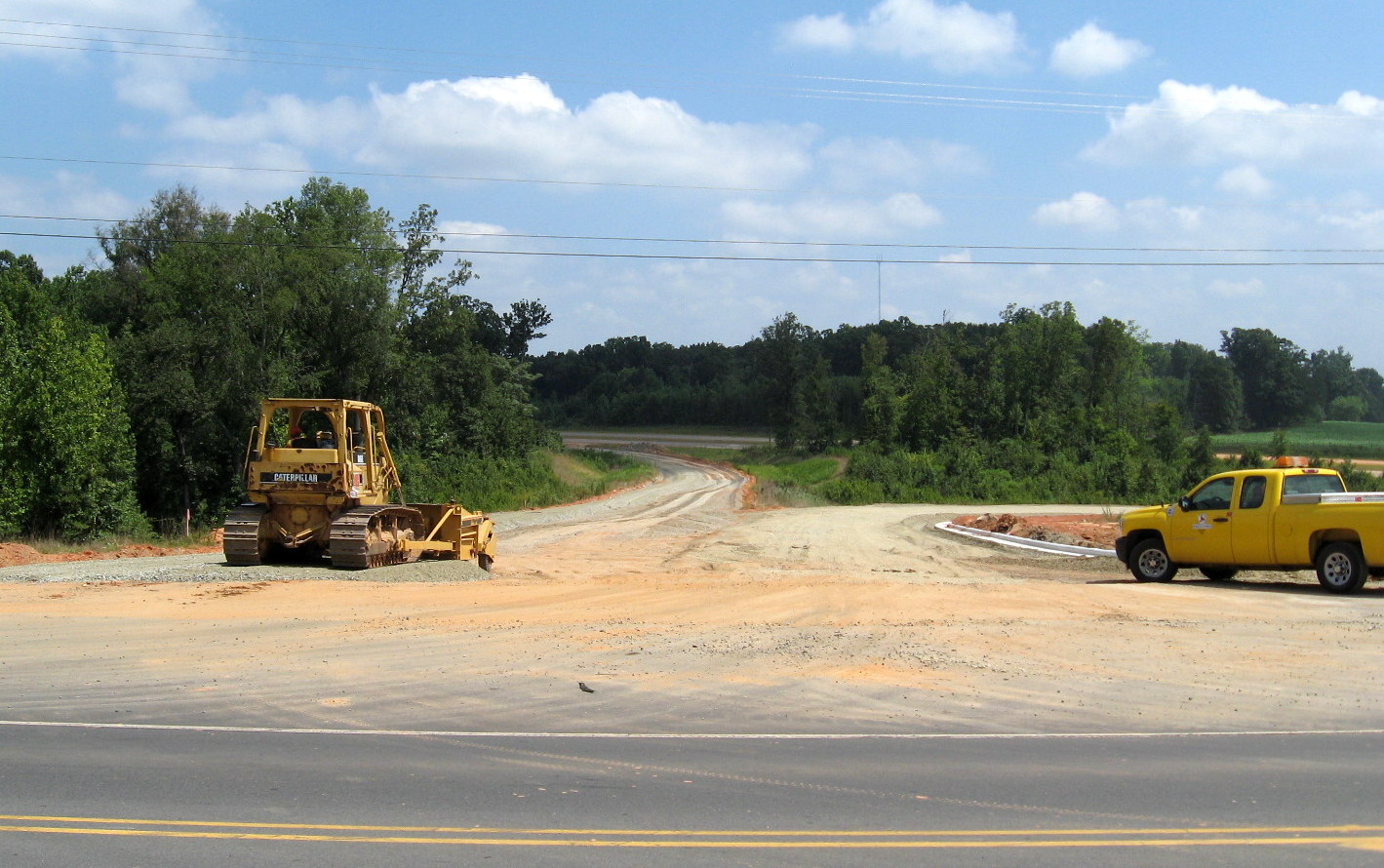
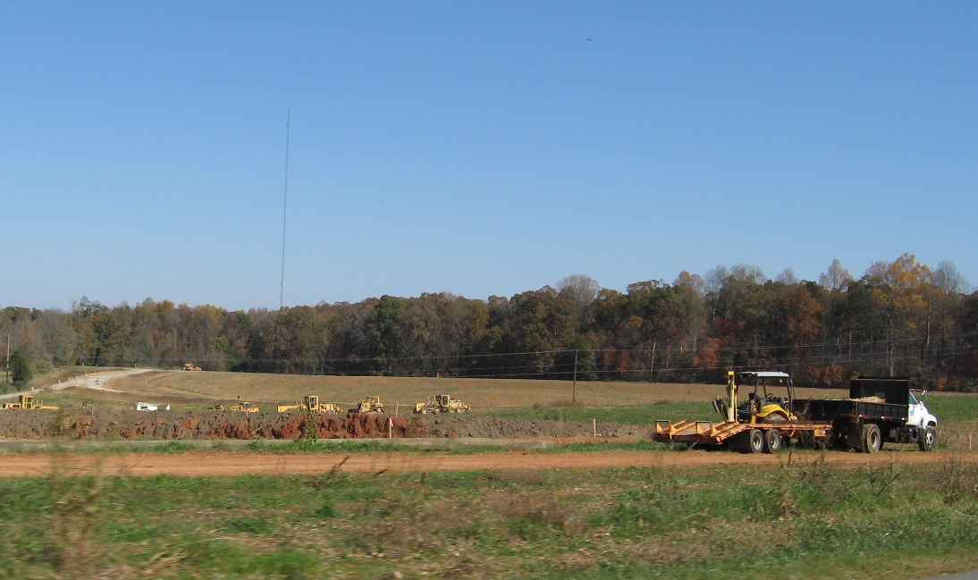
This road did not receive a bridge across the new freeway. It was closed to through traffic in April 2011. It now consists of two sections; 'Old Spencer Road' west of the new freeway to current US 311 and 'Spencer Road' to the east which has been extended, now turning left at the freeway right-of-way and proceeding south for about 1/2 mile, it is not completed to the next road, however. Traffic wishing to get to current US 311 south of Glenola now has to go over to Cedar Square Road. Spencer Road itself is currently being extended parallel to the US 311 freeway south to meet Banner Whitehead Road which will cross I-74/US 311.
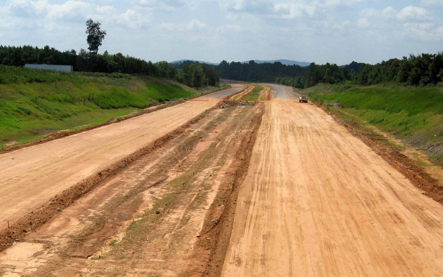
 View of I-74
freeway from extension of Spencer Road parallel to highway. Roadway
simply ends at top of next hill. Construction equipment can be seen at
end of paved area which extends from Cedar Square Rd. (8/1/12)
View of I-74
freeway from extension of Spencer Road parallel to highway. Roadway
simply ends at top of next hill. Construction equipment can be seen at
end of paved area which extends from Cedar Square Rd. (8/1/12)
 A closer
look at the equipment revealed the big truck was being used for soil
stabilization. Work that, needed in many places, evidently slow down the
completion rate of the Interstate. (8/1/12)
A closer
look at the equipment revealed the big truck was being used for soil
stabilization. Work that, needed in many places, evidently slow down the
completion rate of the Interstate. (8/1/12)
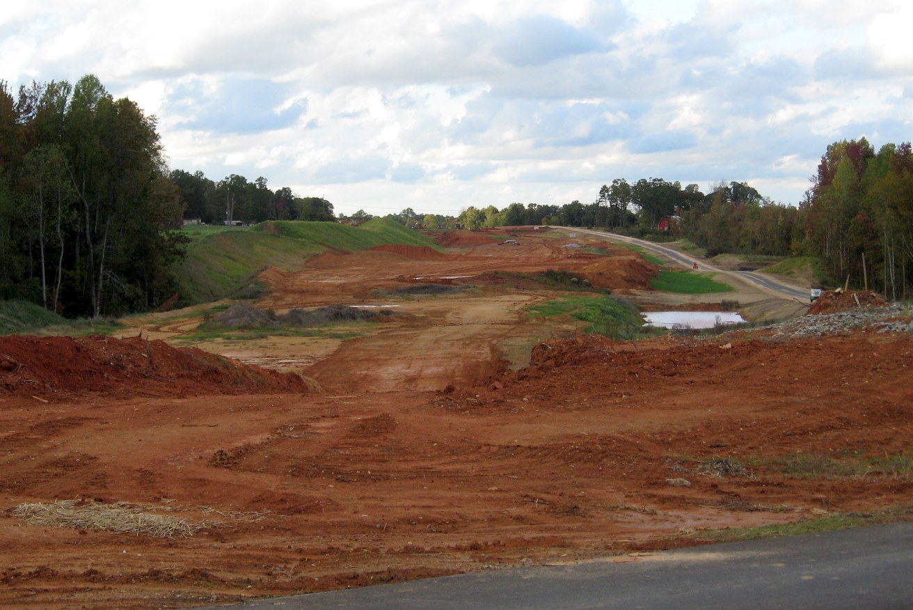
 View
looking back toward the Cedar Square Road area from the current end of
the Spencer Road extension. (8/1/12)
View
looking back toward the Cedar Square Road area from the current end of
the Spencer Road extension. (8/1/12)
 Photo looking back at the Cedar Square Road interchange
from the roadbed now splitting Spencer Road in October 2011. Photo taken
from the future East I-74 roadbed which will probably receive another
layer of asphalt before work is completed. (10/13/11)
Photo looking back at the Cedar Square Road interchange
from the roadbed now splitting Spencer Road in October 2011. Photo taken
from the future East I-74 roadbed which will probably receive another
layer of asphalt before work is completed. (10/13/11)
 View
looking the other direction along the future I-74 East roadbed towards
Banner Whitehead Road. Both roadbeds had received the same coatings of
asphalt. (10/13/11)
View
looking the other direction along the future I-74 East roadbed towards
Banner Whitehead Road. Both roadbeds had received the same coatings of
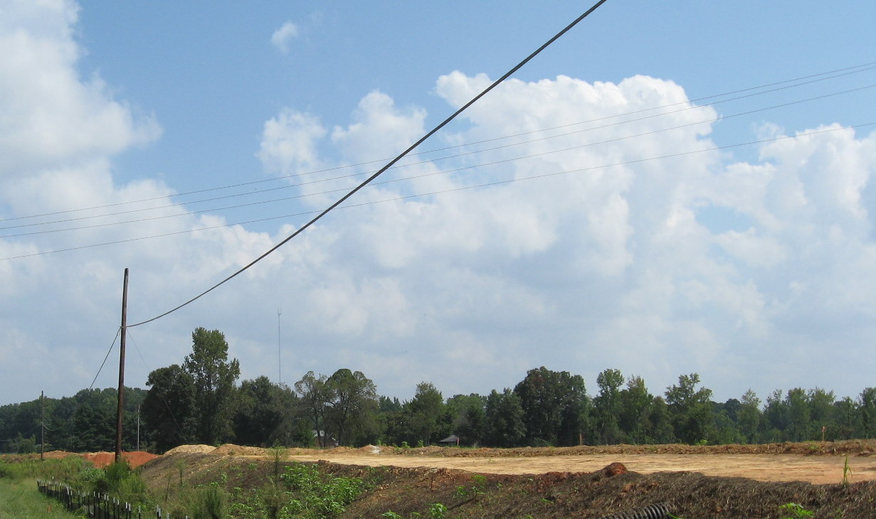
asphalt. (10/13/11)
 View looking north/west from Spencer Road before the start
of construction on this phase of the US 311 Bypass project.
(September 2009)
View looking north/west from Spencer Road before the start
of construction on this phase of the US 311 Bypass project.
(September 2009)
II. Banner Whitehead Road
A bridge was built to carry this road over I-74/US 311. It was completed in late 2011. In May 2011 the end pillars had been placed and work commenced on the middle pier. The bridge itself was almost complete by July. However, the connecting roadway approaches were still covered in mounds of dirt until the fall. The bridge was finally open by the end of 2011.
 The view looking west over
the completed Banner Whitehead Rd bridge in August 2012. (8/1/12)
The view looking west over
the completed Banner Whitehead Rd bridge in August 2012. (8/1/12)
 Looking
south from the bridge, soil problems may exist here in that they were
still working on grading the roadway as it proceeded toward Branson
Davis Road. (8/1/12)
Looking
south from the bridge, soil problems may exist here in that they were
still working on grading the roadway as it proceeded toward Branson
Davis Road. (8/1/12)
 The
view north shows similar conditions. The equipment seen in the distance
are for the soil stabilization project seen above. Spencer Road ends at
the other side of the tree stand at right, apparently not continuing, at
least for now, due to property issues. (8/1/12)
The
view north shows similar conditions. The equipment seen in the distance
are for the soil stabilization project seen above. Spencer Road ends at
the other side of the tree stand at right, apparently not continuing, at
least for now, due to property issues. (8/1/12)
 One
of the houses along now Old Banner Whitehead Road is very close to the
freeway, just north of the bridge. NCDOT has not built a connection
between the old and new roads, residents have to access their houses
through a sloping gravel entryway. (8/1/12)
One
of the houses along now Old Banner Whitehead Road is very close to the
freeway, just north of the bridge. NCDOT has not built a connection
between the old and new roads, residents have to access their houses
through a sloping gravel entryway. (8/1/12)
 View
looking north from Banner Whitehead showing clearing that had taken
place for I-74 freeway as of August 2010. (8/29/10)
View
looking north from Banner Whitehead showing clearing that had taken
place for I-74 freeway as of August 2010. (8/29/10)
 Debris that
has been cleared in the general area of the future bridge in the summer
of 2010. (8/29/10).
Debris that
has been cleared in the general area of the future bridge in the summer
of 2010. (8/29/10).
III. Branson Davis Road
A bridge was needed here to take this road over I-74/US 311. Work started in the summer of 2010 and was completed in June 2012. Work had been completed on building a new road alignment to tie into the ends of the bridge back in May 2011. The bridge took longer with, work to complete the center pier finished in July 2011, when work proceeded on building the bridge deck which took almost a year. Delays in finishing this bridge have helped push back the roadway's opening to beyond 2012. This was the last bridge completed for the project.
 Workers complete grading the area around the completed
Branson Davis Rd bridge in August 2012. Work had been completed along
the southbound side the week before. (8/1/12)
Workers complete grading the area around the completed
Branson Davis Rd bridge in August 2012. Work had been completed along
the southbound side the week before. (8/1/12)
 Looking
north of the bridge along new access road showing how work on grading
this section was progressing after the bridge was opened in June 2012.
(8/1/12)
Looking
north of the bridge along new access road showing how work on grading
this section was progressing after the bridge was opened in June 2012.
(8/1/12)
 View
looking southeast from access road showing progress in completing
highway grading under the Branson Davis Rd Bridge. (8/1/12)
View
looking southeast from access road showing progress in completing
highway grading under the Branson Davis Rd Bridge. (8/1/12)
 View driving over the
newly opened Branson Davis Rd Bridge in late July 2012. (7/27/12)
View driving over the
newly opened Branson Davis Rd Bridge in late July 2012. (7/27/12)
 Looking north
along old alignment of Branson Davis Road with unopened bridge to the
right in June 2012. (6/10/12)
Looking north
along old alignment of Branson Davis Road with unopened bridge to the
right in June 2012. (6/10/12)
 The delay in completing
the bridge is most apparent here, the car seen crossing is where the
I-74 roadbed should be. (6/10/12)
The delay in completing
the bridge is most apparent here, the car seen crossing is where the
I-74 roadbed should be. (6/10/12)
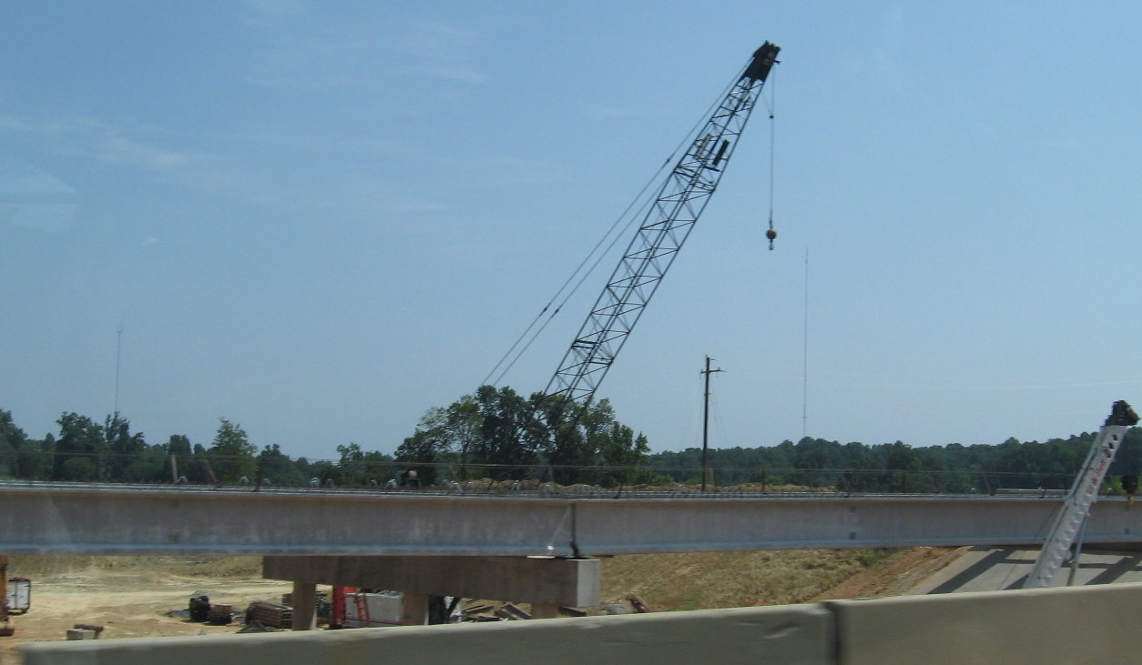
 View
of Branson Davis Road bridge deck in October 2011. The concrete deck for
the bridge had been poured. Work remained along the sides of the bridge.
(10/13/11)
View
of Branson Davis Road bridge deck in October 2011. The concrete deck for
the bridge had been poured. Work remained along the sides of the bridge.
(10/13/11)
 Looking under the bridge
in June 2012 towards the south and the next bridge over I-74, at Walker
Mill Road. Lack of completion of both bridges had stalled building the
freeway at this location until later that month. (6/10/12)
Looking under the bridge
in June 2012 towards the south and the next bridge over I-74, at Walker
Mill Road. Lack of completion of both bridges had stalled building the
freeway at this location until later that month. (6/10/12)
 Looking under the bridge
in October 2011 toward Walker Mill Road shows similar progress as 8
months later. (10/13/11)
Looking under the bridge
in October 2011 toward Walker Mill Road shows similar progress as 8
months later. (10/13/11)
 View
looking south a year earlier, in the fall of 2010, toward construction
along Walker Mill Road (see below). (10/3/10). Note construction on the
bridge had not started yet.
View
looking south a year earlier, in the fall of 2010, toward construction
along Walker Mill Road (see below). (10/3/10). Note construction on the
bridge had not started yet.
 Future Branson Davis Road
bed being cleared in the Summer of 2010. (8/29/10)
Future Branson Davis Road
bed being cleared in the Summer of 2010. (8/29/10)
 Looking the other
direction as the gap in the future road shows the future bridge
location. (8/29/10)
Looking the other
direction as the gap in the future road shows the future bridge
location. (8/29/10)
 View northwest of Branson
Davis Road in June 2012 showing where grading of the freeway stopped to
wait for completion of the bridge. (6/10/12)
View northwest of Branson
Davis Road in June 2012 showing where grading of the freeway stopped to
wait for completion of the bridge. (6/10/12)
 View
looking northwest back in October 2011 toward Banner Whitehead Road. An
access road was almost completed to the right to allow traffic to travel
between the two roads. (10/13/11)
View
looking northwest back in October 2011 toward Banner Whitehead Road. An
access road was almost completed to the right to allow traffic to travel
between the two roads. (10/13/11)
 Another view of
progress in building the future I-74 freeway from Branson Davis Road
north of future bridge. (10/13/11)
Another view of
progress in building the future I-74 freeway from Branson Davis Road
north of future bridge. (10/13/11)
 Same
view looking toward Banner Whitehead Road a year earlier showing
progress in clearing the future freeway's path. (10/3/10)
Same
view looking toward Banner Whitehead Road a year earlier showing
progress in clearing the future freeway's path. (10/3/10)
 Same view a
couple months earlier showing equipment used in clearing the future
freeway's path. (8/29/10)
Same view a
couple months earlier showing equipment used in clearing the future
freeway's path. (8/29/10)
 View
of progress in building the future alignment of Branson Davis Road north
of future bridge (location of telephone pole). (8/29/10)
View
of progress in building the future alignment of Branson Davis Road north
of future bridge (location of telephone pole). (8/29/10)
IV. Walker Mill Road
This road crosses I-74/US 311 on a bridge just north of the future interchange with current US 311. Unlike Branson Davis, the bridge was built along the current road alignment and opened in June 2012 about a week earlier than the bridge at Branson Davis. Work started in 2010. By May 2011 work had been completed on a temporary road to route traffic around the construction area. By July pilings had been placed for the northern edge of the bridge.
 View
of progress in removing soil under the completed Walker Mill Rd Bridge
in August 2012. The construction crews were removing the dirt and
placing them in about 10 trucks which constantly shipped the dirt south
to the future US 311 interchange. (8/1/12)
View
of progress in removing soil under the completed Walker Mill Rd Bridge
in August 2012. The construction crews were removing the dirt and
placing them in about 10 trucks which constantly shipped the dirt south
to the future US 311 interchange. (8/1/12)
 View
of trench being dug to lower this section of the I-74 freeway to grade
just south of the bridge. Truck is waiting to receive a new load of
soil. (8/1/12)
View
of trench being dug to lower this section of the I-74 freeway to grade
just south of the bridge. Truck is waiting to receive a new load of
soil. (8/1/12)
 Traveling
east over the newly opened Walker Mill Rd Bridge in late July 2012.
(7/27/12)
Traveling
east over the newly opened Walker Mill Rd Bridge in late July 2012.
(7/27/12)
 View from the
completed bridge in late July 2012. Looking back toward Branson Davis
and showing progress in grading freeway after work on the two bridges
was completed. (7/28/12)
View from the
completed bridge in late July 2012. Looking back toward Branson Davis
and showing progress in grading freeway after work on the two bridges
was completed. (7/28/12)
 View
looking south from the bridge toward the US 311 interchange (where the
dirt piles are). The grading has progressed well on the future eastbound
lanes. (7/28/12)
View
looking south from the bridge toward the US 311 interchange (where the
dirt piles are). The grading has progressed well on the future eastbound
lanes. (7/28/12)
 Approaching the Walker
Mill Rd Bridge in early June 2012. The bridge (along the road on the
left) would be officially opened later in the week. (6/10/12) The
excavation equipment in the photos above is working approximately where
the temporary road bed (to the right) is above.
Approaching the Walker
Mill Rd Bridge in early June 2012. The bridge (along the road on the
left) would be officially opened later in the week. (6/10/12) The
excavation equipment in the photos above is working approximately where
the temporary road bed (to the right) is above.
 View
looking south from Walker Mill Road towards current US 311 showing
progress in paving and landscaping the future I-74 freeway in the fall
of 2011. The freeway toward the 311 ramps would receive asphalt layers
in the spring of 2012. (10/13/11)
View
looking south from Walker Mill Road towards current US 311 showing
progress in paving and landscaping the future I-74 freeway in the fall
of 2011. The freeway toward the 311 ramps would receive asphalt layers
in the spring of 2012. (10/13/11)
 View
south of Walker Mill Road a year earlier in the fall of 2010. (10/3/10)
View
south of Walker Mill Road a year earlier in the fall of 2010. (10/3/10)
 Similar
view looking south toward current US 311 in August 2010. At this time
the freeway path had been cleared and work had only started on grading
this section. (8/29/10)
Similar
view looking south toward current US 311 in August 2010. At this time
the freeway path had been cleared and work had only started on grading
this section. (8/29/10)
 A
closer view than above, current US 311 runs besides the telephone lines
in the distance, landscaping has been completed along a portion of the
future south/east roadway. (8/29/10)
A
closer view than above, current US 311 runs besides the telephone lines
in the distance, landscaping has been completed along a portion of the
future south/east roadway. (8/29/10)
 View
looking north from Walker Mill Road back to Branson Davis Road showing
state of progress in building the freeway bed in October 2011.
(10/13/11)
View
looking north from Walker Mill Road back to Branson Davis Road showing
state of progress in building the freeway bed in October 2011.
(10/13/11)
 View
looking toward the Walker Mill Road bridge site a year earlier. Note
that the crane was being used to work on the new bridge. (10/3/10)
View
looking toward the Walker Mill Road bridge site a year earlier. Note
that the crane was being used to work on the new bridge. (10/3/10)
 Concrete box culverts and
gravel awaiting placement at the site of the future temporary roadway
for Walker Mill Road to take traffic around the bridge construction.
(8/29/10)
Concrete box culverts and
gravel awaiting placement at the site of the future temporary roadway
for Walker Mill Road to take traffic around the bridge construction.
(8/29/10)
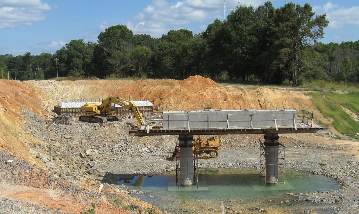
V. 'US 311' Bridge and Interchange
The only interchange between Spencer Road and US 220 will be placed in Sophia at the intersection of the new freeway and the existing US 311. Construction documents have been inconsistent as to what this interchange will be signed. Some documents indicated that US 311 will be routed off here and take its existing pathway east to US 220 (Future I-73). Signs put up along US 220 in July 2012 as part of the project contract seemed to confirm this as new US 311 signs put up at the existing roadway. Other documents insist US 311 will continue with I-74 and this interchange will indicate a road name and/or the town, Sophia. Existing US 311 originally was to be US 311 Business until High Point officials asked that route be decommissioned through their city (see I-74 Segment 6, Part 2) in 2009.2 Construction on this bridge began in the fall of 2009. All the major deck beams were in place in July 2011 and the bridge deck was completed late in 2011. Work has proceeded on the interchange which, due to train tracks on the south side of US 311, will be built completely to the north of the current roadway. Work proceeded on a new rail track and bridge along the old US 311 alignment, this was completed in the Spring of 2012.
 Approaching
the completed US 311 and railroad bridges in the Summer of 2012. Note
trucks dumping dirt to be added to piles of soil excavated between
Branson Davis and Walker Mill Roads. (8/1/12)
Approaching
the completed US 311 and railroad bridges in the Summer of 2012. Note
trucks dumping dirt to be added to piles of soil excavated between
Branson Davis and Walker Mill Roads. (8/1/12)
 Work proceeding
on grading the future I-74 Eastbound on and off-ramps in August 2012.
Gravel was being dumped and spread over the future ramps. (8/1/12)
Work proceeding
on grading the future I-74 Eastbound on and off-ramps in August 2012.
Gravel was being dumped and spread over the future ramps. (8/1/12)
 Scene
approaching the completed bridge on South US 311 in October 2011.
Equipment seen in the distance is working on the new railroad bridge
that will run parallel to the highway. (10/13/11)
Scene
approaching the completed bridge on South US 311 in October 2011.
Equipment seen in the distance is working on the new railroad bridge
that will run parallel to the highway. (10/13/11)
 Approaching
the future interchange on current US 311 South more than a year earlier
in July 2010. Progress on clearing and work on the bridge could be seen
at that time. (7/24/10)
Approaching
the future interchange on current US 311 South more than a year earlier
in July 2010. Progress on clearing and work on the bridge could be seen
at that time. (7/24/10)
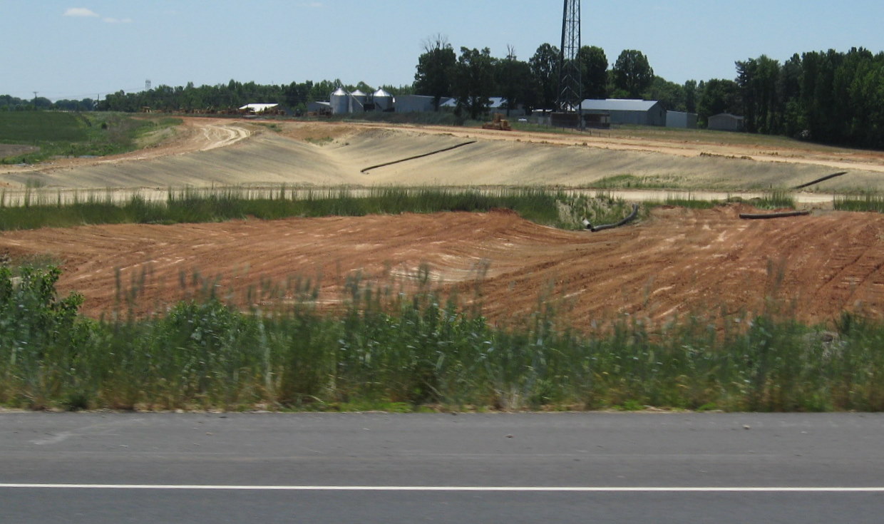
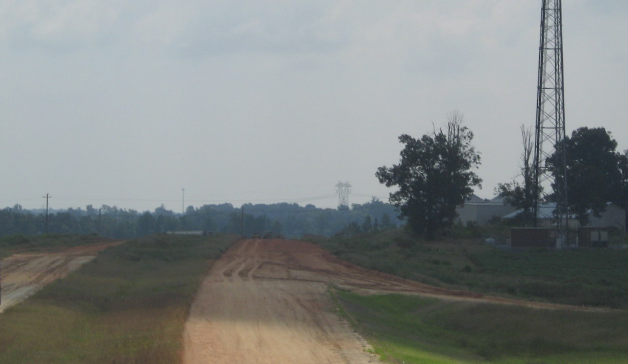
 Progress
in clearing around the future Sophia interchange a couple months
earlier, again approaching on southbound US 311 (5/9/10)
Progress
in clearing around the future Sophia interchange a couple months
earlier, again approaching on southbound US 311 (5/9/10)
 View of new bridge from
the railbed itself (no trains appeared during this time, fortunately)
looking east. (8/1/12)
View of new bridge from
the railbed itself (no trains appeared during this time, fortunately)
looking east. (8/1/12)
 Crossing the completed bridge
on South US 311 in October 2011. Completion of the roadbed to connect
with the highway constructed east of US 311 had to wait until the
railroad bridge, on the right, was complete. (10/13/11)
Crossing the completed bridge
on South US 311 in October 2011. Completion of the roadbed to connect
with the highway constructed east of US 311 had to wait until the
railroad bridge, on the right, was complete. (10/13/11)
 Progress in
completing the US 311 interchange bridge over future I-74 a year earlier
in October 2010. Concrete had been placed and covered over for curing.
(10/3/10)
Progress in
completing the US 311 interchange bridge over future I-74 a year earlier
in October 2010. Concrete had been placed and covered over for curing.
(10/3/10)
 Equipment for
placing re-bar on future bridge to allow for concrete pouring in August
2010. Equipment first needed to be cleared off before the entire road
alignment could be graded. (8/29/10)
Equipment for
placing re-bar on future bridge to allow for concrete pouring in August
2010. Equipment first needed to be cleared off before the entire road
alignment could be graded. (8/29/10)
 View of
excavation between future and current US 311 alignments. The supports at
right were used in constructing a temporary railroad bridge along the
old US 311 after the highway bridge is complete, to allow rail traffic
to continue while the roadbed was excavated for the new railroad bridge.
(8/29/10)
View of
excavation between future and current US 311 alignments. The supports at
right were used in constructing a temporary railroad bridge along the
old US 311 after the highway bridge is complete, to allow rail traffic
to continue while the roadbed was excavated for the new railroad bridge.
(8/29/10)
 A closer look at
the bridge undergoing rebar placement in anticipation of the pouring of
concrete for the bridge deck. (8/29/10)
A closer look at
the bridge undergoing rebar placement in anticipation of the pouring of
concrete for the bridge deck. (8/29/10)
 The view from a
month earlier, pipes for drainage are to be installed as work continues
on grading the bridge approaches. (7/24/10)
The view from a
month earlier, pipes for drainage are to be installed as work continues
on grading the bridge approaches. (7/24/10)
 Progress in
clearing the future US 311 roadway and bridge alignment earlier in May
2010, the view is looking east. (5/9/10)
Progress in
clearing the future US 311 roadway and bridge alignment earlier in May
2010, the view is looking east. (5/9/10)
 This
pile of dirt is what has been excavated from the Branson Davis and
Walker Mill Roads area next to future I-74 westbound off-ramps. This
place I assume was chosen to dump the soil for its easy access to US 311
when it was taken away in late 2012. (7/28/12)
This
pile of dirt is what has been excavated from the Branson Davis and
Walker Mill Roads area next to future I-74 westbound off-ramps. This
place I assume was chosen to dump the soil for its easy access to US 311
when it was taken away in late 2012. (7/28/12)
 View
from the future on-ramps in June prior to the dirt piles, showing paved
lanes heading toward Walker Mill Rd. (6/10/12)
View
from the future on-ramps in June prior to the dirt piles, showing paved
lanes heading toward Walker Mill Rd. (6/10/12)
 View
looking north from current US 311 in August 2010 showing progress in
clearing and grading future freeway and interchange. (8/29/10)
View
looking north from current US 311 in August 2010 showing progress in
clearing and grading future freeway and interchange. (8/29/10)
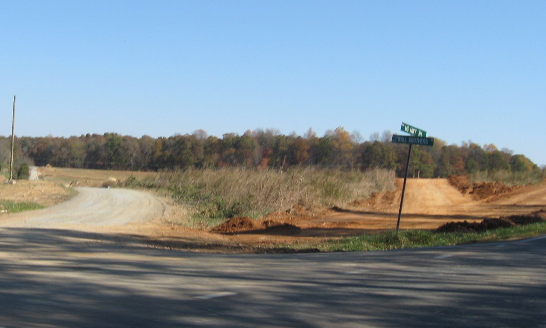 A
similar view from the fall of 2009. This intersection of US 311 and Wall
Brothers Road would be the location of the future off-ramp from I-74
East. Wall Brothers Road was relocated in early 2010 to the west (north)
and ties into what is the new alignment of US 311 just south of the new
bridge. (11/8/09)
A
similar view from the fall of 2009. This intersection of US 311 and Wall
Brothers Road would be the location of the future off-ramp from I-74
East. Wall Brothers Road was relocated in early 2010 to the west (north)
and ties into what is the new alignment of US 311 just south of the new
bridge. (11/8/09)
 View
looking south from railroad bridge showing progress in grading I-74
roadbed. A paved section starts toward the top of the photo and
continues until just before Plainfield Rd. (8/1/12)
View
looking south from railroad bridge showing progress in grading I-74
roadbed. A paved section starts toward the top of the photo and
continues until just before Plainfield Rd. (8/1/12)
 View looking west
toward the bridge along the future US 311 alignment in October 2010.
(10/3/10)
View looking west
toward the bridge along the future US 311 alignment in October 2010.
(10/3/10)
 View of equipment
and progress in creating the new road alignment west of the future
bridge in the summer of 2010. (8/29/10)
View of equipment
and progress in creating the new road alignment west of the future
bridge in the summer of 2010. (8/29/10)
 View
across the US 311 bridge to the existing I-74 freeway roadbed. Truck
proceeding south has more soil for the dirt piles. Roadbed was paved
north of the I-74 west on-ramp. (8/1/12)
View
across the US 311 bridge to the existing I-74 freeway roadbed. Truck
proceeding south has more soil for the dirt piles. Roadbed was paved
north of the I-74 west on-ramp. (8/1/12)
 A view from
existing US 311 to the north a couple years earlier showing progress in
building the future bridge in July 2010. (7/24/10)
A view from
existing US 311 to the north a couple years earlier showing progress in
building the future bridge in July 2010. (7/24/10)
 Progress in
grading the area around the interchange in March 2010. (3/10/10)
Progress in
grading the area around the interchange in March 2010. (3/10/10)
 A
look at the construction at the future interchange site from the
opposite direction in October 2009. An e-mail from a resident and a
check of the plans confirmed they were moving the utilities in order to
construct the interchange with existing US 311.(1) (10/12/09)
A
look at the construction at the future interchange site from the
opposite direction in October 2009. An e-mail from a resident and a
check of the plans confirmed they were moving the utilities in order to
construct the interchange with existing US 311.(1) (10/12/09)
 The
view at the end of the construction zone along North US 311 in Sophia at
the start of the interchange project. (10/12/09)
The
view at the end of the construction zone along North US 311 in Sophia at
the start of the interchange project. (10/12/09)
 The
start of excavation can be seen back in November 2009 behind what was
the pipeline relocation construction seen a month before. (11/8/09)
The
start of excavation can be seen back in November 2009 behind what was
the pipeline relocation construction seen a month before. (11/8/09)
 This
shows the first appearance of construction equipment to move a pipeline
in September 2009. This was approximately where the new freeway is to
cross existing US 311. (9/18/09)
This
shows the first appearance of construction equipment to move a pipeline
in September 2009. This was approximately where the new freeway is to
cross existing US 311. (9/18/09)
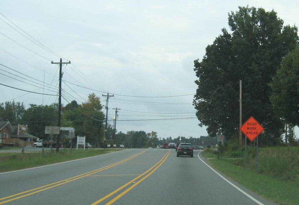 This
road work ahead sign had appeared along US 311 on the way through Sophia
in September 2009.(9/18/09)
This
road work ahead sign had appeared along US 311 on the way through Sophia
in September 2009.(9/18/09)
VI. Plainfield Road
A bridge is being built here to carry the road over I-74/US 311. Work on the bridge started about the same time as the US 311 bridge, in the fall of 2009. The bridge was completed in the spring of 2011. Work started in May 2011 to connect the existing roadway to the new bridge, the bridge was opened to traffic in July.
 Approaching
the completed Plainfield Road Bridge from the east in October 2011.
(10/13/11)
Approaching
the completed Plainfield Road Bridge from the east in October 2011.
(10/13/11)
 View of the work
proceeding under the completed bridge in August 2012. Photo taken from
one of the two high berms that have been placed on either side of the
freeway. (8/1/12)
View of the work
proceeding under the completed bridge in August 2012. Photo taken from
one of the two high berms that have been placed on either side of the
freeway. (8/1/12)
 View of
the completed bridge from the western side in October 2011 showing
progress in grading the freeway roadbed underneath. (10/13/11)
View of
the completed bridge from the western side in October 2011 showing
progress in grading the freeway roadbed underneath. (10/13/11)
 View
of center bridge support for Plainfield Road bridge, bottom covered by
water during rainy fall of 2010. (10/3/10)
View
of center bridge support for Plainfield Road bridge, bottom covered by
water during rainy fall of 2010. (10/3/10)
 Work
on bridge piers earlier in the summer of 2010. Note few differences from
above with rain slowing construction. (8/29/10)
Work
on bridge piers earlier in the summer of 2010. Note few differences from
above with rain slowing construction. (8/29/10)
 View
of roadbed to the south of the Plainfield Rd bridge showing potential
final asphalt layer and the installation of guardrails in the summer of
2012. (8/1/12)
View
of roadbed to the south of the Plainfield Rd bridge showing potential
final asphalt layer and the installation of guardrails in the summer of
2012. (8/1/12)
 Similar
view from a month and 1/2 earlier, prior to guard rail placement, the
Heath Dairy Rd bridge is in the distance. (6/10/12)
Similar
view from a month and 1/2 earlier, prior to guard rail placement, the
Heath Dairy Rd bridge is in the distance. (6/10/12)
 View
south of the bridge 10 months earlier showing completion of a parallel
roadway on the right to service the farm located on the west side of Old
Courthouse Road whose connection (road with equipment on hill) to the
current US 311 was cut off in the summer of 2011. (10/13/11)
View
south of the bridge 10 months earlier showing completion of a parallel
roadway on the right to service the farm located on the west side of Old
Courthouse Road whose connection (road with equipment on hill) to the
current US 311 was cut off in the summer of 2011. (10/13/11)
 View south of the bridge a year earlier showing progress
in building the connection (road with equipment on hill) to the farm to
replace access to be cut off in the summer of 2011. (10/3/10)
View south of the bridge a year earlier showing progress
in building the connection (road with equipment on hill) to the farm to
replace access to be cut off in the summer of 2011. (10/3/10)
 View
south of the bridge two months earlier showing pre-existing asphalt path
for equipment building the service roadway described above, along with
progress in grading future I-74 at that time. (8/29/10)
View
south of the bridge two months earlier showing pre-existing asphalt path
for equipment building the service roadway described above, along with
progress in grading future I-74 at that time. (8/29/10)
 Progress in
constructing the western bridge support as of October 2010. Work had
apparently been stopped to allow for area to completely dry out.
(10/3/10)
Progress in
constructing the western bridge support as of October 2010. Work had
apparently been stopped to allow for area to completely dry out.
(10/3/10)
 View from
bridge itself showing grading work proceeding with the placement of
gravel layers on future eastbound roadway. (8/1/12)
View from
bridge itself showing grading work proceeding with the placement of
gravel layers on future eastbound roadway. (8/1/12)
 View
north of the Plainfield Rd Bridge in August 2012 showing progress in
final grading and initial paving of roadbed. (8/1/12)
View
north of the Plainfield Rd Bridge in August 2012 showing progress in
final grading and initial paving of roadbed. (8/1/12)
 A
similar view northwest from June 2012 showing grading work proceeding.
(6/10/12)
A
similar view northwest from June 2012 showing grading work proceeding.
(6/10/12)
 View
north of Plainfield Road 10 months earlier in October 2011 showing new
access road and progress in grading freeway roadbed. (10/13/11)
View
north of Plainfield Road 10 months earlier in October 2011 showing new
access road and progress in grading freeway roadbed. (10/13/11)
 View
of progress in clearing the future freeway path north of Planfield Road
the year before. A small hill of construction fill was placed here in
the spring of 2011, to act as a berm between freeway and local
residences. (10/3/10)
View
of progress in clearing the future freeway path north of Planfield Road
the year before. A small hill of construction fill was placed here in
the spring of 2011, to act as a berm between freeway and local
residences. (10/3/10)
 View
of progress in clearing the future freeway path north of Planfield Road
a couple months earlier. (8/29/10)
View
of progress in clearing the future freeway path north of Planfield Road
a couple months earlier. (8/29/10)
VII. Heath Dairy Road
NCDOT constructed a bridge over the I-74/ US 311 freeway for a new alignment of Heath Dairy Road from 2009 to early 2011. Houses bypassed by the new alignment are now located on 'Old Heath Dairy Road'. While the bridge was opened in June 2011, it was basically complete in the fall of 2010, however not until May 2011 was blacktop being put down on the future road alignment to tie the existing roadway to the new bridge so it could be used. The view southeast of the bridge provides a good look at the progress in completing the US 220 interchange a 1/2 mile away.
 View from the Heath Dairy Rd bridge looking
east toward interchange with US 220 (I-73) in August 2012 showing the
near completion of this section of I-74 complete with overhead signs in
place. (8/1/12)
View from the Heath Dairy Rd bridge looking
east toward interchange with US 220 (I-73) in August 2012 showing the
near completion of this section of I-74 complete with overhead signs in
place. (8/1/12)
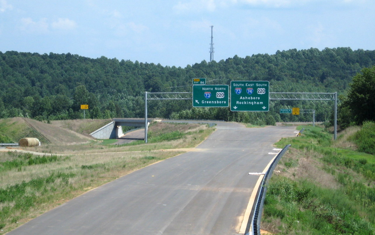 A closeup view of the exit
signs placed in July 2012 clearly identifying the I-73 North as Exit 86.
(7/28/12)
A closeup view of the exit
signs placed in July 2012 clearly identifying the I-73 North as Exit 86.
(7/28/12)
 Here's a similar view,
taken a 2 weeks before, the shields for the I-73/US 220 North exit sign
had not been installed. (7/15/12)
Here's a similar view,
taken a 2 weeks before, the shields for the I-73/US 220 North exit sign
had not been installed. (7/15/12)
 Similar view from the
bridge in early June showing the start of overhead sign installation.
(6/10/12)
Similar view from the
bridge in early June showing the start of overhead sign installation.
(6/10/12)
 View from completed bridge looking east eight months
earlier in October 2011 showing progress in completing the paving of the
roadbed. (10/13/11)
View from completed bridge looking east eight months
earlier in October 2011 showing progress in completing the paving of the
roadbed. (10/13/11)
 View of
the nearly completed Heath Dairy Road bridge in October 2010. Equipment
below is digging the final alignment for the future I-74 freeway.
(10/3/10)
View of
the nearly completed Heath Dairy Road bridge in October 2010. Equipment
below is digging the final alignment for the future I-74 freeway.
(10/3/10)
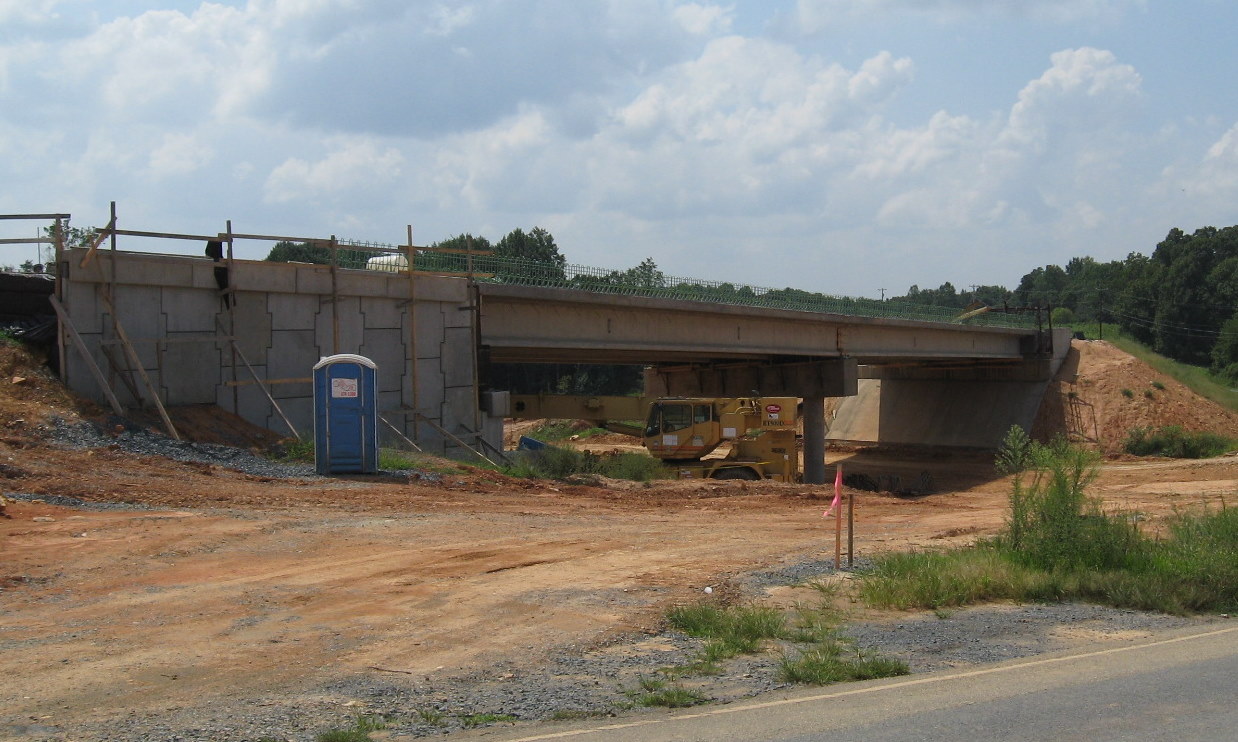 The
bridge as it appeared in August 2010, all but the sides to the bridge
had apparently been completed. (8/29/10)
The
bridge as it appeared in August 2010, all but the sides to the bridge
had apparently been completed. (8/29/10)
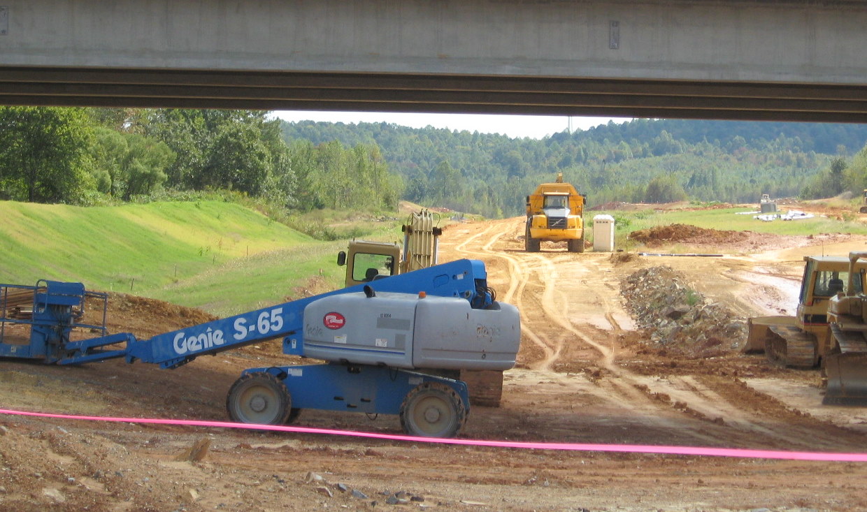 View looking southeast
from under the Heath Valley Road bridge, the mounds in the distance are
at the future interchange with US 220 (see more below). (10/3/10)
View looking southeast
from under the Heath Valley Road bridge, the mounds in the distance are
at the future interchange with US 220 (see more below). (10/3/10)
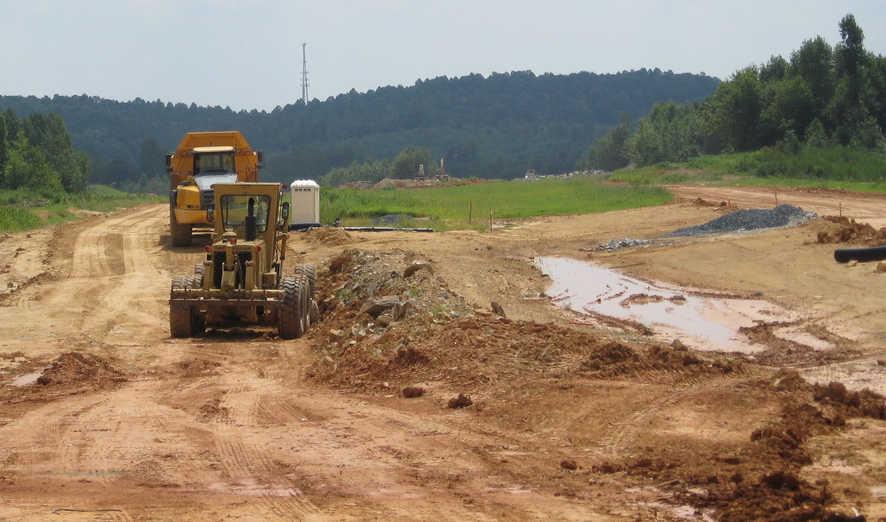 Same view looking
southeast a couple months earlier, the equipment in the distance are
being used to construct the interchange with US 220. (8/29/10)
Same view looking
southeast a couple months earlier, the equipment in the distance are
being used to construct the interchange with US 220. (8/29/10)
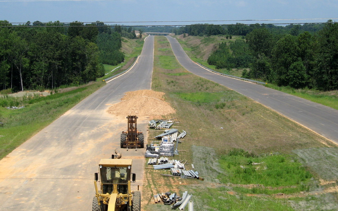 View northwest of the bridge in August 2012
showing installation of guardrail in progress work proceeding from
Plainfield Rd. Unknown where dirt for piles in future eastbound roadway
came from. (8/1/12)
View northwest of the bridge in August 2012
showing installation of guardrail in progress work proceeding from
Plainfield Rd. Unknown where dirt for piles in future eastbound roadway
came from. (8/1/12)
 View from the bridge six weeks earlier
showing progress in paving prior to guardrail installation. (6/10/12)
View from the bridge six weeks earlier
showing progress in paving prior to guardrail installation. (6/10/12)
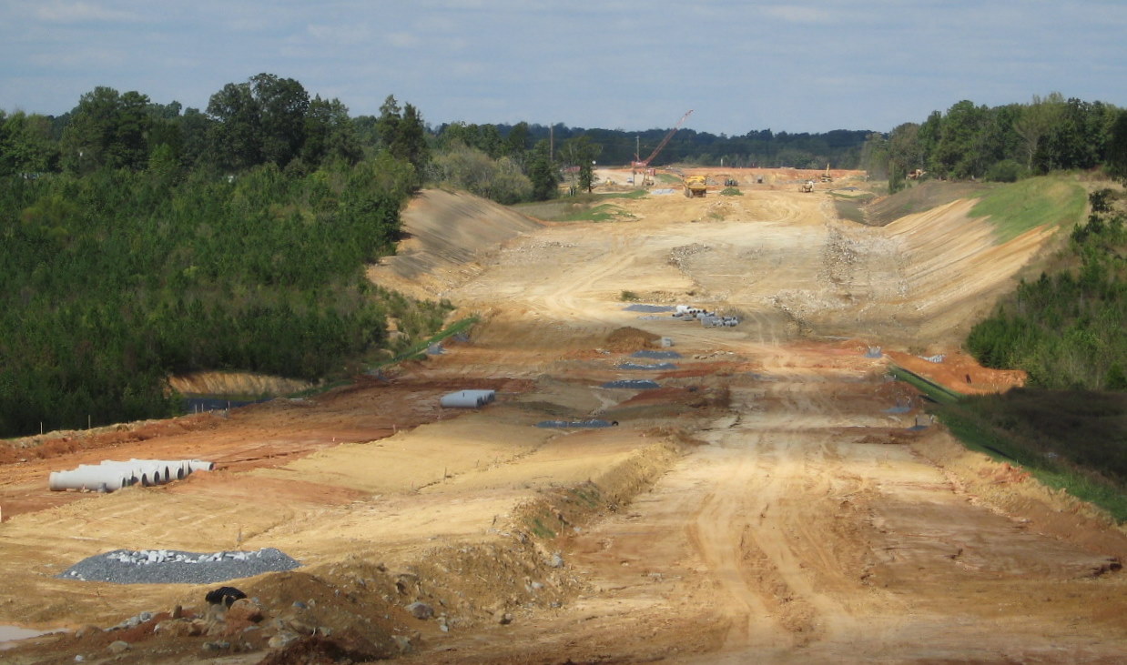 View looking northwest
from opposite the Heath Dairy Road bridge the year before in October
2010. The Plainfield Road bridge site can be seen in the distance.
(10/3/10)
View looking northwest
from opposite the Heath Dairy Road bridge the year before in October
2010. The Plainfield Road bridge site can be seen in the distance.
(10/3/10)
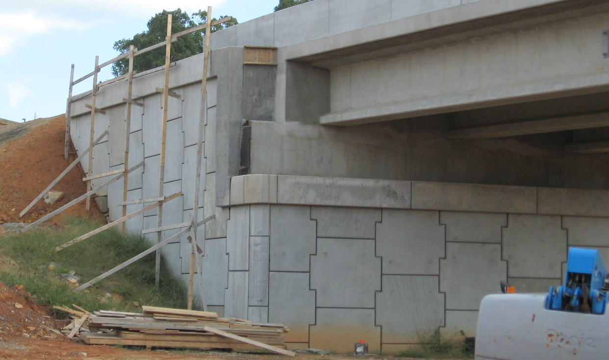 View
of exterior wall pieces after placement on the Heath Dairy Road bridge.
(10/3/10)
View
of exterior wall pieces after placement on the Heath Dairy Road bridge.
(10/3/10)
 Closeup
of west side bridge support, angled instead of vertical east side, for
the new alignment of Heath Dairy Road. (10/3/10)
Closeup
of west side bridge support, angled instead of vertical east side, for
the new alignment of Heath Dairy Road. (10/3/10)
 View along completed roadway connecting to
Heath Dairy Road bridge from west. Equipment still working on future
freeway lanes can be seen to the right. (10/13/11)
View along completed roadway connecting to
Heath Dairy Road bridge from west. Equipment still working on future
freeway lanes can be seen to the right. (10/13/11)
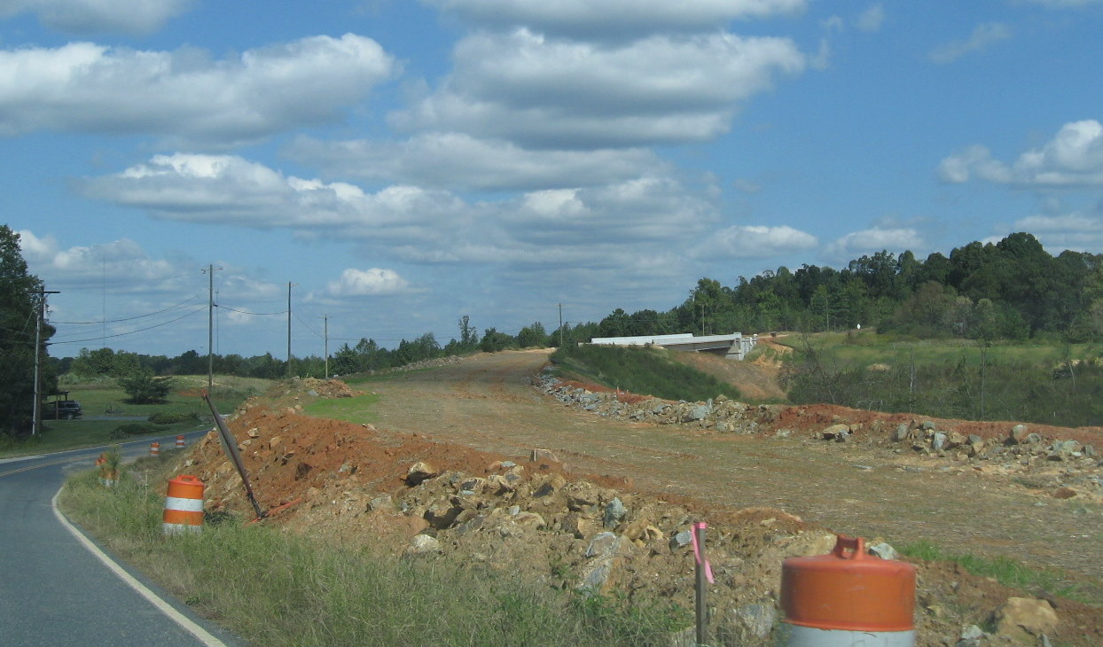 View of bridge from the west showing progress
in building the future alignment for the bridge a year earlier. When
this bridge was opened in June 2011, the old road to the right remained
to access the residences on the west side of the freeway. The road was
renamed 'Old Heath Dairy Road.' (10/3/10)
View of bridge from the west showing progress
in building the future alignment for the bridge a year earlier. When
this bridge was opened in June 2011, the old road to the right remained
to access the residences on the west side of the freeway. The road was
renamed 'Old Heath Dairy Road.' (10/3/10)
VIII.The US 220 Interchange
Construction on this part of the project was almost complete in the summer of 2012. In August 2009 jersey barriers went up and construction equipment appeared along US 220 between the current US 311 exit and the Pineview Street exit.
 Road construction signs can be seen from the
on-ramp from US 311 to US 220 South (Future I-73/74). (9/18/09)
Road construction signs can be seen from the
on-ramp from US 311 to US 220 South (Future I-73/74). (9/18/09)
 The signs indicate the placement of barriers
along the right shoulder (they are on the left too, but not mentioned)
where the ramps to and from I-74 will be built. (9/18/09)
The signs indicate the placement of barriers
along the right shoulder (they are on the left too, but not mentioned)
where the ramps to and from I-74 will be built. (9/18/09)
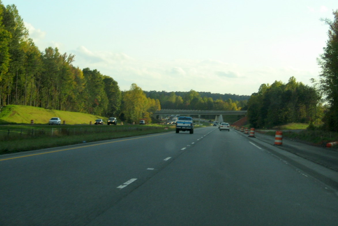 Approaching the
future interchange with I-74 in October 2011, future WB I-74 onramp on
right (10/13/11)
Approaching the
future interchange with I-74 in October 2011, future WB I-74 onramp on
right (10/13/11)
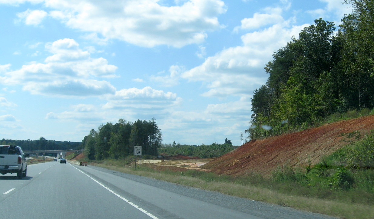 Approaching
the intersection site a year earlier in the fall of 2010. The beginnings
of the graded future ramp to I-74 West can be seen on the right.
(10/3/10)
Approaching
the intersection site a year earlier in the fall of 2010. The beginnings
of the graded future ramp to I-74 West can be seen on the right.
(10/3/10)
 Work had
just started on the I-74 offramp and the girders for the flyover bridge
deck had been placed in this photo from August 2010. (8/29/10)
Work had
just started on the I-74 offramp and the girders for the flyover bridge
deck had been placed in this photo from August 2010. (8/29/10)
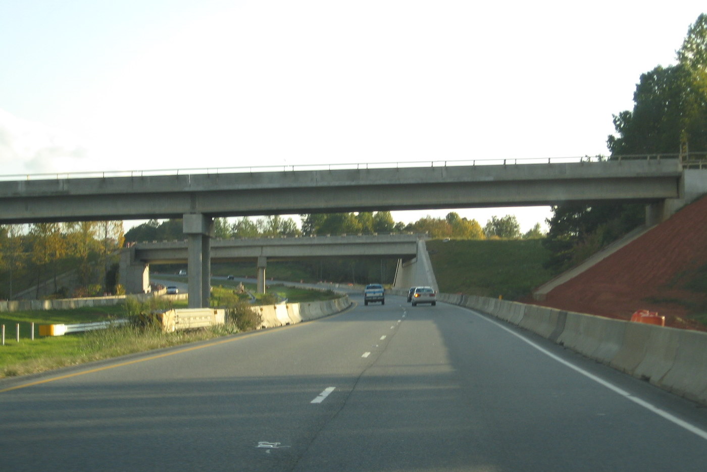 The two ramps
over US 220 as seen in October 2011, ramps appear near completion with
the exception of side railings. (10/13/11)
The two ramps
over US 220 as seen in October 2011, ramps appear near completion with
the exception of side railings. (10/13/11)
 A year
earlier, the recently completed bridge decks for the I-74 ramps can be
seen from US 220 South in the fall of 2010. (10/3/10)
A year
earlier, the recently completed bridge decks for the I-74 ramps can be
seen from US 220 South in the fall of 2010. (10/3/10)
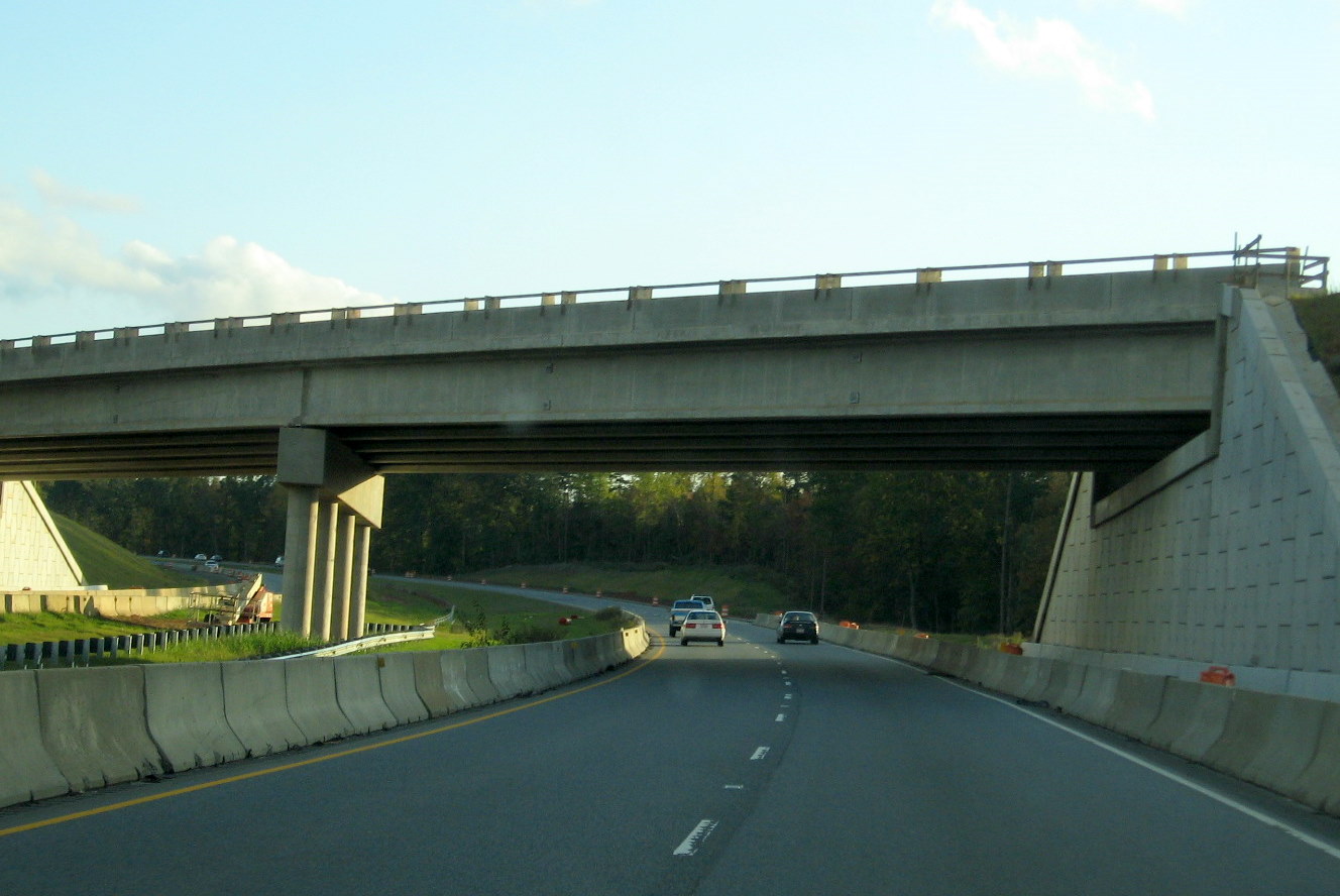 The nearly
completed I-74 Westbound Flyover Ramp from US 220 (I-73) South in
October 2011. (10/13/11)
The nearly
completed I-74 Westbound Flyover Ramp from US 220 (I-73) South in
October 2011. (10/13/11)
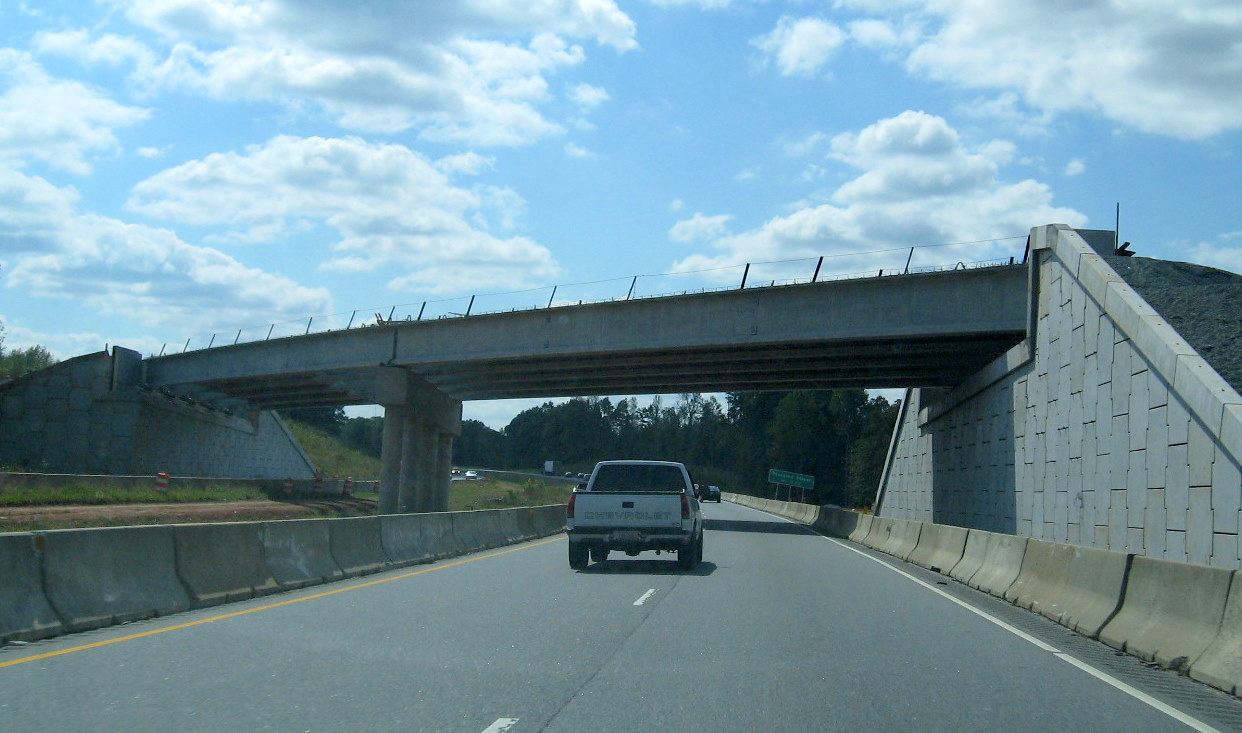 Heading
under the future flyover ramp for I-74 west in October 2010. Due to cost
concerns the previous ramp, which was also to be a flyover was changed
to a bridge carrying traffic to US 220 (I-73) North along a tight
cloverleaf ramp. (10/3/10)
Heading
under the future flyover ramp for I-74 west in October 2010. Due to cost
concerns the previous ramp, which was also to be a flyover was changed
to a bridge carrying traffic to US 220 (I-73) North along a tight
cloverleaf ramp. (10/3/10)
 A closer look
at the progress in placing the girders for the I-74 ramp bridges in the
summer of 2010. (8/29/10)
A closer look
at the progress in placing the girders for the I-74 ramp bridges in the
summer of 2010. (8/29/10)
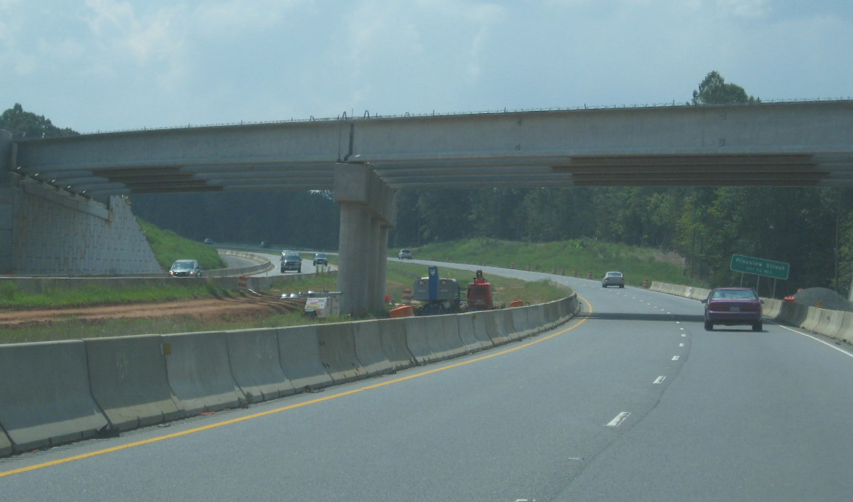 A
closer look at the progress in building the I-74 West flyover ramp
bridge in August 2010. (8/29/10)
A
closer look at the progress in building the I-74 West flyover ramp
bridge in August 2010. (8/29/10)
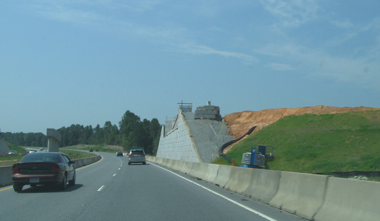 Approaching
the flyover ramp construction area a month earlier, prior to the
building of the I-74 east to I-73 north flyover ramp bridge deck.
(7/24/10)
Approaching
the flyover ramp construction area a month earlier, prior to the
building of the I-74 east to I-73 north flyover ramp bridge deck.
(7/24/10)
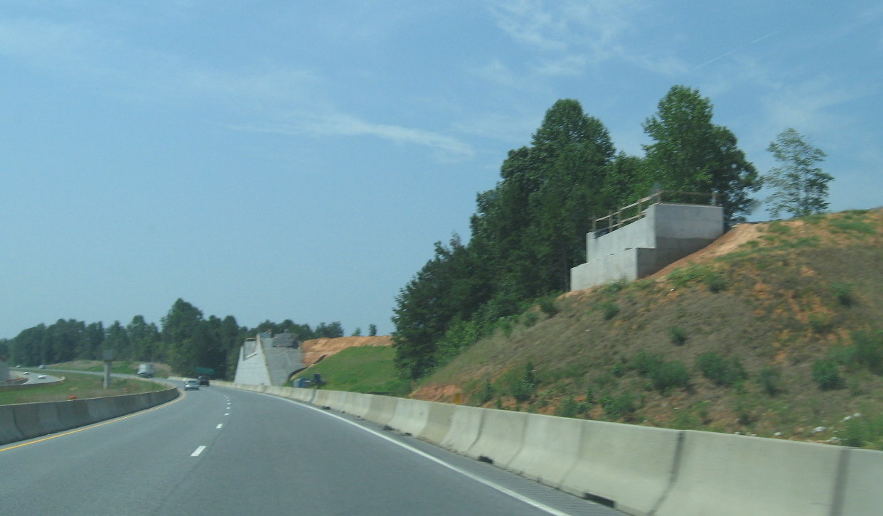 Going back
a month further showing progress on building the bridge supports from
both ramp bridges across US 220 in July 2010. (7/24/10)
Going back
a month further showing progress on building the bridge supports from
both ramp bridges across US 220 in July 2010. (7/24/10)
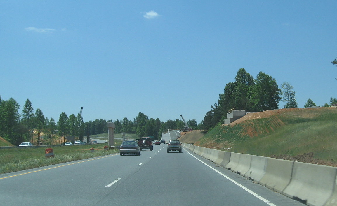 Approaching the
area earlier in May 2009, showing progress on building the two
interchange bridges and ramps. (5/9/10)
Approaching the
area earlier in May 2009, showing progress on building the two
interchange bridges and ramps. (5/9/10)
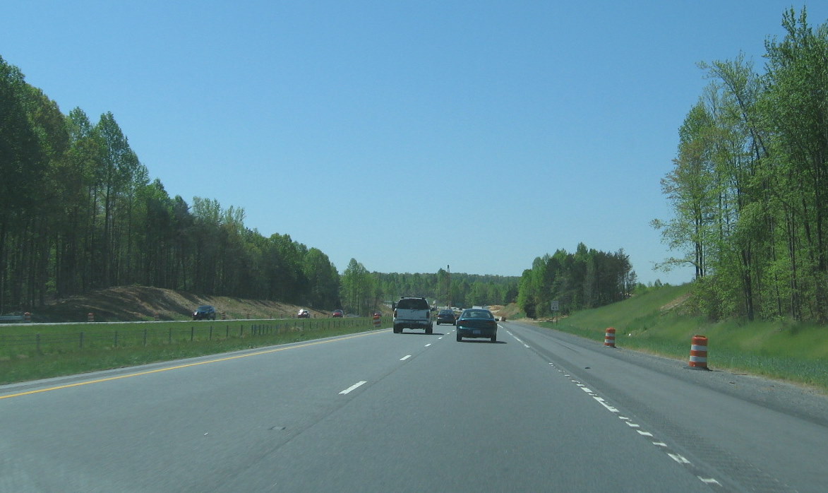 View
approaching the construction zone a month earlier, note progress on the
right side bridges compared to that in the photo below. (4/11/10)
View
approaching the construction zone a month earlier, note progress on the
right side bridges compared to that in the photo below. (4/11/10)
 Closeup view of
the west side of the second bridge for the ramp to I-73 (US 220) North
in May 2010, note the grading behind the bridge support structure.
(5/9/10)
Closeup view of
the west side of the second bridge for the ramp to I-73 (US 220) North
in May 2010, note the grading behind the bridge support structure.
(5/9/10)
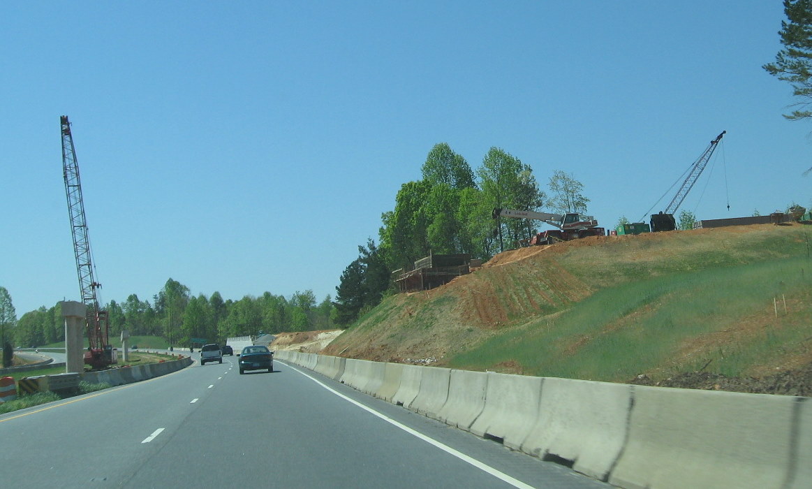 A
close look a month earlier at the I-74 West Flyover ramp, this ramp will
go both over US 220 and the bridge carrying traffic to I-73 north
(4/11/10)
A
close look a month earlier at the I-74 West Flyover ramp, this ramp will
go both over US 220 and the bridge carrying traffic to I-73 north
(4/11/10)
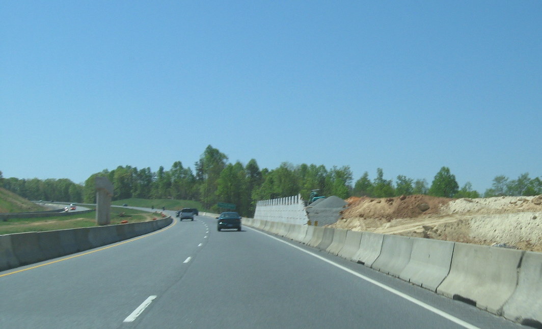 A closer look
at the second ramp going southbound, notice this is lower and made of
concrete blocks, as opposed to the metal work in the previous bridge
support (4/11/10)
A closer look
at the second ramp going southbound, notice this is lower and made of
concrete blocks, as opposed to the metal work in the previous bridge
support (4/11/10)
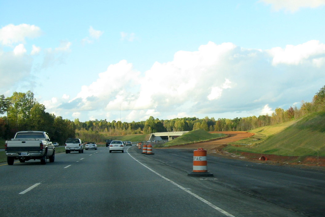 Approaching
the future interchange along US 220 Northbound in October 2011. Note
ramp to flyover bridge has been fully graded. (10/13/11)
Approaching
the future interchange along US 220 Northbound in October 2011. Note
ramp to flyover bridge has been fully graded. (10/13/11)
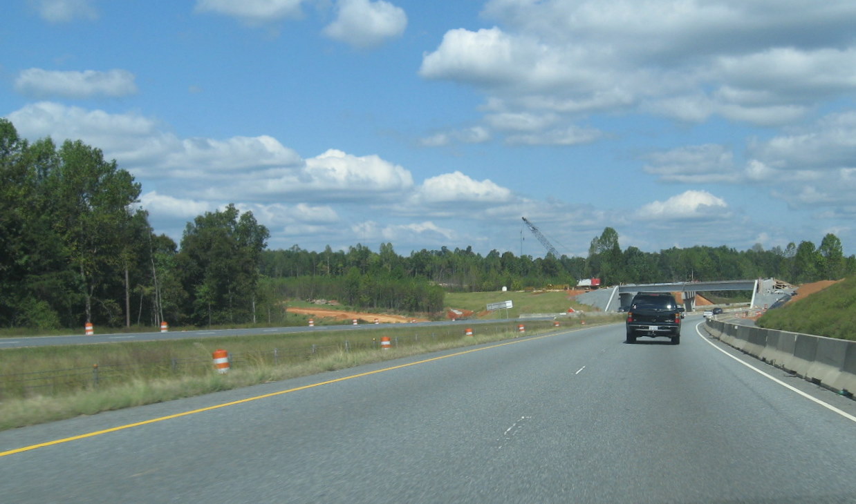 Approaching
the I-74 construction area a year earlier, in the fall of 2010. The
future ramp carrying I-74 onto South US 220 (I-73) can be seen on the
left. (10/3/10)
Approaching
the I-74 construction area a year earlier, in the fall of 2010. The
future ramp carrying I-74 onto South US 220 (I-73) can be seen on the
left. (10/3/10)
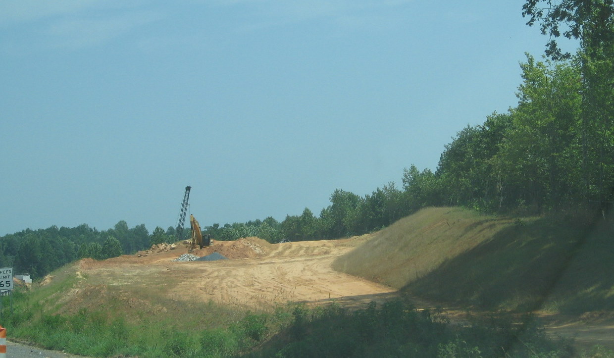 Progress in
building the slope to carry the I-74 west ramp above US 220 to the
flyover bridge in July 2010. (7/24/10)
Progress in
building the slope to carry the I-74 west ramp above US 220 to the
flyover bridge in July 2010. (7/24/10)
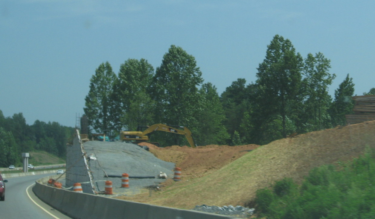 Closeup of
constructing the future I-74 West to US 220 (I-73) ramp bridge in July
2010. (7/24/10)
Closeup of
constructing the future I-74 West to US 220 (I-73) ramp bridge in July
2010. (7/24/10)
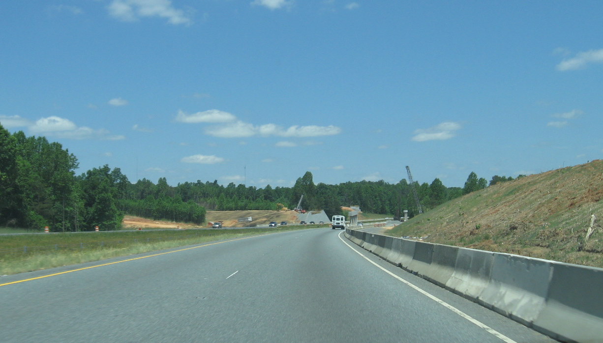 View of the
construction site approaching on US 220 (I-73) North several months
earlier in May 2010. (5/9/10)
View of the
construction site approaching on US 220 (I-73) North several months
earlier in May 2010. (5/9/10)
 Approaching
the nearly completed I-74 Flyover Ramp Bridge in October 2011. Future
ramp to US 220 North in distance. (10/13/11)
Approaching
the nearly completed I-74 Flyover Ramp Bridge in October 2011. Future
ramp to US 220 North in distance. (10/13/11)
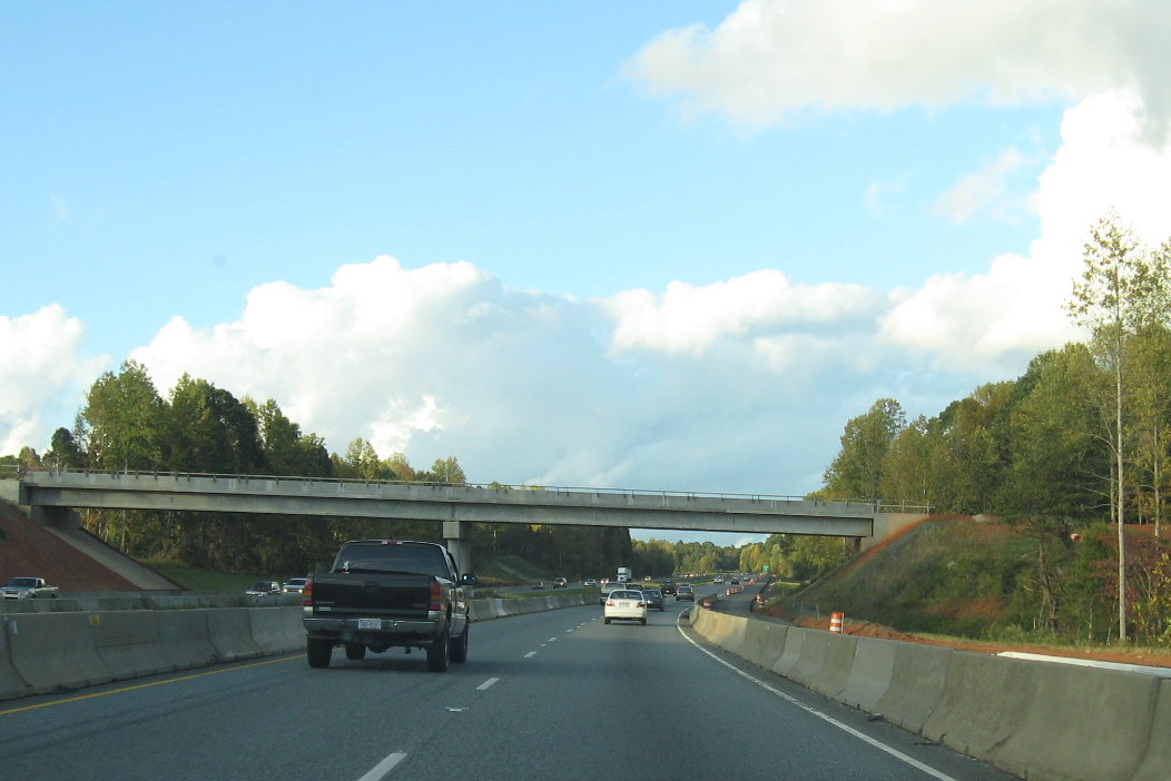 Closer look at
future US 220 (I-73) Northbound off-ramp from I-74 East. Traffic to US
220 will circle around and merge using new third lane seen going under
the bridge on the right. (10/13/11)
Closer look at
future US 220 (I-73) Northbound off-ramp from I-74 East. Traffic to US
220 will circle around and merge using new third lane seen going under
the bridge on the right. (10/13/11)
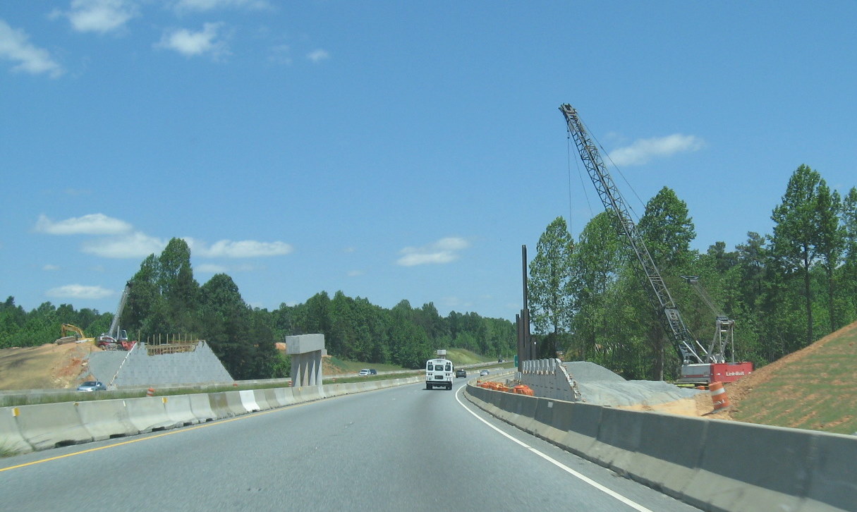 Closeup of the
two bridge piers and progress on the northbound side of US 220 building
the future interchange ramps a year and 1/2 earlier in May 2010.
(5/9/10)
Closeup of the
two bridge piers and progress on the northbound side of US 220 building
the future interchange ramps a year and 1/2 earlier in May 2010.
(5/9/10)
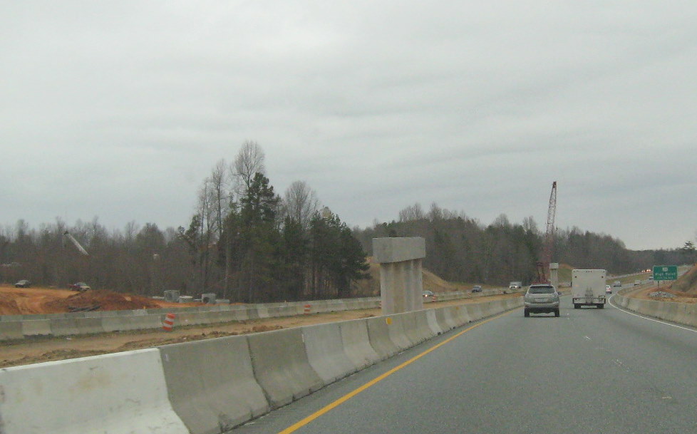 The progress
on the two piers for the flyover ramps in March, the crane is completing
work on the second pier. (3/10/10)
The progress
on the two piers for the flyover ramps in March, the crane is completing
work on the second pier. (3/10/10)
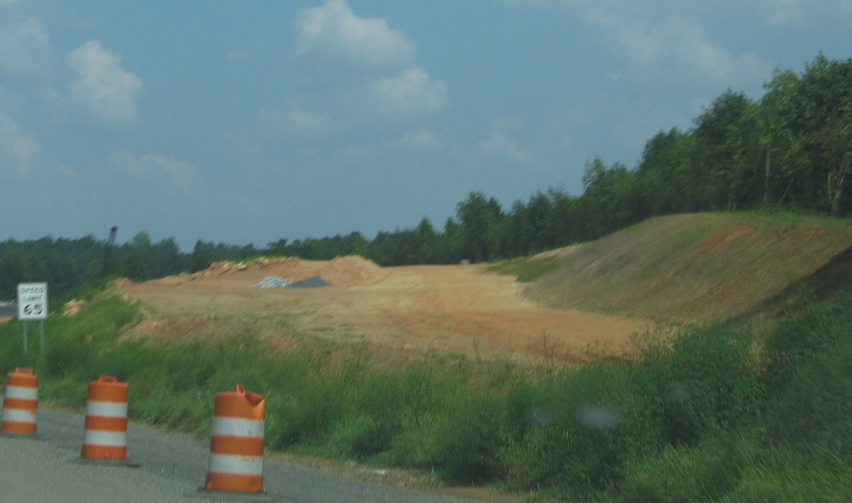 Looking at
progress at creating the ramp to take I-74 West toward the flyover
bridge from US 220 (I-73) North in August 2010. (8/29/10)
Looking at
progress at creating the ramp to take I-74 West toward the flyover
bridge from US 220 (I-73) North in August 2010. (8/29/10)
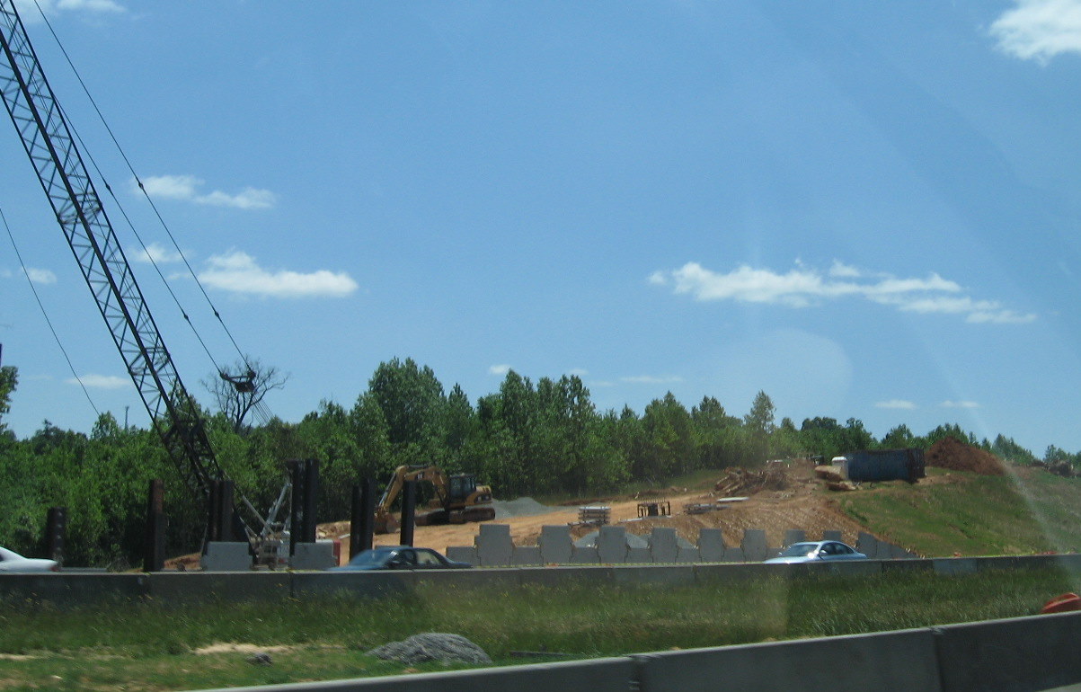 Progress in
building up the grade for the I-74 East flyover ramp looking from US 220
Southbound in May 2010. (5/9/10)
Progress in
building up the grade for the I-74 East flyover ramp looking from US 220
Southbound in May 2010. (5/9/10)
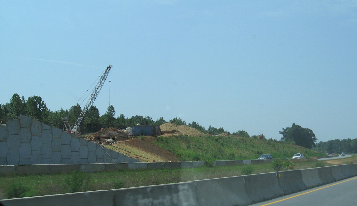 The piers for
the flyover bridges and the progress in land clearing for the I-74 to
I-73 north on-ramps can be seen across the southbound US 220 lanes.
(7/24/10)
The piers for
the flyover bridges and the progress in land clearing for the I-74 to
I-73 north on-ramps can be seen across the southbound US 220 lanes.
(7/24/10)
 From six
months earlier, the first piers for the flyover bridges and the initial
phases of land clearing for the future on-ramps can be seen across the
southbound US 220 lanes. (11/8/09)
From six
months earlier, the first piers for the flyover bridges and the initial
phases of land clearing for the future on-ramps can be seen across the
southbound US 220 lanes. (11/8/09)
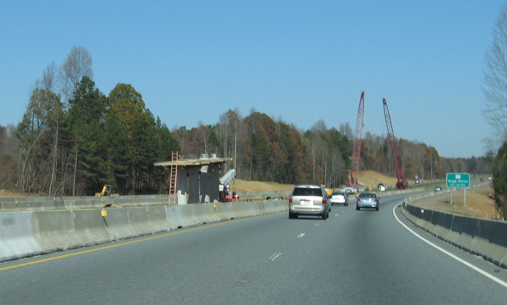 The cranes
in the background used to help start construction of the piers for the
flyover ramps in November 2009 as seen from North US 220. (11/8/09)
The cranes
in the background used to help start construction of the piers for the
flyover ramps in November 2009 as seen from North US 220. (11/8/09)
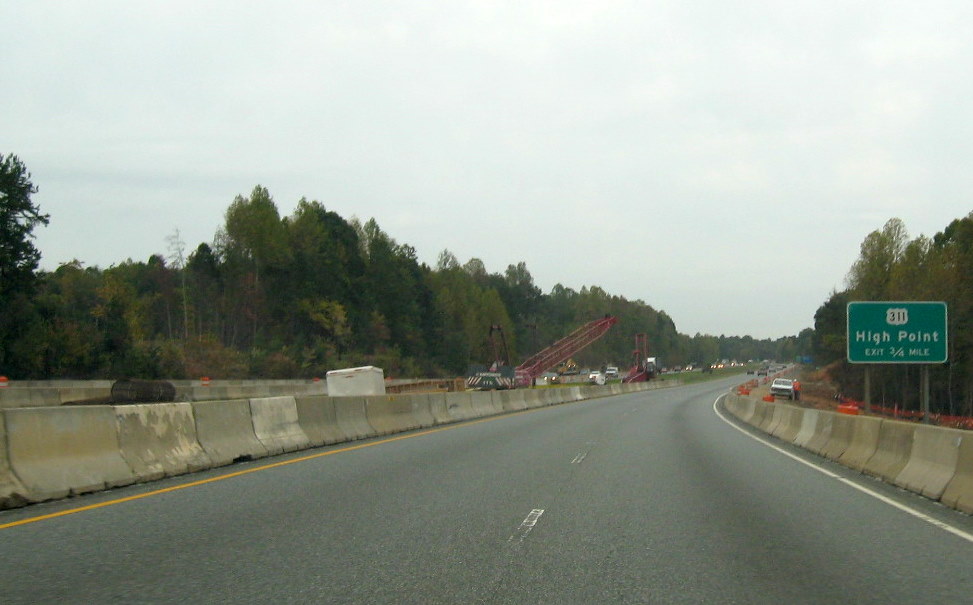 Closer view
northbound in October 2009 of construction equipment in the median
before the start of construction of the 2 flyover ramps that will cross
US 220 (I-73). (10/12/09)
Closer view
northbound in October 2009 of construction equipment in the median
before the start of construction of the 2 flyover ramps that will cross
US 220 (I-73). (10/12/09)
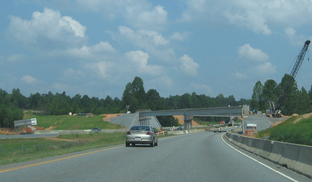 Progress in
building the ramp bridges in the summer of 2010 from US 220 Northbound.
(8/29/10)
Progress in
building the ramp bridges in the summer of 2010 from US 220 Northbound.
(8/29/10)
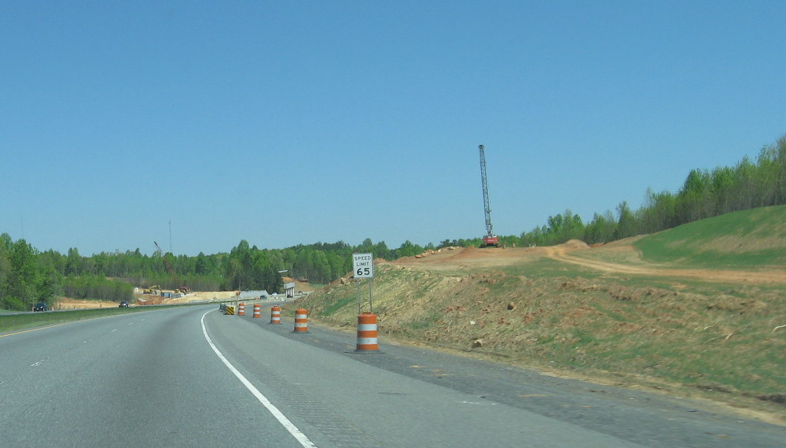 View
of progress in interchange area as of April 2010, with the center
supports for the two I-74 ramps in the distance. (4/11/10)
View
of progress in interchange area as of April 2010, with the center
supports for the two I-74 ramps in the distance. (4/11/10)
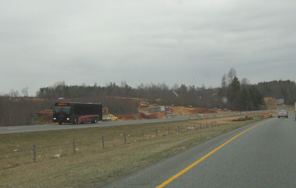 The view of
construction progress on the flyover ramps and interchange clearing in
March 2010. (3/10/10)
The view of
construction progress on the flyover ramps and interchange clearing in
March 2010. (3/10/10)
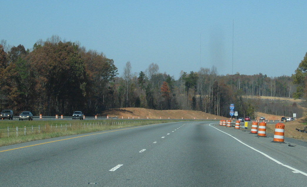 View
northbound showing progress in clearing the construction zone a few
months earlier in November 2009. (11/8/09)
View
northbound showing progress in clearing the construction zone a few
months earlier in November 2009. (11/8/09)
 Here
is the construction area in September 2009 heading southbound with
barriers on the shoulders surrounding the construction equipment that
was then present. (9/18/09)
Here
is the construction area in September 2009 heading southbound with
barriers on the shoulders surrounding the construction equipment that
was then present. (9/18/09)
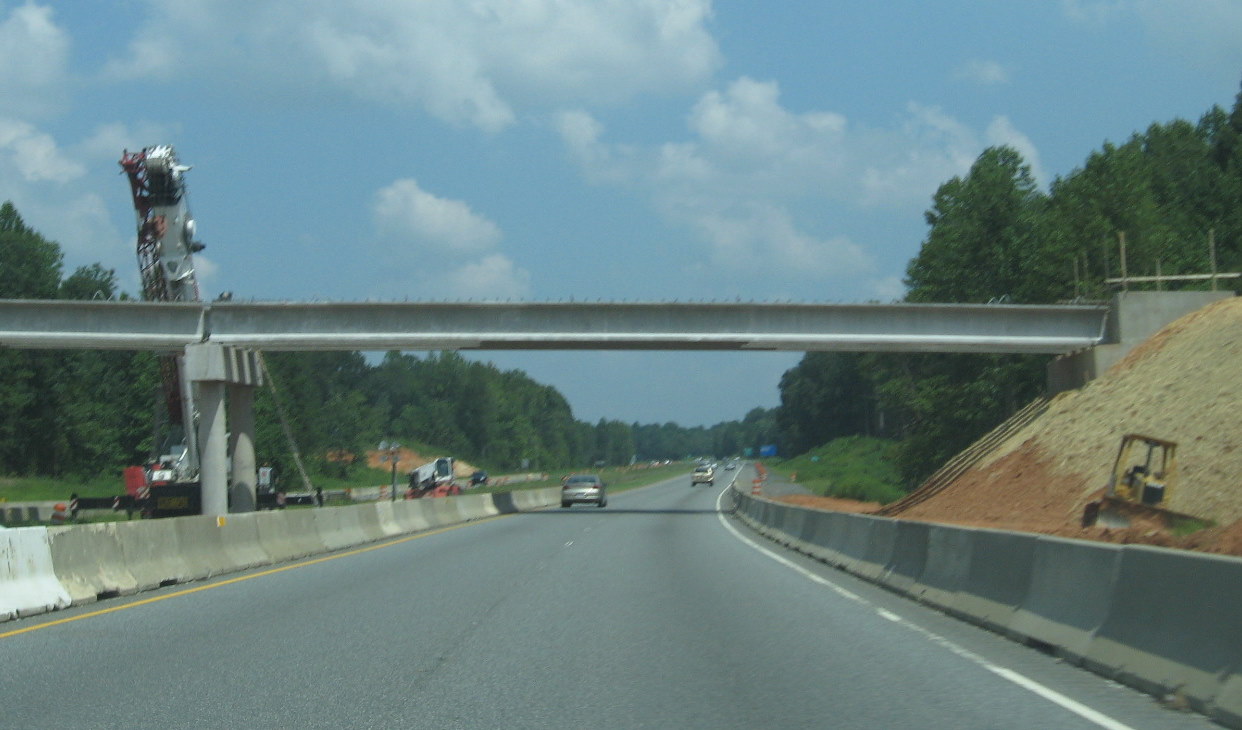 Closeup of
progress in building bridge from I-74 East ramp to US 220 (I-73) North
in the summer of 2010. (8/29/10)
Closeup of
progress in building bridge from I-74 East ramp to US 220 (I-73) North
in the summer of 2010. (8/29/10)
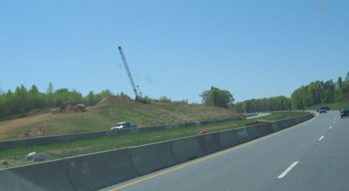 View
of progress on Westbound I-74 ramp to flyover bridge from southbound US
220 in April 2010. (4/11/10)
View
of progress on Westbound I-74 ramp to flyover bridge from southbound US
220 in April 2010. (4/11/10)
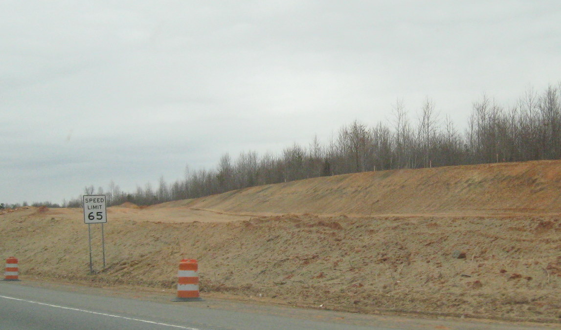 View of
progress a month earlier in March 2010 in creating northbound ramp to
flyover bridge heading northbound. (3/10/10)
View of
progress a month earlier in March 2010 in creating northbound ramp to
flyover bridge heading northbound. (3/10/10)
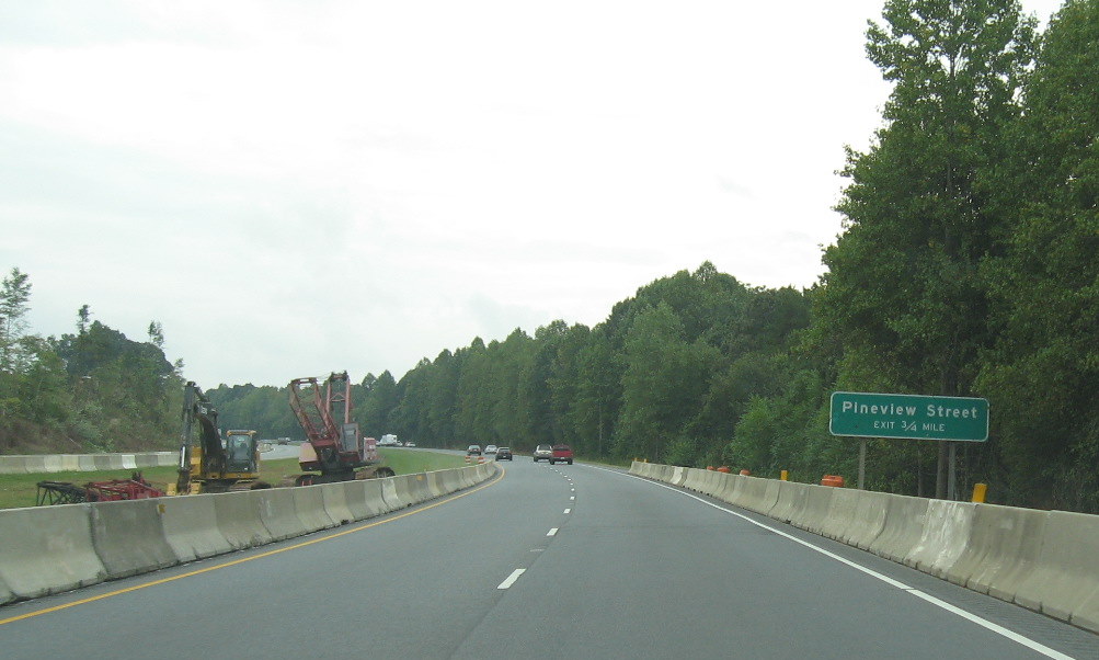 Six
months earlier you could see the start of the removal of trees across
the road along the northbound roadway. Land needed to be cleared for the
I-74 West on-ramp and the flyover ramp to US 220 (I-73) North. (9/18/09)
Six
months earlier you could see the start of the removal of trees across
the road along the northbound roadway. Land needed to be cleared for the
I-74 West on-ramp and the flyover ramp to US 220 (I-73) North. (9/18/09)
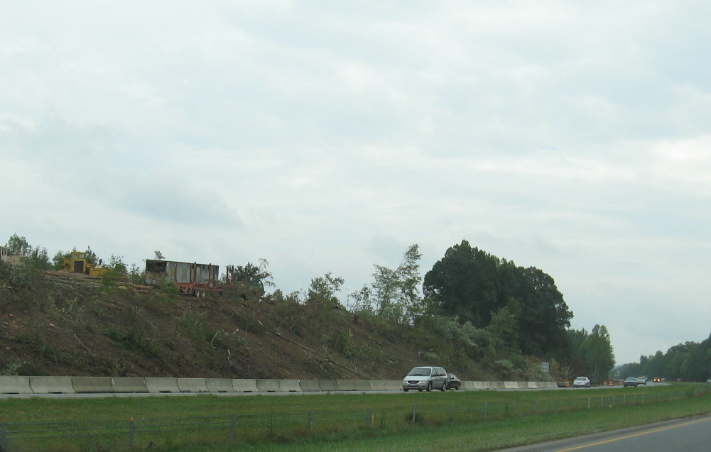 Progress
in tree removal in September 2009 and construction equipment can be seen
better looking across toward the northbound lanes of the highway.
(9/18/09)
Progress
in tree removal in September 2009 and construction equipment can be seen
better looking across toward the northbound lanes of the highway.
(9/18/09)
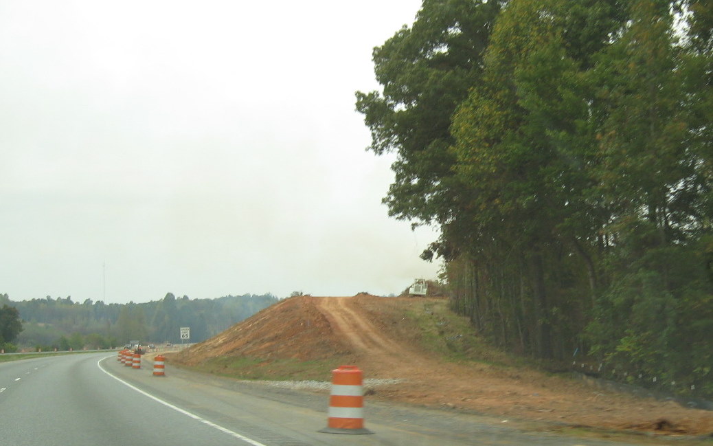 View going
northbound in October 2009 showing progress in building what will be the
flyover ramp taking I-74 West to High Point, this is same area seen in
the photo above in September. (10/12/09)
View going
northbound in October 2009 showing progress in building what will be the
flyover ramp taking I-74 West to High Point, this is same area seen in
the photo above in September. (10/12/09)
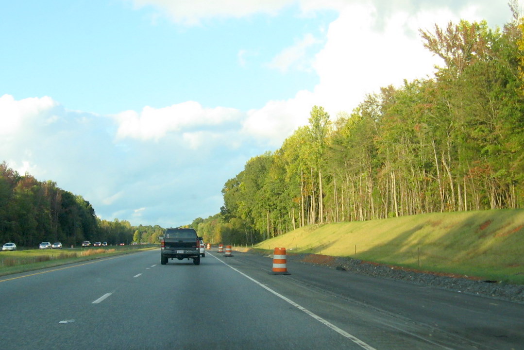 View beyond
interchange bridges on US 220 North showing landscaping and grading for
new on-ramp nearly complete. (10/13/11)
View beyond
interchange bridges on US 220 North showing landscaping and grading for
new on-ramp nearly complete. (10/13/11)
 View two
years earlier in October 2009 of same construction area which will be
for the off-ramp from I-74 East to I-73 North (10/12/09)
View two
years earlier in October 2009 of same construction area which will be
for the off-ramp from I-74 East to I-73 North (10/12/09)
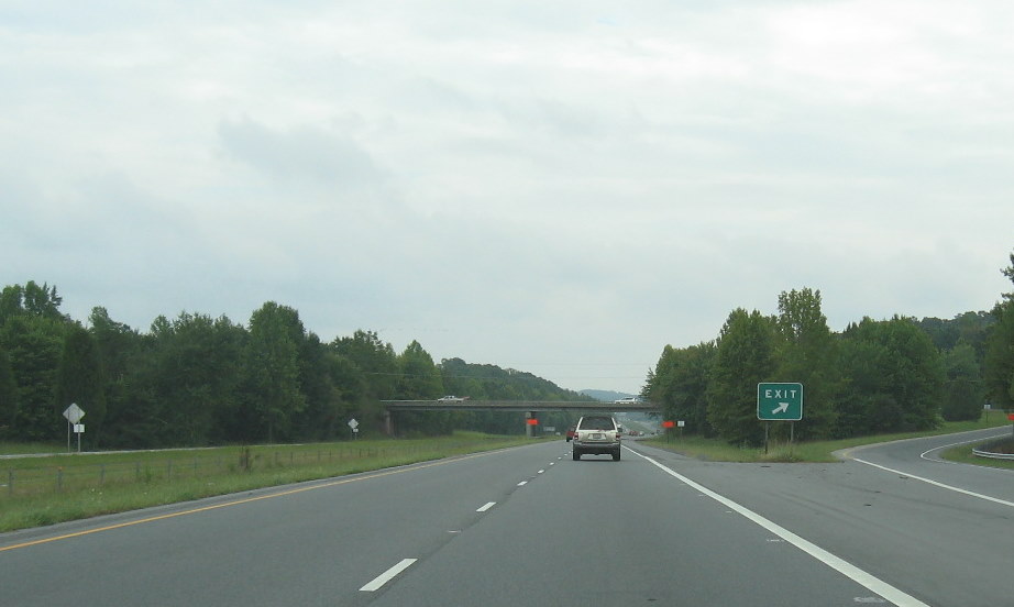 The
construction zone ends southbound just before the Pineview Street
bridge, the zone is about two miles in size. (9/18/09)
The
construction zone ends southbound just before the Pineview Street
bridge, the zone is about two miles in size. (9/18/09)