Where:
I-73/I-74 "US 220 Bypass" from NC 134/Bus. 220, Ulah to US
220A near Candor
Length:
26 Miles (12 miles of new construction, 14 miles of
previously existing freeway)
Status:
COMPLETE*
Signed
as:
*except for 14 miles of needed shoulder
widening
Segment Info
The US 220 Bypass was opened by May 1997 from Ulah to Steeds and was
the first freeway to be signed as Interstate 73 and 74.1 The
constructed bypass ran between two older sections of US 220 freeway.
Later the interstate signage was extended further south to Candor on the
previously existing US 220 freeway built in the 1980s.2 This
part received the Interstate designation, though it is not up to current
Interstate standards. NCDOT was allowed to sign this 14-mile section as
an Interstate with an agreement to fund a project to correct the
remaining deficiencies in this section of the highway. Project No.
I-4406 was to start in 2011 and increase the widths of the shoulders in
this portion to interstate standards, 10 feet, in 2011 at a cost of $3.7
million.3 However, in the spring of 2011, NCDOT revised its
project list and defunded the project, thus technically moving it to
after 2027.4 The project did not appear either in the Draft
2024-2033 STIP, meaning no project until at least 2035. (For examples of
some of the interchange and road signage in the area see the photos
below.) Exit numbers along the new freeway (along with mileposts), ran
from 39 to 51 and reflected US 220's mileage, the remaining exits on the
older portions were not numbered. This changed during the fall of 2013
when a contract to upgrade exit signage south of Asheboro to Ellerbe was
completed. All the exit signs now have numbers reflecting I-73's
mileage, matching the numbers put up on new I-73 mileposts along the
freeway, and on the exits through Asheboro after construction to bring
that highway up to interstate standards was completed in 2012. For a
list of the I-73 exit numbers, go to the bottom of the page.
"Drive" this Segment viewing these Videos
Taken by Tar Heel Travels, in June 2022 (New 12/14/22):
Images from Google Maps Street View taken in April 2018
View of
one of the new signs placed along the original section of I-73/I-74 in
the fall of 2013, this the 1-Mile Advance for Black Ankle Road.
The upgraded signage
for the Star/Robbins exit on I-73 US 220 South/I-74 East put up in 2013,
compare with the previous sign in photo below taken in July 2012.
The
2-Miles advance sign for the NC 24/27 exit on I-73 US 220 North/I-74
West. Notice the still substandard shoulders more than 20 years after
the interstate(s) was first signed.
Ground mounted
sign for the NC 211 on I-73 US 220 North/I-74 West put up in 2013, the
southernmost exit on this segment.
The I-73 North Mile 50 marker after the NC 24/27
exit.
A 2013 era
post-interchange distance sign on I-73 US 220 North/I-74 West after the
NC 211 exit, again showing the non-standard right shoulder.
Photos Taken in June 2017 by David Johnson
Exit sign installed in
2013 for Alternate US 220 at start of pre-1997 part of segment in Ether.
Exit sign at southern end
of segment for South US 220 restored to its old routing in Candor in
2013.
Photos from November 2009
Junction I-73/74 US 220
signage on new portion of US 220 Bypass Freeway, note signs of wear on
the then 12 year-old shields (11/8/09).
Typical Interstate 73/74
US 220 signage at on-ramps south of Asheboro. This interchange is on the
part of Interstate 73/74 signed on the newer US 220 freeway. (For a list
of exits in this segment, Go to the I-73 Exit
List.)
Signage for then Exit 45,
NC 705. The barrels are from a rest area under construction (see below).
(11/8/09)
Another sign for Exit 45 showing the US 220
milepost the exit numbers were then based on. (11/8/09)
Typical view of route
signing and freeway landscape in this segment. (11/8/09)
The last exit in this
segment heading north, and the end of this segment of I-73 and I-74,
after then Exit 51 in Ulah (Alternate US 220 begins here going south but
is not signed). (11/8/09)
Photos from July 2012
New exit number for
Business 220/NC 134 Exit South of Asheboro. (7/28/12)
I-73/I-74 shield
assembly on NC 211 West in Candor dating to time of Interstates'
extension South in 1997. (7/28/12)
View on North I-73/West
I-74 near NC 24/27 exit showing substandard conditions of shoulders
along this segment of I-73/74. (7/28/12)
View along North I-73/West
I-74 approaching Star/Robbins Exit showing substandard condition of Exit
Signs (that were replaced in summer 2013). (7/28/12)
View of then new I-73/I-74
sign assembly just beyond now Exit 68 South/Westbound. Similar
assemblies have been put up south of McConnell Road in both directions
in the Asheboro segment. The remainder of the new signs were not put up
to the south until the end of summer 2013. (7/28/12)
"Classic" Photos from June 2002
Signage at the I-73/74
and US 220 Interchange with To US 220A and NC Zoo, looking East.
Signage at Intersection
of US 220A and the road leading back to I-73/74. The Interstate is 1/2
mile behind where the picture is taken, these signs direct people to
go left or right, probably safer than trying to turn around.
Signage at the entrance
to the NC Zoo in Asheboro, one of the several I-73/74 sign assemblies
miles from the freeway itself.
The Two 'Visitor Centers'
The only new construction on this stretch (until the shoulders are
widened on the southern section*) after 1997 was the building of two
rest areas on the north and southbound roadways near Seagrove in
Randolph County just north of the Montgomery County line. The contract
(C201776) was let on February 19, 2008 and work began in 6 weeks later
on April 2. The estimated completion date for these rest areas was the
end of 2009. Work fell slightly behind though in 2009, particularly on
the southbound side. The northbound area opened on January 15, 2010
but the southbound side was not opened until about a week later. These
rest areas serve also as 'Visitor Centers' meaning they are run by
local groups supporting regional tourist attractions, in this case
North Carolina's Pottery Region. There was some controversy when the
NC legislature passed a bill that would make the rest areas more
expensive 'Welcome Centers'. The bill was criticized as an unneeded
expense, since Welcome Centers are run by the state with state
personnel, and ridiculed for, unlike the normal Welcome Center at the
state line, these would be 50 miles from the SC border. The
legislature quickly passed a bill to make them the supposedly less
expensive Visitors Centers, but, as the photos show below, the
complexes are still impressive.5
Approaching the Northbound
Visitor Center. (1/28/10)
Construction
progress on the northbound rest area in November 2009 (11/8/09)
View in
the distance from a year earlier, showing the progress made (10/20/08)
The Northbound Visitor
Center itself, showing that, in size, it's similar to NC's Welcome
Centers. (1/28/10)
The Center has a
fountain in front, not the case with the Southbound Center (which has
a flowing stream). (1/28/10)
The southbound Visitors
Center is on top of a hill overlooking the freeway, the best I could
do at that time was show that the road was still one-lane in this
direction and the southbound on-ramp. (11/8/09)
The
Southbound Center is on a hill allowing a view of the surrounding
landscape, including the Northbound Center. (1/28/10)
The Southbound
Center features picnic tables above the Center buildings taking
advantage of the hilltop location. (1/28/10)
The
Southbound Center Complex, the Center is on the right, restroom
facilities on the left, behind the rest rooms are soda and food
vending machines. (1/28/09)
This Segment's Exit Number Scheme Using I-73 Mileage, Going from
North to South. All of signs were switched to the new numbers in
August and September 2013:6 Interchange
Old
Number
New (I-73 Mileage) Number
Business 220/NC 134
51
68
New Hope Church Rd
49
66
NC 705 Seagrove
45
61
Black Ankle Rd
42
58
Alt US 220 Esther Steed
39
56
Star Robbins
--
(36)*
52
NC 24/27 Biscoe
-- (33)*
49
NC 211 Candor
-- (28)*
44
US 220 South Candor
24
41 7
*Exit was not numbered, based on Closest US 220 Mile Marker.
 Segment 9 /
  Segment 10
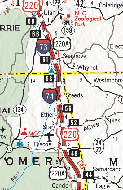


 View of
one of the new signs placed along the original section of I-73/I-74 in
the fall of 2013, this the 1-Mile Advance for Black Ankle Road.
View of
one of the new signs placed along the original section of I-73/I-74 in
the fall of 2013, this the 1-Mile Advance for Black Ankle Road. The upgraded signage
for the Star/Robbins exit on I-73 US 220 South/I-74 East put up in 2013,
compare with the previous sign in photo below taken in July 2012.
The upgraded signage
for the Star/Robbins exit on I-73 US 220 South/I-74 East put up in 2013,
compare with the previous sign in photo below taken in July 2012. The
2-Miles advance sign for the NC 24/27 exit on I-73 US 220 North/I-74
West. Notice the still substandard shoulders more than 20 years after
the interstate(s) was first signed.
The
2-Miles advance sign for the NC 24/27 exit on I-73 US 220 North/I-74
West. Notice the still substandard shoulders more than 20 years after
the interstate(s) was first signed. Ground mounted
sign for the NC 211 on I-73 US 220 North/I-74 West put up in 2013, the
southernmost exit on this segment.
Ground mounted
sign for the NC 211 on I-73 US 220 North/I-74 West put up in 2013, the
southernmost exit on this segment.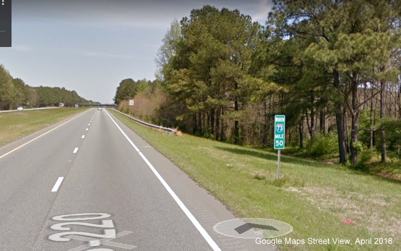 The I-73 North Mile 50 marker after the NC 24/27
exit.
The I-73 North Mile 50 marker after the NC 24/27
exit.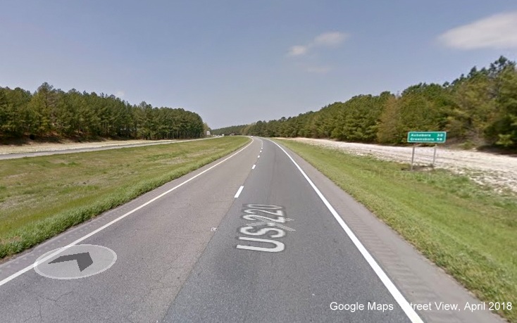 A 2013 era
post-interchange distance sign on I-73 US 220 North/I-74 West after the
NC 211 exit, again showing the non-standard right shoulder.
A 2013 era
post-interchange distance sign on I-73 US 220 North/I-74 West after the
NC 211 exit, again showing the non-standard right shoulder.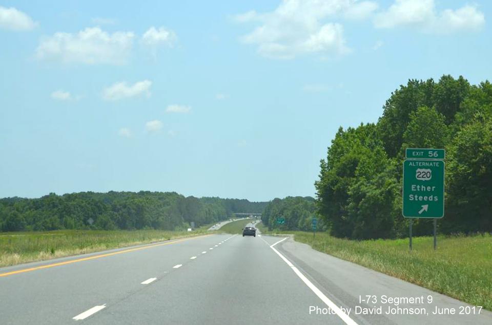 Exit sign installed in
2013 for Alternate US 220 at start of pre-1997 part of segment in Ether.
Exit sign installed in
2013 for Alternate US 220 at start of pre-1997 part of segment in Ether.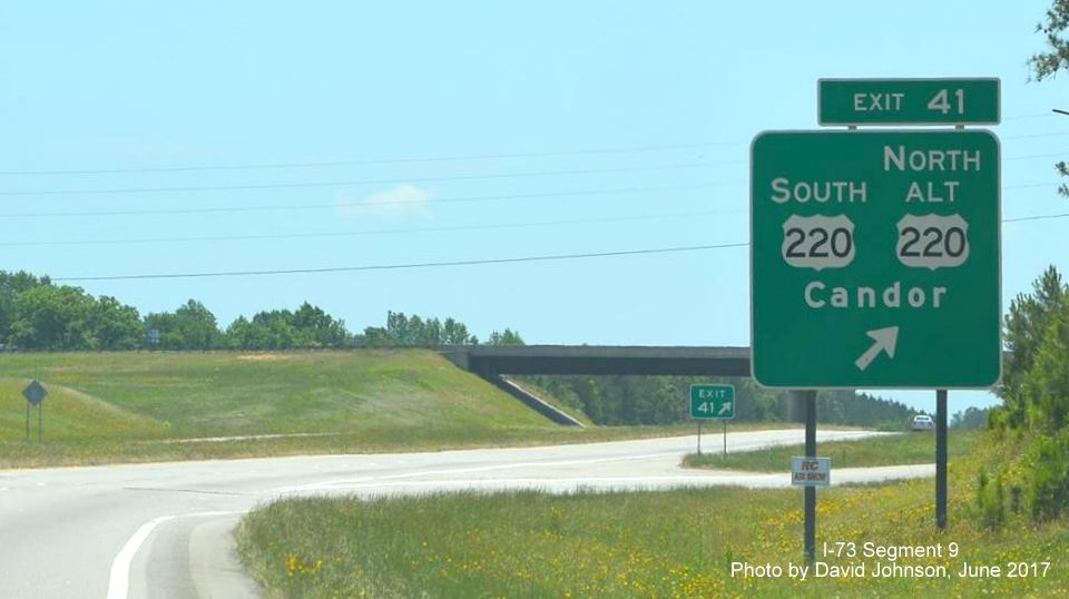 Exit sign at southern end
of segment for South US 220 restored to its old routing in Candor in
2013.
Exit sign at southern end
of segment for South US 220 restored to its old routing in Candor in
2013.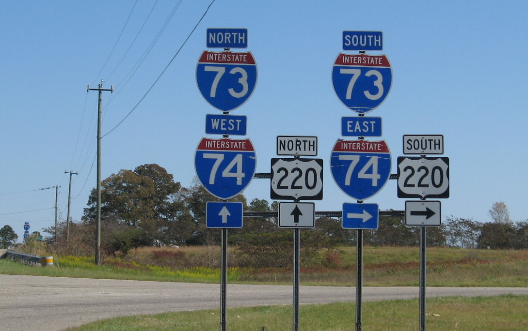 Junction I-73/74 US 220
signage on new portion of US 220 Bypass Freeway, note signs of wear on
the then 12 year-old shields (11/8/09).
Junction I-73/74 US 220
signage on new portion of US 220 Bypass Freeway, note signs of wear on
the then 12 year-old shields (11/8/09).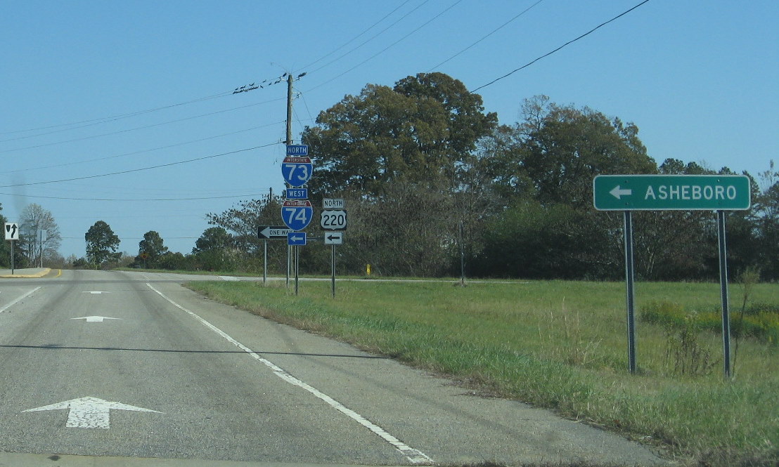 Typical Interstate 73/74
US 220 signage at on-ramps south of Asheboro. This interchange is on the
part of Interstate 73/74 signed on the newer US 220 freeway. (For a list
of exits in this segment, Go to the
Typical Interstate 73/74
US 220 signage at on-ramps south of Asheboro. This interchange is on the
part of Interstate 73/74 signed on the newer US 220 freeway. (For a list
of exits in this segment, Go to the 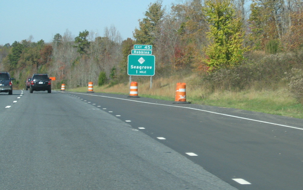 Signage for then Exit 45,
NC 705. The barrels are from a rest area under construction (see below).
(11/8/09)
Signage for then Exit 45,
NC 705. The barrels are from a rest area under construction (see below).
(11/8/09)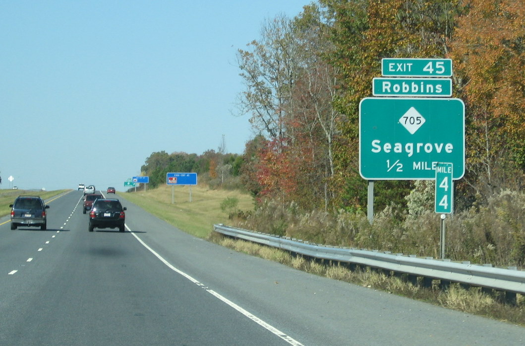 Another sign for Exit 45 showing the US 220
milepost the exit numbers were then based on. (11/8/09)
Another sign for Exit 45 showing the US 220
milepost the exit numbers were then based on. (11/8/09)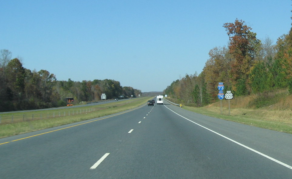 Typical view of route
signing and freeway landscape in this segment. (11/8/09)
Typical view of route
signing and freeway landscape in this segment. (11/8/09)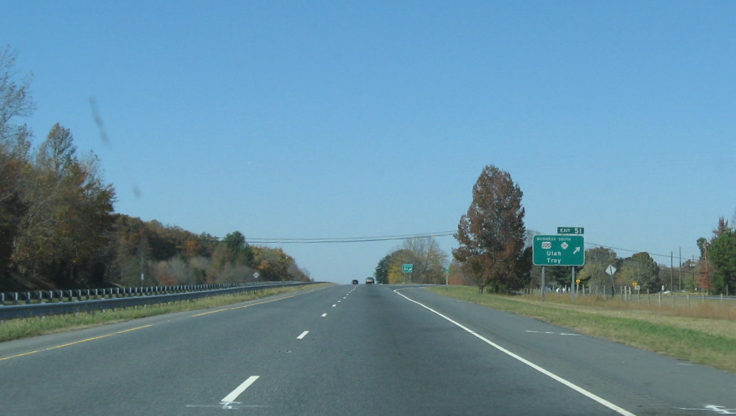 The last exit in this
segment heading north, and the end of this segment of I-73 and I-74,
after then Exit 51 in Ulah (Alternate US 220 begins here going south but
is not signed). (11/8/09)
The last exit in this
segment heading north, and the end of this segment of I-73 and I-74,
after then Exit 51 in Ulah (Alternate US 220 begins here going south but
is not signed). (11/8/09)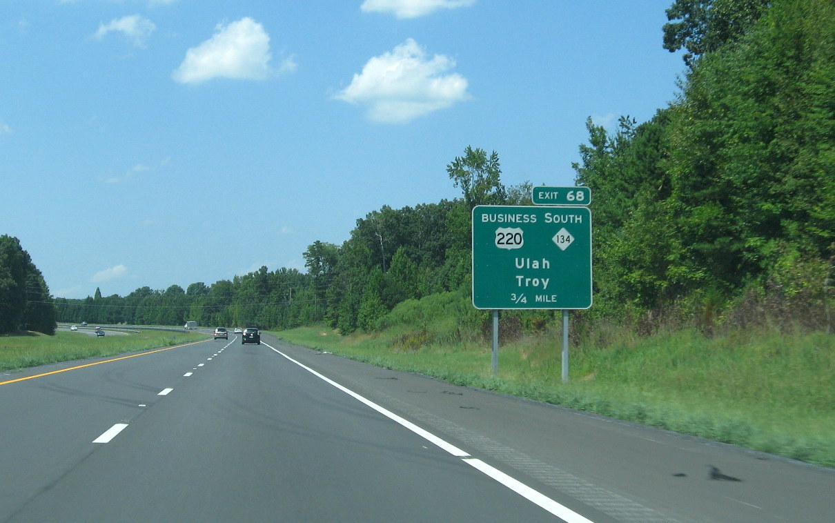 New exit number for
Business 220/NC 134 Exit South of Asheboro. (7/28/12)
New exit number for
Business 220/NC 134 Exit South of Asheboro. (7/28/12)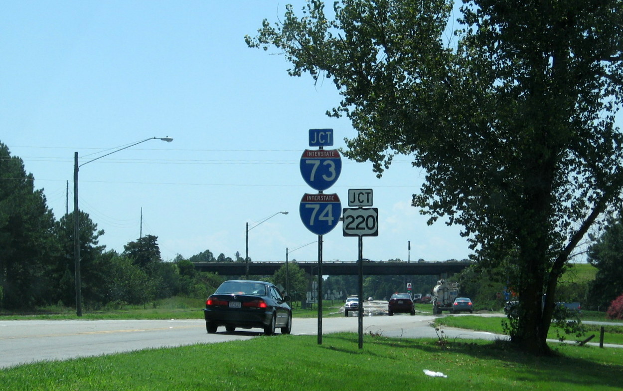 I-73/I-74 shield
assembly on NC 211 West in Candor dating to time of Interstates'
extension South in 1997. (7/28/12)
I-73/I-74 shield
assembly on NC 211 West in Candor dating to time of Interstates'
extension South in 1997. (7/28/12)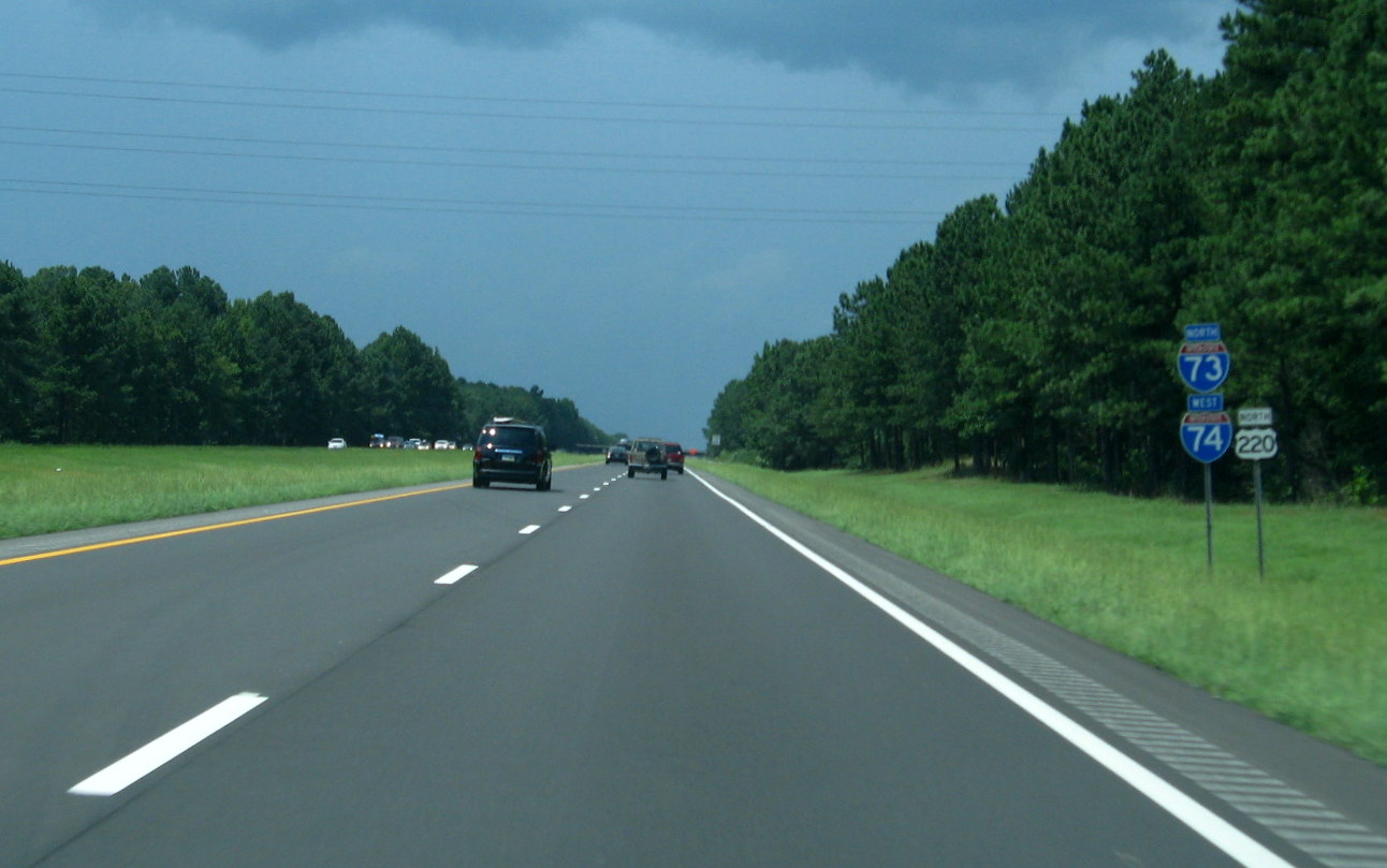 View on North I-73/West
I-74 near NC 24/27 exit showing substandard conditions of shoulders
along this segment of I-73/74. (7/28/12)
View on North I-73/West
I-74 near NC 24/27 exit showing substandard conditions of shoulders
along this segment of I-73/74. (7/28/12)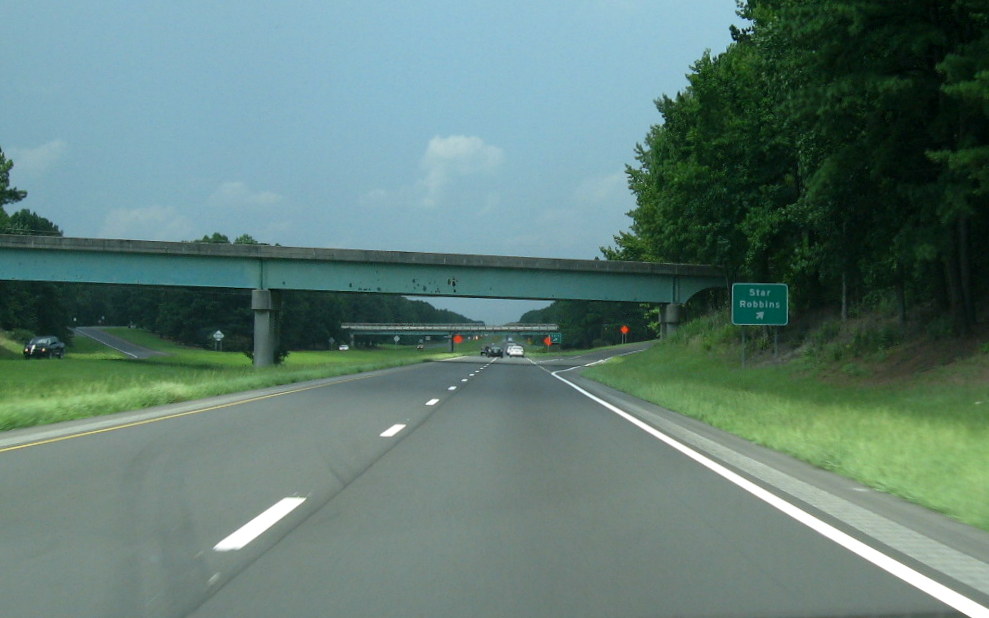 View along North I-73/West
I-74 approaching Star/Robbins Exit showing substandard condition of Exit
Signs (that were replaced in summer 2013). (7/28/12)
View along North I-73/West
I-74 approaching Star/Robbins Exit showing substandard condition of Exit
Signs (that were replaced in summer 2013). (7/28/12)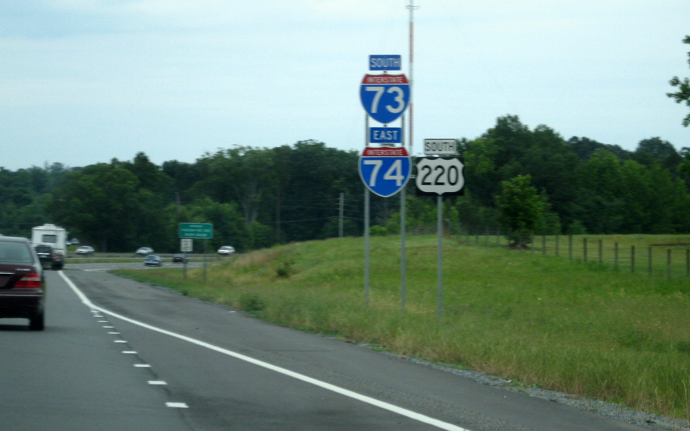 View of then new I-73/I-74
sign assembly just beyond now Exit 68 South/Westbound. Similar
assemblies have been put up south of McConnell Road in both directions
in the Asheboro segment. The remainder of the new signs were not put up
to the south until the end of summer 2013. (7/28/12)
View of then new I-73/I-74
sign assembly just beyond now Exit 68 South/Westbound. Similar
assemblies have been put up south of McConnell Road in both directions
in the Asheboro segment. The remainder of the new signs were not put up
to the south until the end of summer 2013. (7/28/12)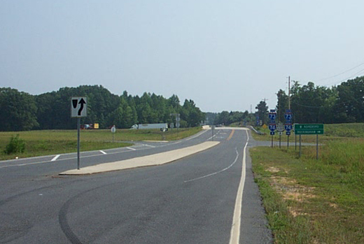 Signage at the I-73/74
and US 220 Interchange with To US 220A and NC Zoo, looking East.
Signage at the I-73/74
and US 220 Interchange with To US 220A and NC Zoo, looking East.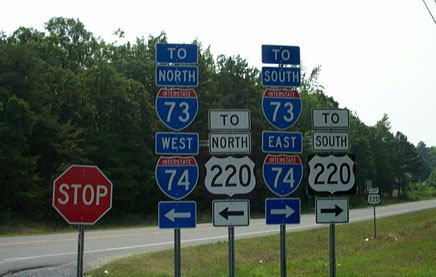 Signage at Intersection
of US 220A and the road leading back to I-73/74. The Interstate is 1/2
mile behind where the picture is taken, these signs direct people to
go left or right, probably safer than trying to turn around.
Signage at Intersection
of US 220A and the road leading back to I-73/74. The Interstate is 1/2
mile behind where the picture is taken, these signs direct people to
go left or right, probably safer than trying to turn around. 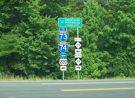 Signage at the entrance
to the NC Zoo in Asheboro, one of the several I-73/74 sign assemblies
miles from the freeway itself.
Signage at the entrance
to the NC Zoo in Asheboro, one of the several I-73/74 sign assemblies
miles from the freeway itself.  Approaching the Northbound
Visitor Center. (1/28/10)
Approaching the Northbound
Visitor Center. (1/28/10)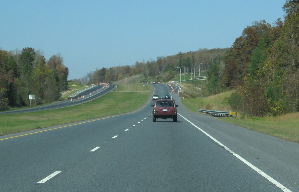 Construction
progress on the northbound rest area in November 2009 (11/8/09)
Construction
progress on the northbound rest area in November 2009 (11/8/09) View in
the distance from a year earlier, showing the progress made (10/20/08)
View in
the distance from a year earlier, showing the progress made (10/20/08)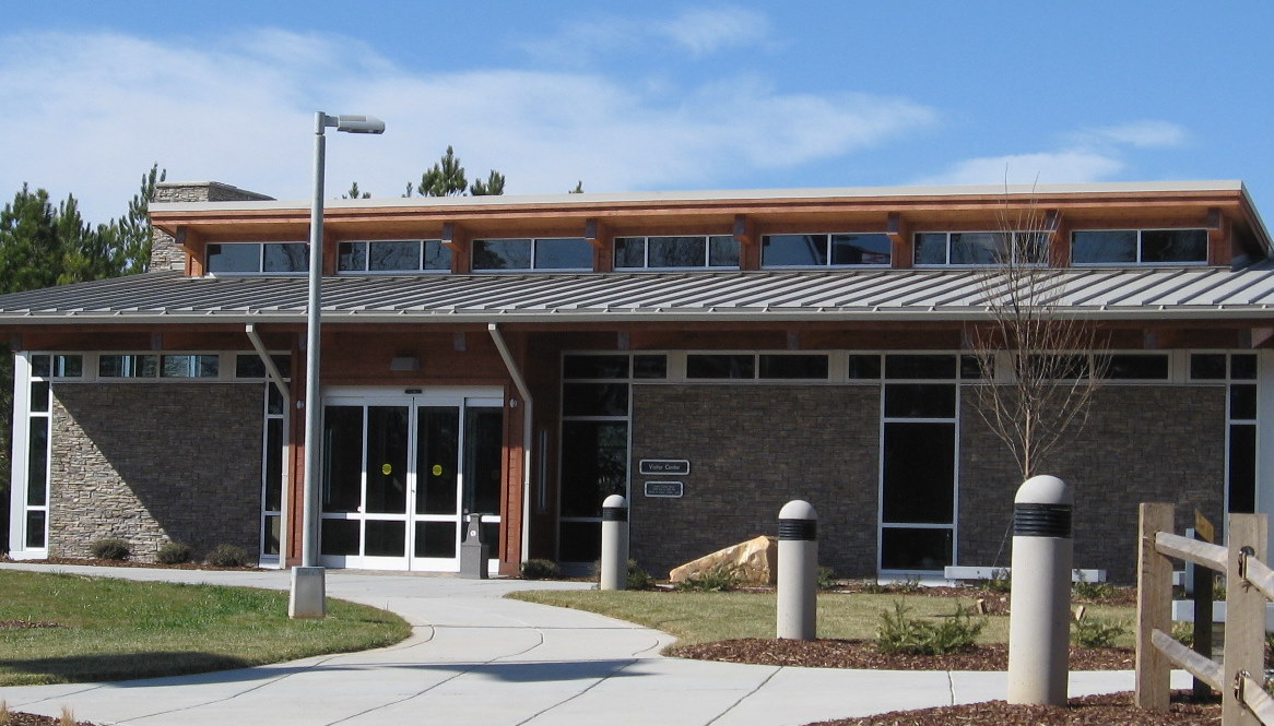 The Northbound Visitor
Center itself, showing that, in size, it's similar to NC's Welcome
Centers. (1/28/10)
The Northbound Visitor
Center itself, showing that, in size, it's similar to NC's Welcome
Centers. (1/28/10)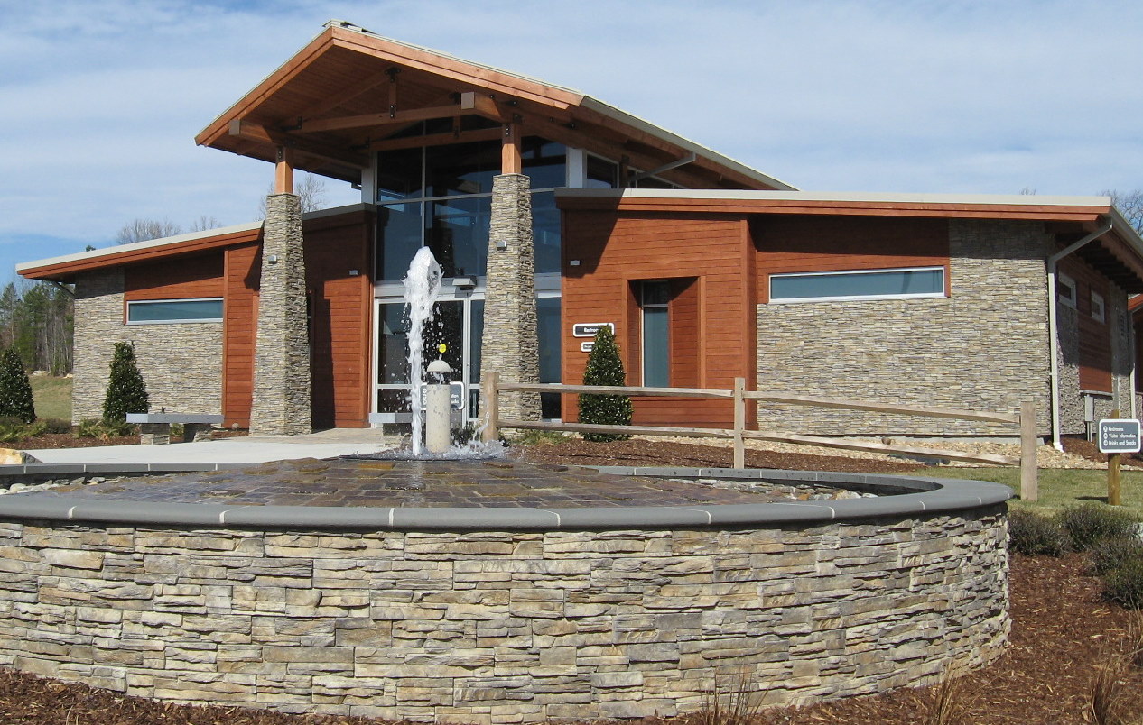 The Center has a
fountain in front, not the case with the Southbound Center (which has
a flowing stream). (1/28/10)
The Center has a
fountain in front, not the case with the Southbound Center (which has
a flowing stream). (1/28/10) The southbound Visitors
Center is on top of a hill overlooking the freeway, the best I could
do at that time was show that the road was still one-lane in this
direction and the southbound on-ramp. (11/8/09)
The southbound Visitors
Center is on top of a hill overlooking the freeway, the best I could
do at that time was show that the road was still one-lane in this
direction and the southbound on-ramp. (11/8/09)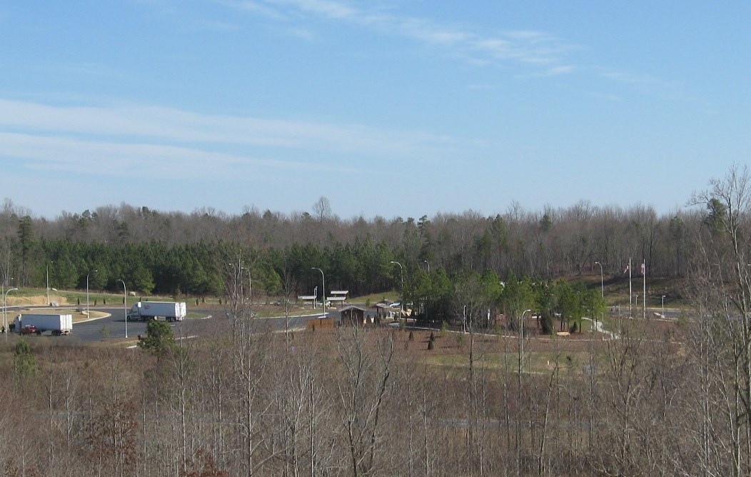 The
Southbound Center is on a hill allowing a view of the surrounding
landscape, including the Northbound Center. (1/28/10)
The
Southbound Center is on a hill allowing a view of the surrounding
landscape, including the Northbound Center. (1/28/10)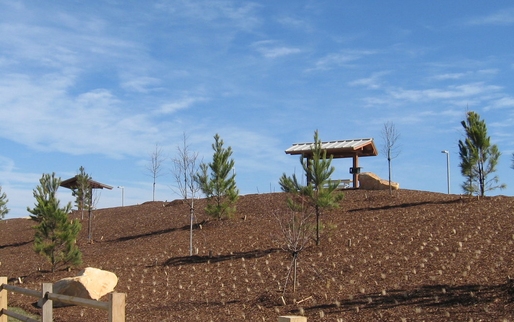 The Southbound
Center features picnic tables above the Center buildings taking
advantage of the hilltop location. (1/28/10)
The Southbound
Center features picnic tables above the Center buildings taking
advantage of the hilltop location. (1/28/10)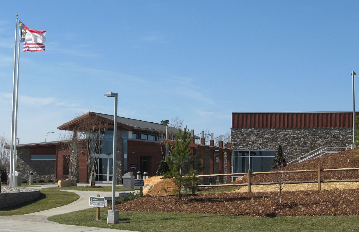 The
Southbound Center Complex, the Center is on the right, restroom
facilities on the left, behind the rest rooms are soda and food
vending machines. (1/28/09)
The
Southbound Center Complex, the Center is on the right, restroom
facilities on the left, behind the rest rooms are soda and food
vending machines. (1/28/09)