 North Carolina Exit List
| Current
Highway Signed As: |
Mile |
(Scroll Down) |
(Scroll Up) |
|
|
|
 |
|
|
|
|
  East East Lumberton |
|
4
|
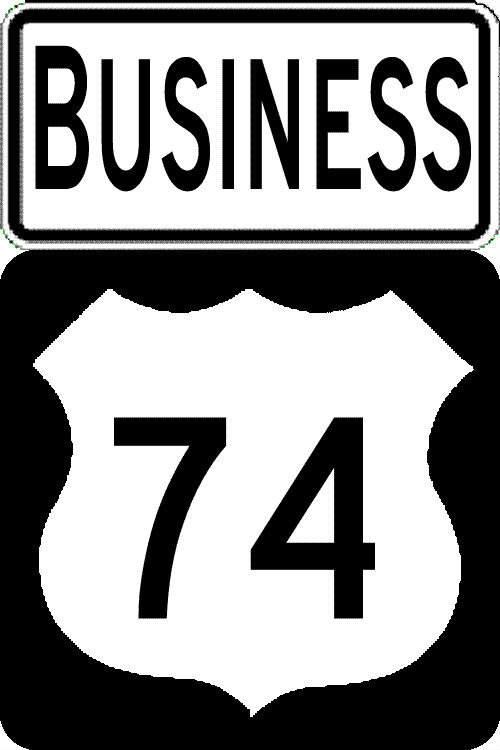
I-73 joins US 74
Rockingham Bypass from NC 38 Corridor from SC Border |
I-73 leaves US 74 Rockingham Bypass along NC
38 Corridor to SC Border |
|

|
|
 Hamlet Richmond Comm College |
|
|
|
|
 Rockingham Southern Pines Cheraw |
|
|
|
15 |
EXIT 308Galestown RdZion Church Rd |
|
|
onto New Rockingham Bypass Freeway |
New Rockingham Bypass Freeway onto current US 74 Bypass |
||
 |
16 |
EXITS 16 A/B
|
|
| |
20 |
EXIT 20Cartledge Creek Rd |
|
|
|
|
from New Rockingham Bypass Freeway |
Freeway |
 |
22 |
EXIT 22
|
|
| |
23 |
EXIT 23Dockery Rd / Haywood Cemetery Rd |
|
|
|
|
EXIT
25
 North NorthEllerbe
|
|
|
|
|
EXIT
28
To
 West
WestMillstone Rd REST AREA |
|
| |
30 |
EXIT
30 Haywood Parker Rd |
|
| |
33
|
EXIT
33
|
|
|
|
35 |
EXIT 35
Norman |
|
|
|
|
Enter
Richmond County
|
Enter Montgomery County |
|
|
|
EXIT
39
Tabernacle Church Rd |
|
|
|
41
|
EXIT
41
South
Candor***
|
|
 |
|
 Candor Pinehurst |
|
|
|
|
EXIT
49
  Biscoe [Troy Carthage] |
|
|
|
|
Star Robbins |
|
|
|
|
EXIT
55
 Ester Steed*** |
|
|
|
|
EXIT 58
Black Ankle Road |
|
|
|
|
Enter
Randolph County
|
Enter Montgomery County |
60 |
Rest Area Visitor Center |
Rest Area Visitor Center |
|
|
|
61
|
EXIT 61
 Seagrove [Robbins] |
|
| 64 | SPEED LIMIT 65 | SPEED LIMIT 70 | |
|
|
|
EXIT 65 New Hope Church Rd |
|
|
|
68 |
EXIT 68

 Ulah Troy |
|
| |
70 |
EXIT
70A
 East EastRaleigh
|
|
| |
70 |
EXIT
70B
West Charlotte
|
|
| |
71 |
EXIT 71 McDowell Road Randolph Community College |
|
|
|
72 |
EXIT
72A
East Bus. North  [Siler City] Raleigh |
|
| |
72 |
EXIT 72B
West Bus. South
Charlotte |
|
|
|
|
EXIT 74
 Asheboro Left Exit |
|
|
|
|
EXIT
75
Presnell Drive |
|
|
|
|
EXIT
76
Vision
Drive
|
|
|
|
|
EXIT
77
Spero Road
|
|
|
|
|
EXIT 79
Pineview Street
|
|
|
|
|
West High Point Winston-Salem |
|
| |
|
 d d
Randleman |
|
| |
|
EXIT 82 Randleman [Richard Petty Museum] |
|
| |
86 |
EXIT
86
SouthLevel Cross |
|
| 87 |
Enter Guilford County |
Enter
Randolph County
|
|
|
|
|
|
|
| |
94 |
EXIT
94 Old Randleman Road |
|
|
|
95
|
EXIT
95A North North
 South To
  East EastDurham/Raleigh Sanford |
|
| |
95 |
EXIT
95B
North Winston-Salem To Groometown Rd (I-73 currently uses 220 exit numbers, so exits off of itself. Access to I-85 South using Bus. 85) |
EXIT 95 South Asheboro |
| |
|
North
I-73 Begins on I-85 C/D Ramp and joins US 421 North after
Exit 121A on Greensboro Urban Loop |
I-73 leaves US 421 South
and Ends. Future I-73 continues onto US 220 South |
| |
96 |
|
EXIT
97B  South SouthHigh Point Charlotte |
| |
97
|
Exit 121A
Groometown Road [Was to be re-signed Exit 97 as part of I-73 exit sign update project in 2013, but has not been changed as of 2023] |
EXIT 97A
NorthGreensboro |
| |
100 |
Exit
100
Gate City Blvd (Formerly High Point Rd) (New Exit opened 5/14/16) |
|
|
|
102 |
EXIT
102 Wendover Ave |
|
| |
103 |
EXIT
103A
EastGreensboro |
|
| |
103 |
EXIT
103B West North Winston-Salem |
EXIT 103
NorthGreensboro
Winston-Salem |
 |
104 |
EXIT
104 W. Friendly Ave |
|
| |
107 |
EXIT
107
A/B
North / Bryan Blvd GSO PTI Airport Martinsville, VA |
EXIT
107 A/B
South
West To Asheboro Winston-Salem |
|
|
I-73 exits itself from I-840 Greensboro Loop and Joins
Upgraded Bryan Boulevard
|
I-73 Exits itself from Bryan Blvd. and Joins I-840
Greensboro Loop
|
|
|
|
109 |
EXIT
109 Old Oak Ridge Rd PTI-GSO Airport |
|
| 110 |
I-73 to leave Bryan Blvd
for 'I-73 Connector' |
I-73 to leave 'I-73
Connector'
for Bryan Blvd. |
|
|
110 |
EXIT
110
High Point South
South |
|
|
|
111 |
I-73
crosses to parallel existing NC 68 Expressway from 'I-73
Connector' |
I-73 crosses over NC 68
Expressway to join 'I-73 Connector' |
|
|
111 |
EXIT 111 North Oak Ridge |
|
|
|
112 |
I-73
crosses NC 68 to join 'NC 68 - US 220 Connector' |
I-73 crosses and
parallels NC 68 leaving 'NC 68- US 220 Connector'' |
|
117 |
EXIT 117 Summerfield Kernersville |
|
| 116 |
I-73 leaves NC 68-US 220
Connector and joins US 220 |
I-73 leaves US 220 to
join NC 68-US 220 Connector |
|
|
|
119 |
EXIT
119 South Greensboro |
|
|
|
120 |
EXIT
120
 Stokesdale Reidsville
|
|
| 121 |
Enter Rockingham County |
Enter Guilford County |
|
| |
122 |
EXIT
122
 To South To SouthStokesdale |
EXIT
122 Stokesdale |
|
|
123 |
EXIT
123 South High Point |
|
|
End |
End Freeway |
Begin Freeway |
|
|
130 |
 North South North SouthMadison |
|
| SPEED LIMIT
60 |
SPEED LIMIT
55 |
||
| |
133 |
North
 Eden |
|
|
|
135 |
South Madison Stoneville |
|
|
|
136 |
 Stoneville Eden |
|
|
|
138 |
Smith Rd |
|
140 |
 |
|
|
*This is a List of Exits on Freeways along I-73's proposed
route, using information gathered from road trips along the I-73
corridor. Exit signage assumes I-73 is built as planned and current
exits along existing freeways will not change after the roadways are
upgraded to an Interstate. I-73 mileage is for potential future exit
numbers when I-73 is signed along existing routes; numbers based on
difference between existing exit numbers, map calculations and, for
proposed construction project sections, mileage listed in the NCDOT
2009-2015 STIP. I have also used mileage presented in the NCDOT
Strategic Highway Corridors website, where it did not conflict with my
own records. Most speculative exit locations not official.
**( )Indicates no Exit Number assigned, assumed exit
number based on mileage from previous numbered exit(s).
***NCDOT changed the exit numbers that used US
220 mileposts to new ones reflecting I-73's proposed mileage
(requiring an adjustment upward by 17 miles) as part of a contract
updating exit signage over the summer of 2013. Sign texts,
except where route numbers will change, have been updated to match
those on new signs. US 220, for example, is to be put back on its
former route, currently Alternate/Business 220 between Ellerbe and
Candor (Exits 25 to 41).
*I-273 is my proposed designation for the planned
'I-73-74 Connector' being studied by the NC Turnpike Authority that
would run from the end of Bryan Boulevard to the I-74 Winston-Salem
Northern Beltway. It would include a spur connecting to I-40 near the
current I-40, Business 40 split east of Winston-Salem.For
more, go to NC
Future Interstates.
Route
Shields courtesy of David
R. Kendrick's Shields Up!
Business 40 shield courtesy of
www.steveriner.com/nmhighways/us-interstates.htm
 |
|
|
Created:
July 25, 2006.
Last Revised: February 1,
2025 (updated to account for completed Rockingham Bypass and the addition of I-74 along the US 74 freeway to Hamlet.