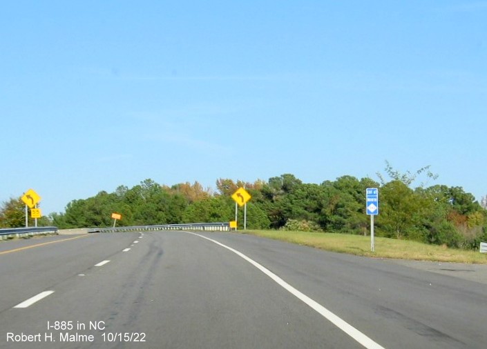
 East End Connector / Durham
Northeastern Bypass
East End Connector / Durham
Northeastern Bypass
Project First Proposed: 1960s Interstate First Proposed: 2014
Construction Started: February 2015 Completed and Opened: June 30, 2022
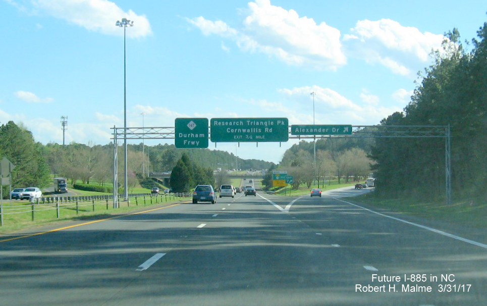
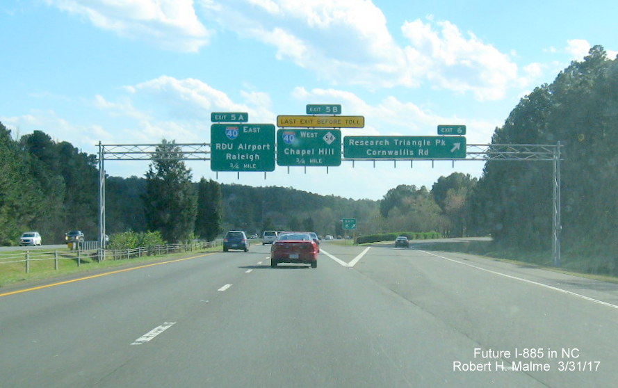
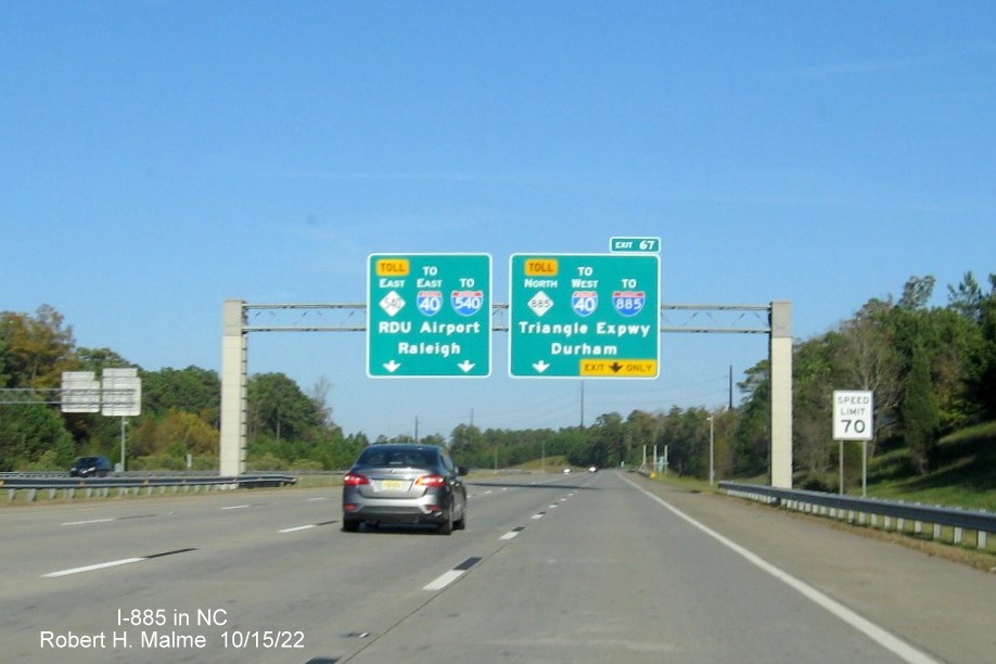
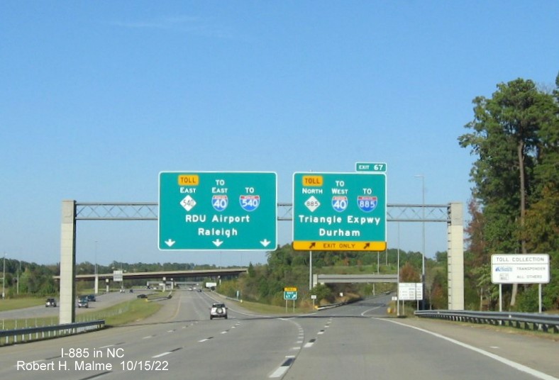
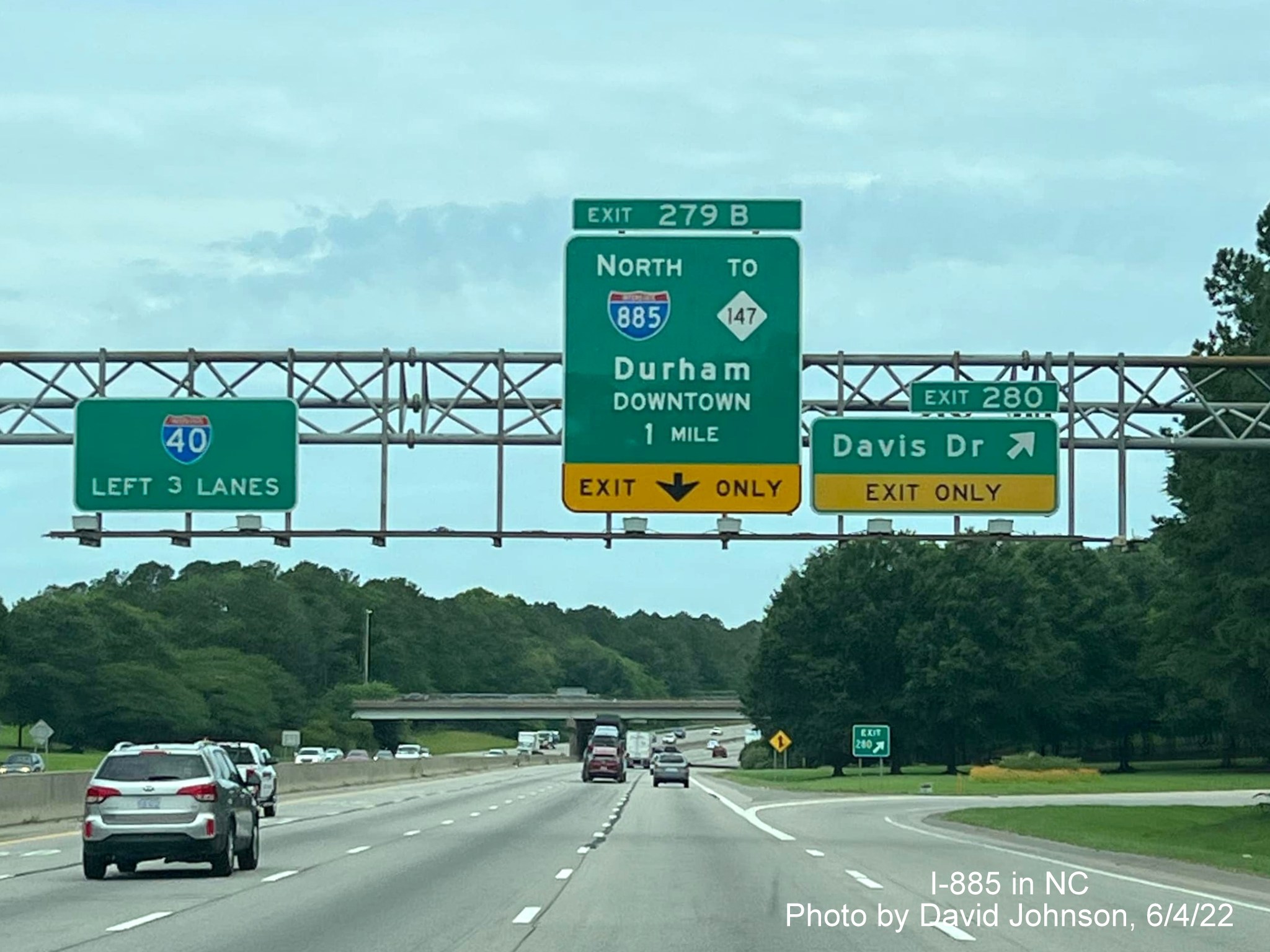
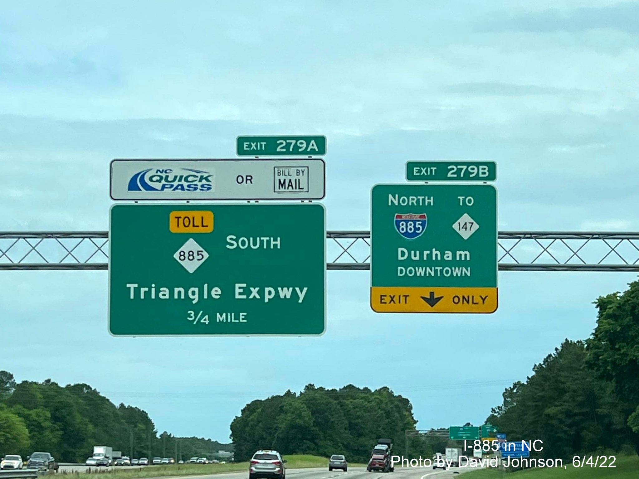
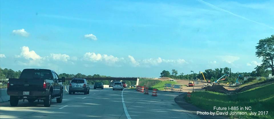
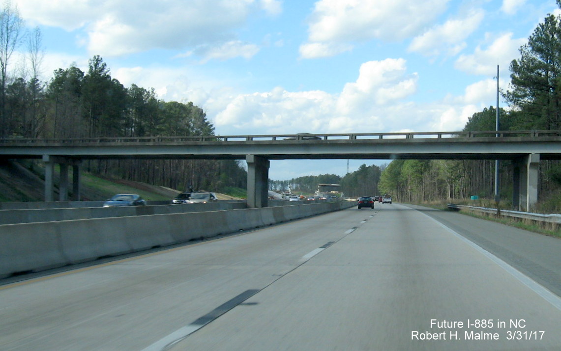
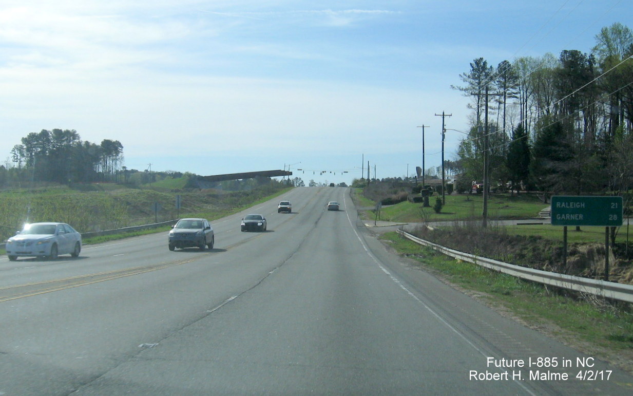
The Route: From I-85/US 70 interchange east of Durham to current I-40/NC 147 - Durham Freeway interchange in Research Triangle Park, 8 miles
Go to Photos (Latest added 6/25/23)
Go to Past Videos (Latest 9/30/22)
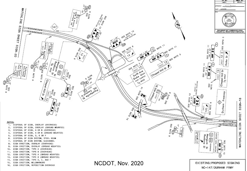
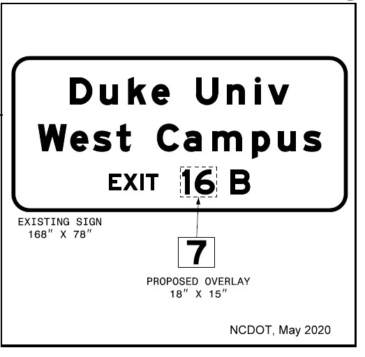
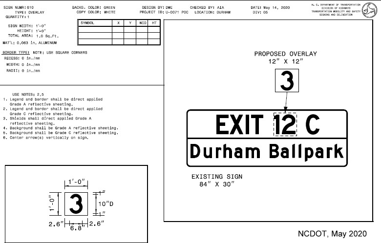
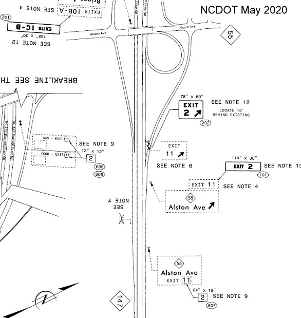
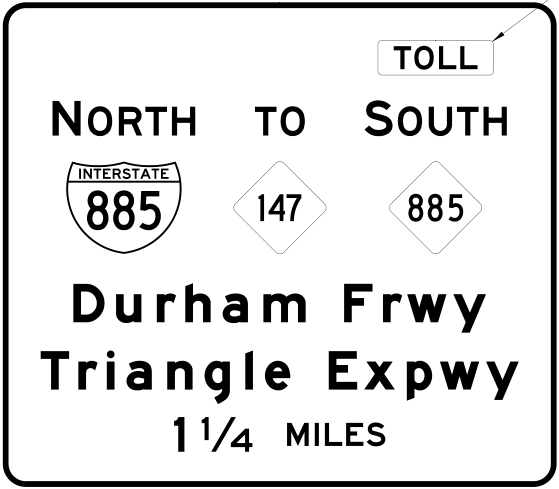
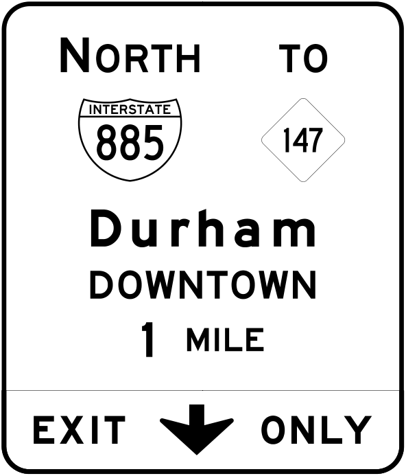
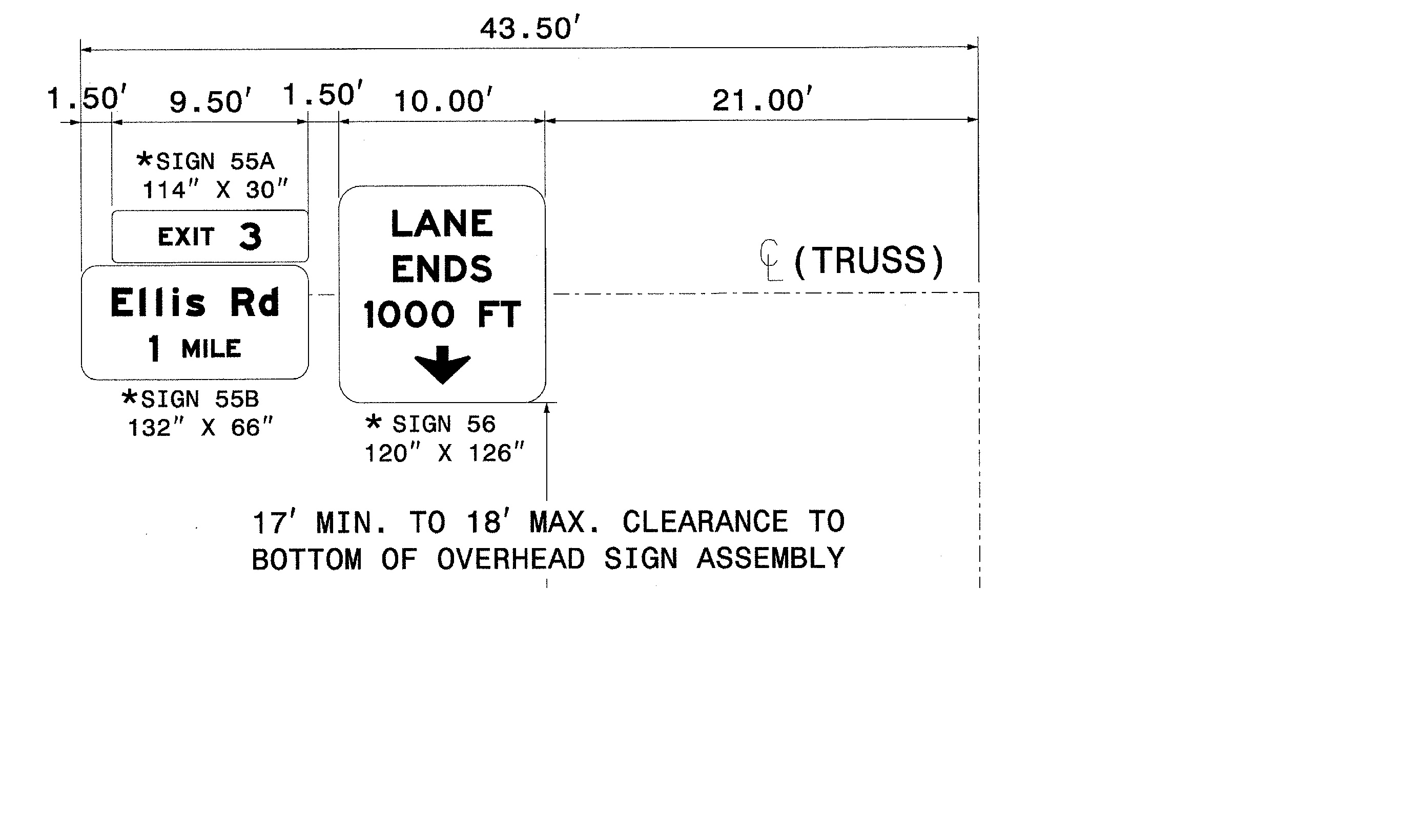
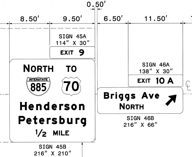
Go to Sign Plans
Check out these new videos from Roadwaywiz from February 2026:
Travel NC 885/I-885 North from NC 540 to I-85
Travel I-885/NC 885 South from I-85 to NC 540
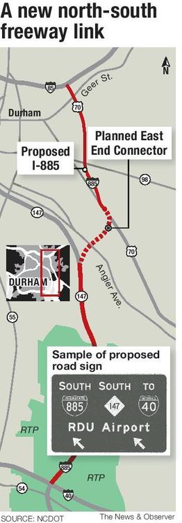
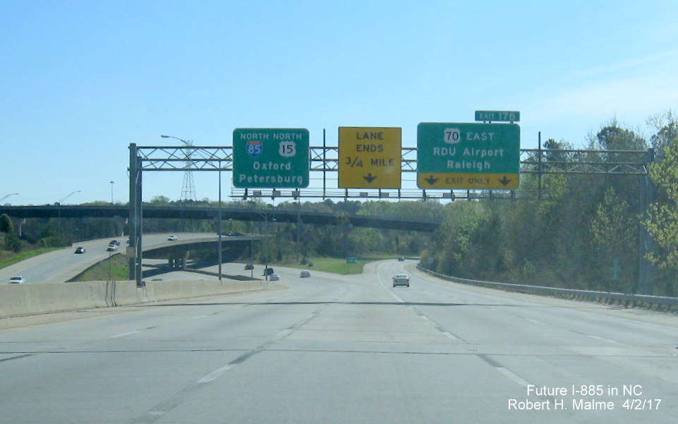
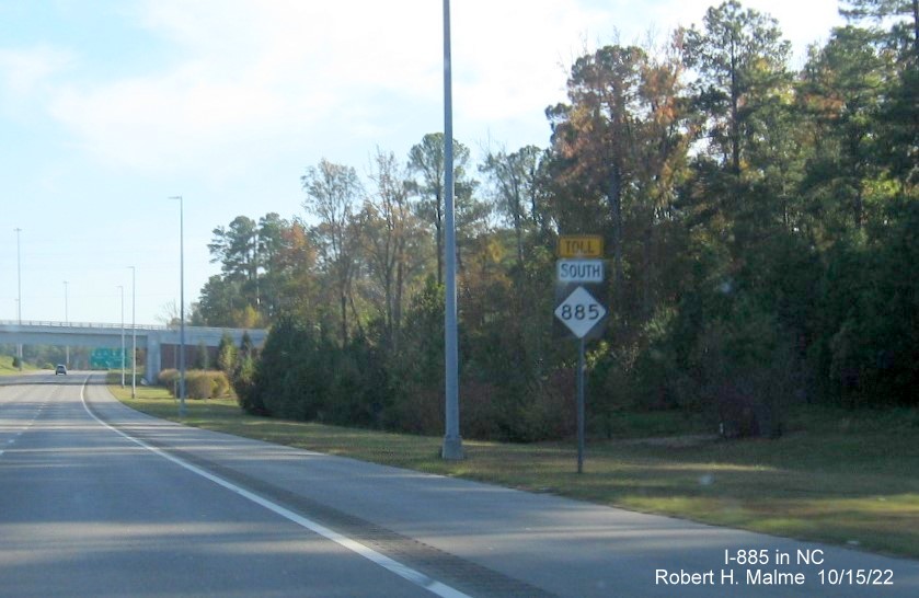
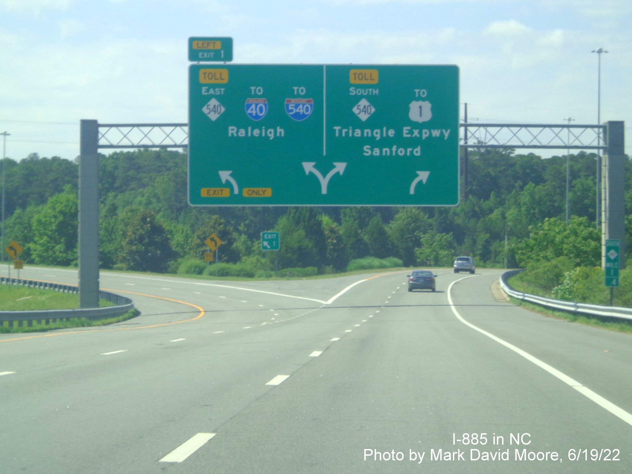
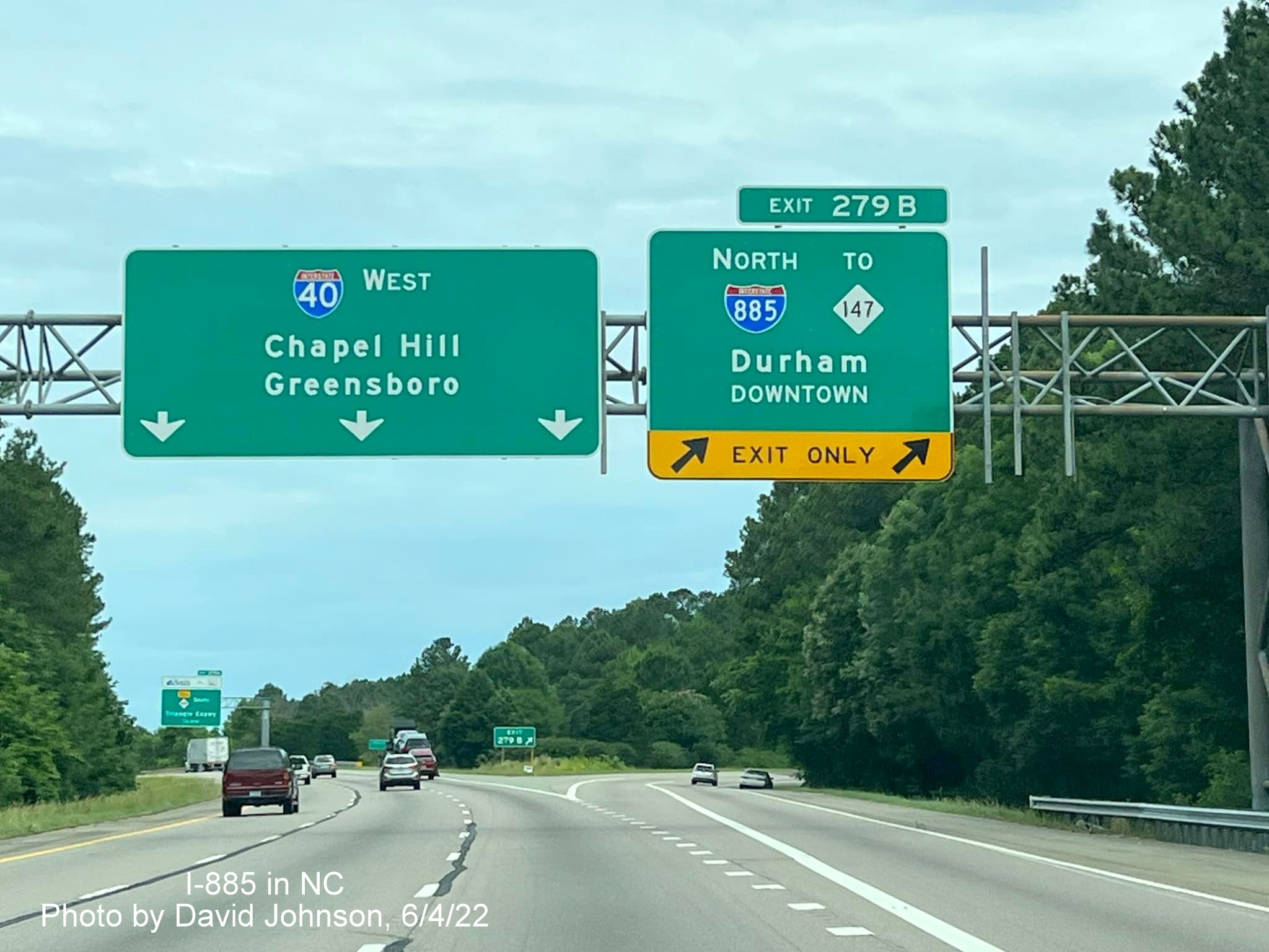
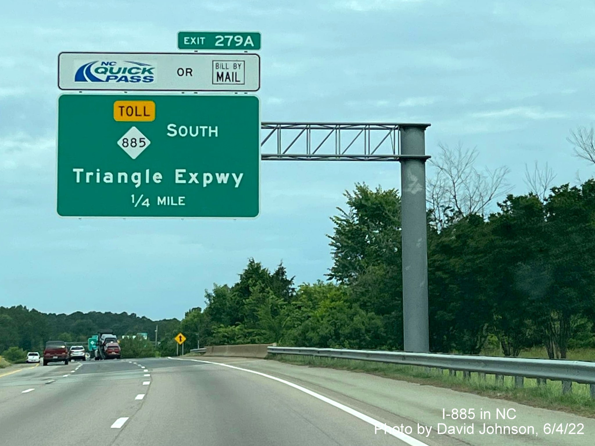
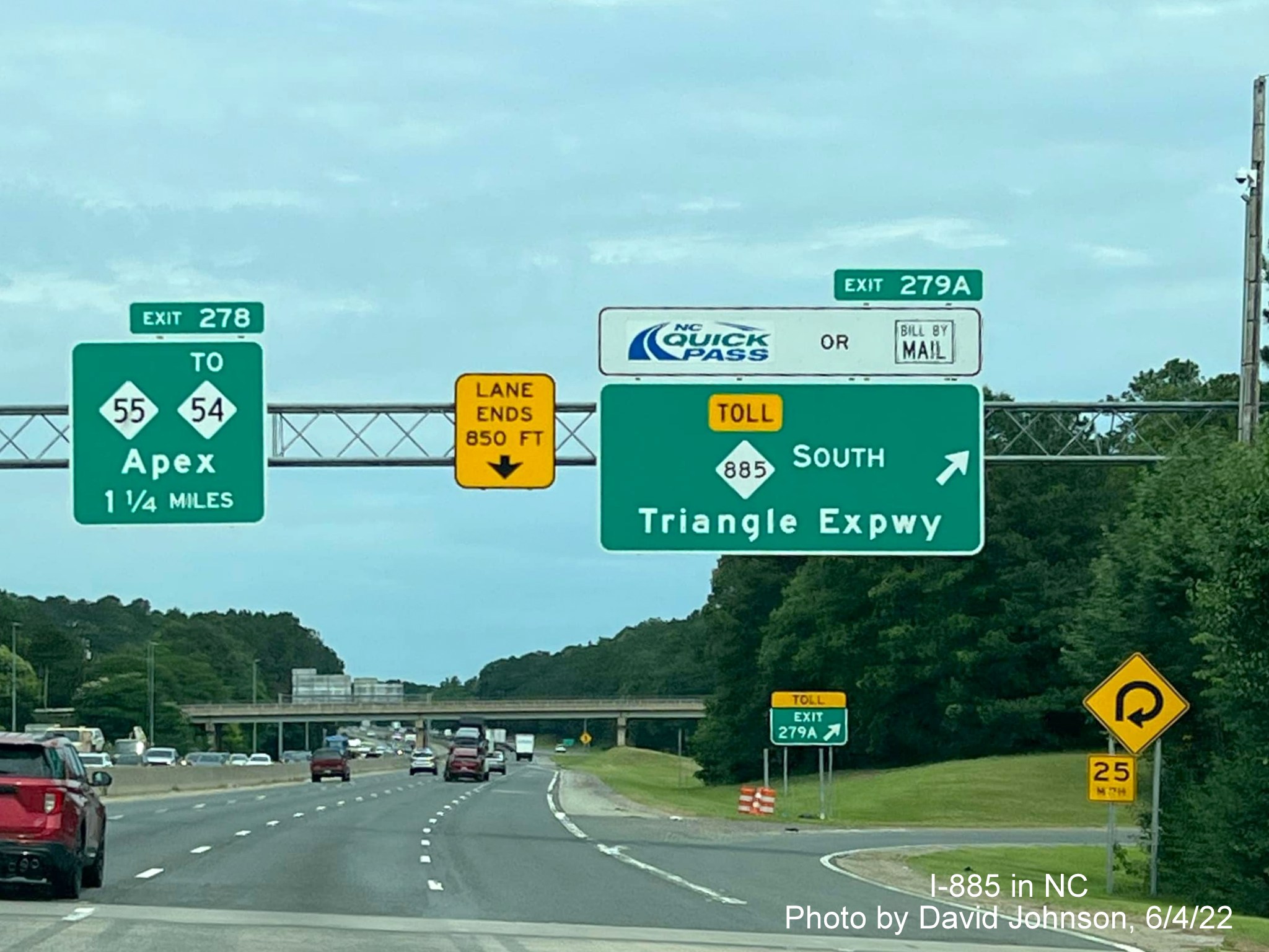
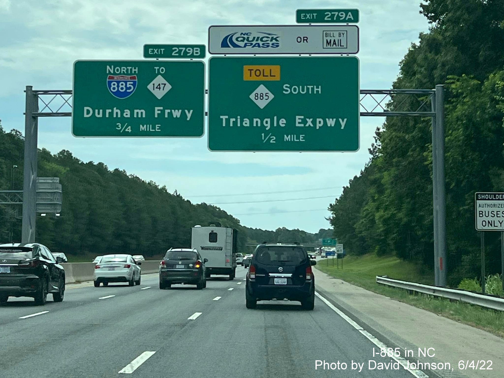
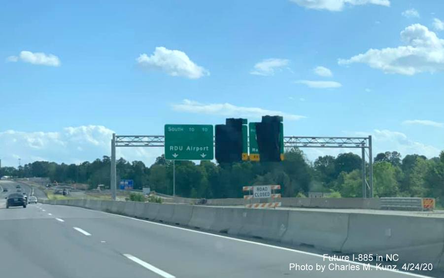
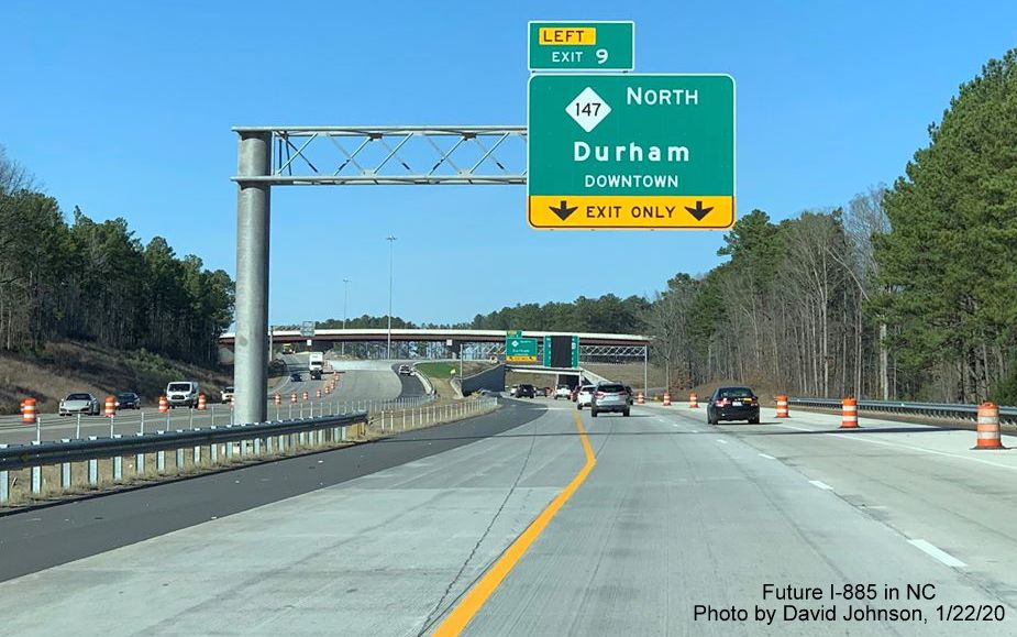
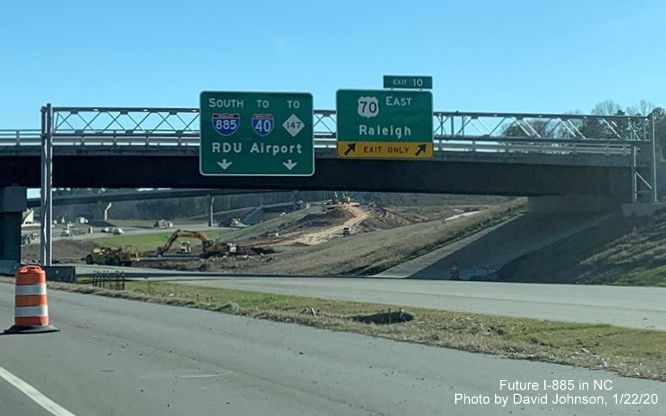
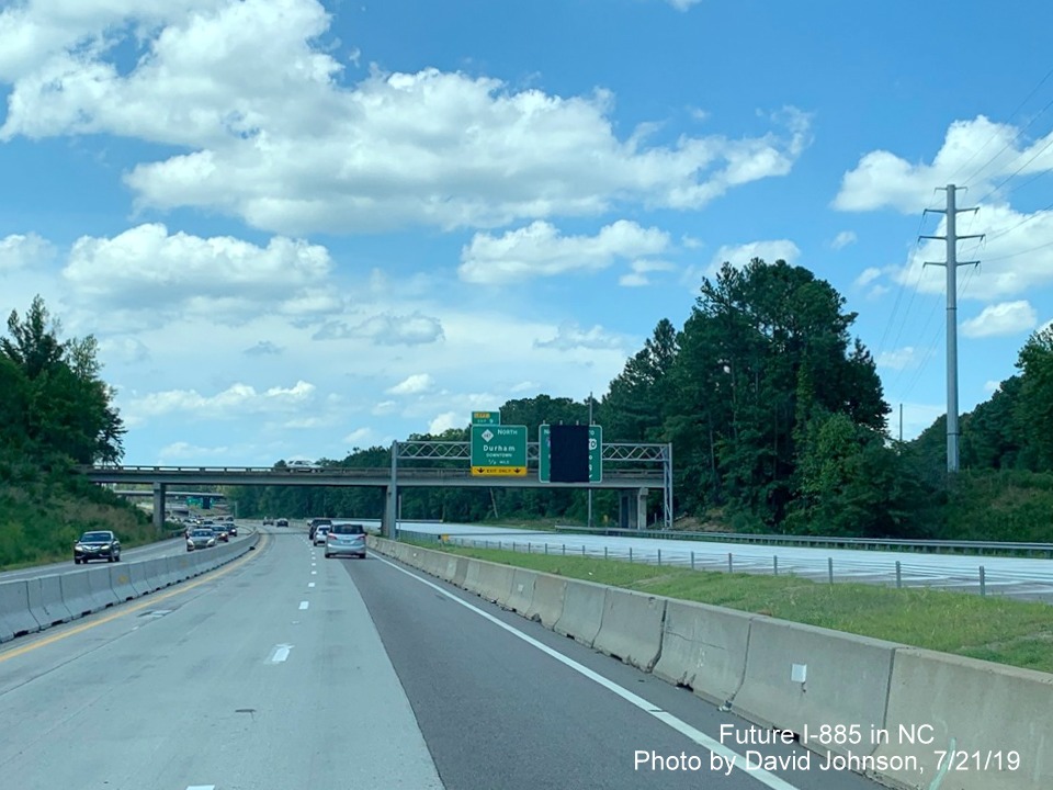
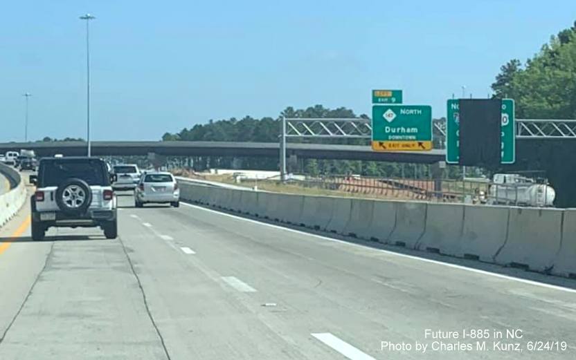
This interstate, completed in June 2022, approved by AASHTO in
May 2022, was first shown in signage plans for the Durham East End Connector Project, placed online on August 19,
20141, and runs from the current I-85/US 70 interchange in Durham to I-40 in Research Triangle Park, using
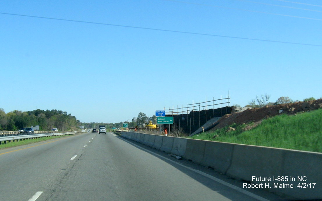
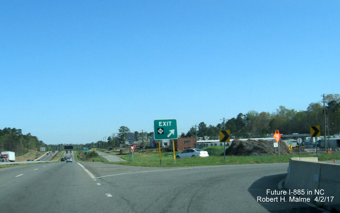
the Connector to provide a direct connection between the Durham Freeway (NC 147) and US 70 (Miami Boulevard), forgoing
the need to use streets through Durham. The Connector opened on June 30, 2022, and includes improvements to upgrade US 70 to a
limited access freeway from Pleasant Drive to north of Holloway Street (NC 98).
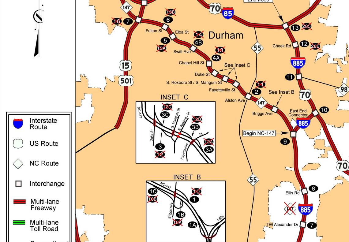
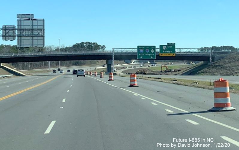
I-885 Exit List
East End Connector Project History
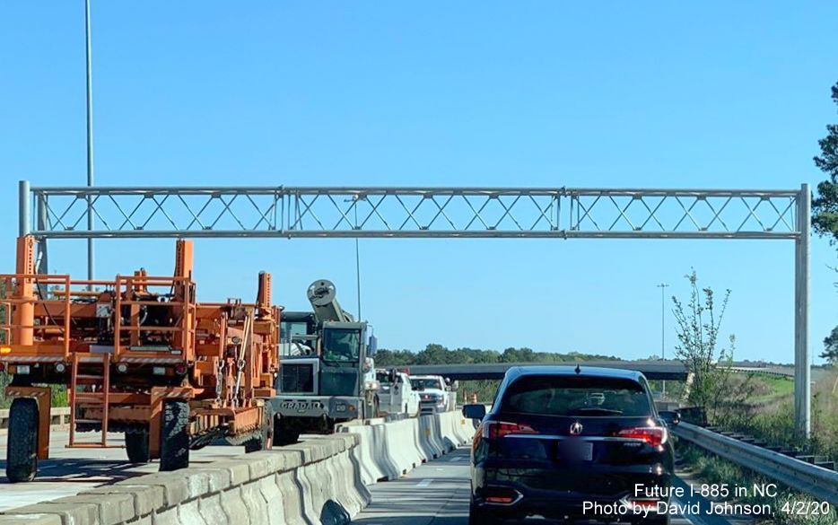
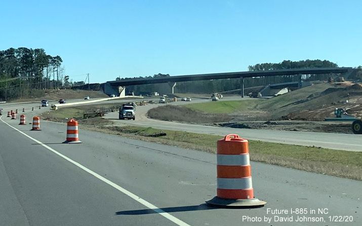
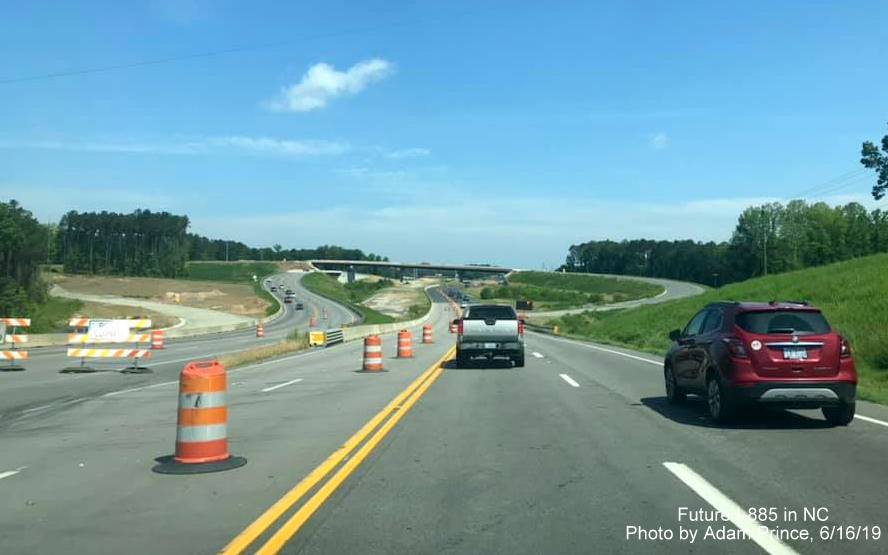
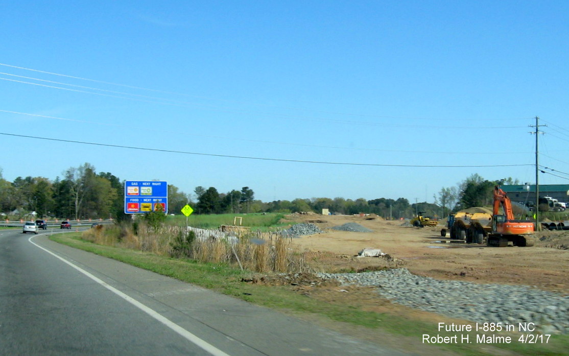
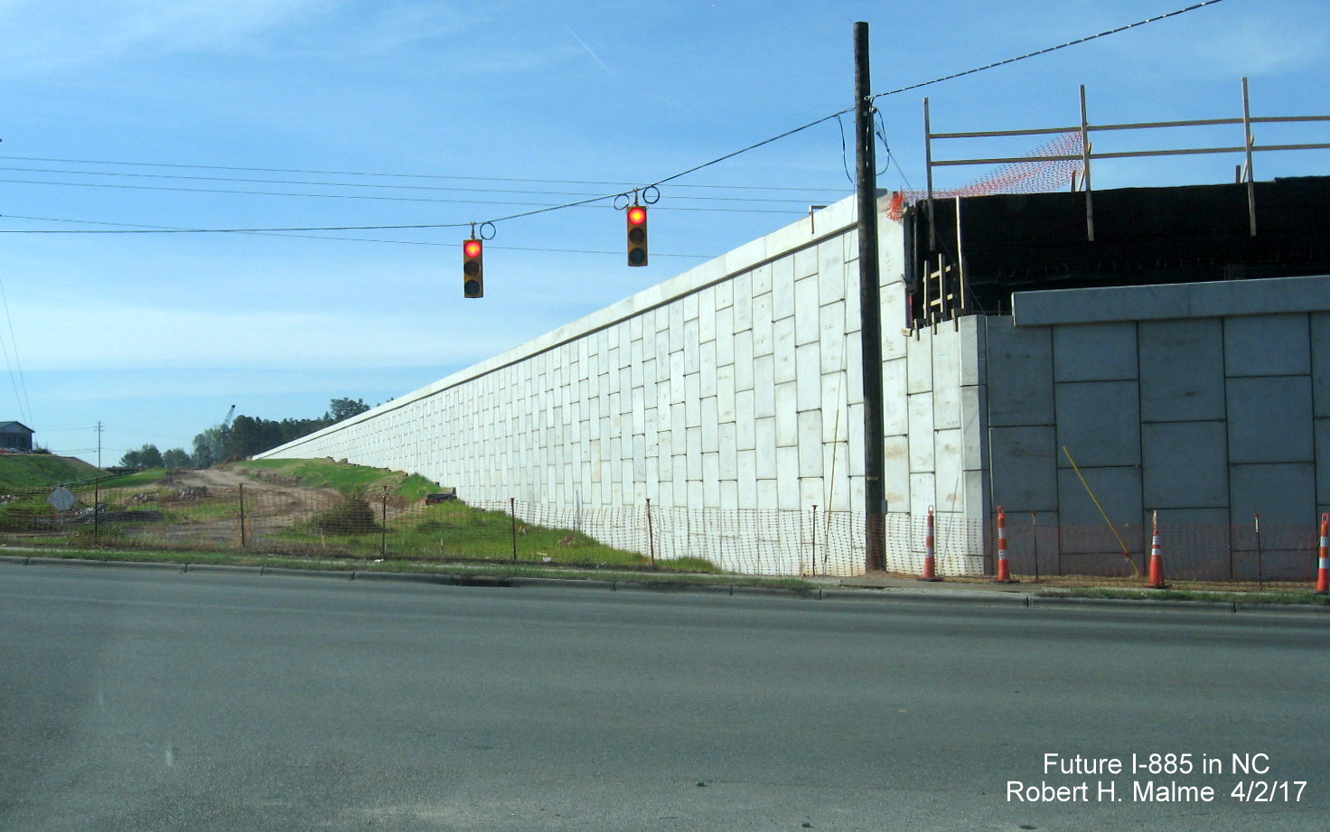
Construction of the Connector started more than 7 years ago on
February 26, 2015 after NCDOT awarded the $142 contract to Dragados USA
of New York City on January 7 and completion has been delayed at least 4
times. The project originally had a tentative completion date of May
2020, though NCDOT said in 2017 that the road could open as early as
July 2019. Weather and other delays officially pushed back the date to
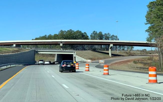
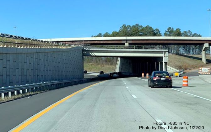
June 30, 2022.2 Although the Durham Freeway and US 70 are
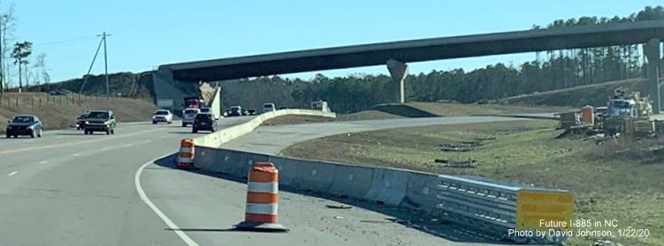
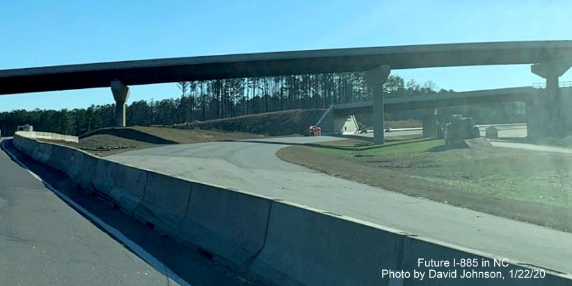
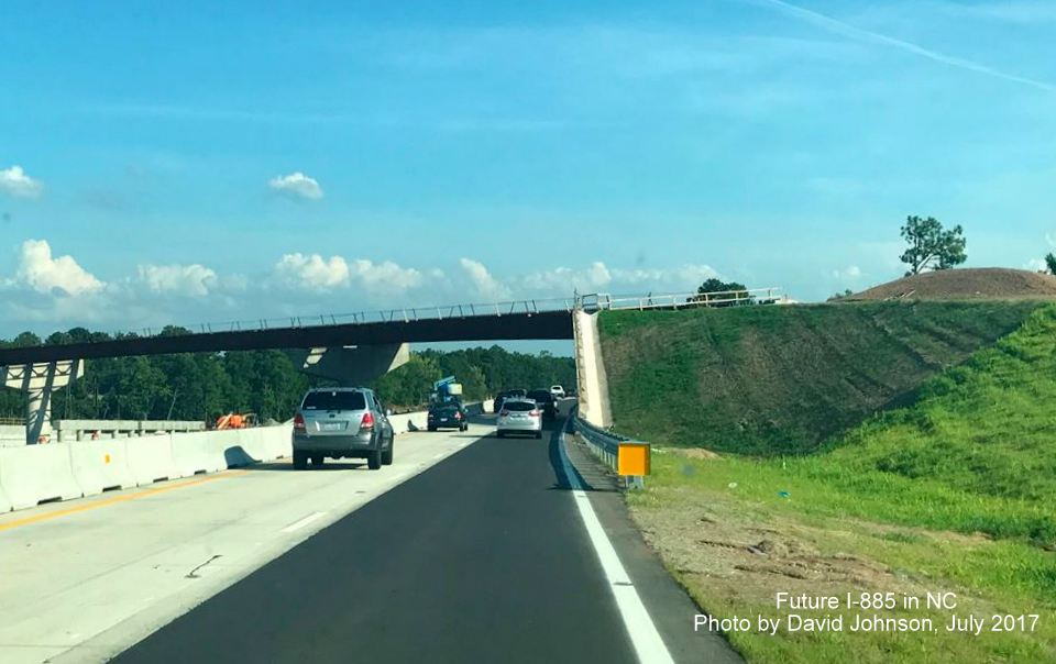
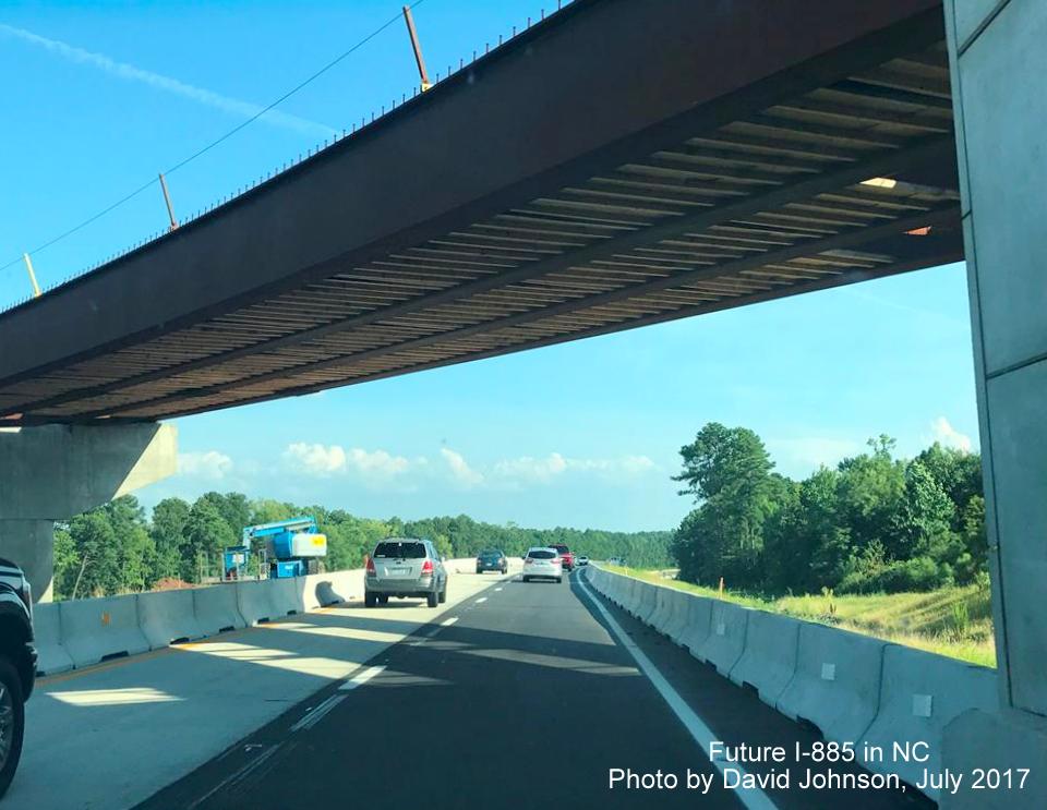
just a mile apart, the project involved constructing 3.9 miles of
roadway, including car and railroad bridges, and long loop ramps at both
ends. The new freeway has two lanes each way with room to add a third
lane in the future.3 Work on moving traffic to new northbound
lanes on NC 147 was to be completed by June 2018, according to the NCDOT
project website, that milestone was then pushed back on December 18,
2018, then to May 2019.5 A news
story from June 11, 2019 put the completion of the NC 147 part
back to July 2019, the extreme wet weather of the region being probably
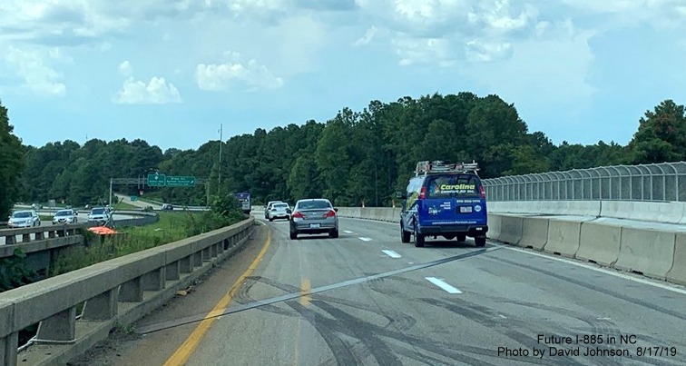
the biggest culprit for that delay. On August 17, 2019 the revamped
North NC 147/Durham Freeway lanes were finally reopened ending the
temporary use of the southbound lanes that had lasted since 2017.8
While work was completed south of the future I-885 interchange in 2019,
work north of it was not completed until June 2020.6 The
rest of the work on widening the new US 70 East/Future I-885 South lanes was completed in October 2020.
The completion date for the entire project and the route's number have
been in flux for more than 2 1/2 years. In a November 21, 2019 NCDOT
press release, the opening date was pushed back to November 2020, in
February 2020 the official project page updated the opening of the
Connector to November 18, 2020.7 A NCDOT press release of
June 8, 2020 regarding closure of US 70 lanes to install girders for the
future I-885 South bridge over NC 98 now indicated the
project should be completed by the end of the year. The
NCDOT project website in October 2020 listed that the opening of the
Connector to traffic won't happen until June 2021, however the
Construction Progress Report for the contract updated as of April 30,
2022 still says the completion date is February 22, 2021.4
The continuing delays appear to be connected to construction of a new
railroad bridge on the US 70 portion, according to a news article
published on December 31, 2020, there was a problem with the steel
girders that caused them to bend when concrete for the bridge was being
poured. That problem has now been fixed. Once the new bridge is
completed, it will take 6 weeks to demolish the temporary bridge (see
photos below) and repave the lanes underneath.9 Though this
does not explain the delay in opening the Connector between NC 147 and
US 70 which is apparently complete. A reply sent to a poster on AARoads
Forum on April 26, 2021 indicated that there would be further delays in
opening beyond June. The NCDOT spokesman stated it now should be open by
the end of the year, perhaps as early as September.10
However, in June 2021, the NCDOT project page was updated listing
December 2021 as the date the highway would open to traffic and Spring
2022 as the completion date for the project.11As of early
October 2021 the temporary railroad bridge was still in place, putting
the end of the year opening date in doubt. In early November 2021, NCDOT
reported that the work on the new railroad bridge was complete and the
temporary one could now be demolished. They said, however, that
demolition would not start until December, putting the completion date
in late January or early February 2022. Since paving and lane striping
would have to wait until it warmed up, they would not commit to a
specific completion date, only sometime in the spring of 2022.12
NCDOT then announced in mid-January 2022 that the bridge demolition
would not start until later that month or early February. The demolition
work though did not start until mid-February with the NCDOT press
release indicating the work would finish by the end of March.13
Lane striping and the installation on new signage would then have to
take place before the Connector can open. Despite the additional delays,
the NCDOT project site still listed a 'Spring' 2022 opening. On May 4,
2022 NCDOT issued a press release saying the workers on the East End
Connector project were beginning to wrap up their work. Final paving and
lane striping on US 70 had begun and would continue for a few more
weeks. The the installation of remaining I-885 (and NC 885 signs along
the toll portion of NC 147) would start the week of May 9.14
Coincidentally or not, this was the same date the AASHTO Special
Committee on U.S. Route Numbering met in New Orleans to approve the
latest state US Route and Interstate applications, which included I-885
(and Future I-685) from NCDOT. A browse through traffic cameras from May
13 to June 5 showed signage gradually being changed north to south where
signs could be seen. Many signs remained unchanged through the second
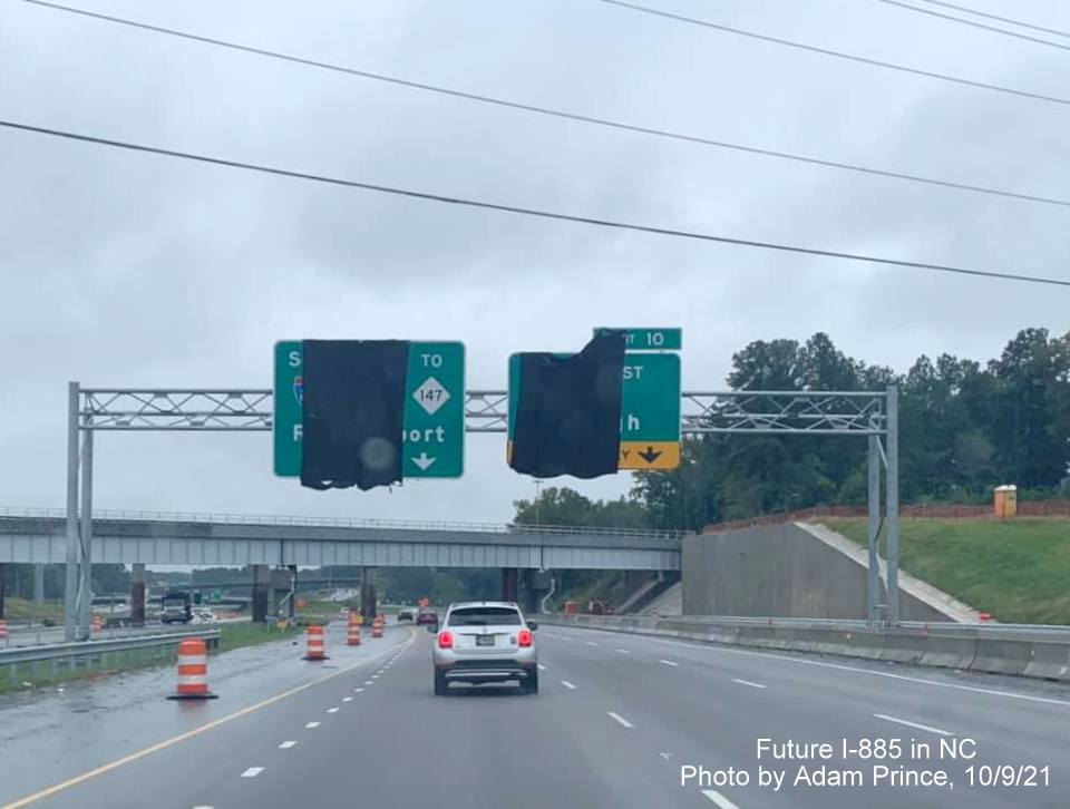
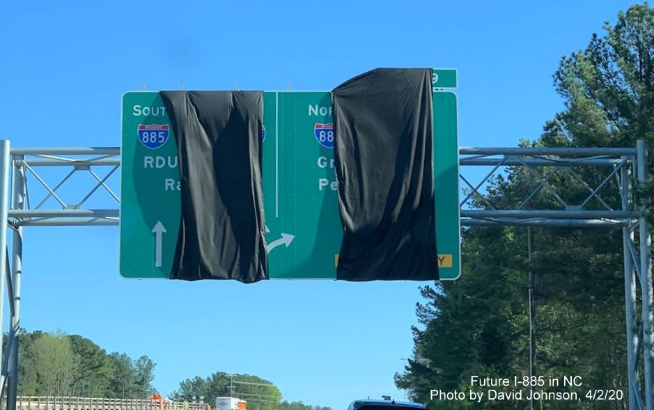
week of June. New I-885 exit gore signs with new numbers were still
covered by with black plastic on US 70 until the first week of June, and
signage south of I-40 still showed NC 147 shields until the middle of
June:
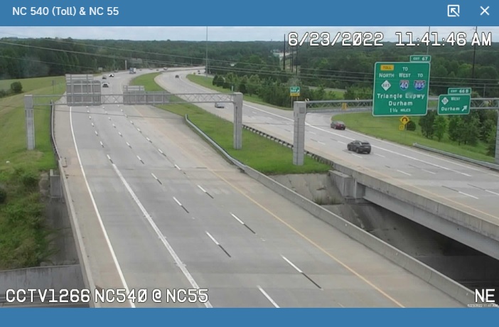
Meanwhile on NC 540, signs still showed Toll NC 147 at the NC 55 exit
until June 23, probably one of the last changed:
NCDOT still did not list an actual opening date, but an NCDOT
spokesman quoted in an early May news article said that he hoped all the
paving work would be completed in June.15 On June 22, 2022
NCDOT announced there would be a ribbon cutting followed by the opening
of the Connector on June 30.16 Meanwhile, NCDOT's traffic map
jumped the gun on the night of May 11 and started signing the Durham
Freeway as I-885 and the Triangle Parkway as NC 885, despite the East End Connector not being open as of yet:
On December 17, 2019 information was posted on AARoads Forum from
NCDOT indicating that the NC 147 designation was now to be dropped from
the Durham Freeway south of the future I-885 interchange, and, because
of that, the Toll NC 147 portion south of I-40 would be renumbered as
Toll NC 885. This allows all the exits between NC 540 and the future NC
147 North interchange to retain their numbers, but will cause a change
in the planned exit numbers along I-885 north of the Durham Freeway (see
link to Exit List above or sign plans below). Signage put up on the
unopened connector in 2020 heading west/south still had NC 147 listed as
running concurrently with I-885 along the Durham Freeway, perhaps, like
other signage, this is a mistake that will be corrected later, see
photos below. The February 2022 press release on the beginning of the
railroad bridge demolition reiterated the route changes first publicly
announced in January, confirming that NC 147 will be truncated to the
I-885 interchange.16 Entries on NCDOT's Construction Progress
Report for Durham County lists two contracts, one (DE00310) taking place
on NC 540, I-885, and NC 885, the other on NC 540 and NC 885 that also
confirm the future existence of that route number on the Triangle
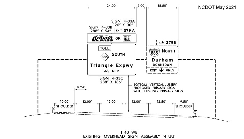
Parkway toll road. Plans released for upgraded signage on the Triangle
Expressway and NC 147 included signs for Toll 885 and new exit numbers
for NC 147 (see Sign Plans section).
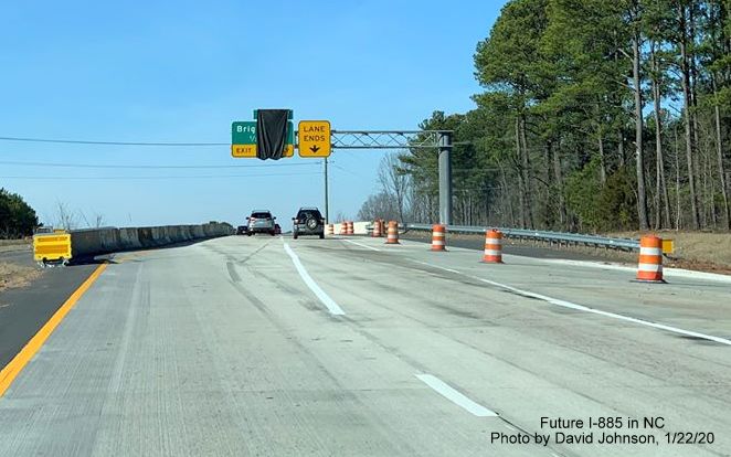
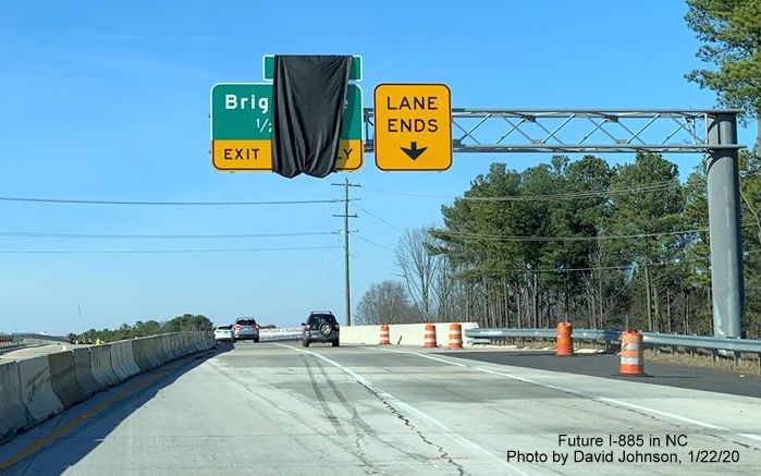
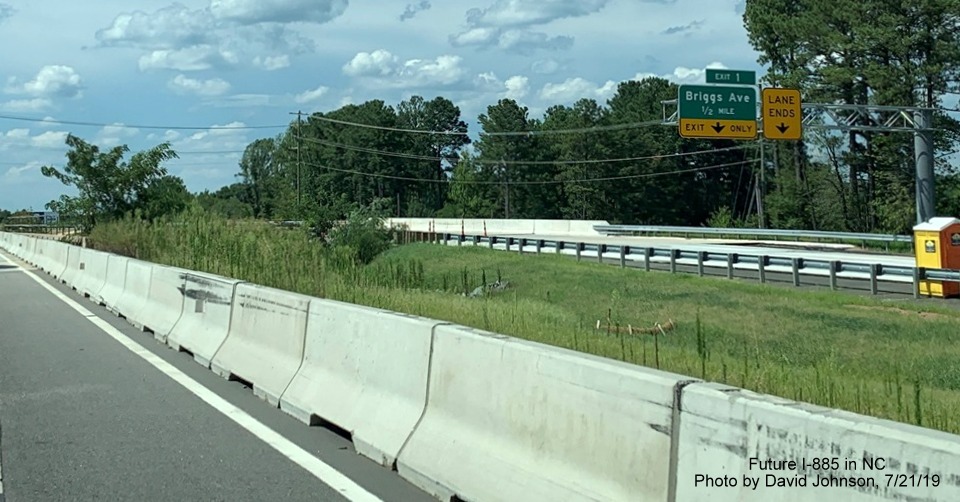
The planned completion of all I-885 related work on the Durham Freeway
was set for December 2019, but was actually not completed until November
2020 when a project to finish widening the ramp from Briggs Avenue to NC
147 South was completed.11
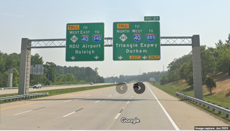
The News and Observer published a cropped version of NCDOT's map that
shows the route and exit number changes on May 5:
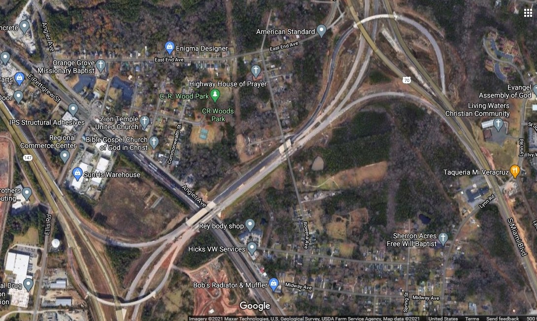
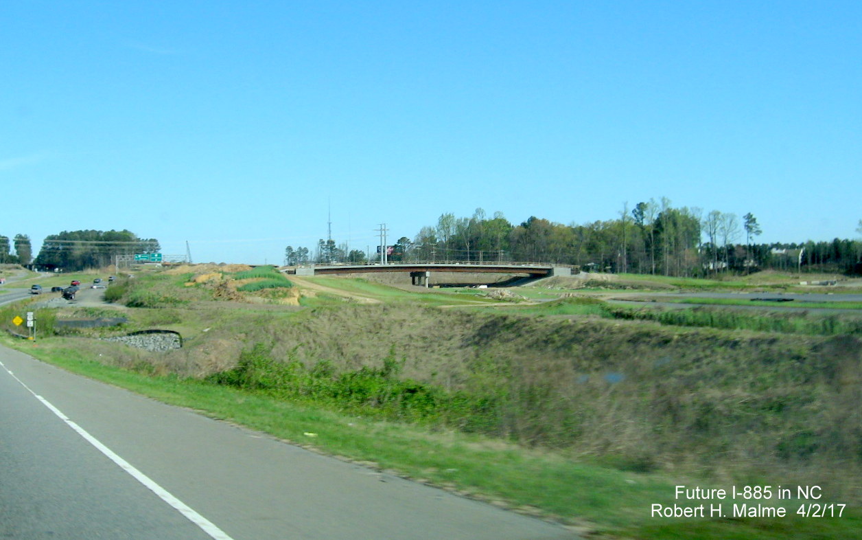
Google Maps satellite view of East End Connector, taken around
the summer of 2020, showing near completion of the project:
New Interstate Photos
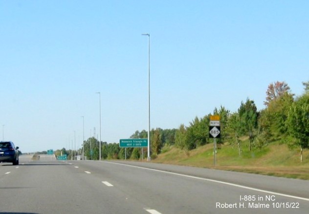
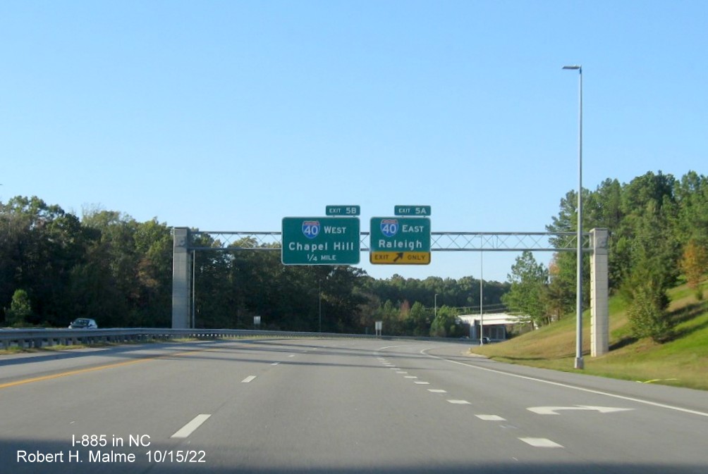
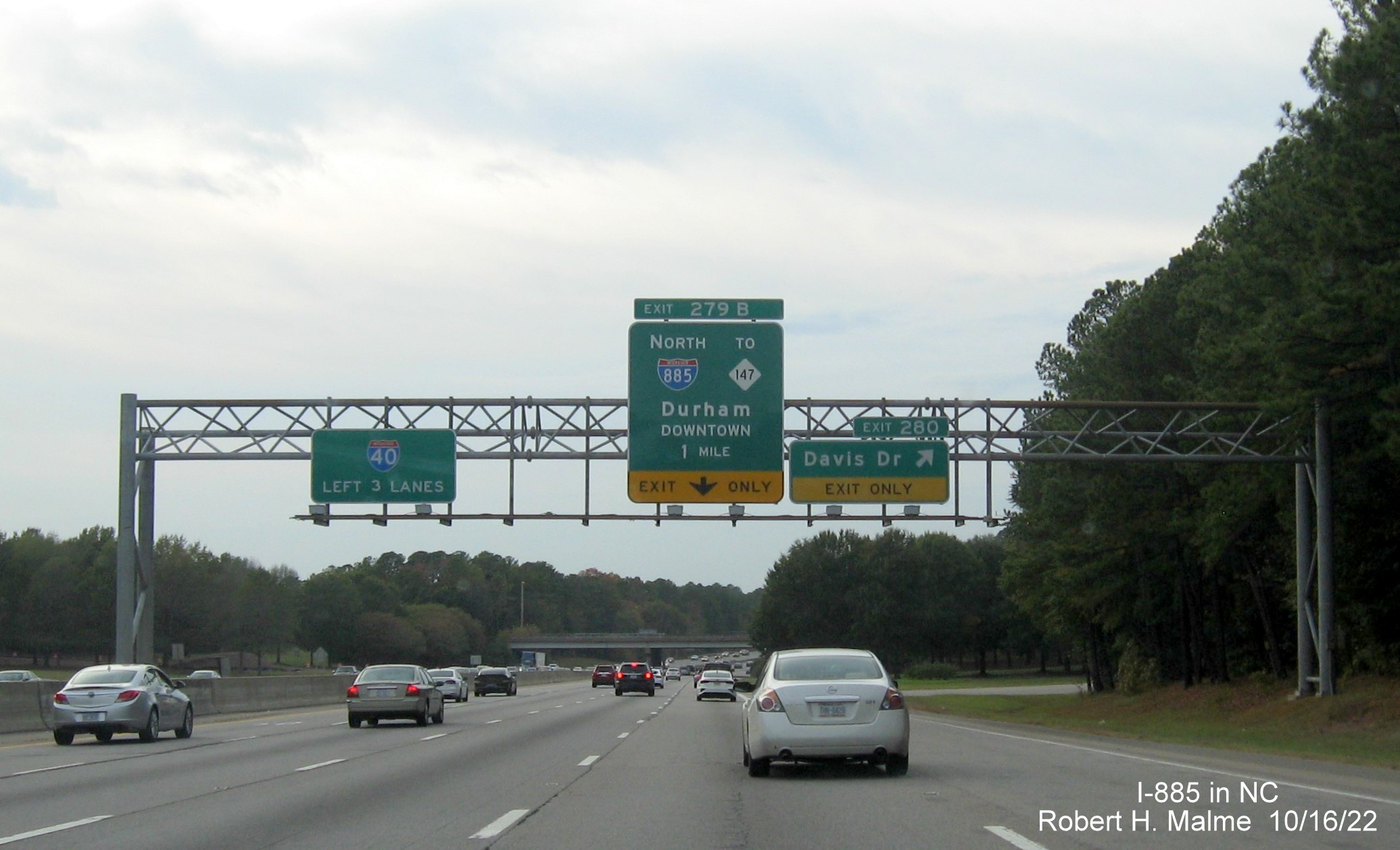
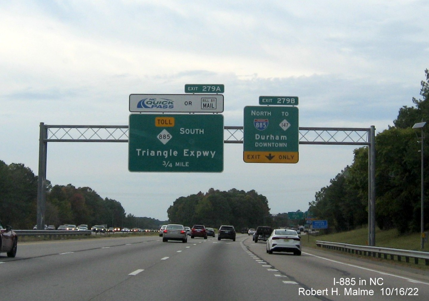
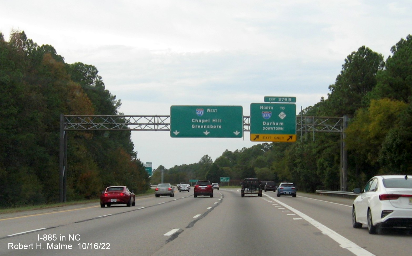
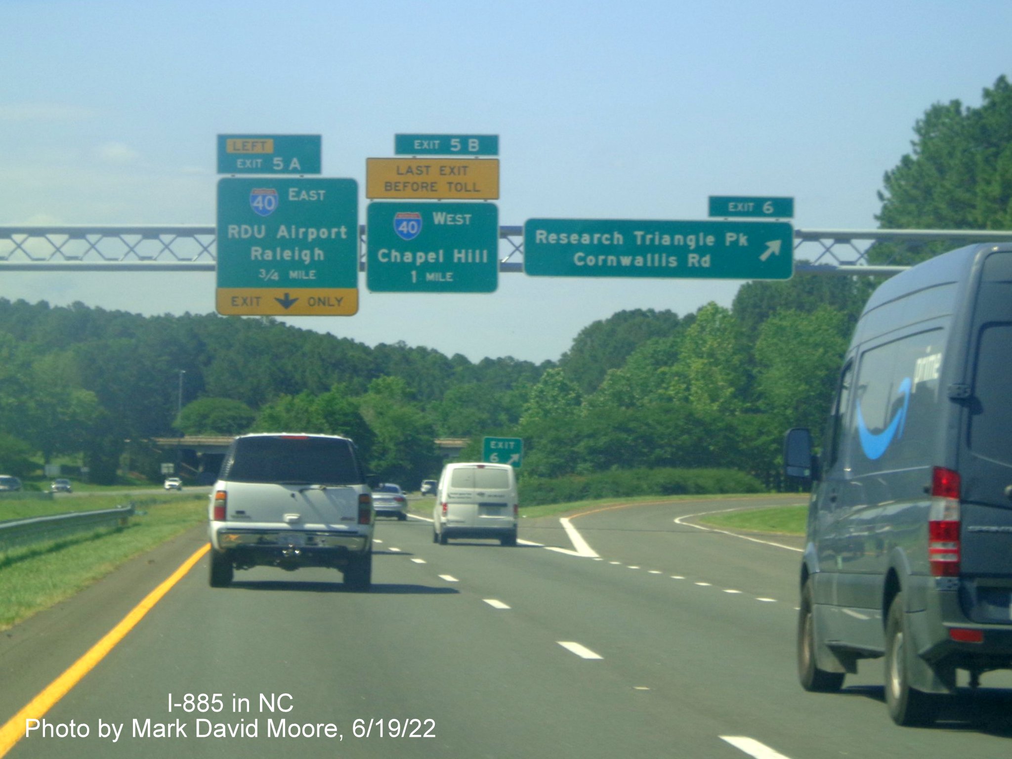
Taken October 15 and 16 on a trip to Durham, starting on I-85 North and heading south to I-40 (*Added May 2023):
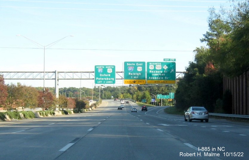
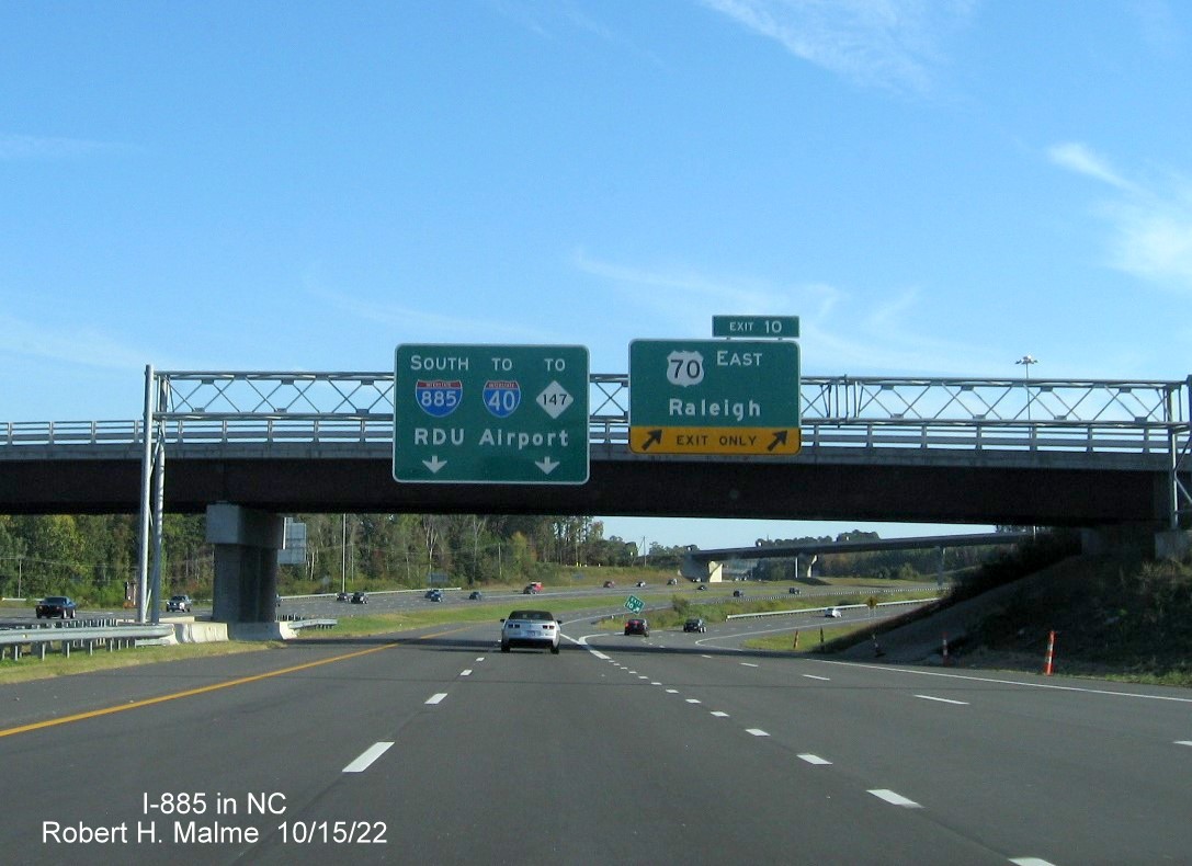
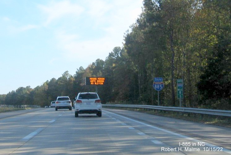
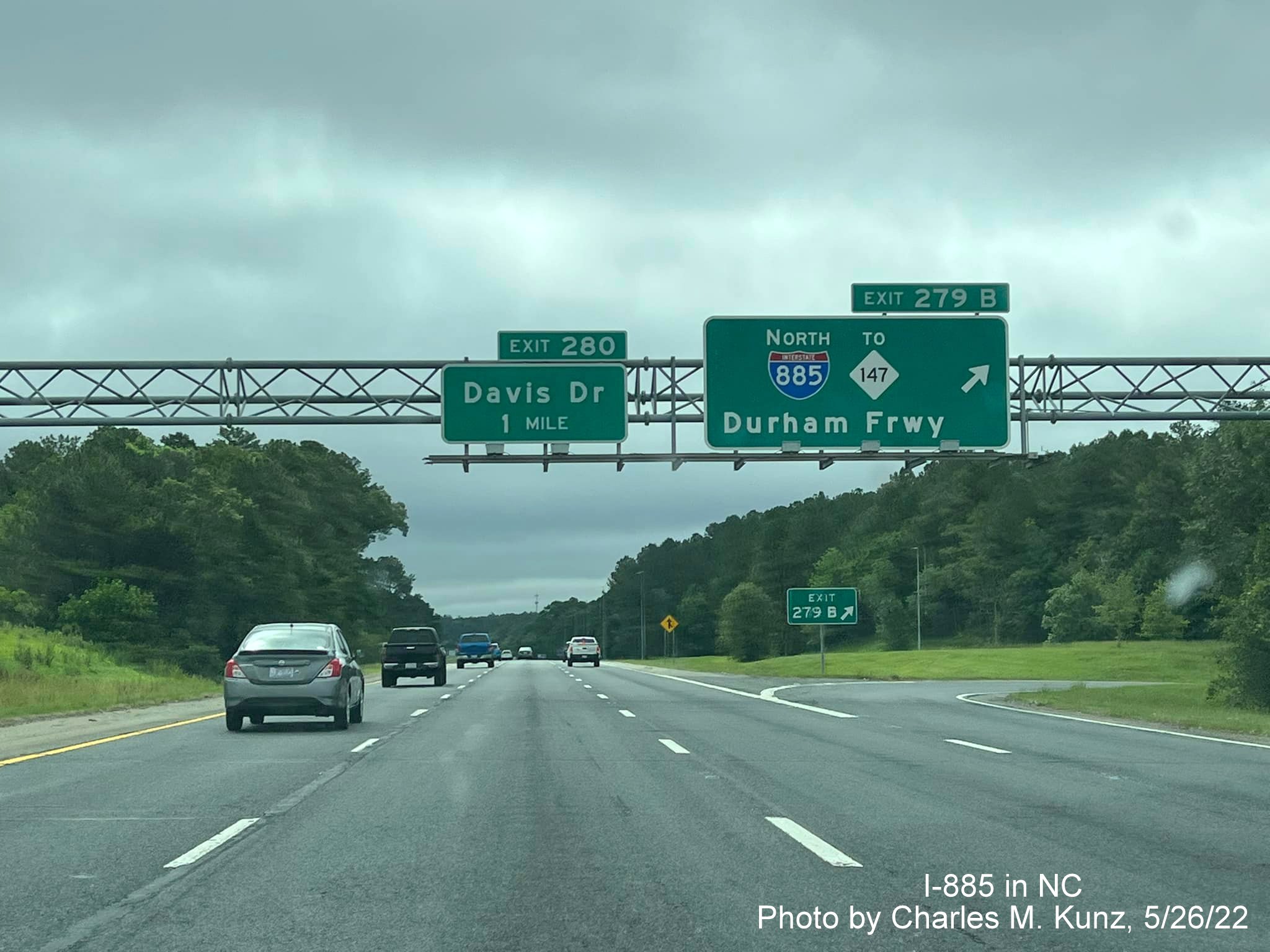
The first reference to I-885 heading North on I-85 at the Business 15/501 exit.
The lone sign on the gantry is the 1/2 mile advance for the I-885 South/US 70 East exit.
The signage at the exit ramp, notice no reference to RDU Airport on any of the overhead signs. Turning around...
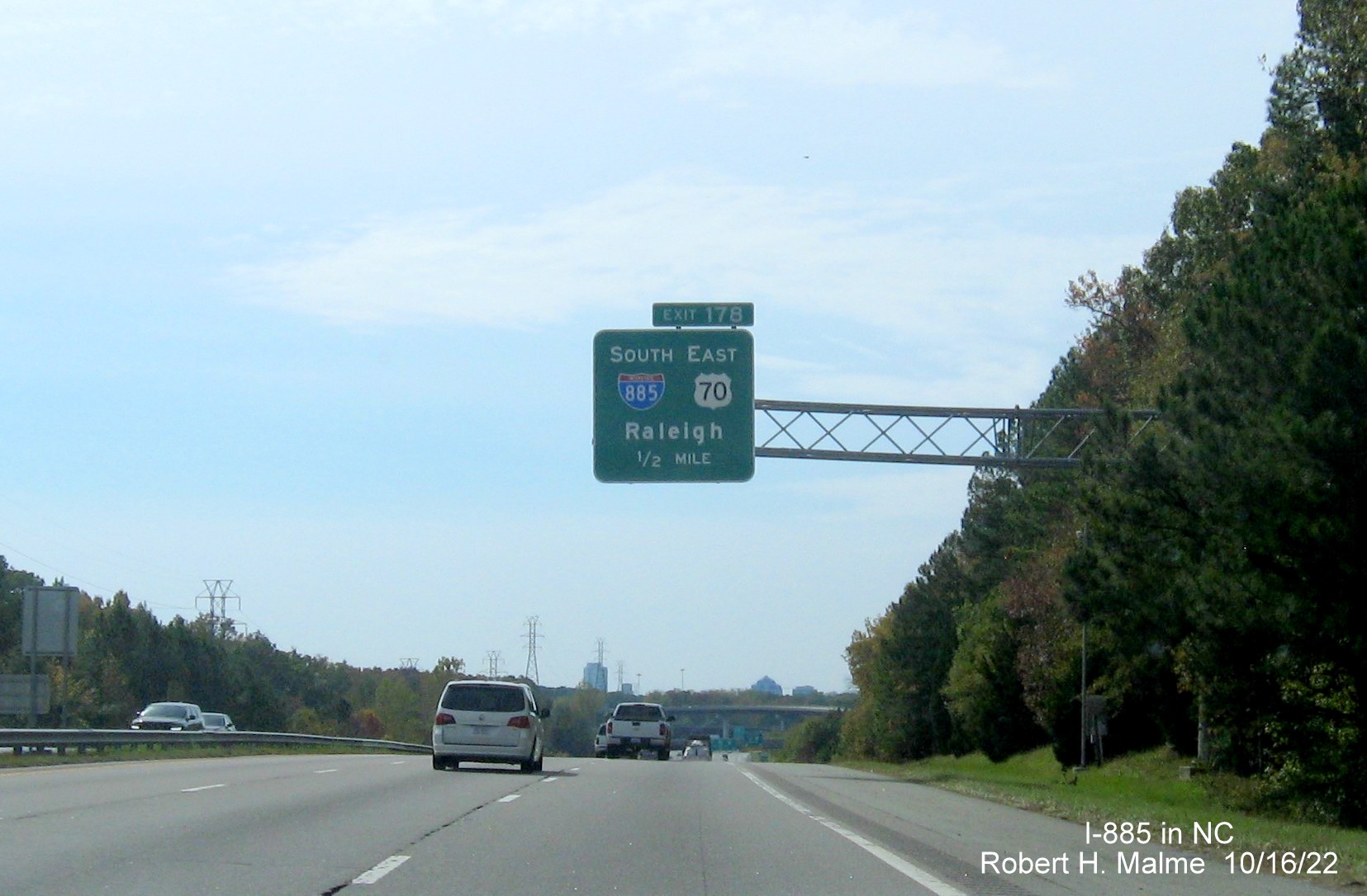
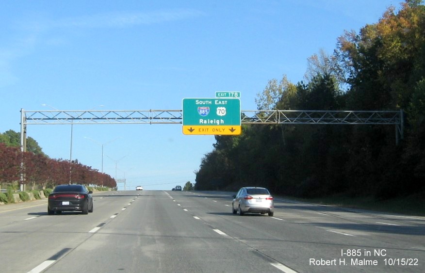
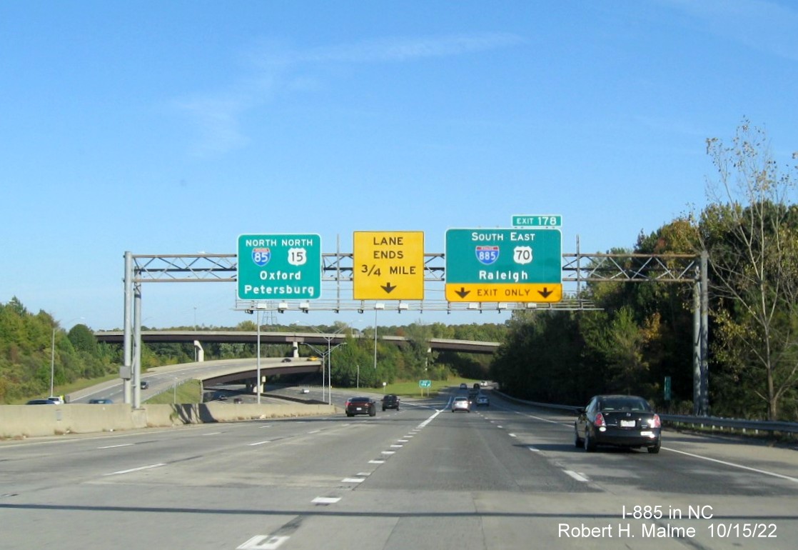
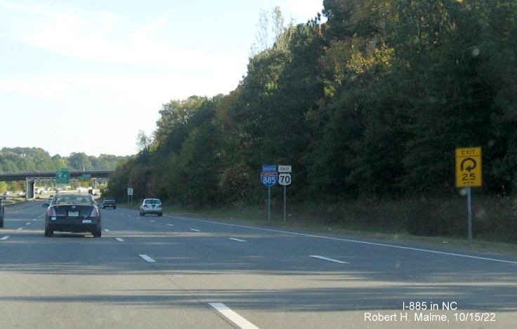
The 1/2 mile advance for the I-885 exit heading South on I-85.
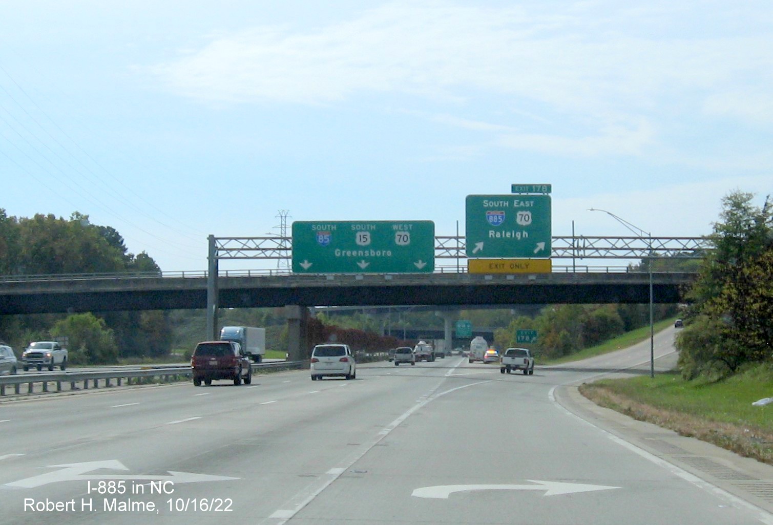
The overhead signage at the now I-885 South/US 70 East exit.
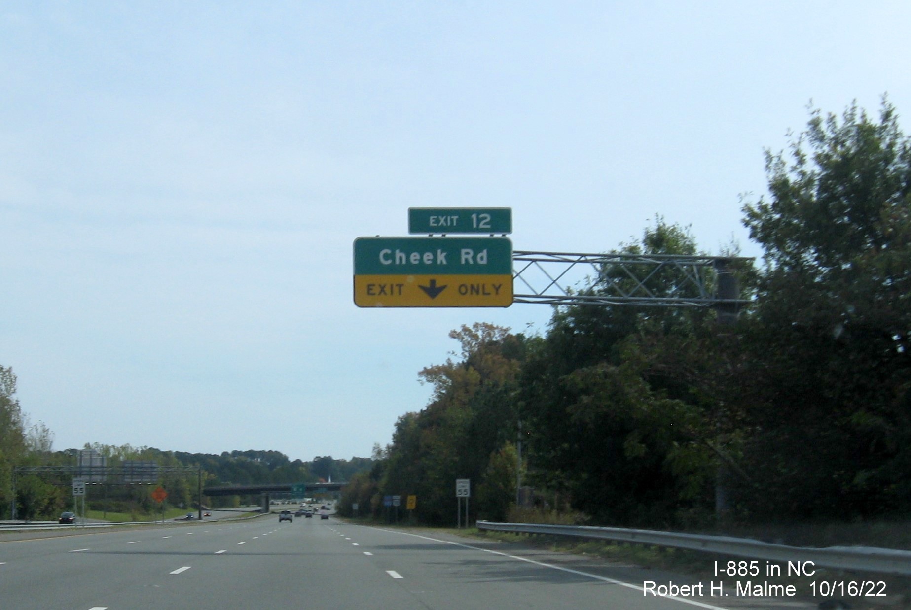
The 1/2 mile advance for the now first I-885 exit heading south, Cheek Road.
The first set of South I-885/East US 70 reassurance markers approaching the Cheek Road exit.
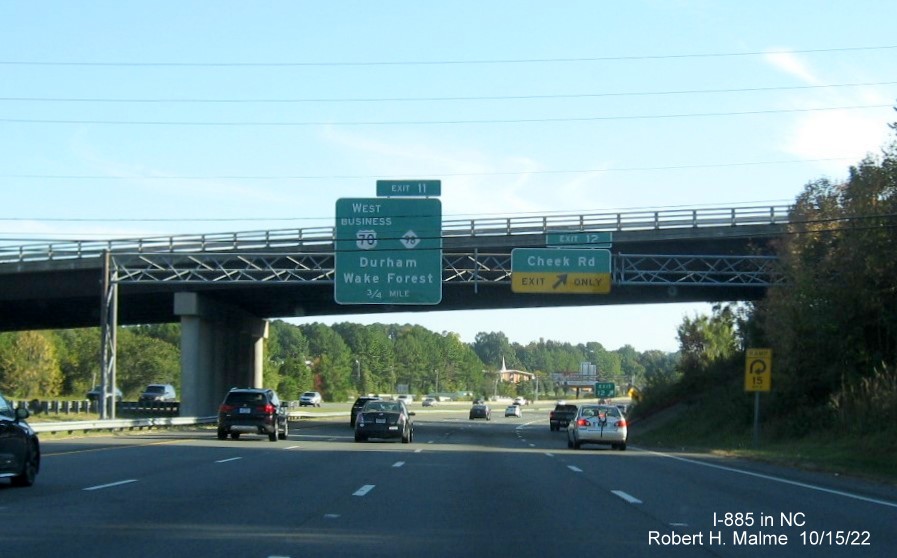
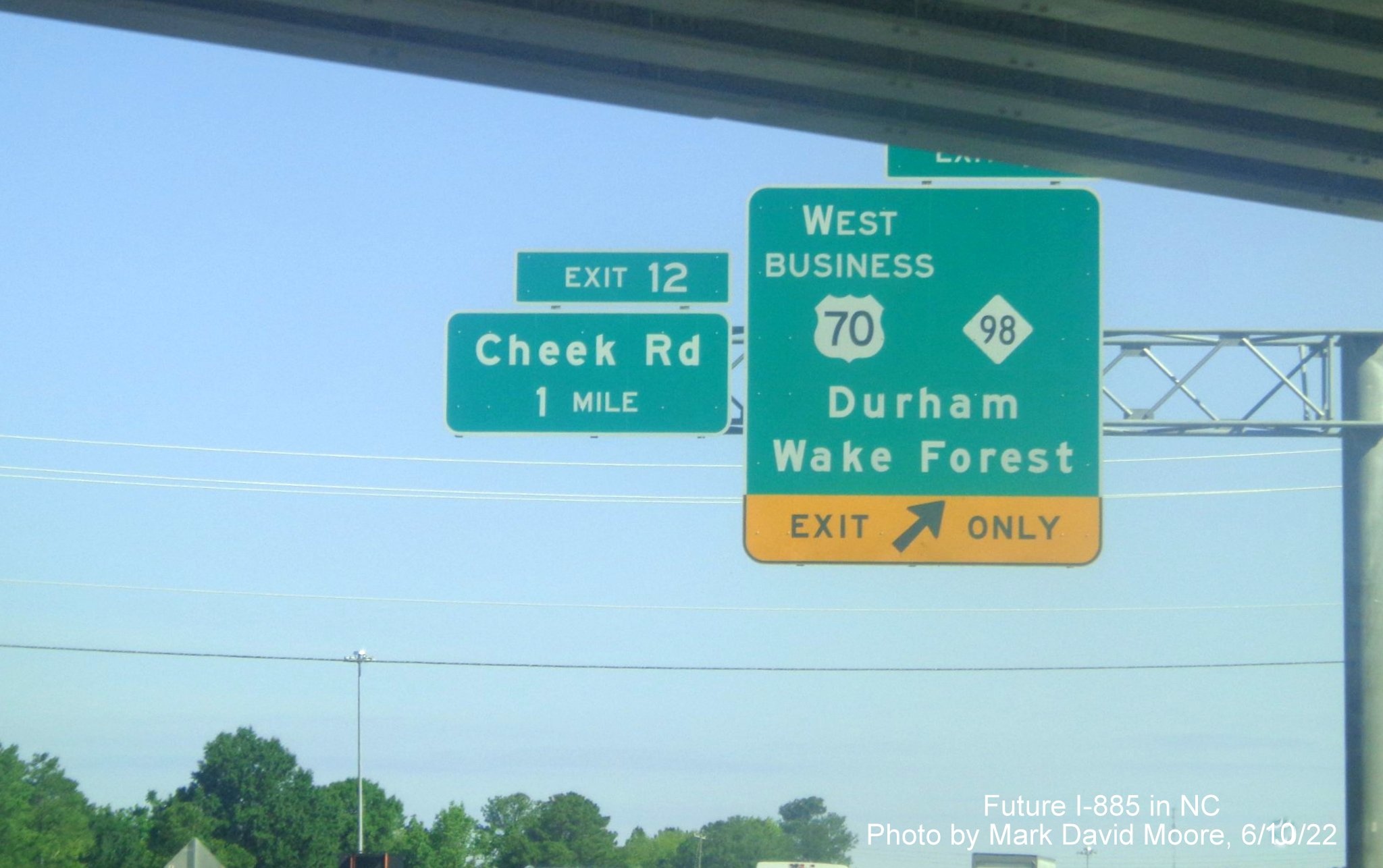
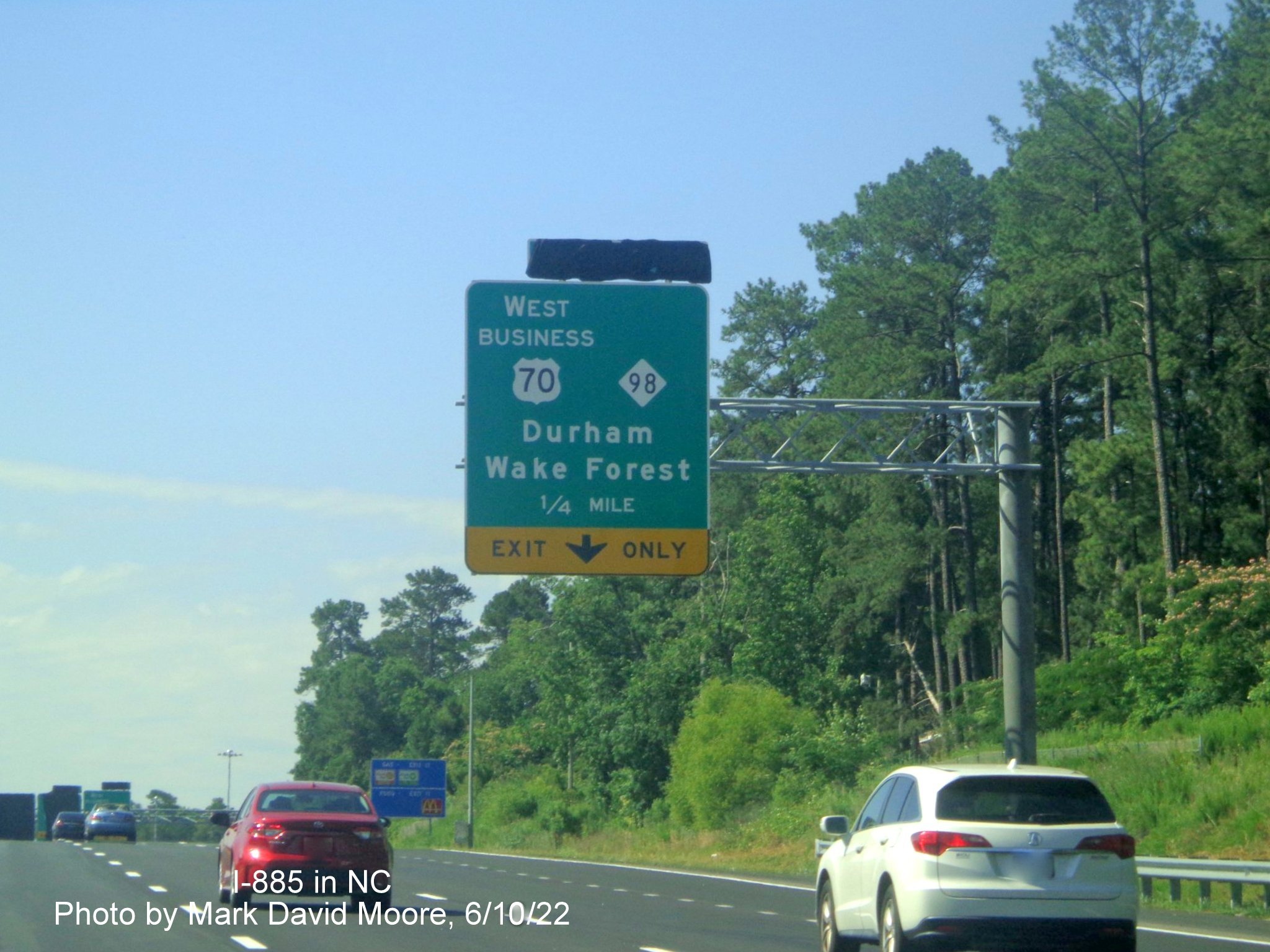
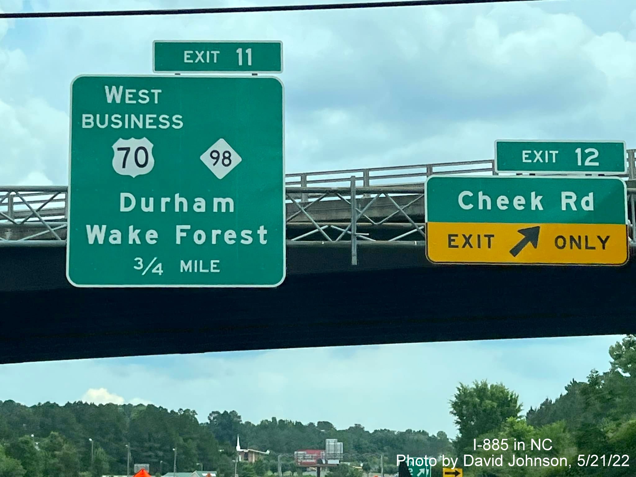
The first advance sign for the new Business 70/NC 98 shares a gantry with the Cheek Road exit sign (and some wires crossing to obscure the view.
The 1/4 mile advance for the West Business 70/NC 98 exit.
The second set of reassurance markers.
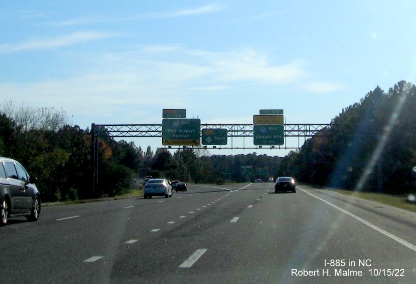
The overhead signage at the West Business 70/NC 98 exit. Notice that US 70 East gets Raleigh as the control city and I-885 gets the RDU Airport.
The gore sign for the West Business 70/NC 98 exit with new I-885 number.

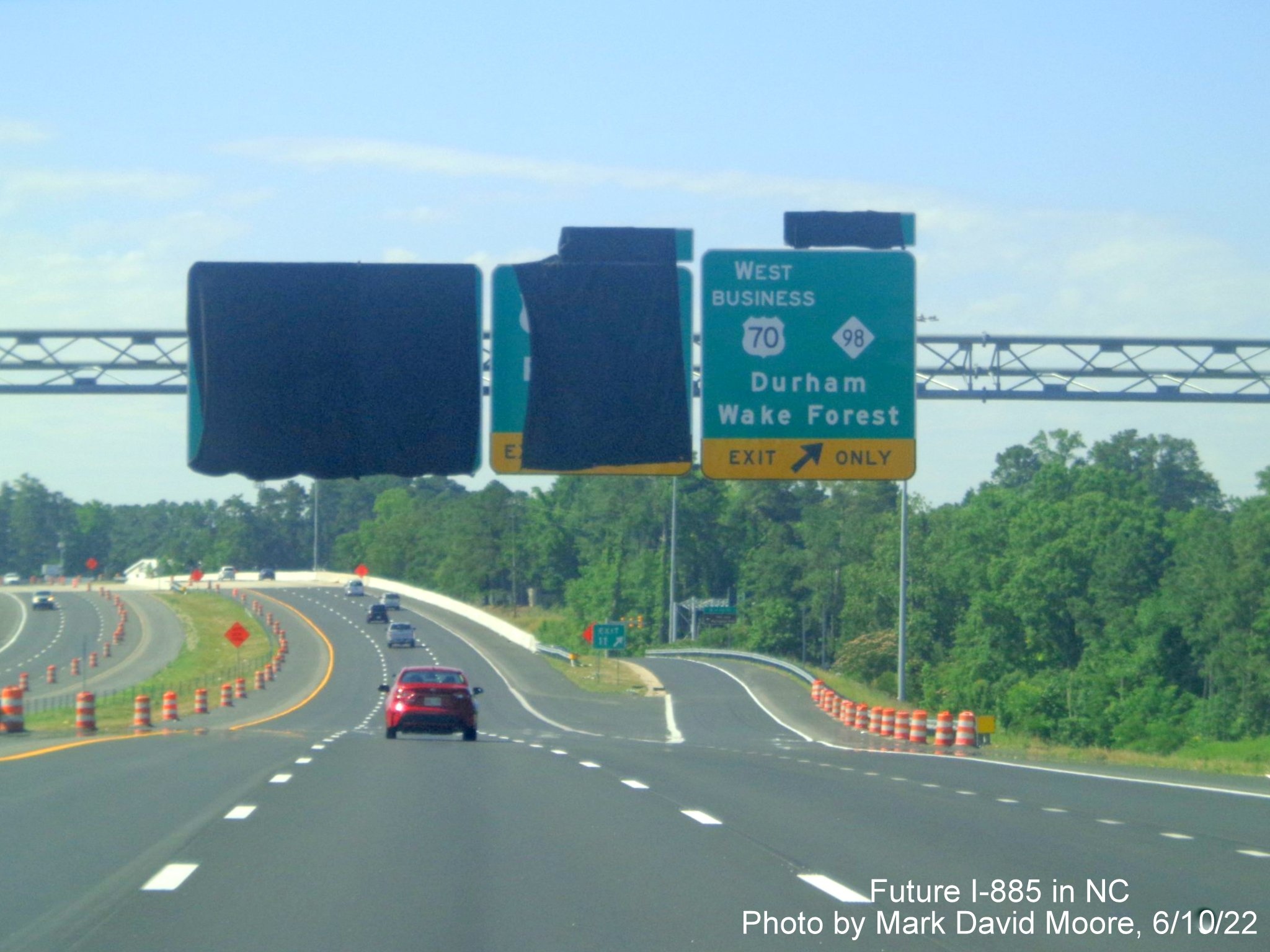
The second I-885 pull through sign with the 1/2 mile advance for the US 70 East exit. Notice the shields on the pavement below the sign, which way to look?

A closer look at the pavement markings prior to the US 70 East exit.
Overhead signage prior to the US 70 East exit. The gore sign appears to already have been hit.
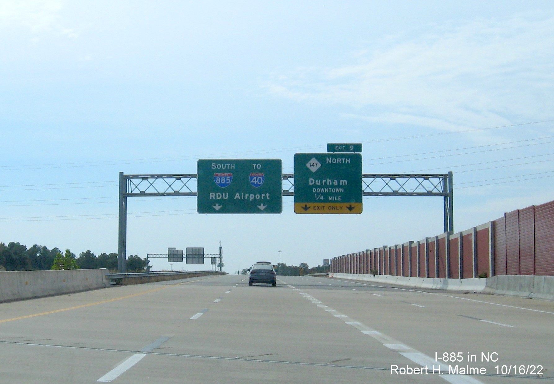
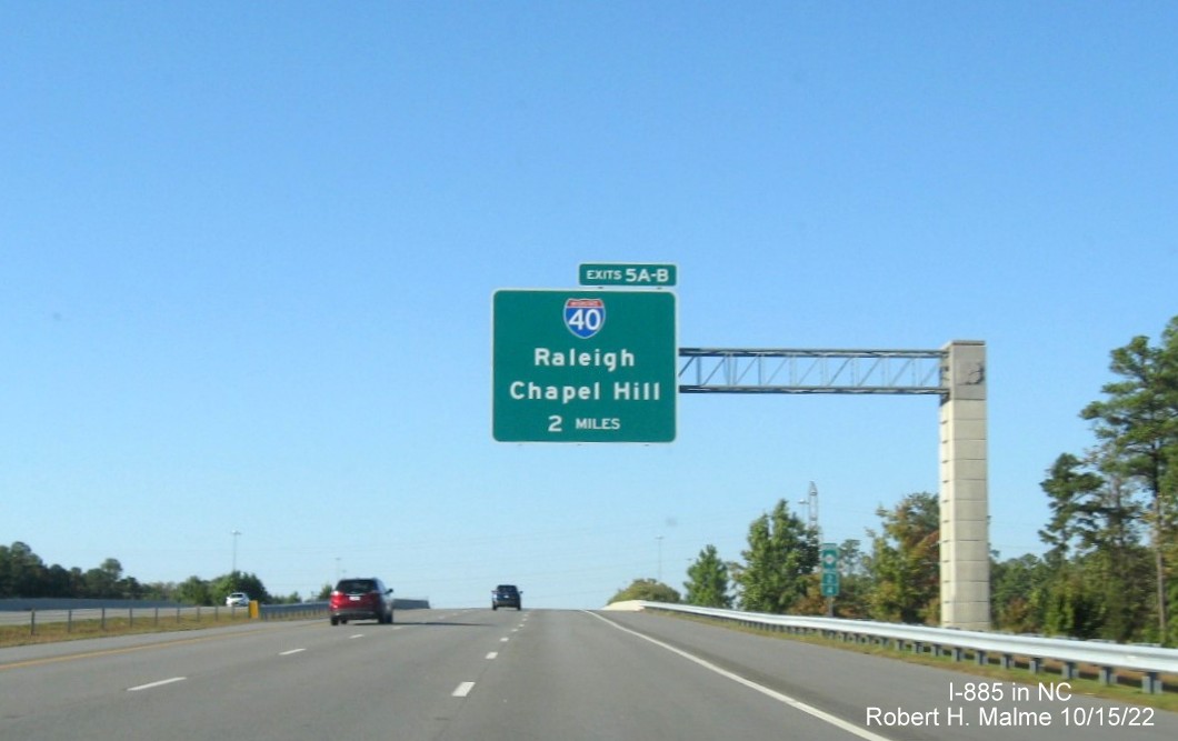
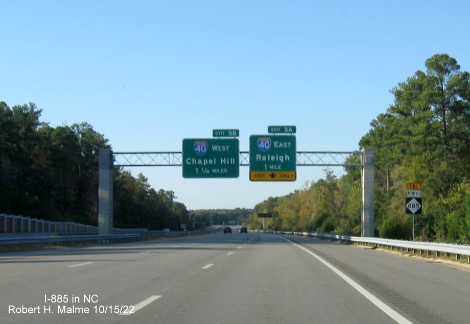
The first exit sign on the East End Connector indicates the end of the new highway at NC 147 North is only 1/4 mile away.
The signage for the now beginning on NC 147 North exit as I-885 takes the rest of the Durham Freeway. These signs were changed from those initially put up (see photos from Roadwaywiz below) that included a reference to NC 147 South.
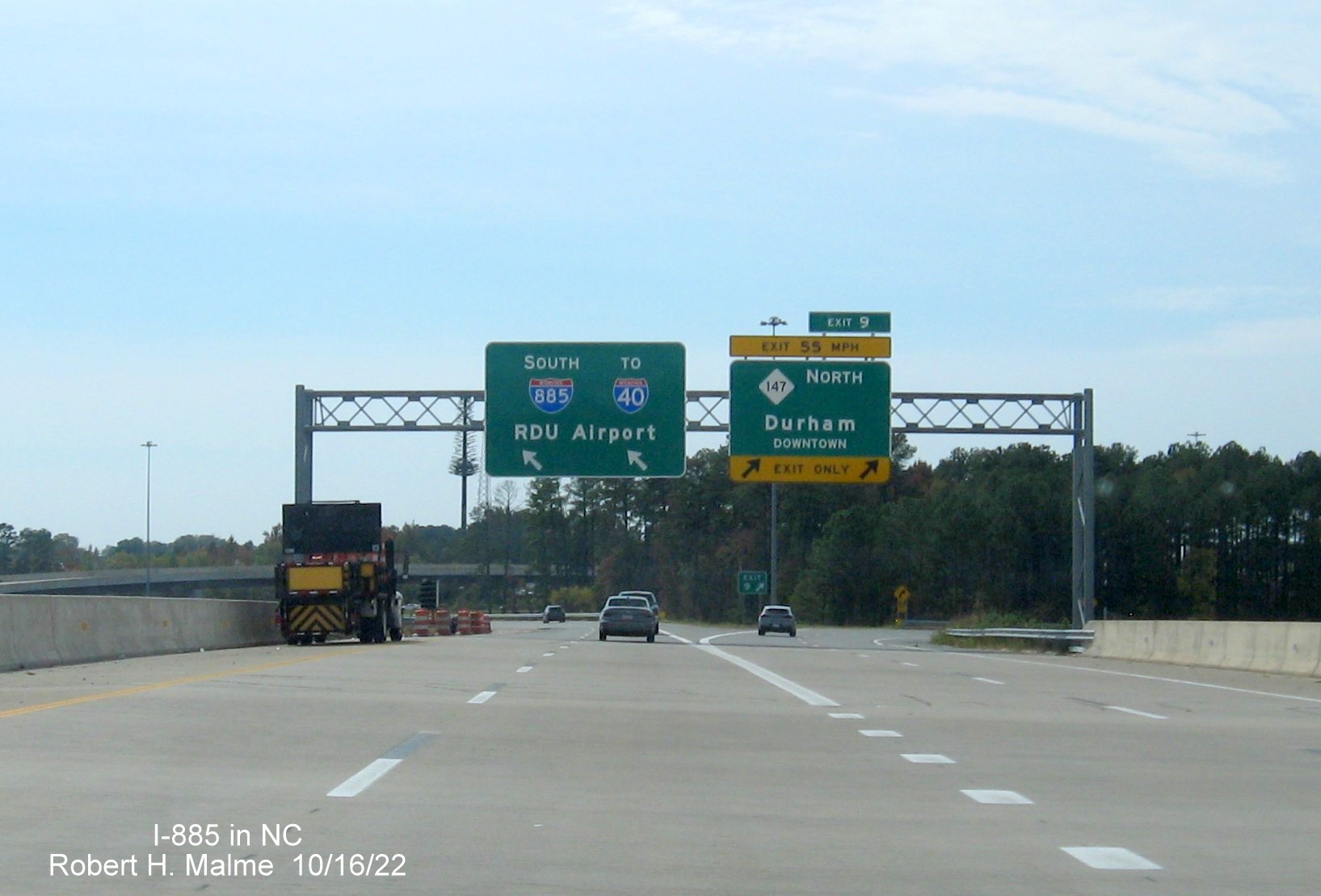
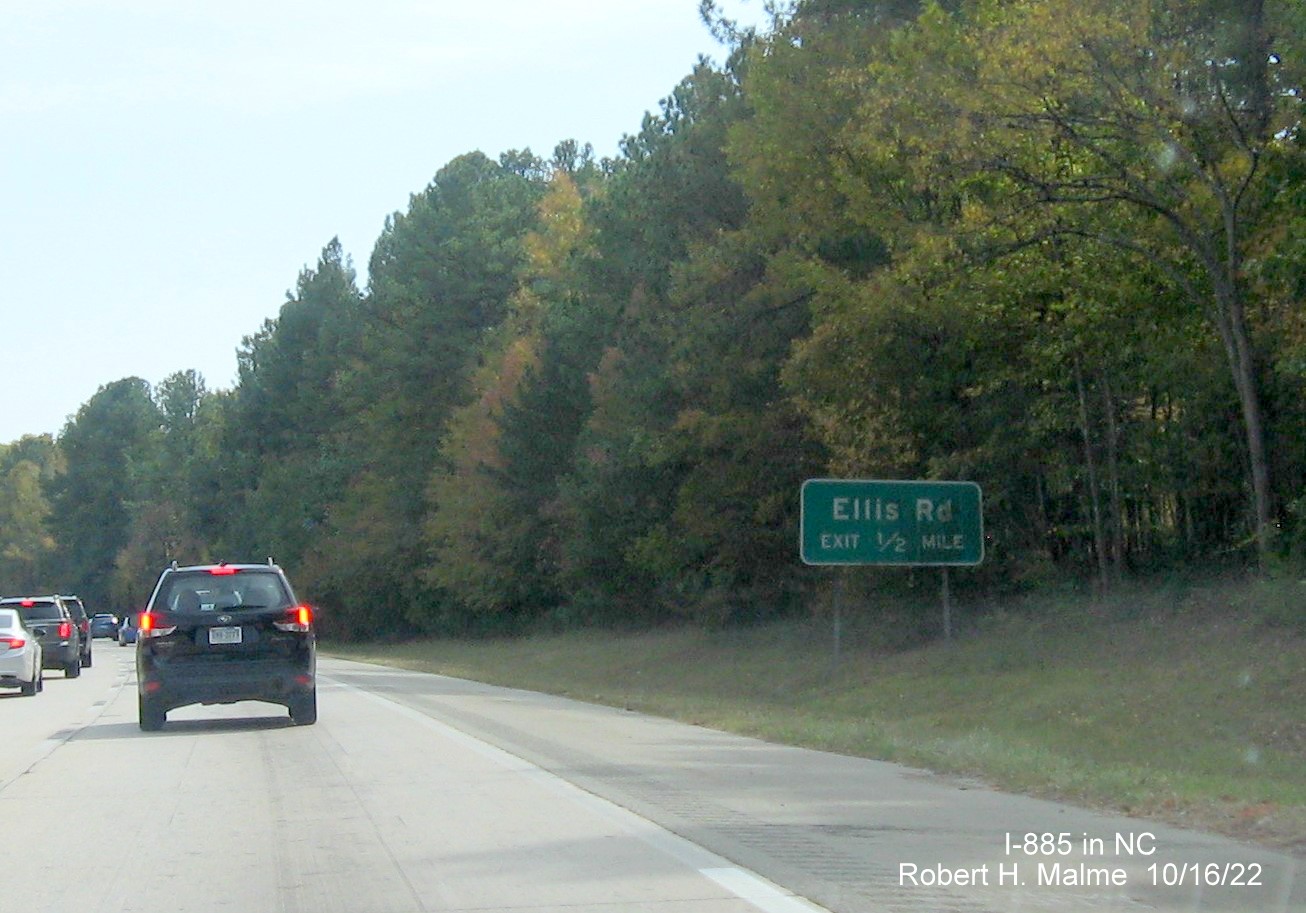
After the merge with the Durham Freeway the first advance sign for the Ellis Road exit as the road shrinks down to 2 lanes (a project that will widen the entire Freeway to 3 lanes each way is a few years off).
A first standalone (and longest standing) South I-885 reassurance marker, with newer mile marker in front.
The look closely or you will miss it ground mounted 1/2 mile advance sign for the Ellis Road exit.

The signage at the ramp to Ellis Road has never had exit tabs when it was NC 147 Exit 8, and still doesn't despite in being I-885 Exit 8.
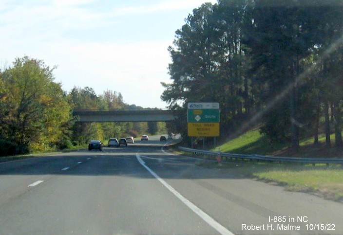
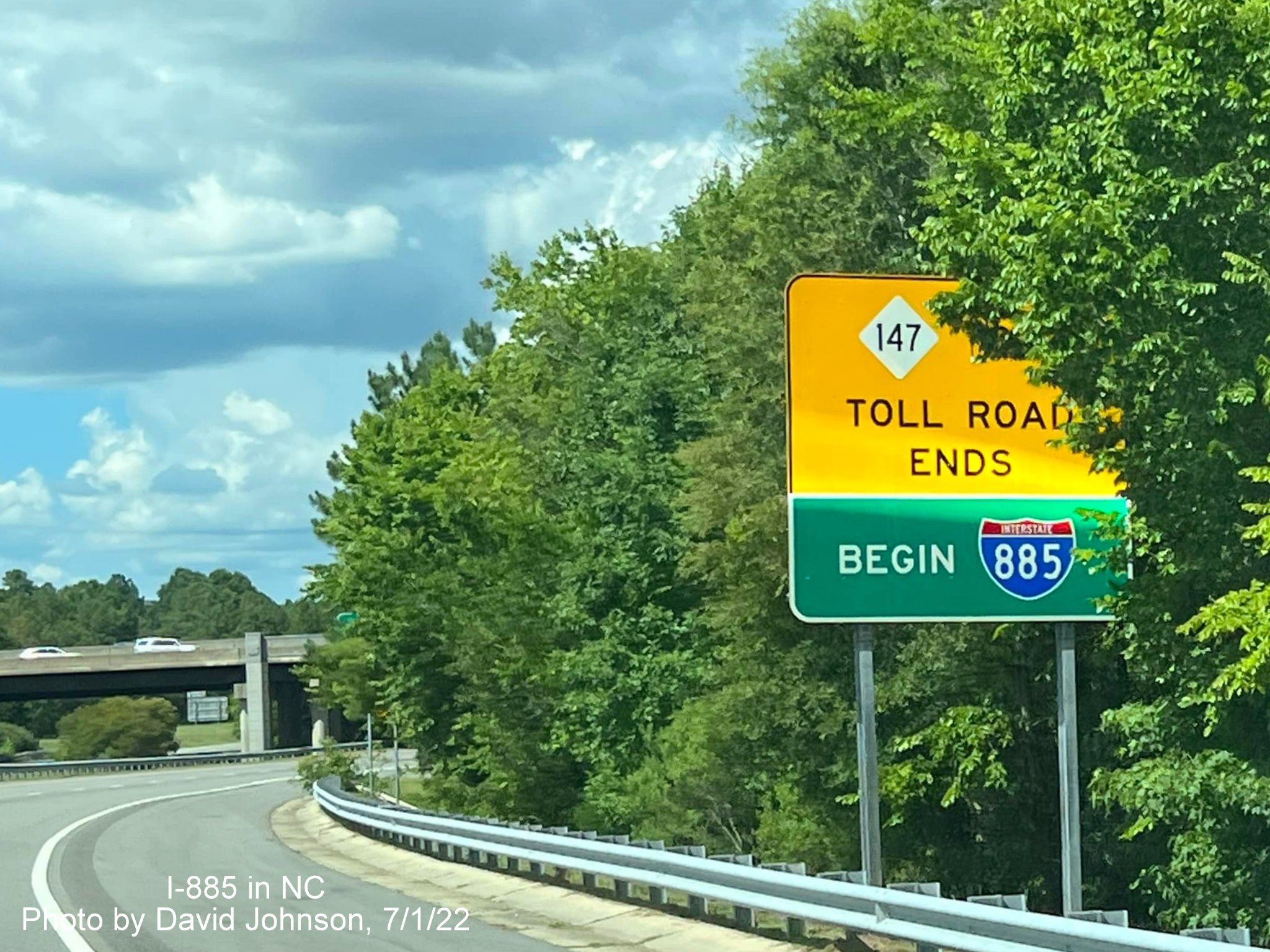
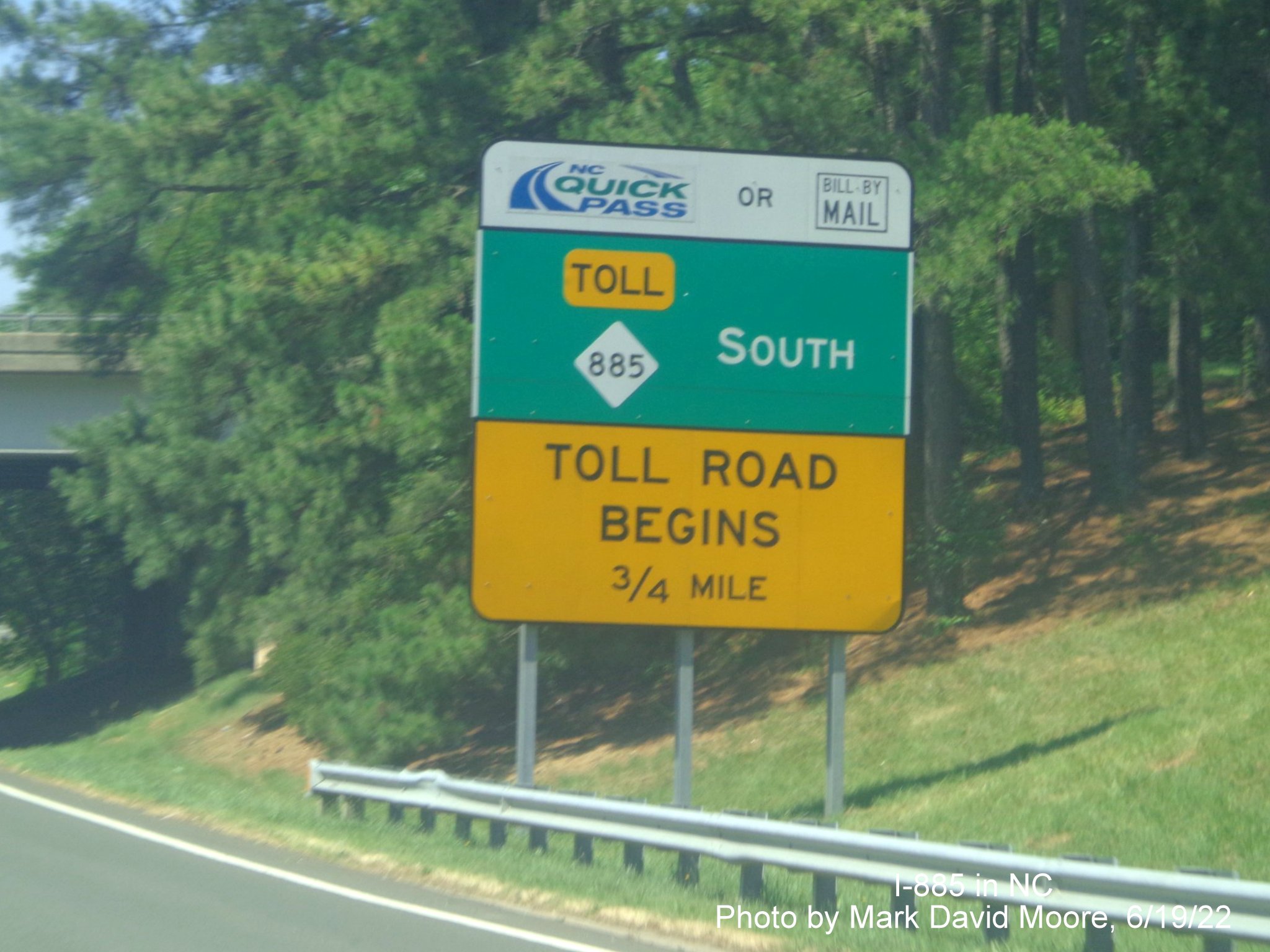
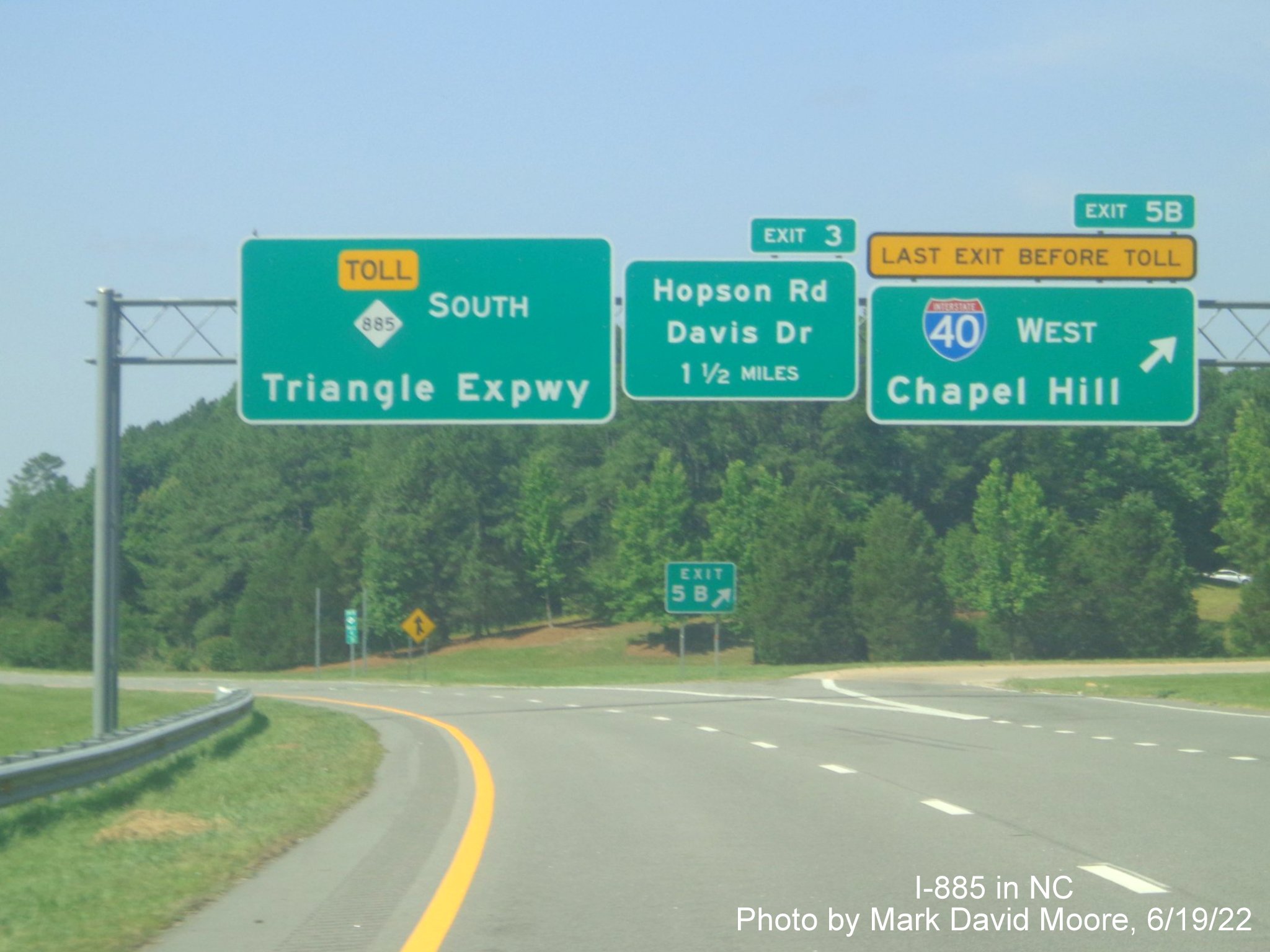
One of the advisory signs indicating the Triangle Freeway Toll Road begins after the I-40 exit.
UPDATE: It appears NCDOT fixed the problem, at least a little, by moving the NC 885 South sign over next to the I-40 West sign in November, here is an updated image from Google Maps Street View:
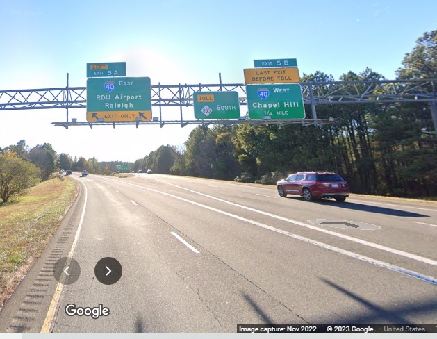
Overhead signage at the I-40 exit, where I-885 ends and becomes NC 885. Notice the placement of the Toll NC 885 pull through, oops.
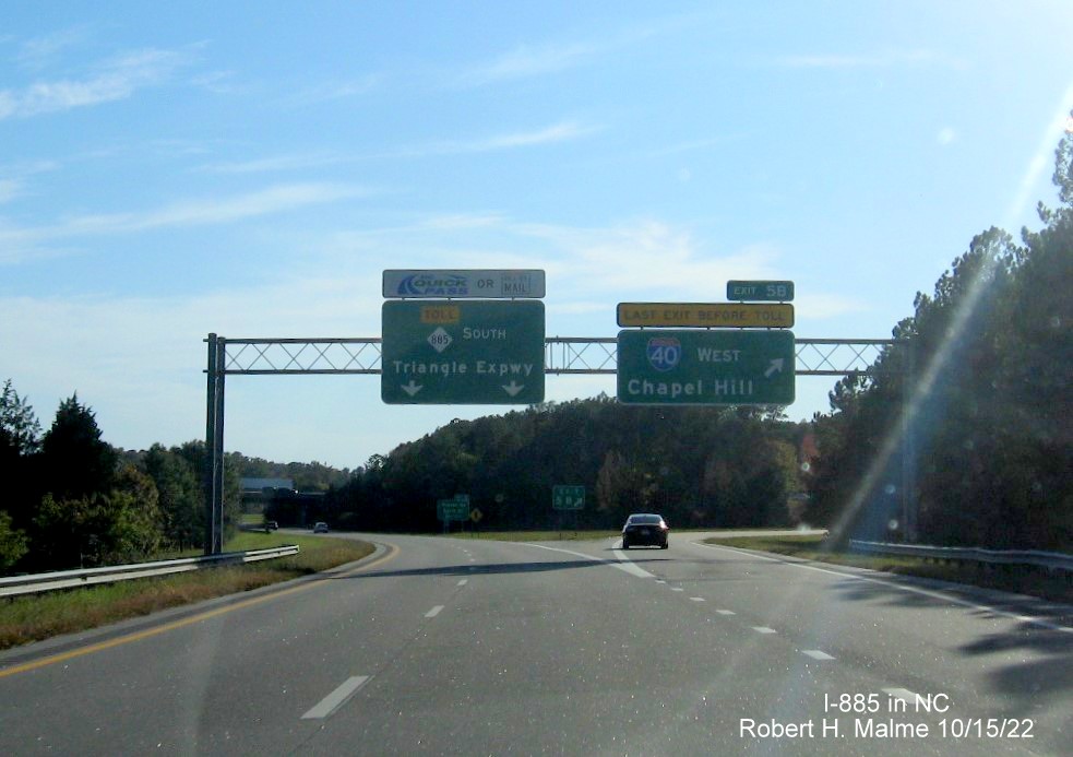
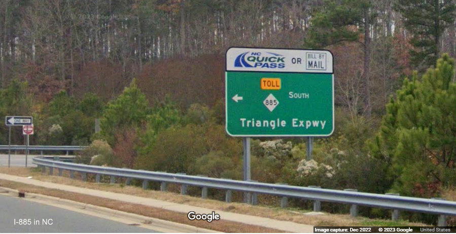
The Toll NC 885 pull through here official marks the start of the Triangle Freeway.
A few signs from NC 885:
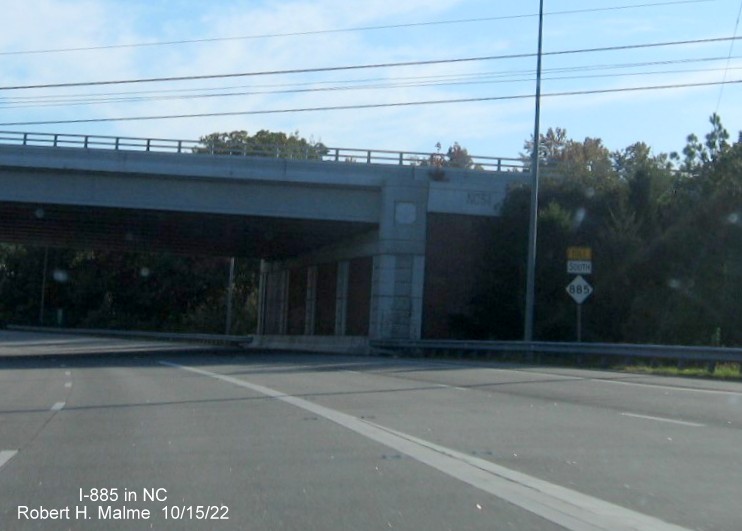
The first Toll South NC 885 reassurance marker after the I-40 exit.
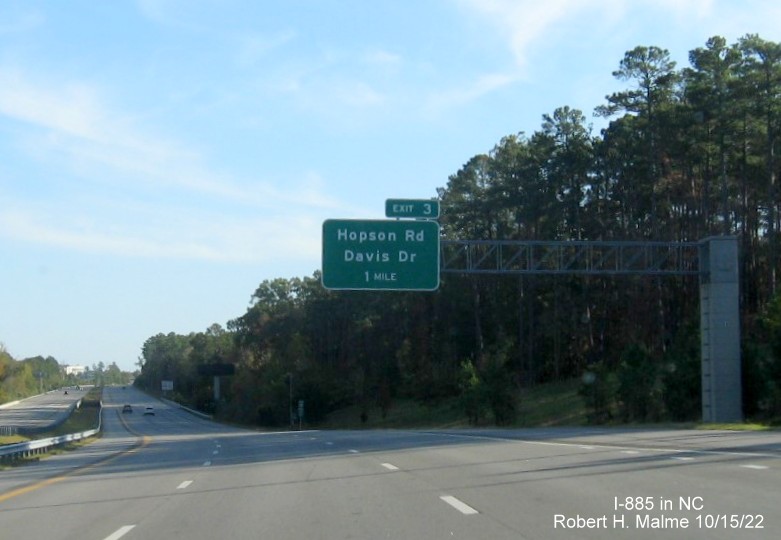
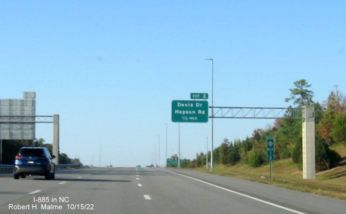
The 1 mile advance sign for the Hopson Road/Davis Drive exit.
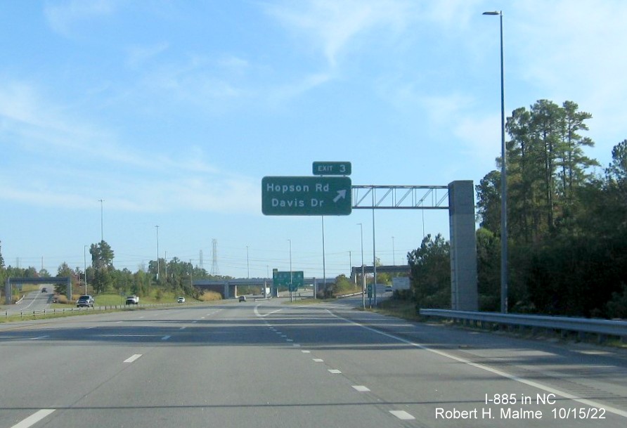
The Hopson Road/Davis Drive exit sign.
Google Street View image from December 2022 on Hopson Road:
One of the now NC 885 ramp signs on Hopson Road.
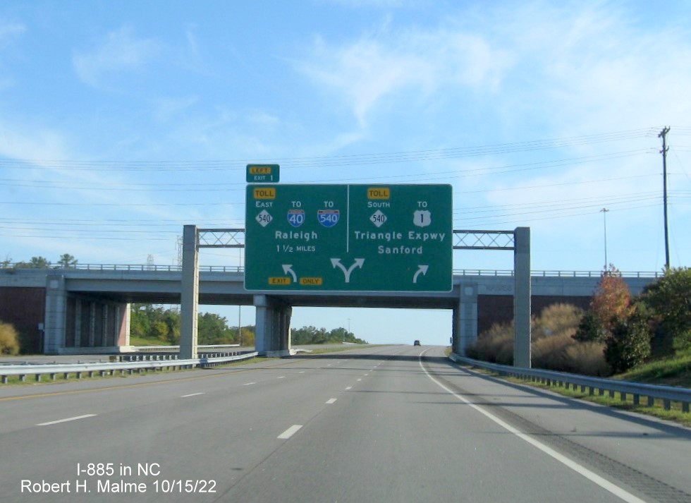
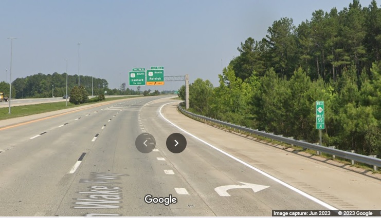
The first advance sign for the NC 540 exits at the end of NC 885 South. Plans released for a NC 540 sign replacement project indicate that the directions would be later changed to West and East, this was completed in May 2023, see photo below.
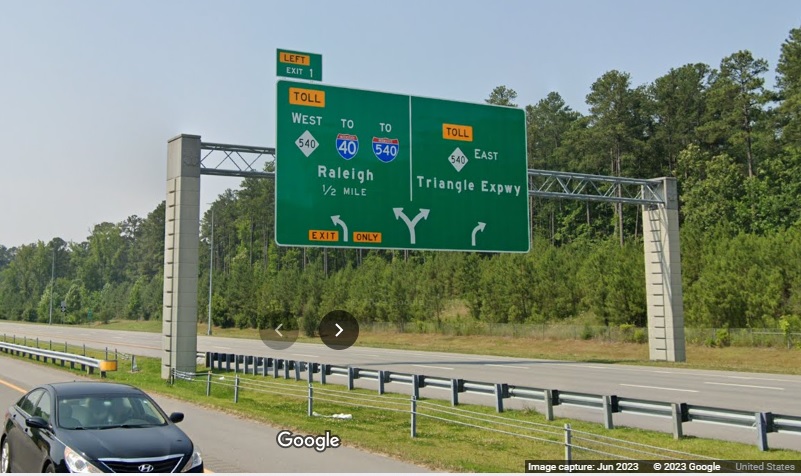
The 1/2 mile advance sign now with West NC 540 heading to I-40 and East NC 540 continuing the Triangle Expressway, from Google Maps Street View, June 2023.
Another South NC 885 reassurance marker after the Hopson Road/Davis Drive exit.
The North NC 885 Triangle Expressway 1/2 mile advance sign on NC 540 East (now signed West, see below), with new I-885 shield also.
The new sign put up in May 2023 indicating your now traveling 'West' on NC 540, from Google Maps Street View.
Original signage at the North NC 885 exit ramp on Toll NC 540. This sign would also be changed in May 2023, here's the new version:
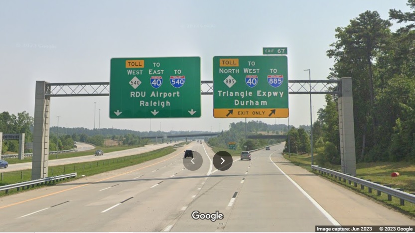
Toll NC 540 is now heading West, even though its going in the same easterly direction. Heading back north towards Durham...
A blue marker seen on the exit ramp indicating this is the Exit 67 ramp from North NC 540. This was probably changed to West NC 540, like was done to the mile marker below:
The now West NC 540 mile marker on former NC 540 North approaching the US 1 interchange.
A North NC 885 mile marker prior to the 1/2 mile advance sign for the Hopson Road/Davis Drive exit.
The first North NC 885 reassurance marker prior to the Hopson Road/Davis Drive exit.
The fancy support 2 Miles advance sign for the I-40 exits at the end of NC 885.
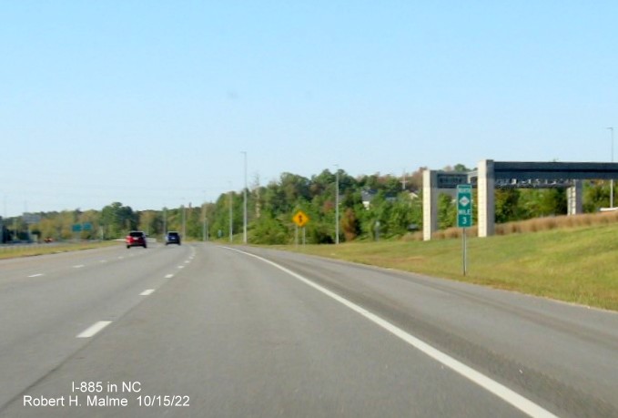
The North NC 885 Mile 3 marker, why not have a toll label on this too?
The 1 3/4 Miles and 1 Mile advance signs for the I-40 exits, just beyond a North Toll NC 885 reassurance marker.
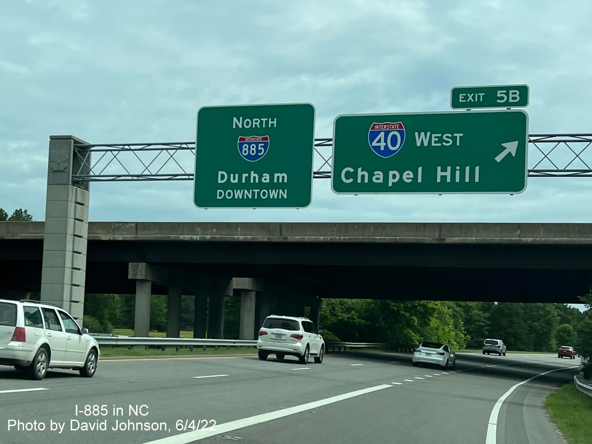
Overhead signage at the ramp to I-40 East at the end of NC 885 North. Transitioning to I-885 North...

The first North I-885 pull through sign at the I-40 West exit.
Still one more NC 885 mile marker prior to the I-40 bridges.
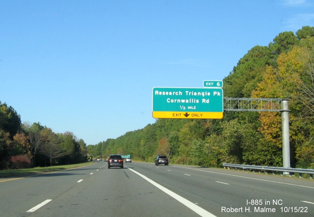
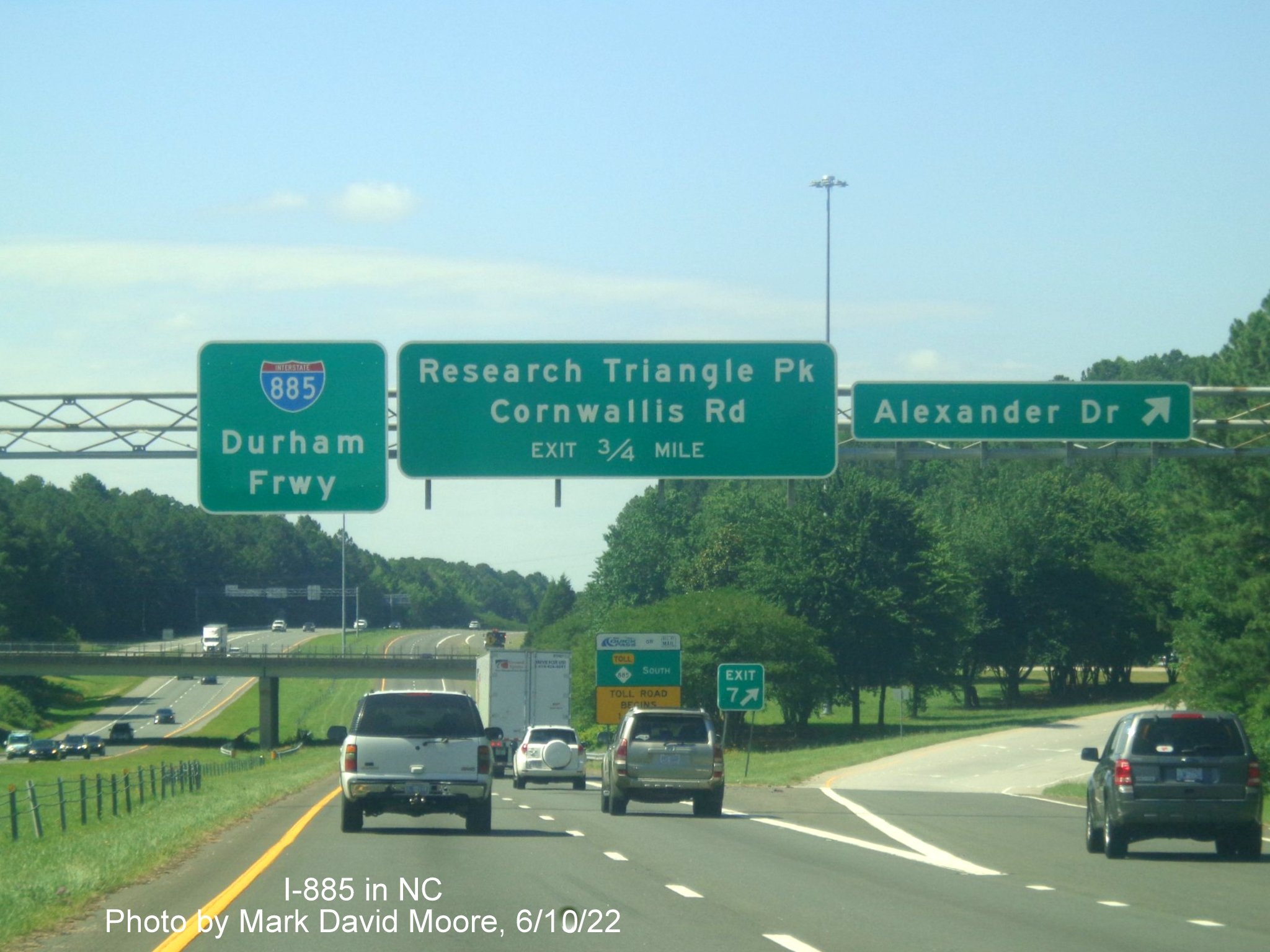
The first advance sign for Cornwallis Road on I-885 North/Durham Freeway.
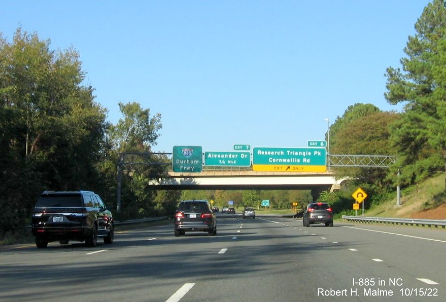
The second North I-885 pull through sign at the Cornwallis Road exit.
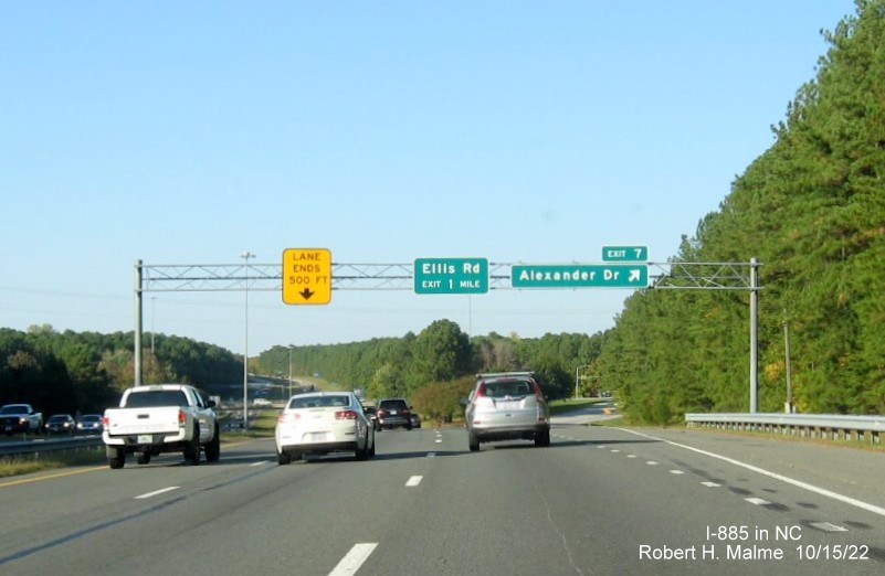
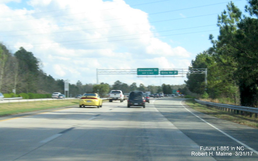
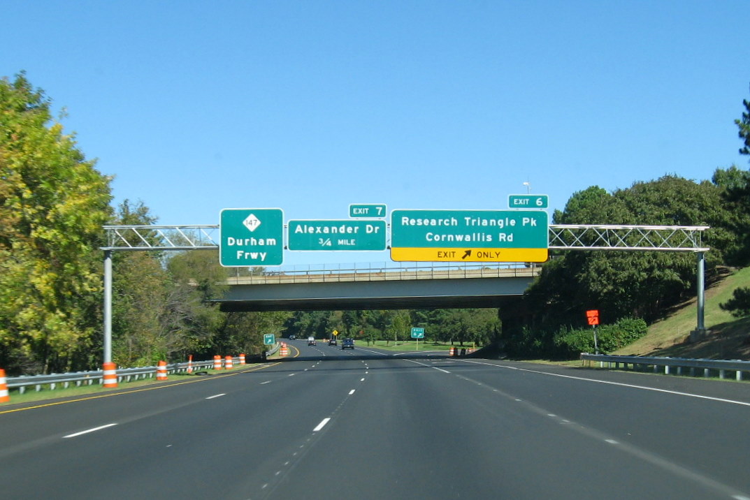
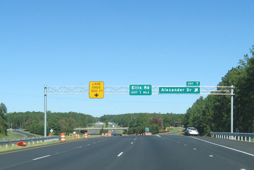
The unchanged North I-885 exit signage at Alexander Drive, still no exit number for Ellis Road (same in 2026).
The 1/2 Mile advance sign approaching the East End Connector/NC 147 North exit.
Painted North NC 147 shields ahead of the NC 147/Durham Freeway exit.
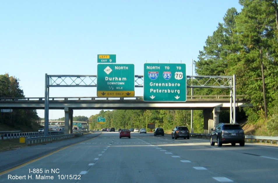
The overhead signage at the new beginning for NC 147 North and the start of the I-885 North East End Connector.
Signage on I-40 West
The 1 Mile advance sign for the Durham Freeway exit, now I-885 to NC 147, at the Davis Drive exit.
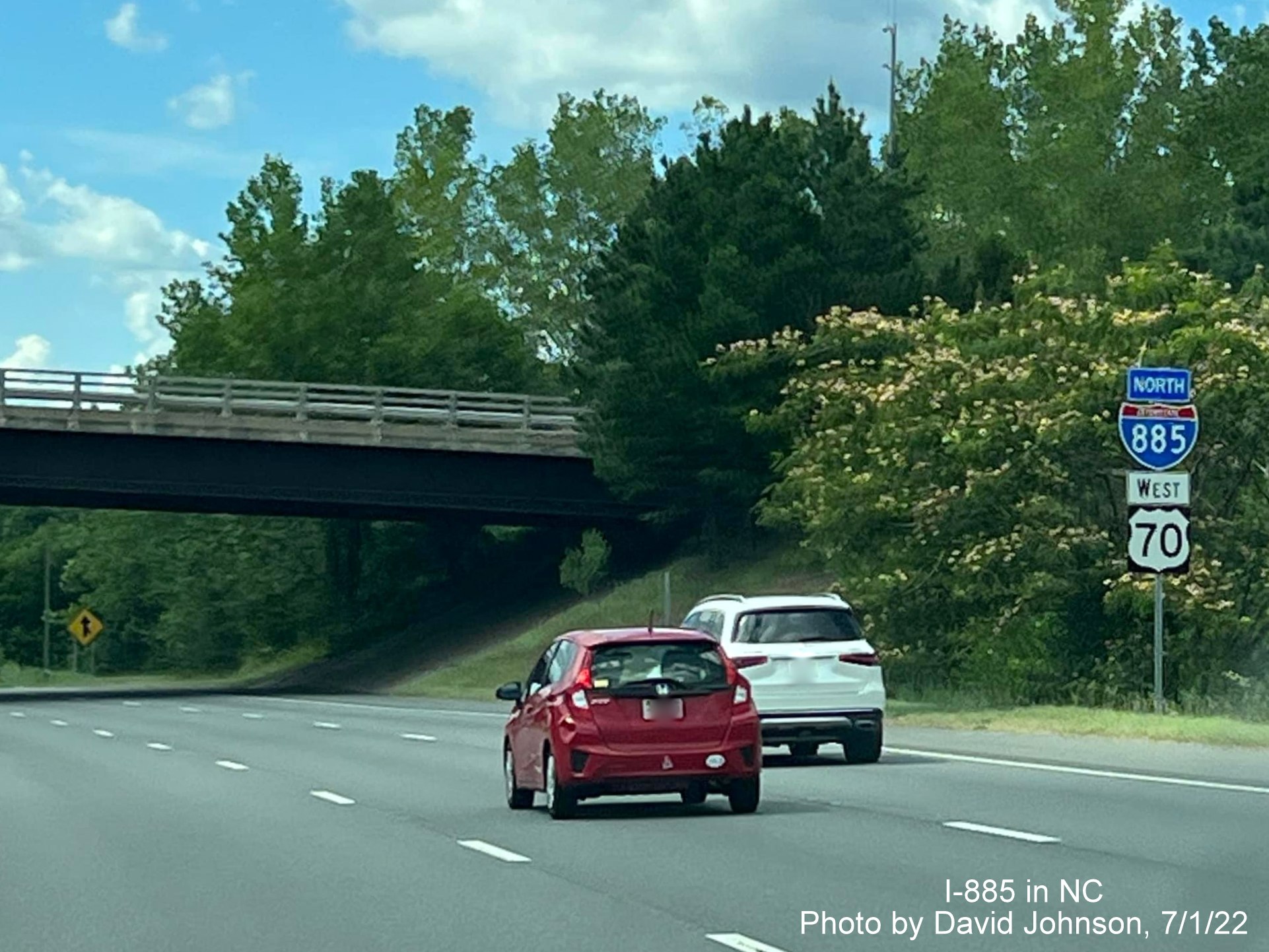
The 1/2 Mile advance sign for I-885 North paired with a 3/4 Mile advance for now Toll NC 885 South.
The 1 Mile advance sign for the Durham Freeway exit, now I-885 to NC 147.
Earlier in 2022
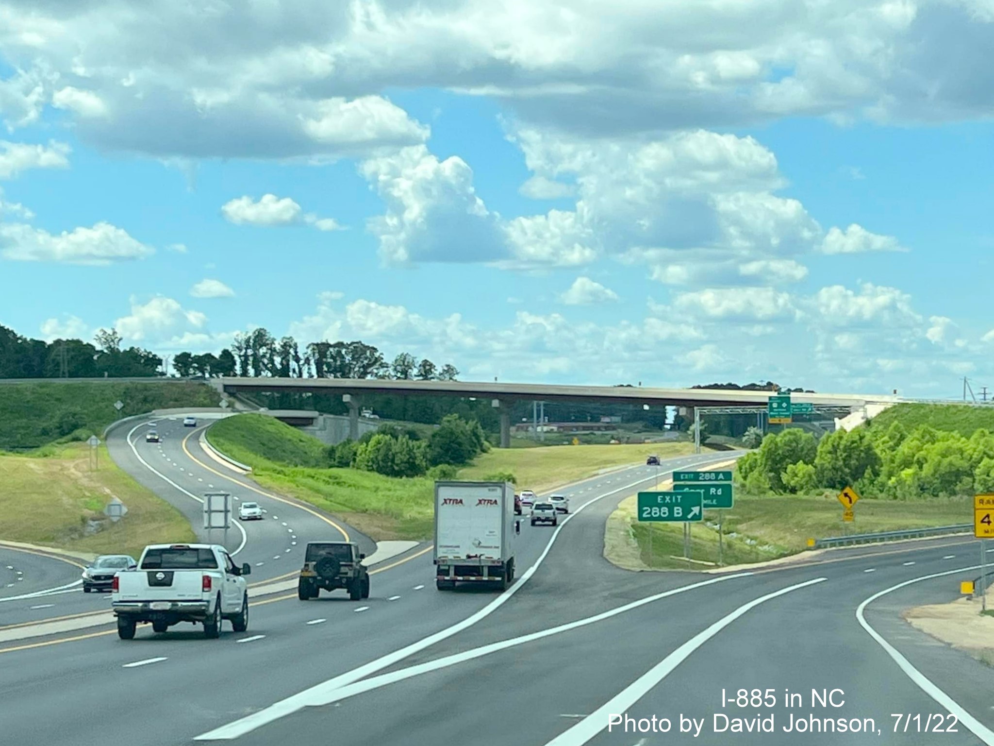
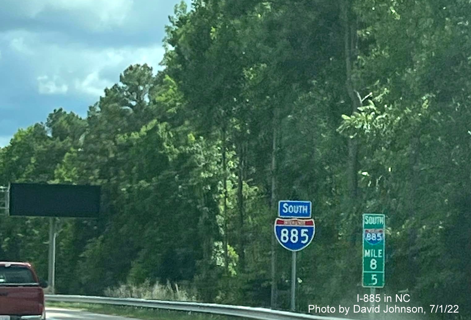
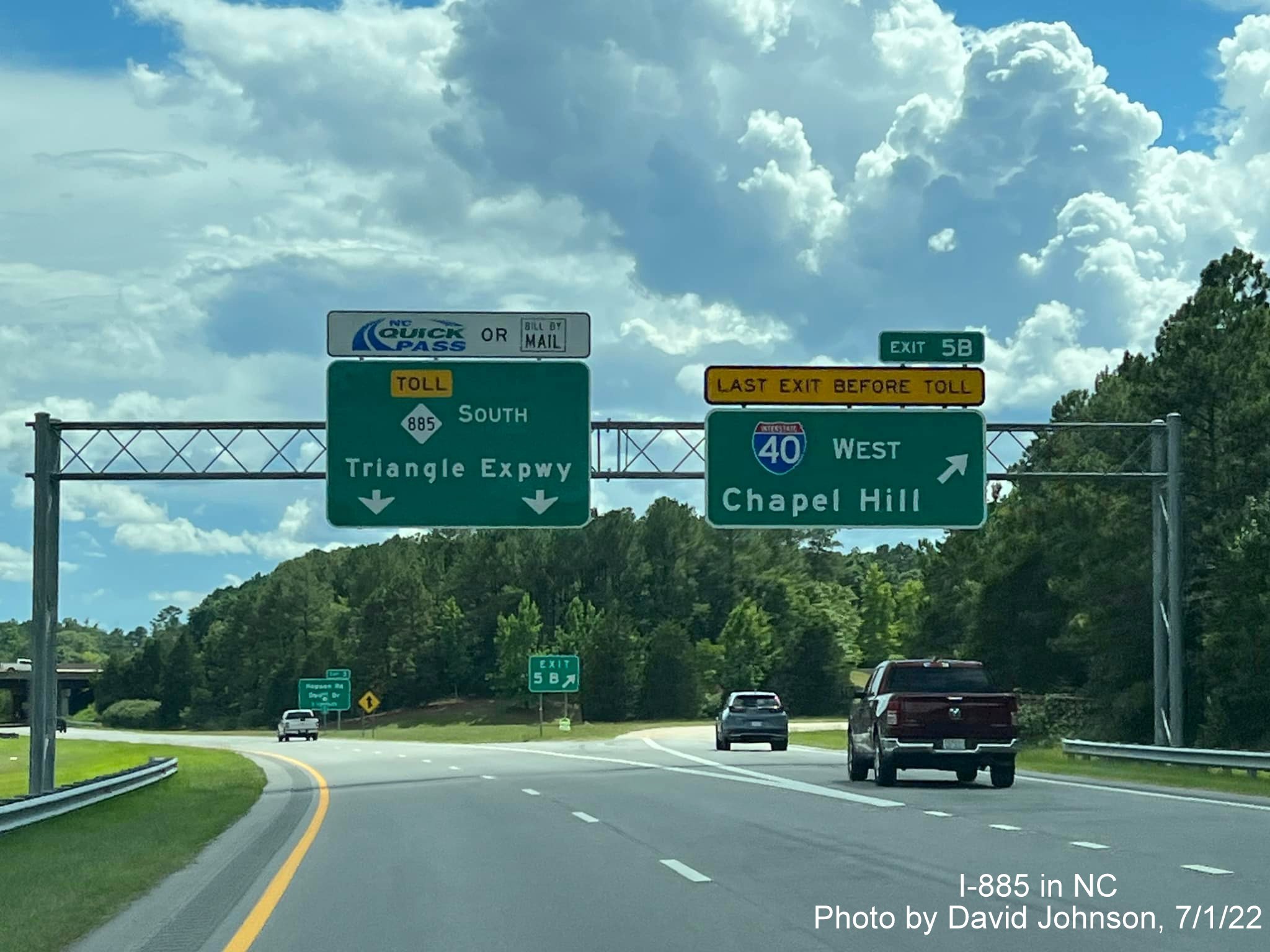
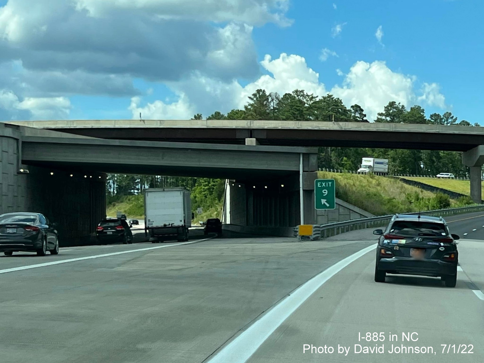
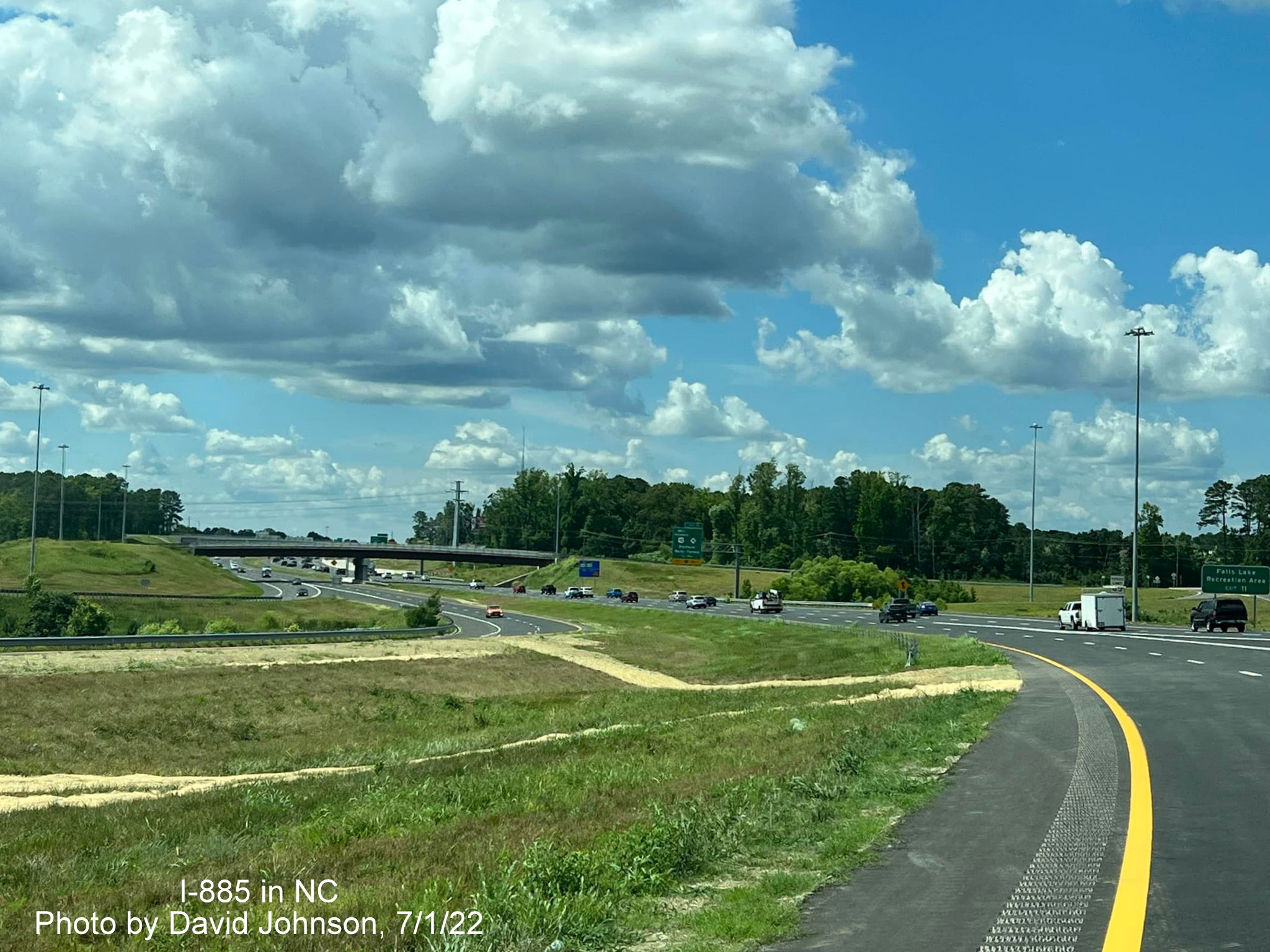
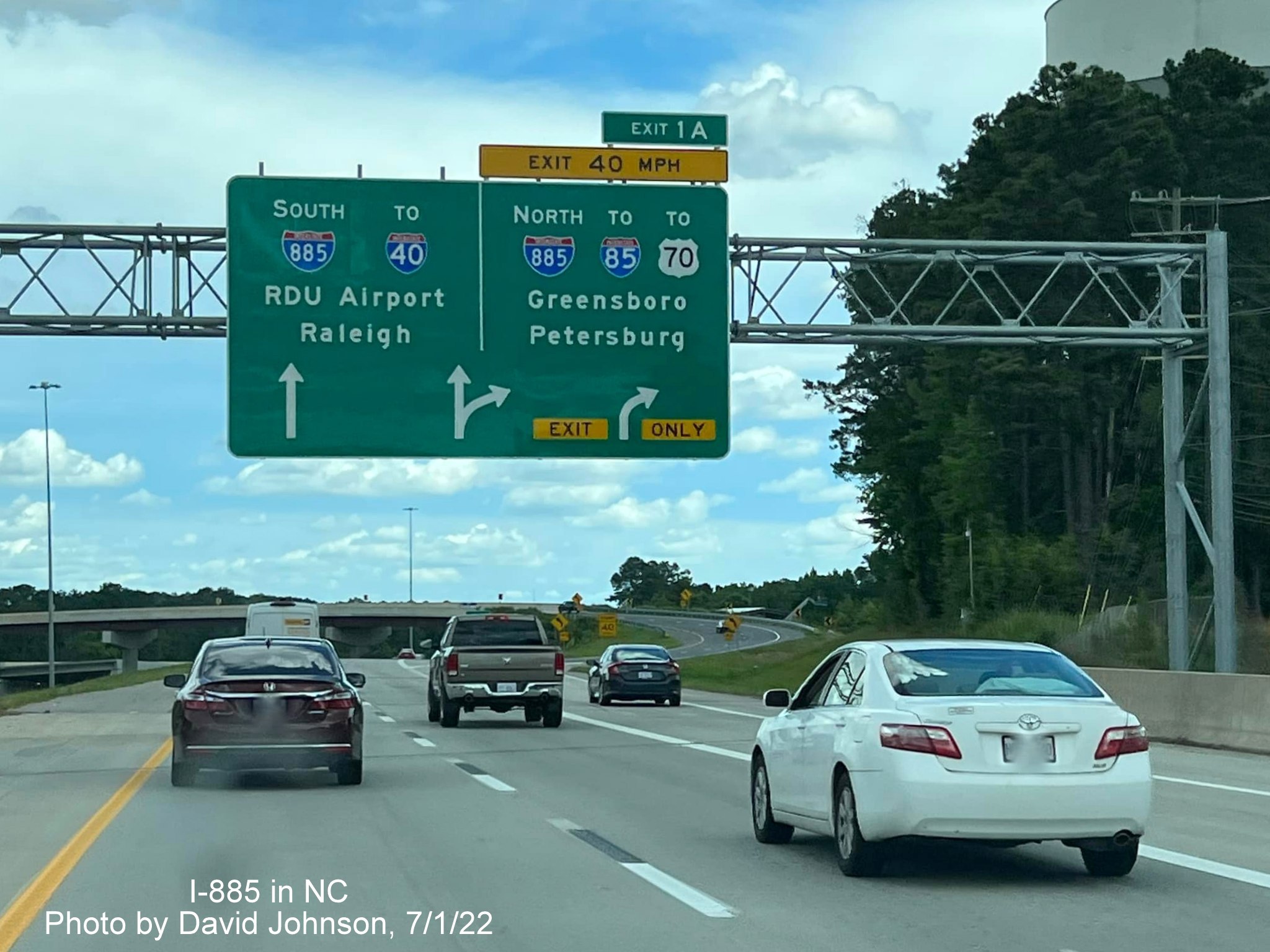
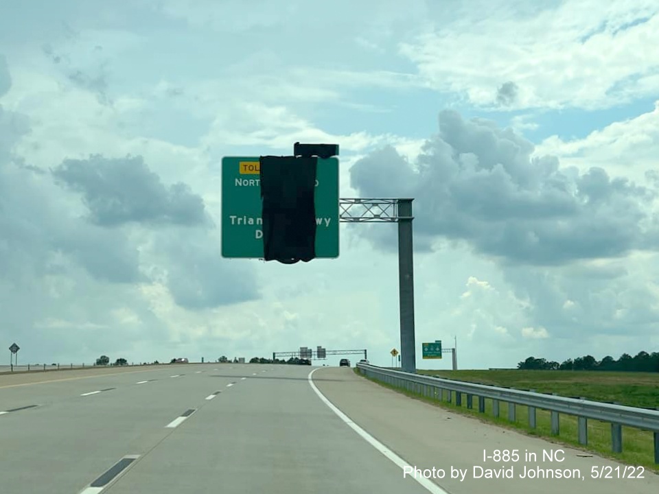
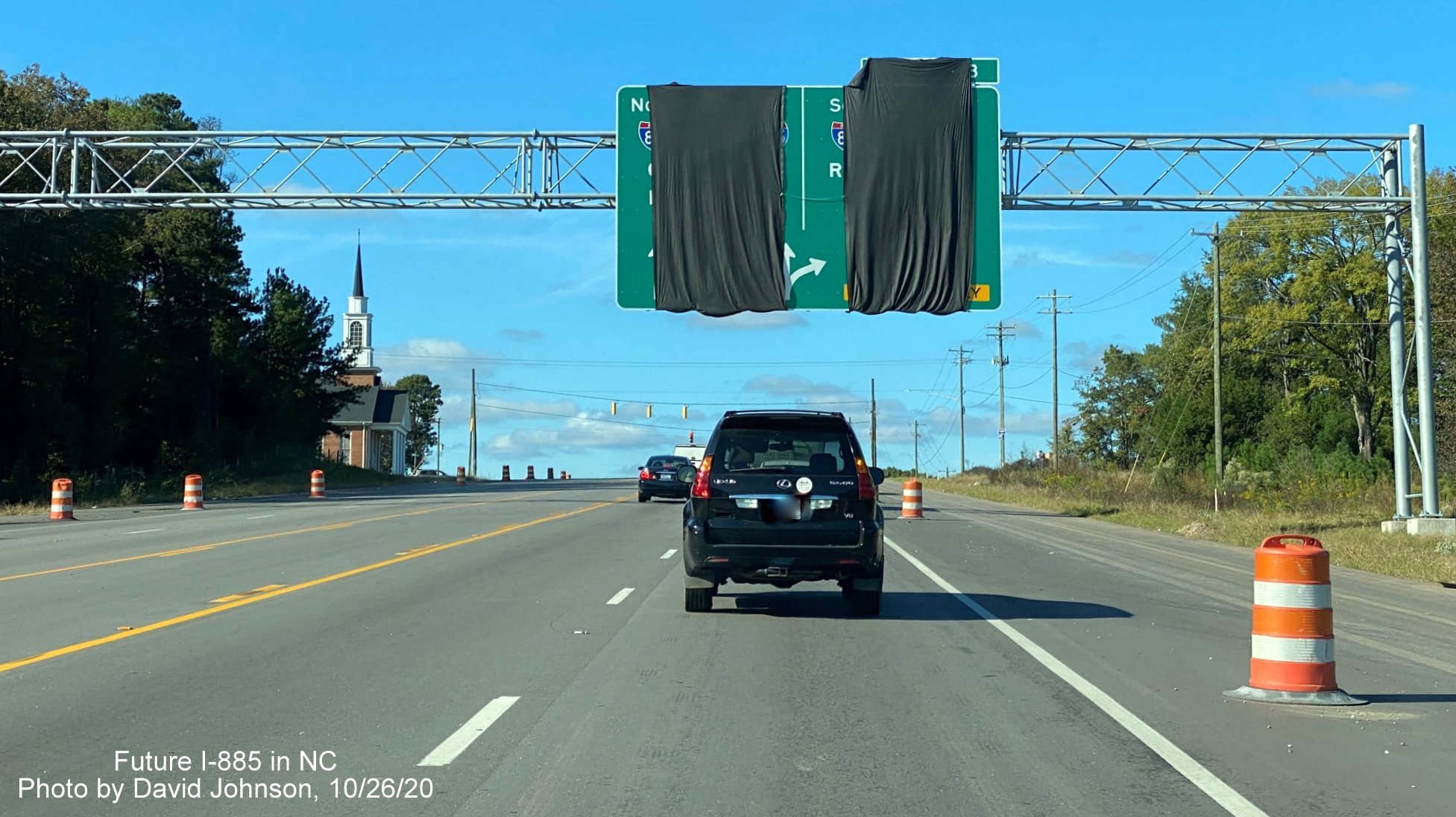
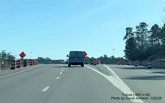
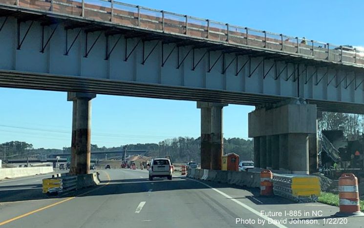
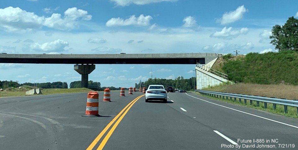
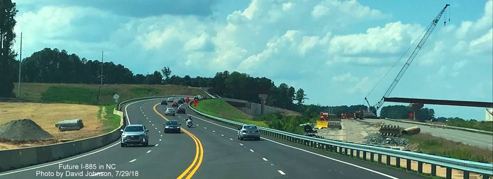
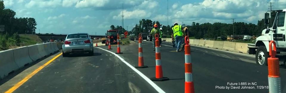
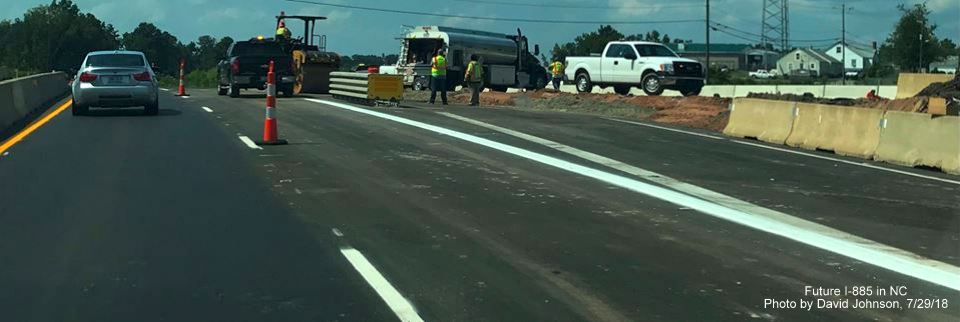
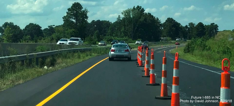
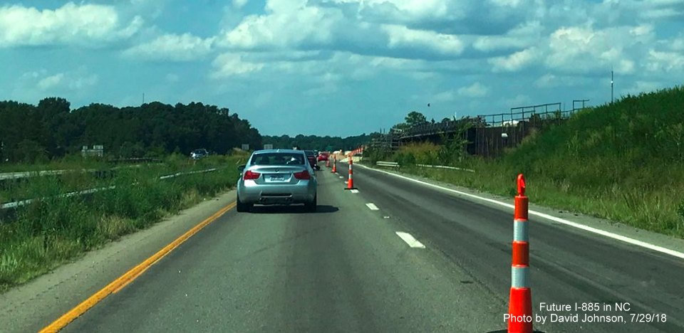
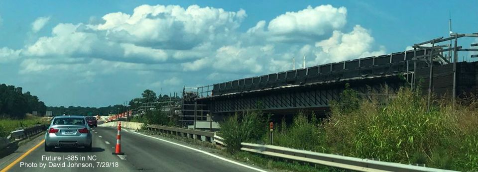
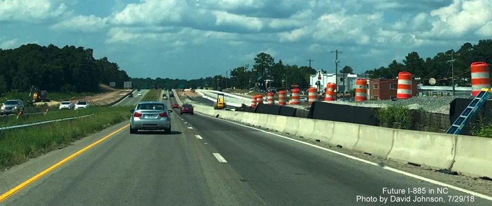
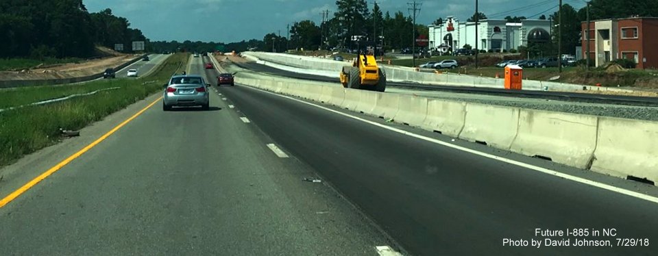
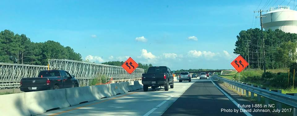
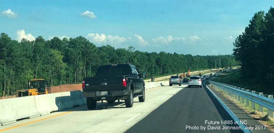
Taken July 1, courtesy of David Johnson. Photos start along US 70 West:
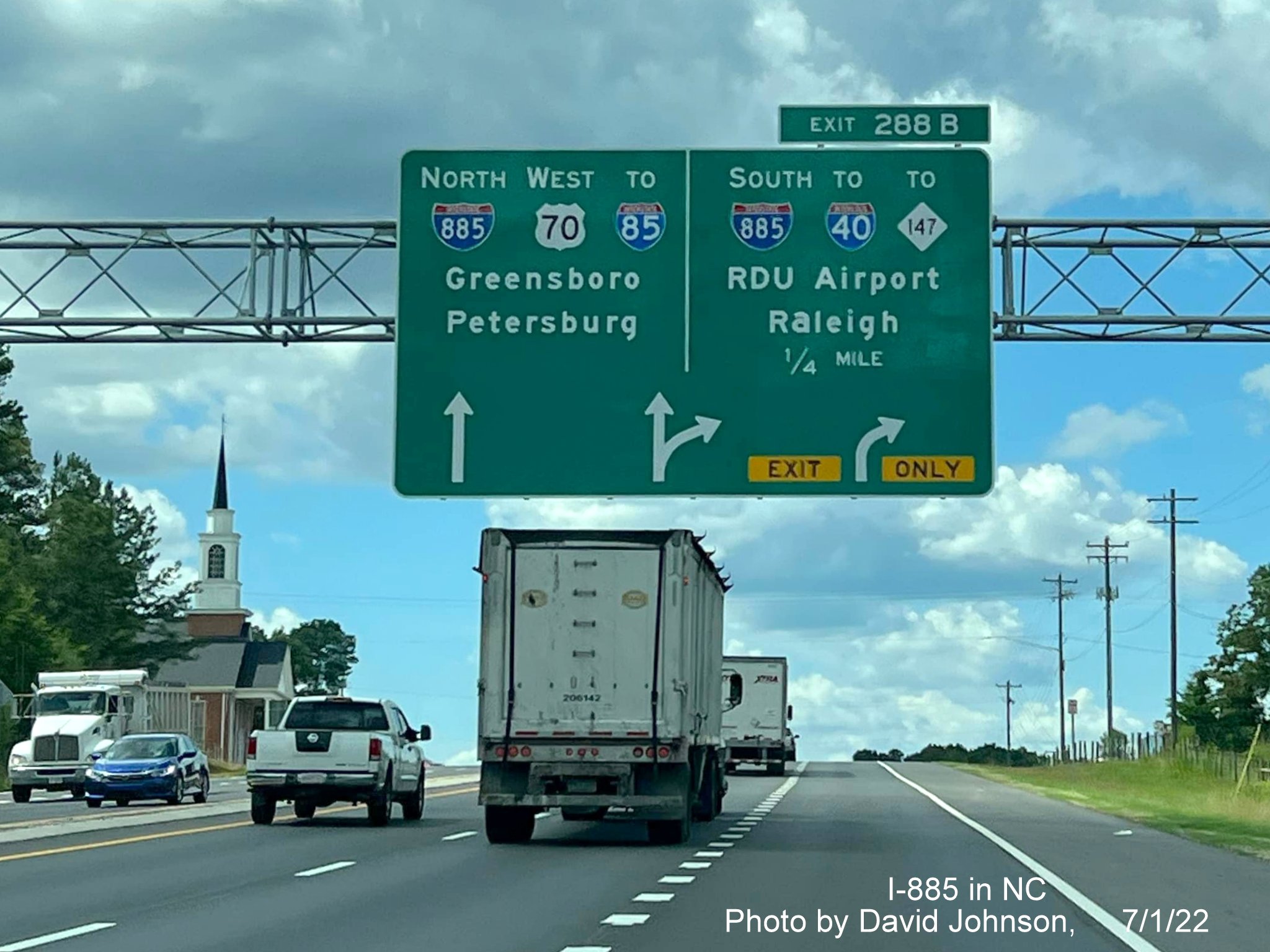
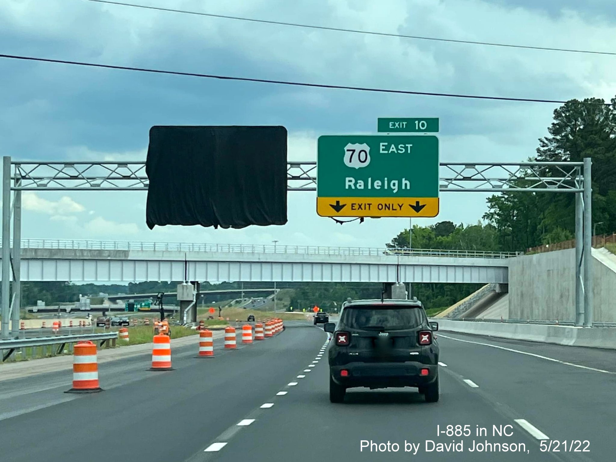
The now uncovered arrow-per-lane 1/4 Mile advance sign for the now open I-885 South/East End Connector.
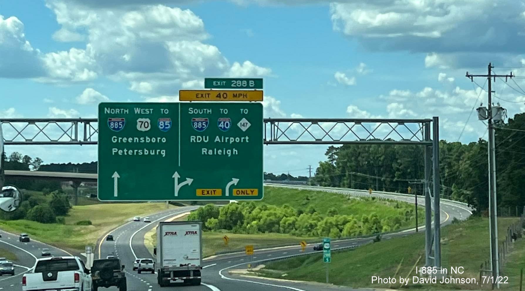
The now uncovered arrow-per-lane sign at the now open I-885 South/East End Connector exit.
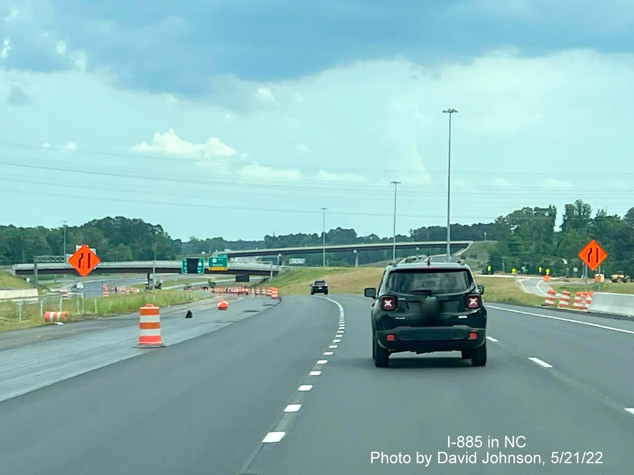
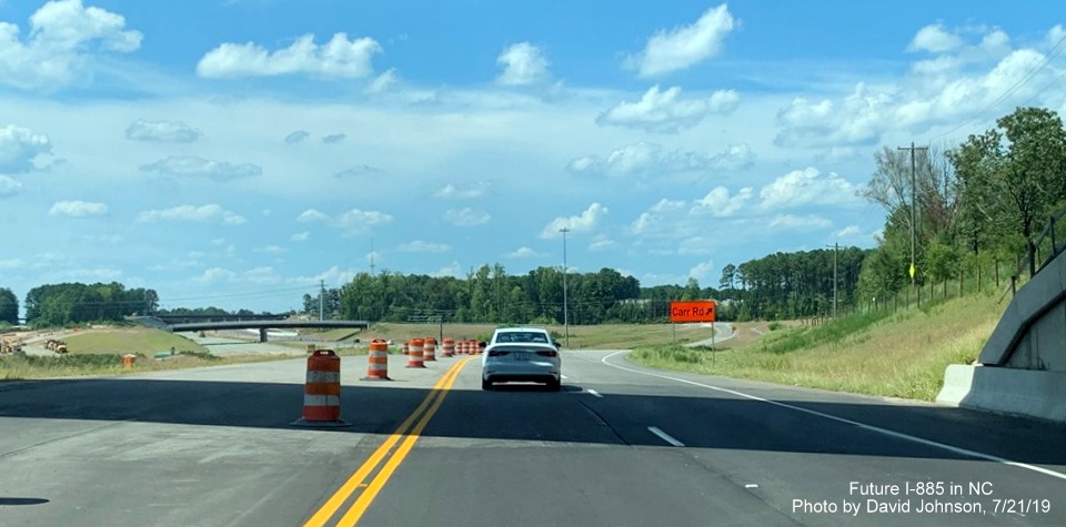
Driving onto the newly opened I-885 South/East End Connector from US 70 West.
US 70 West ramp approaching I-885 South ramp at start of East End Connector.
US 70 West ramp meeting the I-885 South ramp.
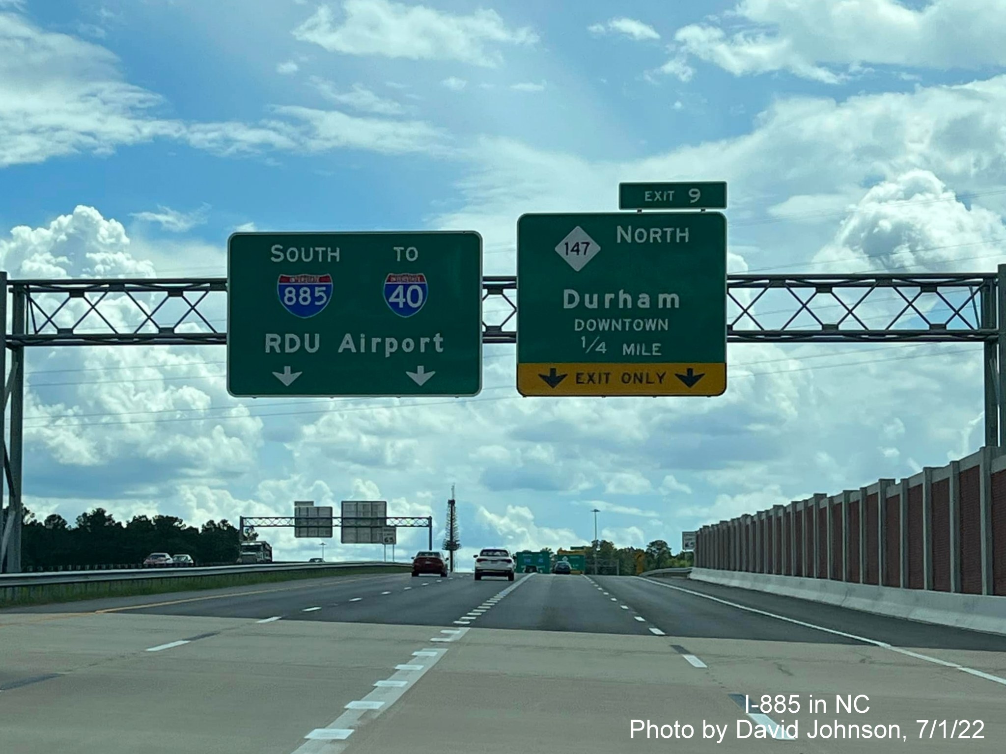
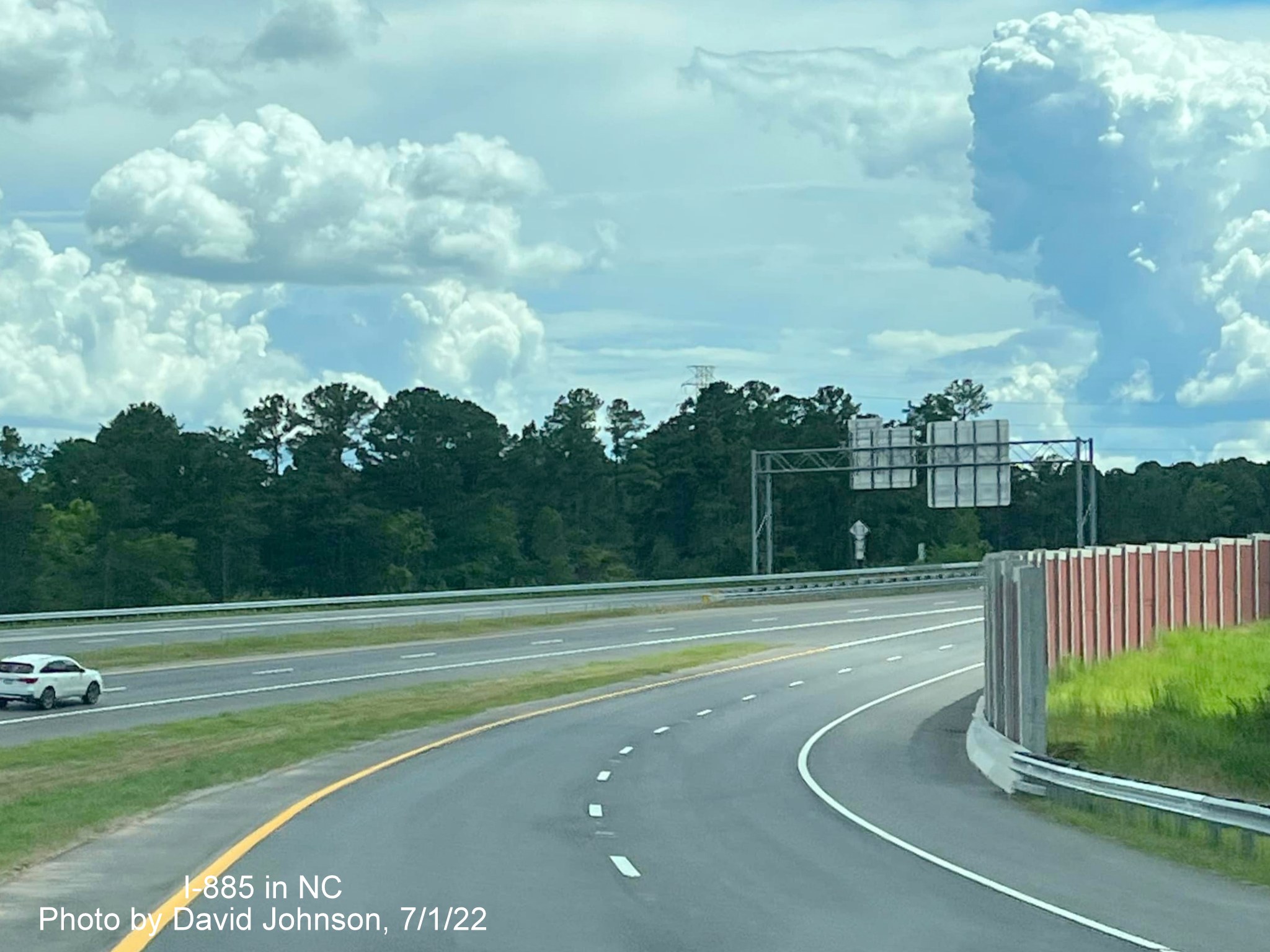
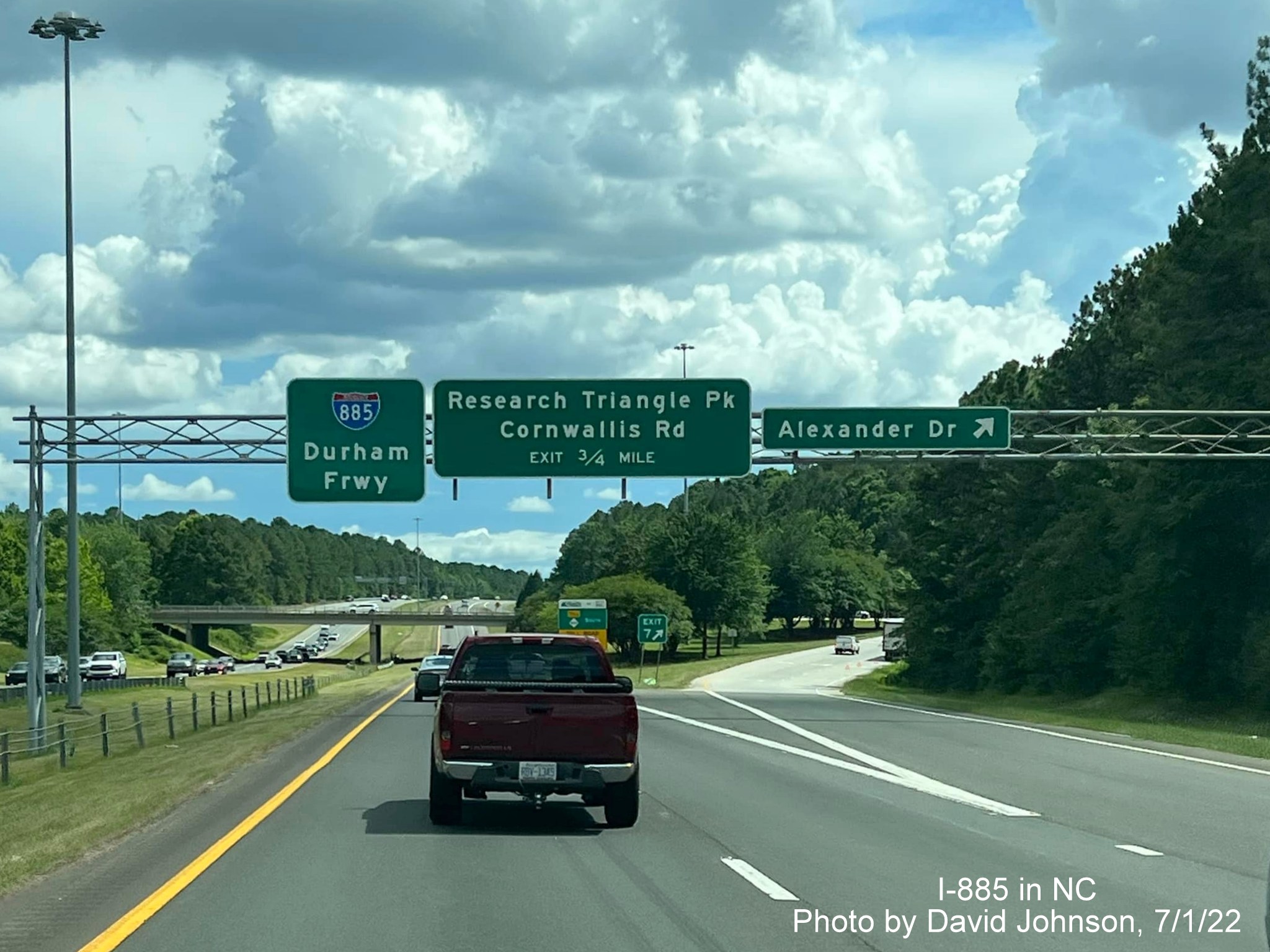
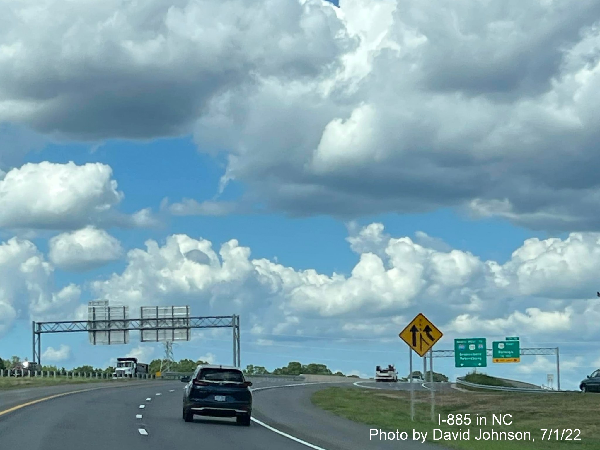
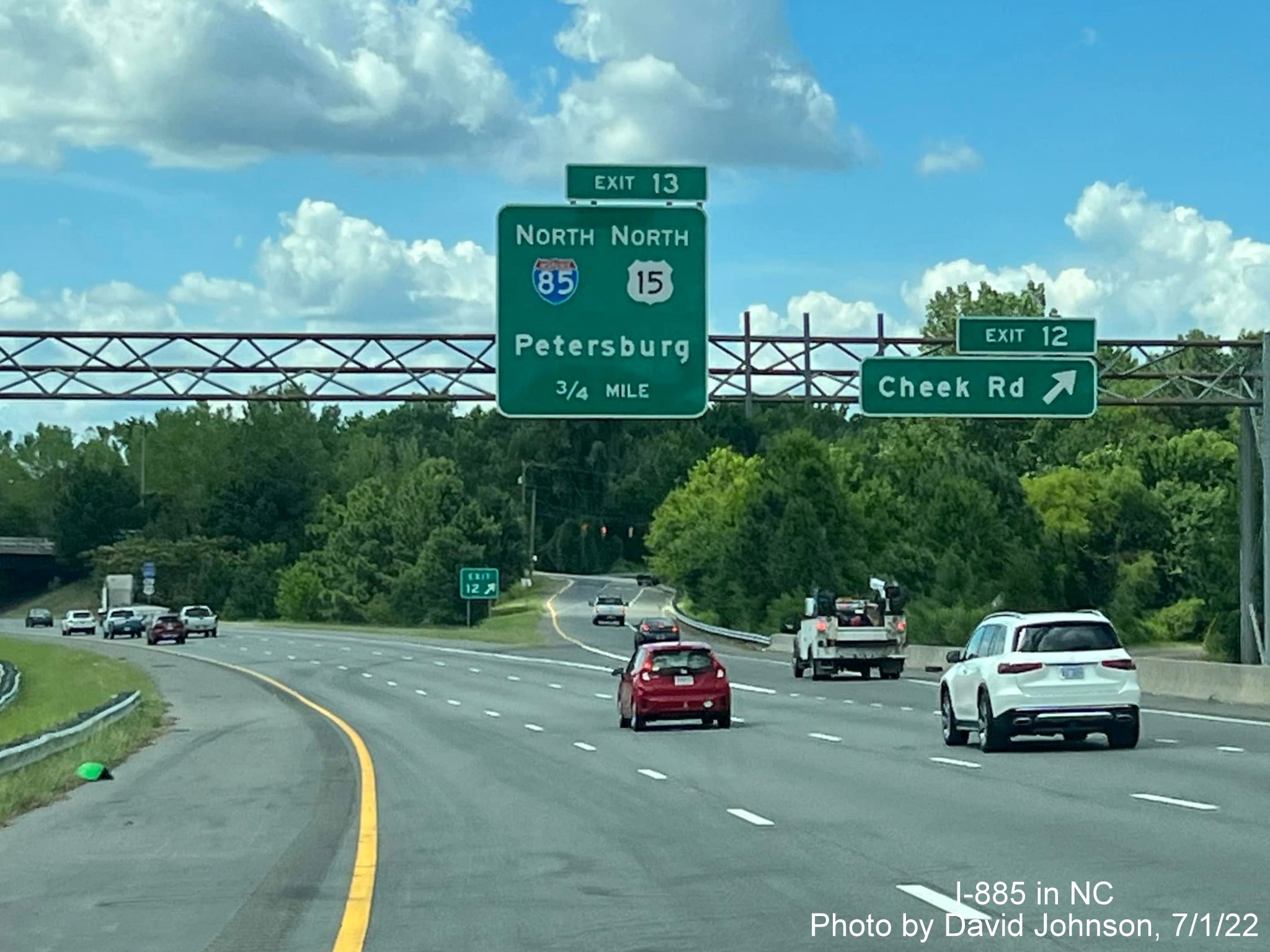
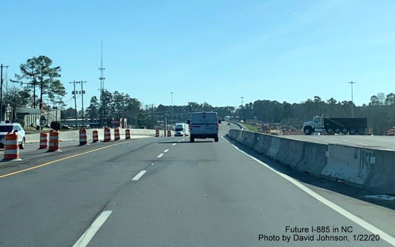
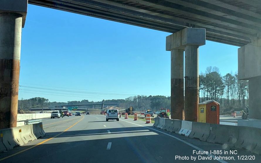
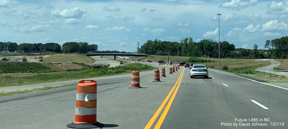
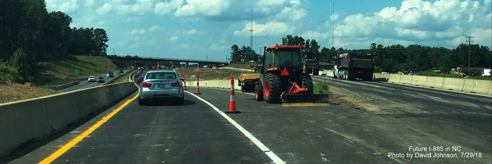
First set of overhead signs on the East End Connector indicates only 1/4 mile to the NC 147 North exit.
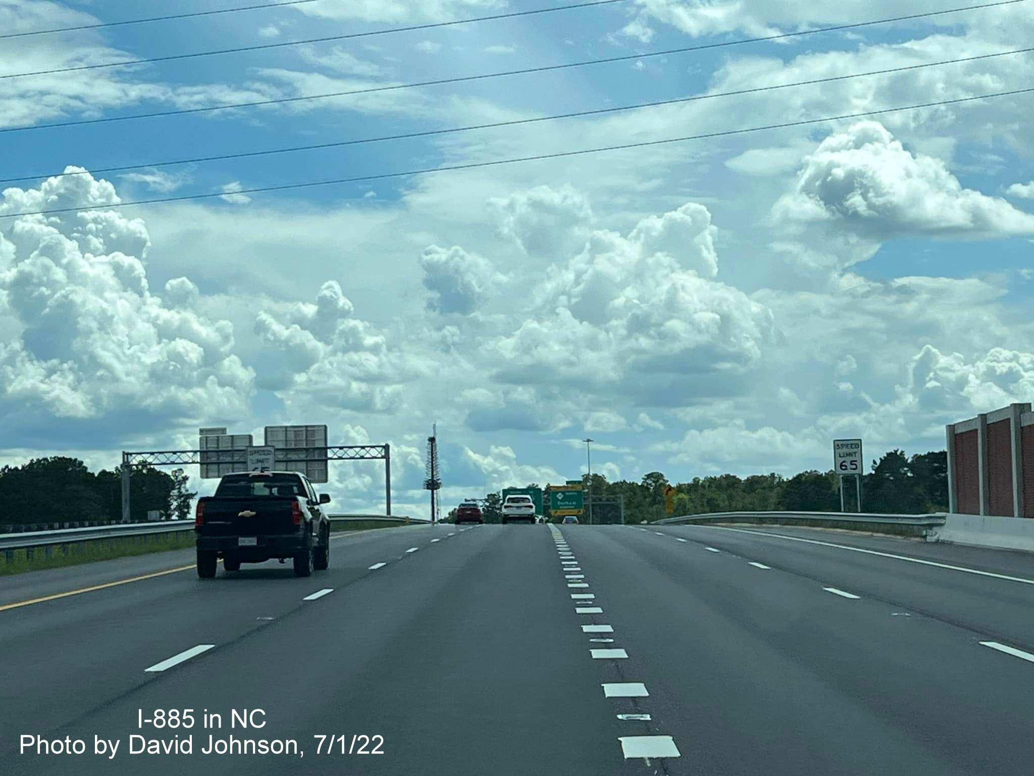
The speed limit on the East End Connector is 65 MPH.
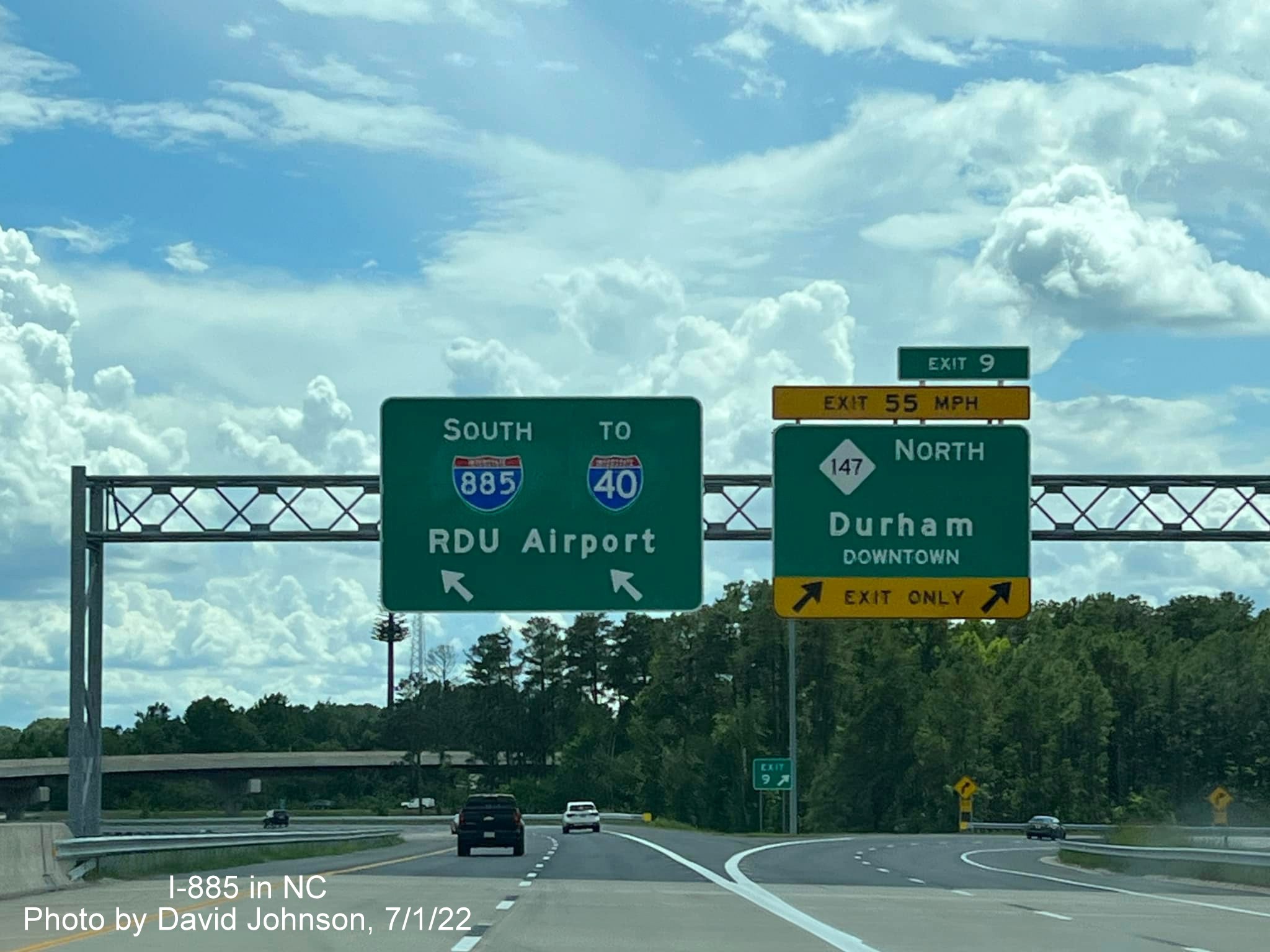
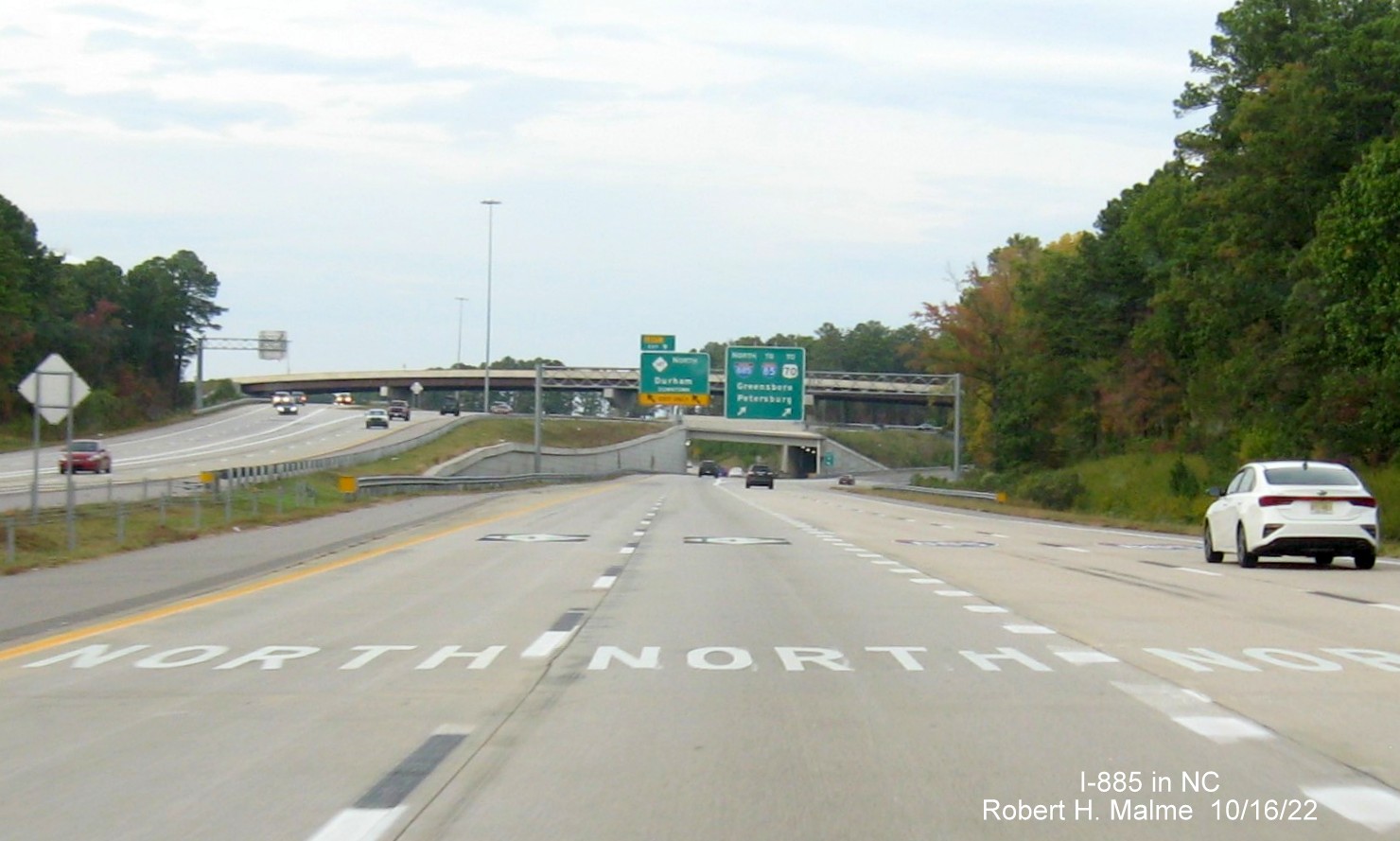
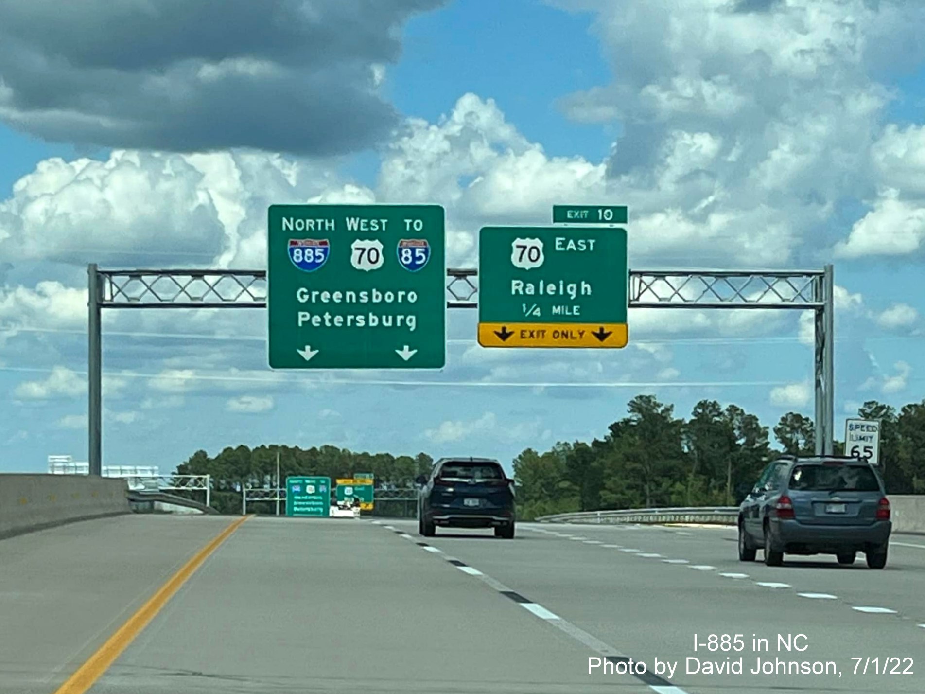
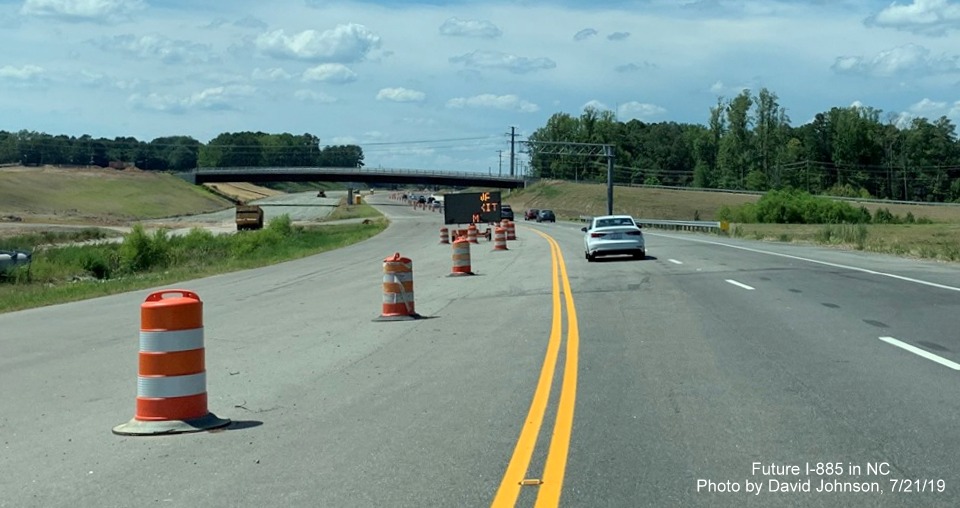
Last set of overhead signs for the NC 147 North exit at the end of the Connector. If you compare with the aerial photos taken below of the Connector notice the pull through signs have been changed, they originally included NC 147 South.
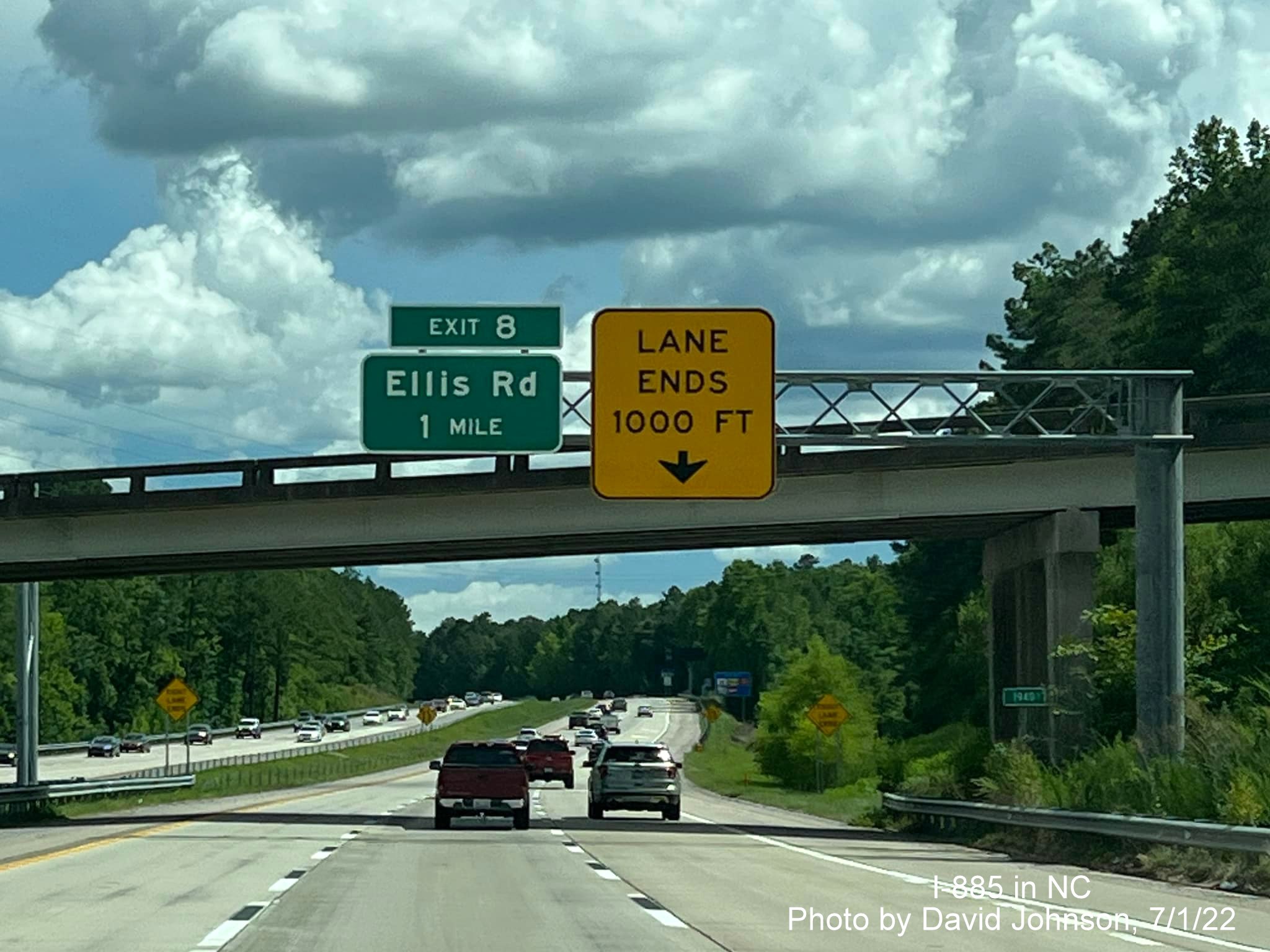
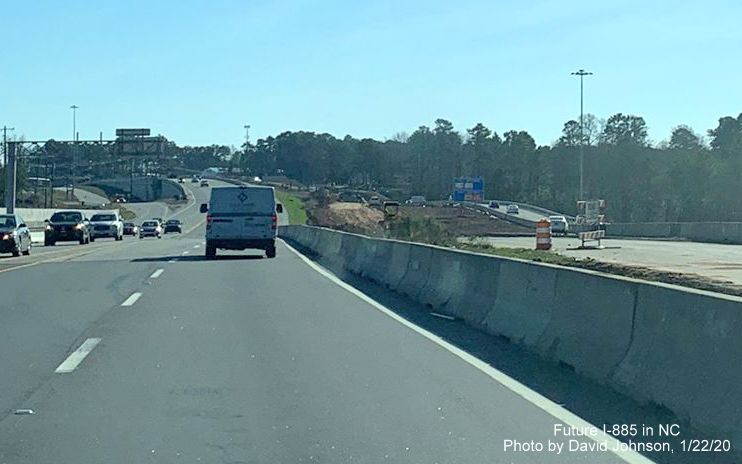
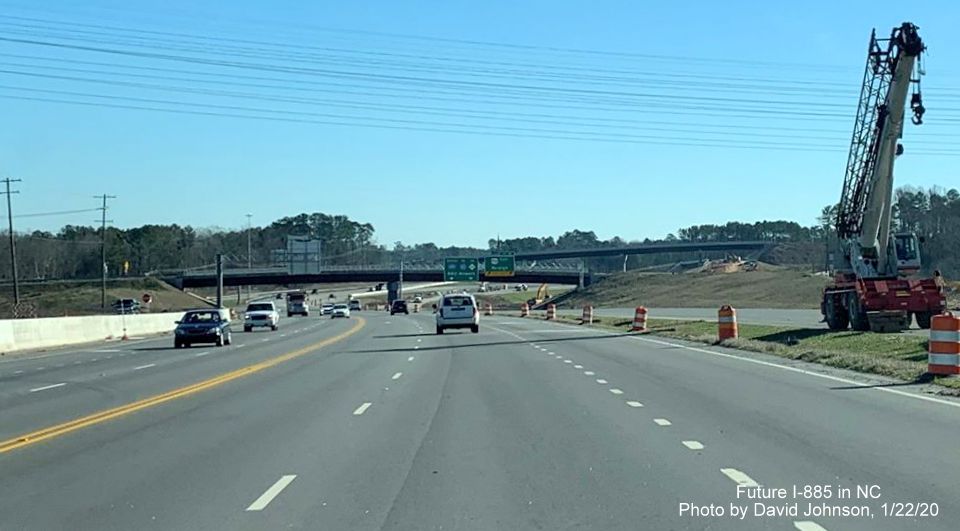
First set of overhead signs on the Durham Freeway on now officially I-885 South after the NC 147 North exit. Lanes narrow from 3 to 2. There is a project to widen the Durham Freeway to 3 lanes south of here but it is currently not funded in the 2024-2033 Draft STIP.
While the reassurance marker has been up for 2 years, the South I-885 mile marker is new, mile markers have been installed the length of the Durham Freeway both north and south.
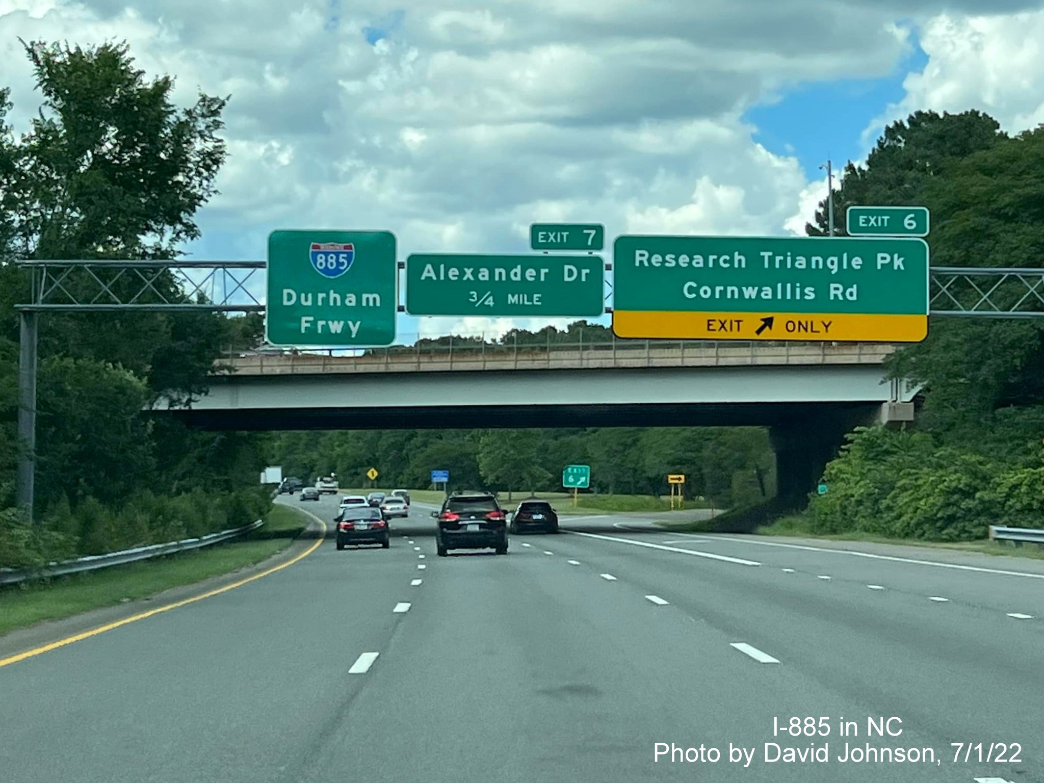
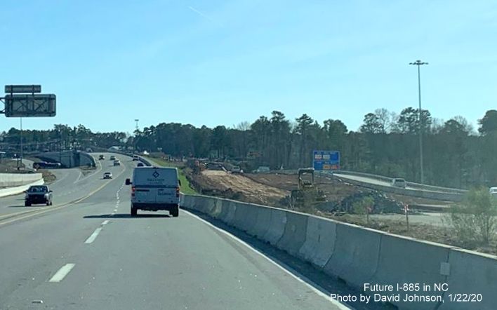
The newly updated I-885 Durham Freeway pull through sign at the Alexander Drive exit headed south.
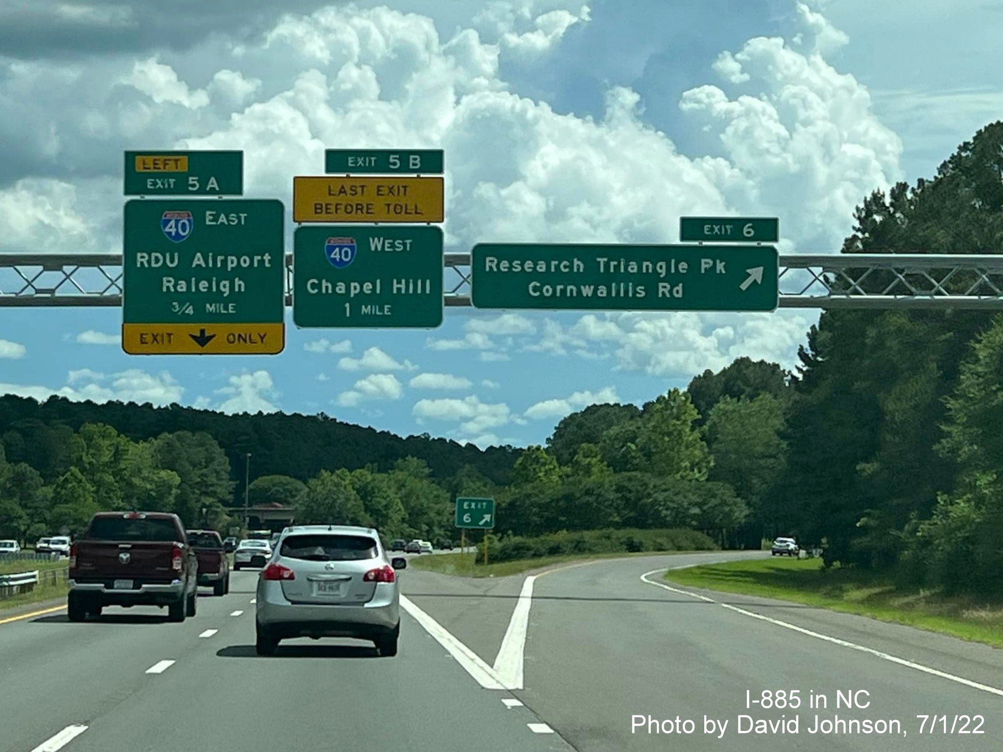
The revised I-40 exit advance overhead signs at the Cornwallis Road exit headed south.
There is a problem with the location of this newly placed Toll NC 885 pull through sign, its on the wrong side. It replaced a lane ends advisory sign for the I-40 East ramp. How much confusion will this cause?
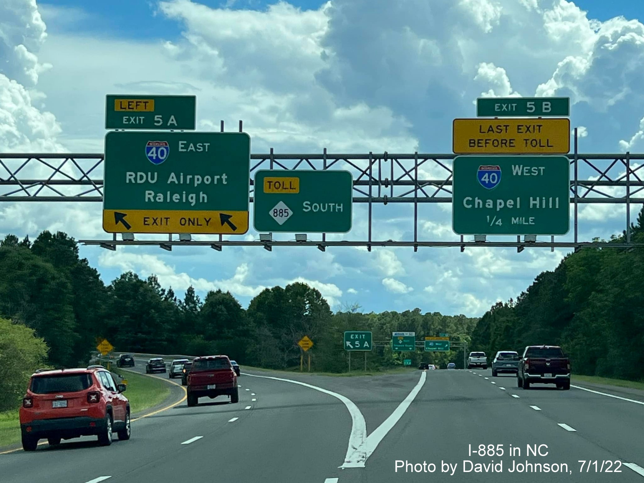
A correctly placed Toll NC 885 pull through sign at the I-40 West exit. Now turning around and heading north...
This sign has a couple problems. First, its partially hidden by a tree. Second, it still has a NC 147 shield.
The revised now I-885 Durham Freeway pull through sign at Cornwallis Road.
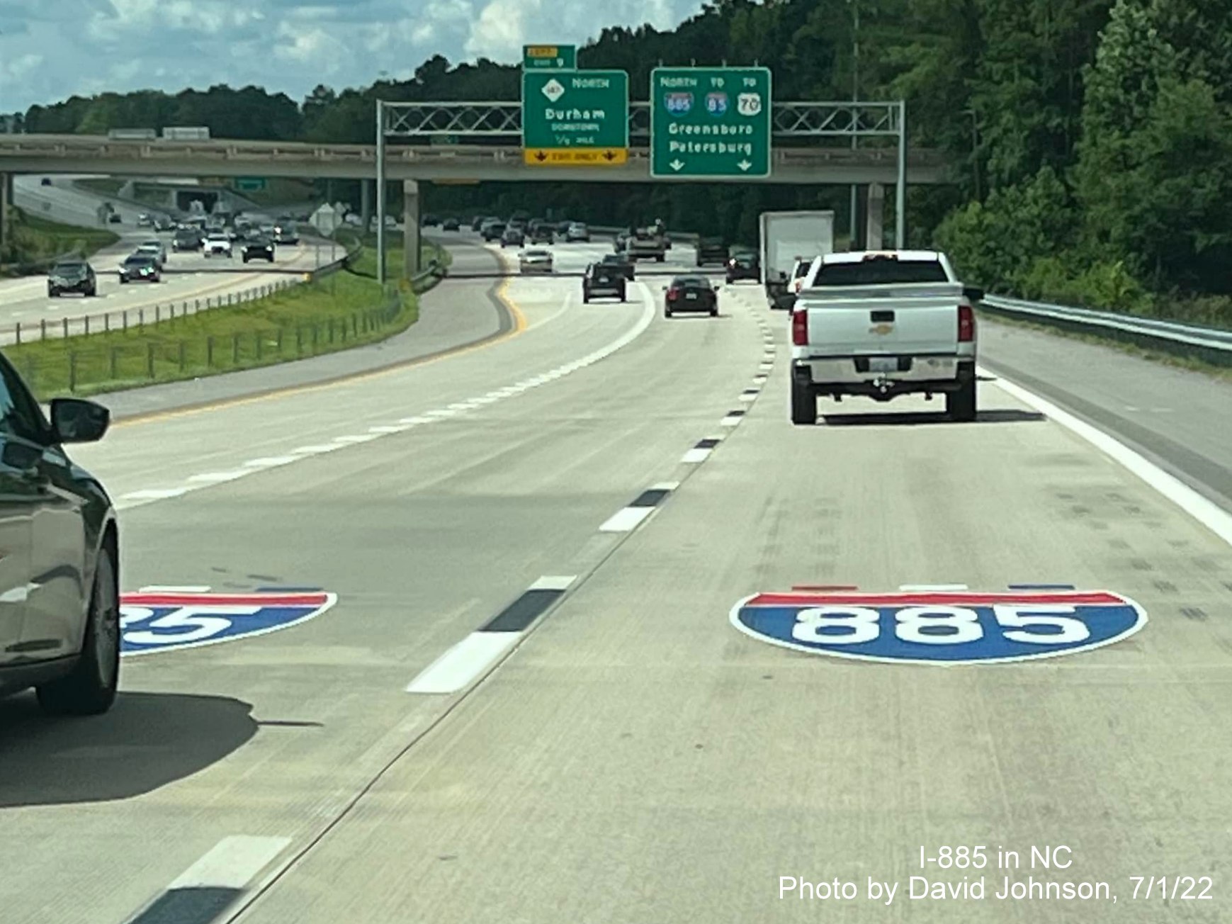
They've painted I-885 shields on the pavement prior to the NC 147 North/Durham Freeway exit.

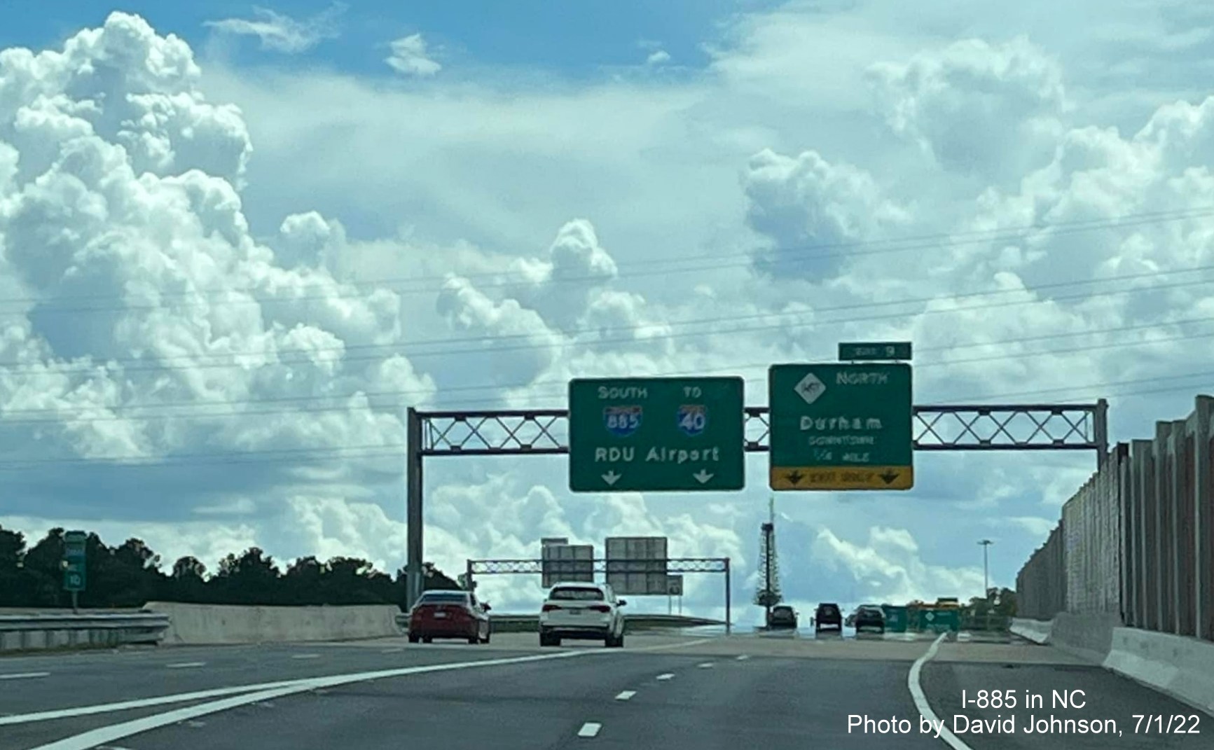
Finally, the I-885 North overhead signs at the NC 147 North exit are uncovered.
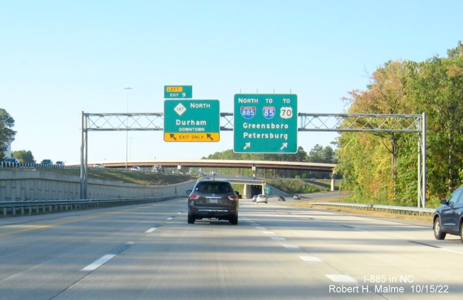
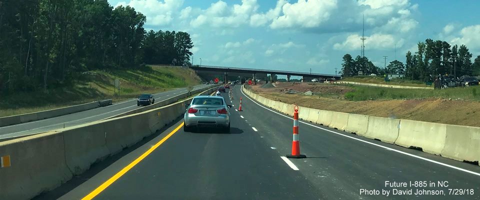
Headed onto the opened East End Connector on I-885 North, NC 147 North/Durham Freeway traffic to the left.
East End Connector traffic on I-885 North approaching ramp from NC 147 South/Durham Freeway.
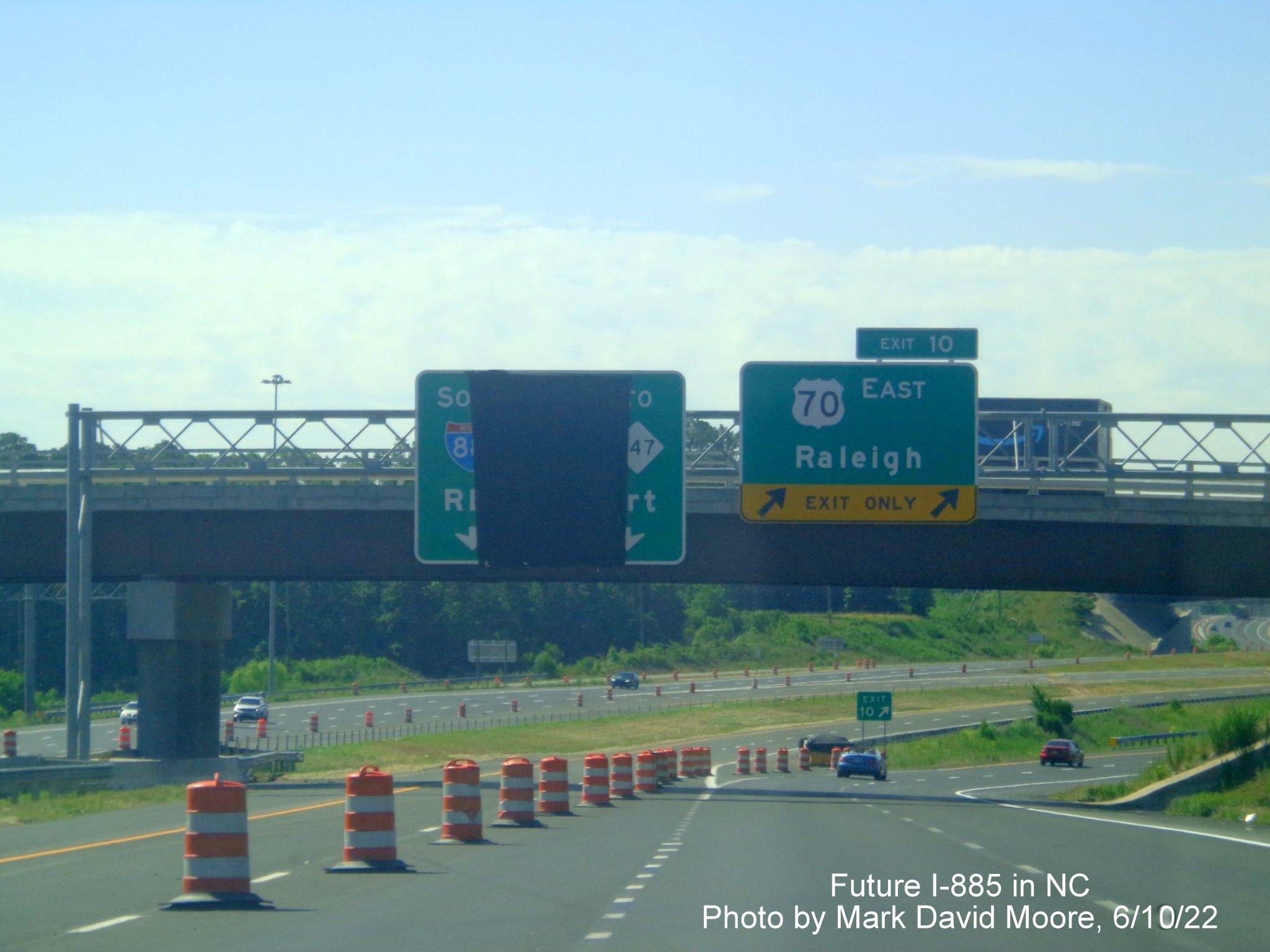
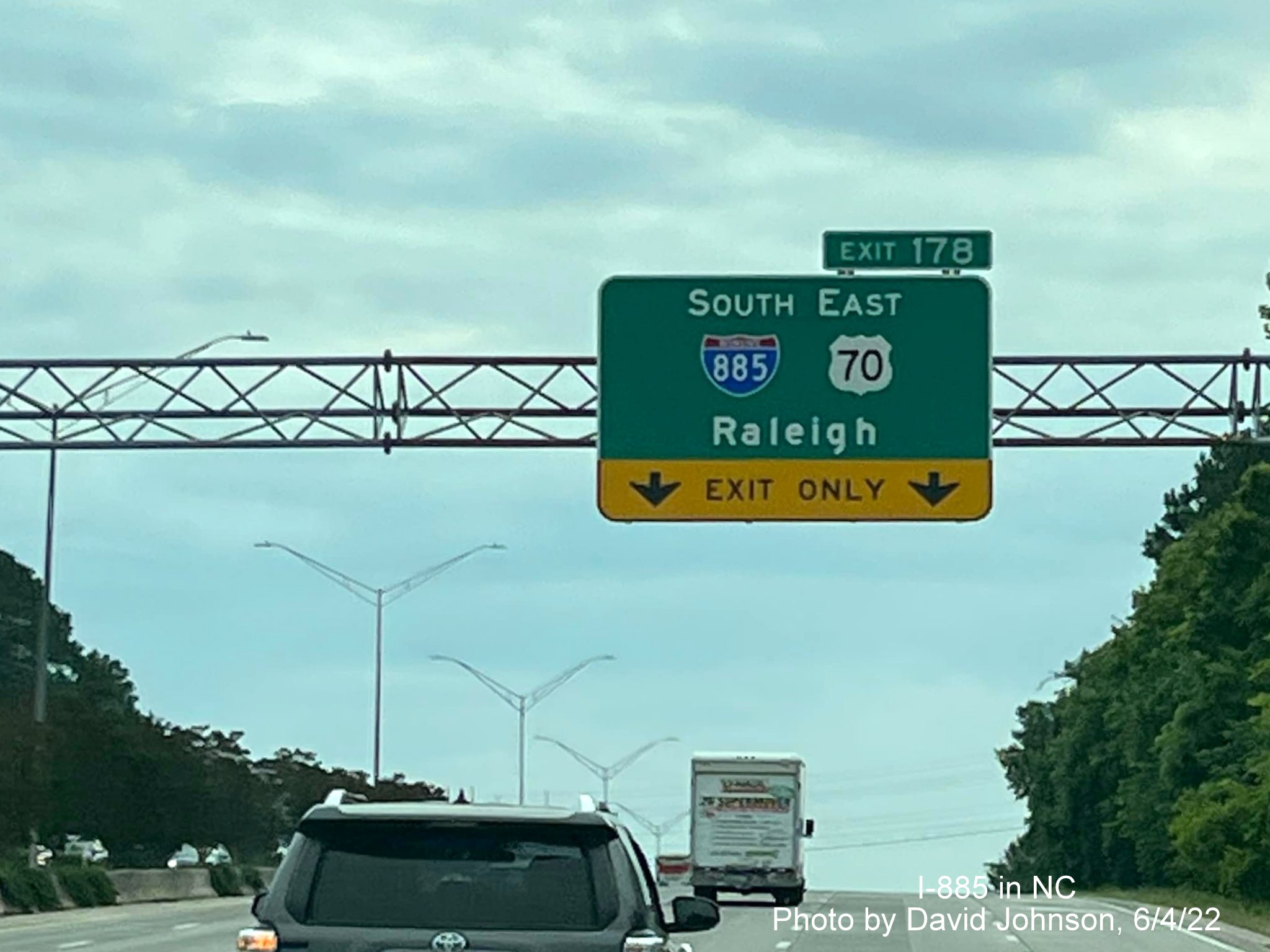
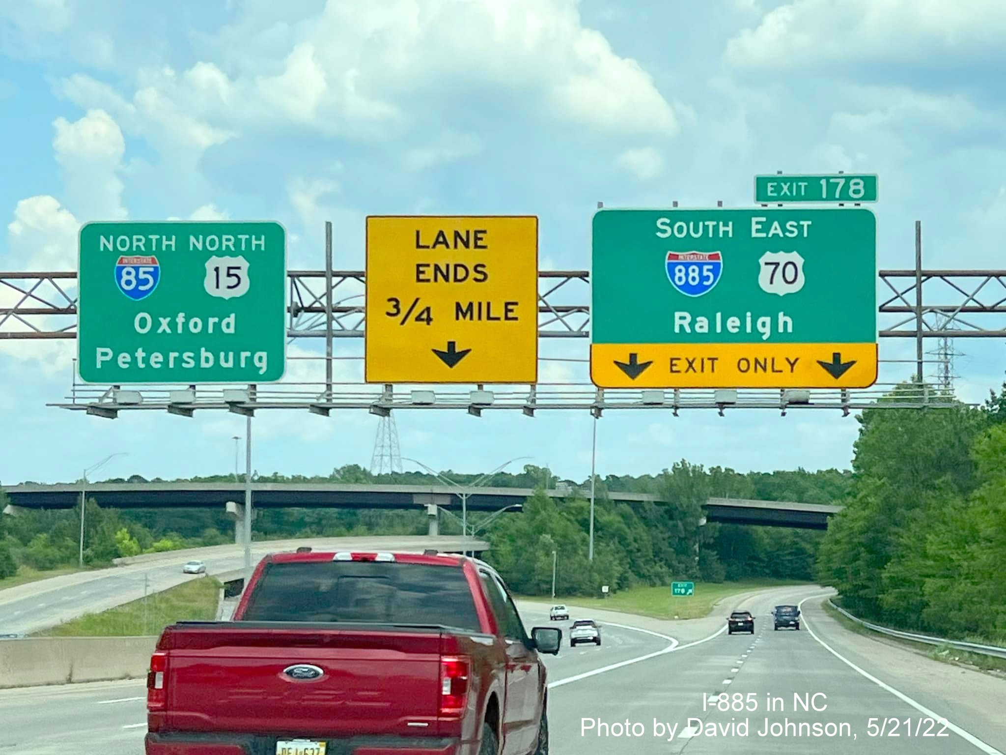
Again, the first overhead signage on the Connector is a 1/4 Mile advance sign, this time for US 70 East.

Overhead signage at the US 70 East exit, notice the 3 control cities here for I-885 North.
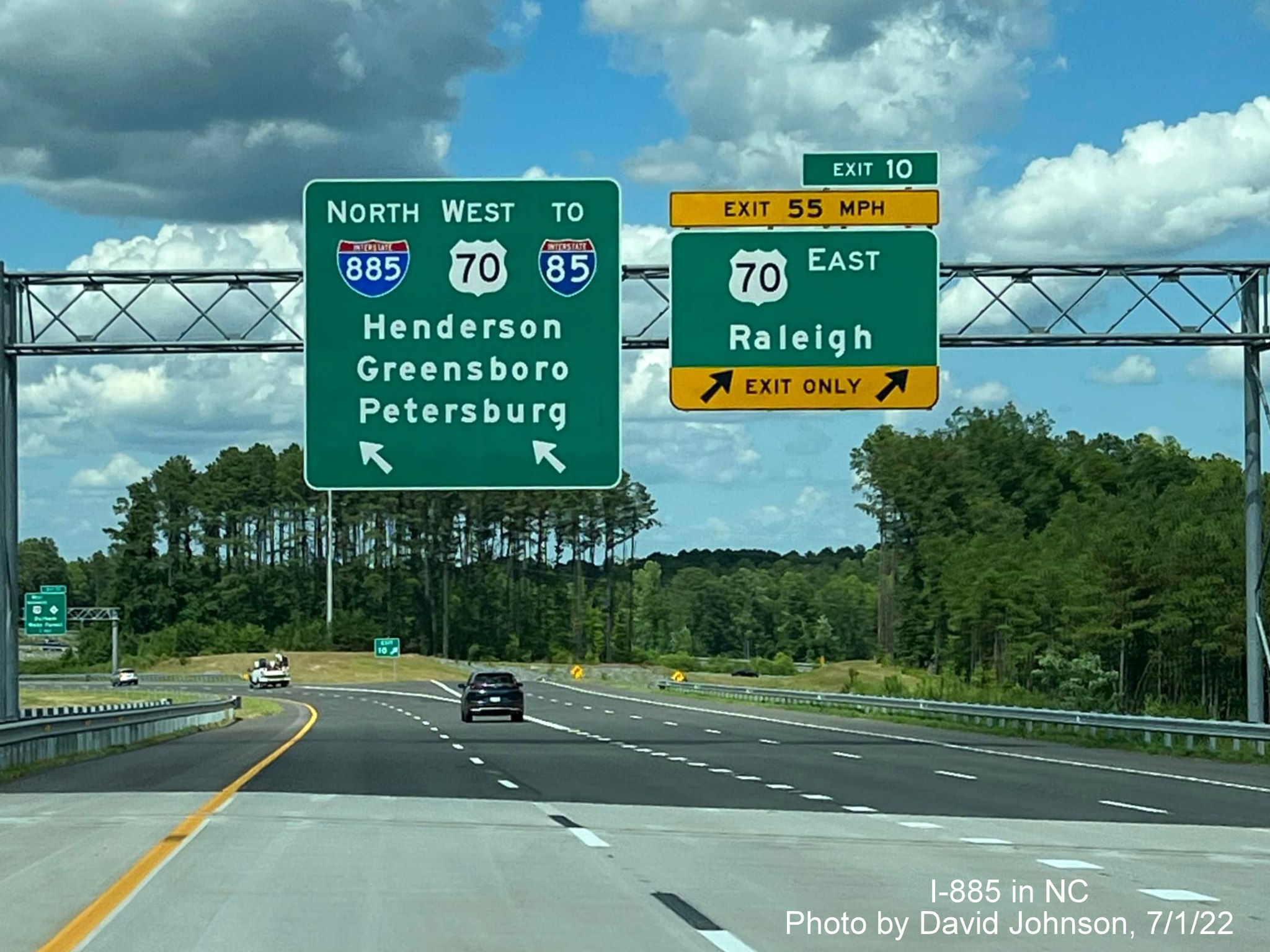
A closer view of the overhead signage.
A wide median where I-885 North traffic merges with that from US 70 West.
Overhead signage at the Cheek Road exit. NCDOT apparently decided not to number the ramp to I-85 North, keeping it unnumbered as it was when just US 70.
A now uncovered (again) North I-885/West US 70 reassurance marker after the Cheek Road exit. Now heading south on NC 147:
The uncovered advance signage for the North I-885/East End Connector exit.
The uncovered Arrow-per-lane sign at the split of ramps for the North and South I-885.
More to come...
VIDEO LINKS (New 9/30/22)
Drive I-885 in both directions, courtesy of Mileage Mike, shot on July 3, 2022
Watch these videos of the opened sections of Future I-885/NC 885
by  :
:
Durham Freeway and Triangle Expressway South
Triangle Expressway and Durham Freeway North
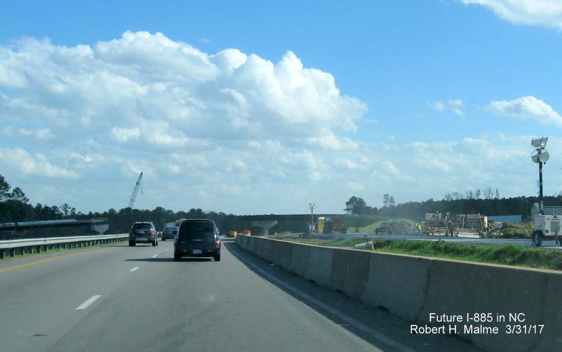
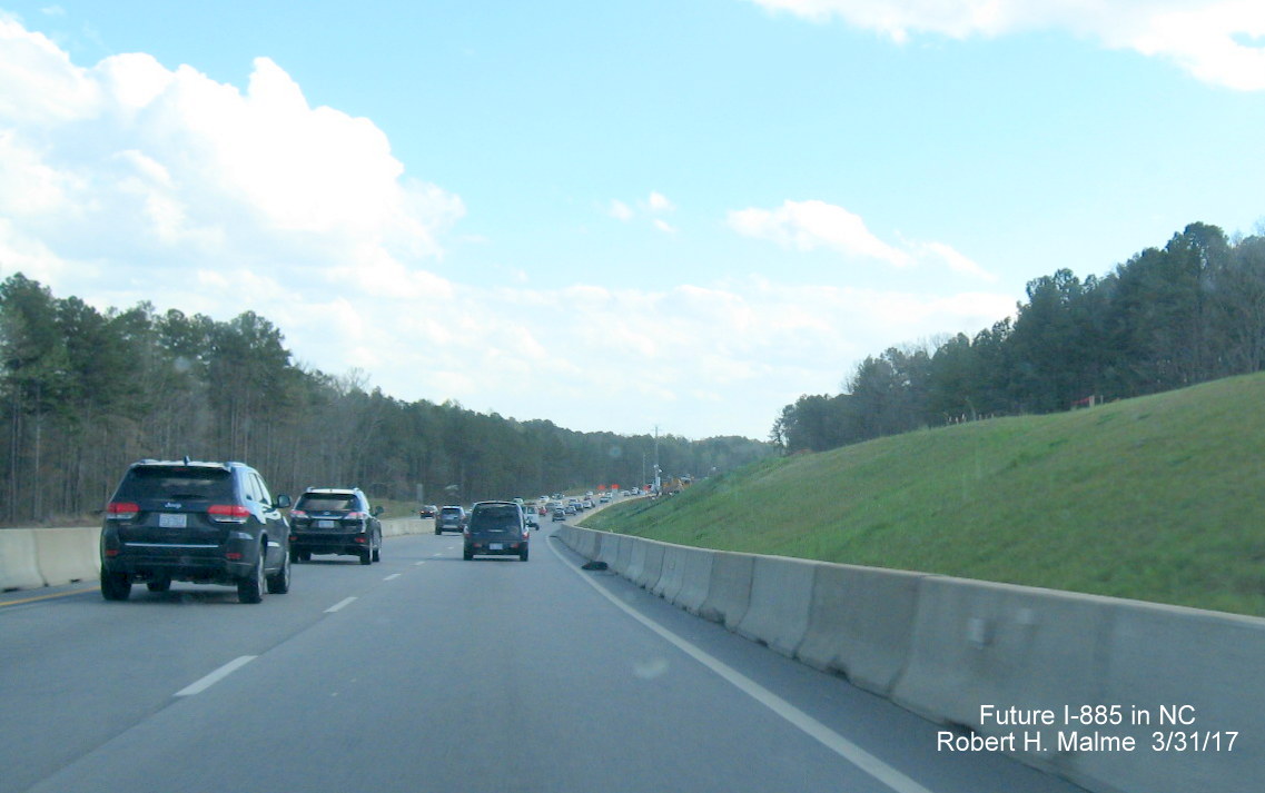
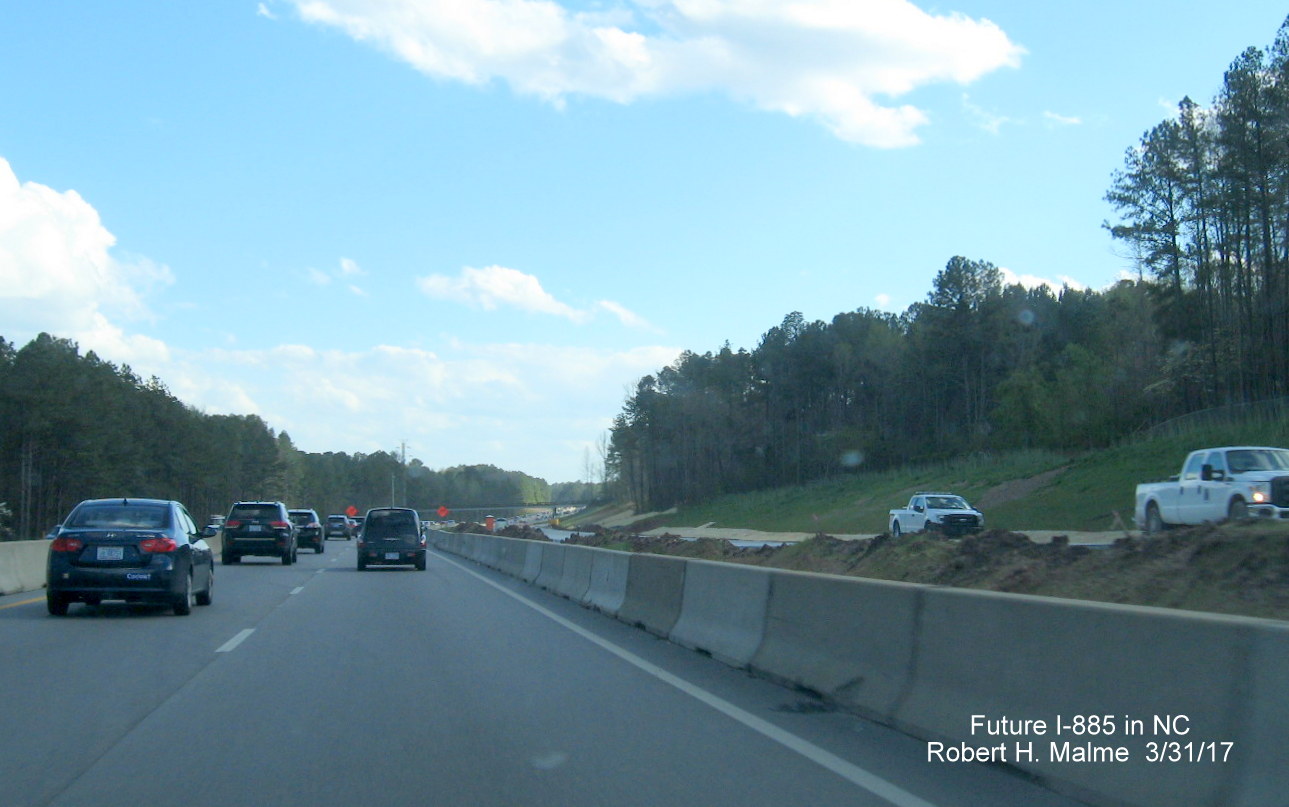
CONSTRUCTION PHOTOS
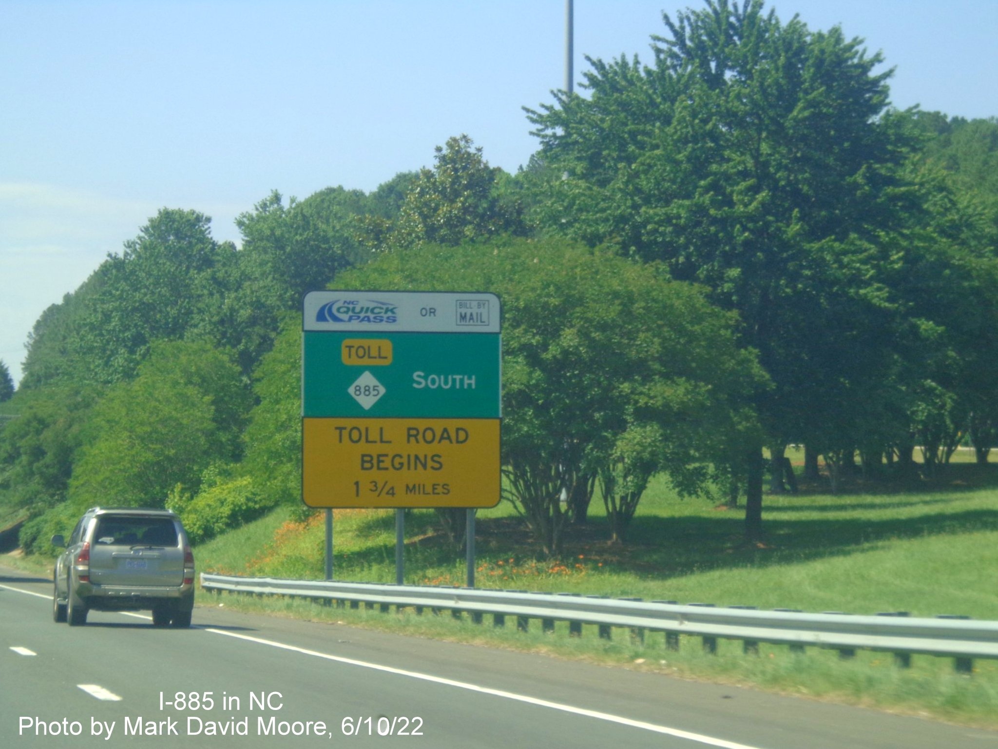
Photos taken by Mark David Moore on June 10:
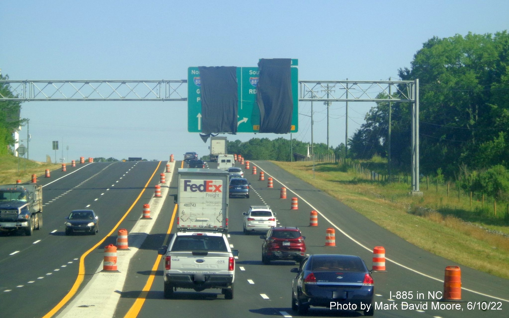
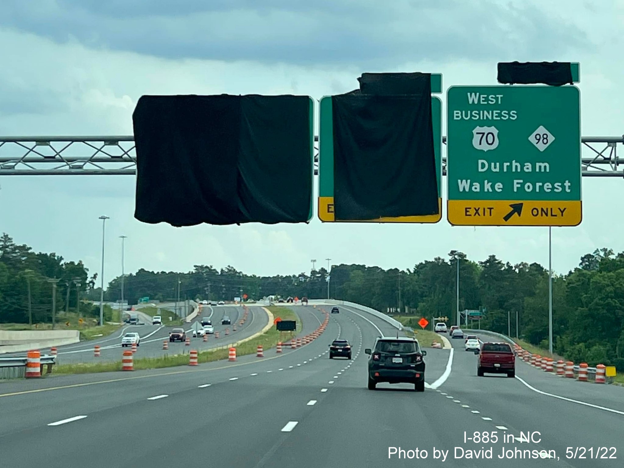
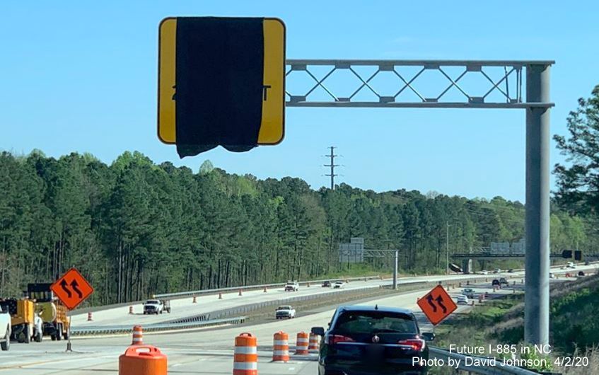
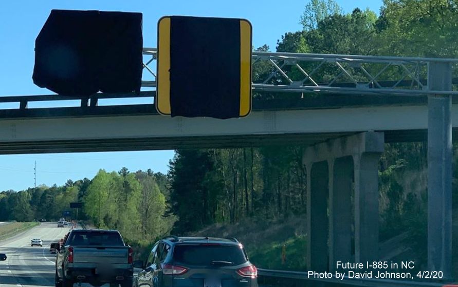
Exit signs along US 70 West approaching the Connector still covered over as of the middle of June.
Uncovered exit signs along US 70 West show both US 70 and I-885 exit numbers.
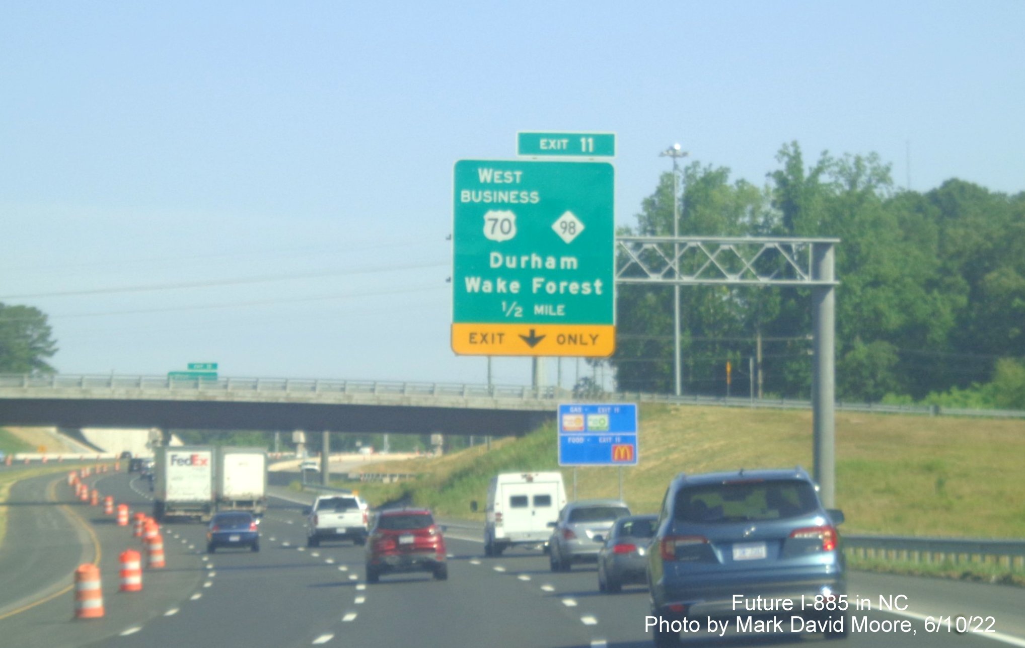
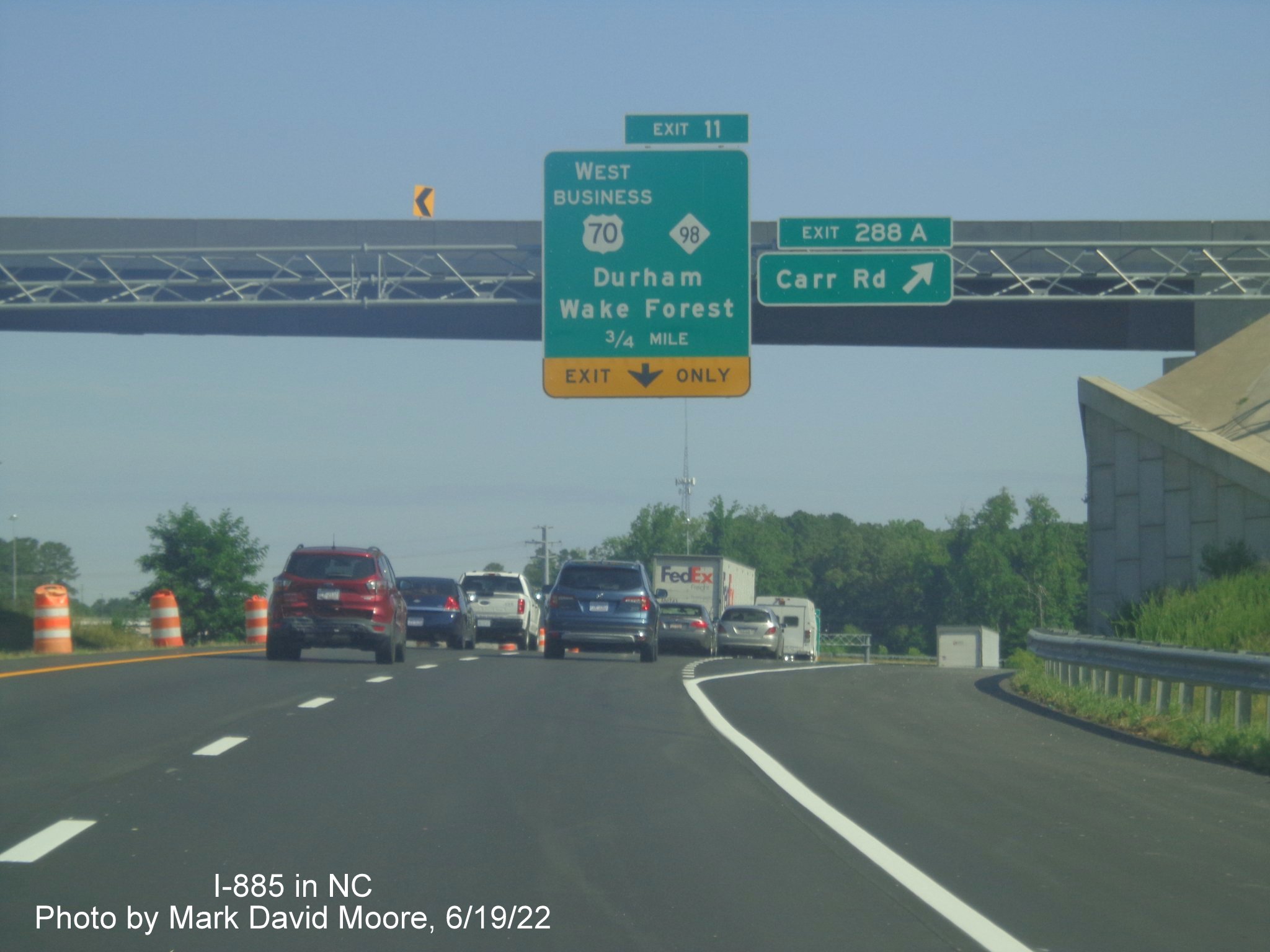
The 1/2 mile advance sign for the Bus. 70 West/NC 98 exit with uncovered exit tab and completed lane markings on the roadway.
The uncovered exit tab with I-885 exit number for Cheek Road can be seen from under the railroad bridge.
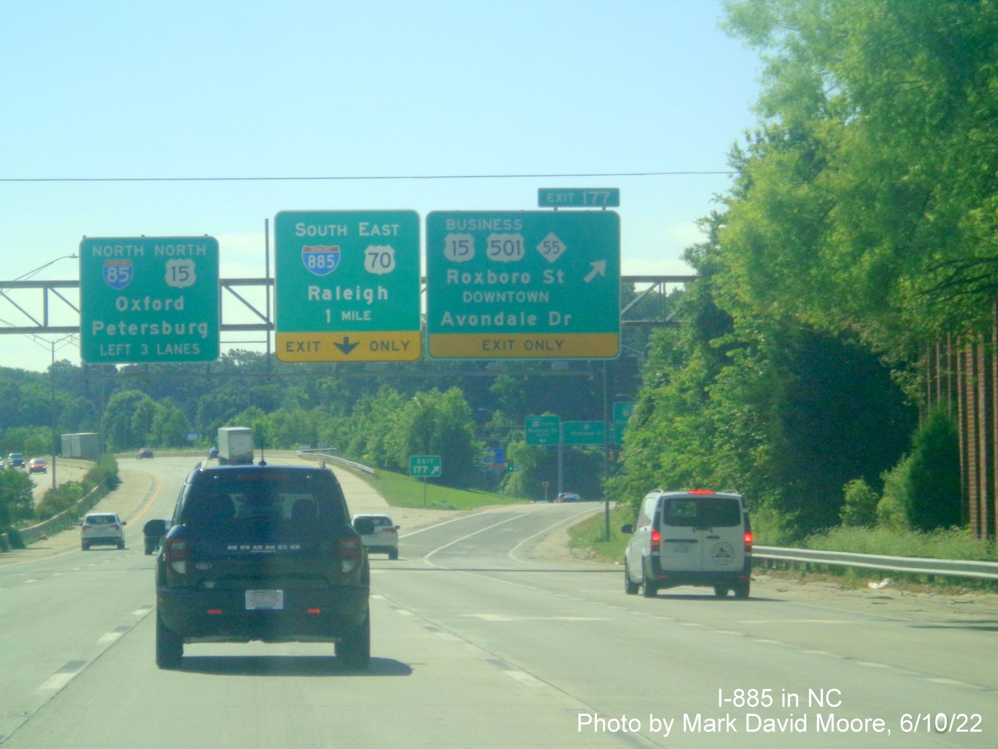
Now on I-85 North, the new 1 mile advance sign with an I-885 shield seen at the Roxboro Street/Avondale Drive exit.
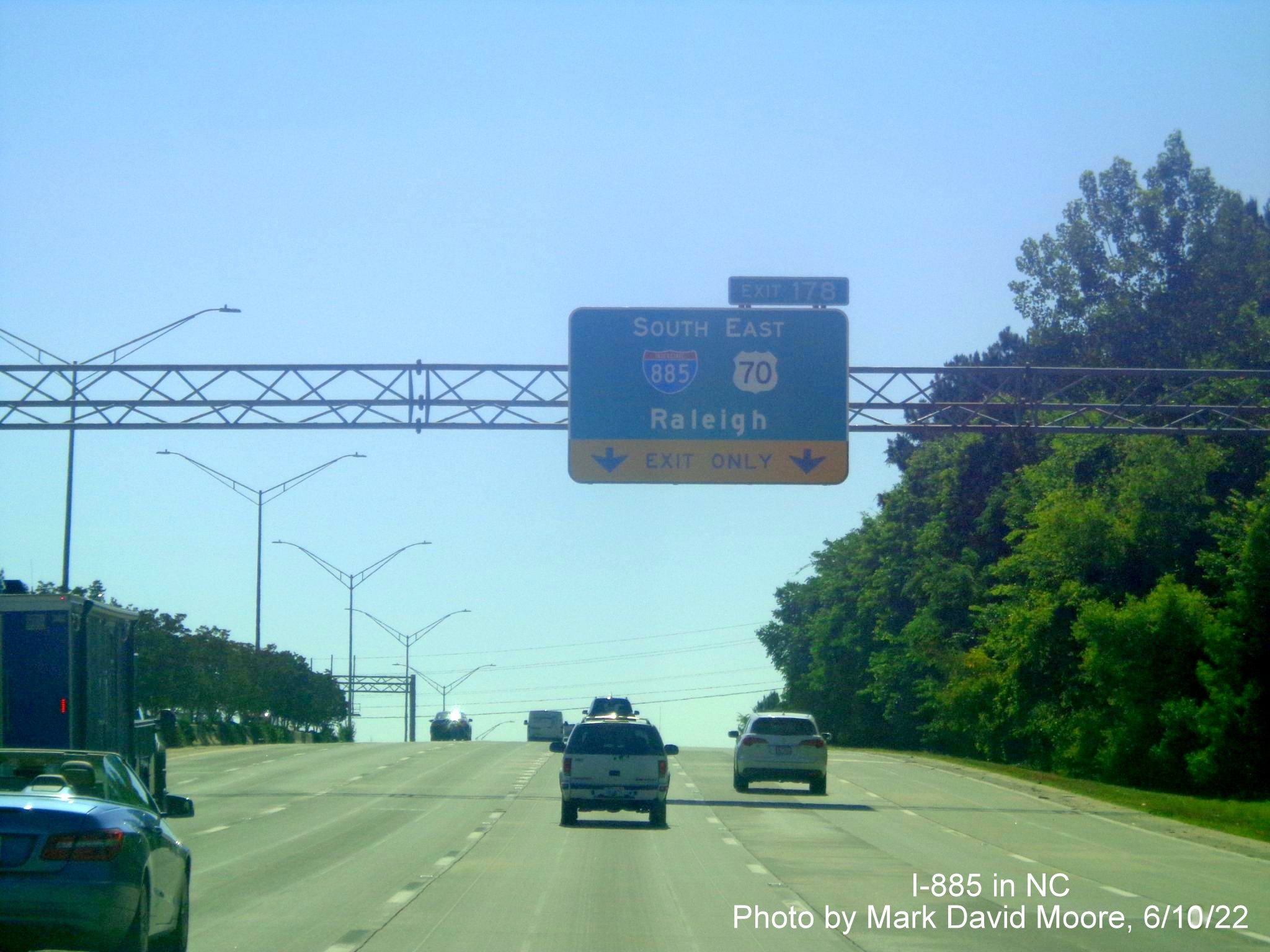
The new 1/2 mile advance sign on I-85 North.
The exit tabs for the Bus. 70 West/NC 98 exit were still covered over on US 70 East.
As is that at the ramp for the Bus. 70 West/NC 98 exit, though uncovered Exit 11 gore sign can be seen in the distance.
The completed lane markings for Future I-885 South can be seen heading toward the US 70 East exit ramp.
Now on the Durham Freeway headed south, where an I-885 shield has replaced NC 147 on the pull through sign at Alexander Drive.
A NC 885 shield has replaced NC 147 on the 1 3/4 Mile Toll Road Begins advisory sign just after the Alexander Drive exit.
New signage for the I-40 West exit no longer includes a NC 54 shield.
Another NC 885 shield replacing NC 147 on the next, 3/4 Mile Toll Road Begins advisory sign just after Cornwallis Road.
The new NC 885 pull through sign at the ramp to I-40 West (with NC 54 shield also removed).
The end of new NC 885 at NC 540. The directions on this sign for NC 540 were changed to West and East in May 2023.
Taken by David Johnson on June 18, 2022:

Overhead signs with new NC 885 and I-885 shields at Hopson Road interchange with the Triangle Expressway.

Ground mounted guide sign with new NC 885 and I-885 shields at Hopson Road ramp for the Triangle Expressway headed north.
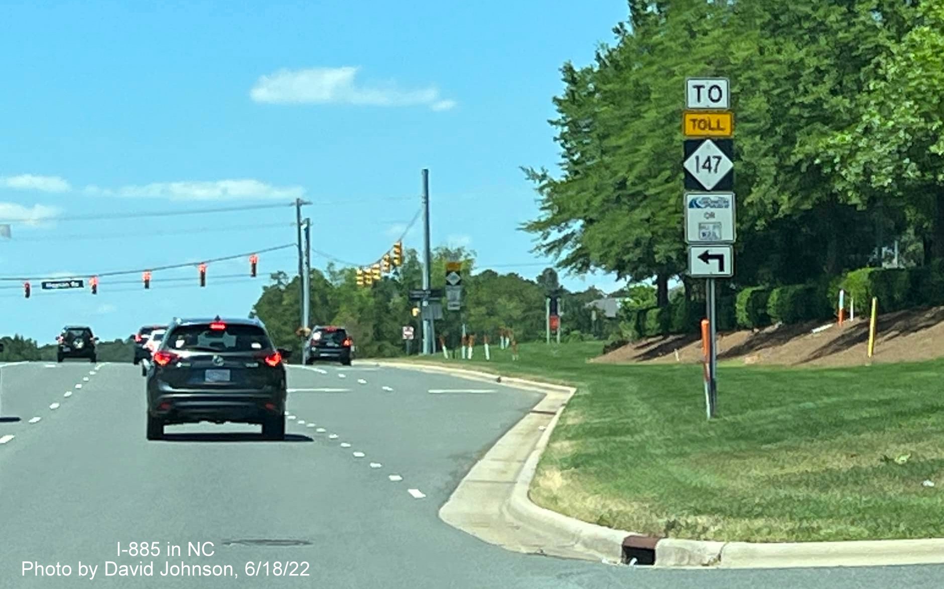
Meanwhile the Toll NC 147 trailblazers still stand approaching the Triangle Expressway ramps at Hopson Road.
Taken earlier on June 4:
New 1 Mile advance sign for the Durham Freeway exit on I-40 West with I-885 shield.
New 3/4 Mile advance sign for the Triangle Expressway with NC 885 shield and 1/4 mile advance with I-885 shield for Durham Freeway exit on I-40 West.
The new exit sign for the Durham Freeway with I-885 shield on I-40 West.
The 1/4 Mile advance sign for the Triangle Expressway exit with new NC 885 shield on I-40 West.
The exit sign for the Triangle Expressway with NC 885 shield on I-40 West. Turning around...
New advance signage for the Durham Freeway and Triangle Expressway with I-885 and NC 885 shields on I-40 East.

New advance signage for the Durham Freeway and Triangle Expressway with I-885 and NC 885 shields on I-40 East.
Taken by Charles M. Kunz on I-40 East on May 26:
New I-885 North signage and replacement NC 885 shield on Triangle Expressway sign put up the night of May 24-25.
The new I-885 North to NC 147 exit sign, westbound signs were put up the night of May 25-26.
Taken by David Johnson on June 4 and May 21, 2022. First at the start of the Durham Freeway:
New pull through sign for the Durham Freeway with I-885 shield prior to ramp for I-40 West. Other overhead signs and reassurance markers had not been changed as of June 4.
Along I-85 North:
New advance signage with I-885 shield approaching US 70 exit on I-85 North.
The first appearance of an I-885 shield on I-85 North, here at the US 70 East exit. The new sign drops RDU Airport as a control city. Perhaps it will appear on a new auxiliary sign for this exit.
Closeup of the overhead signs at the Cheek Road exit, the new I-885 exit numbers are not covered up, unlike the gore sign seen at the bottom of the photo.
The Exit 11 tab is covered over at the Business 70/NC 98 exit, along with the remaining signs which are an I-885 South pull through and US 70 East exit sign.
The next sign for the US 70 East exit has the number uncovered. Final paving of the left lane from prior to the railroad bridge to the future split of I-885 South and US 70 East has not been completed.
The unpaved future I-885 South left lane continues approaching the US 70 East exit.
Along Toll NC 540 East:
This new overhead sign for the current NC 147 Toll North exit was put up earlier this year and covered up, despite not having NC 885 and I-885 shields.
Earlier Photos
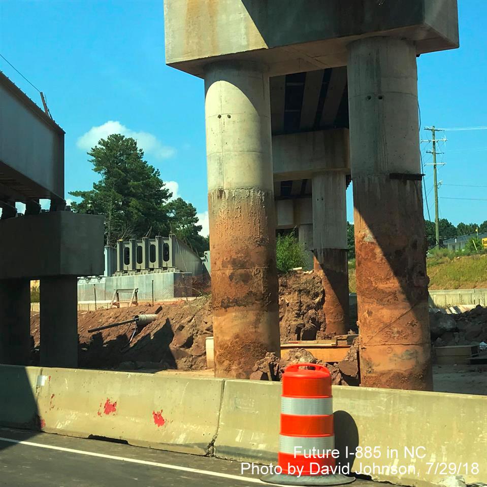
Courtesy of Adam Prince on March 12, 2022 showing start of demolition of railroad bridge:
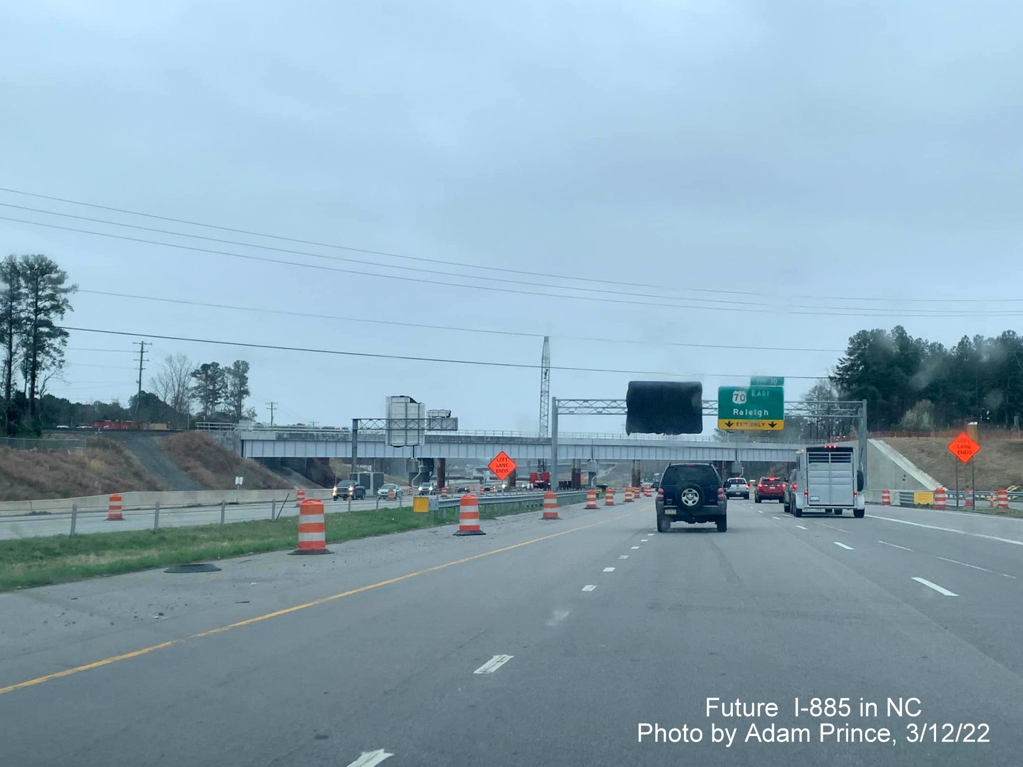
Heading east of US 70 approaching the new railroad bridge with old one partially dismantled behind it.
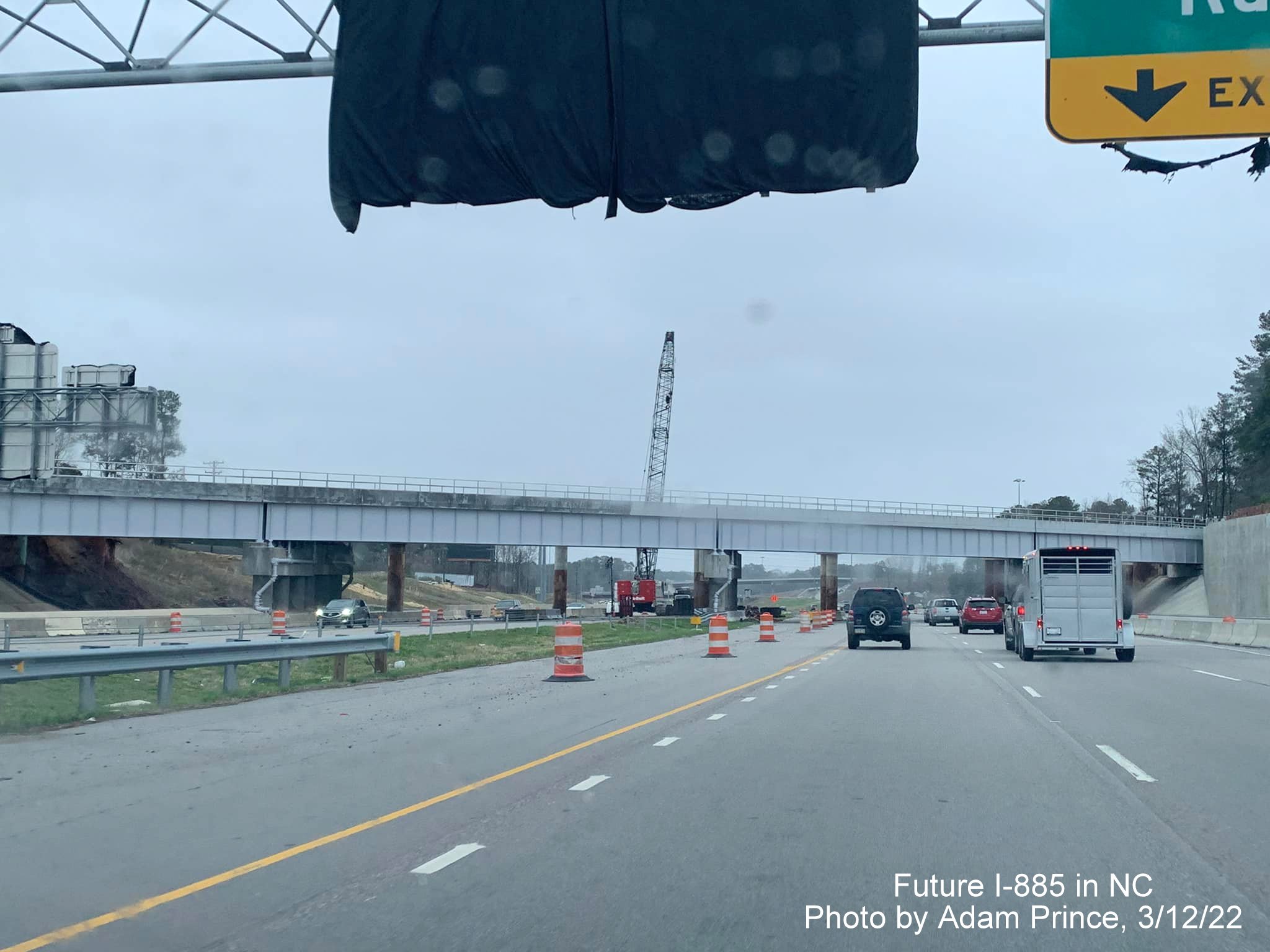
Near the new railroad bridge with only support posts for old bridge left behind on other side.
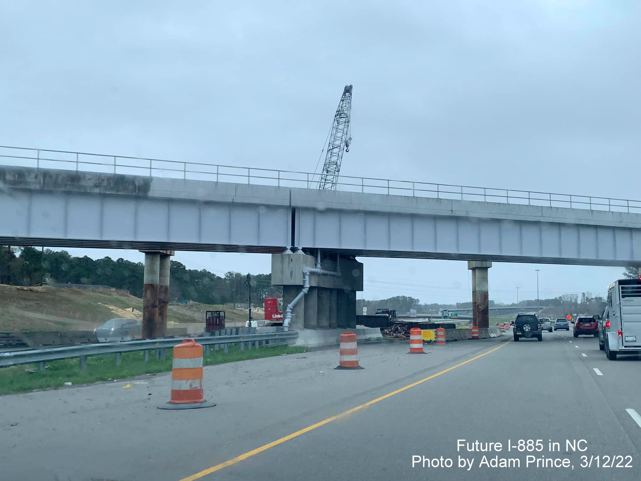
A closer look at the crane behind the new railroad bridge helping to dismantle the temporary one.
For photos of what's left of the temporary bridge heading west, go HERE.
PREVIOUS PHOTOS
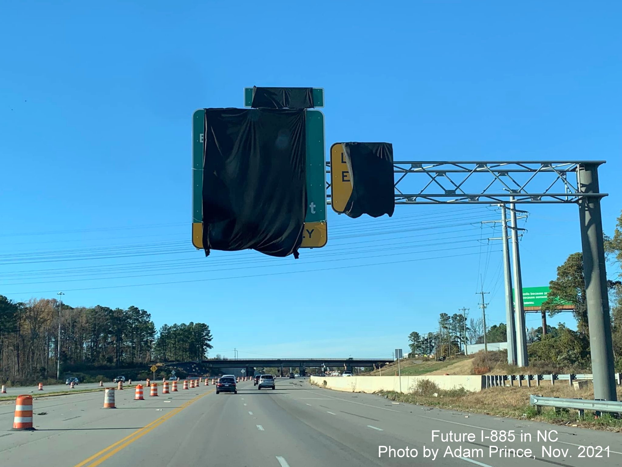
From November 2021 courtesy of Adam Prince, showing the lack of progress in the removal of the temporary railroad bridge:
The first overhead signs approaching the Connector are still covered up on US 70 West.
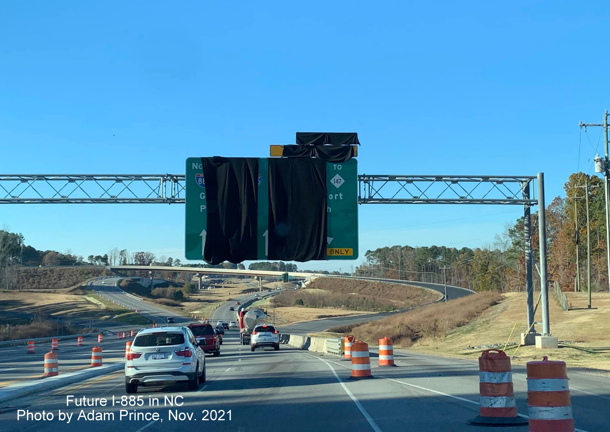
The Arrow-per-Lane (APL) overhead signs at the future I-885 South Connector ramp still covered up too.
The exit sign for the Business 70/NC 98 exit at the Carr Road off-ramp is also still covered up, though the exit is open. It should just have the I-885 exit number tab covered as it is on US 70 East.
The next sign for Business 70/NC 98 is also still covered up.
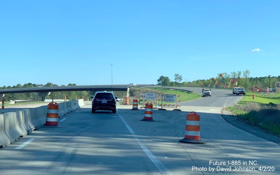
The lanes of US 70 West are still painted for when there was two-way traffic. NCDOT has stated they will not update lane markings or put paint new lines until just before the Connector is to open, perhaps in April or May 2022.
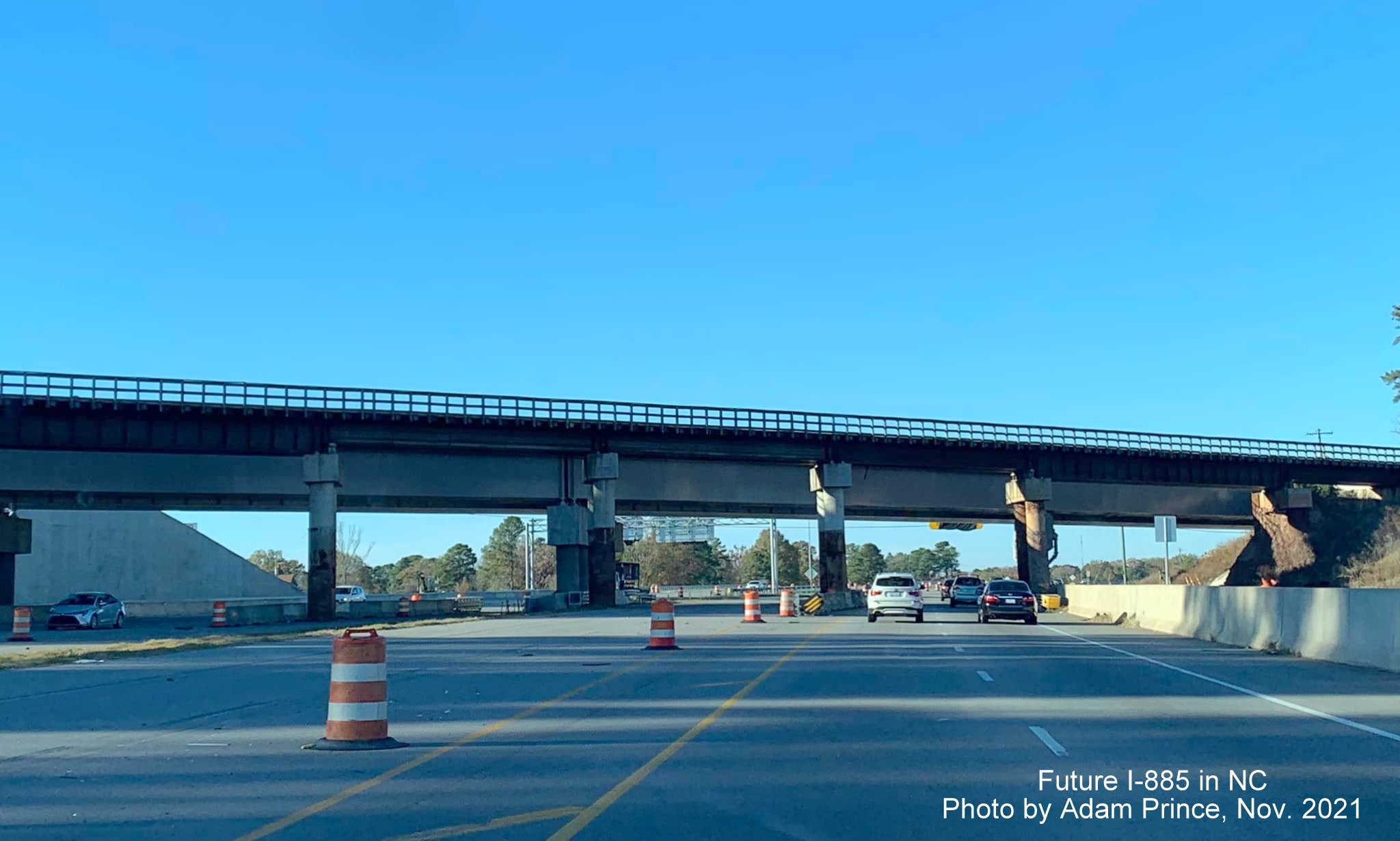
The reason the Connector is not open yet. The temporary railroad bridge still in place prior to the permanent bridge on US 70 West. Demolition is to start in December, but final paving will have to wait until the spring of next year.
From Google Maps Street View in October 2021:
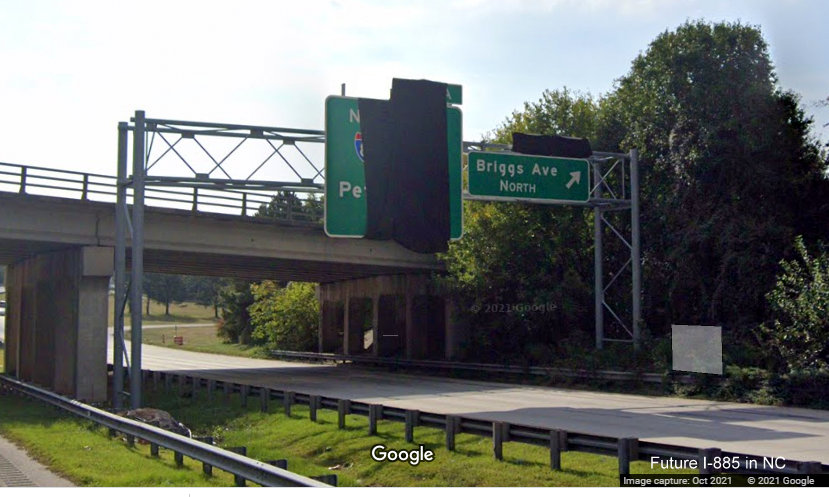
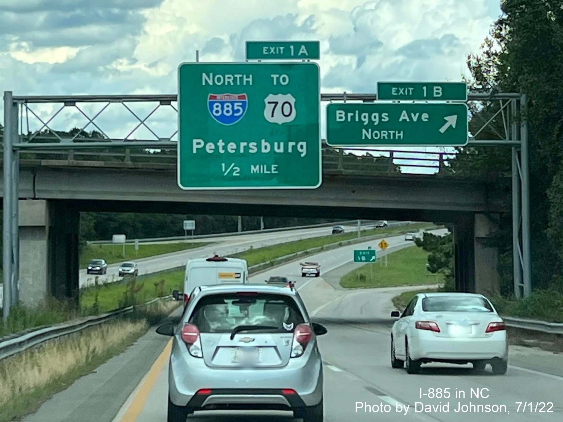
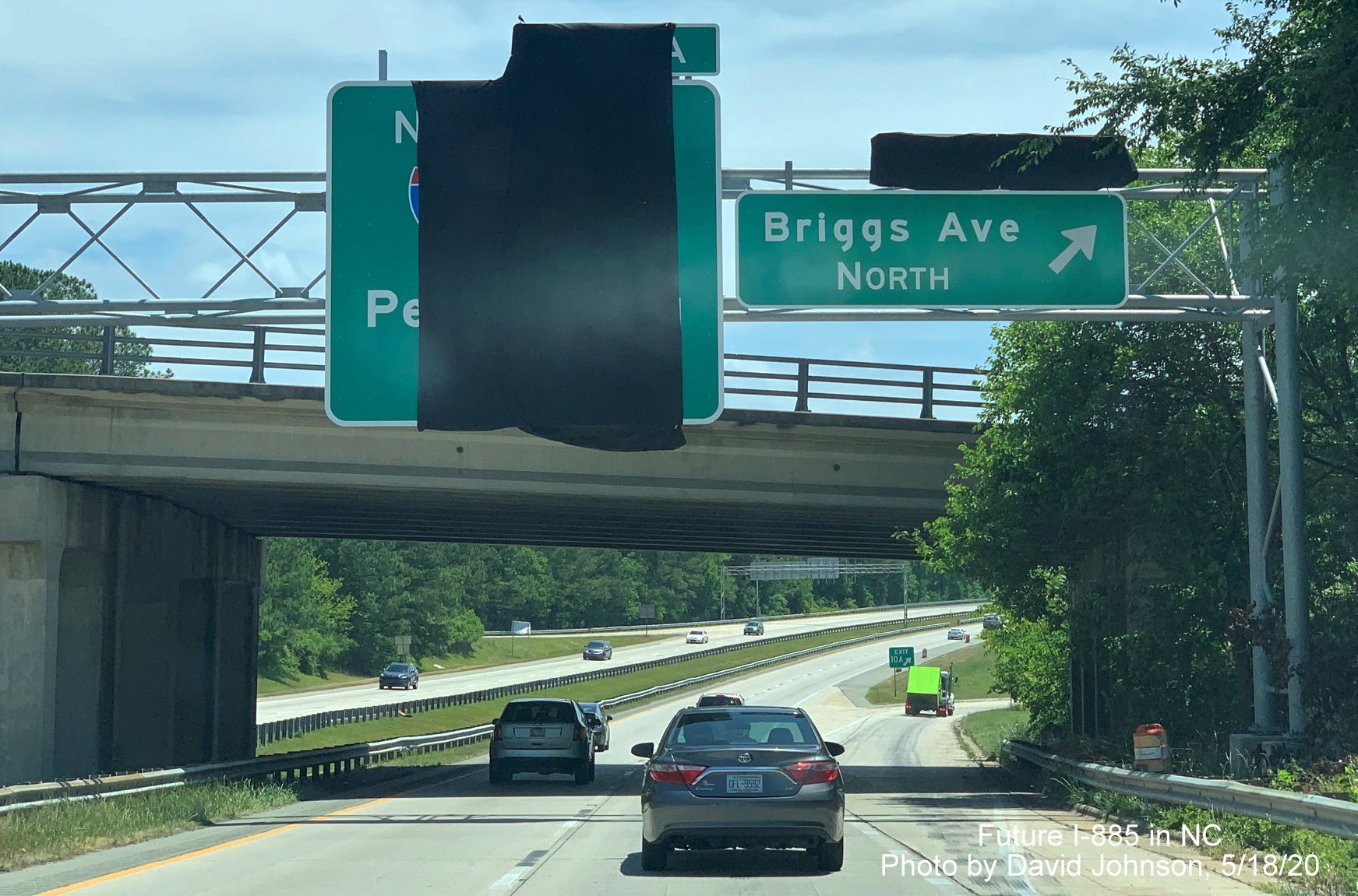
Closeup view of covered 1 mile advance sign for I-885 North exit with future exit number, 1A (the Briggs Avenue North exit is to become 1B once I-885 is opened and NC 147 truncated to the East End Connector interchange.
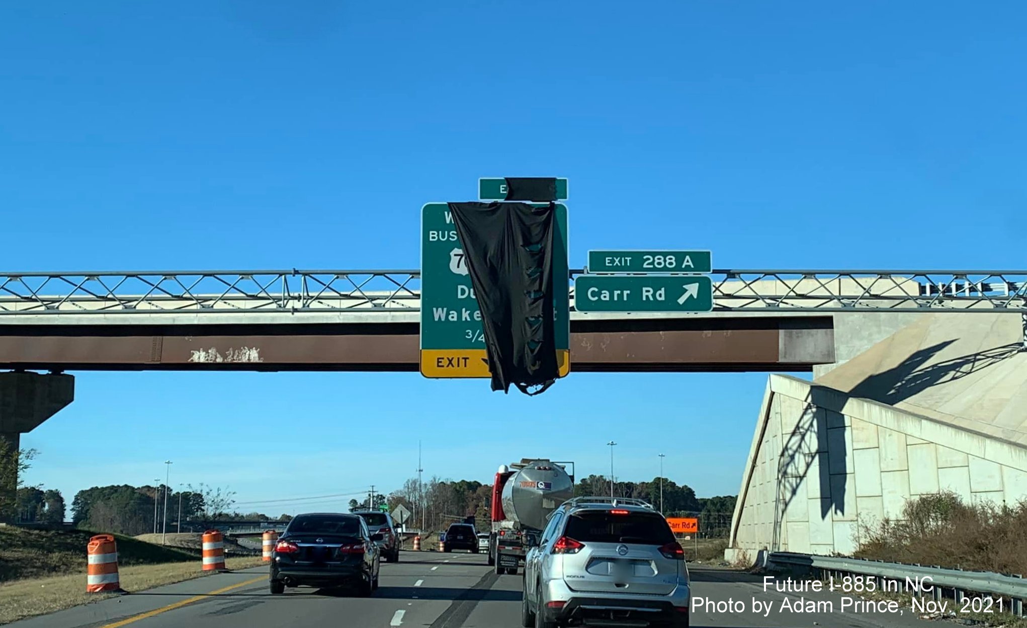
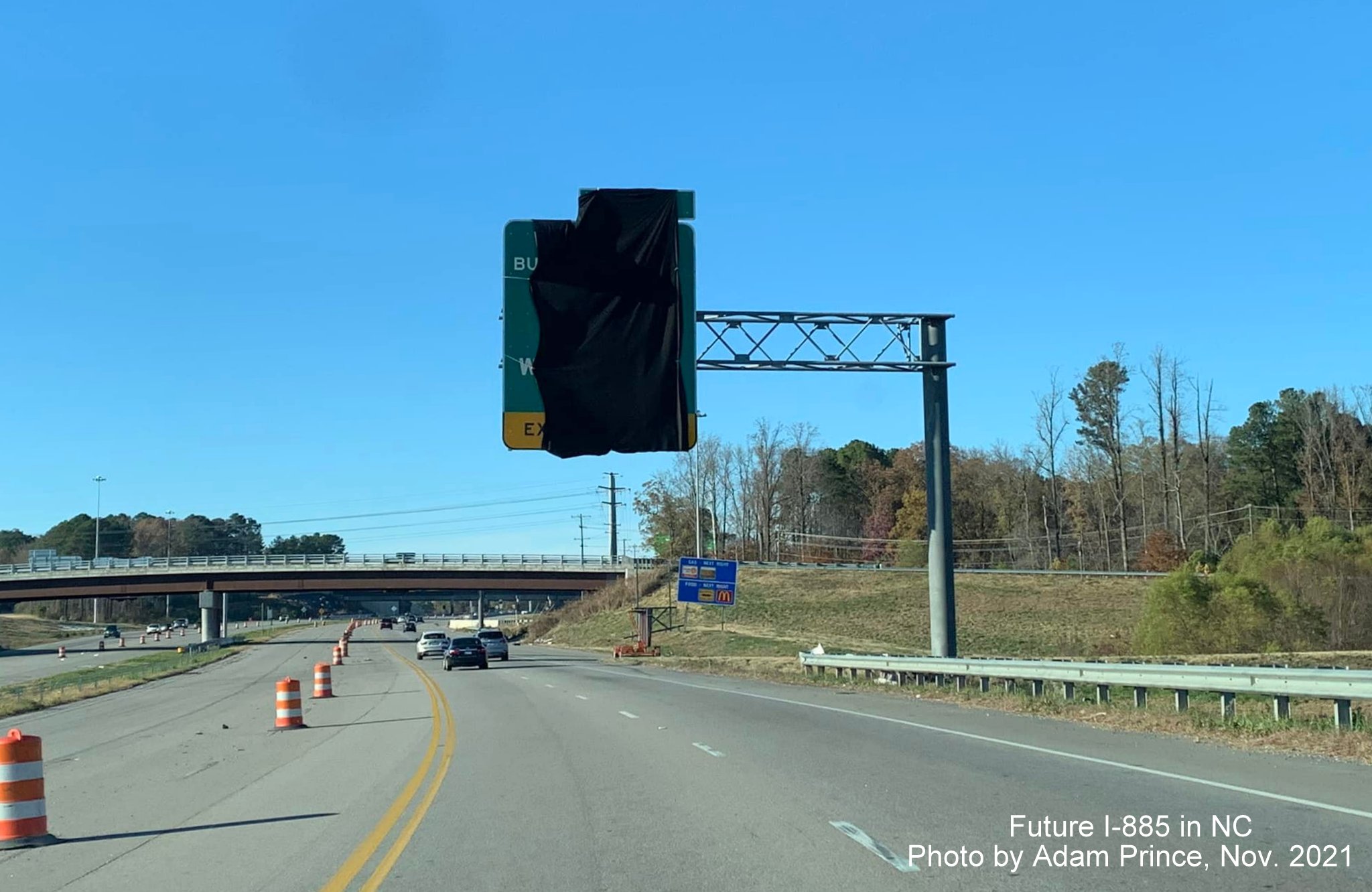
Taken by Adam Prince in October 2021
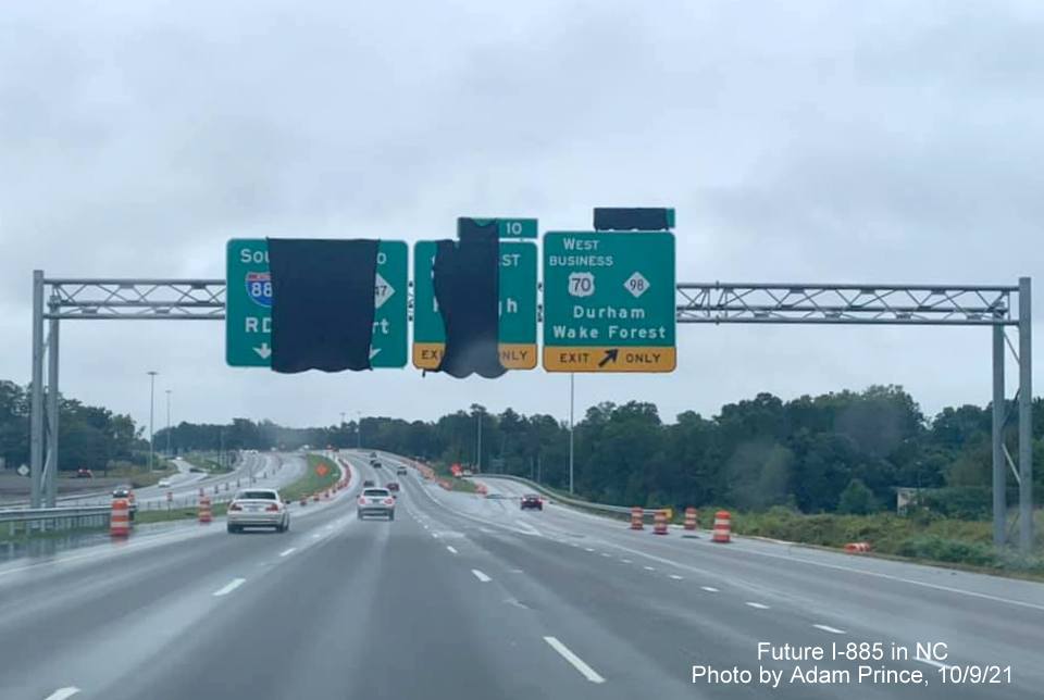
Overhead signs for the East End Connector/US 70 exit still covered up at the exit for Business 70/NC 98. Exit tab covered over for Future exit 11.
More covered up
overhead signs due to still unopened East End Connector, the reason,
the still standing temporary railroad bridge seen behind the new
bridge.
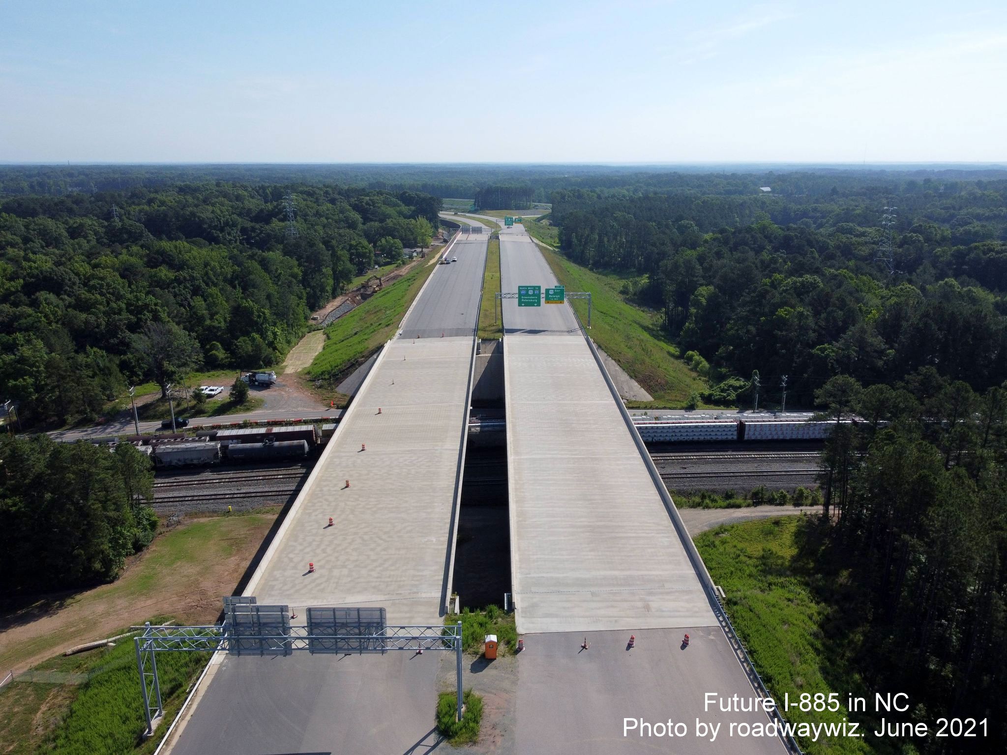
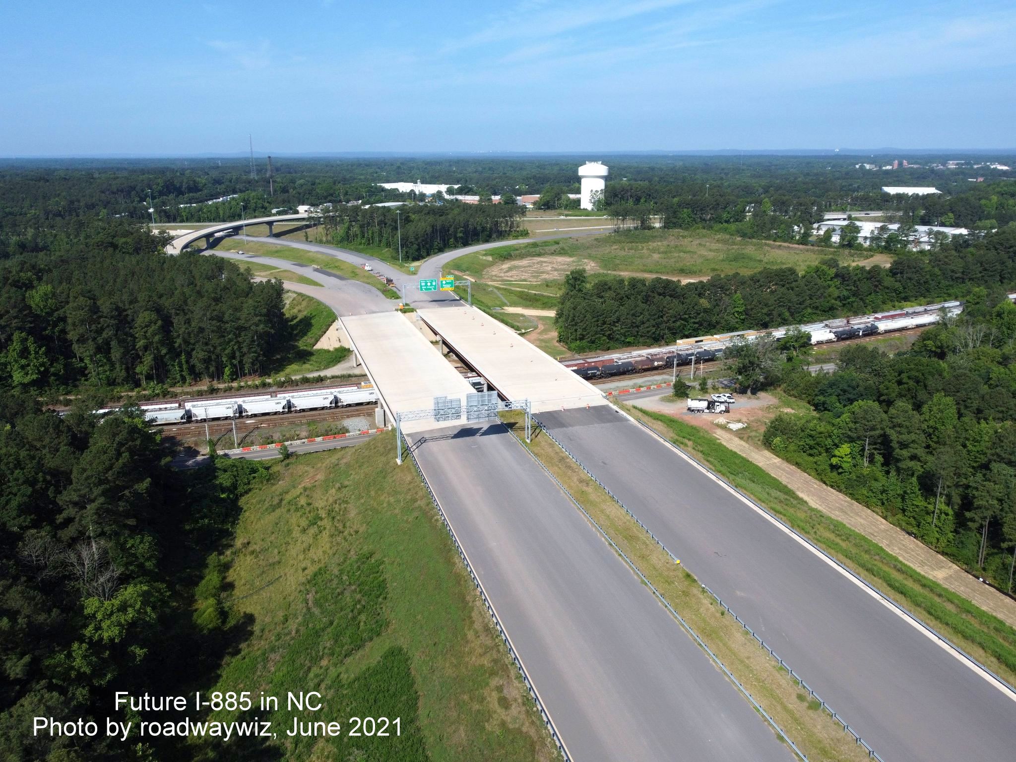
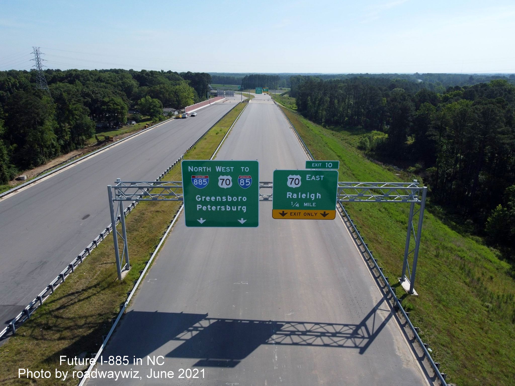
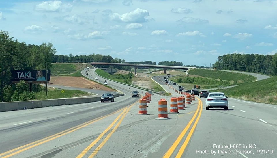
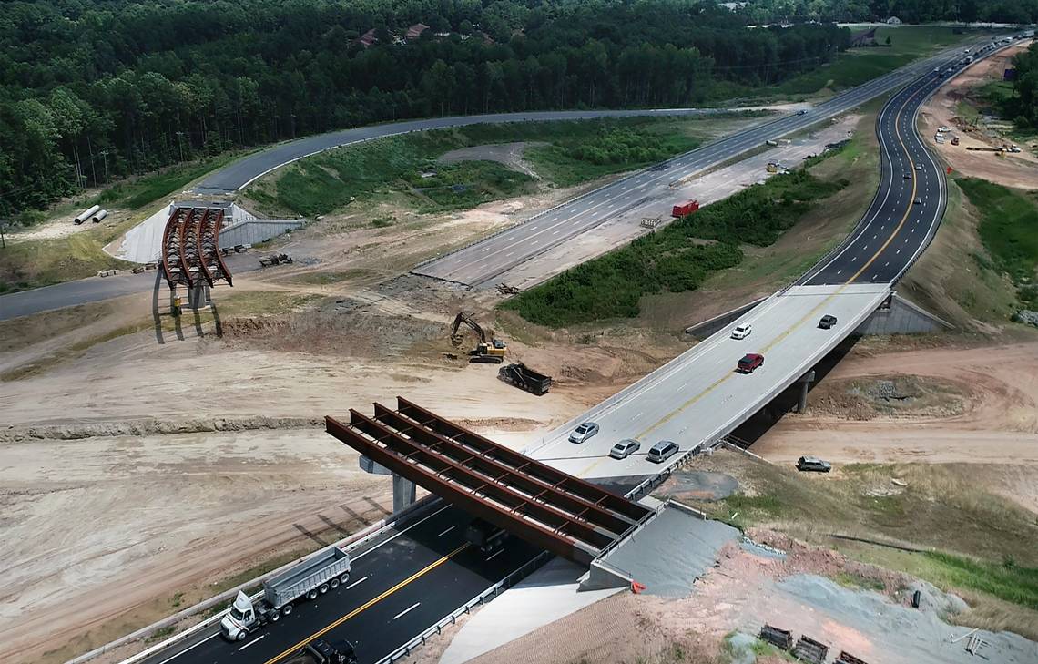
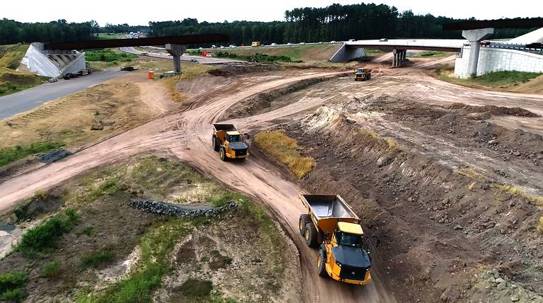
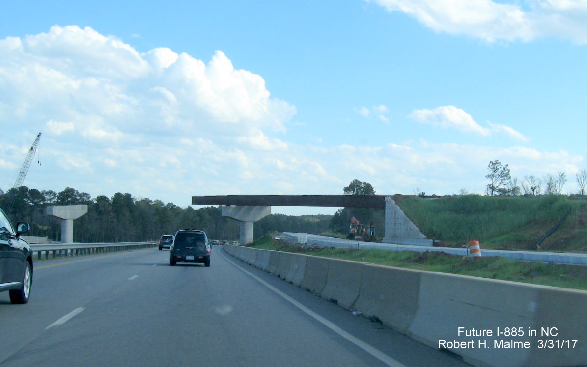
Courtesy of roadwaywiz, taken in June 2021 over the unopened East End Connector:
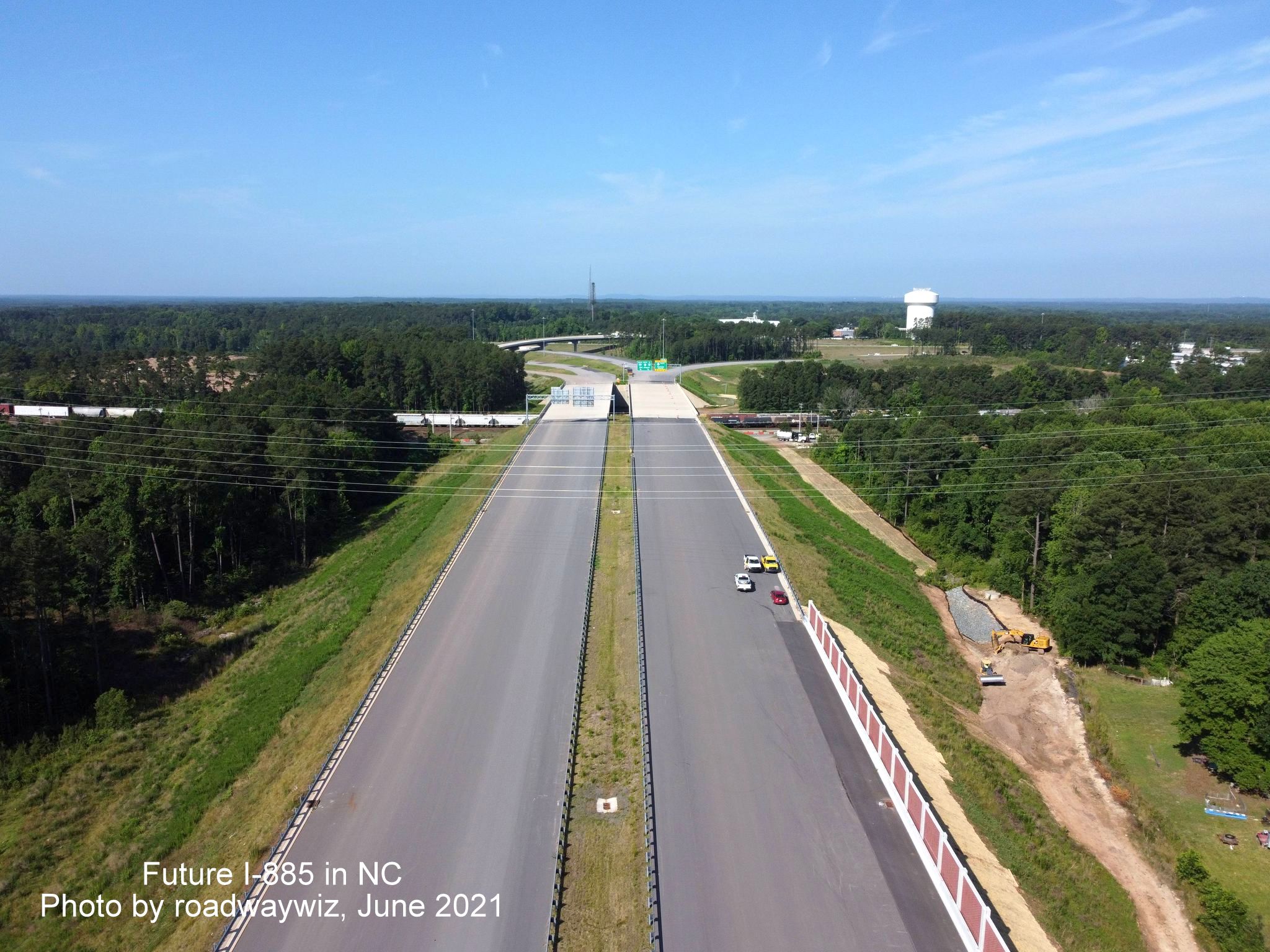
Halfway along the route looking west toward the interchange with the Durham Freeway.
And now looking west toward the interchange with US 70.

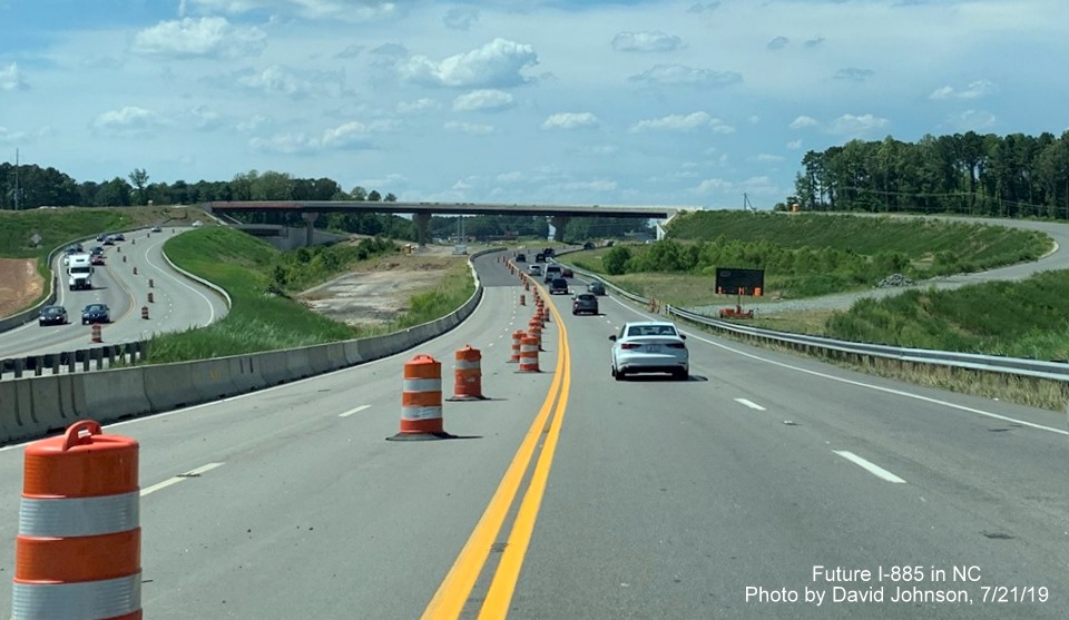
A closer look at the interchange with the Durham Freeway, including the flyover ramp from NC 147 South to I-885 North.
Now a closer look at the interchange with US 70.
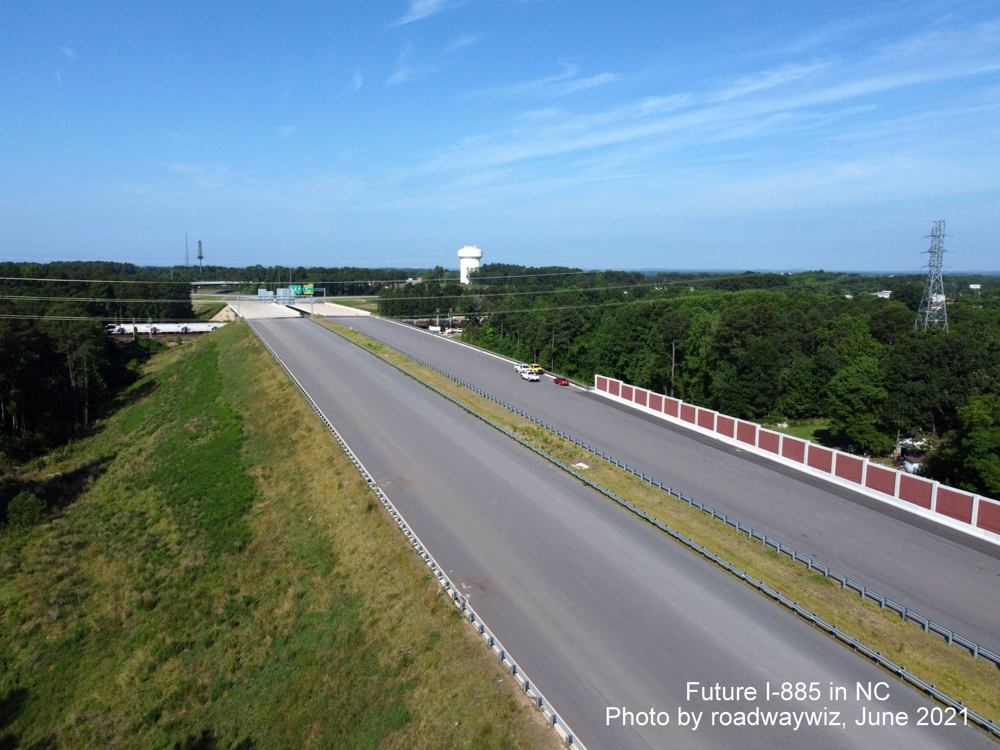
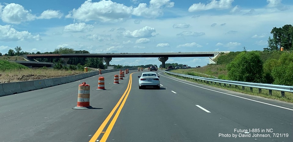
And a closer look at the East End Connector roadway itself.
Closeup view of the bridge over Angier Avenue and railroad tracks looking west.
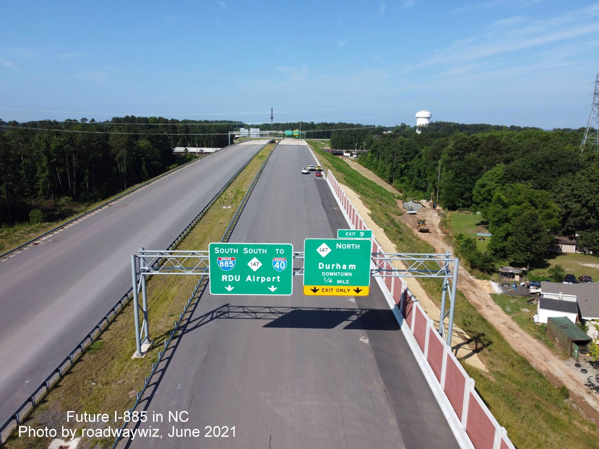
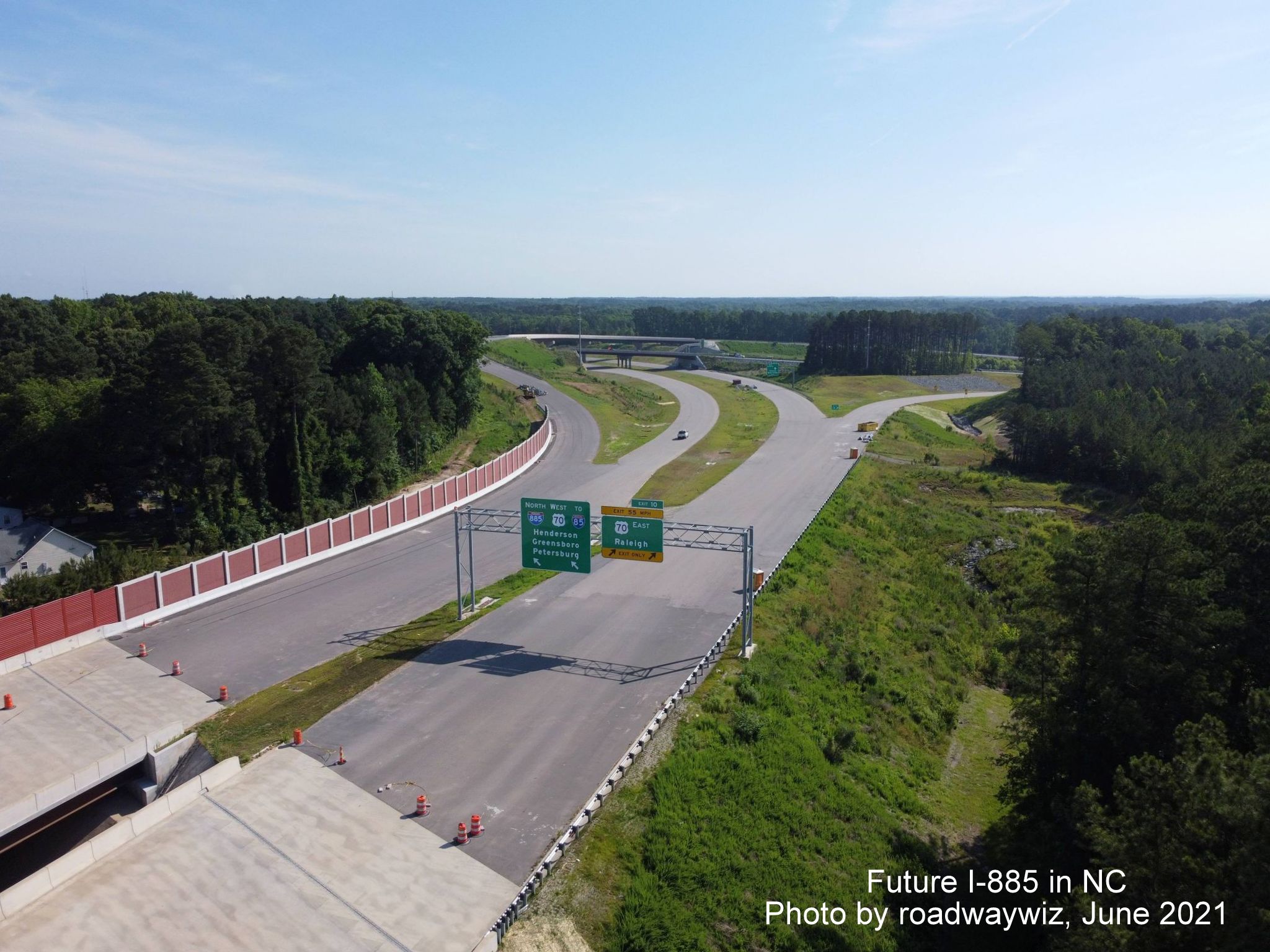
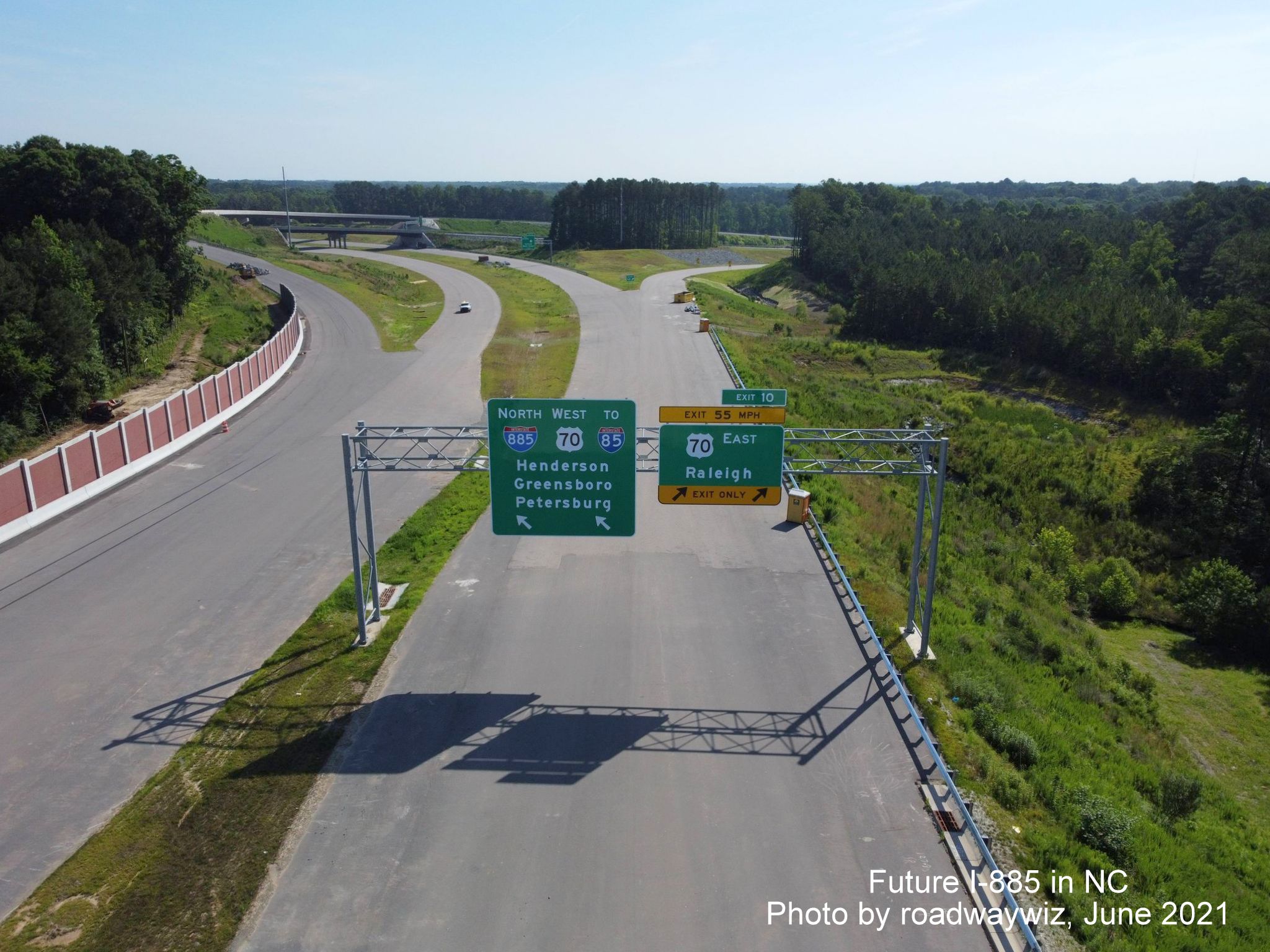
Closeup of the
1/4 Mile advance and pull through signage approaching the interchange
with the Durham Freeway on Future I-885 South. The signs were
apparently designed, and then put up, prior to the decision to
truncate NC 147 to the East Connector interchange. These signs were
changed prior to the road opening at the end of June 2022, see WRAL
video link at top of page.
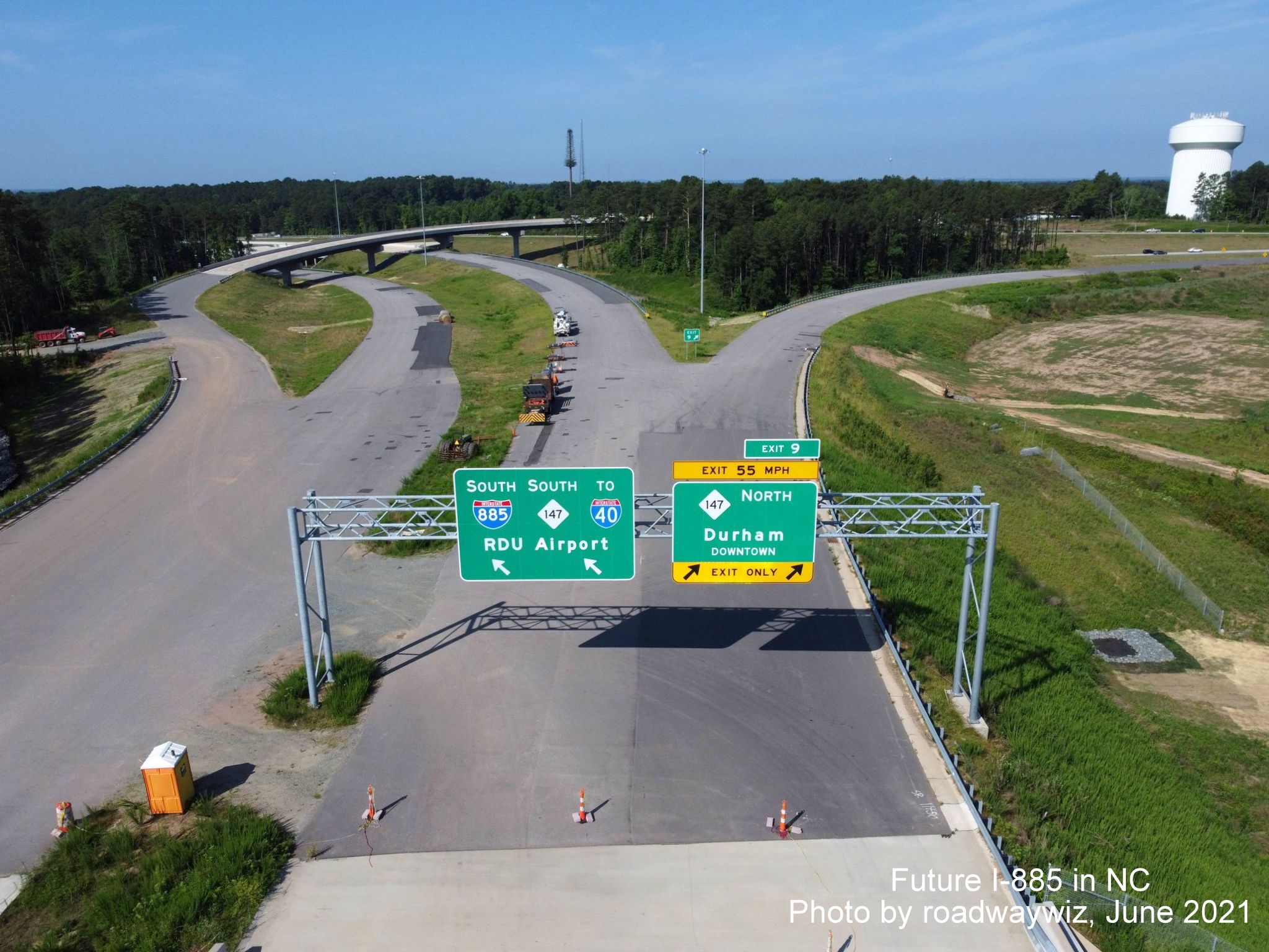
Close up of the
exit and pull through signage at the Durham Freeway interchange. Same
problem with the NC 147 shield on the pull through. The NC 147 North
ramp has a 55 MPH advisory speed which presumes the Connector will be
signed at 65 MPH.
Heading the other way on Future I-885 North. A closeup of the 1/4 advance and pull through signs for the approaching US 70 exit.
Here's a closeup of the exit and pull through signs at US 70, no problems with the signage in this direction.
Looking beyond the US 70 exit signs, you can see the flyover ramp to I-885 South from US 70 West.
Previous Photos
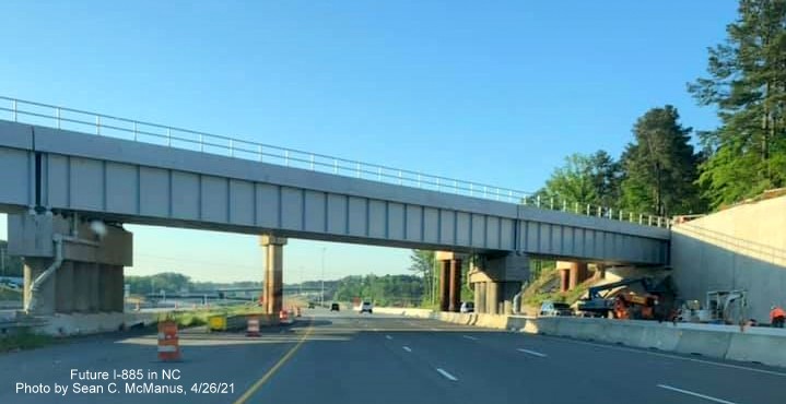
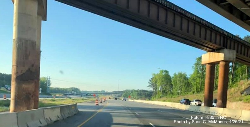
Taken by Sean C. McManus on April 26, 2021:
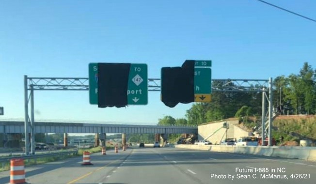
The railroad bridge is nearer to completion behind the covered over Future I-885 East End Connector signage on US 70 East.
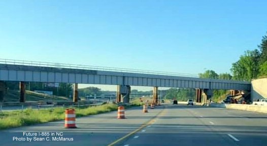
A closer view
of the railroad bridge. Will it take until December now for this to be
completed and the temporary bridge demolished?
Approaching the
new railroad bridge with the old bridge and its supports in the future
roadway.
A closer view
of the temporary bridge. Construction vehicles in place but little
sign of actual work going on.
Previous Photos
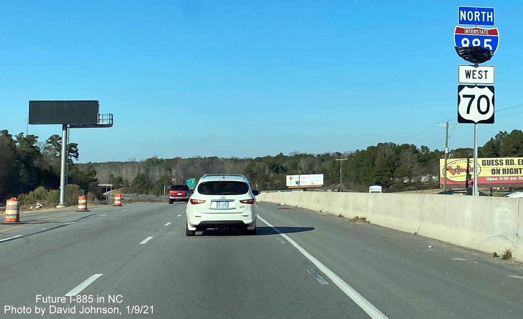
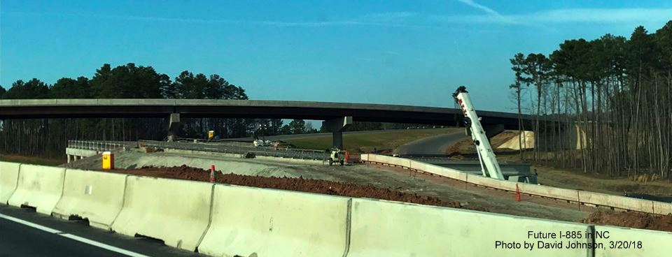
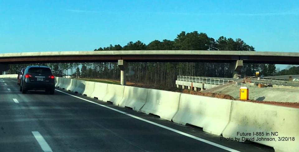
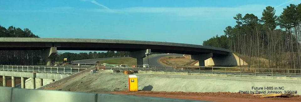
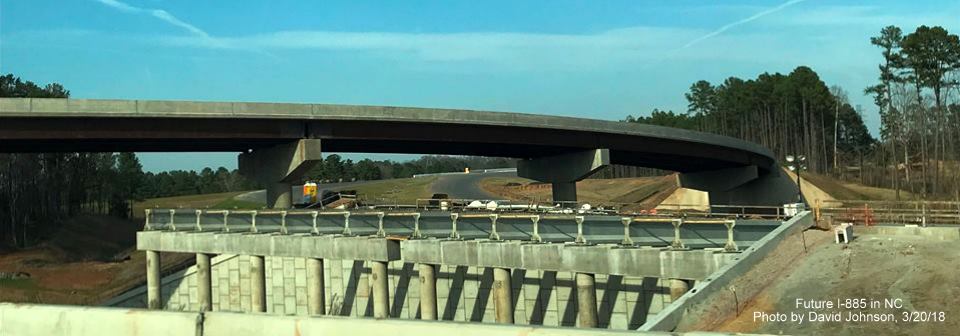
Taken by David Johnson on January 9:
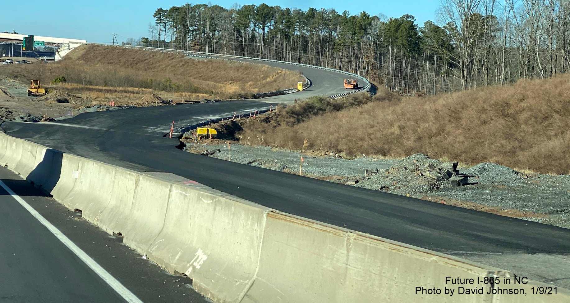
Recently paved roadway to connect US 70 West to flyover that will carry traffic to I-885 South.
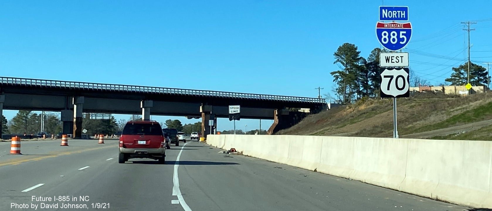
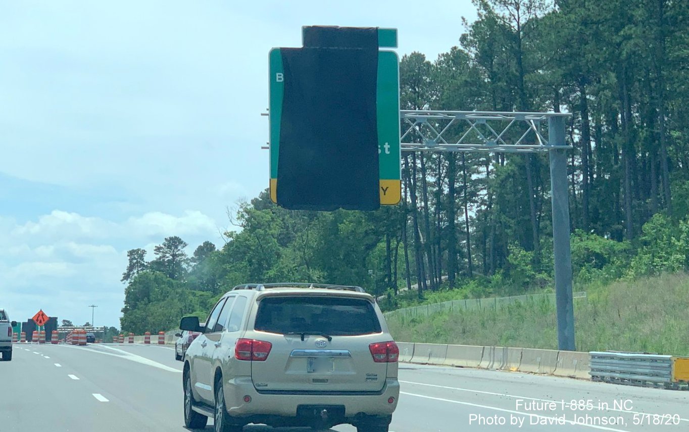
This reassurance marker pair was recently placed prior to the railroad bridge, whose construction is delaying the actual opening of I-885, apparently the I-885 shield was covered over later, in early February.
This reassurance marker pair also went up after the Business 70/NC 98 exit, it appears here that the first attempt to cover over the I-885 shield was only partially successful.
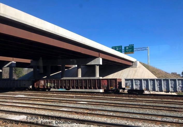
Taken by Andrew B. Futrell showing signage along the unopened East End Connector after bridge over railroad tracks heading toward the US 70 interchange in December 2020:
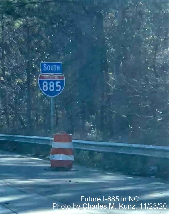
Taken by
Charles M. Kunz on November 23, 2020. Jumping the gun? This South
I-885 reassurance marker has appeared between the future East End
Connector interchange and the Ellis Road exit. Is this supposed to be
covered up?
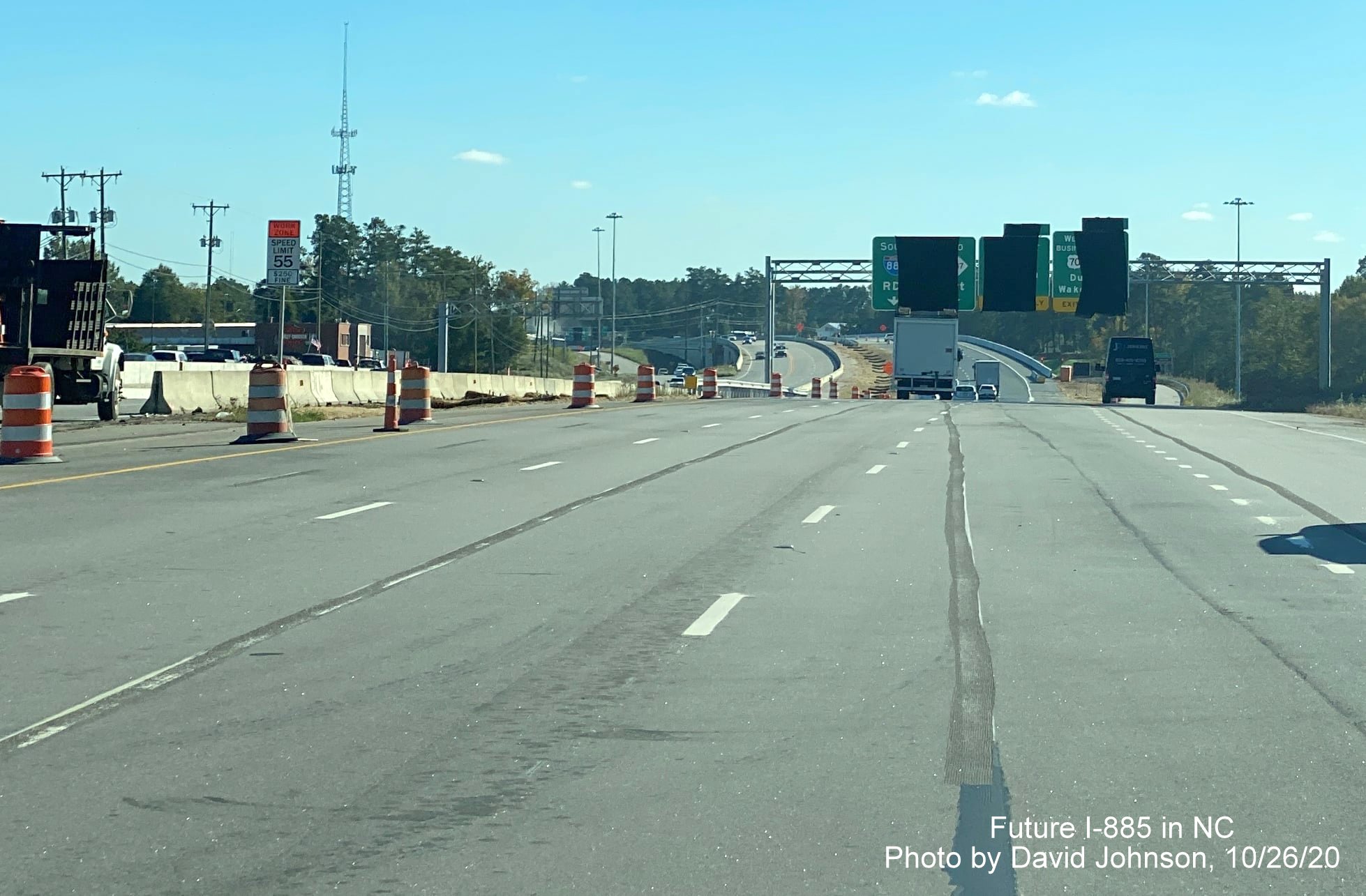
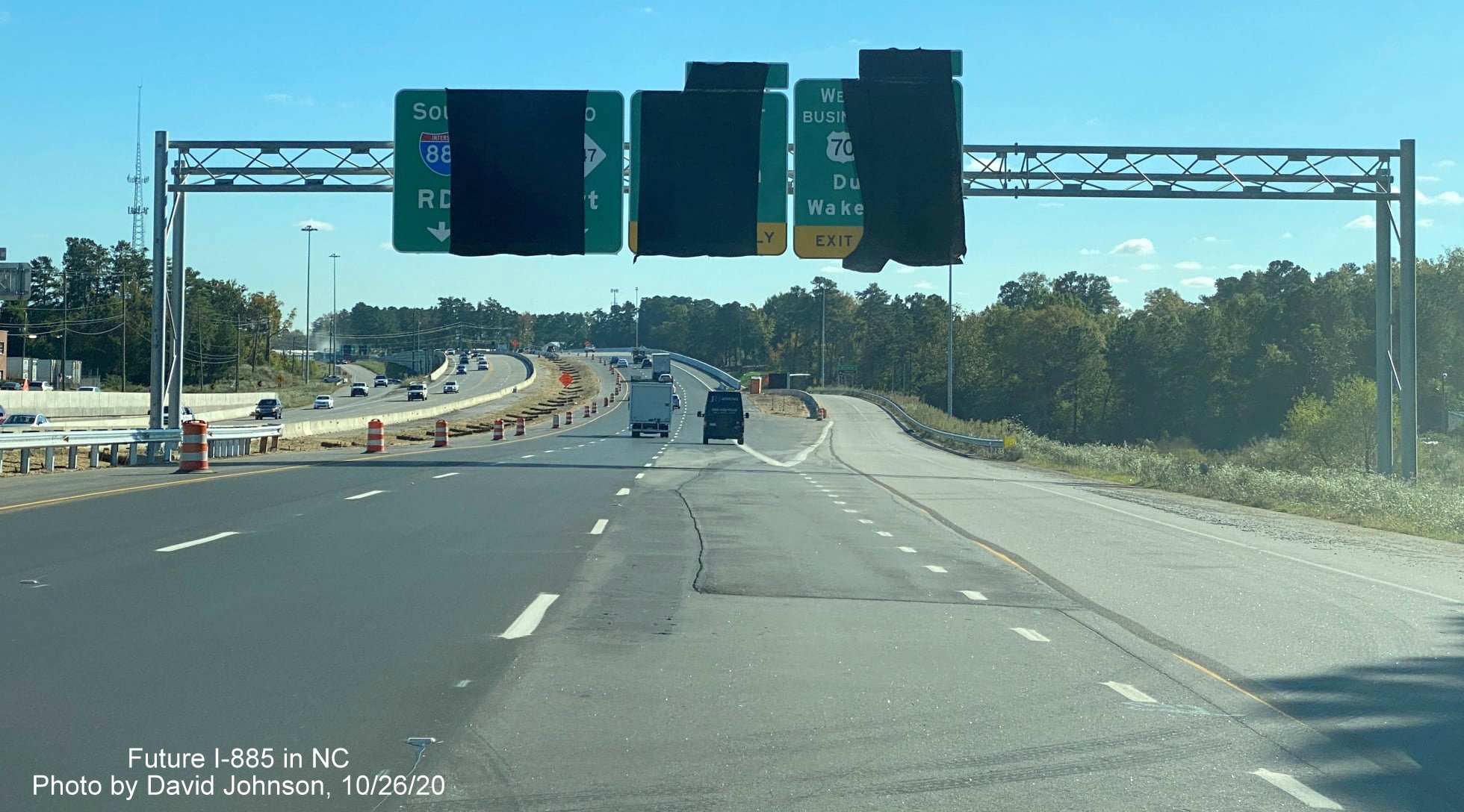
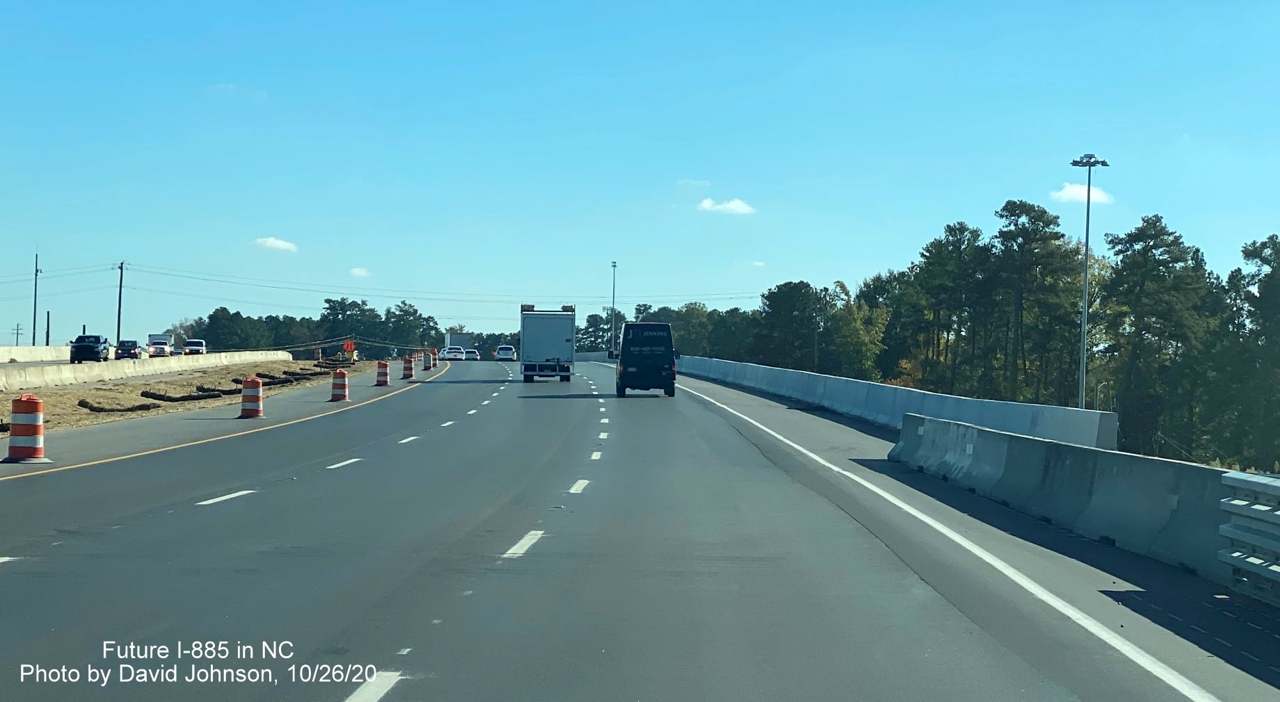
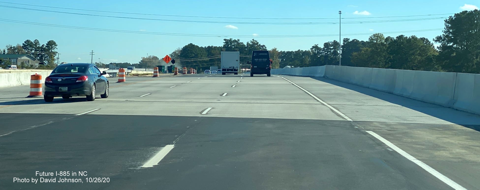
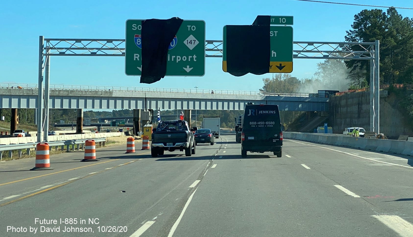
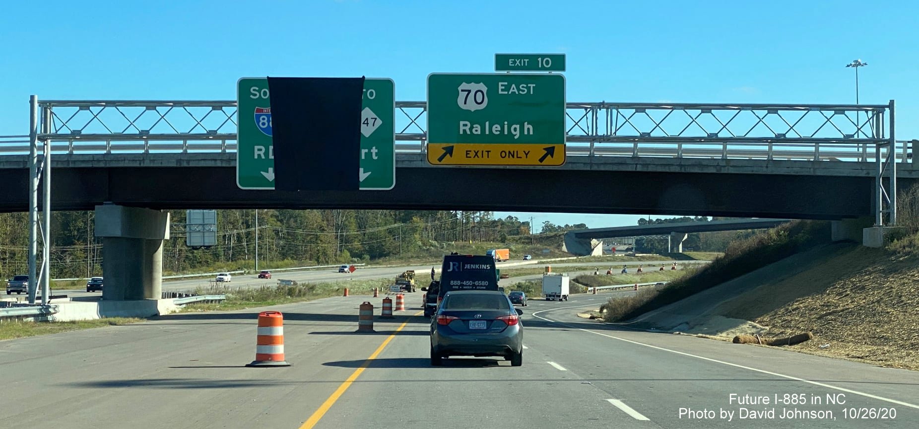
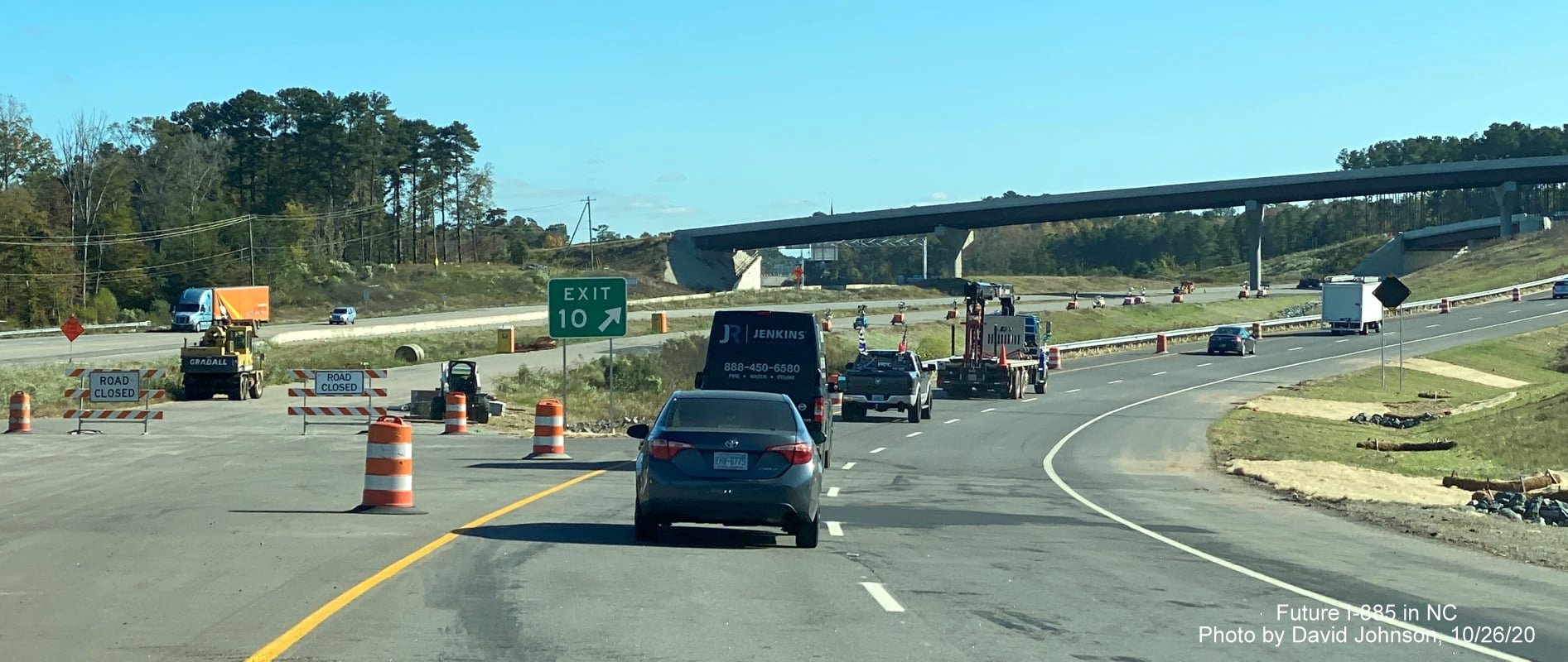
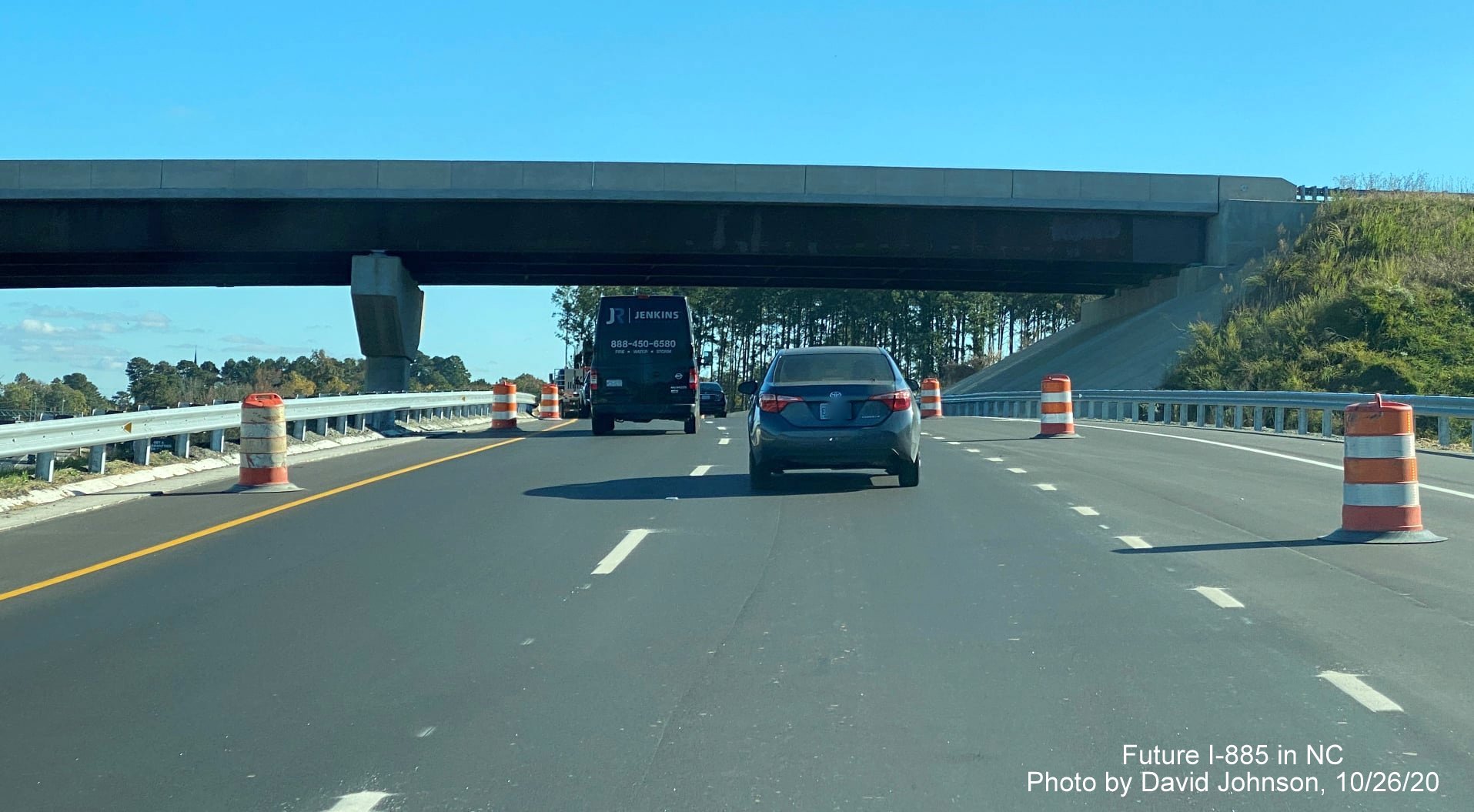
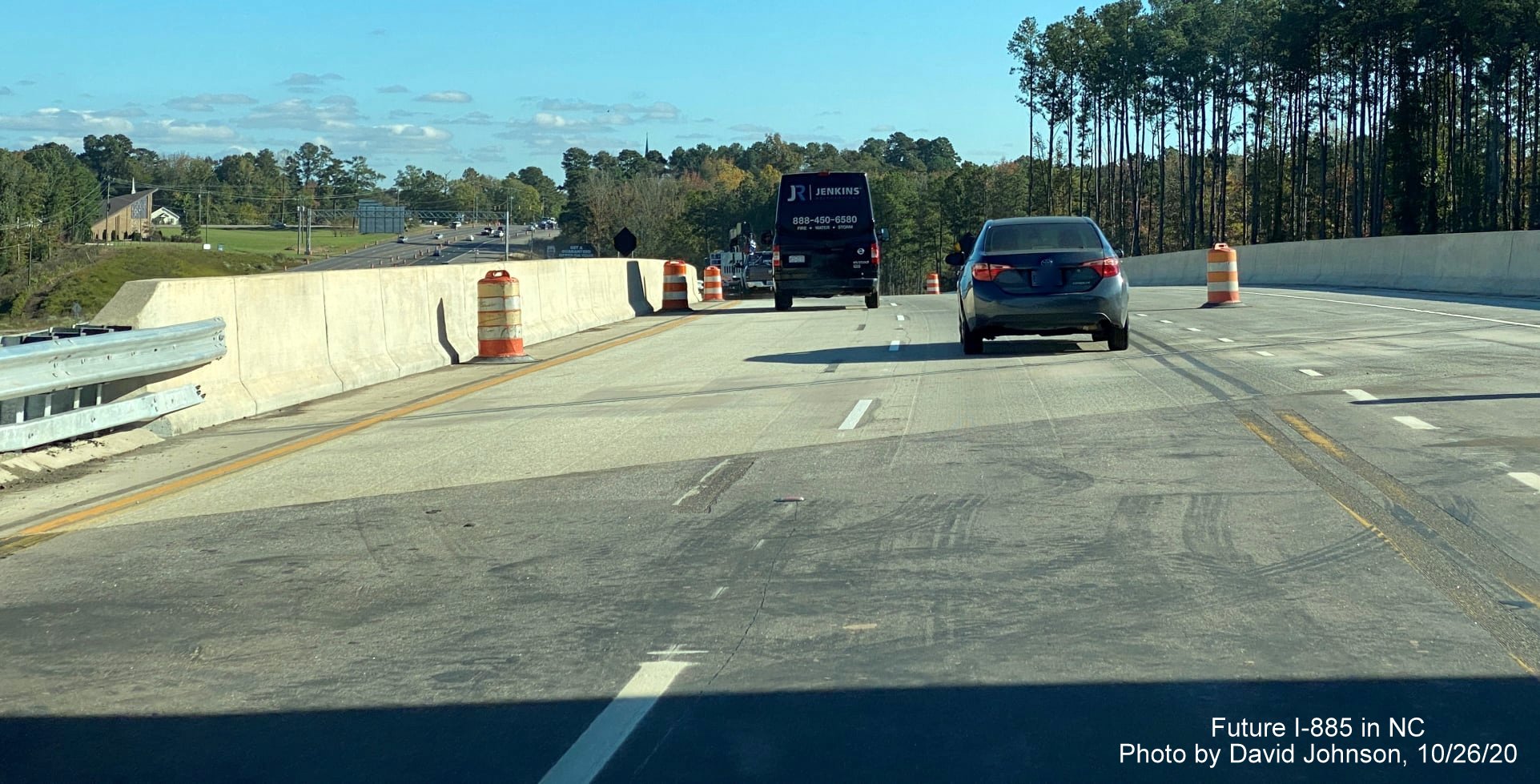
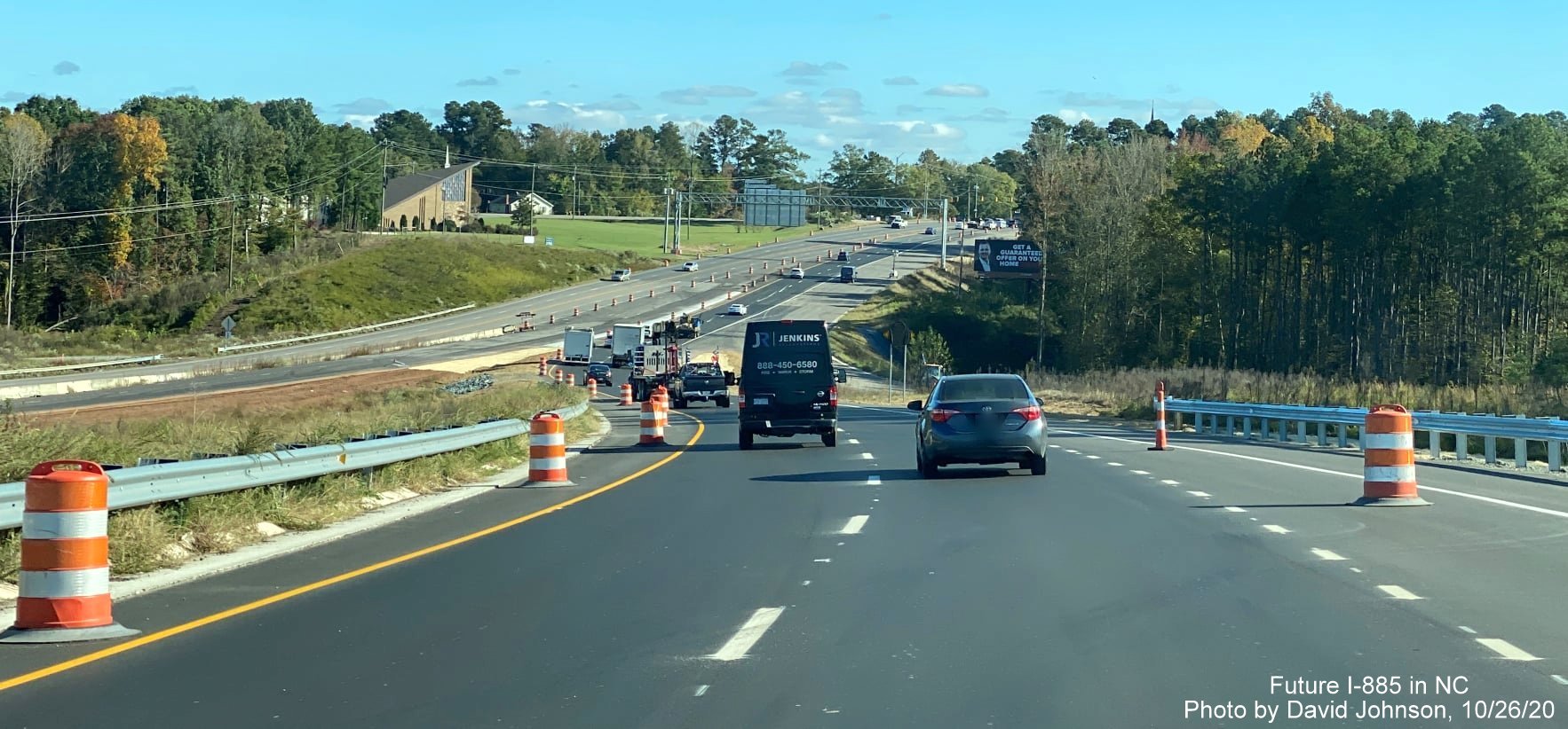
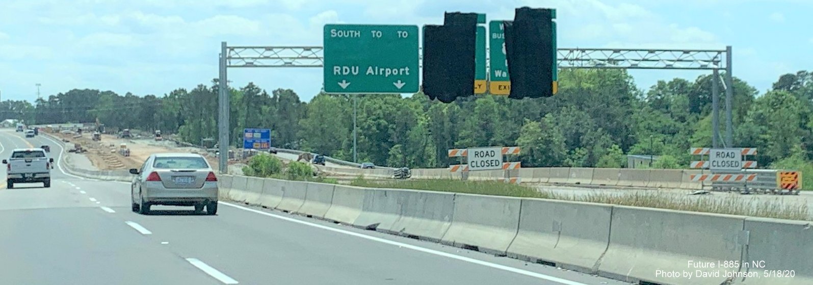
Taken by David Johnson on October 26, 2020 along US 70 West

Widening work along US 70 has been completed east of the Lynn Road intersection.
The partially covered up new overhead signs for the future US 70 West / I-885 East End Connector interchange prior to Lynn Road.
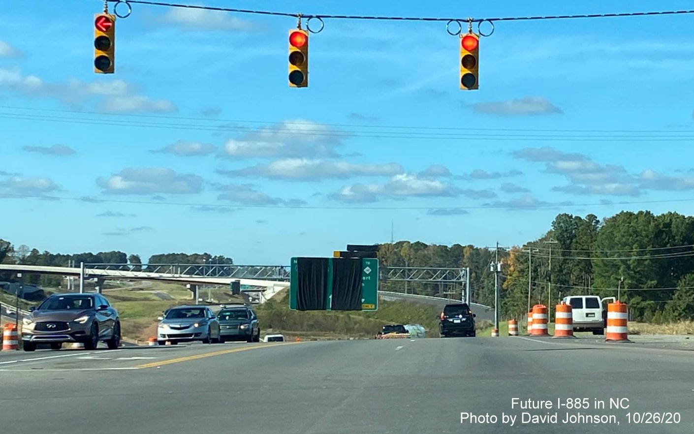
The future flyover ramp from US 70 East to I-885 South can be seen on the other side of the Lynn Road intersection.
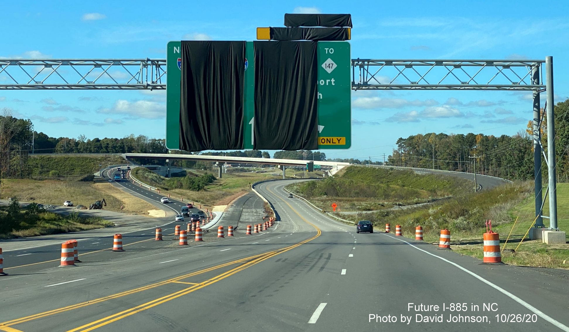
The new overhead sign ahead of the future ramp to I-885 South, US 70 East traffic now moved to its permanent alignment using the exit ramp from I-885 South on the other side of the interchange.
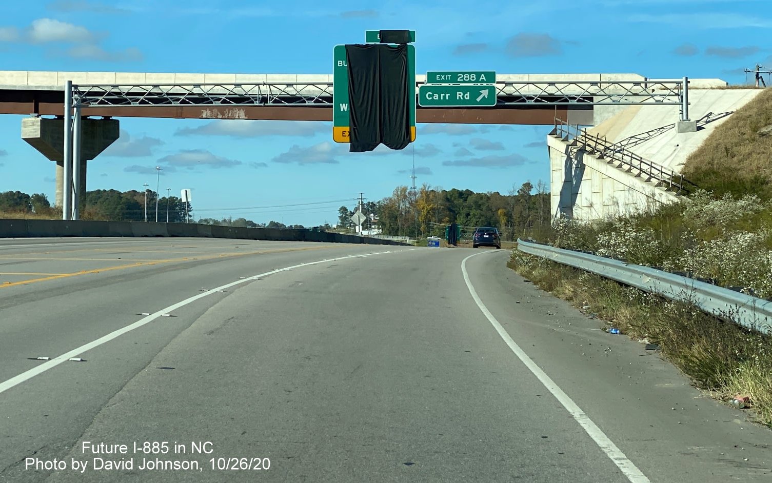
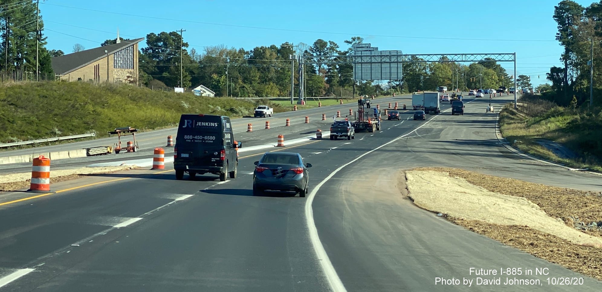
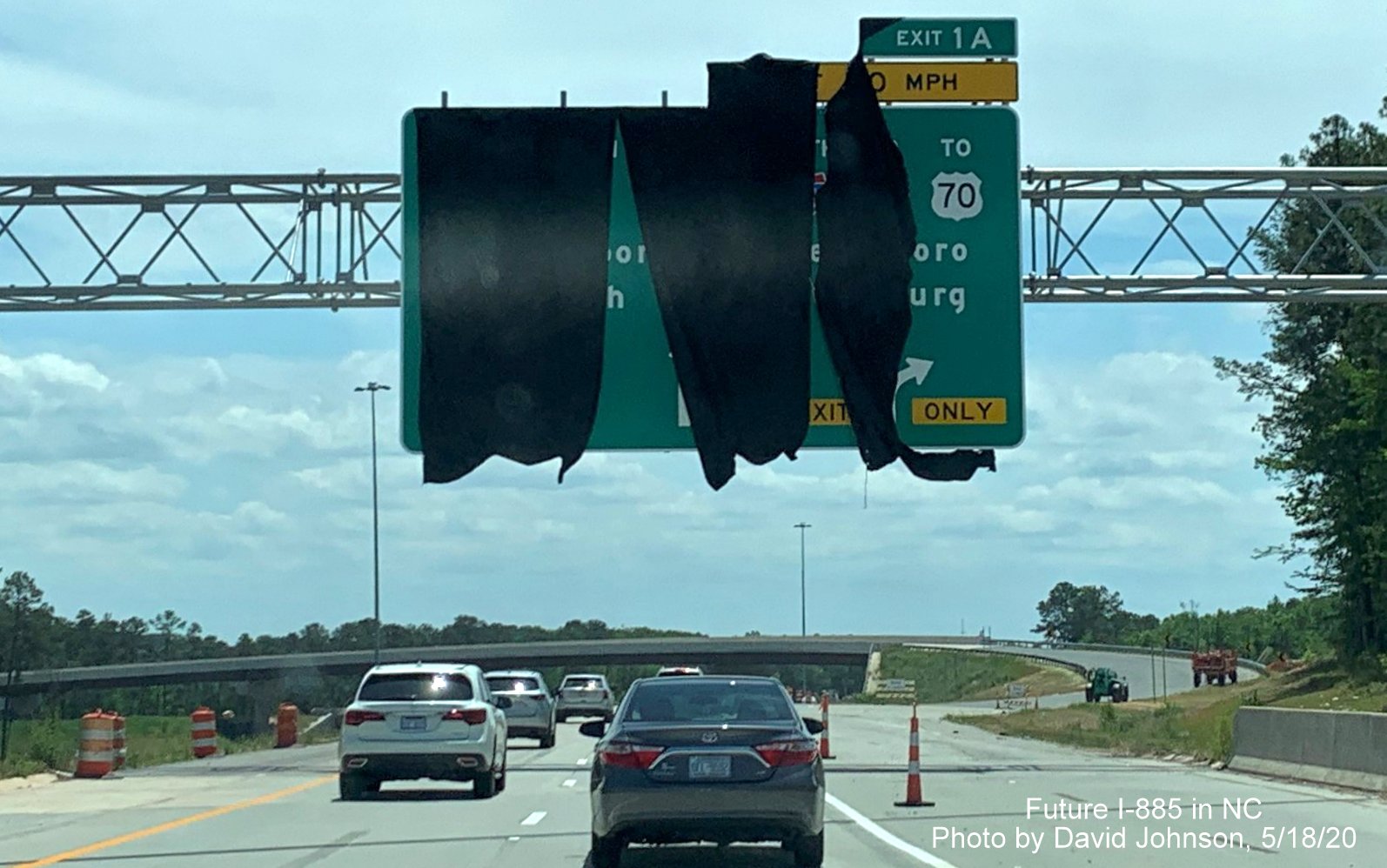
New overhead signs put up, uncovered for Carr Road, and covered for the Business 70/NC 98 exit, which will be Exit 11 on I-885 North (I-885 South being Exit 288B).
Along US 70 East (Future I-885 South)
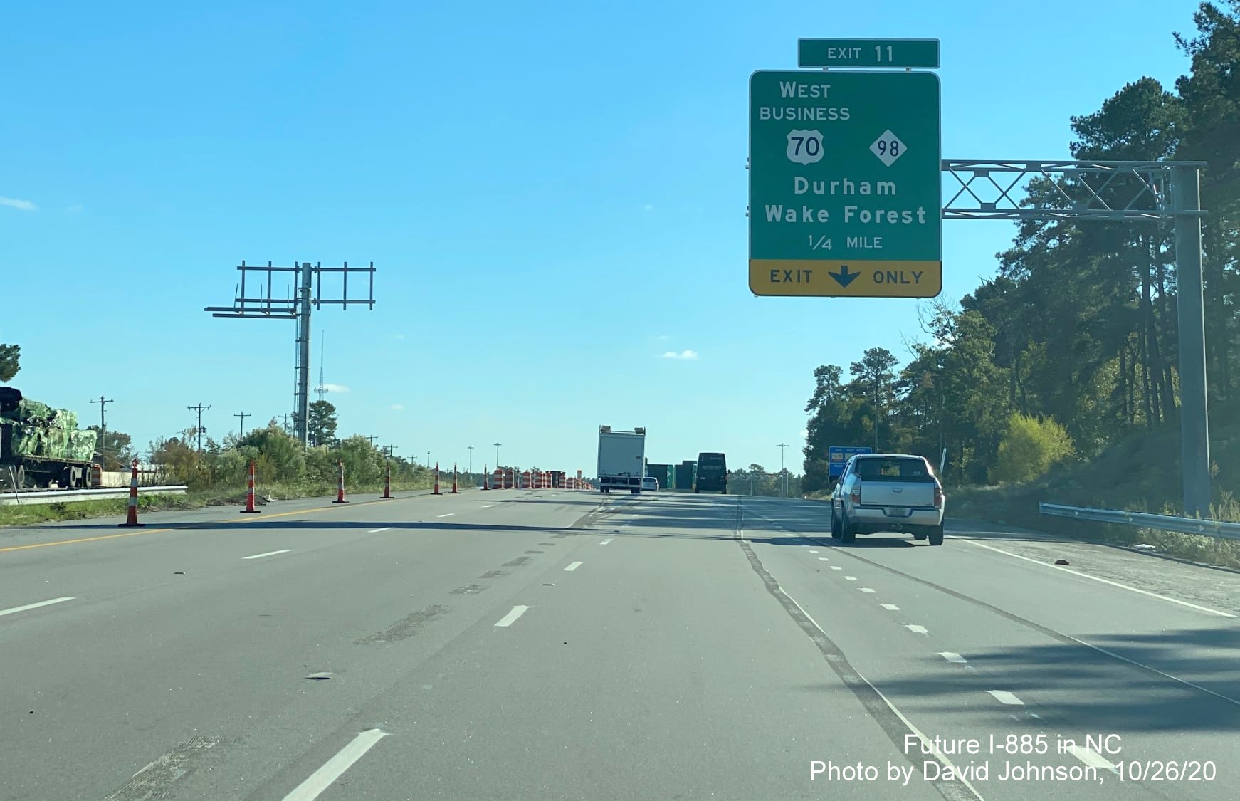
The 1/4 mile advance sign for the East Business 70/NC 98 exit has the future I-885 exit number, 11.
US 70 traffic now using permanent alignment of future I-885 South lanes just prior to Business 70/NC 98 exit (whose exit sign is still covered up, despite being open).
A closer look at the overhead signs at the Business 70/NC 98 exit, the sign in the middle is for the US 70 East exit off of Future I-885 South.
Driving the newly opened US 70 East (future I-885 South) lanes approaching the bridge over Business 70/NC 98.
Crossing over the newly opened bridge over Business 70/NC 98.
Covered over pull through and advance signs approaching the newly opened ramp that will carry US 70 East traffic at the East End Connector interchange. Coverings still allow you to see the I-885 exit number, 10 and that the pull through is South I-885 to I-40, NC 147 RDU Airport.
Traffic alignment of lanes heading under Carr Road bridge now changed to use opened US 70 East exit ramp.
US 70 East traffic heading onto future I-885 South exit ramp at East End Connector interchange.
Traffic on the US 70 East ramp heading under future flyover ramp from US 70 West to I-885 South.
Traffic now heading across bridge over future I-885 North lanes in East End Connector interchange.
US 70 East traffic traveling down hill towards former alignment.
US 70 East lanes approaching future ramp from I-885 North heading toward the southern end of the East End Connector work zone.
EARLIER PHOTOS
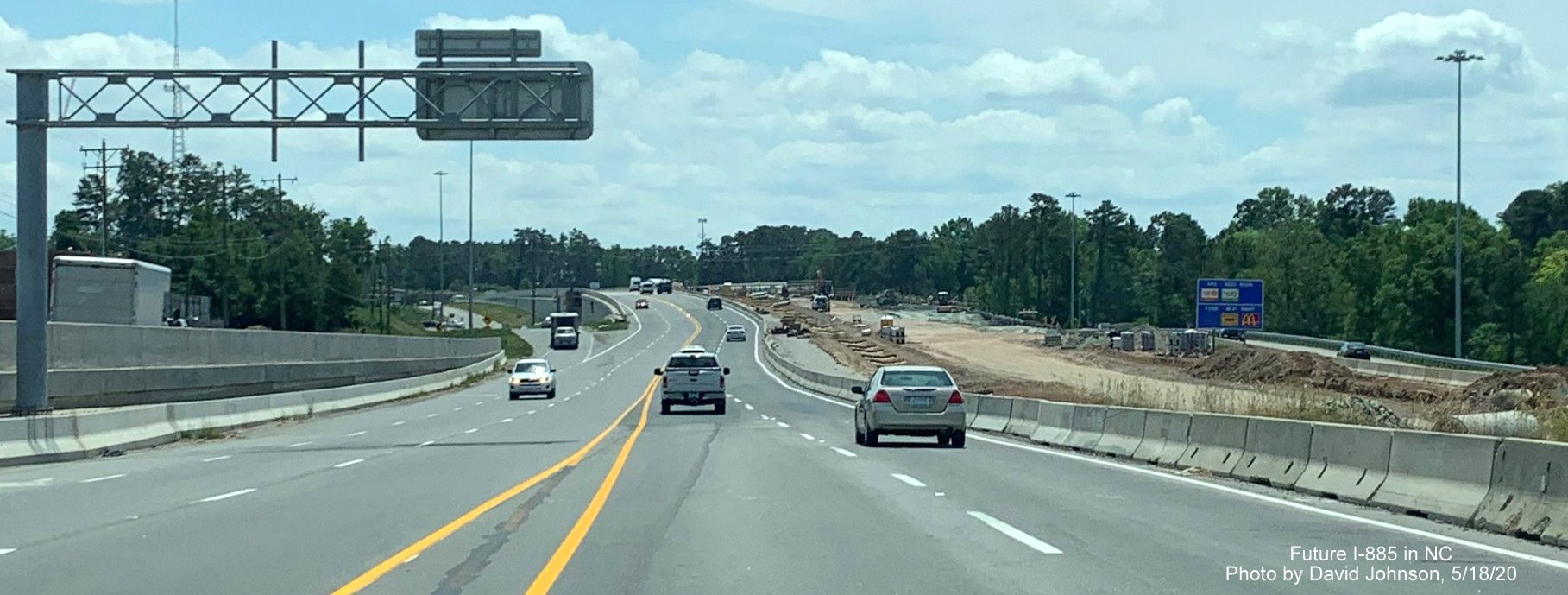
Taken by David Johnson on May 18, 2020
Along NC 147 South
These overhead signs were put up in early May 2020, the left is for I-885 North and the correct exit number, 1A, can be partially seen. The exit tab for the Briggs Avenue exit is covered up because it should have the future NC 147 exit number 1B.
Another view of the earlier placed 1/4 mile advance sign for the I-885 South exit. Wind has apparently helped reveal more of the sign including all of the I-885 shield and that this sign has the now outdated Exit 9 listed.
The new sign placed at the future ramp to the I-885 North/East End Connector. The uncovered exit tab shows the correct future exit number, 1A. It may also be, that unlike the 1/4 mile advance, there are only 2 route shields on the left side of the sign.
US 70 East
The covered over newly placed overhead sign for the now open Business US 70/NC 98 exit on Future I-885 South.
Shields have still not been placed on the pull through signs along the future I-885 South lanes at the new bridge over Business US 70/NC 98 and grading work continues.
Work continues in constructing the future I-885 South lanes as seen from current US 70 East using the future I-885 North lanes. This may be the last significant piece of construction needed to be completed for the project to be completed.
Taken by Charles M. Kunz along US 70 on April 24, 2020:
Newly installed overheads on future I-885 South lanes with missing I-885, NC 147 and I-40 shields, and covered over signs for US 70 East and Business 70 West/NC 98 exits as seen from current US 70 East lanes using future I-885 North lanes.
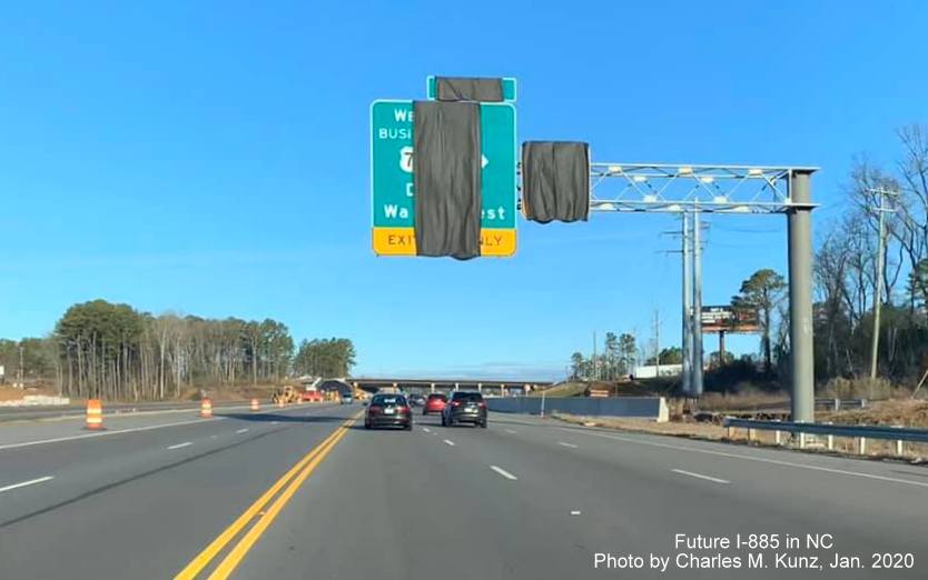
Photo from January showing new covered overhead sign on US 70 West for future West Business 70/NC 98 exit.
Taken by David Johnson along NC 147 South on April 2, 2020 showing new signage in that direction:
This overhead gantry was put up in early April and will have signage approaching the ramp to I-885 North from NC 147 South.
The 1/2 mile
advance overhead seen in the traffic camera image above. It would
appear that the contractor has installed signs from the original
plans, since you can see an '9' on the tab, this was to be Exit 9, but
with the decision to truncate NC 147 at I-885, this should be Exit 1A.
Also the spacing of the shields on the left side of the sign (South
I-885 is seen, I-40 on the right is mostly covered up) implies that
there are 3 shields, the old plan had South NC 147 in the middle.
The nearly completed future ramp from NC 147 South to the East End Connector, I-885 North.
The other overhead sign seen from behind by the traffic camera is this yellow advisory sign that may read "Merging Traffic 2 Left Lanes' referring to the I-885 South lanes ahead.
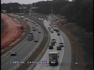
Another new pair of overhead signs has been installed southbound prior to the Glover Road bridge, the right one is probably about the right lane ending ahead, perhaps the other is a South I-885 pull through.
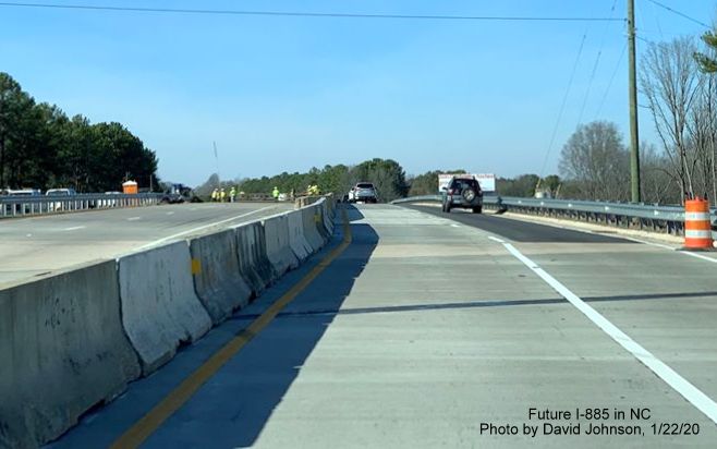
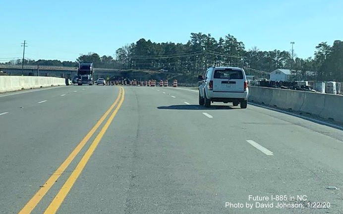
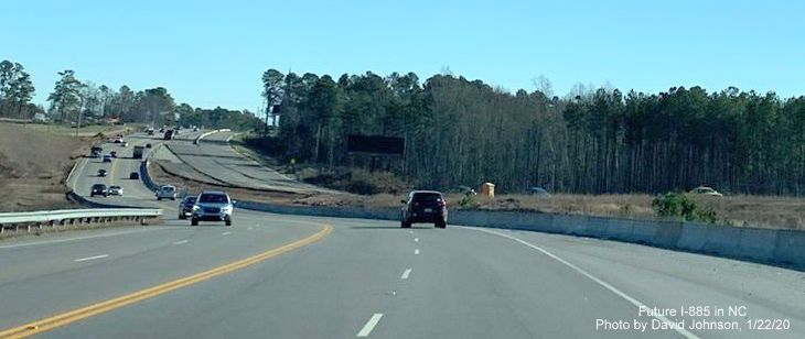
Taken by David Johnson along NC 147 on January 22, 2020 showing new signage and completed southbound roadwork shown in traffic camera images above:
The new 1/4 mile advance sign put up in the media prior to the future I-885/NC 147 split. Southbound traffic using recently completed lanes, restricted to 2 lanes by traffic barrels.
It appears the future I-885 lanes heading off to the right are mostly complete, and only partially blocked off.
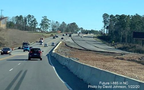
NC 147 North traffic heading under support structure for Future I-885 South roadway from the East End Connector.
Traffic north of the East End Connector interchange still has to shift to the right around continued widened railroad bridge construction.
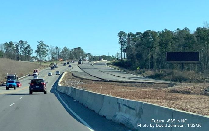
The new 1/2 mile advance sign for the Briggs Avenue exit, with the future Exit 1 tab, has now been partially covered by a tarp.
Work has mostly been completed along future left lanes of NC 147 North prior to the railroad bridge.
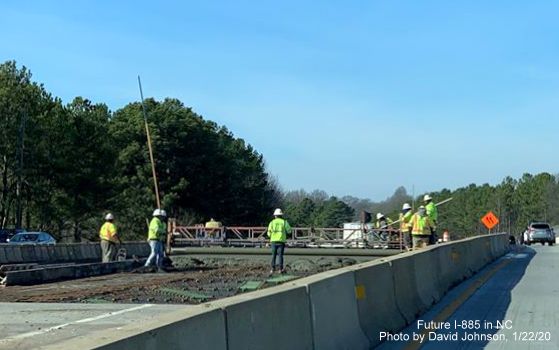
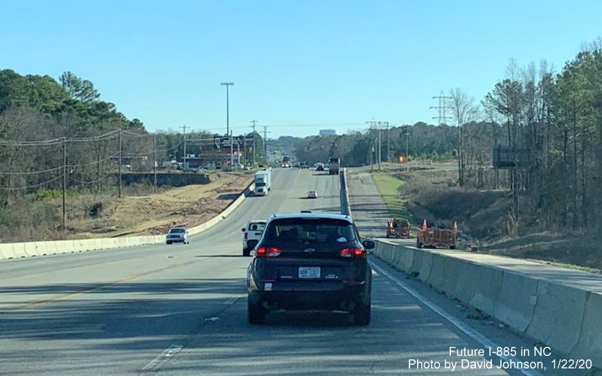
Workers in closed off left lanes of NC 147 placing new concrete on railroad bridge.
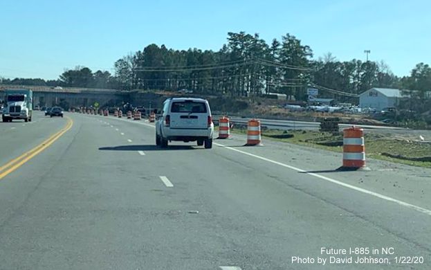
Photos by David Johnson along US 70 East on January 22, 2020:
New sign support awaits Bus. 70/NC 98 exit sign at new off-ramp from US 70 East (Future I-885 South) at start of project work zone.
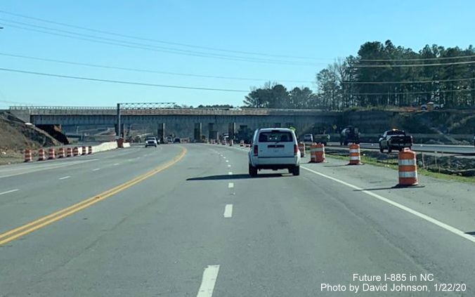
Closeup view of the exit ramp, US 70 East traffic moves over to Future I-885 North lanes over the hill.
Traffic on US 70 East moved over to future I-885 North lanes after crossing bridge over NC 98.
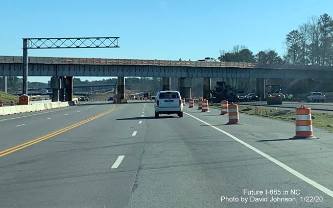
Grading still continues for Future I-885 South lanes south of the Business 70/NC 98 exit, on-ramp traffic can be seen on the right.
Temporary exit ramp to Future I-885 South/US 70 East continues across construction area from US 70 traffic south of NC 98/Bus. 70.
US 70 East traffic continues using Future I-885 North lanes headed toward new railroad bridge being constructed prior to the East End Connector interchange.
The future I-885 South lanes are paved approaching site of the new railroad bridge.
A gantry for a future advance sign for the US 70 Business/NC 98 exit has been placed just to the north of the new railroad bridge.
Approaching the new railroad bridge, work is proceeding on paving the Future I-885 South lanes in the vicinity.
Traveling under the new railroad bridge, with the temporary one just behind it.
Traveling under the soon to be removed temporary railroad bridge with the East End Connector interchange in the distance.
US 70 East traffic still in Future I-885 North lanes, future south lanes paved and sign gantries in place.
Signs up and uncovered for future split of I-885 South and US 70 East approaching the East End Connector interchange.
Closer view of the new signage including an I-885 shield, though not officially approved by AASHTO.
Work continues on Future I-885 South lanes approaching the East End Connector interchange.
Concrete barrier at end of future North I-885 lanes merging with US 70 West within the East End Connector interchange.
Looking down paved future I-885 North lanes approaching US 70 lanes in East End Connector interchange.
US 70 lanes south of the future East End Connector interchange, future US 70 East lanes now paved in the distance.
Heading toward future end of US 70 freeway showing work continues in building future US 70 East lanes.
Closer view of still incomplete future southern end of US 70 freeway.
Work continues
to widen US 70 at the southern end of the East End Connector project
work zone.
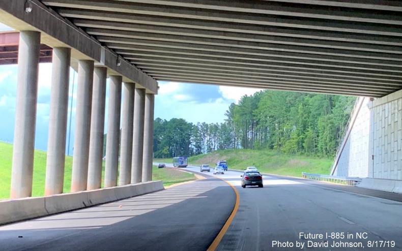
Photos Taken by David Johnson on August 17, 2019
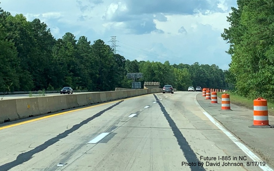
Traffic no longer crosses over at the southern end of the Project work zone.
Driving the new northbound lanes.
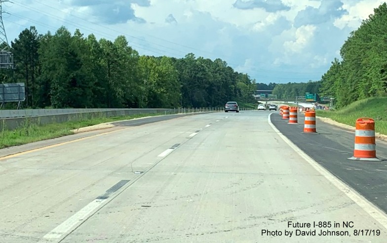
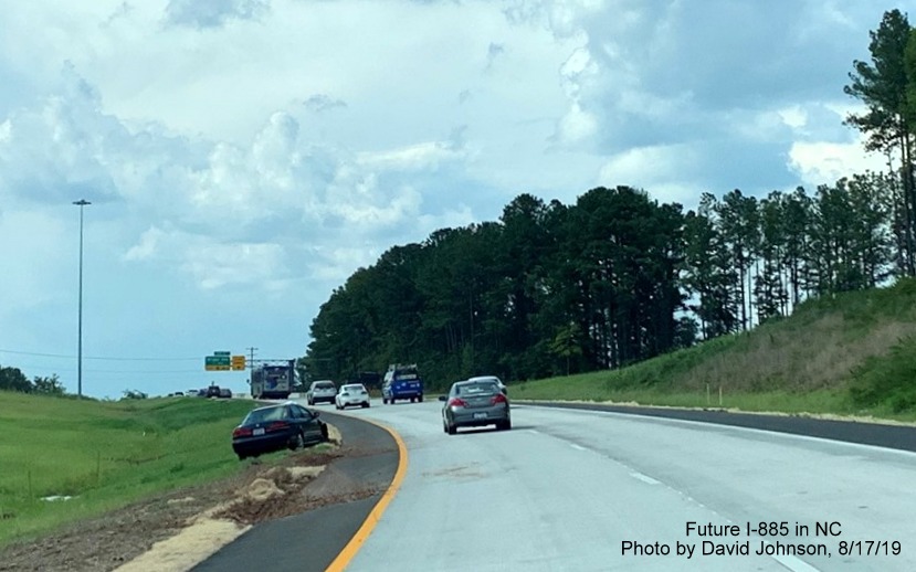
Future third lane of NC 147 North currently blocked off by yellow line.

Closeup of the new 1/2 mile advance signage from the new northbound lanes.
New NC 147 North lanes approaching the future I-885 split.
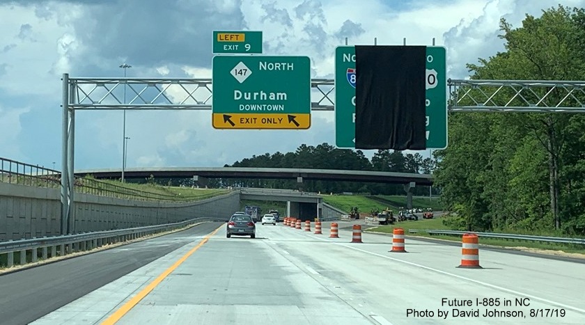
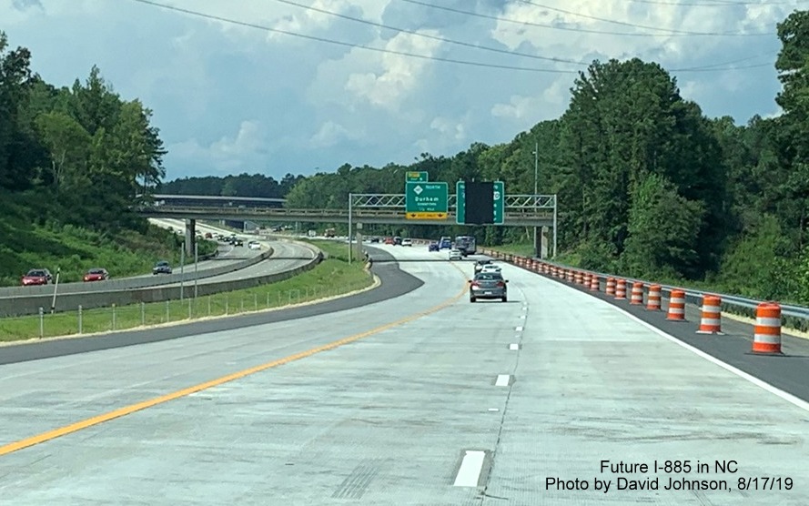
Closeup of overhead signage at future ramp for I-885 North on new NC 147 North lanes, traffic moved over to the left lanes.
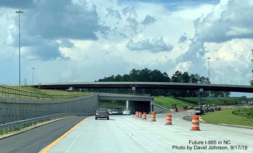
Construction equipment is apparently being stored in the future I-885 lanes at the East End Connector interchange.
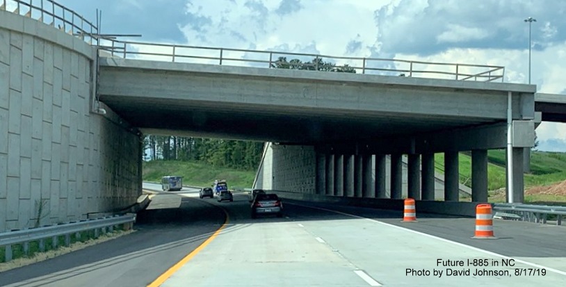
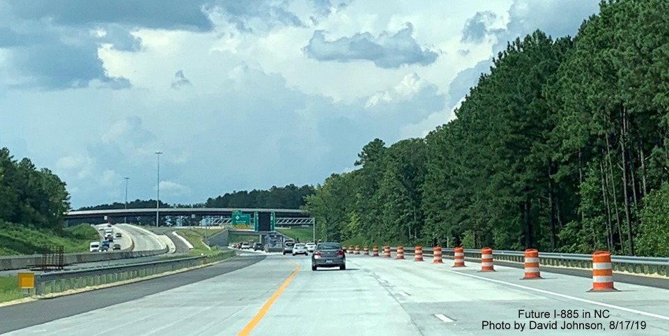
About to head under the ramp that will carry Future I-885 South traffic to the Durham Freeway.
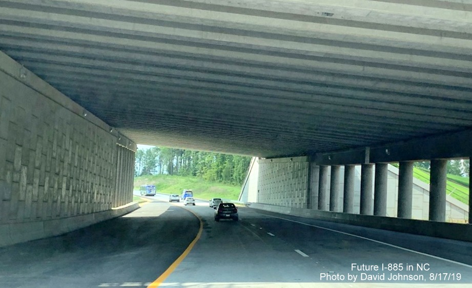
Driving under the Future I-885 South lanes.
The light at the end of the tunnel, or I guess underpass, in the East End Connector interchange.
The new lanes continue up to the future on-ramp from I-885 South.
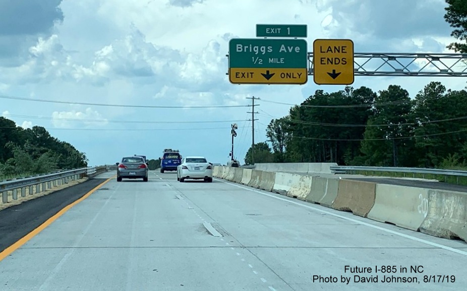
At present the exit only tab for the Briggs Avenue exit points to the closed third lane just after merging with the future I-885 South on-ramp (exit number still has not been corrected, should be 10). [Update-based on new information above, this is correct, though could be signed as 1B.]
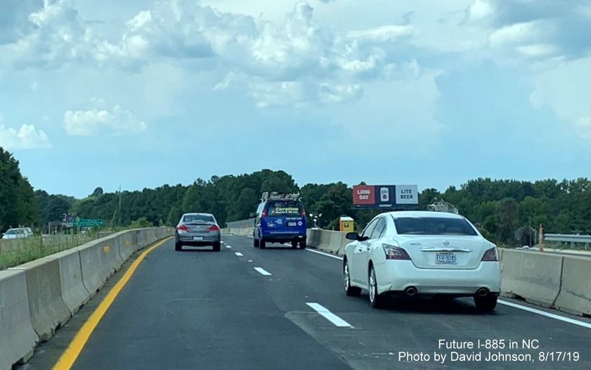
More work is still needed where new NC 147 lanes meet the old alignment at the railroad bridge prior to Briggs Avenue.
View of conditions at the end of the East End Connector Project work zone prior to the Briggs Avenue exit.
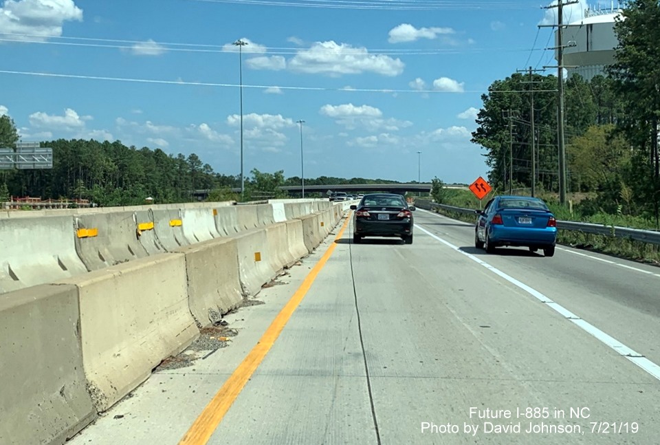
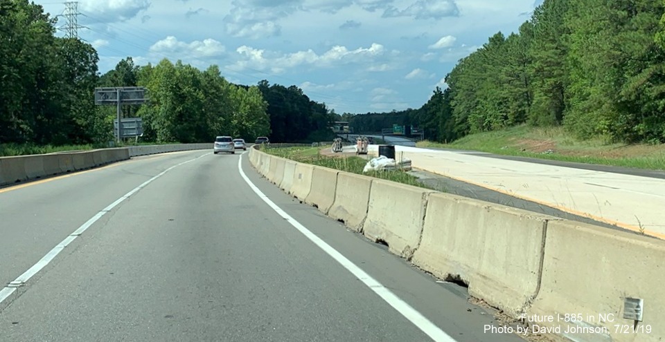
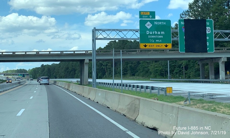
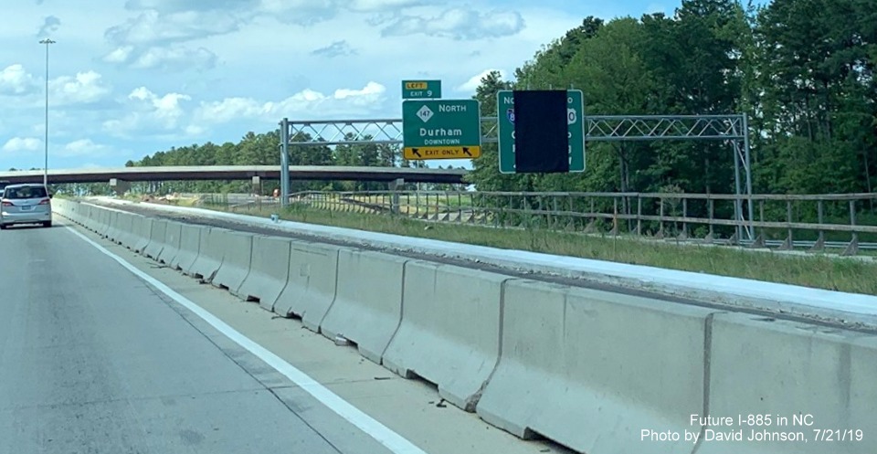
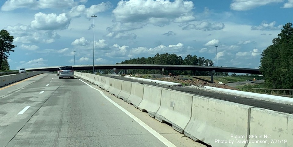
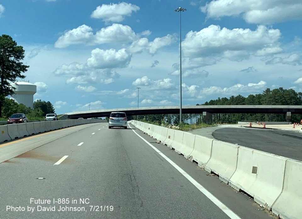
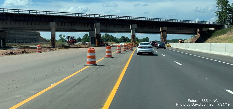
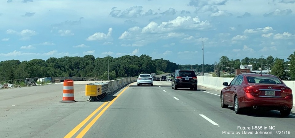
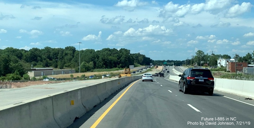
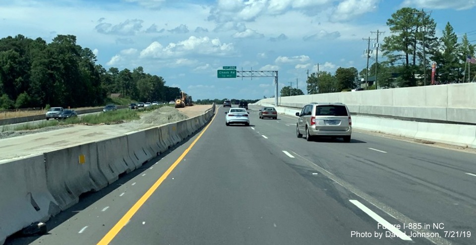
Taken by David Johnson on July 21, 2019
Western end (NC 147)
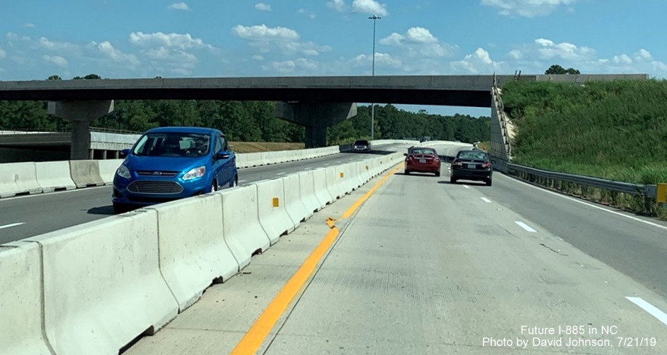
Traffic entering the East End Connector work zone on NC 147 South, future flyover ramp to I-885 North in distance.

Passing by the future ramp to I-885 North. Notice the ramp has not been paved as of yet.
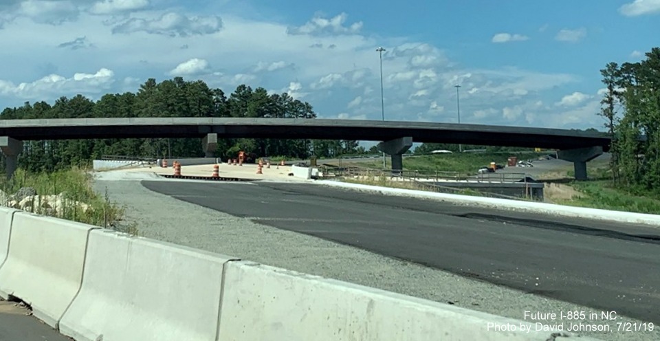
Traffic passing under the completed flyover ramp. Northbound traffic using southbound lanes still temporarily. Permanent NC 147 North lanes are supposed to be opened this month. Switching directions...
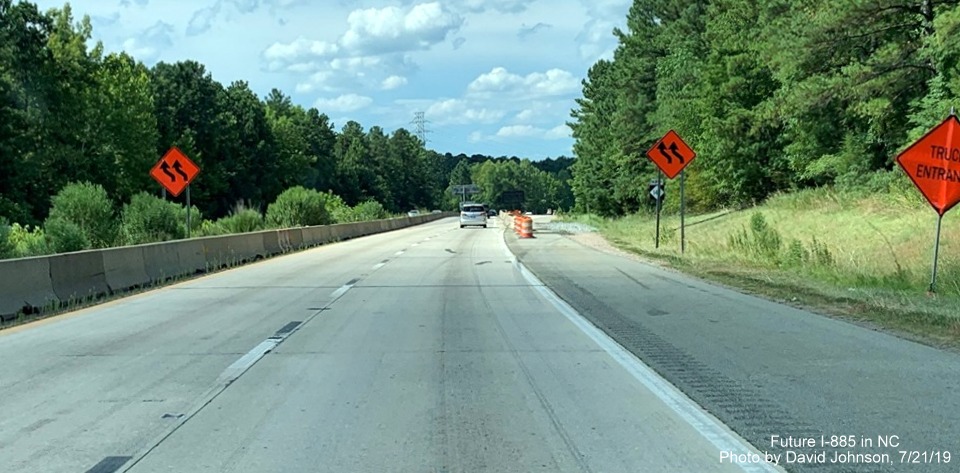
The start of the work zone for the East End Connector project on NC 147 North.
NC 147 North traffic shifting to temporary lanes prior to the East End Connector interchange. Work is still ongoing to transition the old alignment to the new lanes.
The future I-885/NC 147 North lanes appear close to completion but are still missing some lane markings.
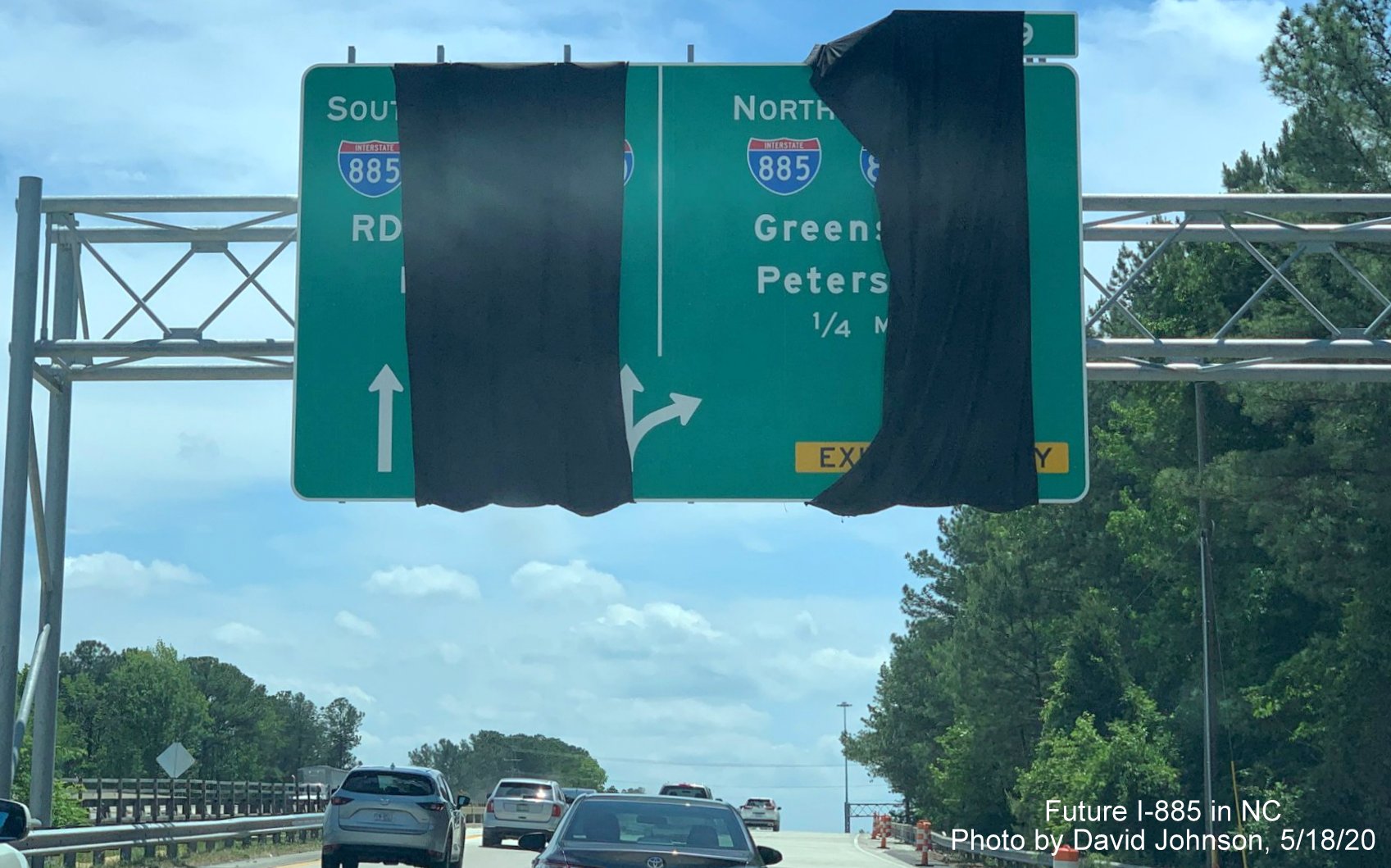
Closeup view of the 1/2 mile advance sign for NC 147 North and the covered over I-885 North to US 70, I-85 pull through sign. The control cities hidden are Greensboro and Petersburg.
Closeup of the exit signs at the future NC 147 North exit ramp. Will future traffic reporters refer to this as the I-885/NC 147 Split? Work is near completion beyond the barrier for the future South I-885/NC 147 left shoulder.
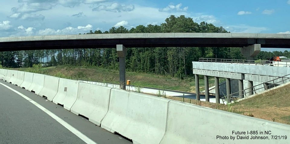
Shoulder work continues back toward future merge between I-885 and NC 147 South beyond the flyover ramp.
View of the future merge area of South NC 147 and I-885 traffic, work on the I-885 ramp bridge continues.
Closer view of the the future I-885 South lanes as they approach NC 147 South.
Support structure for Future I-885 South lanes extends out over Future NC 147 North prior to flyover ramp.
Looking under the flyover ramp toward the future on-ramp to NC 147 from I-885 South.
Nearing the end of the work zone with future NC 147 lanes to the right still needing lane markings.
The overhead exit tab for Briggs Avenue is still missing a 0 (unless NCDOT decided to change the number to 1 after the sign was manufactured?).
Angier Avenue Bridge
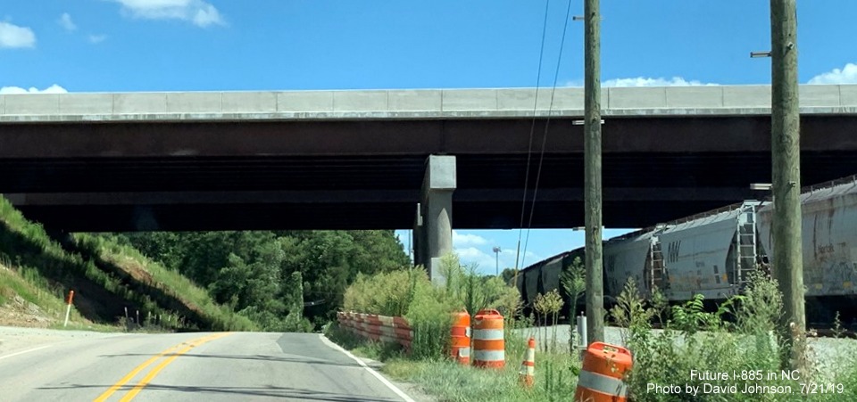
Driving north under the completed Future I-885/East End Connector bridges over Angier Avenue and railroad tracks.
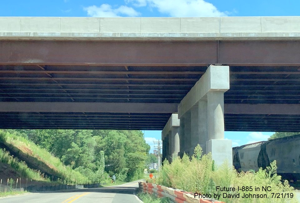
Closeup view of the underside of the two bridges.
East End/US 70
View heading west on US 70 at start of construction zone, not much change in the past month.
Still no progress in tying in future flyover ramp to I-885 South to US 70 lanes, nor grading Future US 70 East lanes to the left.
More work appears needed to complete the flyover ramp as well as build new US 70 East lanes at the I-885 interchange.
A closer look at the flyover ramp, no pavement markings for future temporary US 70 East travel lanes.
Still only 1 temporary exit sign for Carr Road exit seen going under flyover ramp.
Little progress seen on the left in completing the grading of the Future I-885 South/US 70 East lanes approaching the Carr Road bridge.
A better look at the future I-885 South/US 70 East lanes. Portable VMS with information on NC 98 exit.
New railroad bridge can be seen nearing completion behind temporary bridge from US 70 West.

A better look at the new bridge behind the temporary structure. Hopefully the overhead sign gantry beyond the bridge will be moved further north.
Traveling over the bridge at NC 98/Business US 70 along Future I-885 lanes.
Construction work still continues to the left to complete the Future I-885 North lanes in the vicinity of NC 98/Business 70.
Work to grade future I-885 lanes continues at northern end of East End Connector project work zone following the NC 98/Business 70 exit.
Photos taken in late June 2019 by Charles M. Kunz show first new East End Connector signage on NC 147:
The overhead signage installed in mid-June show, partially hidden, the first I-885 shield, though still not officially approved by AASHTO. The exit tab also shows that they have changed the exit number plan since the first sign plans were created, this was to be Exit 4 (see plans below). Apparently having 2 Exit 1s along the Durham Freeway corridor between NC 540 and the Connector was thought to be too confusing, so NC 147 mileage will continue to be used, at least until I-885 splits off toward US 70.

A newly installed 1/2 mile advance sign along the future NC 147 lanes for the Briggs Avenue exit. There appears to be a missing 0 on the exit tab, as the exit number should be 10.
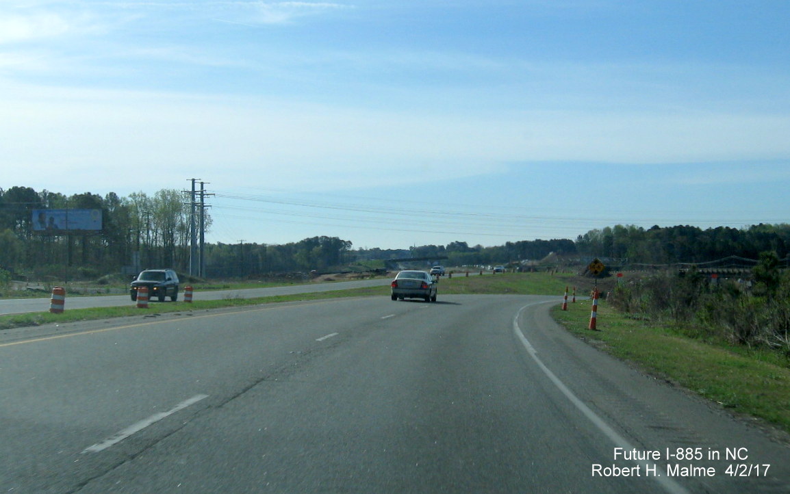
Photos taken in June 2019 by Adam Prince show little progress since April due to the weather along US 70:
Little work has occurred in completing the future US 70 eastbound lanes at the future interchange with I-885, looking west.
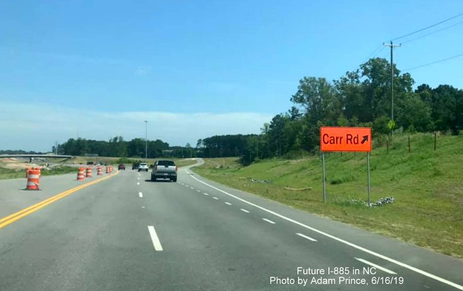
This temporary sign has been put up prior to the off-ramp for the new Carr Road exit on US 70 West.
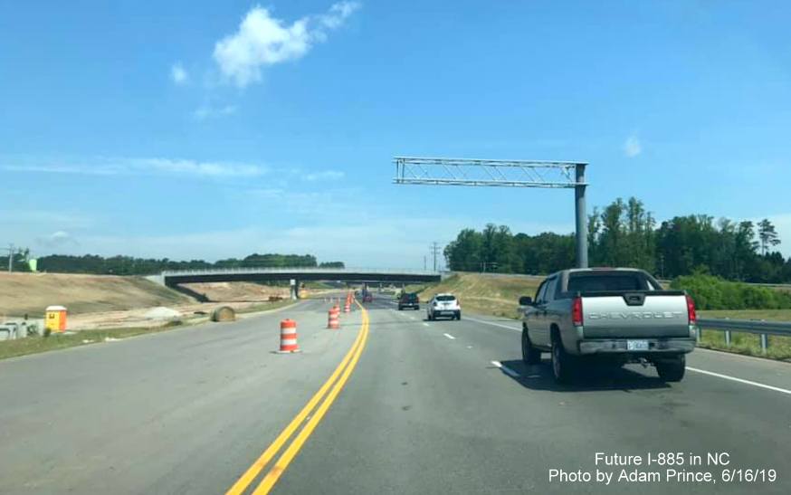
Again, progress on the future I-885 South lanes to the left has not really advanced near the Carr Road bridge since April.
US 70 west traffic traveling under temporary railroad bridge, not much progress seen in building the permanent structure on the other side.
Large cell tower looms over new NC 98 exit off-ramp currently without any permanent signage.
New overhead 1/2 Mile advance sign for Cheek Road exit, blank space on right is presumably for yellow right lane ends sign. Notice lack of progress on completing the road to the left of the concrete barrier.
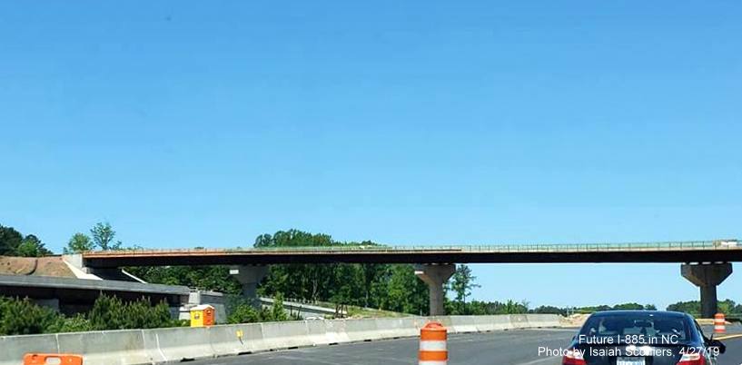
Photos taken in April 2019 by Isaiah Sconiers showing US 70 West moved to permanent alignment earlier in the month:
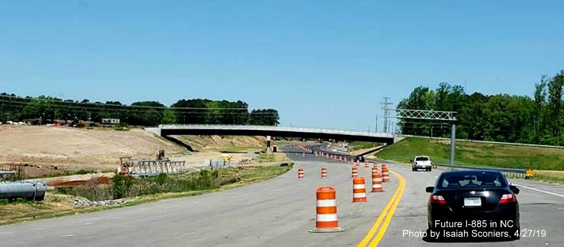
Westbound US 70 traffic at future ramp to I-885 South with nearly completed flyover ramp in distance, eastbound US 70 traffic to also be shifted to future US 70 West lanes in near future.
Closeup view of flyover ramp, current US 70 will serve as a service road going underneath flyover on left.
One new exit sign gantry is up prior to Carr Road bridge while others await placement in future US 70 East lanes.
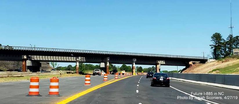
US 70 traffic heads under temporary railroad bridge with support posts now in path of roadway.
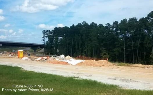
Photos taken in late August 2018 at the NC 147 interchange by Adam Prince:
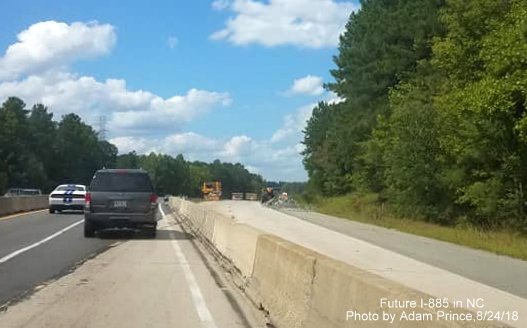
Traffic on NC 147 North using temporary cross over to southbound lanes prior to future East End Connector interchange.
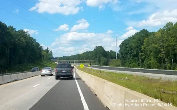
Future I-885/NC 147 lanes currently share northbound traffic while future northbound lanes are widened and reconstructed ahead of Future I-885 interchange.
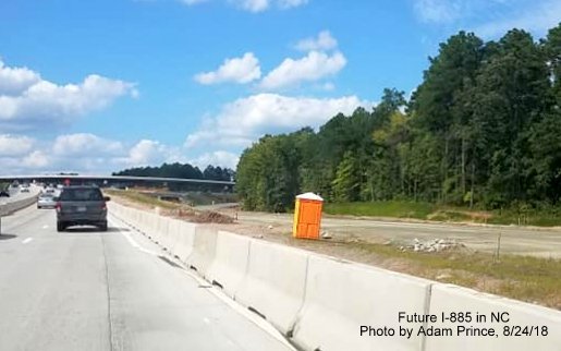
View approaching future I-885 and NC 147/Durham Freeway split shows future north lanes still only graded. NCDOT's official timeline has the NC 147 modifications completed by June 2018.
Graded future NC 147/Durham Freeway and I-885 North lanes continue as ramp for I-885 can be seen heading right in the distance.
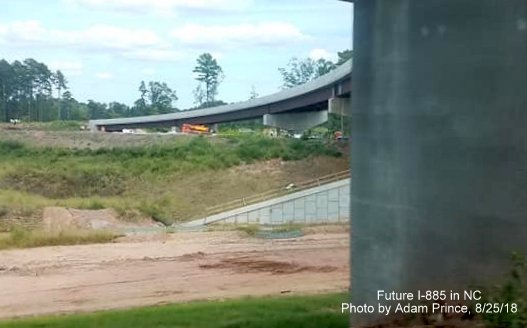
Traveling under the future NC 147 South to I-885 North flyover ramp with view of future Durham Freeway north lanes and ramp curving off to left in the distance.
View of the future ramp from I-885 South to NC 147/Durham Freeway North still only graded, along with future NC 147 North lanes.
Photos taken in late July 2018 at the US 70 interchange by David Johnson:

US 70 traffic has been diverted onto an new roadway to the left of the future lanes at the East End Connector interchange, part will be used for future US 70 East ramp traffic (Variable message sign is indicating NC 98 exit is temporarily closed).
Work to build the flyover ramp from US 70 West to I-885 South can be completed now that US 70 traffic has been shifted to the left.
Looking to the west of the US 70 roadway one can see the building of the future ramp to US 70 East from I-885 North.
Closeup view of the US 70 West flyover ramp gap over the incomplete I-885/US 70 freeway.
US 70 traffic on temporary alignment heading under completed part of future flyover ramp to I-885 South.
Completed Carr Road bridge can be seen to the right as US 70 transitions back to its existing lanes after the East End Connector interchange.
Closer view of completed Carr Road bridge over future I-885/US 70 lanes.
Workers place asphalt along the closed right lane of US 70 West heading toward the NC 98 exit.
Workers prepare new alignment for US 70 West lanes diverging from current roadway approaching railroad bridge.
New lane being built on the right appears will take US 70 West traffic to right side of railroad bridge in the distance.
US 70 lanes using future I-885 South roadway approaching railroad bridges (current temporary and future).

New but temporary bridge in front of permanent bridge under construction approaching NC 98 interchange.
Piers of temporary bridge being dug out as part of construction process for permanent railroad bridge.
Work is proceeding on new lanes to connect to future NC 98 bridge.
End of new pavement ahead along current alignment of US 70 approaching the closed NC 98 exit.
Future bridge over NC 98 can be seen on the right, the closed NC 98 exit was at the other side of the bridge.
Closer view of he bridge and work behind it to connect to future I-885 lanes.
Presumably when future I-885 North bridge over NC 98 is complete, traffic will be shifted over so that southbound bridge can be constructed along what is currently US 70 East and West lanes.
Pavement is being placed to the right for future I-885 North lanes between NC 98 and Cheek Road.
Earlier photos taken by the Durham Herald Sun at the Future US 70 interchange in July 2018:
Construction of flyover ramps still in progress. US 70 traffic using future eastbound lanes.

Looking along future path of incomplete flyover ramp over Future I-885 North lanes looking east.
Different view showing construction progress at future interchange with US 70.
View taken from future flyover ramp structure for future US 70 interchange.
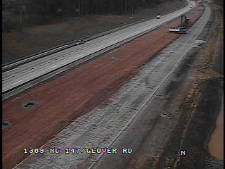
Latest traffic camera view looking south from the NC 55 exit (northbound camera has been off-line since May 2018) showing progress adding future I-885 on-ramp to NC 147 North:

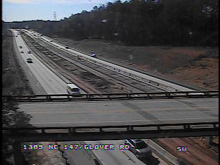
Earlier Views from NCDOT Traffic Cameras in March 2018 and December 2017 showing Durham Freeway near EEC interchange, as of March northbound traffic has been shifted temporarily to completed southbound lanes so northbound lanes can be rebuilt:
Northbound: Southbound:
Latest Photos -
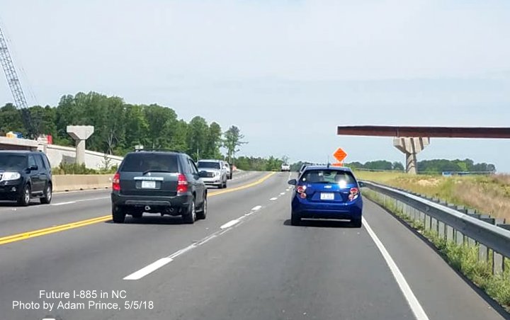
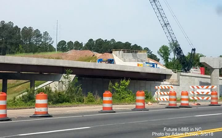
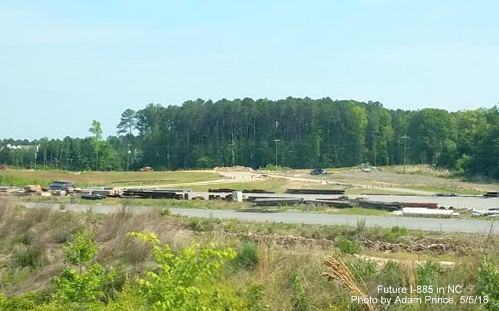
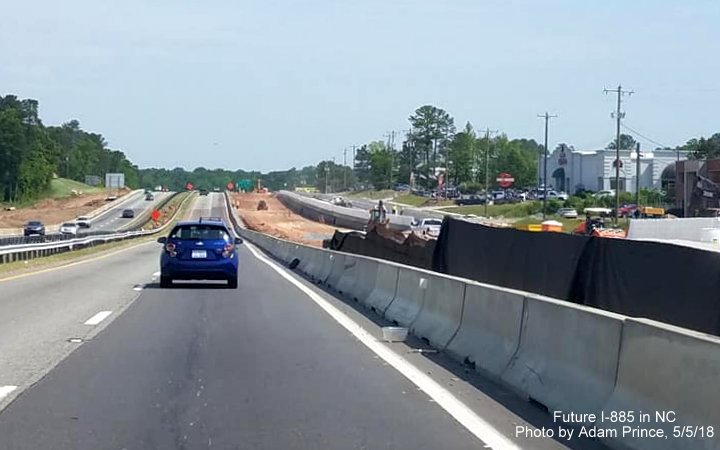
Taken on May 5, 2018 by Adam Prince along US 70:
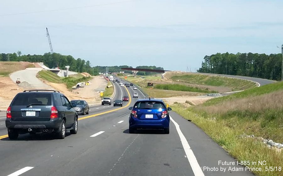
US 70 West approaching future off-ramp to I-885 South, future on-ramp from the Connector to US 70 East can be seen on the left.
There has been little progress in extending the flyover ramp across the current US 70 lanes, perhaps they are waiting for traffic to be shifted to the US 70 freeway lanes.
Future interchange ramp bridges can be seen across US 70 from the current westbound lanes.
The paved future US 70 freeway lanes are being used as a storage area for construction materials.
Beyond the NC 98 exit, work continues to upgrade US 70 to become the future northern end of the I-885 freeway.
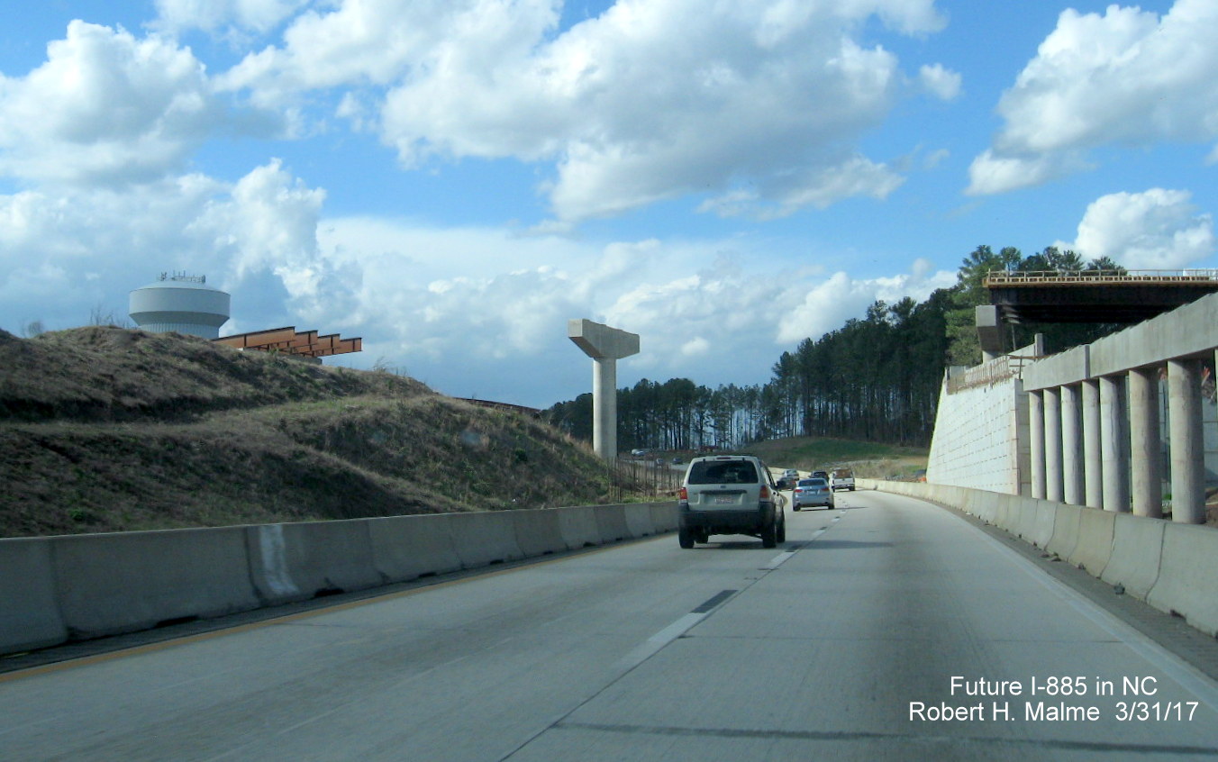
Earlier Photos-Taken on March 20, 2018 by David Johnson from temporary NC 147 northbound lanes:
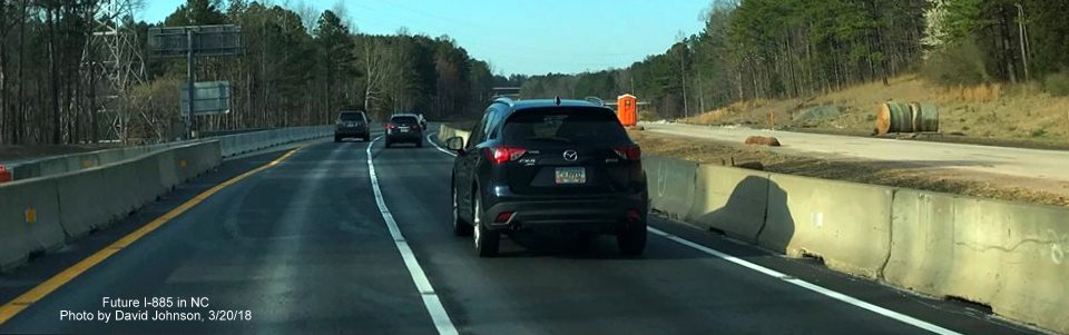
NC 147 North traffic using crossover to access completed southbound lanes to be shared by Durham Freeway traffic while new northbound lands approaching the Future I-885 North interchange is completed.
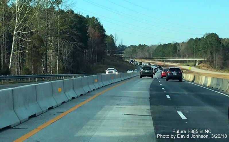
NC 147 traffic in future southbound lanes approaching Glover Road bridge prior to East End Connector construction.
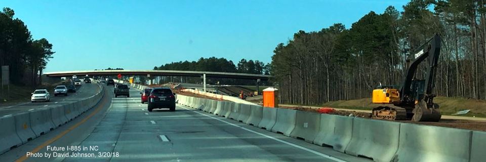
Contractors have already ripped out old northbound lane surface approaching future I-885 North exit ramp.
View under completed NC 147 South to I-885 North flyover ramp of paved Future I-885 ramps and new bridge construction.
Closer look at new bridge construction and removal of former northbound lanes beyond concrete barriers.
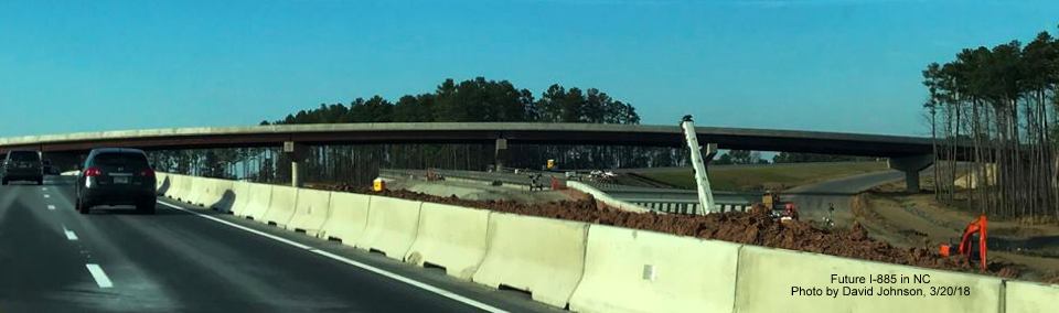
Closer view of completed flyover ramp for NC 147 traffic to access the East Connector roadway.
Another view of new bridge construction from temporary Durham Freeway north lanes.
Closer look at new bridge construction heading under the flyover ramp bridge.
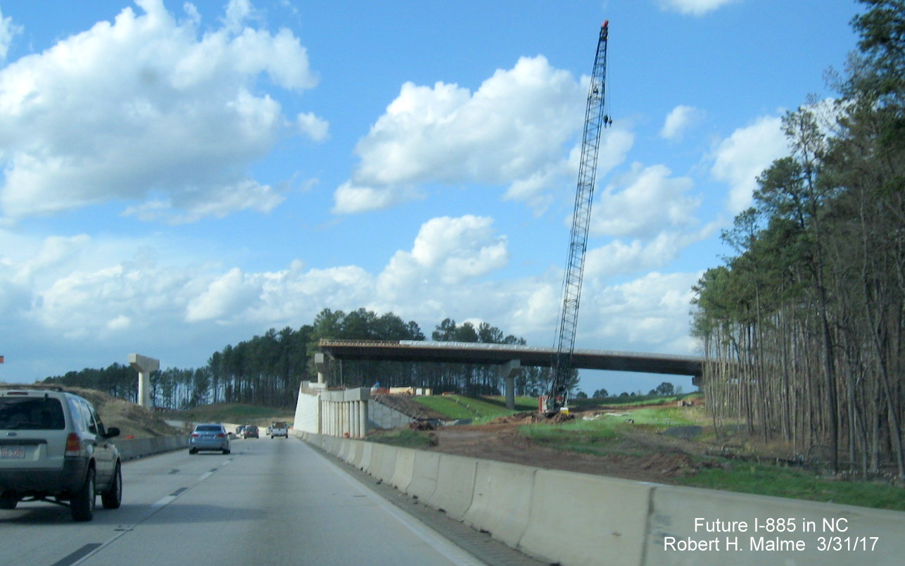
Earlier Photos - Taken on July 23 and 28, 2017 by David Johnson:
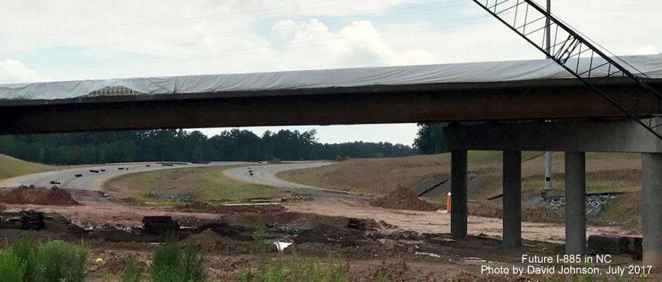
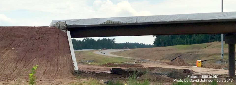
Traveling southbound showing progress in building ramp structures over the Durham Freeway:
Traffic being shifted heading toward future I-885 North off-ramp.
The future I-885 North off-ramp is being graded.

The girders for the future I-885 North off-ramp were placed during the weekend of July 14-16.
While the beams are new the grading of the surrounding roadway has been completed for a while, based on the grass growth.
A closeup of the bottom of the new ramp structure already having bridge deck materials being placed between the girders.
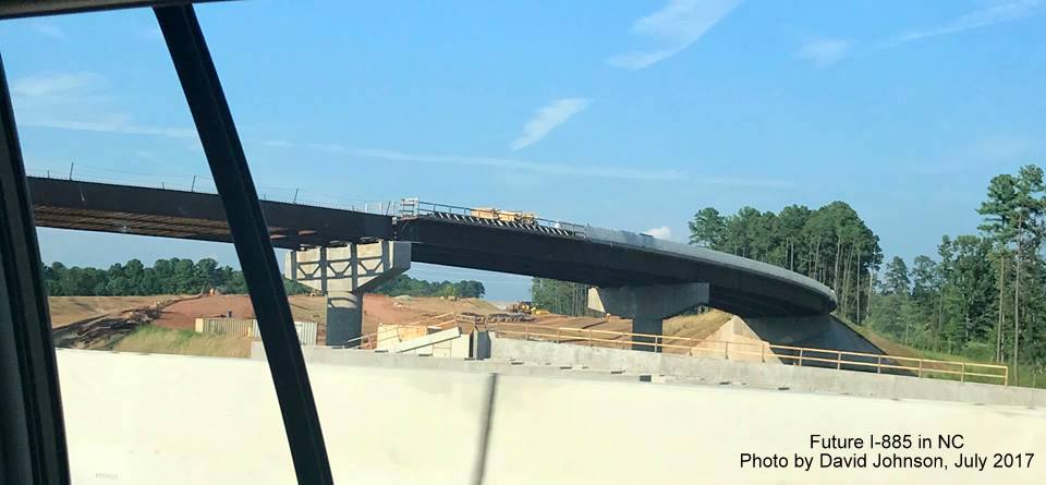
The previously placed part of the ramp over the northbound lanes have been mostly completed.
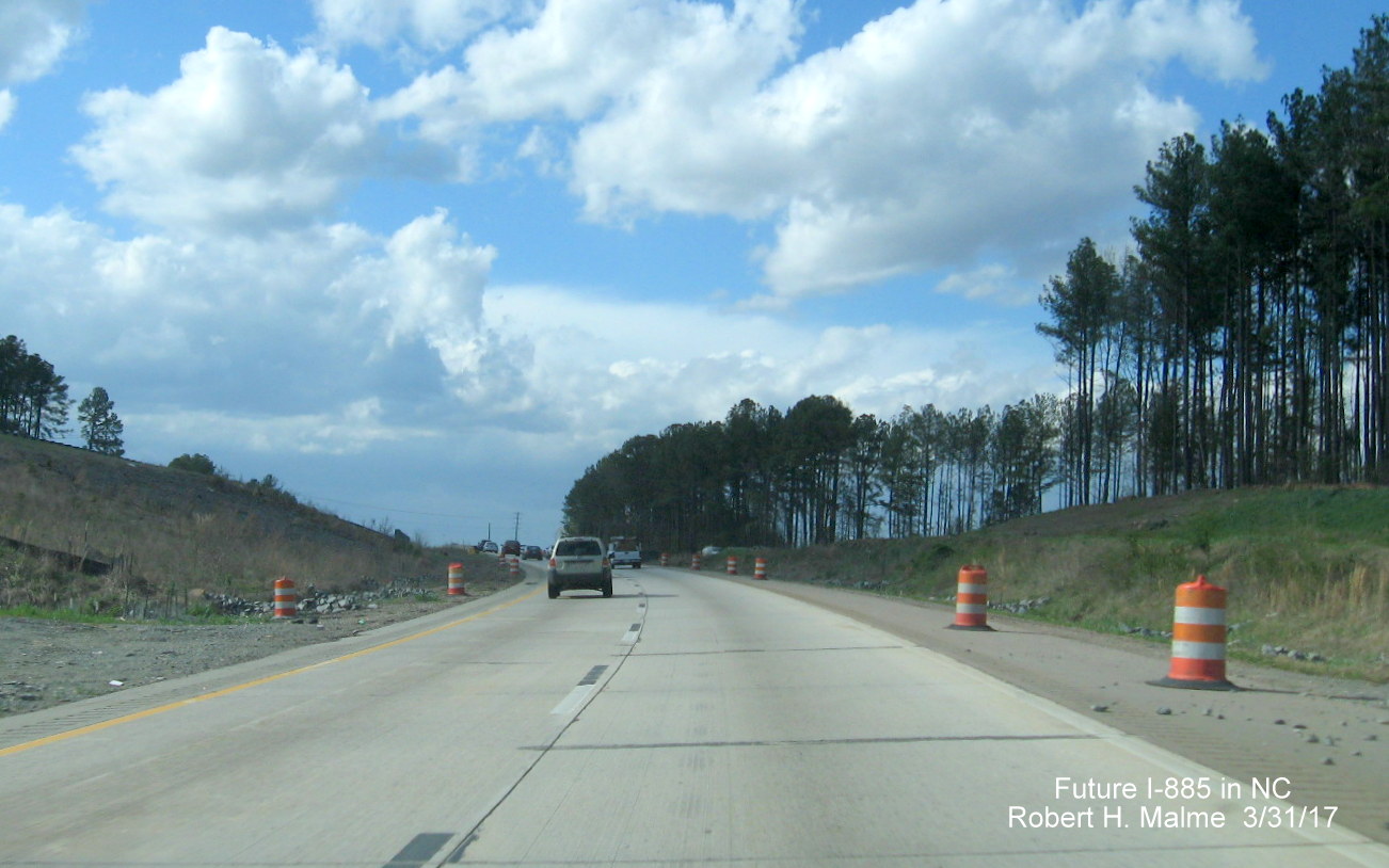
Traffic south of the interchange is now using the new southbound lanes heading toward Ellis Road.
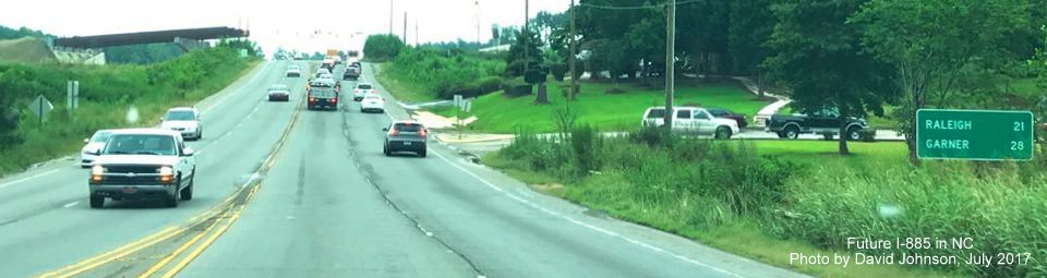
Along US 70 at the other end of Connector construction:
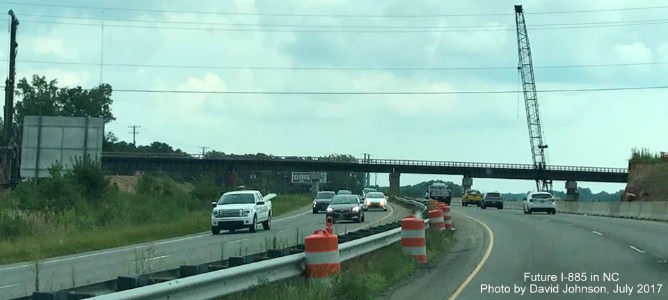
View from US 70 East heading toward East End Connector construction zone.
Long standing destination mileage sign on US 70 East approaching future flyover ramp for East End Connector.
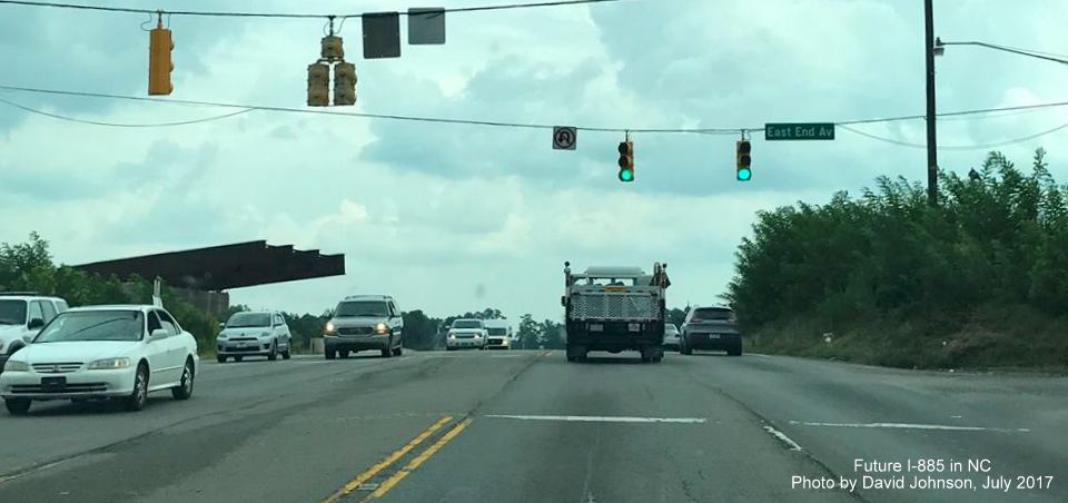
Incomplete flyover ramp for future I-885 South traffic as seen from US 70 East at East End Avenue.
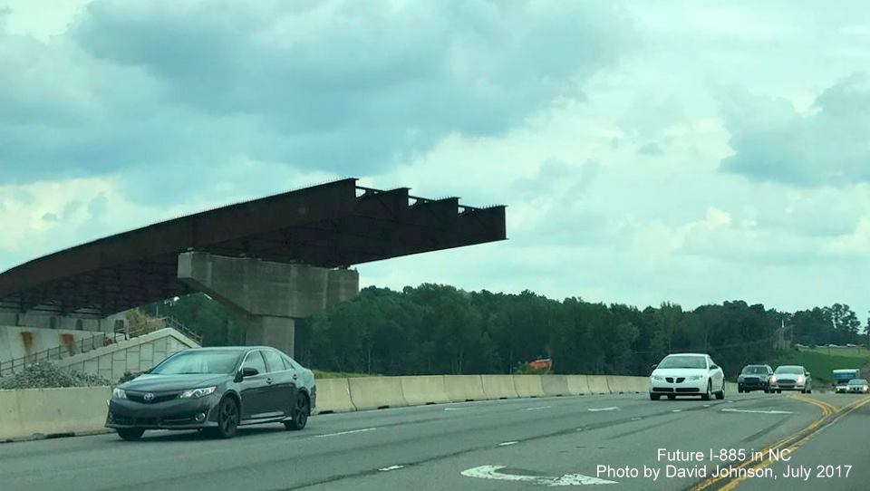
A closer view of he flyover ramp with completed steel work above future I-885/US 70 lanes.
Some of the support structures for other ramps seen from US 70 awaiting their steel their completion.
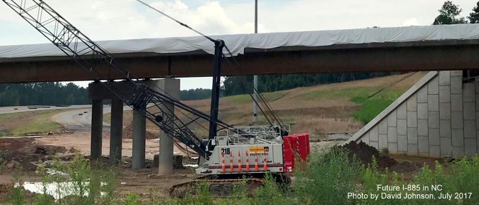
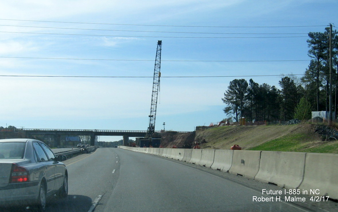
Idle crane waits in front of bridge under construction over Future I-885 lanes being graded leading away from US 70 East.
Looking under the bridge reveals future I-885 roadway toward the Durham Freeway receiving final grading.
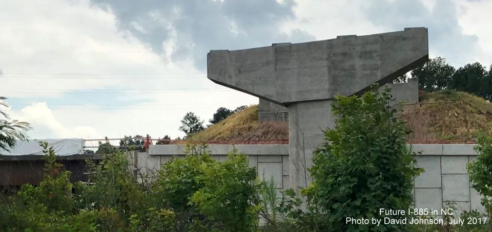
Closer view of southern end of bridge showing work proceeding on creating barrier walls above Future I-885 lanes.
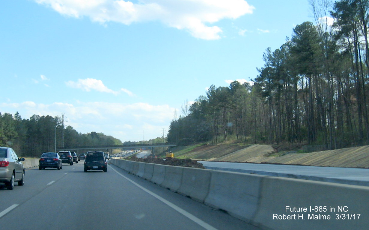
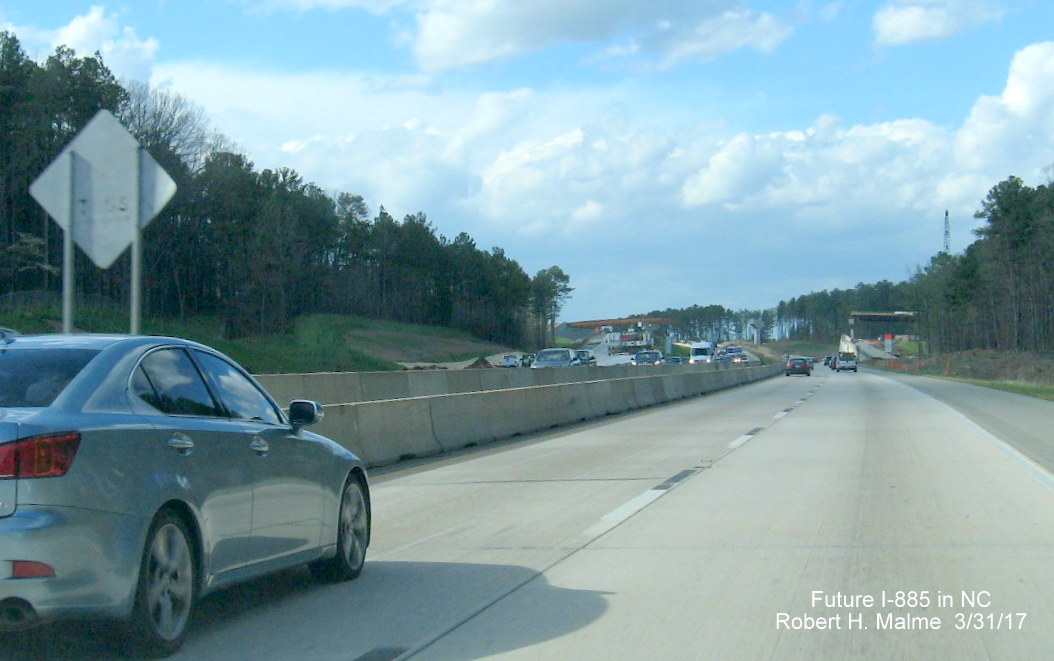
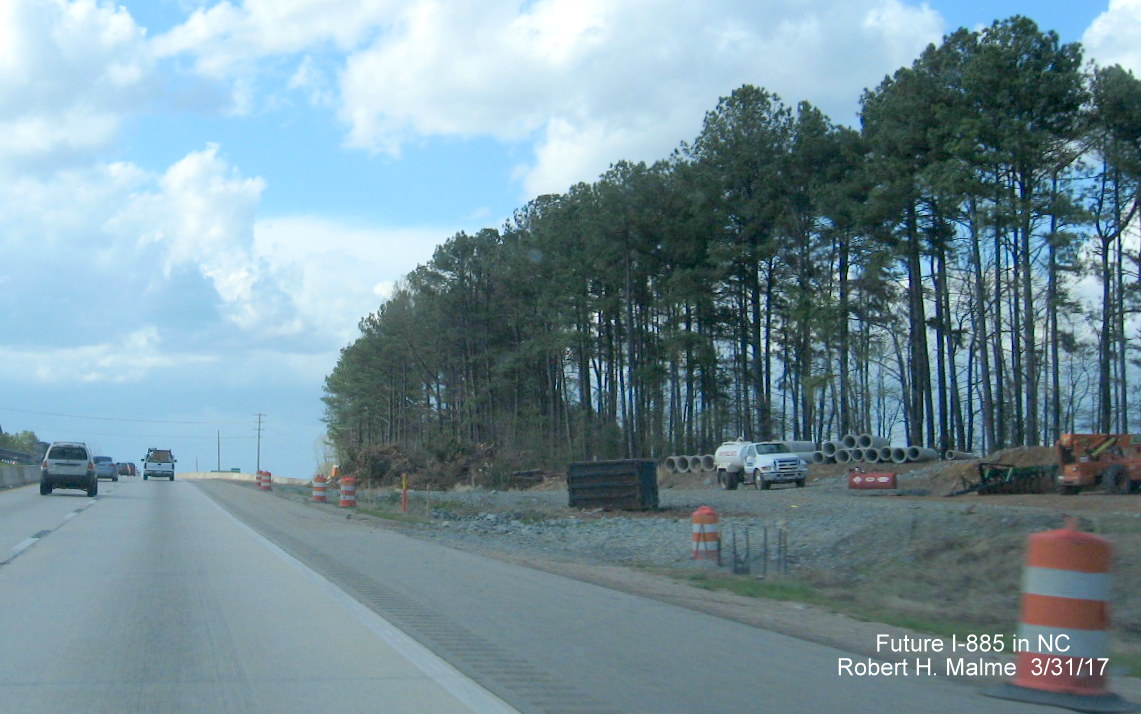
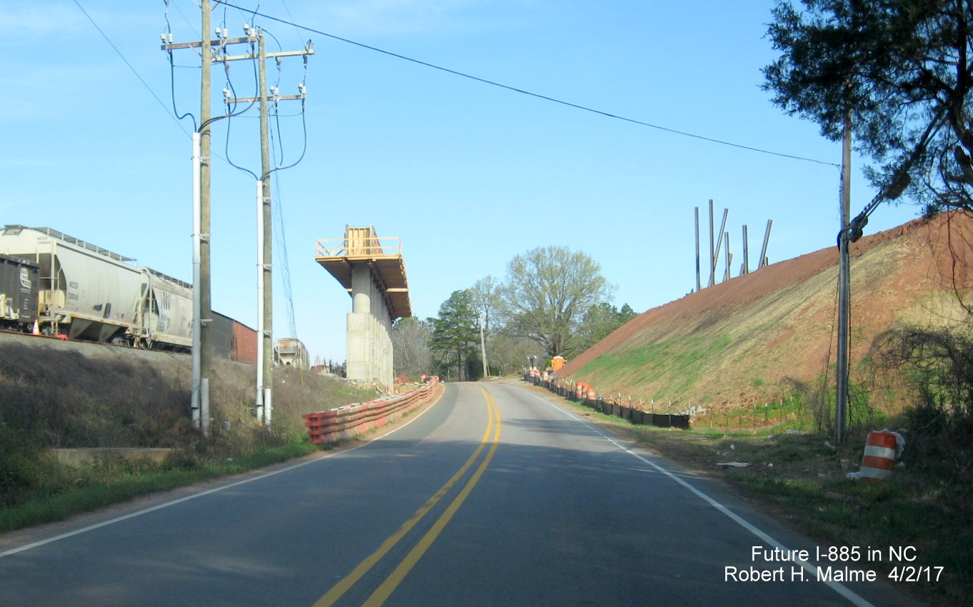
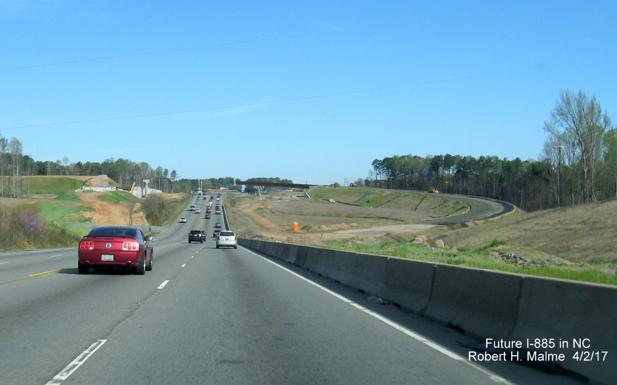
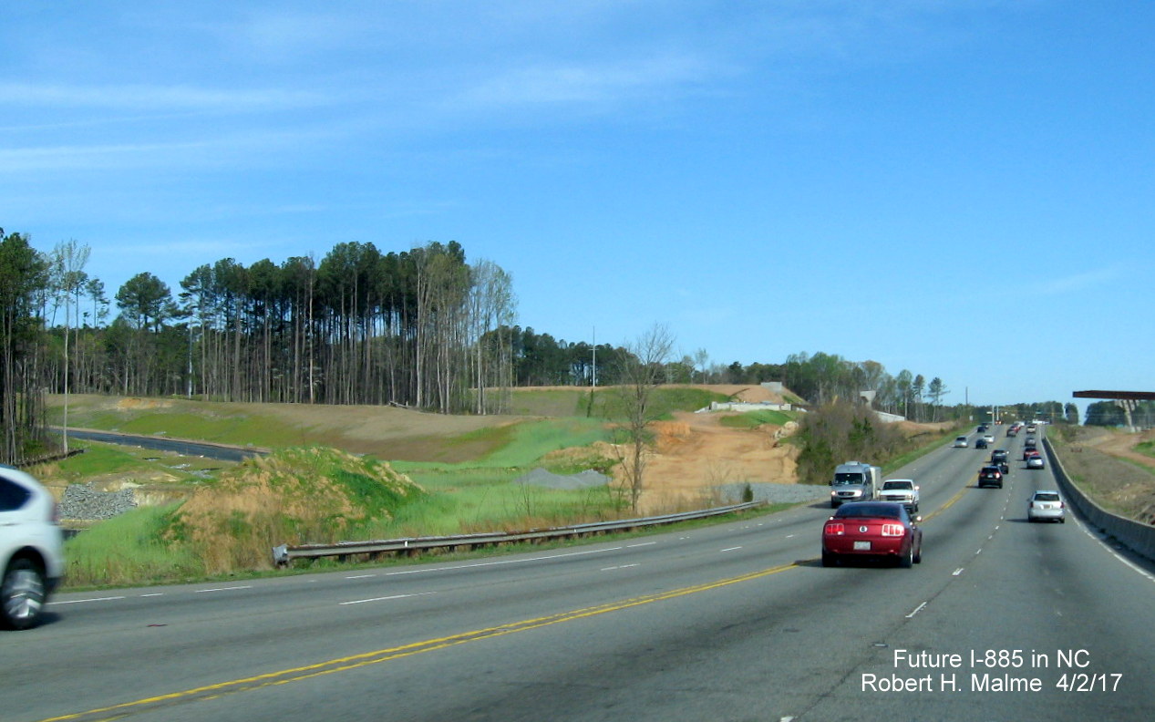
Earlier Photos from March 31 and April 2, 2017:
First the western section, NC 147, between Briggs Avenue and Ellis Road, heading South then turning around: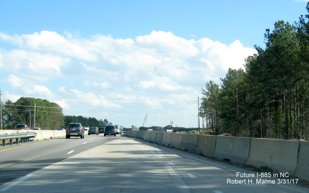
Entering NC 147 South from the Briggs Ave. on-ramp showing traffic being shifted to a temporary bridge while the future southbound lanes and ramps are being constructed.
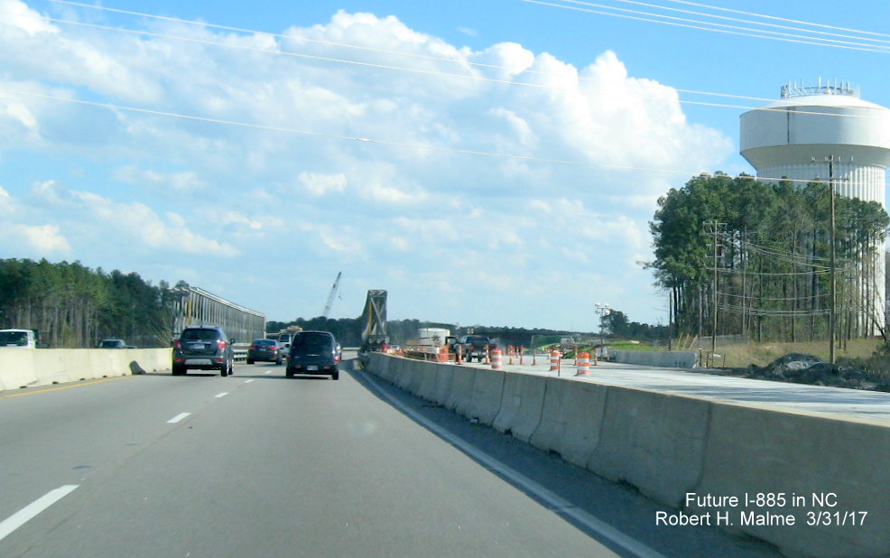
About to head over the temporary bridge on NC 147 South showing concrete has been poured for future Southbound lanes and bridge approaching the Future I-885 North off-ramp.
A little further south, concrete barriers separate NC 157 South traffic from future southbound lanes approaching interchange fly-over ramps.
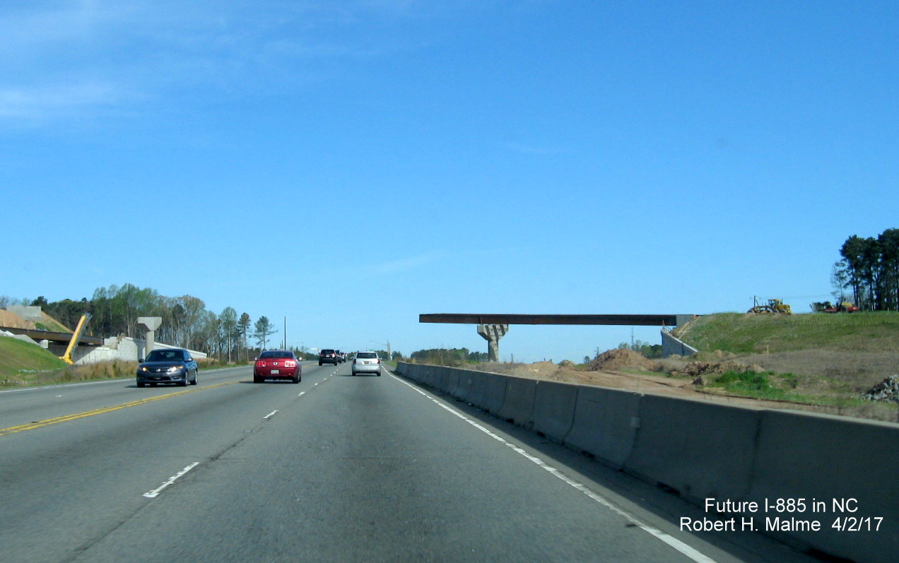
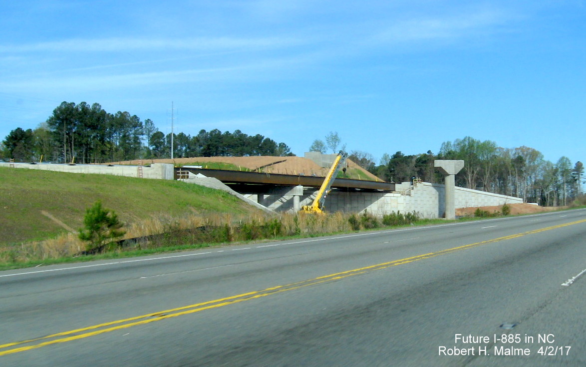
Approaching the flyover ramp that will take NC 147 South traffic to I-885 North showing not all the overhead beams have been installed yet. To the right, not all of the concrete roadway has been placed for the future South lanes.
Traveling further south after the flyover ramps with the future NC 147 South lanes now elevated to the right.
Work is ongoing in building the future I-885/NC 147 South lanes south of the interchange with both lanes of current traffic in the future North lanes.
Construction of new I-885/NC 147 South lanes continues south from the East End Connector toward Ellis Road, with Glover Road bridge in distance.
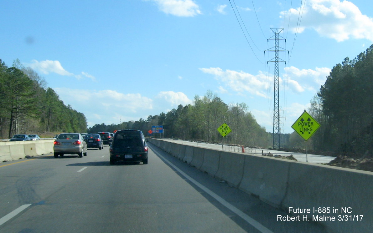
Power line warning signs and the start of concrete placement on the future Southbound lanes highlight the southern part of the East End Connector work zone.
Turning around at Ellis Road and heading north, the East End Connector work zone is first viewed prior to passing under the Glover Road bridge.
Work on the Future Southbound lanes can be barely seen above the median barriers as seen from North NC 147.
Approaching the future split of NC 147 with I-885 North, work on the future southbound lanes can be seen to the left.

Heading further toward the flyover ramps, the future North I-885 ramp can be seen to the right, only recently begun grading work.
A closer view of the Future I-885 ramp heading off from NC 147 lanes about to go under the future flyover ramp and bridge.
A close view of the flyover and other ramp bridges being built over NC 147 North.
View after traveling under the future ramps of construction area heading towards the Briggs Avenue exit.
At the northern end of the construction zone, work has started on the right in building the Future I-885 South ramp to NC 147 North.
Next, the Middle Section-Angier Avenue:
Heading north on Angier Avenue through the East End Connector work zone shows progress in building supports and grading the future I-885 lanes to the east to carry traffic over the road and the railroad tracks to the left.

A closer view of construction while traveling between the bridge pier construction and the elevated land for the I-885 roadway.
Finally, the Eastern Section - US 70 from East End Avenue to NC 98 (and back beyond):
View from US 70 West at East End Avenue intersection with East End Connector work zone coming into view.
View from US 70 west just passed the East End Avenue intersection, showing Current and Future US 70 lanes.
Approaching the future ramp from US 70 to I-885 South on the right, where some paving has started heading up toward the ramp overpass.
Looking to the west of US 70, a paved on-ramp from Future I-885 North and bridge construction can be spotted.
Approaching the future site of the I-885 South off-ramp from US 70 West with a closer look at the paved lanes.
Another look to the west of US 70 opposite the future I-885 South Off-Ramp showing grading and paving of future ramp to US 70 East.
Approaching the flyover ramp for I-885 South partially completed over current US 70 lanes with bridge being constructed to the left.
Closer look of ramp bridge being constructed that will take traffic under the flyover ramp for US 70 West traffic heading onto I-885 South.
A view to the right from US 70 West shows future I-885/US 70 lanes heading under completed bridge currently not connected to any street.
A closer look at the future I-885/US 70 lanes shows paving has not begun along graded roadway underneath the completed bridge.
Signage for the pre-existing US 70 Business exit from US 70 West in the middle of the East End Connector work zone. When I-885 is completed US 70 Business traffic will use the revised NC 98 exit.
US 70 lanes travel toward future I-885/US 70 lanes to travel under bridge prior to NC 98 exit.

About to travel over new bridge over Future I-885/US 70 lanes, current US 70 traveling in future southbound lanes will work is still ongoing to excavate future northbound lanes.
Future I-885 North lanes continue to the right paralleling US 70 headed toward the NC 98 Exit.
Prior to the NC 98 exit, work is continuing of the bridge that will take I-885 North/US 70 West over NC 98.
A closer look at the NC 98 Exit Gore Sign. This will be Exit 11 when I-885 is completed, see sign plans below.
View at the bottom of the US 70 West off-ramp to NC 98 showing the construction is proceeding that will take I-885 North traffic over the intersection.
Returning east on US 70 showing work is half finished in demolishing old railroad bridge in front of new one being completed over Future I-885 South lanes.
Looking South beyond the bridge, over approaching project work zone as US 70 curves to meet US 70 Business.
Further along approaching East End Avenue intersection with Future I-885/US 70 lanes to left and flyover ramp in distance.
Approaching East End Avenue and future interchange area, another look at US 70 West to I-885 South flyover ramp construction.
View on US 70 East beyond East End Avenue showing future US 70 lanes slowly making their way back to the alignment of the current lanes at the bottom of the hill.
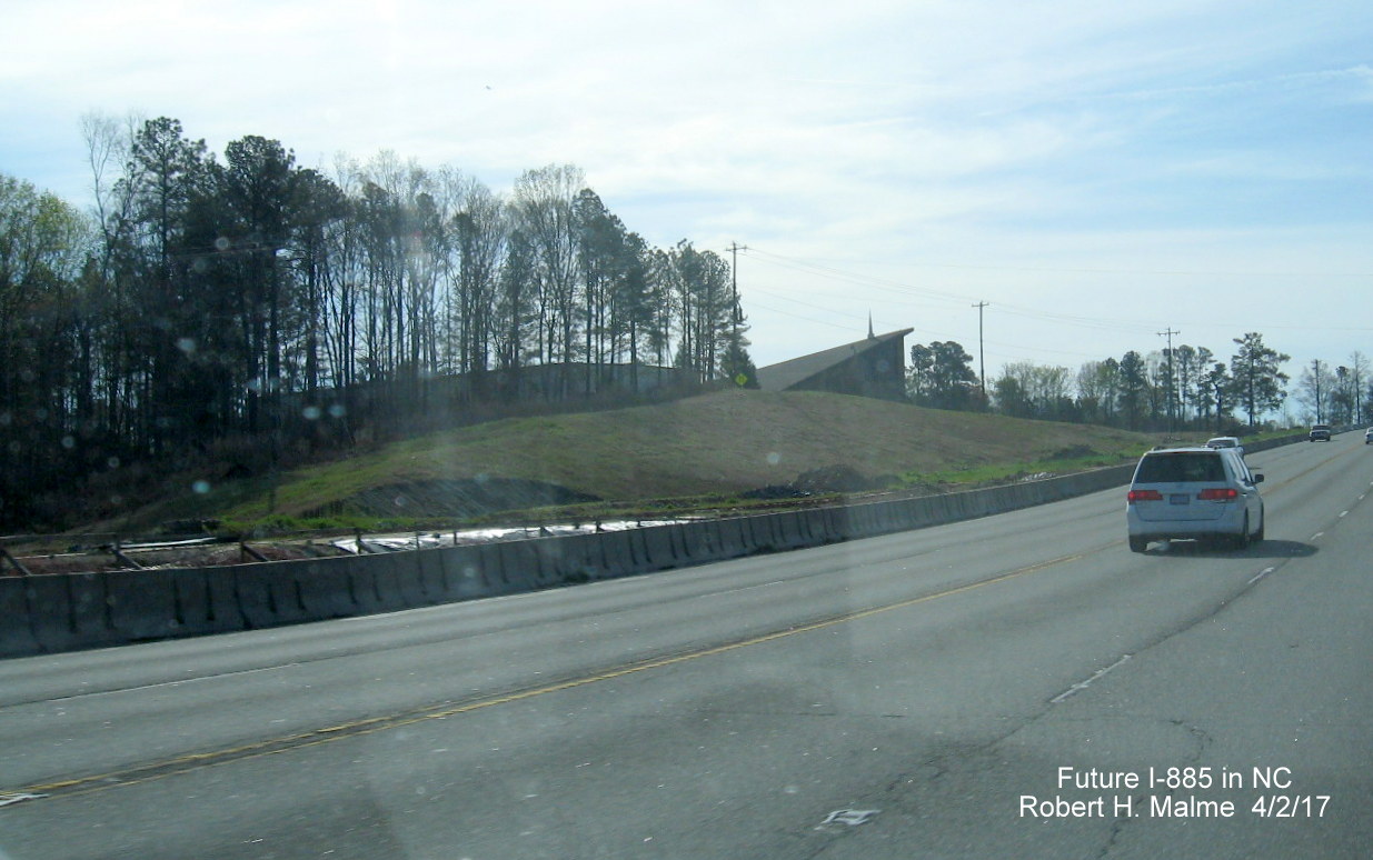
At the bottom of the hill and the southern end of the East End Connector project work zone, showing the last part of the new road alignment merging with the old prior to the Living Waters Community Church.
Earlier Photos - February 19, 2017
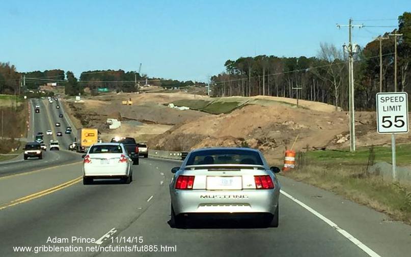
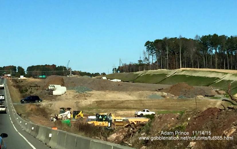
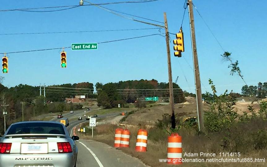
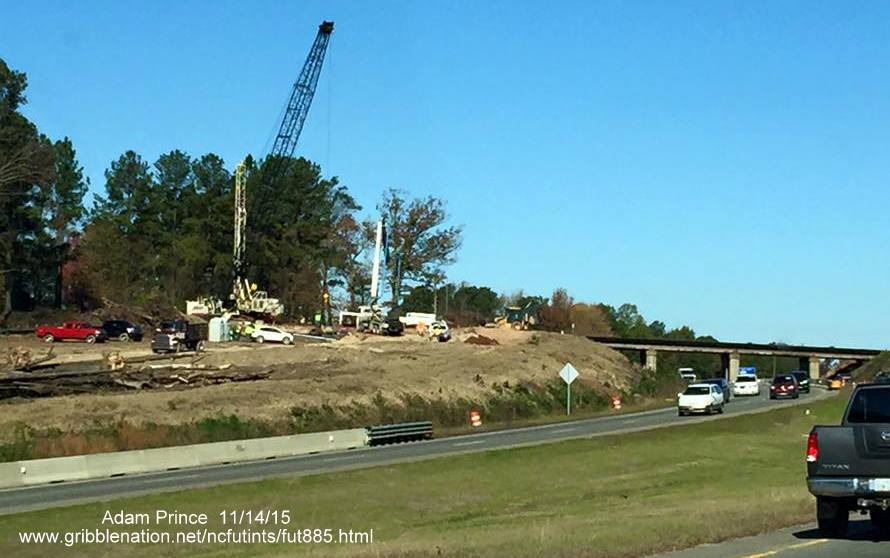
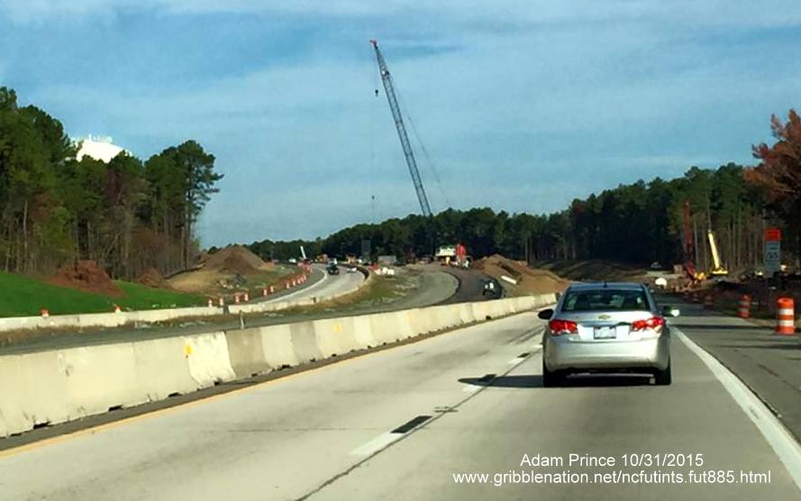
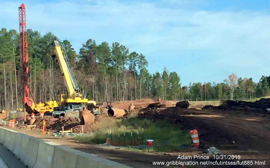
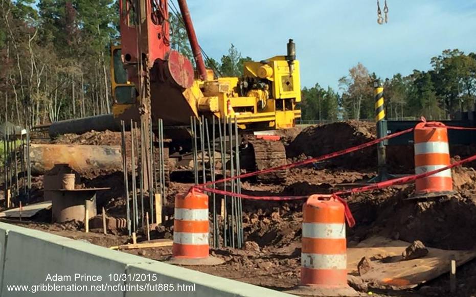
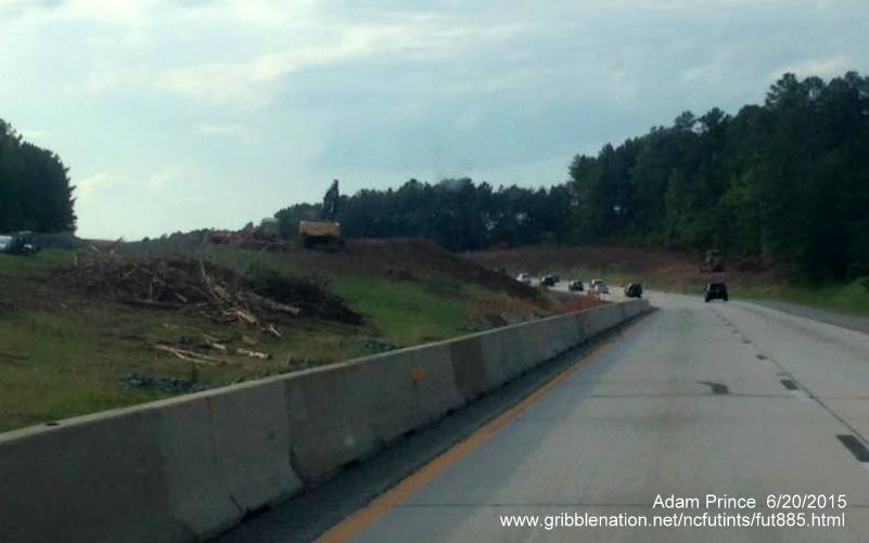
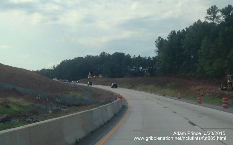
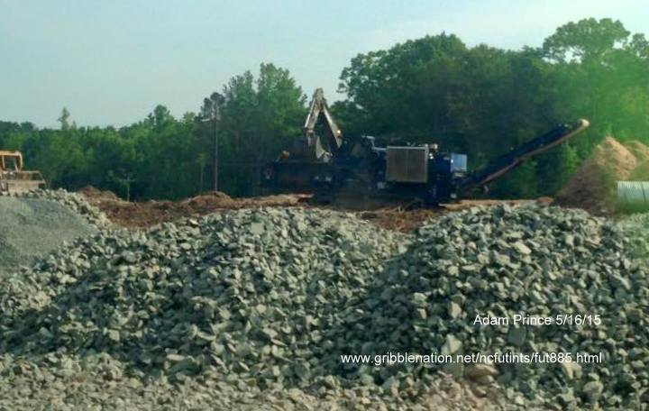
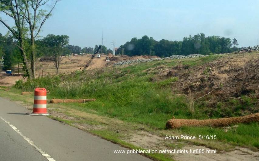
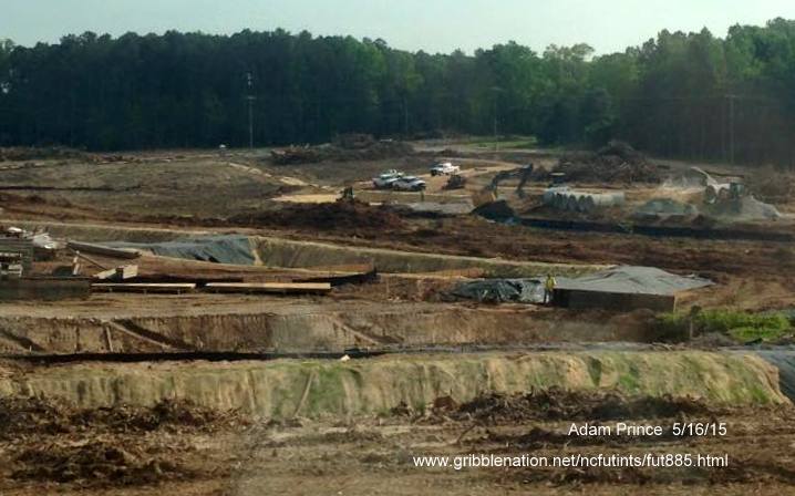
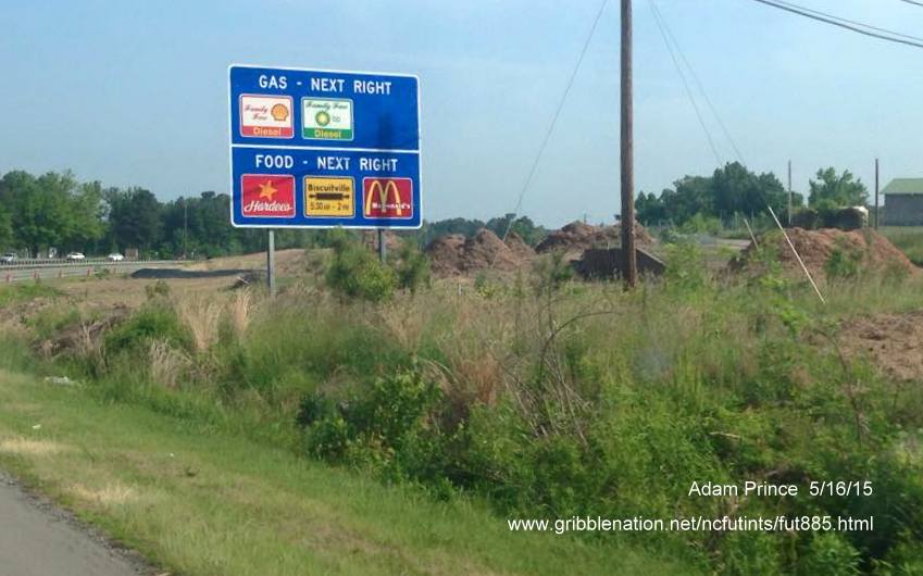
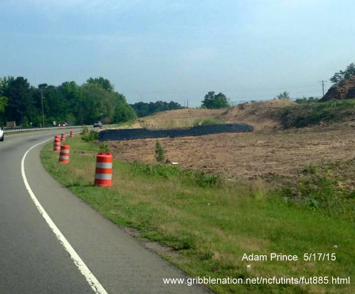
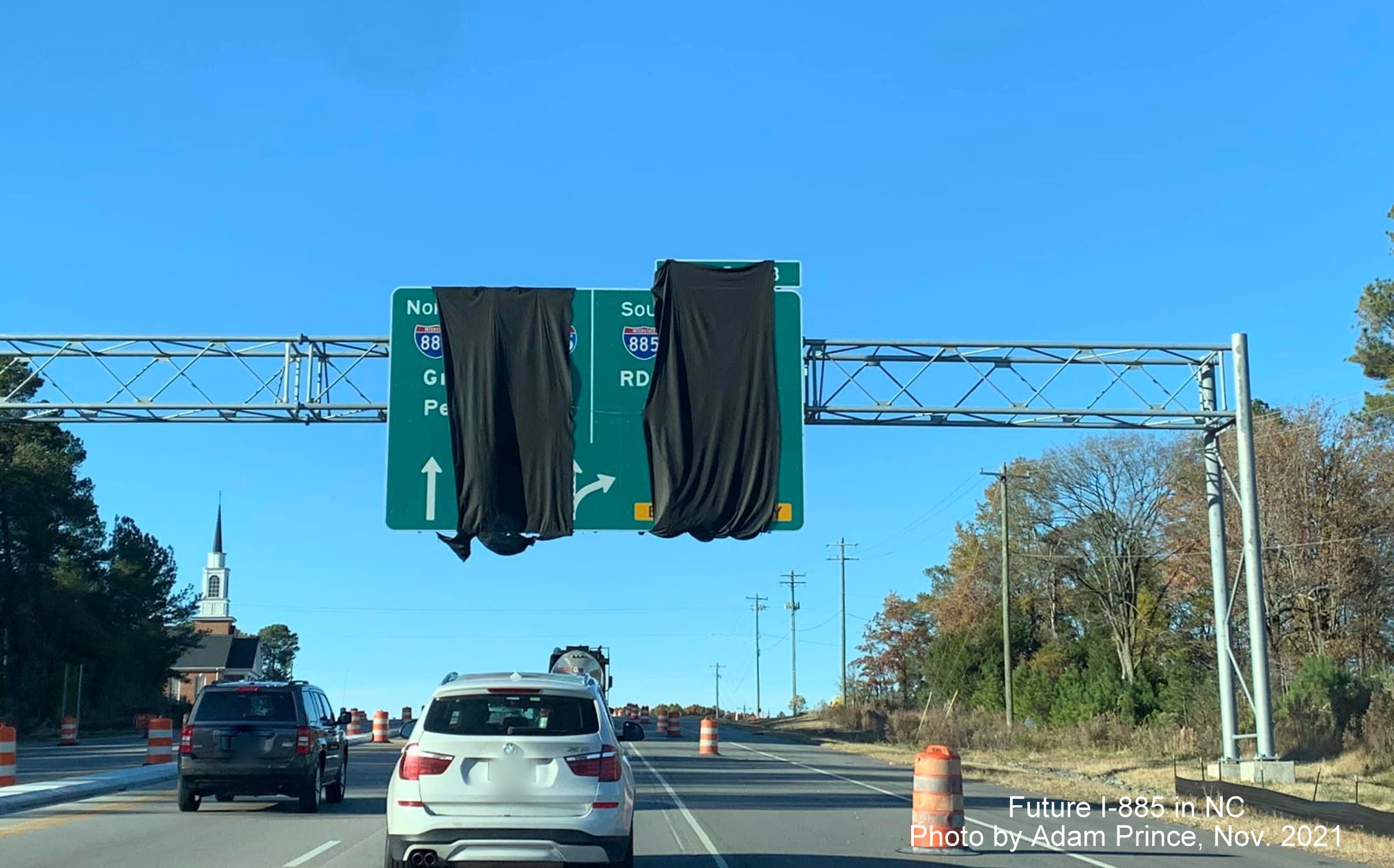
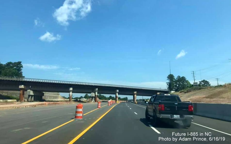
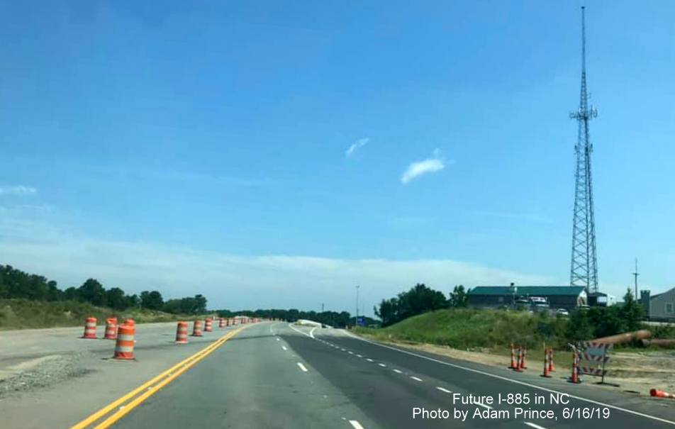
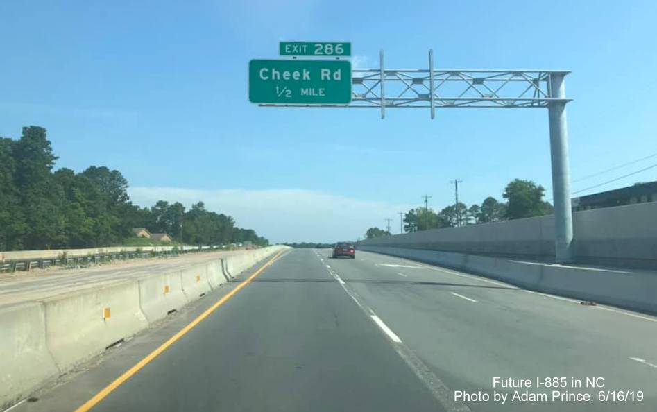
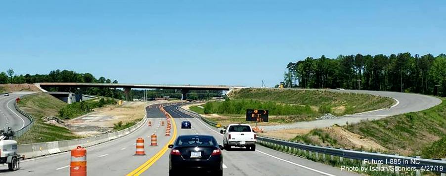
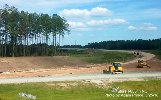
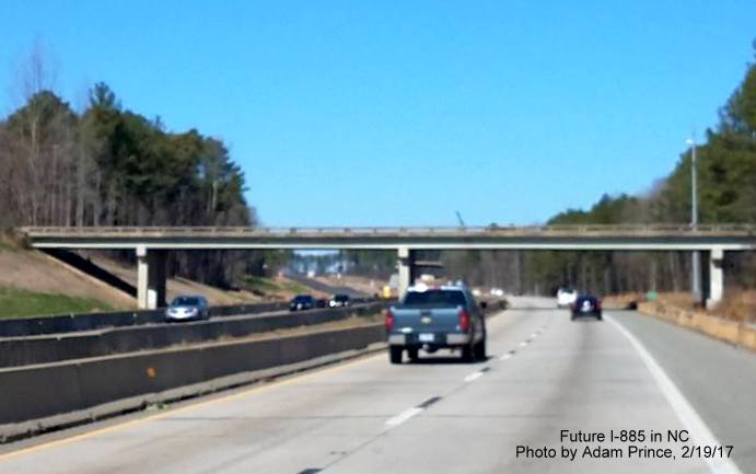
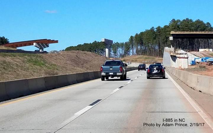
A few photos from Adam Prince showing the progress building the interchange with NC 147, the Durham Freeway approaching the interchange on NC 147 North:


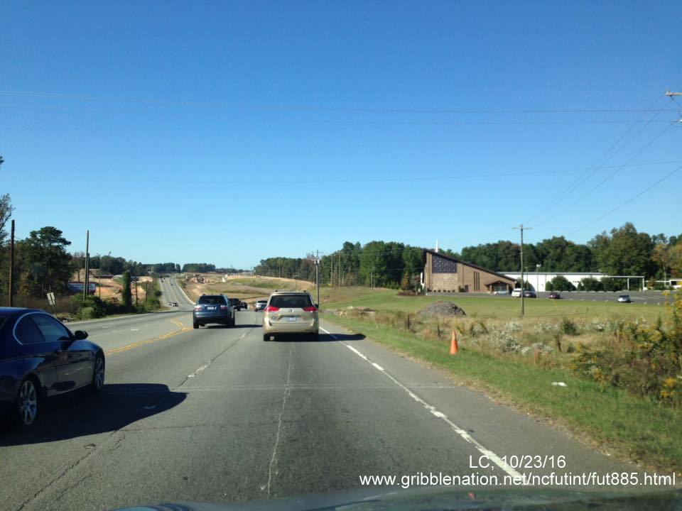
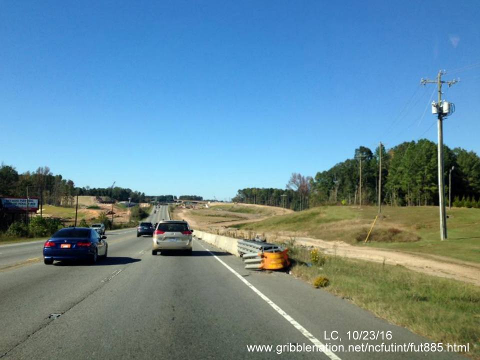
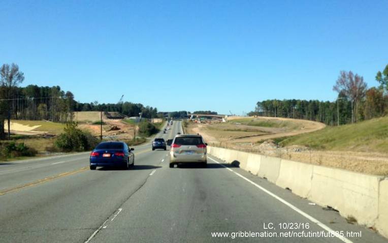
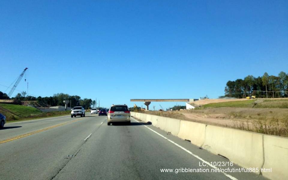
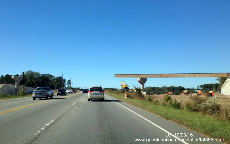
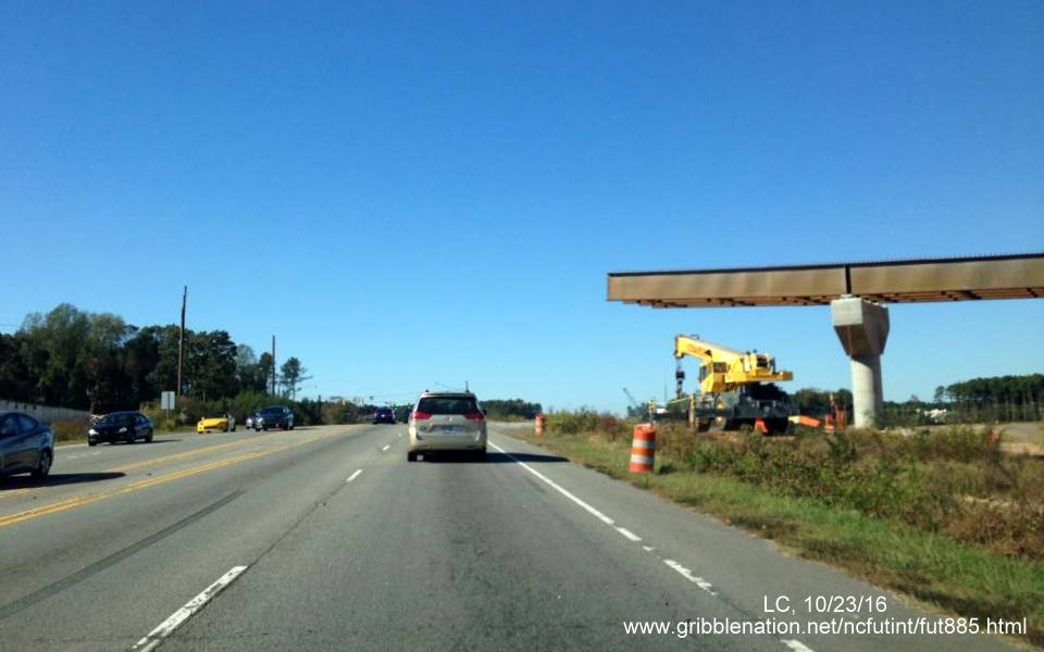
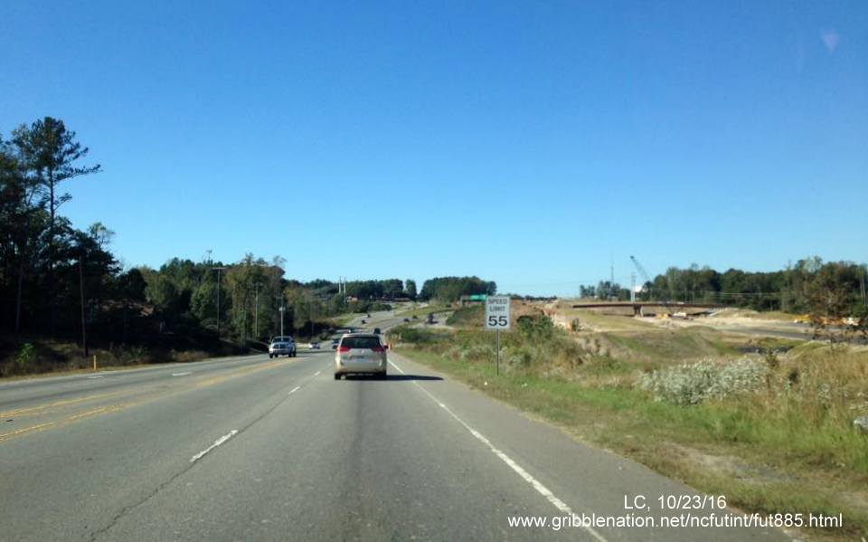
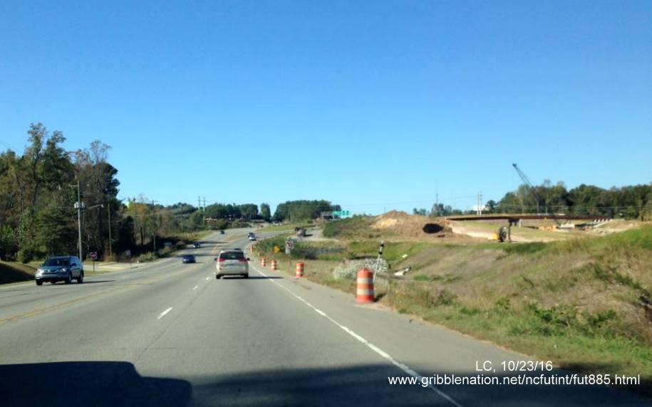
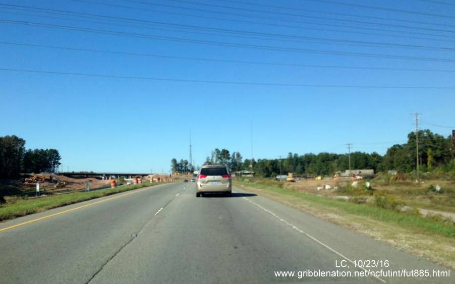
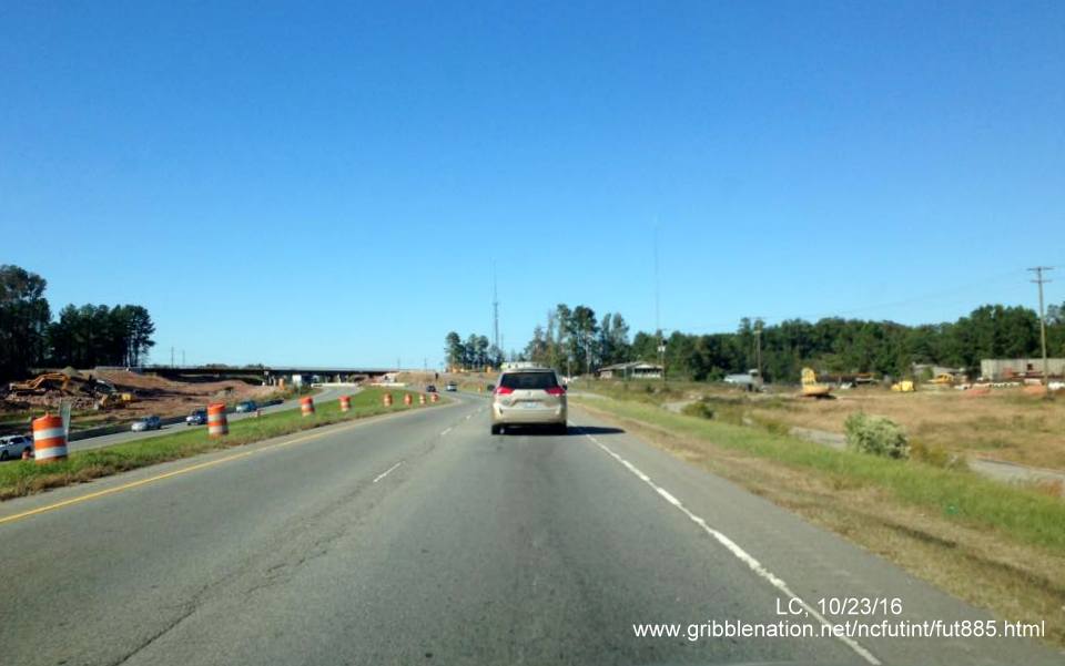
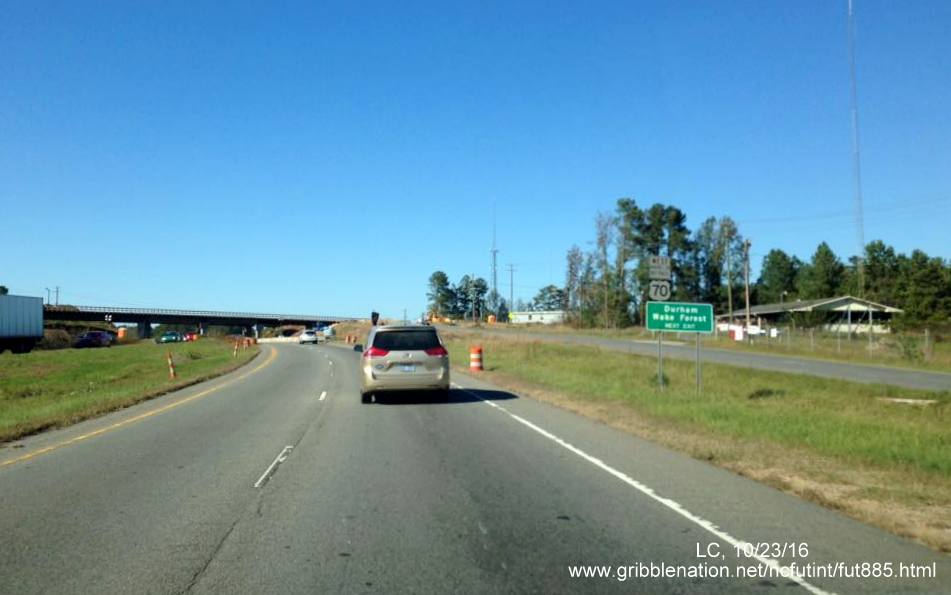
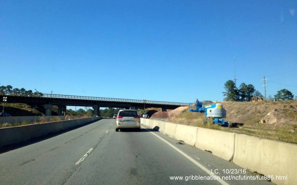
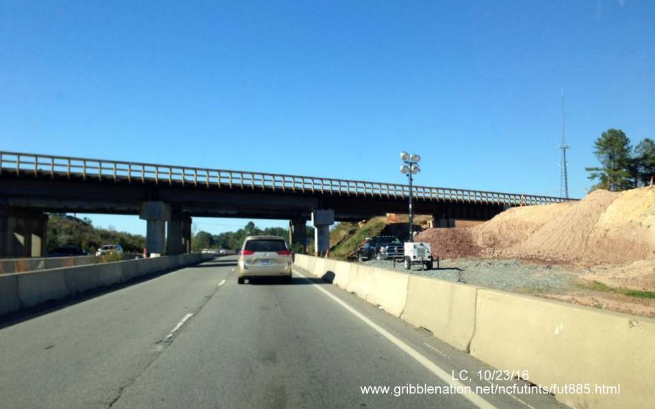
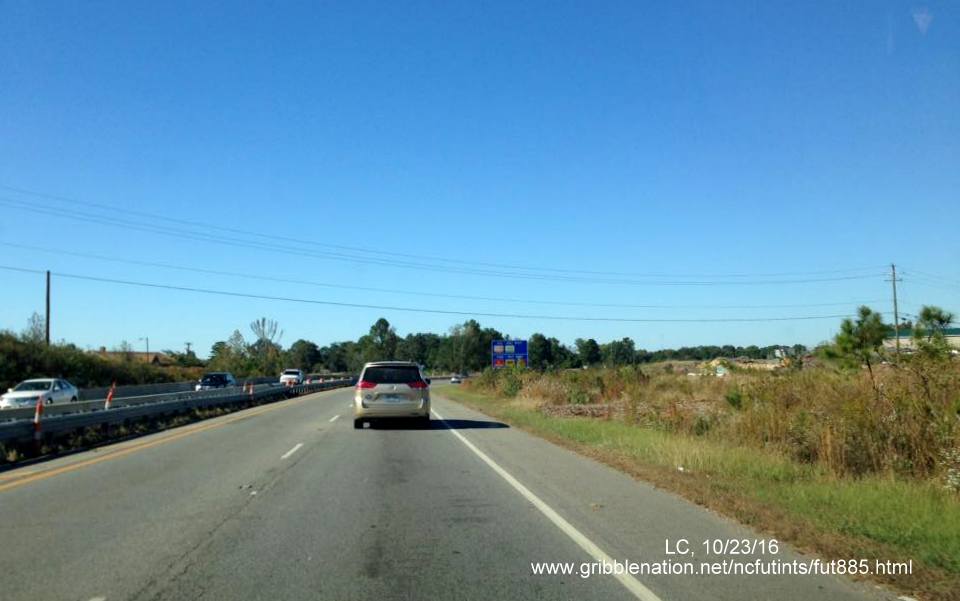
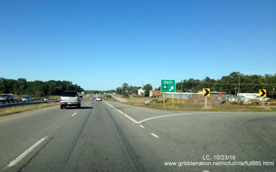
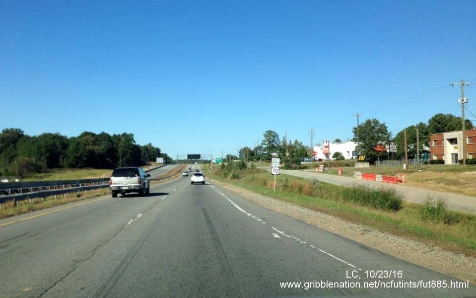
Previous - October 23, 2016
These photos, from LC, show progress on the eastern side of the project along US 70 West, traveling through the future I-885/US 70 interchange and further north to the existing freeway north of NC 98:


Here's a view of progress on the NC 147 side from the NCDOT Traffic Camera in the area, taken 10/15/16:
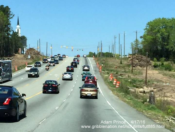
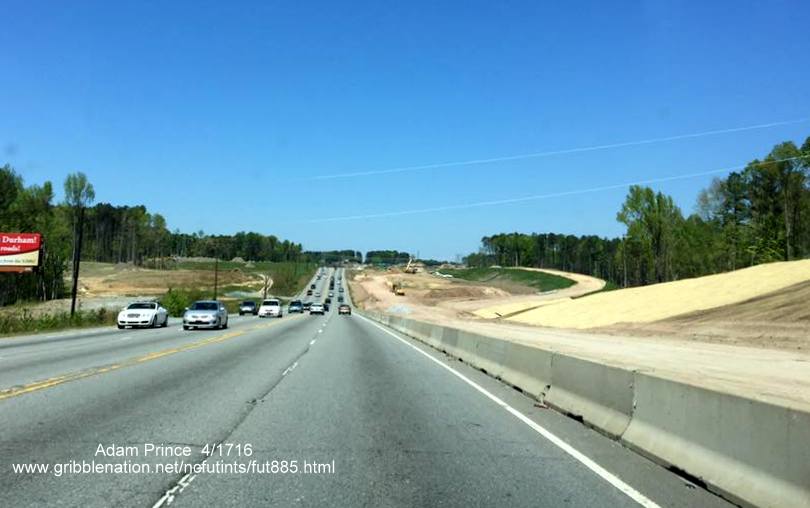
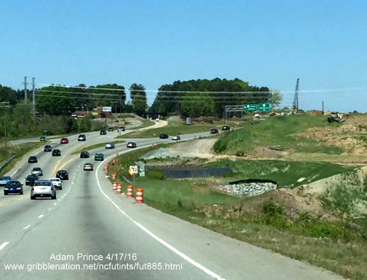
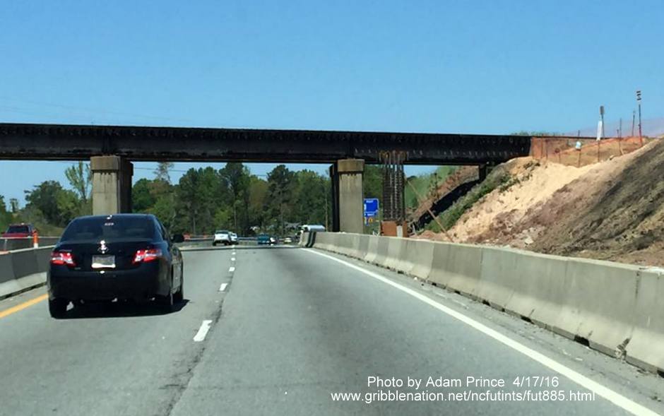
Previous Photos - April 17, 2016
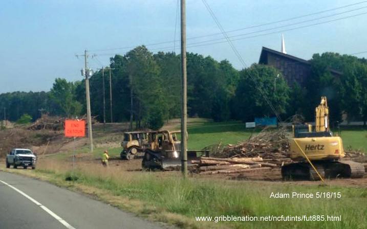
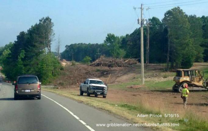
These photos, from Adam Prince, show progress on the eastern side of the project along US 70 West traveling through the future I-885/US 70 interchange and then further north toward the current Business 70 off-ramp: