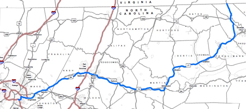
The Establishment and Then the Decommissioning of I-495
NCDOT did not seem to be too interested these interstate proposals,
at least publicly, until March 2013 when they sent an application to
AASHTO's Special Committee on US Route Numbering asking for the I-495
designation for US 64 and, at the same time, put a map of the proposed
route on their Route Changes website.6 Within the
application packet was a copy of a letter to the FHWA (more below)
from NC Governor Pat McCrory seeking the same thing. AASHTO approved
the I-495 designation in May 2013 conditionally pending final approval
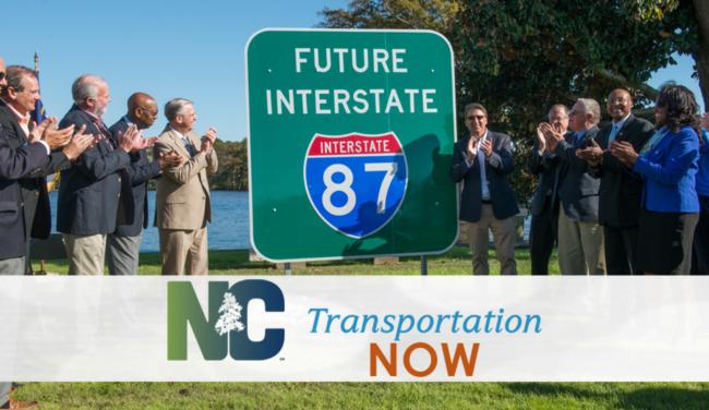
of the FHWA.7 FHWA approval was announced at
RTA’s 12th Annual Meeting in
Cary on December 12, 2013 by Governor McCrory and NCDOT
Secretary Tony Tata.
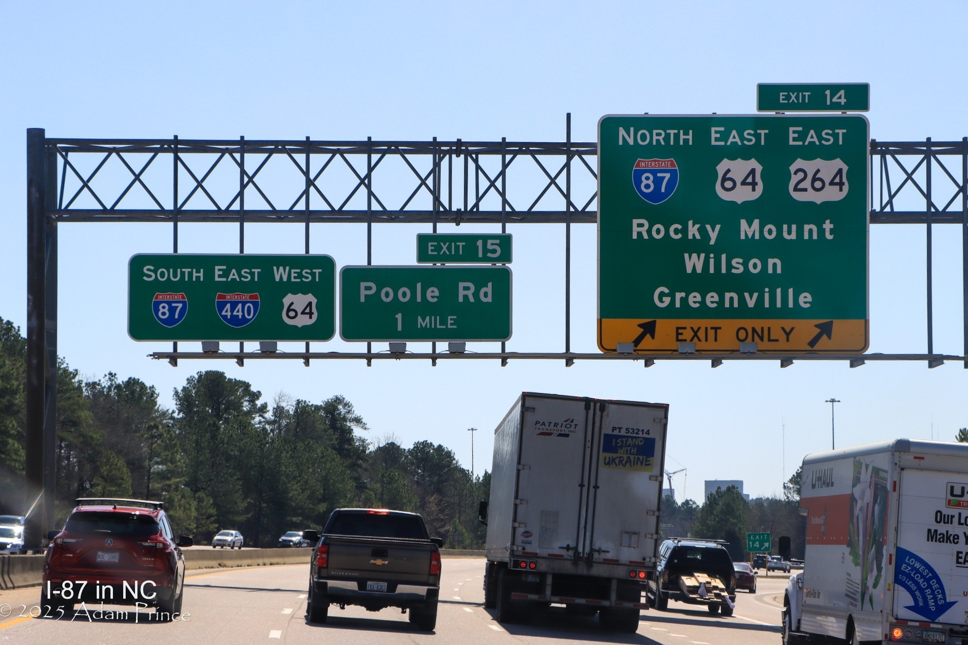
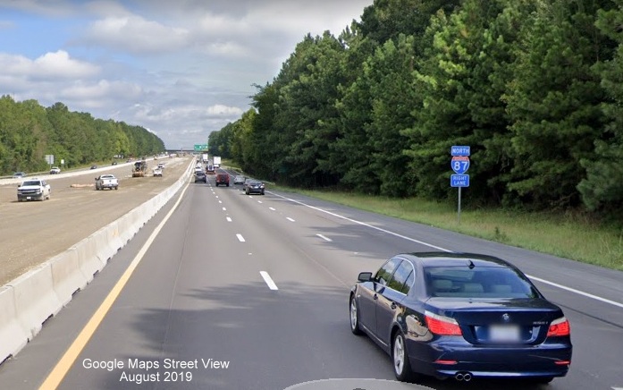
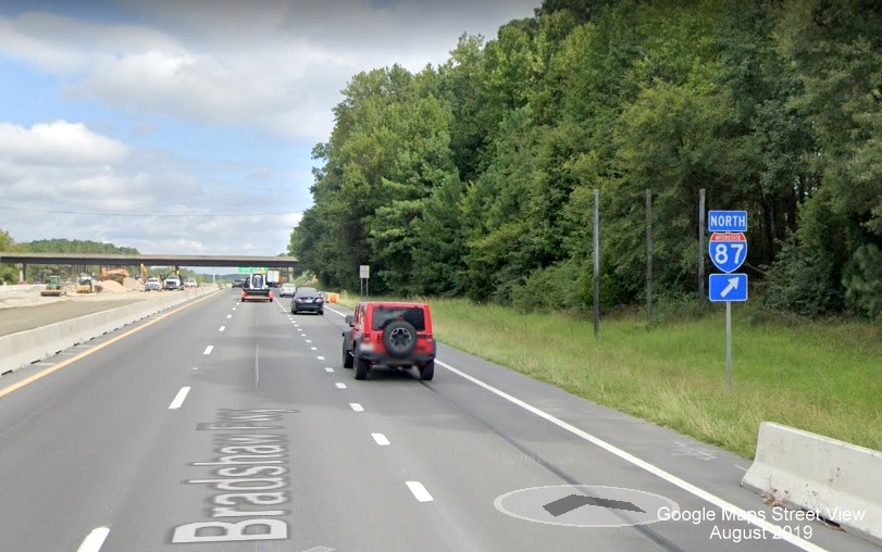
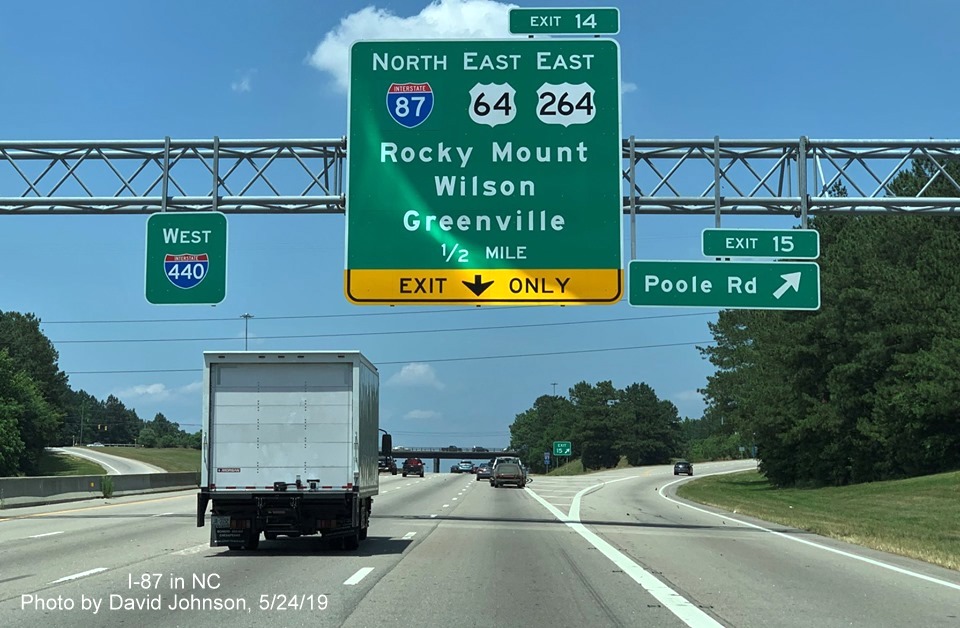
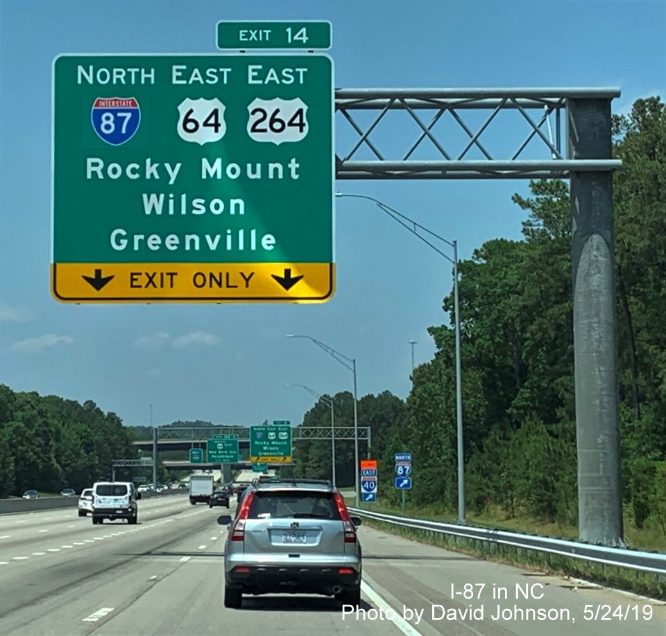
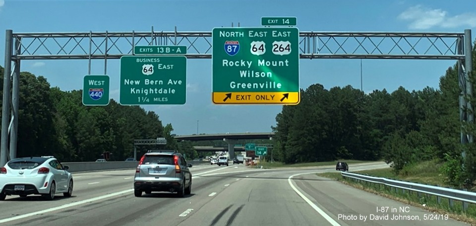
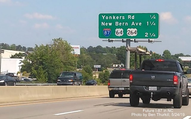
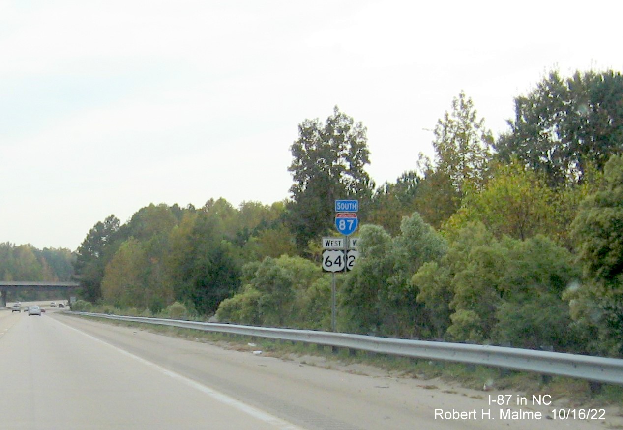
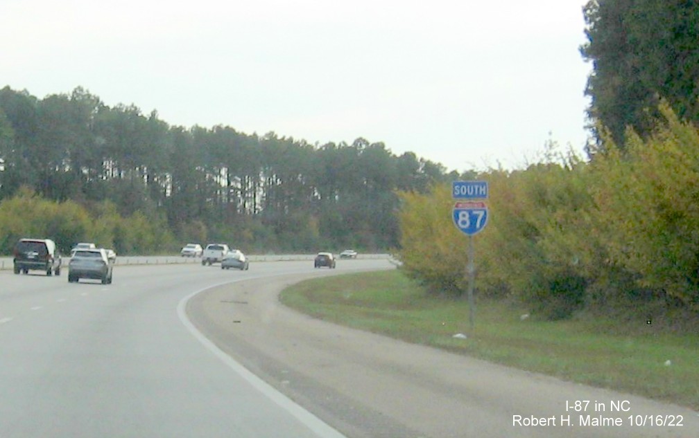
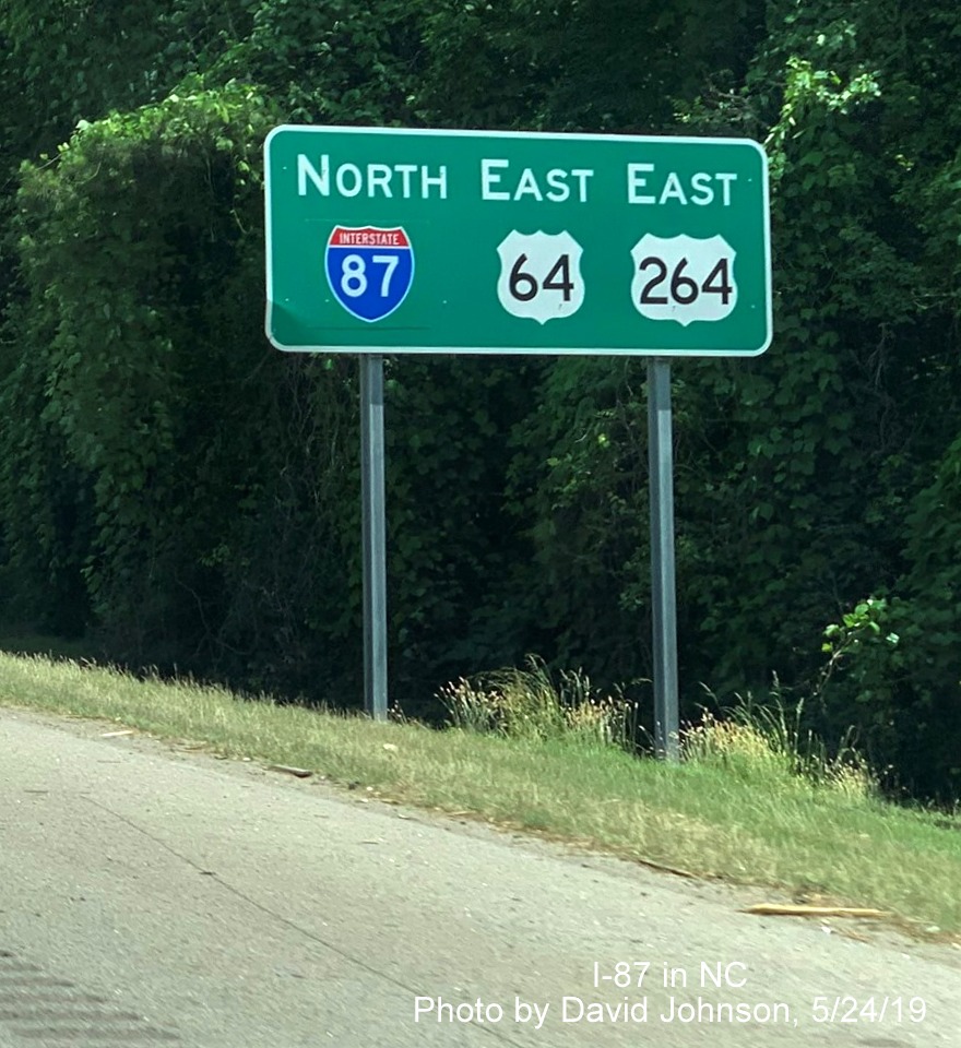
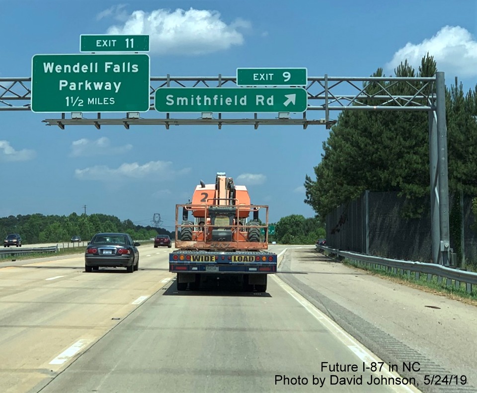
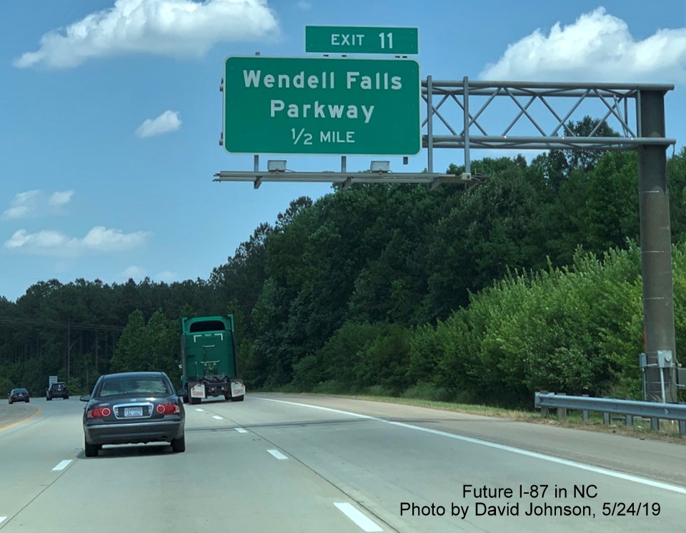
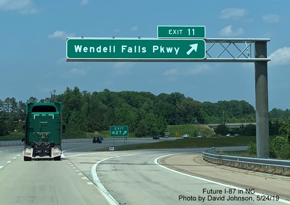
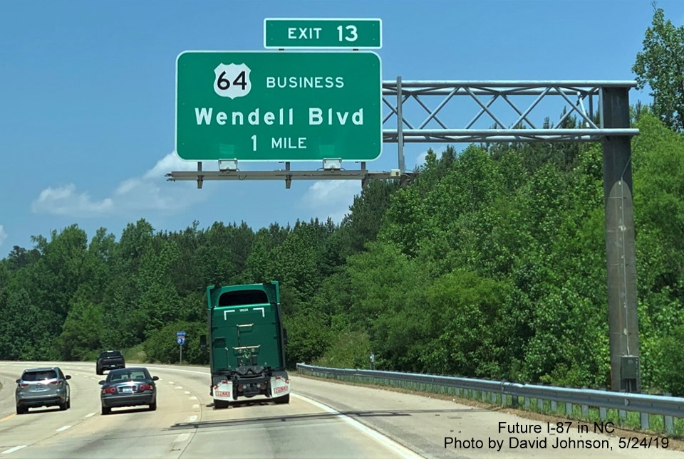
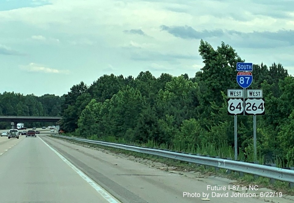
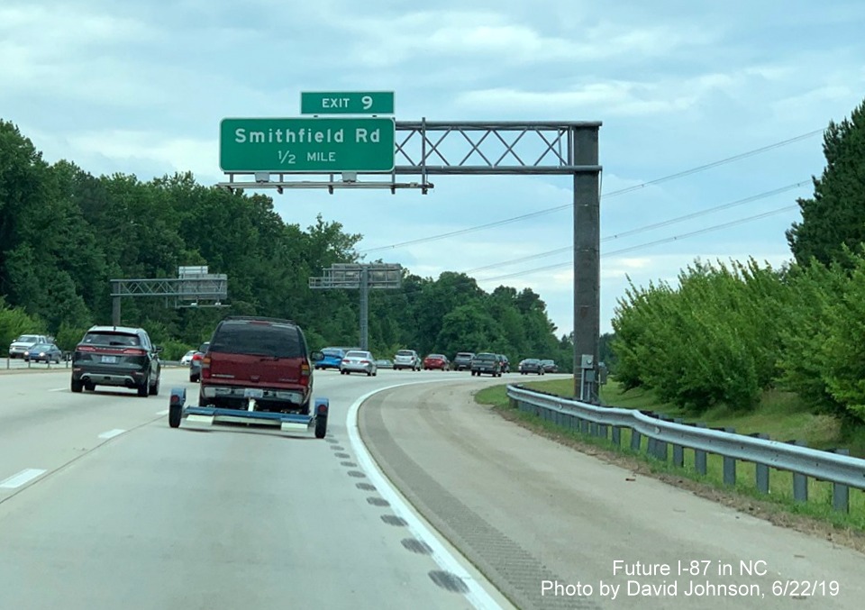
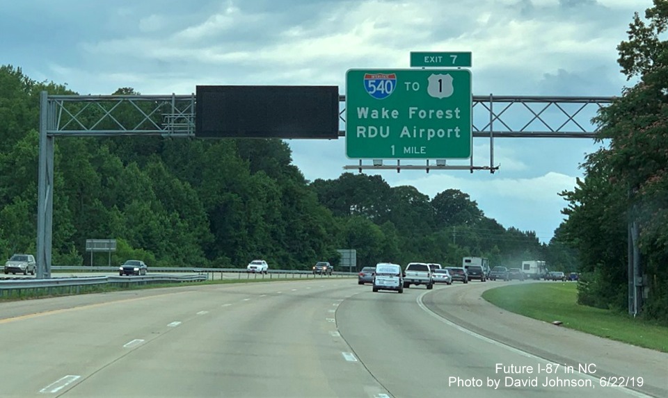
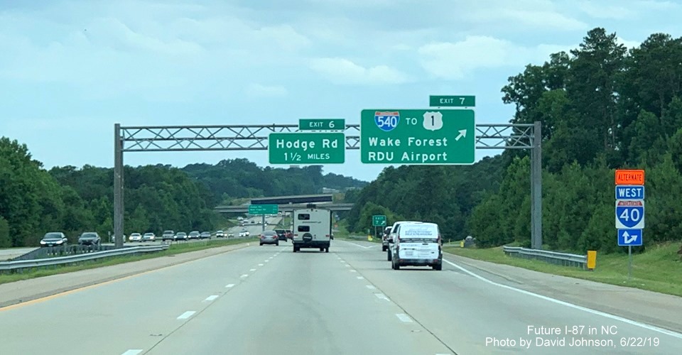
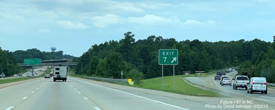
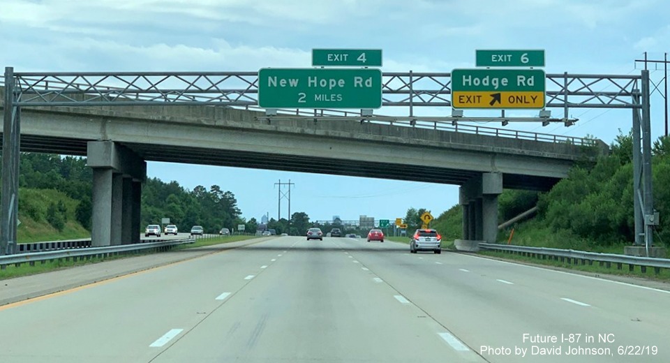
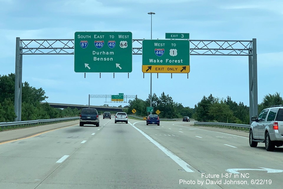
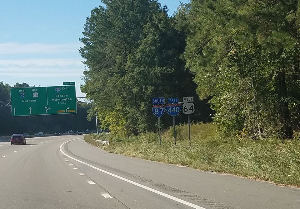
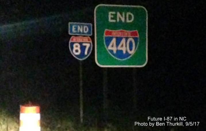
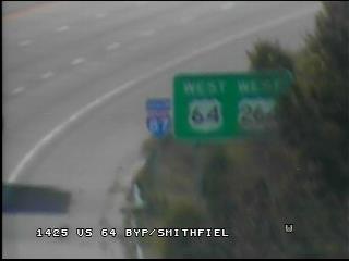
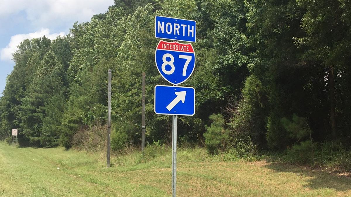
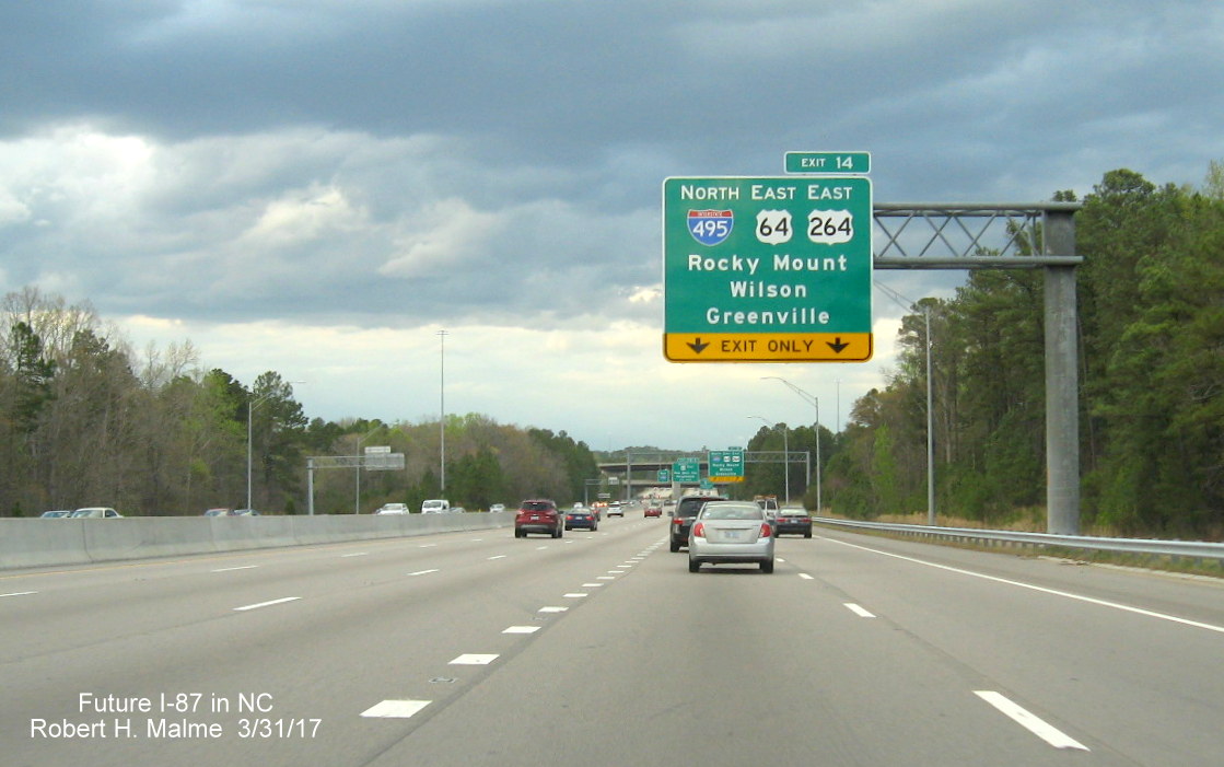
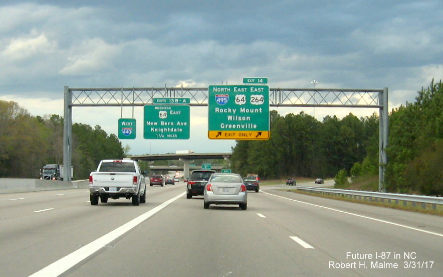
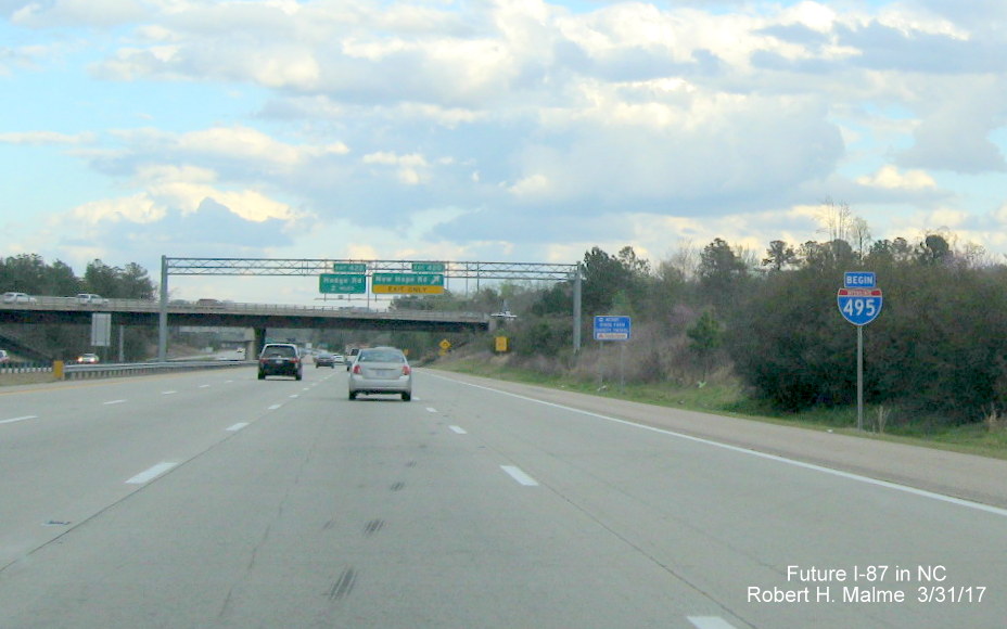
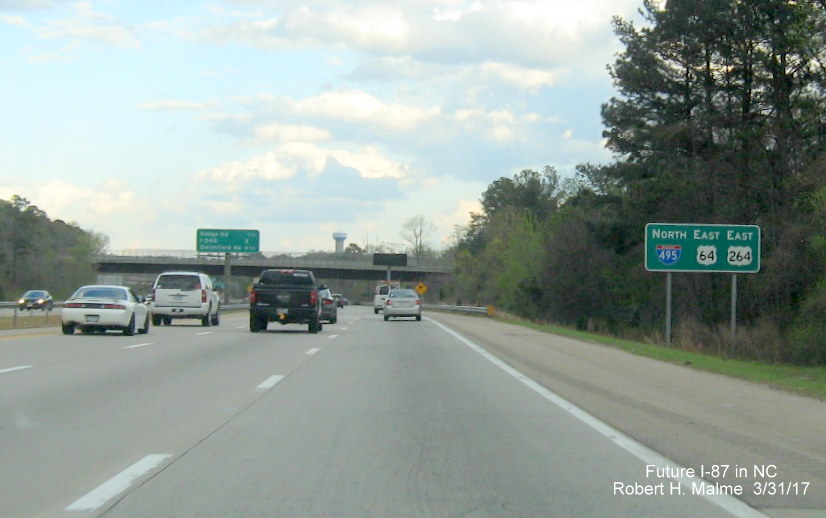
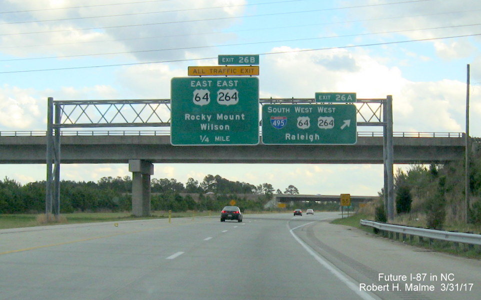
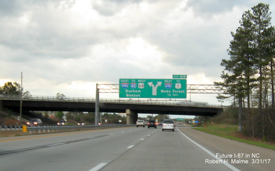
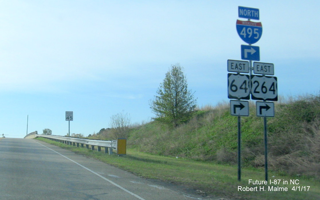
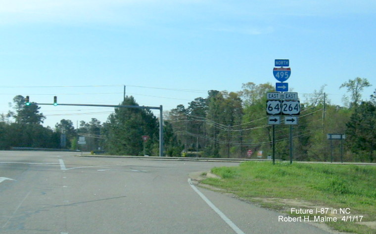
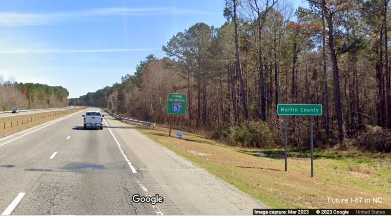
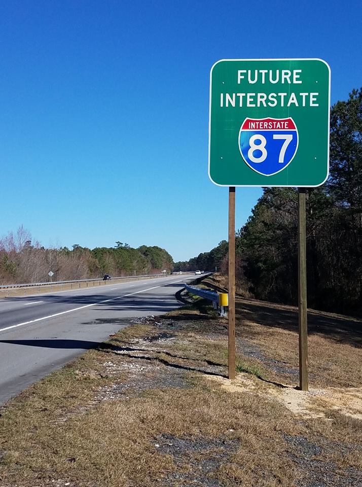
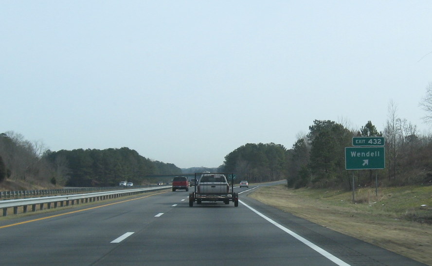
NCDOT started the placement of I-495
signs during mid-April 2014. Standard interstate shields were placed along the Bypass freeway
from I-440 to I-540, with North and South directional banners. Green signs with Future 495 were installed
on wooden posts along the rest of the US 64 freeway to I-95, first eastbound, and then back westward.
8
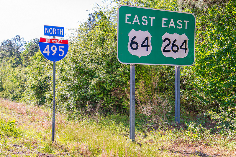
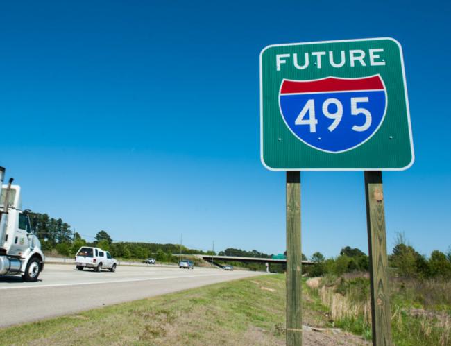 Photo courtesy of NCDOT.
Congressional Bill Results in New Designation
Despite the I-495 designation, NC officials and business groups like
the RTA still pursued an interstate designation for the entire US
64/US 17 Raleigh to Norfolk corridor. On December 15 2015, language
specifically calling for an interstate route for the corridor, and
along US 70 from Raleigh to Morehead City (Future I-42), was included
in the new transportation bill passed by Congress, the Fixing
America's Surface Transportation (FAST) Act. RTA and NCDOT immediately
started the process of getting an interstate number for the corridor.
RTA's suggested number, I-89, was applied for during the May 25, 2016
meeting of AASHTO's Special Committee on US Route Numbering.9
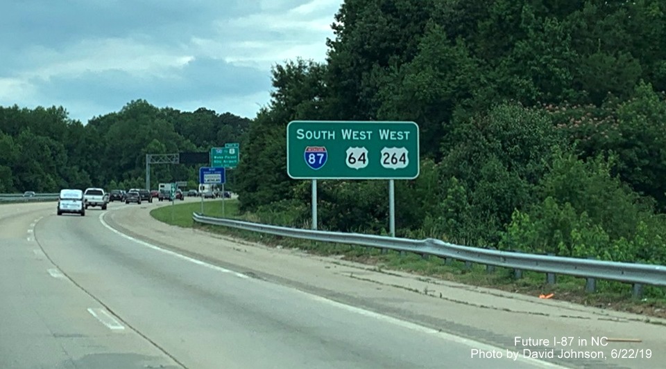
AASHTO agreed to approve the route, but only if it was numbered as
I-87. In November 2016, the FHWA and AASHTO approved NCDOT's request
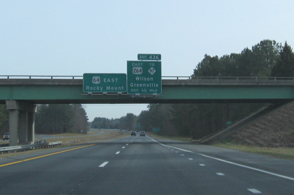
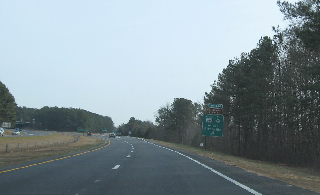
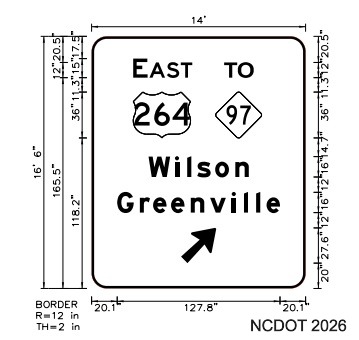
that US 264 from US 64 in Zebulon to Greenville be designated an I-87
spur route, I-587.10 In February 2017 the FHWA Interstate
Route Log was updated to include I-87. In May 2017, the AASHTO Special
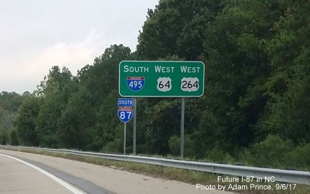
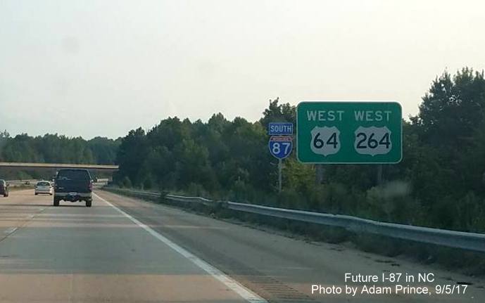
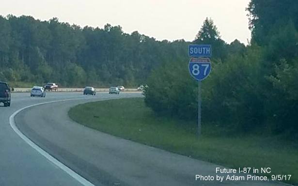
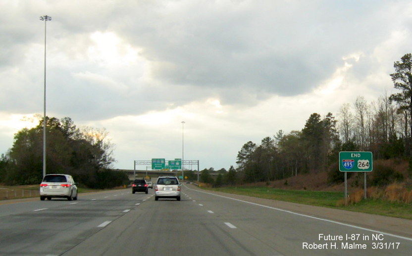
Committee on US Route Numbering approved NCDOT's request to delete the I-495 routes in favor of I-87.11
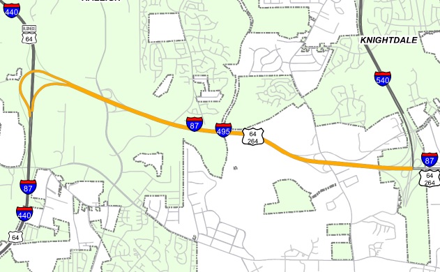
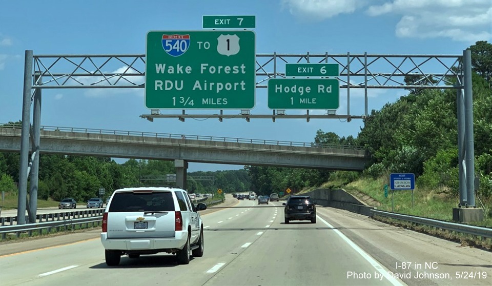
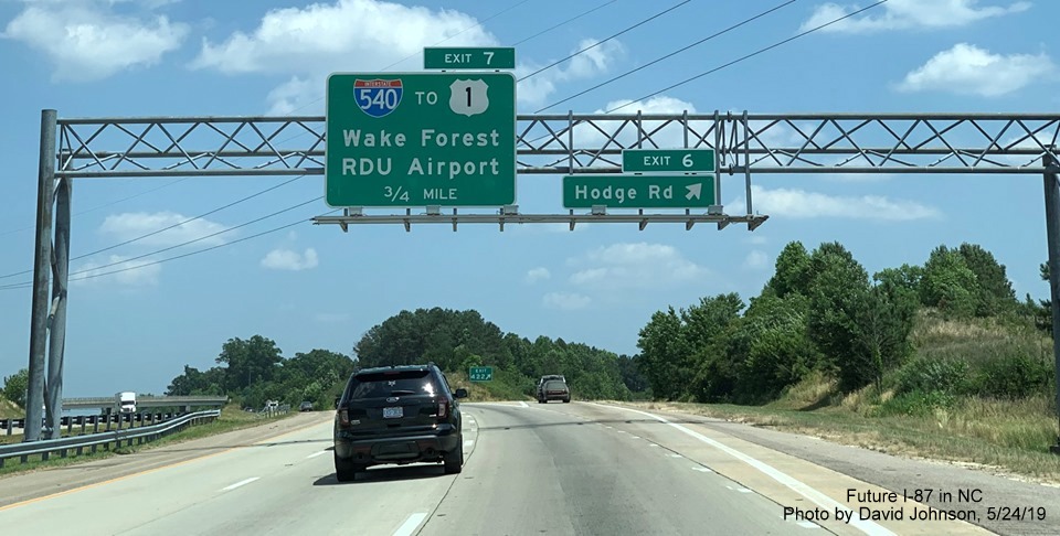
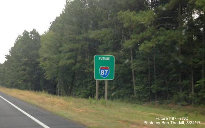
Future Construction
The US 64 freeway west of US 64 Business in Knightdale to
Williamston, nor US 17 from there to the Virginia border are currently
up to interstate standards. These parts of the I-87 route needs to be
upgraded before full interstate designation can be applied. The route
therefore, for the immediate future, will only be signed as I-87
section from I-40 along 2.9 miles of I-440 and along the Knightdale
Bypass for 11 miles to the US 64 Business exit (Rolesville Road exit
southbound). NCDOT did release a feasibility study (FS-1504A) about
upgrading US 64 from the current end of I-87 to its intersection with
US 17 in Williamston on August 16, 2017 breaking up the route into 8
segments.12 NCDOT estimated the upgrade of the 86.4 miles
of US 64 would cost between $267 and $369 million depending on what
modifications were made.They also published a feasibility study about
the US 17 portion in January 2018, 10 segments were evaluated with
costs ranging from $850 to $945 million depending on alternatives
chosen.13 Given that US 64 is already a freeway from
Raleigh to Williamston, upgrades to those segments should be easier to
make than those for US 17, which could take decades to build. Below,
based on the feasibility studies segments, are the proposed
construction plan, or plans, proposed to bring the route up to
interstate standards, the costs, whether the projects are funded, and
construction dates, if any. An unfunded project is unlikely to start
before 2035. In the fall of 2020, due to NCDOT budget problems related
both to extra costs due to hurricane related repairs, a court decision
regarding the need to make millions of dollars in payments to property
owners located at future highway sites, and budget shortfalls due to
the COVID-19 pandemic many future projects, including many involving
Future I-87, were delayed. The 2026-2035 STIP released in July 2025 did not add any new I-87 related projects
to its list of approved roadwork, see list below:
Videos of the I-87 Corridor
Drive south on the Future I-87 Corridor from Williamston to Raleigh on this
RoadwayWiz video from February 2026.
Drive north on the Future I-87 Corridor from Raleigh to Williamston on this
RoadwayWiz video from February 2026.
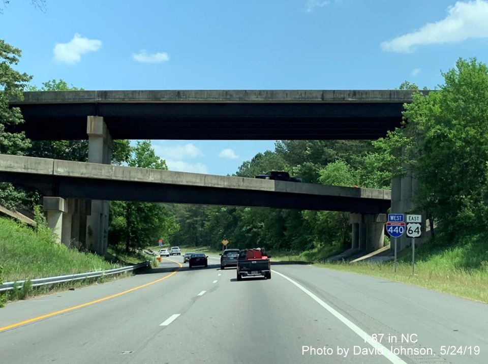
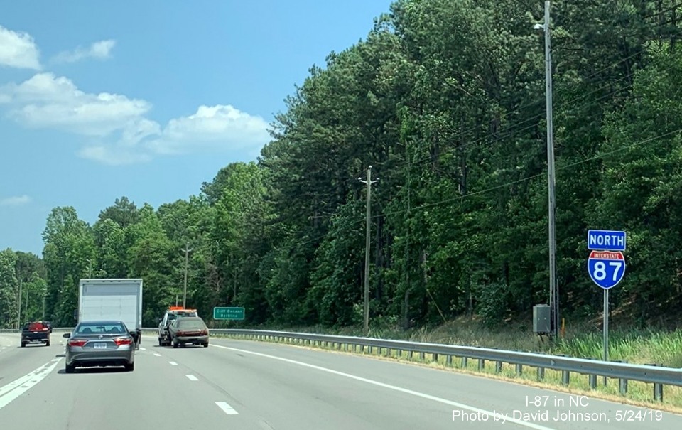
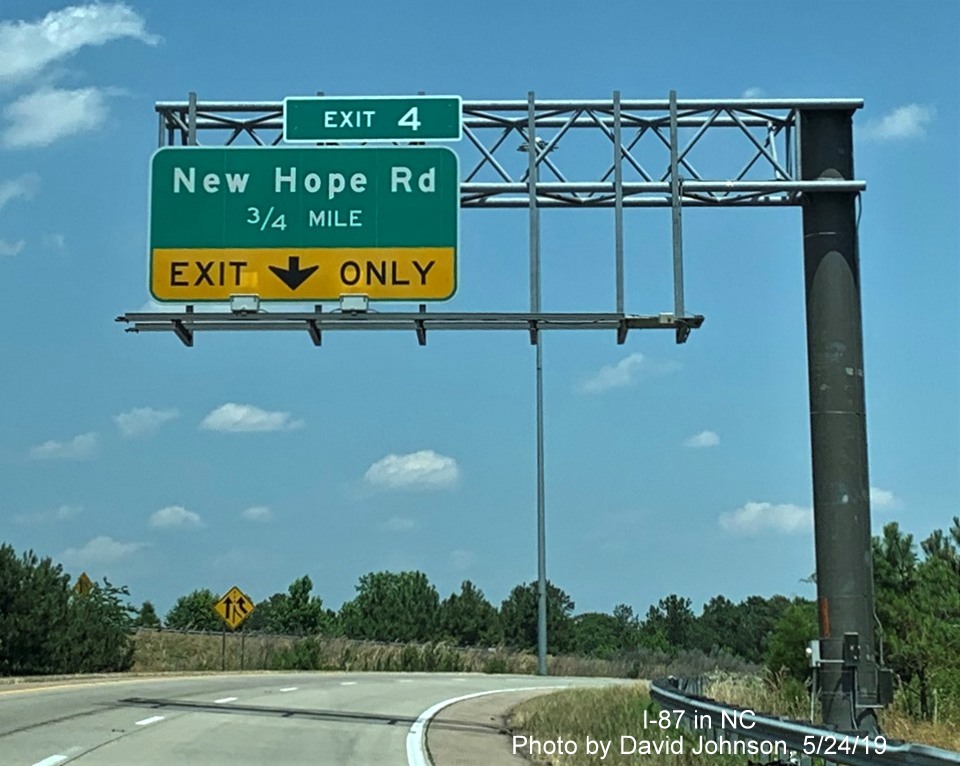
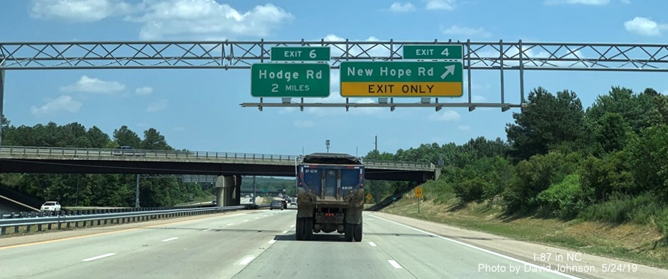
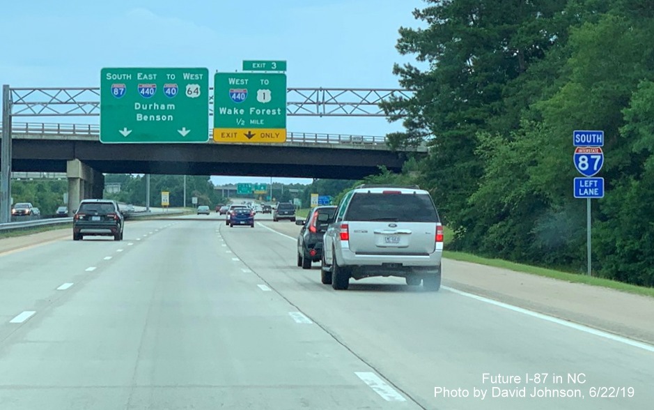
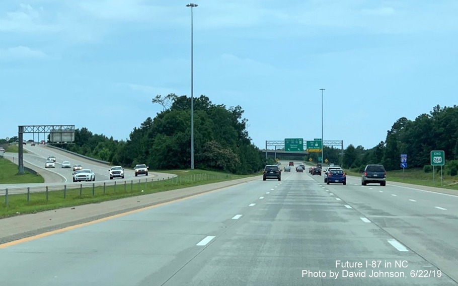
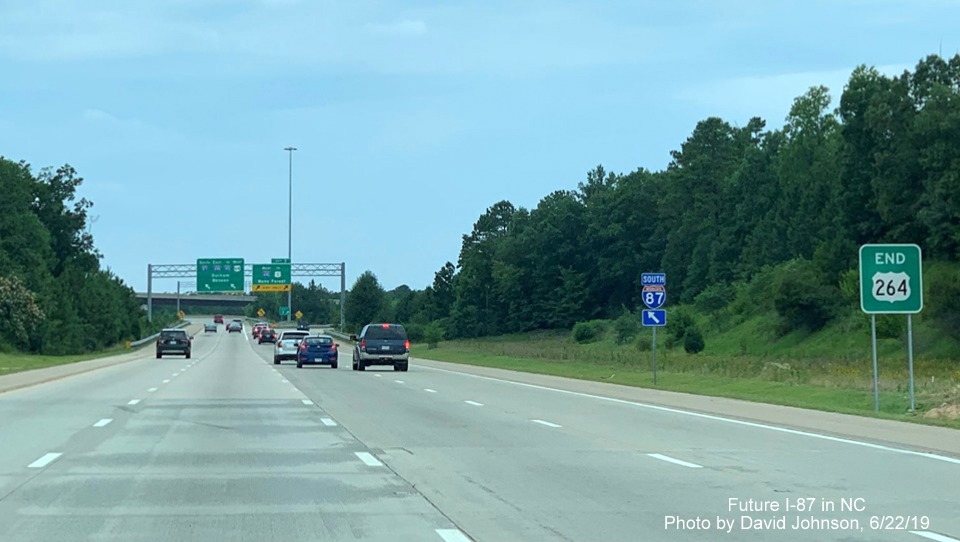
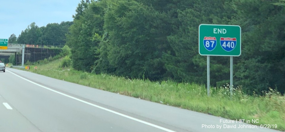
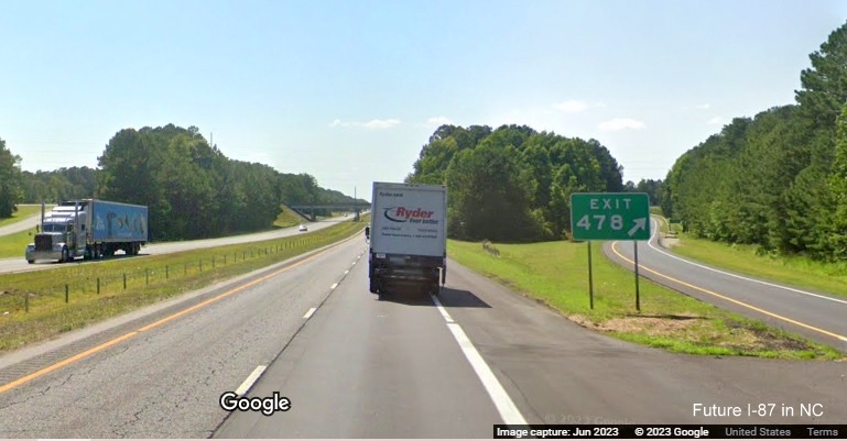
Segment 1
I-440, I-40 to US 64/264 Knightdale Bypass
Route Type: Interstate
Length: 2.9 Miles Status: Complete
This southern most segment for I-87 was first signed in September 2017 and was 'completed' when overhead signage
with I-87 shields were put up in May and June 2019 (see photos below). The exit numbers remained based on I-440 mileage
presumably because having Exits 1 and 2 on both sides of the Loop route might be confusing to motorists.
Drive north on this segment, and part of the next with this
RoadwayWiz video from the Summer of 2021.
Drive south on part of this segment, from the previous one with this
RoadwayWiz video
also from the Summer of 2021.
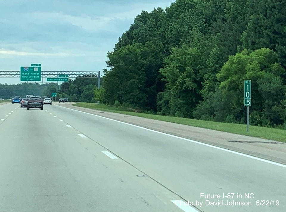
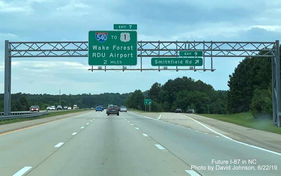
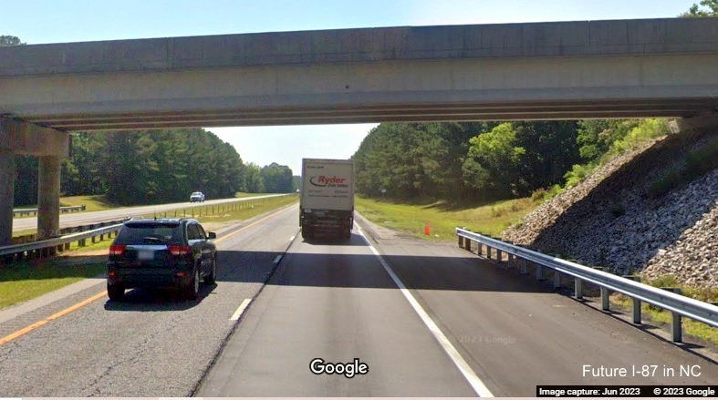
Segment 2
US 64/264 Knightdale Bypass, I-440 to Rolesville Road
Route Type: Interstate Length: 11 Miles Status: Complete
This segment for I-87 was also first signed in September 2017 and was
'completed' when overhead signage with I-87 shields were put up in May
and June 2019 (see photos below). Prior to the I-87 designation, the
segment between I-440 and I-540 was signed as I-495 and that between
I-540 and US 64 Business in Wendell was designated Future I-495. These
signs remained up until the permanent overhead I-87 signs went up in June 2019.
Drive north on this segment from the I-540 interchange with this
RoadwayWiz video also from the Summer of 2021.
Drive south on this segment from Wendell to the I-540 interchange with
this RoadwayWiz video also from the Summer of 2021.
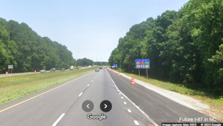
Segment 3 (Updated 6/15/26)
US 64/264 Freeway, Rolesville Road until US 64/US 264 Split in Zebulon
Route Type: 4-Lane Freeway Length: 7.5 Miles
Status: Not Interstate Standard Upgrade Project Funded: No*
The US 64/264 freeway east of the Knightdale Bypass has a 70 MPH
speed limit but has shoulders not up to interstate standards. NCDOT
originally planned to widen US 64/264 from the current end of I-87 at
Business 64 to the split on US 64 and US 264 (Future I-587) (Project
I-6005) starting in 2025, however that date was pushed back first to
2029 in the 2020-2029 STIP then later to at least 2034 in the final
2024-2033 STIP released in June 2023.14, 15It was then placed in the 'Unfunded' category the latest STIP
document published in July 2025 meaning no work is to start until after 2035. It was hoped that at least interstate
standard shoulders would be built as part of this construction project. The feasibility Study (Study) also indicated
the NC 96 and US 264 interchanges would need to be modified as part of the that project. Total estimated cost for the
6-lane project was $59.1 million.
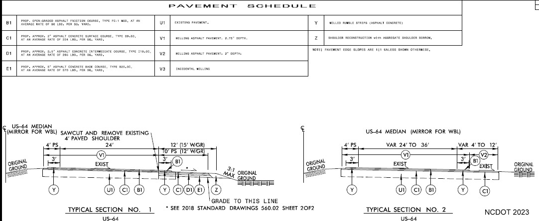
A pavement rehabilitation project (I-6001) from Rolesville Road through Franklin County to the
Nash County line that covers this segment and the first few miles of was first to be let in August 2025, this
was later delayed to March 2026, then to April, then May 2026 after NCDOT did not accept
any of the submitted bids.16 The project was finally started on June 1, 2026. It was hoped that shoulder
widening to interstate standards would be included. When the plans were first released in January 2026, however, they
indicated that while the shoulders would be widened, it would only be to 8 feet, of which only half would be paved, the
other half would be made of gravel, these plans were not changed in the subsequent lettings:
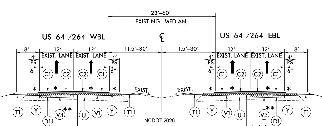
Plan of roadway section showing 8 foot paved (PS) and gravel shoulder on the right and 4 foot paved shoulder on the
left, this did not change between the February and March lettings.
Further new signs that are to be installed as part of this project are simply duplicates of the existing signs, this
includes the current exit numbers as well. The sign plans were the same when the second letting occured in March. There
are no hints of future I-87 (or I-587) signage, here are some examples:
Work is to be completed in August 2028.17 No other projects for this segment were listed in the 2026-2035 STIP released in
June 2024 nor funded in the Final STIP published in July 2025.18
*In October 2020, the NCDOT Board revised the 2020-2029 STIP "To Assist in the Balancing of Funds" and moved
Right-of-Way purchases from FY 2025 to 2028 and construction costing $53.7 million from 2029 to 'Post Years'
meaning the project was no longer funded. Funding then was restored in the updated Draft 2024-2033 STIP released
in August 2022, with the same start date, 2029, as before. The final STIP, however released
in June 2023, again removed funding except for preliminary engineering work for the project meaning it now would not
start until after 2033, the post-years status did not change with the new 2026-2035 STIP pushing it back to 2036.
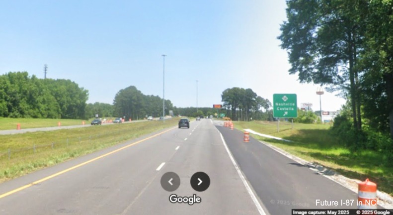
Segment 5 (Updated 6/25/26)
US 64 Freeway, US 264 exit in Zebulon to US 64 Alt./NC 231 exit in Spring Hope
Route Type: 4-lane Freeway Length: 9.8 Miles
Status: Not Interstate Standard Upgrade Project Funded: No
US 64, after splitting off from US 264 is a 4-lane freeway with shoulders and bridges not up to interstate standards.
Besides widening the shoulders to 12 feet, the Study recommends rebuilding 3 bridges, including at Alt. US 64/NC 231 at
a total cost of $27.1 million. The pavement rehabilitation contract (Project I-6001) from the
Rolesville Road exit to the Nash County line discussed above started in June 2026 includes part of this segment as well,
but the shoulders will not be widened to interstate standards . There are currently no other funded projects in the
Final 2026-2035 STIP that was published in July 2025, meaning no other projects are scheduled for construction until after
2035.
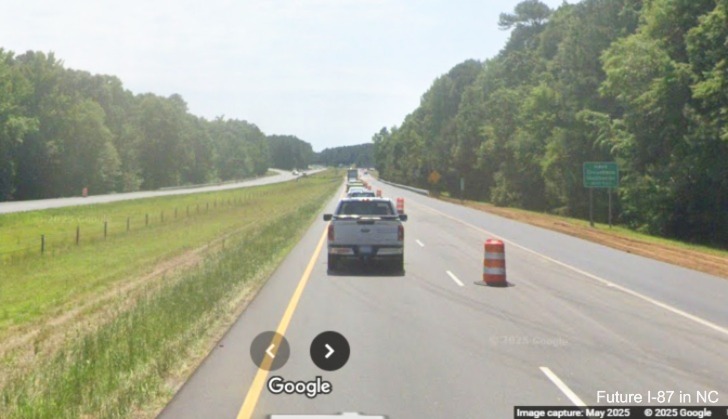
Segment 5
(Updated 4/16/26)
US 64 Freeway, US 64 Alt/NC 231 exit in Spring Hope to NC 58 exit in Nashville
Route Type: 4-lane Freeway Length: 11.9 Miles
Status: Not Interstate Standard Upgrade Project Funded: Some
US 64 in this segment is a substandard freeway. There is one
improvement project, part in this segment and part in Segment 6,
funded in the 2024-2033 STIP. NCDOT posted a press release on August
9, 2023 indicating a ten mile pavement rehabilitation project (I-6045)
from SR 1306 (Old Franklin Road) Exit 452 to Old Carriage Road at Exit
463 was awarded for $14.4 million to Wilson based contractor S.T.
Wooten Corp. While shoulder rehabilitation is a part of this contract
there was no mention of any interstate standard shoulder widening and traffic cameras images
from along US 64 in the area during 2023 and 2024 did not show any widening taking place.16 This
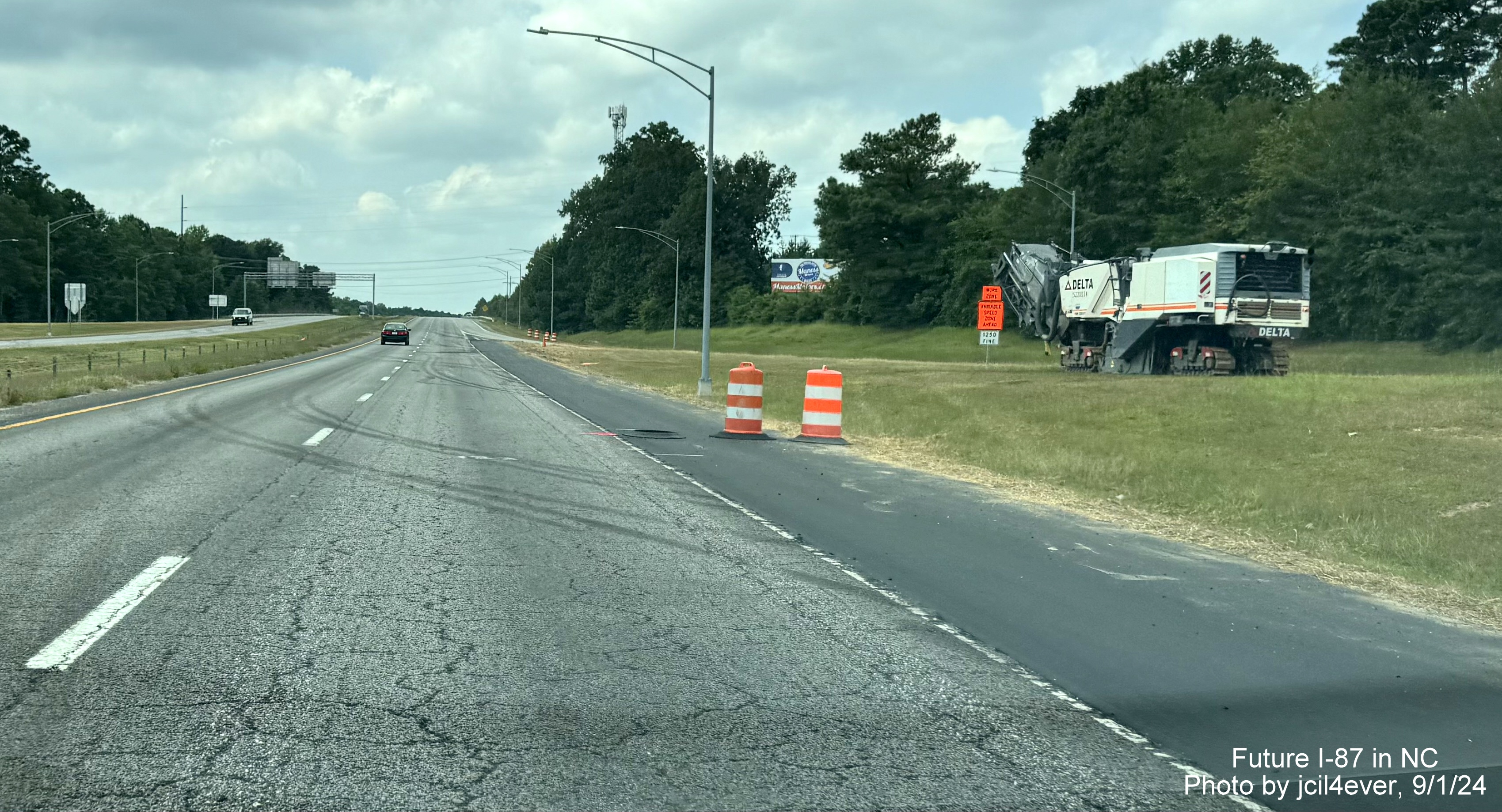
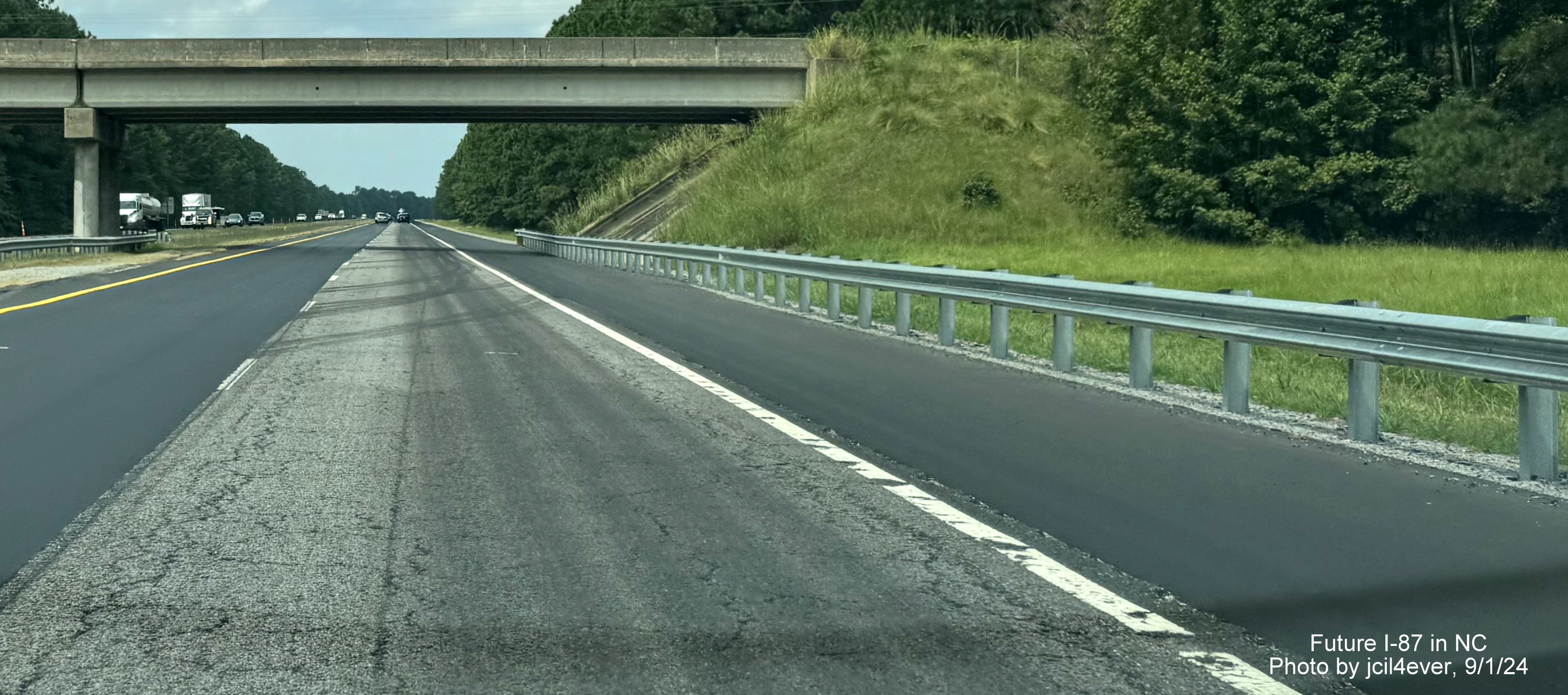
changed in early June 2025. AARoads Forum member jcil4ever (Benjamin Wolf) posted on June 4 that shoulder
widening was indeed taking place west of NC 58 in both directions. He posted several photos (see below) showing
the widening work.19 Work began in January 2024 and the project was to be completed in
October 2025, though according to the NCDOT Construction Project Report, work was still only 84.6% complete as of the end
of November 2025. The project was then removed from the Report in January 2026, implying its completion.20
According to the Study, this segment, in addition to needing shoulders widened to 12 feet, requires the widening of the dual
bridges over the Tar River and replacing the SR 1144 (Pine Street) bridge, along with the US 64 Alt Bridge in Nashville. Bridges
with low vertical clearances at SR 1148 (Big Woods Road) will remain with pavement milling to achieve increased height. Estimated
cost was $46 million. These are currently not funded projects, therefore construction cannot start until after 2035.
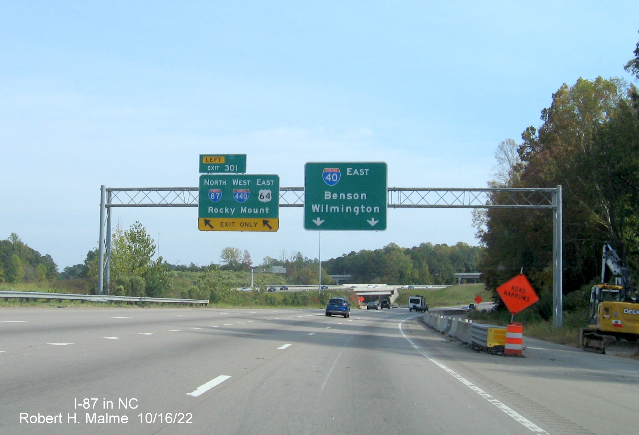
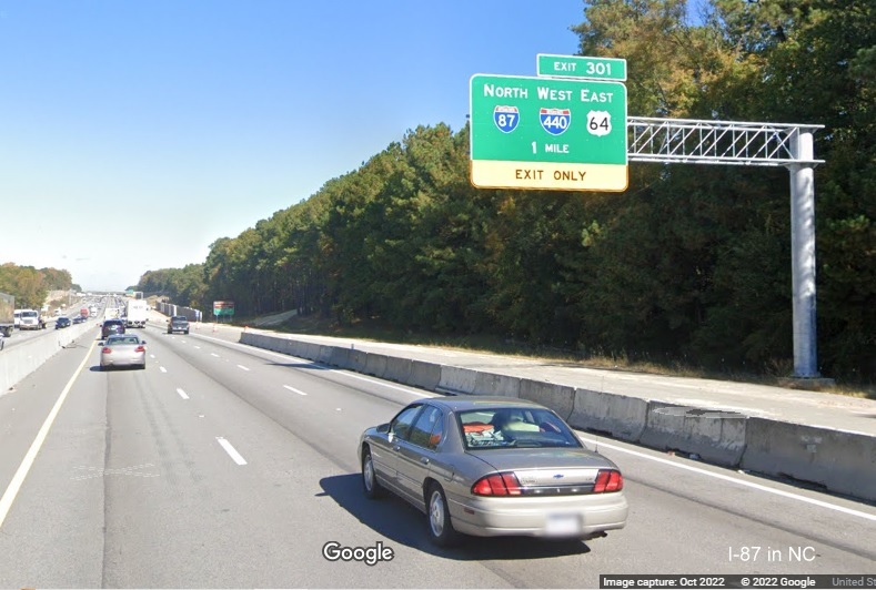
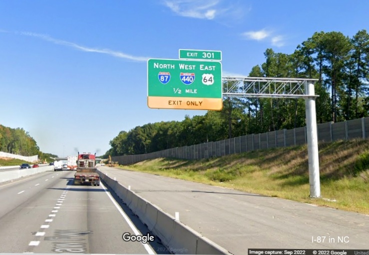
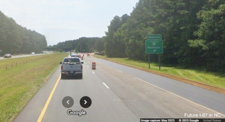
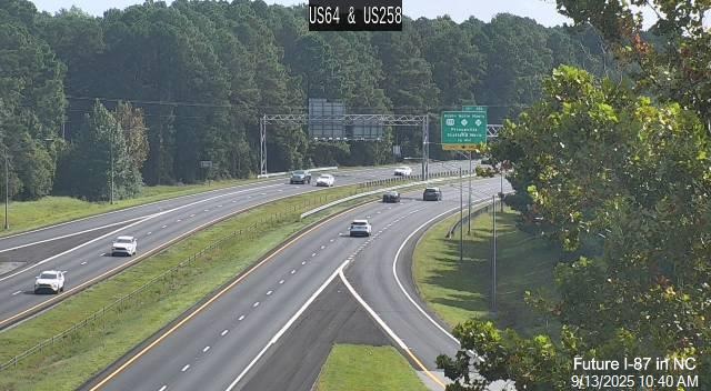
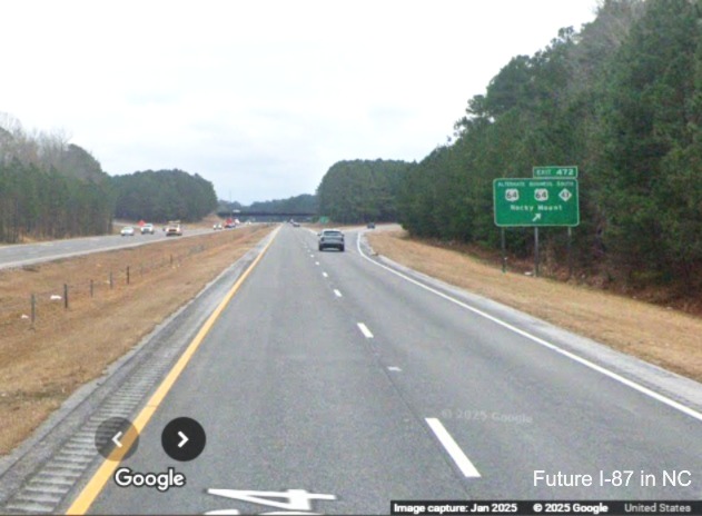
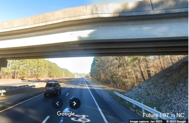
Segment 6 (Updated 8/4/25)
US 64 Freeway, NC 58 Exit in Nashville to I-95 in Rocky Mount
Route Type: 4-lane Freeway Length: 5.2
Miles Status: Not Interstate Standard
Upgrade Projects Funded: One
A project listed in the 2020-2029 STIP was to upgrade US 64 to
Interstate Standards (U-6149) from NC 58 in Nash County to beyond I-95
to the Thomas Road overpass east of Rocky Mount, a total of 15.1
miles, but, was not planned to start until after 2029, meaning the
project was unfunded, though right of way purchases were to start in
2029.21 This project though disappeared in the 2024-2033 STIP released in July 2023.
In the list of potential projects for the upcoming 2026 to 2035 STIP,
released in May 2024 U-6149 reappeared at a projected cost of $204.1
million. It's State Mobility score however was listed as 70.89/100,
indicating it probably would not get funded when the draft list of projects is
released in early 2025, it did not, nor did it appear in the
Final 2026-2035 STIP published in July 2025.22 As discussed in Segment 5, there
is a pavement rehabilitation project (I-6045) from SR 1306 (Old
Franklin Road) in Nash County to I-95. This project was to be let on
January 21, 2020 but was never advertised and later was deleted from
the Letting List in February 2020. It reappeared in the 2024-2033
Final STIP document published in June 2023, only this time between Old
Franklin Road and Old Carriage Road (1 mile short of I-95) with a 2023
construction date.23 NCDOT's August 9, 2023 press release
said work could start in the fall and the contractor would have 2
years to complete the project.18 As mentioned in Segment 5,
work finally started in January 2024. Shoulder rehabilitation is a
part of the contract, along with shoulder widening performed in the spring and summer of 2025.
The rest of the segment is covered by the other pavement
rehabilitation, project (I-6046) from Old Carriage Road (SR 1603) to
beyond I-95 at Kingsboro Road (SR 1225), discussed in Segment 7.
Shoulders are interstate standard the last mile of this segment from Red Oak Road to I-95. The
Study also discusses three different alternatives for the current
median, keep it at current width (36 feet), widen it to 42 feet, or,
with the use of a median barrier, reduce it to 26 feet. It also
recommended that the remaining bridges could simply be widened. The
cost estimate range from $32.9 to $45.3 million depending on which
median option is chosen. This project was not funded in the latest STIP.
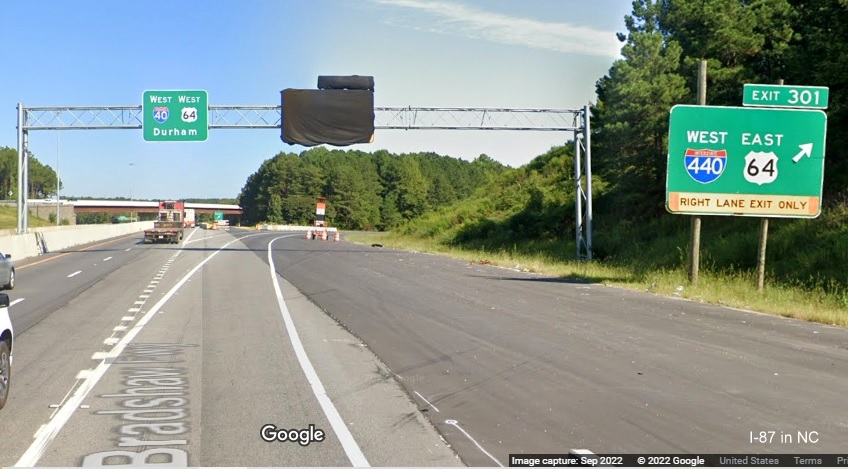
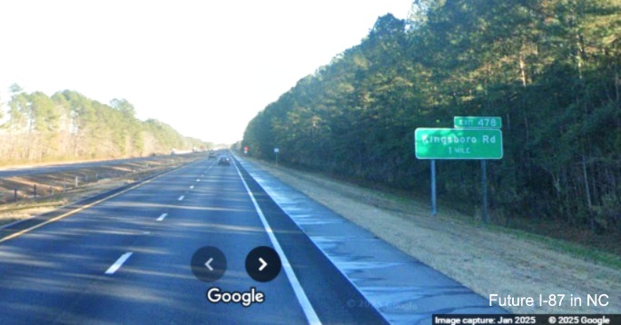
Segment 7 (Updated 8/4/25)
I-95 in Rocky Mount to US 64 Alt./US 64 Bus./NC 43 South exit at eastern city limits of Rocky Mount
Route Type: 4-6 lane Freeway Length: 7.5
Miles Status: Partially Interstate
Standard Upgrade Projects Funded: Some
Most of this segment was also part of the unfunded project listed in
the 2020-2029 STIP for Segment 6 to upgrade US 64 to Interstate
Standards (U-6149) from NC 58 in Nash County to beyond I-95 to the
Thomas Road overpass east of Rocky Mount (except for the portion
between the Thomas Road overpass and the US 64 Alt./US 64 Bus./NC 43
exit) that was not funded in the 2026-2035 STIP. There are several
funded pavement and bridge rehabilitation projects for US 64 in Nash
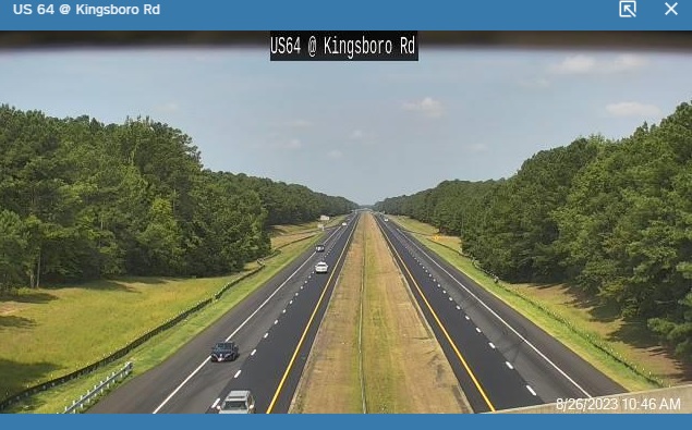
and Edgecombe Counties planned for this segment, I-6046 from I-95 to
SR 1225 (Kingsboro Road), underway and discussed under Segment 6, and
I-6041 from SR 1225 to NC 33, that was to start in 2020, but were
delayed 3 years and finally advertised in May 2023.24 (This
project was later due to start in FY 2022, but then delayed
temporarily to 2025 by STIP modifications in October 2020, along with
Projects 6041A that will rehabilitate the bridges over US 64 in the
area.25) Shoulder widening may be part of these contracts,
though the shoulder is interstate standard from I-95 to Business 64 at
Mile 467. The listing for I-6046 was removed from NCDOT's Construction
Progress Report in October 2024, implying work was complete, it had been
listed as 85.7% complete at the end of July.26 Some shoulder widening was a part of this
project, as seen in these videos from May 2025 and traffic camera from 2023:
Drive north on this segment from the I-95
interchange to Kingsboro Road in Segment 8 in this video
from Mileage Mike Travels from May 2025.
Drive south on this segment from the Kingsboro Road exit in Segment 8 to the I-95
interchange to Kingsboro Road in this video from Mileage
Mike Travels from May 2025.
It appears though that this was due to some supplemental funds added to the contract, that only cover the
segment around Kingsboro Road eastward to Thomas Road (the rest towards Rocky Mount to be upgraded
to an interstate under Project U-6149). Regardless, further upgrade work besides shoulders would be needed.
The Study recommends two alternatives, one that would keep the current 65 MPH speed limit, the other with projects
that would allow this segment to match the speed limit, 70 MPH, in the surrounding segments. Other projects in upgrading
US 64 would involve creating auxiliary lanes between I-95 and the Winstead Avenue exit, replacing the eastbound bridge
over Stony Creek and widening the westbound bridge and bridges for SR 1616 (Country Club Road) and SR 1243 (Leggett
Road) to accommodate the auxiliary lanes. Loop ramps for Exits 467 (Bus. 64), 468A (US 301 Bypass), 468B (NC 43/48),
469 (US 301 Business) and 470 (NC 97) would also have to be rebuilt as part of the upgrade project. The 65 MPH alternative
is estimated to cost $27.3 Million, while the 70 MPH version would be $32.9 million. These projects are likely not to start
until after 2035.
Segment 8 (Updated 4/16/26)
US 64 from eastern Rocky Mount City Limits to western Tarboro City Limits
Route Type: 4-lane Freeway Length: 11.1 Miles Status: Not Interstate
Standard Upgrade Projects Funded: Some
US 64 in this segment is a 4-lane freeway whose shoulders and bridges are not up to interstate standards. The two
funded pavement rehabilitation projects for US 64 cited in Segment 7 continue in this segment too with I-6046 underway
from I-95 to SR 1225 (Kingsboro Road), and I-6041 from SR 1225 to NC 33. Work on the first
project started in September 2023 and was completed nearly 2 1/2 years later, by the end of 2025, when its listing on
NCDOT's Construction Progress Report information was removed.25 Shoulder widening at least from Mile
470 to Kinsgsboro Road was completed in June 2023, see photos below for this segment, and may be part of the rest of the
contracts. A traffic camera image from December 5, 2024 shows shoulder widening was complete in the vicinity of the McNair
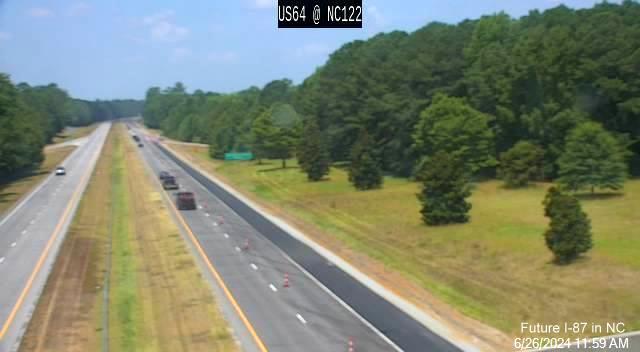
Road (NC 122) exit but work was continuing to the US 258 exit 4 miles further east:
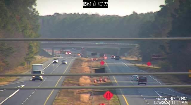
The view 6 months earlier when the shoulder widening was completed heading west:
By August work has reached further east to the US 258 exit and project notices
indicated lane closures all the way to the eastern project limits at NC 33:
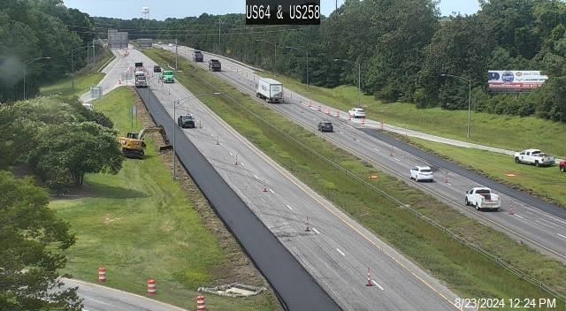
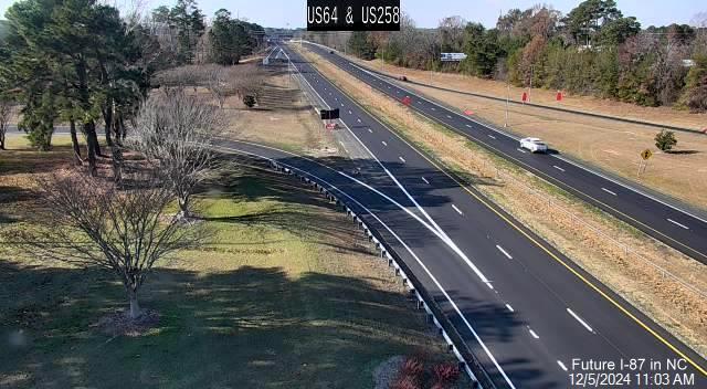
Work was completed in the fall, here's a December traffic camera image showing the completed highway:
The Study recommends, besides widening the shoulders, that the US 64 East bridge over the CSX railroad
tracks and both bridges over SR 1208 (Howard Avenue) be widened. Total cost is estimated at $27.2 million.
This project remained unfunded in the 2026-2035 STIP, thus not planned to start until at least after 2035.
Drive west on the Future I-87 Corridor from Tarboro to Rocky Mount on this
D~Town Drives video from March 2026.
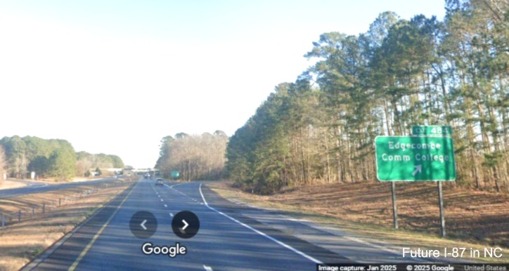
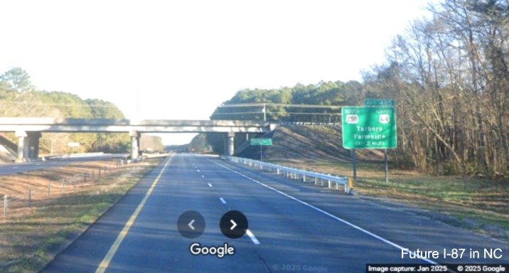
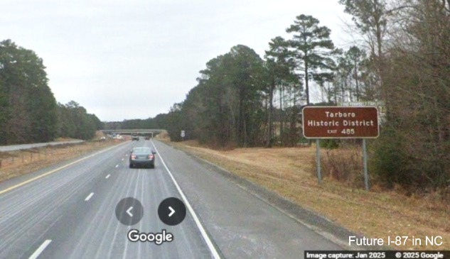
Segment 9 (Updated 2/23/25)
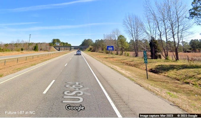
US 64 from western Tarboro City Limits to Edgecombe/Martin County Line
Route Type: 4-lane Freeway Length: 13.4 Miles
Status: Interstate Standard* Upgrade Project Funded: Yes
While most of the shoulders in this segment are already interstate
standard (east of US 64 Alt, Exit 486), this segment will still need
some upgrades to be able to be signed as I-87. The funded pavement
rehabilitation project I-6041, cited in Segment 8, covers the first
2.4 miles of this segment. Project I-6042 covers the final 11 miles
from NC 33 to the Martin County line. Both projects were to start in
2022, but later were delayed in the the October 2020 STIP
modifications to 2025.28 In April 2022, however they were
added back to the 13-month tentative letting list for May 2023.29
Project I-6042 started on January 29, 2024 and work was apparently
completed by the end of November of that year since its listing was removed from
NCDOT's Construction Progress Report site.30 Interestingly, while up, the
listing for I-6042 already indicated the route was I-87, shoulder widening was part of the project:
See photos below showing the completed widening. Further upgrade work is
needed however. The Study recommends, besides shoulder widening of the eastbound bridge over the CSX railroad,
replacing the US 64 Alt./US 258 South bridge over US 64 as well as both bridges over the Tar River. In addition
to the US 64 bridge replacement, the study recommends revamping the interchange (Exit 485) as well as widening
the interchanges at Exits 486 (US 64 Alt East/US 258 North), 487 (Kingsboro Road), 488 (Shiloh Farm Road),
491 (SR 1524/Chinquapin Road), 494 (NC 42) and 496 (US 13/NC 11). Total cost is estimated at $45.4 million. These
projects are not listed in the July 2025 Final 2026-2035 STIP and therefore will not be constructed at
present until after 2035.
*Shoulders are interstate standard, except those to the west of the Tar River bridges which will have to be widened.
Segment 10 (Updated 7/1/24)
US 13/64 from Edgecombe/Martin County Line to US 17 in Williamston
Route Type: Interstate Standard Freeway Length:
18.4 Miles Status: Complete (Signage could be updated)
The US 13/64 freeway from the Edgecombe/Martin County Line was built to interstate standards. The feasibility study
only recommends possible signage updates and the addition of an ITS system costing $2.2 million. They also suggest the
possible reconstruction of the NC 125 (Prison Camp Road) interchange which would add another $2.5 million to the total.
A divisional contract (DA00512, TIP No. I-6028C) was let on January 19, 2022 that resurfaced 7.3 miles in Martin County
from NC 125 to the US 17 intersection. Work was completed by the end of December 2023. Work was also completed on another
pavement rehabilitation contract (I-6028B) that did similar work from US 64 Alternate to NC 125.
Segment 11 (Updated 8/5/25)
US 13/17 from US 64 Exit in Williamston to Roanoke River Bridge
Route Type: 4-Lane Highway Length: 1.4 Miles
Status: Not Interstate Standard Upgrade Project Funded: No
I-87 is to continue along US 17 which runs concurrently with US 13
after the US 64 exit after which the highway becomes a 4-lane arterial
roadway with businesses and side streets through Williamston. There
are no projects to upgrade this segment to an interstate in the
2024-2033 STIP. The list of potential 2026-2035 STIP projects from May
2024 does list two projects to upgrade US 17. The first would upgrade
the route to Interstate Standards from US 64 to the Roanoke River
bridge at a cost of $90.3 million. The State Mobility Score though is
only 56.98/100, so it was not a surprise when the project did not show up in the Draft
STIP published in January 2025 nor the Final version released in July. The second from US 64 to US 13
in Windsor (also covering Segments 12 and 13) that would only upgrade
US 17 to Freeway Standards. It has a higher estimated cost of $240.3
million and the State Mobility Score is lower, 53.46, so it also was not
included in the new Draft or Final STIP.22
The US 17 Feasibility Study (Study) suggests 3 alternatives. The
first is an upgrade of the existing highway, the US 13/17 interchange
with US 64 would be upgraded to a partial cloverleaf. Extensive ROW
purchases would be required to create service roads parallel to US
13/17. The existing Roanoke River bridge would be used and a design
exemption sought from the FHWA due to its narrow shoulders. The second
suggested alternative would be a new freeway built to the east of US
13/17. The freeway would tie back into the existing route just south
of the Roanoke River Bridge which would be retained, again with a
design exemption sought for the insufficient shoulders. The third
would include the new freeway from the second alternative but continue
it across the Roanoke River on a new bridge meeting the existing US
13/17 just north of the bridge. The costs range from $75.3 million for
the first alternative to $76 million for the third (the cost of a new
bridge is offset by the reduced the cost for much fewer ROW purchases).
Segment 12 (Updated 8/5/25)
US 13/17 from Roanoke River Bridge to Pleasant Oak Road
Route Type: 4-Lane Highway Length: 8.5 Miles
Status: Not Interstate Standard Upgrade Project Funded: No
US 13/17 in this segment is a 4-lane divided roadway with several
intersections. No project was funded in the Final 2024-2033 STIP
published in June 2023. There would be an upgrade under the proposal
from the preliminary 2026-2035 STIP project list previously discussed
in Segment 11 only bringing US 17 to Freeway Standards from US 64 to
US 13 in Windsor. It had a cost of $240.3 million and a low State
Mobility Score of 53.46, and therefore was not chosen to be included in
the Final STIP released in July 2025, which means no construction before 2035.
The Study has only one suggested alternative for the upgrading the
current US 13/17 highway. Exits would be constructed for Outlaw Farm
Road and George Leggett Road. The intersection with Willoughby Lane
would be grade separated. A series of service roads would be created
to tie businesses into the surrounding road network. Total cost is projected at $87.8 million.
Segment 13 (Updated 8/5/25)
US 13/17 from Pleasant Oak Road to Beginning of Windsor Bypass
Route Type: 4-Lane Highway Length: 4.5 Miles
Status: Not Interstate Standard Upgrade Project Funded: No
The needed upgrades to this segment were not funded in the 2024-2033 STIP
for this part of US 13/17. Again, there was an upgrade project listed under the preliminary 2026-2035 STIP project list
previously discussed in Segment 11, but only bringing US 17 to Freeway Standards from
US 64 to US 13 in Windsor. It had a cost of $240.3 million and a low State Mobility Score of 53.46, therefore was not
chosen to be included in the Final STIP published in July 2025.
The Study has 2 alternatives for the segment: Upgrade the existing US
13/17 highway to interstate standards with the road being widened
along the northbound side which would require taking properties. The
existing southbound lanes would become a service road and a new
service road would be built next to the northbound lanes. An
interstate standard exit would be constructed for the split of US 13
from US 17 at the Windsor Bypass while grade separations would occur
elsewhere. The second alternative is to build a new freeway to the
west of existing US 13/17 with an interchange built north of Roquist
Creek to provide access to current US 13/17. The freeway would tie
back to the existing alignment at the Windsor Bypass. This alternative
requires construction through wetlands as well as farmlands. The costs
range from $60.7 million for the new freeway to $67.5 million for
upgrading the existing road, the major expense being for right-of-way purchases estimated at $23.4 million.
Segment 14 (Updated 8/5/25)
US 17 Windsor Bypass
Route Type: 4-lane Freeway Length: 6.8 Miles
Status: Not Interstate Standard Upgrade Project Funded: No
The US 17 Windsor Bypass is a 4-lane freeway that only needs a few modifications to become an interstate. While an
upgrade project was listed for potential inclusion in the 2026-2035 STIP, listing an upgrade of US 17
to Interstate Standards starting at the US 13 intersection. The cost was estimated to be $75.1 million, and it had a
State Mobility Score of only 52.11 out of 100, these factors kept it off the final STIP list released in July 2025.20
The Study recommends widening the shoulders to 12 feet and minor modifications to the existing King Street and Wakelon
Road exits. Costs are projected at $43.6 million.
Segment 15 (Updated 8/5/25)
East End of Windsor Bypass to Chowan River
Route Type: 4-lane Highway Length: 4.8 Miles
Status: Not Interstate Standard Upgrade Project Funded: No
US 17 continues from the western end of the Windsor Bypass to the
Chowan River bridge as a 4-lane expressway. No funding was listed in
the Final 2024-2033 STIP for upgrading this segment. The preliminary
list of possible 2026-2035 STIP projects does have an upgrade of US 17
to Interstate Standards from the end of the Windsor Bypass to the
south end of the Chowan River Bridge "to upgrade an existing highway
and provide a section of I-87 connecting Raleigh NC to Norfolk VA."
The cost was estimated at $228.8 million while the State Mobility Score
was 54.83, and therefore was not chosen to be funded for Final STIP construction prior to 2035.22
The Study suggests 2 alternatives. The first, upgrading the existing
highway, would redo the interchange at the end of the Windsor Bypass
to create a service road that would parallel US 17 until a proposed
exit at Jamestown Road. Additional service roads would be built on
either side of the highway ending just before the Chowan River bridge.
Access to NC 45 would only be through the service roads. An additional
exit would be built for Bal Gra Road. The second alternative would
build a new freeway to the east/south of the existing US 17. Diamond
interchanges would be built at NC 45 and Bal Gra Road, the Jamestown
Road intersection would become a grade separation. Service roads would
be built to the north of Bal Gra Road to the Chowan River. The cost of
alternative 1 would be $132.9 million compared to $118.3 million for
the second alternative. Again most of the differences in cost are due
to additional ROW purchases required for the first alternative ($43.4 vs. $16.9 million).
Segment 16 (Updated 8/5/25)
Chowan River Bridge to northern end of Edenton Bypass
Route Type: 4-lane Highway/Freeway Length: 11.6 Miles
Status: Not Interstate Standard Upgrade Projects Funded: Yes
US 17 in this segment is a mix of a 4-lane expressway and access controlled freeway, the Edenton Bypass. There is a
pavement rehabilitation project funded along US 17 for Chowan County (I-6027) which was to start in 2022, but that was
delayed to 2025 in the 2020-2029 STIP31 and in the Final 2024-2033 STIP was delayed again to 2029, it is
unclear whether this will involve shoulder widening.32The Final 2026-2035 STIP released in July 2025 did not
list any projects for this segment.
For the freeway portion, the Study simply recommends widening of the road's shoulders. The existing Chowan River
Bridge would be retained. For the 4-lane portion the study recommends upgrading the route to include service roads
which would include using the existing southbound lanes as a service road in the vicinity of Thick Neck Road.
A diamond interchange is recommended for the current intersection with Davenport Lane. Total costs are estimated at
$87.5 million.
Segment 17 (Updated 8/5/25)
North end of Edenton Bypass to southern end of Elizabeth City Bypass
Route Type: 4-lane Highway Length: 19.0 Miles
Status: Not Interstate Standard
Upgrade Project Funded: Some (Only for Part of Hertford Bypass)*
US 17 between the Edenton Bypass and Elizabeth City Bypass is a
4-lane expressway with an existing Bypass around Hertford. The
2024-2033 STIP included 3 projects (R-5869A-C) to upgrade
intersections along the Hertford Bypass. The Bypass work included the
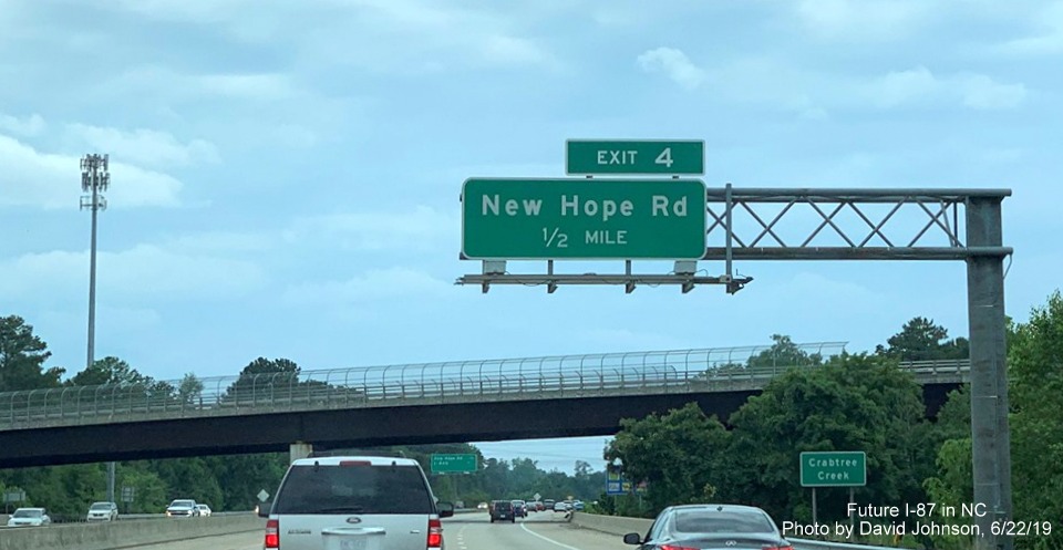
upgrade of the Harvey Point Road SR 11336 (R-5869A) and New Hope
Road/SR 1300 intersections (R-5869B) to interchanges with work to start to 2028. However the
project to upgrade US 17 from Edenton Road to Wiggins Road (R-5869C)
was unfunded in the 2024-2033 STIP.34It was, however, cited among possible
2026-2035 STIP projects in the May 2024 list where it is described as
an "Upgrade Arterial to a controlled access corridor to achieve
Interstate Standards." The cost estimate was $349.2 million but its
State Mobility Score was only a modest 58.08/100, meaning it was not
included in the final 2026-2035 STIP published in January 2025.22
In the Final STIP released in July 2025 the R-5869C project remained
unfunded. The R-5869A and B projects received funding for 'Preliminary Engineering Only.' Therfore,
it appears these projects also will not start until after 2035. There are also listed in the new STIP several pavement
rehabilitation projects planned along over 10 miles of US 17 in Perquimans County. (HI-0026, HI-0027 and HI-0028)
which would improve the roadway between the Perquimans County line and the bridges over the Perquimans river. Work
would start in 2029 at a cost of $10.6 million, it is unknown if shoulder widening would be included.35
The Study recommends 2 possible alternatives for the remainder of
the segment. The first upgrades the existing highway to interstate
standards requiring grade separations and the building of service
roads north of a Davenport Road interchange. The service road along
the southbound side would stop at a proposed diamond interchange at
Bear Swamp Road, picking up again after the exit. A partial
interchange would be constructed at Edenton Road while a half
cloverleaf exit would be built at Church Street. The existing bridge
would be used to cross the Perquimans River followed by a partial
cloverleaf exit at Creek Drive. A partial cloverleaf interchange is
proposed for Woodland Church Road with service roads constructed on
both sides of US 17 to the north of the exit. The existing Okisko Road
exit would be modified with minor ramp improvements. The second
alternative follows the first until Wiggins Road where a partial
cloverleaf interchange would be built. A new freeway would then be
built to the north of the existing highway with a diamond interchange
proposed for Chapanoke Road. A service road would be built to the west
of the new freeway with it meeting the existing US 17 south of Okisko
Road where that exit would be modified as in the first alternative.
Costs are project to be $193.5 million for the first and $217.7 for
the second. The highest cost for any Future I-87 segment.The I-6030
project was put on NCDOT's Suspended list in September 2019.
Segment 18 (Updated 8/5/25)
US 17 Elizabeth City Bypass
Route Type: 4-lane Freeway Length: 10.2 Miles
Status: Not Interstate Standard Upgrade Project Funded: No
The US 17 Elizabeth City Bypass was built in 2002, but not to
Interstate Standards. There was a funded pavement rehabilitation
project in the 2020-2029 STIP (I-6029) to improve 9.9 miles of US 17
in Pasquotank County from the Perquimans County line to the northern
end of the Bypass. The project cost $11.9 million, was let on October
15, 2019 and work started on March 31, 2020.36 The project
was completed by 2022, however shoulder widening to interstate
standards was not a part of this project (see segment photos below).
There are no other projects for upgrading US 17 to an interstate listed
in the Final 2026-2035 STIP published in July 2025. Besides
shoulder widening though, the Study proposes additional right-of-way
purchases needed to upgrade the freeway to an interstate. Costs are estimated at $36.4 million.
Segment 19 (Updated 8/5/25)
US 17 from North End of Elizabeth City Bypass to Dismal Swamp State Park
Route Type: 4-lane Highway Length: 8.1
Miles Status: Not Interstate
Standard Upgrade Project Funded: No
A planned upgrade along US 17 from the end of the Elizabeth City
Bypass to the Virginia border was dropped from the 2020-2029 STIP and
not restored since. There was a funded pavement rehabilitation project
for this segment in the 2024-2033 STIP, I-6026, which would cover this
segment from the Pasquotank County border northward to Virginia at a
cost of $8.4 million, now to start in 2025, but more work would be
needed to bring this segment up to interstate standards.34The
list of potential 2026-2035 STIP projects has two proposals to upgrade
US 17 to an interstate, the first from the northern end of the Bypass
to Okisko Road at a cost of $62.8 million, it only received a State
Mobility Score of 28.02/100 though, and the other from Okisko Road to
the Perquimans River Bridge costing $114.5 million with a much higher
Mobility Score of 63.76/100 therefore they did not make it
into the Draft STIP published in January or the Final released in July 2025.22
The Study breaks this section into 2 segments. For this segment, from
the end of the Elizabeth City Bypass to Dismal State Park, it
recommends 1 alternative along the existing US 17 highway with a half
cloverleaf interchange at US 158 and another at Northside Road to
allow local traffic to enter the interstate. Total costs are estimated
at $70.8 million. Elizabeth City officials are working with NCDOT to
determine the final alignment of the interstate and have discussed
projects including adding bike lanes along the route as part of a
proposed Main to Florida bike trail called the East Coast Greenway.
The Elizabeth City Council endorsed the bike route plan in December
2018 in hopes it might help speed the securing of a final alignment of I-87 through the area.37
Segment 20 (Updated 8/5/25)
US 17 from Dismal Swamp State Park to Virginia Border
Route Type: 4-lane Highway Length: 4.6 Miles
Status: Not Interstate Standard Upgrade Project Funded: No
As with the previous segment, the remaining length of US 17 north to
the Virginia Border had funds for an upgrade project removed from the
2020-2029 STIP and not restored since. The pavement rehabilitation
project, I-6026, from Segment 18 would cover this segment as well, but
more work would be needed to bring this segment up to interstate
standards. The list of potential 2026-2035 STIP projects released in
May 2024 has one project, contract No. R-5856, to upgrade US 17 from
the US 158 intersection to the Virginia border to Interstate Standards at a cost of $269.3 million.22
The project got a Statewide Mobility Score of only 58.56 out of 100, which is not very high therefore it
was not included in the Draft STIP released in January, nor the Final published in July 2025. Therefore
no construction is expected until after 2035. The only project listed for Future I-87 in Camden
County in the Final STIP is a safety related project, HS-2401A, closing a gap in the median on US 17 at the
intersection with Business 17 and NC 343 in South Mills. The project is to start in 2025 at a cost of $1.1
million.35
The Study recommends 2 alternatives. The first alternative is to
upgrade US 17 to interstate standards using the existing bridge over
the Dismal Swamp. A service road would be provided to the east of US
17 for local business access. At the current intersection with
McPherson Road the US 17 alignment would shift east and a partial
cloverleaf interchange would be built to allow access to the Dismal
Swamp Canal Welcome Center, the current US 17 would become a connector
to the Welcome Center. The service road would continue north to the
Virginia border. The second alternative is more complicated. It would
involve the same alignment with a new interchange at McPherson Road as
the first alternative but the service road would be built further east
to intersect local residential streets. It would also involve
building, at the McPherson Road interchange, a 7-mile connector road
traveling east between US 17 and NC 168 that would be routed through
farm, forest and swamp lands. The estimated cost for the first
alternative is $75.8 million while it is $125 million for the second.
While the NC 168 connector is not part of the approved route for I-87,
some have suggested the interstate use it so it can access the VA 168
toll freeway to Chesapeake. Both the Elizabeth City-Pasquotank County
Economic Development Commission and Pasquotank County Board of
Commissioners adopted resolutions against the second alternative.29
NCDOT has 30 years from the future interstate designation to make the necessary upgrades. Therefore,
it could be a long time before the entire route can be signed a full interstate. Also
how receptive Virginia is to building its section might determine the length of construction for
US 17. Both studies have no timetable for construction but uses forecasts of 2040 traffic counts
in the Level of Service estimates for each alternative.37
 First Proposed: 2012