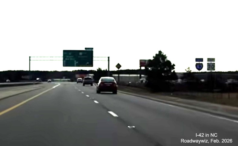
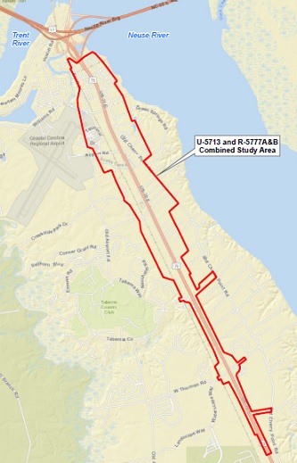
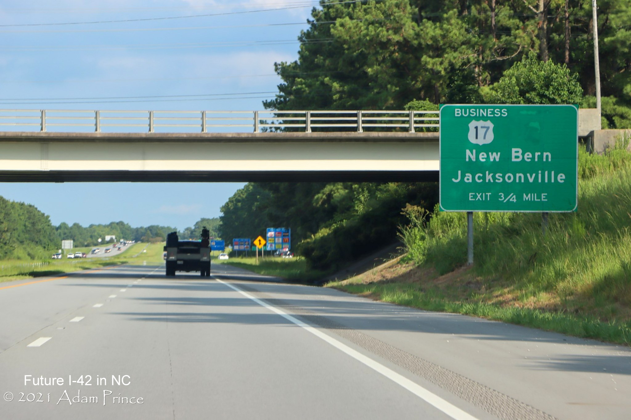
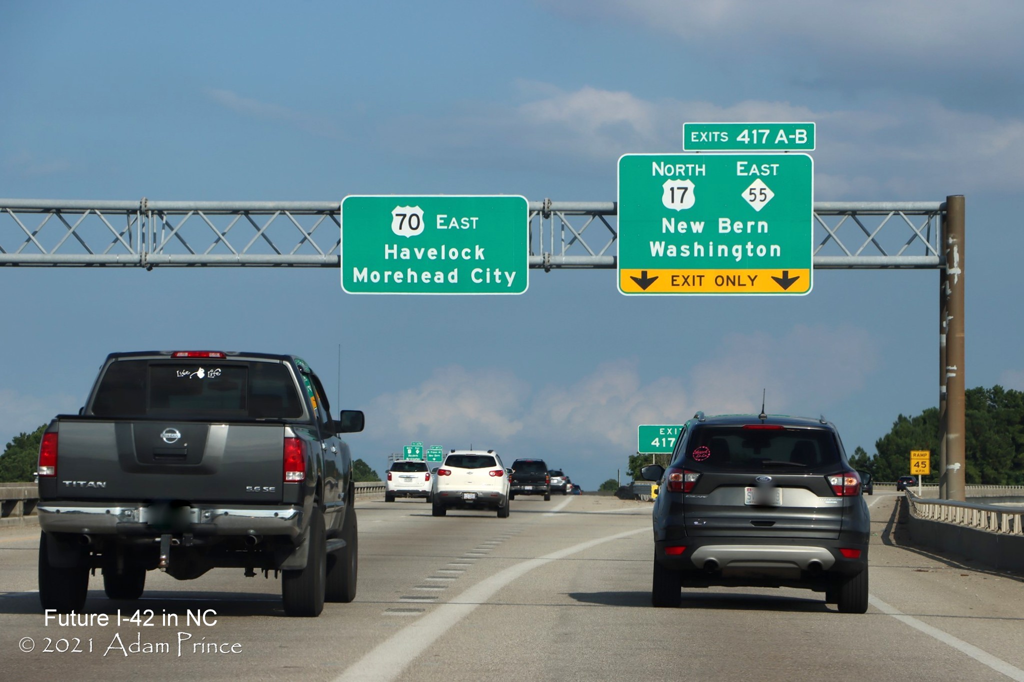
New/Future
Interstate 42 in NC
Interstate 42 is
a 137 mile planned interstate route from I-40 south of Raleigh to
Morehead City mostly along existing US 70. AASHTO gave approval to the
number in May 2016, though originally NCDOT asked that the route be
designated I-36, after the corridor was granted interstate status under
the 2015 Fixing America's Surface Transportation (FAST) Highway Act. The
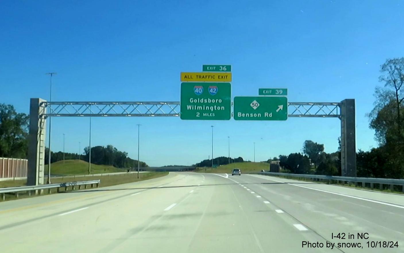
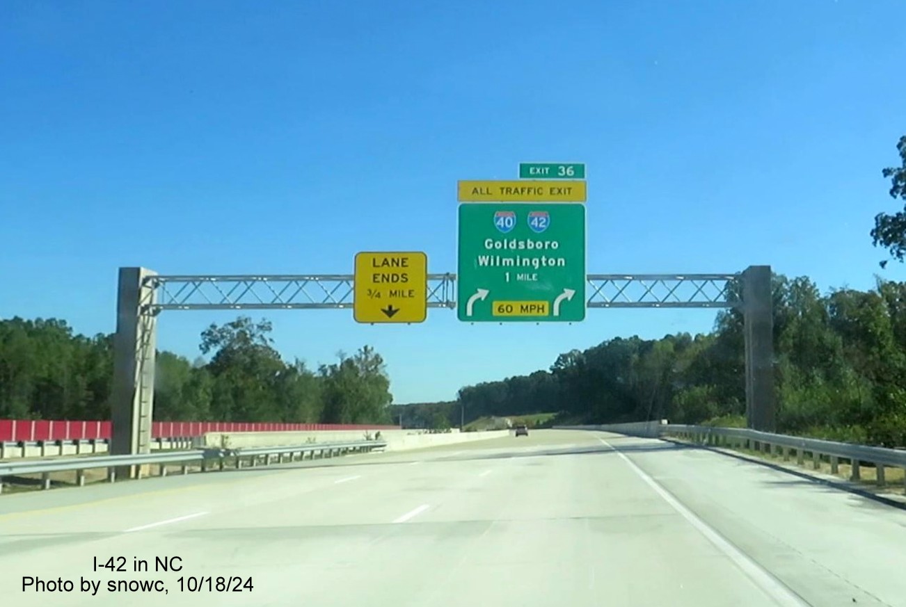
first of three completed segments of I-42, the Goldsboro Bypass, is
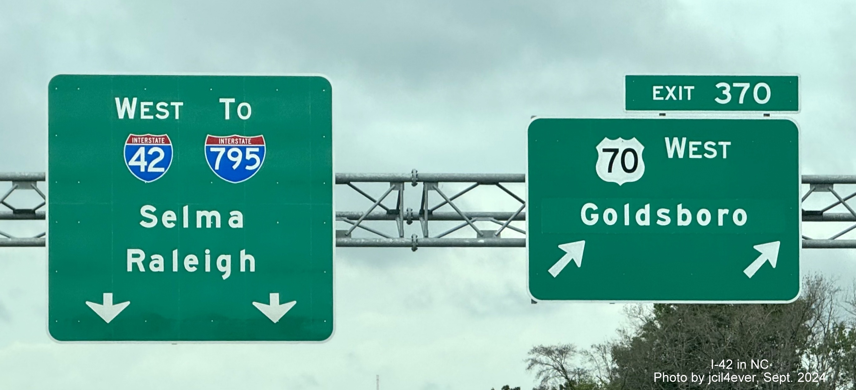
being signed as of September 2024, another, the Clayton Bypass will be
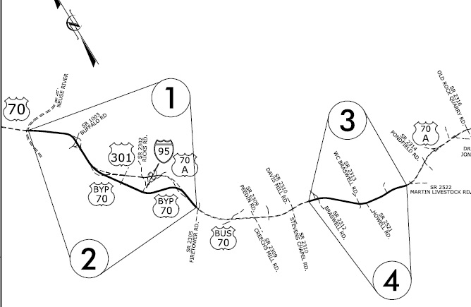
signed in early 2025. Here's the corridor map as submitted in its AASHTO application:1
This page will
summarize the progress in building and signing the route from west to
east. While I-42 is now being signed, the projected completion date for the entire route is 2032.2
I've broken the route into 8 segments with a description of the progress of constructing I-42 in
each. As of December 2025, 4 Segments are Complete:
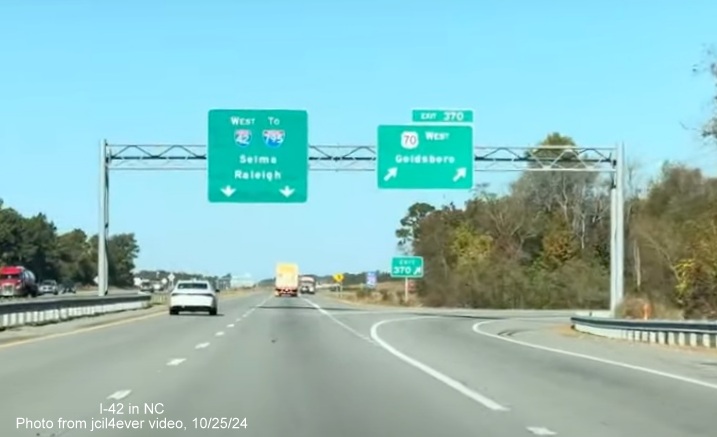
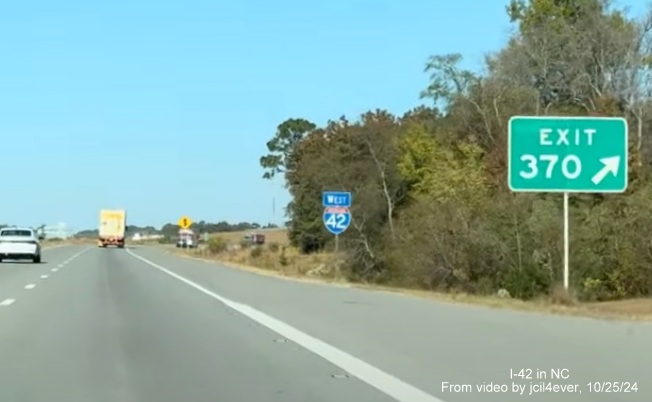
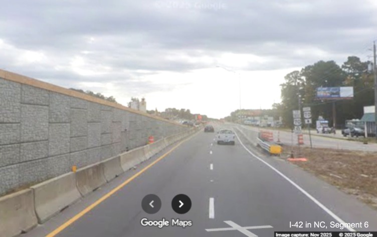
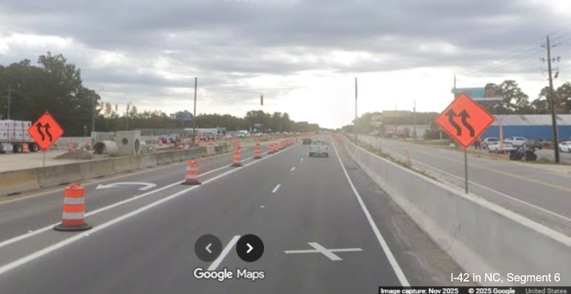
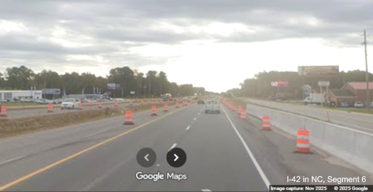
Segment 1 (Updated 6/23/25)
US 70 Clayton Bypass
Road Type: Interstate Standard Freeway Length: 10.0 Miles
Status: Complete
This segment was officially completed in March 2025 when it was fully signed as I-42. The interstate standard US 70 Clayton
Bypass from I-40 to US 70 Business got approval to be signed as I-42 from AASHTO at its Fall 2021 meeting, conditioned on
FHWA approval. The FHWA granted its approval in March 2022. According to a press release by NCDOT a timeline for the signing
of I-42 was to be released later in 2022.3 However, 2022 ended without an announcement. I made an
inquiry to NCDOT via their website in early 2023 and got this response about the potential timeline for signing the Clayton
Bypass:
"Hi, we are working to include this upcoming signage change with what
also will be needed as part of the ongoing I-40 widening from MM 300-312
and NC 540 project that will have a major interchange in this same
vicinity. We are looking to finalize that signing contract later this year."4
Following up, I got another response with more details about the
possible removal of US 70 from the Bypass:
"This is in
reference to your contact us inquiry concerning the routing of US 70 and
I-42 in Johnston, Wayne and Lenior Counties. We will begin the process
of acquiring resolutions and completing AASHTO applications to gain
permission to return US 70 onto it’s original route through Clayton. As
with any project, engineering plans are needed for construction
including signing modifications. The signing plans are currently in production."5
In October 2023 NCDOT held a public meeting in the Clayton area for a
proposal to renumber NC 42 in most of Johnston County to NC 36 to reduce
driver confusion. This, and the removal of US 70 from the Bypass to
its former route through Clayton (currently US 70 Business) was to take
place before I-42 could be signed. This article indicated this now may be
less than a year away, putting it into 2024.6 An April 2024
Johnstonian News article indicated that the signing of I-42, the
redesignation of Business 70 and the renumbering of NC 36 was likely in
the fall. It indicated the last needed approval by the Johnston County
Commission would happen later in the month, noting that NCDOT had already
approved the NC 36 plan. The Commission voted to rename the section of current NC
42 from Clayton to the Wake County line from just NC 42 to Veterans Blvd and Business 70 was renamed Clayton
Blvd effective February 10, 2025.7 On February 7,
NCDOT issued a Press Release stating the changes would begin on February 10 and take 3 months to complete. Here is a map of the
proposal, note that only parts of NC 42 would be renumbered, not most of
the route further east and west from I-42, and the part of the NC 36 route
would use I-42 between the current NC 42 and Ranch Road exits:8

In its Fall 2023 meeting, the Special Committee on US Route Numbering of
AASHTO approved the move of US 70 from the Clayton Bypass back to its
original alignment through Clayton.8 Here is the map
showing the new (old) route sent as part of the application:

Meanwhile, NCDOT announced on June 23, 2022 that the ramp from US 70 to
I-40 East would permanently close on July 6 as part of the NC 540
Extension 'Turbine Interchange' project. This may also have something to
do with the signing plans for I-42 being delayed as the detour route used
NC 42 and might have caused confusion, the ramp was to be re-opened in
September 2023, however this was pushed back to December 31 and did not
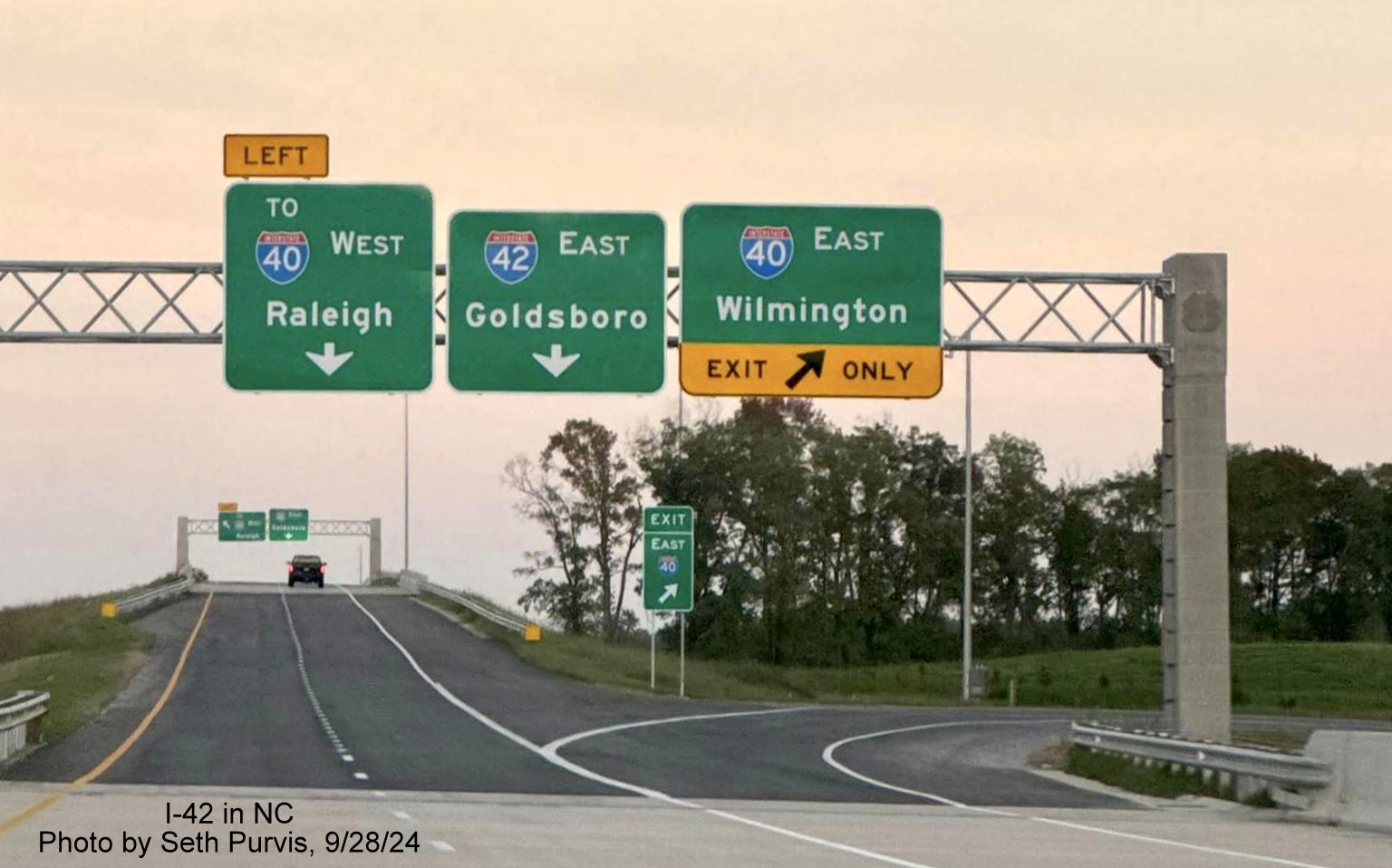
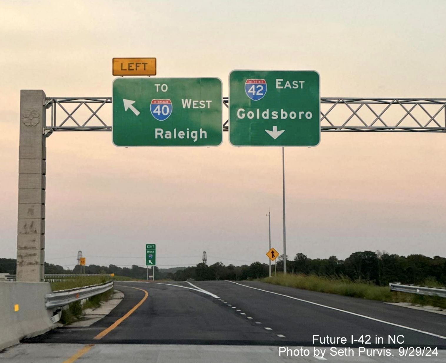
open until the summer of 2024. Despite the new appearance of an I-42
shield on the Clayton Bypass and I-42 shields on I-40 West and at the end
of NC 540 (see photos below), a video shot February 18, 2025
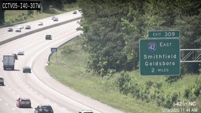
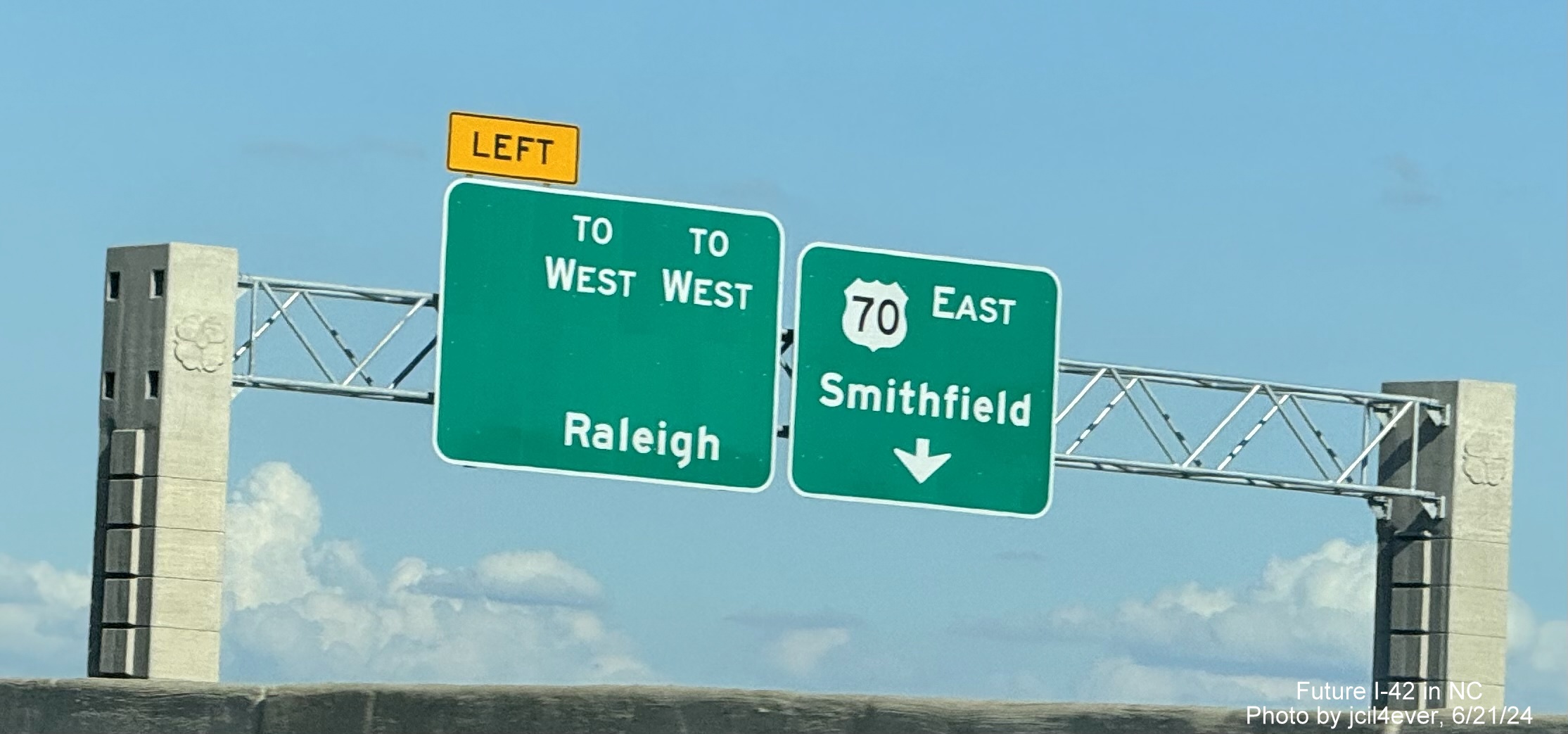
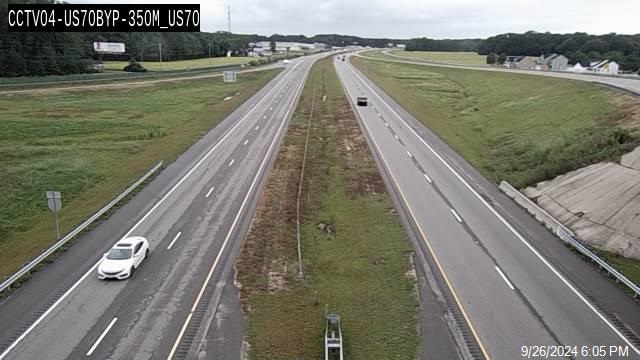
still showed US 70 on I-40 East exit signs, as shown also in this April 1 traffic camera image:

Signs along I-40 East for I-42 and US 70 were finally changed in May 2025as this updated traffic camera image shows:
And as seen in this photo posted by Adam Prince:

Also on this traffic camera image from May 8:

As of June 19 all signs had been updated along the I-40 corridor. New I-42 shields had
started to appear on the Bypass the week of February 18. This included new NC 36 reassurance markers, but only supports for
the new exit signs had been put up. Previously on June 21, new signage was placed at the future I-42 interchange ramp with
I-40, with US 70 shields. As seen in the photo at the top of this page and below, the signs having recently been changed to
include an I-42 shield. This hopefully meant that I-42 would be signed along the Bypass before the ramp is opened, but
according to a later NCDOT press release, this was not to happen until the start of 2025. Other signs on NC 540 were
updated with I-42 and the exit sign seen below at the future end of I-42 at I-40 which now had an 'Exit 1' tab
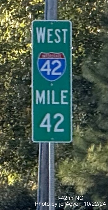
indicating that new exit numbers would be coming with the I-42 shields. The new I-42 signs went up in late February and March.
The last signs to be revised were for the US 70 exit on I-40 East, these were replaced the night
of June 18-19. Photos of all these signs can be seen in the Section 1 photos below.
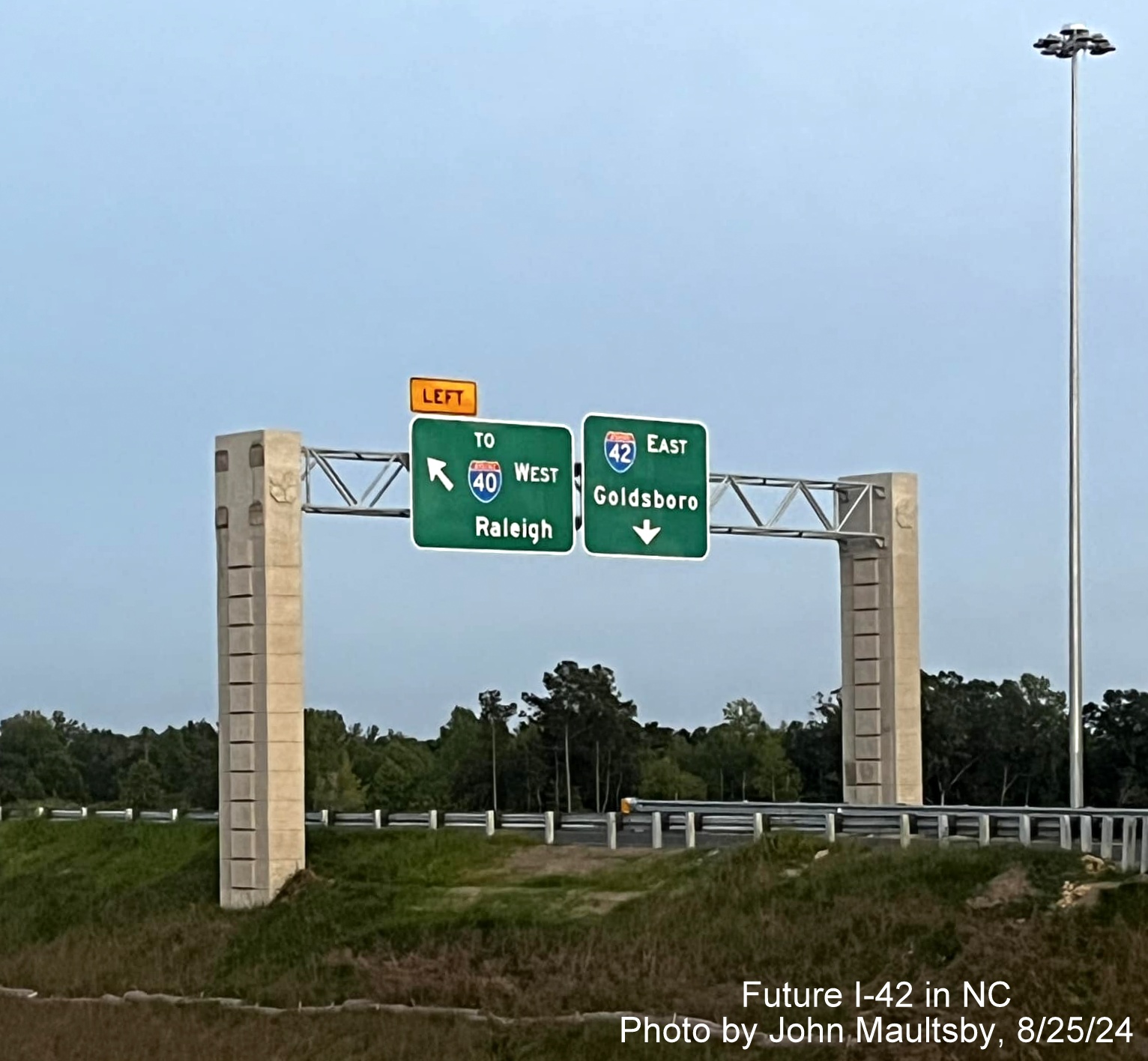
Photo of earlier
version of signage put up in June courtesy of jcil4ever on AARoads Forum:
View of the new
signage from the open ramp to the Clayton Bypass across I-40:
Meanwhile,
despite the announcement of I-42 was to be signed in early 2025, I-42 shields did not appear on I-40 West approaching
the Clayton Bypass exit until the fall of 2025, photo courtesy of AARoads Forum member,
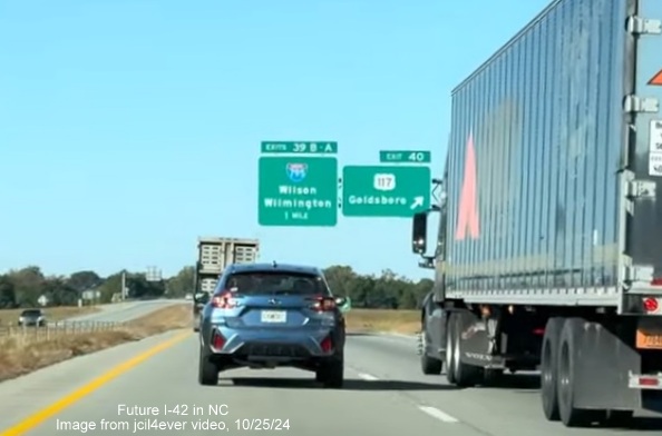
jcil4ever, taken Sept. 28, the signs headed east remain unchanged as of late October:
In November a new
advance sign was placed for the I-40 exit heading west. This photo and others from this segment are in the Photos
section below.
Drive the first 2 segments of I-42 on these videos
by Benjamin Wolf (Filmed 6/23/25):
Posted on February 18, 2025: Heading East
Drive this Segment watching two New Videos from RoadwayWiz from Summer 2021:
Eastbound
Westbound
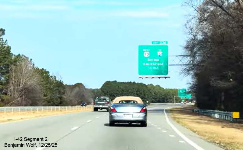
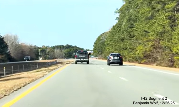
Segment 2 (Updated 6/15/26)
US 70 from End of the Clayton Bypass to Beginning of US 70
Goldsboro Bypass (includes Bypass US 70 in Smithfield)
Road Type: 4-lane
Divided Roadway with some Freeway Sections Length: 22.5 Miles
Status: Needs Upgrade to Interstate Status
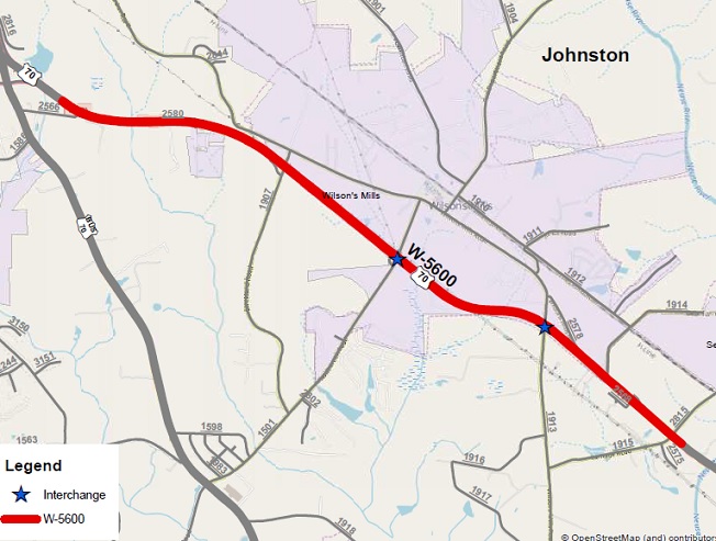
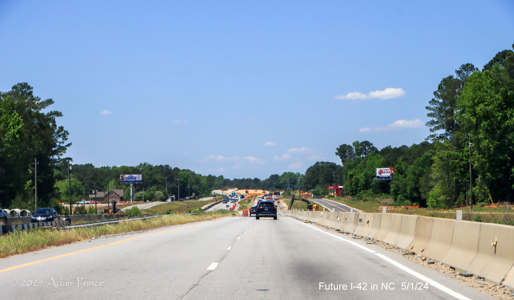
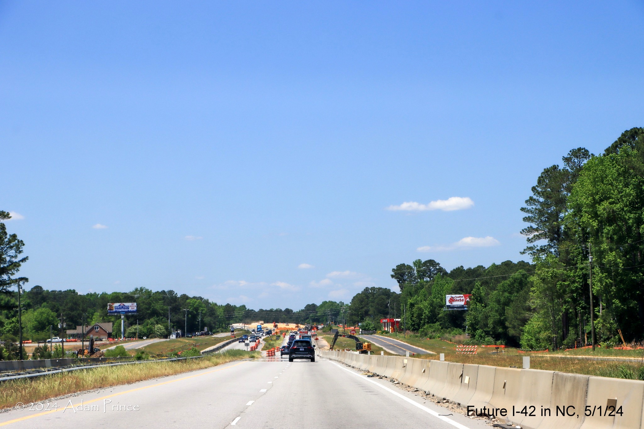
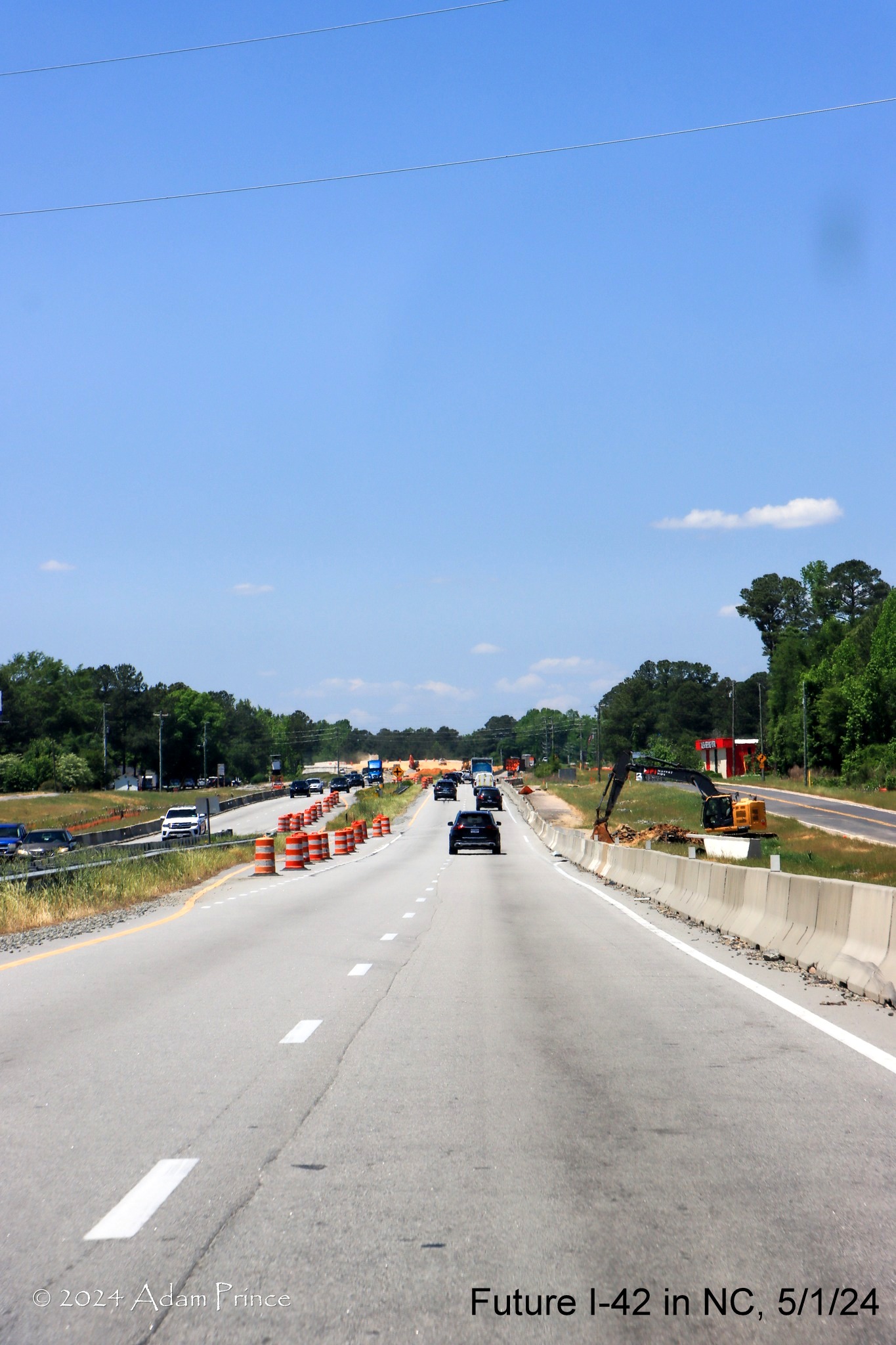
There were two funded projects and one feasibility study underway to upgrade this section of US 70:
The first is complete as of January 2026, the upgrading 5 miles of US 70 to Interstate Standards
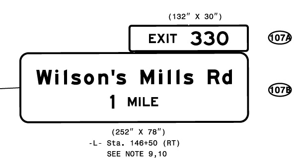
from US 70 Business to the Neuse River Bridge (W-5600), NCDOT replaced the US 70 intersections with Wilson Mills Road and
Swift Creek Road with interchanges. Originally the plan was to award the contract in September
2020, however, due to COVID funding issues, the contract letting was postponed until March 2021 and work started on May 12.
The project was removed from NCDOT's Construction Progress Report site in March 2025 implying its completion.9
Though notices about the project remained on the NCDOT DriveNC traffic site until July 4. Work
continued along the shoulders, apparently some issues with drainage, into December.10In January 2026 the
speed limit was officially raised to 70 MPH indicating work had been completed. The project built
a bridge over Wilson Mills Road while a bridge now carries Swift Creek Road over US 70. The interchange with Swift Creek Road
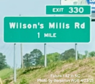
was opened in the spring of 2024. The westbound exit to Wilson's Mills Road. That interchange was opened in September
2024. The eastbound side, including the new exit ramp, was opened the week of November 10, though no exit signage
appeared until late in the year. The total initial cost for the 2 Wilson Mills interchanges was estimated at $77 million.
The project was originally scheduled to be completed by the end of 2024.
Here's a map of the project area:10
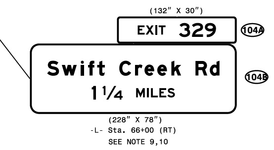
NCDOT advertised the W-5600 contract on January 16, 2021. Among the sign plans included those for the new exit signs for
Swift Creek and Wilson Mills Road, along with the new signs for the Business 70 exit westbound.12
The exit for Swift Creek Road opened in the spring of 2024 (see Section 2 photos below) with the exit number applied to
a temporary exit sign.
Here are video screen grabs and photos
by AARoads
Forum contributor Benjamin Wolf (jcil4ever) showing progress completing the Wilson's Mills Road interchange
April 21, 2025
New advance signage heading west at the Swift Creek Road exit:

More new signage heading west at the Wilson's Mills Road exit:
March 24, 2025
New signage seen in April video heading west at the Wilson's Mills Road exit:
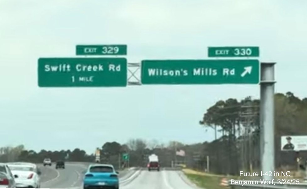
New overhead signs for both
exits at the Wilson's Mills Road exit heading west.
Photos taken September 23, 2024
Views from US 70 West approaching the nearly completed Wilson's
Mills Road interchange:
Work continues in the median approaching the future Wilson's Mills
Road exit.
Workers applying lane markings on the future westbound roadway over
Wilson's Mills Road.
A closer look at
the work at the future overpass over the Wilson's Mills Road exit, including a new US 70 mile marker.
At the traffic signals at the current US 70 intersection with
Wilson's Mills Road. The future on-ramp to I-42/US 70 West is to the left.
September 2
Work has nearly been completed creating the median barrier
approaching the bridge over Wilson's Mills Road:
and that by early
September some of the concrete barriers separating traffic from the construction had been removed:
An October 9, 2025 article in the News & Observer explained further drainage issues and a bump that
developed one one of the lanes near the Neuse River bridge had delayed completion of the project. The article went on to say that
NCDOT was talking to the FHWA about allowing them to put up I-42 signs along the completed freeway. There has been no further
word on whether permission would be granted as of mid-2026.11
Upgrading the Remainder of this Segment
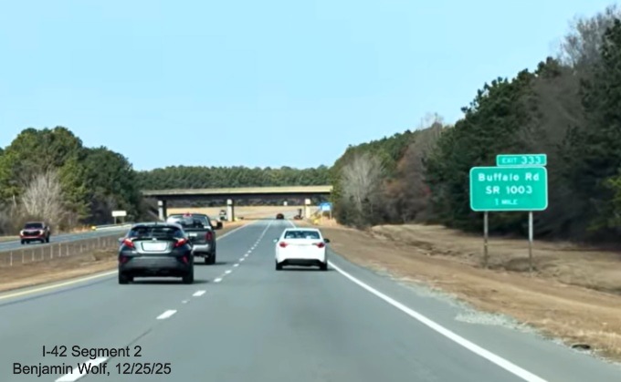
Between the Neuse River Bridge and I-95 US 70 is freeway with the exception of a short
section westbound prior to the bridge where there is an intersection with West Oak Street:
There are 3 existing exits along this stretch, for US 70 West and East and for Buffalo Road:
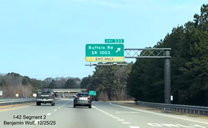
It appears that shoulder widening and eliminating the one intersection would make this stretch
interstate standard but there currently are no funded projects to do so, but had I-42 been signed anyway?
NCDOT extending I-42 in Johnston County? (Updated 6/14/26)
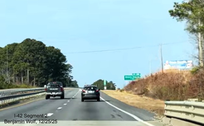
In a video posted by Benjamin Wolf to the AARoads Forum on April 6, 2026 a new exit sign
for Buffalo Road is seen with its exit number covered up (screen grab below). He believes this is the start of exit renumbering
along US 70 between the end of the Clayton Bypass and I-95. Perhaps the mixture of I-42 and US 70 exit numbers along the
route through Johnston County, especially at the US 70 Business exit at the east end of the Bypass where the exit has two
numbers, 10 headed east and 326 headed west, is too confusing to drivers. Doing so would be consistent with recent NCDOT practice where
the Future I-587 segment of US 264 and the Future I-74 segment of US 52 were given exit numbers using the future interstate's
milepost numbers. The Buffalo Road sign was the only new one installed, as of June 2026. For the possible future numbers, visit
the I-42 Exit List (Link at Top).
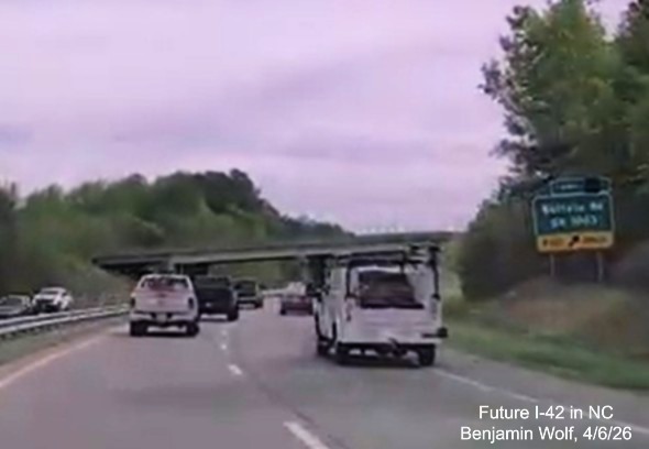
The eastbound Buffalo Road exit sign with new number.
On June 12, 2026 a video about I-42 was posted by Mileage Mike (see
video section). Among the comments received was one stating that I-42 was now signed along US 70 from Pine Level east of I-95
through Johnston County to the Clayton Bypass, except the section with the at grade intersection discussed above. Given that
most of this section of US 70 is not up to Interstate standards, it would seem unlikely to be signed as I-42, though as
indicated aboive NCDOT was in discussions last year with the FHWA about extending the interstate along the newly
opened interstate standard section through Wilson Mills. A post by Benjamin Wolf in the AARoads Forum on June 14,
after he drove the length of US 70 West through Johnston County, indicated that no new I-42 signage has appeared.12 However,
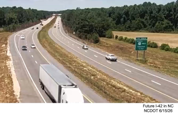
NCDOT has signed this section of US 70 as I-42 on their new traffic site map, perhaps indicating their eagerness to sign it:
A recent traffic camera image at the East end of the Clayton Bypass indicates exit numbers have not been changed, as of
June 15:
The westbound Buffalo Road exit:
To the east of I-95, another NCDOT project would have upgraded US 70 to Interstate Standards in Princeton Area (R-5829AB)
from US 70A to the Goldsboro Bypass as a Design Build Project. Originally, Part A was to start in 2025, Part B in 2028.*
Here's a map of the project area:15
However, these projects did not appear in the Final 2026-2035 STIP that was released
on July 8, 2025, meaning there is now no plan to construct them until after 2035. However, in a
new version of the STIP released in January 2026, one new Future I-42 project was added. Project R-5795 would "construct
access management improvements" on US 70 between US 301 and I-95. However, since the official path of I-42 runs on Bypass
US 70 that does not have an interchange with I-95, this may not be I-42 related at all.16
A Feasibility Study (FS-1604A) was published in August 2018 for
determining how to upgrade the remaining section between the Neuse River
Bridge and Smithfield. It split the segment into 4 sections and compared
the cost of simply upgrading shoulders to a complete upgrade to interstate
standards of the existing route. The upgrade option was the preferred
alternative, though they suggested maybe simply upgrading shoulders could
get the route signed as I-42 for Sections 1 and 2, that is from the end of
the Clayton Bypass to Creech's Mill Road in Smithfield (includes I-95 interchange). Here's a
Link
to the Report. Construction Date TBD. Here's a map of the study area:17
The only other project for this segment that got a mention for possible funding in the list of potential 2026-2035
STIP projects is the segment from Turnage Road (SR 1915) to US 301, just to the west of I-95. The estimated cost was
$133.1 million, but its statewide priority score was only 66.84 out of 100, leaving it out of the final list of
projects to be started before 2035 when the draft STIP was released at the end of January 2025 and in the final list
when it was released in July.18
There are also several pavement upgrade projects for US 70 in Johnston
County which may be part of I-42, depending on what final alignment is
chosen, including a project C204333 (TIP No. I-6044) that will, as part of
the project, reconstruct US 70 Bypass and other portions of US 70. Here is
a map of the project area and 2 of the 4 work zones, work started in
August 2019 and was scheduled to be completed in October 2020, the project
no longer appeared on NCDOT's Construction Progress Report website as of November 2020:19
Here's the typical section plan showing shoulders varying
from 2 to 10 feet. Rumble strips will also be added to Bypass 70 section, the only section that is currently a
freeway:20

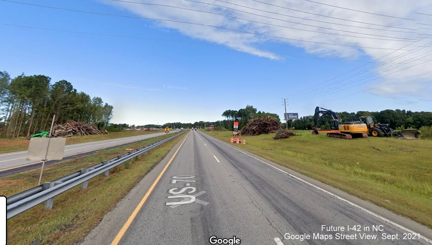
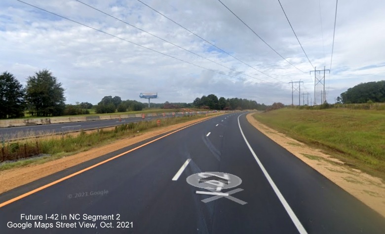
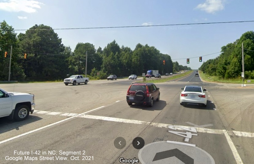
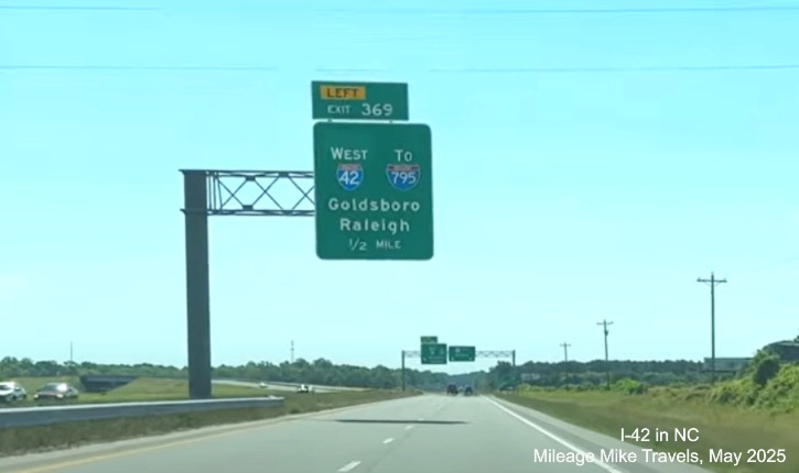
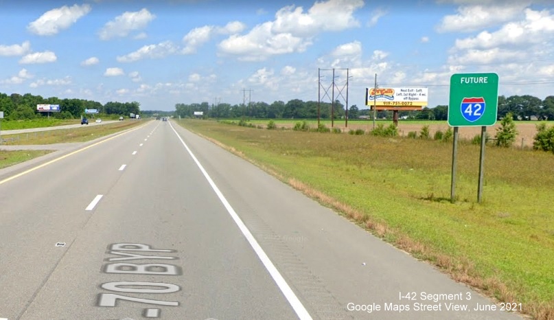
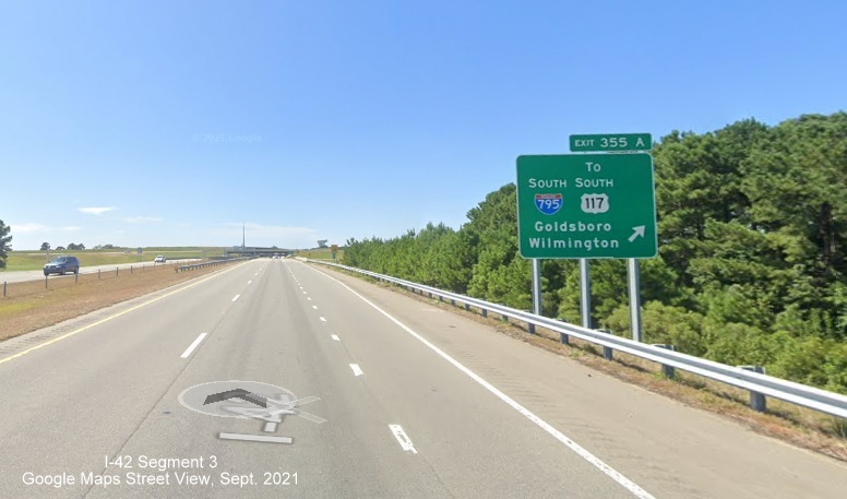
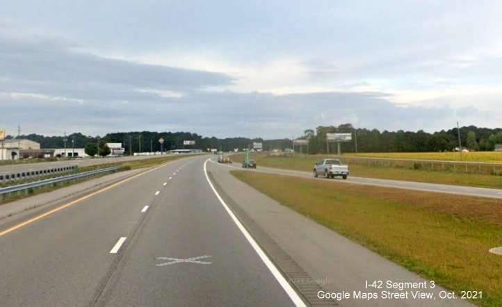
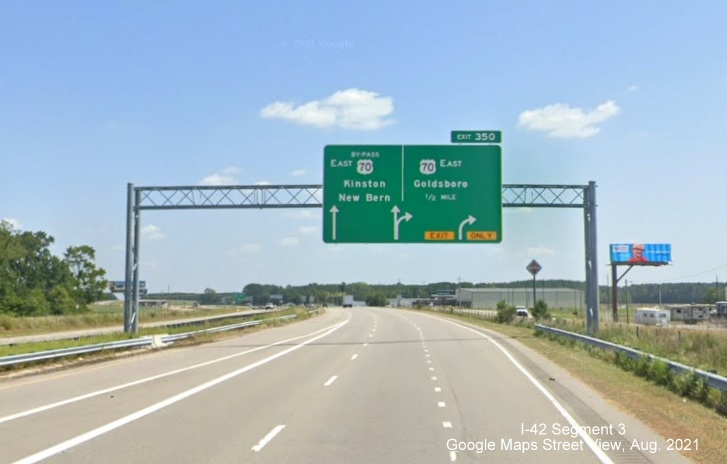
Segment 3 (Updated 12/27/24)
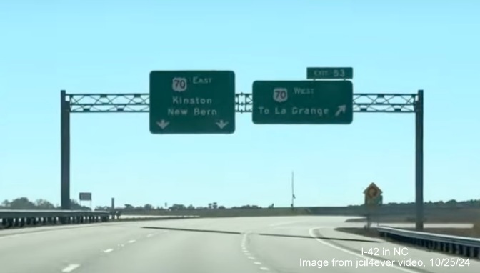
US 70 Goldsboro Bypass and US 70 to NC 903 in LaGrange
Road Type: Interstate Standard Freeway
Length: 21.6 Miles
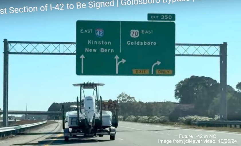
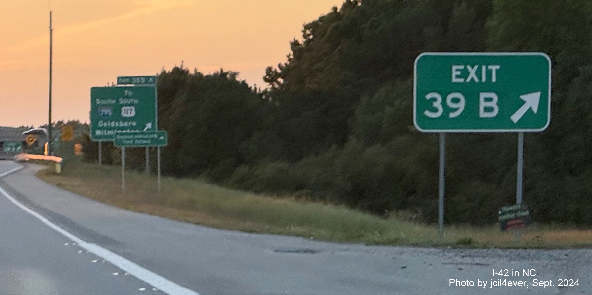
Status: Complete [I-42 Signage added in September and October 2024]
Here's the first I-42 trailblazer spotted on the Goldsboro Bypass, from a NCDOT traffic camera image, the back of a
new I-42 West trailblazer at the NC 581 interchange on September 17, 2024, see the Photo section for
Segment 3 for additional photos:
Here's the new End West I-42 sign, courtesy of AARoads Forum's jcil4ever (Benjamin Wolf):
I-42 first appeared on a Google Map of the Goldsboro Bypass earlier, on April 30, 2024:
According to Jim Dunlop, a NCDOT sign engineer, an application was sent
to AASHTO in the fall of 2021 regarding signing the Goldsboro Bypass as
I-42.21 On February 13, 2022 the applications were finally
posted on the AASHTO Special Committee on US Route Numbering website.22
The application for the Goldsboro Bypass was approved, along with the
Clayton Bypass (Segment 1), pending approval also by the FHWA. Despite a
Super 70 Commission Director reporting in his January/February 2019
message that the FHWA has approved signing the Goldsboro Bypass as I-42,23NCDOT sign
engineer Dunlop indicated they had not done so as of
the summer of 2021. It was announced again by the Super 70/I-42 Group at a
meeting on March 16, 2022. This time NCDOT issued a press release
indicating the approval of both the Goldsboro and Clayton Bypasses as
I-42.1 The press release indicated a timetable for the
placement of I-42 signs would be released later in the year, however 2022
came and went without any further word on the signing of I-42. Nothing
happened in 2023 either. An NCDOT spokesman indicated in the summer of
2024 that signage would go up by the end of the year. Is the third year
the charm? Apparently, yes. A poster to the AARoads Forum spotted a new
I-42 shield on August 30 at the eastern end of the Bypass on the new
overhead sign at the US 70 exit (current Exit 370).22 On Friday
the (Sept.) 13th it was a lucky day for I-42. NCDOT issued a
Press
Release that I-42 signing would start on Monday Sept. 16. The
signing would take place over several weeks and would involved
installing over 80 mile markers, 82 metal signs and overlays of I-42
over US 70 for another 108. As of late October most, if not all
reassurance markers had gone up as well as exit signs renumbered and
I-42 mile markers had been placed along the Bypass. The press release
also indicated signing of the Clayton Bypass as I-42 would take place
'early next year' (see Segment 1).24
Unlike for the Clayton Bypass, there was no need for any route changes or renumbering since US 70 was never re-routed,
only a Bypass US 70 designated. NCDOT simply sent an application to AASHTO about removing the Bypass designation that was
approved at their May 19, 2022 meeting. This approval was confirmed in a January 31, 2023 email I received from NCDOT
which specifically stated "Since the portion of what was US 70 Bypass is now approved as an Interstate, there is no need to
have a concurrent route following the same pavement. Removal of the US Bypass route allows for simplification of the signs
and messaging."5The email, however, gave no date for when I-42 signs would go up. A check of traffic
cameras along the Bypass throughout 2023 and most of 2024 still showed it signed as Bypass US 70:

In the distance you can somewhat make out a Bypass US 70 reassurance marker on the right.

And traffic camera images from January to August 2024 still showed US 70 mileage exit numbers along the Bypass,
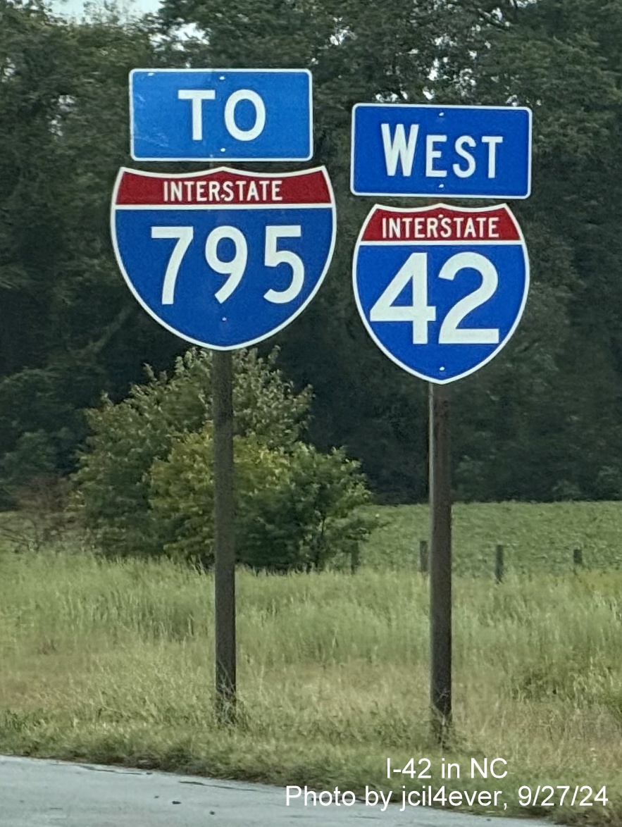
including at the I-795 exit:
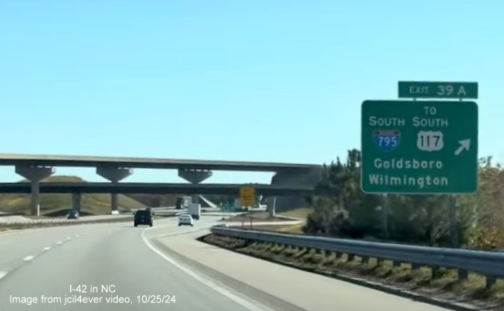
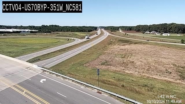
This changed as of September 2024, here's the same view on December 10:
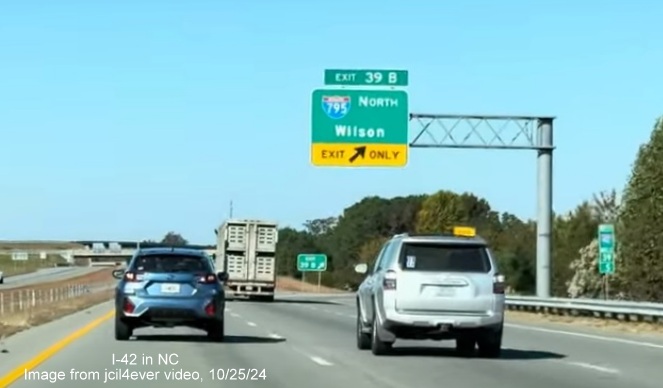
An updated view of the new exit number, 39A for
I-795 North.
And this East
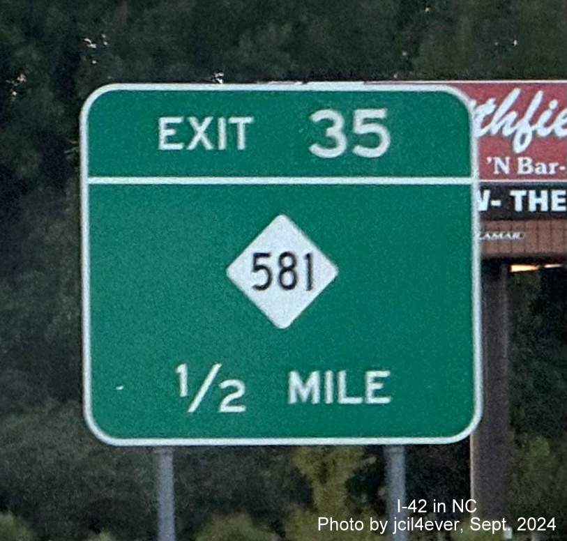
I-42 reassurance marker was shown by the camera at the NC 581 exit.
The only change since the Bypass was signed as I-42 is that a
new reassurance marker was put up along US 70 East just prior to the start of the Bypass in 2025, showing a rare, for now,
concurrency of the 2 routes:
The new reassurance marker showing the future I-42/US 70
concurrency west of the Goldsboro Bypass.
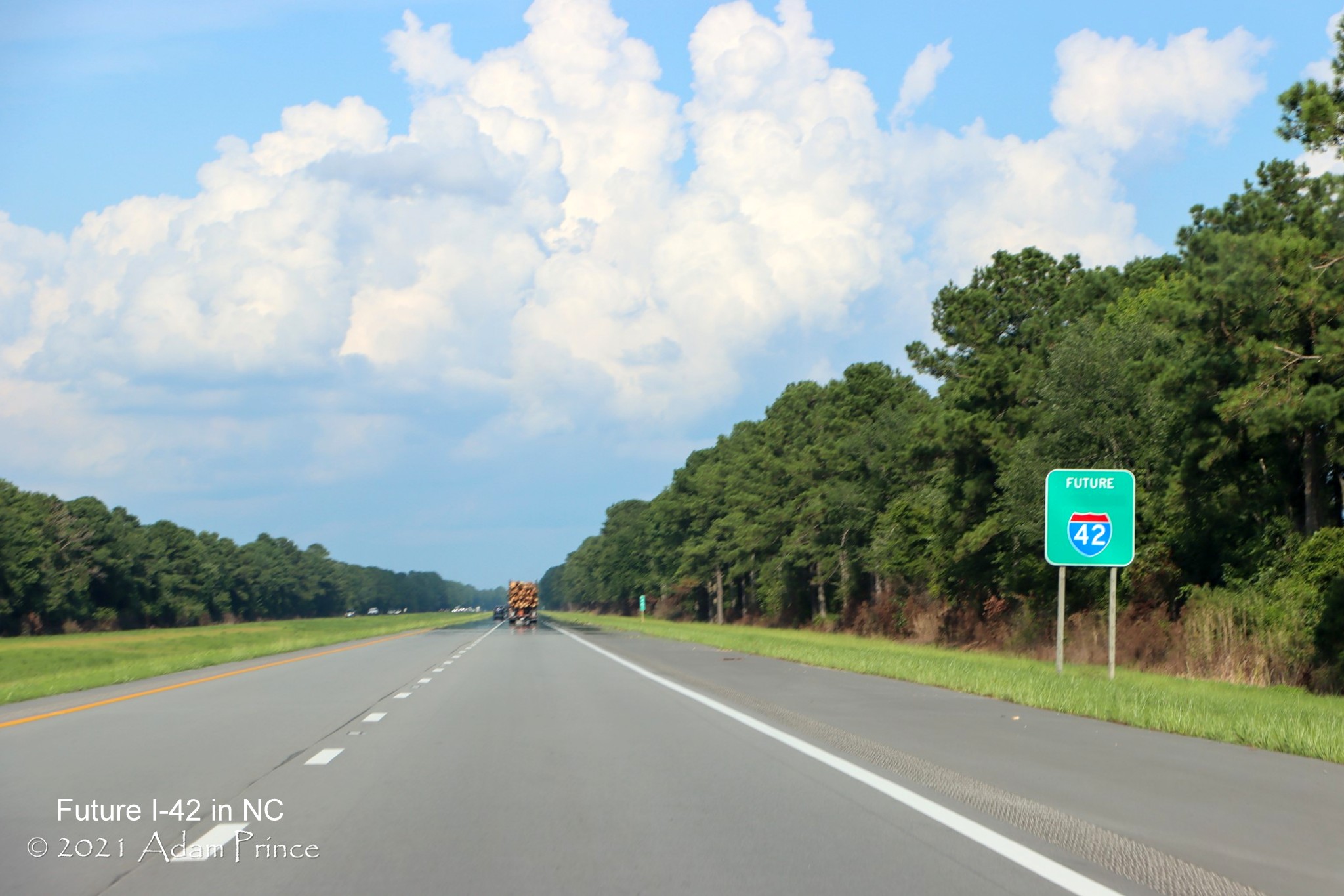
Segment 4 Updated 8/3/25
Existing US 70
from NC 903 in LaGrange to the to be built Kinston 'Shallow' Bypass and along an upgraded US 70 to Dover
Road Type:
Upgrade to Interstate Freeway (part to be built on new location)
Length: 21.1 Miles
Status: Unfunded
Originally, construction was to start in 2020 (US 70 Freeway) and 2027 (Bypass),
however due to COVID-19 related budget shortfalls that year, the projects were postponed in 2021 with no official start date.
These projects were then listed as 'Not Funded' in the Final 2024-2033 State TIP released on June 6, 2023.26
There was no mention of the project at all in the Draft 2026-2035 STIP released on January 31, 2025, however it did appear,
interestingly without being labeled as the 'Kinston Bypass,' just as a freeway, part in a new location in Lenoir County,
in the Final STIP released July 8. However, the entry was 'Programmed for Planning and Environmental Study Only' with
no dates for right-of-way or construction, meaning most likely now any project will now not start until at least
2036.27
In June 2022 NCDOT has posted a website for the project that
provides a '3D view' of the Kinston Bypass, despite no construction date being announced (see below). You can use the
website to
take a Virtual Tour of the Bypass.
In April 2018, NCDOT announced 12 possible alternative routes for the
Kinston Bypass Project (R-2553) that will run from the end of the US 70 Goldsboro Bypass near LaGrange to the beginning
of the US 70 freeway in Dover. Here was a map of the possible alternatives:28
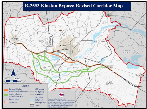
NCDOT held a public hearing in Kinston on August 31, 2019 allowing the
public to weigh in on the possible routings. Many Lenoir County businesses
and officials supported the 'Shallow Bypass' or Alternative 1SB which
would have the Bypass follow existing US 70 for 14.6 of the 21.1 miles in
this segment, the remainder would be on a new 6.5 mile bypass close to the
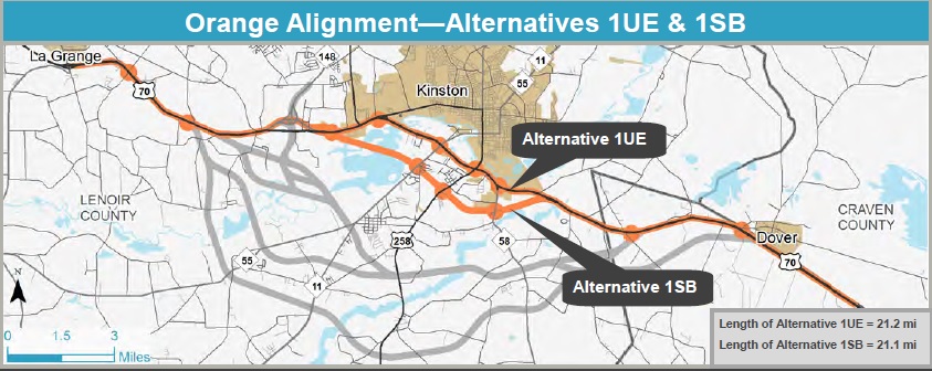
existing US 70 and its businesses. NCDOT selected this as the Preferred Alternative in 2020.
Here's a map of the chosen alternative:
The pre-COVID timeline for the project was for right-of-way acquisition
to start in 2023, presuming the environmental impact statement was approved in 2021. Construction would then have
started in 2027. This has now been changed, the Final EIS is to be released in the winter of 2022,
right-of-way acquisition now will start in 2026 with the construction date
still to be determined. The western section of the bypass follows current
U.S. 70 for approximately 7 miles to just east of NC 148 (C.F. Harvey
Parkway). Interchanges would be located at Willie Measley/Jim Sutton
roads, Albert Sugg/Barwick Station roads, and NC 148. A new
interchange east of NC 148 would provide access to the new shallow bypass
section, which would be parallel existing U.S. 70 to the south for
approximately 6.5 miles. Interchanges along the Bypass would be located at
NC 11/NC 55, US 258 (South Queen Street), and at NC 58 (Trenton Highway).
A new interchange east of Lenoir Community College would connect the
shallow bypass back to existing U.S. 70. The bypass would then follow
existing U.S. 70 to the end of the project near Dover, upgrading US 70 to
a freeway with interchanges at Wyse Fork /Caswell Station Roads and Old
U.S. 70 (West Kornegay Street) in Dover.29 Meanwhile, a
project that will resurface and upgrade 3.1 miles of the existing US 70
freeway to Interstate Standards from the Bear Creek Bridge at the end of
the Goldsboro Bypass to Willie Measley Road east of LaGrange (Project
I-6034) was to be let in September 2019, but in July 2019 that was pushed
back to March 2020, the project then disappeared from the March 2020
Letting list in February, also a COVID related postponement.
As indicated above, NCDOT released the scores for possible projects to be chosen for the
2026-2035 STIP in May 2024. Several I-42 projects for this segment were on
the list. They include the upgrade of US 70 to interstate standards from
LaGrange to Albert Suggs Road (SR 1522), Project No. R-2553A at an
estimated cost of $140.7 million, and the upgrade of US 70 to interstate
standards from Albert Suggs Road to NC 148/C.F. Harvey Parkway, No.
R-2553B at a cost of $65.5 million. They also include three projects
related to the Kinston Bypass: An upgraded US 70 from NC 148 to the NC
11/55, Project No. R-2553-CA at a cost of $220.3 million, construction of
a new freeway from NC 11/55 to US 258, R-2553-CB costing $56.4 million and
the remainder of the Bypass from US 258 back to US 70, No. R-2553-CC at a
cost of $154.7 million. The Statewide Quantitative Scores for these
projects range from 46.97 out of 100 for the eastern section of the Bypass
to 64.4 for the western most section near LaGrange. None of these scores
are particularly high enough on their own, but it may be that some of the
projects, particularly the US 70 upgrades, could be chosen to start in the
early 2030s.18
Segment 5 (Updated 8/2/21)
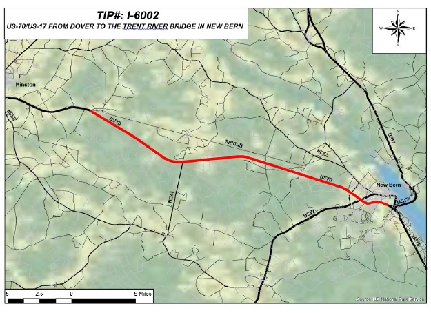
US 70 Freeway from Dover to New Bern
Road Type: Freeway Length:
26.1 Miles
Status: Needed Upgrade to Interstate Status, Complete of as
March 2021 [Except for I-42 Signage]
NCDOT awarded a contract in the Spring of 2019 to repave and widen US 70
to interstate standards along the existing freeway between Dover and the
Neuse River Bridge in New Bern. Work was completed in the spring of 2021.
July 2020 Google Maps Street View images show that all of the US 70
shoulder work has been completed, work is now proceeding on upgrading exit
and entrance ramps, the last to be completed were in the New Bern area.
Here's a map of the project location:30
Signing of the section as I-42 cannot occur until the Kinston Bypass and
related construction to the east are completed.
See the
completion of shoulder widening in Photos section below.
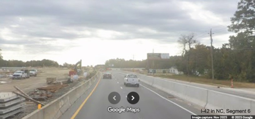
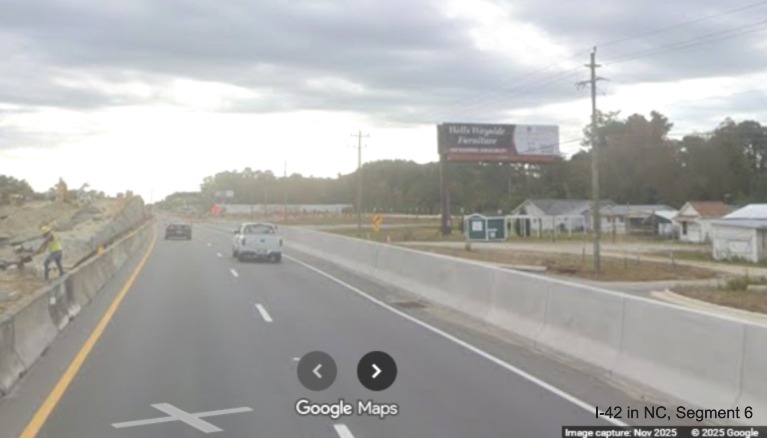
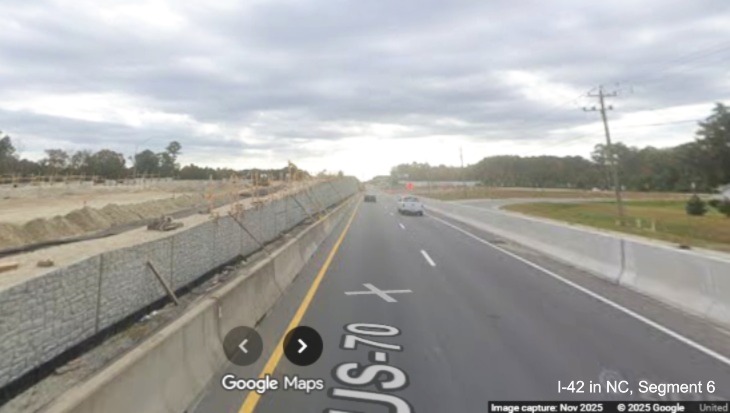
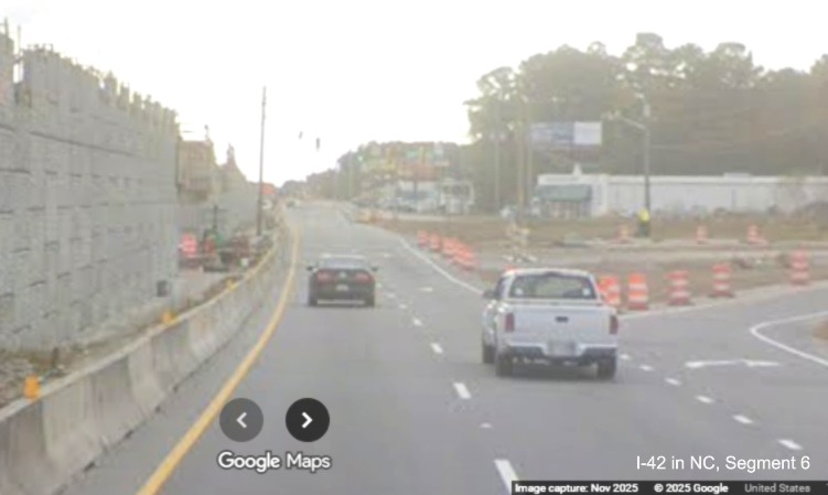
Segment 6 (Updated 5/23/26)
US 70 Neuse River Bridge to Havelock Bypass
Road Type: 4-lane Divided Roadway Length: 13.7 Miles
Status: Needs Upgrade/New Construction to Interstate Freeway
A 2-Part Project: First is from Neuse River Bridge to Thurman Road, (U-5713/R-5777AB, 5.1 Miles). Start of Construction-
2019. Completion was originally set for September 2023, however earlier in that year the estimated date was moved to December
2024 (Design/Build Project was awarded in September 2019) and work started on October 22, 2019. As
of April 22, 2026, over 6 years later, work is nearly 2/3 complete at 64.3%.31 Part of the contract that is
creating an interchange at Thurman Road already under construction, work started during the summer of 2025 building the bridge
over US 70 (see new video link) along with another interchange with Glen Burnie Road. An NCDOT press release
on November 19, 2025 indicated work was about to start on the second interchange, Taberna Way, with frontage roads and
completed ramps to be used for traffic detours.32An earlier press release on November 29, 2023 indicated
work had been completed on 1 roundabout at the future Grantham Road exit, while another one was near completion.
Two-way frontage roads served by roundabouts had been completed and will be used as temporary roadways once work starts on
building the interchange. The two direction frontage road design was supported by residents over one-way roads, according to
NCDOT engineer Jim Dunlop, because they allowed easier access to current US 70 businesses.
The roundabouts were not originally supported, however NCDOT engineers convinced residents they would produce fewer land
takings for the project.33
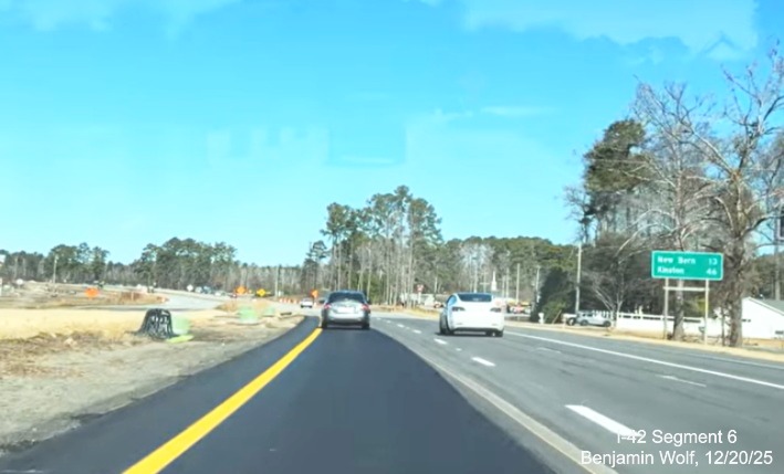
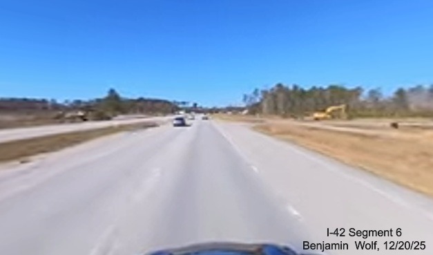
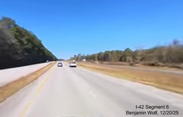
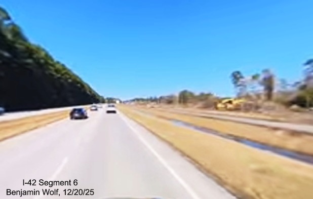
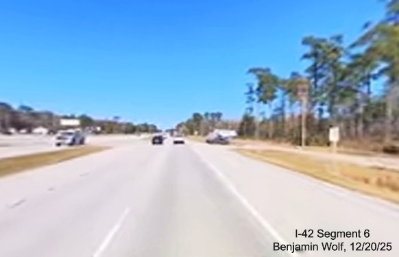
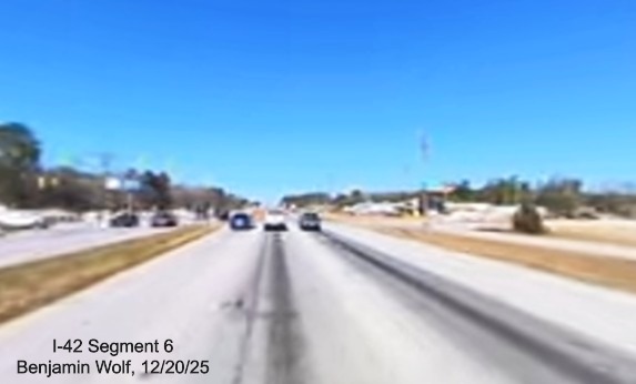
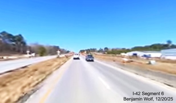
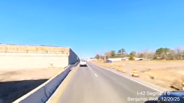
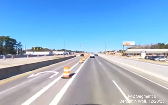
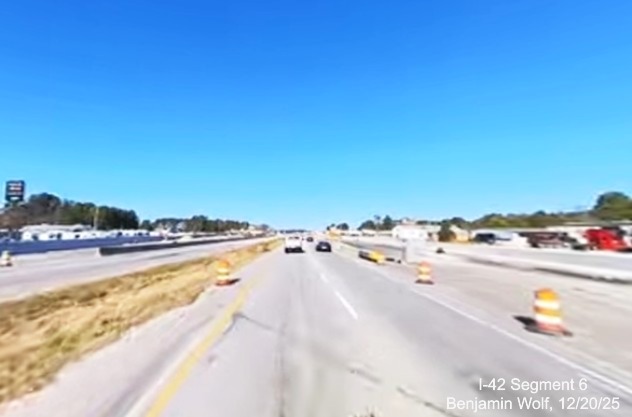
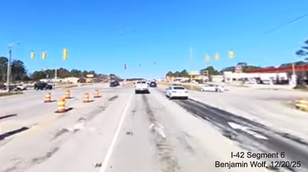
For images of recent progress, see this video by Benjamin Wolf
taken on December 20, 2025. Preliminary work at the four other intersections (Williams Road, Airport Road,
Taberna Way, and Thurman Road) continued through 2024. The frontage roads and roundabouts at
the future ramps need to be completed before work can start on building the interchanges themselves. The first interchange
to be constructed will be for Grantham Road while the road is closed. A
May 13, 2025
press release indicated that traffic along US 70 will soon be diverted in the area of Grantham Road starting on
May 16 to widened areas of the highway and to the future exit ramps so the future overpass can be built for the exit.
Temporary traffic signals and reduced conflict intersections, forcing traffic to turn right, will be installed for
Grantham Road traffic to access or cross US 70. Despite it being less that 1/2 complete at the end of 2024, construction
was still scheduled to be completed in August 2025 until May 2025 when the date was pushed back
to late October 2025, according to the NCDOT Construction Progress Report page.34 Work on the bridges at
Taberna Way and Airport Road started in 2025.
Map of Project Corridor:35
Images of roadway construction in December 2025 from Benjamin Wolf Video:
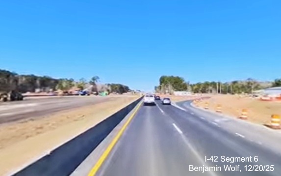
Looking north at future Taberna Way interchange.
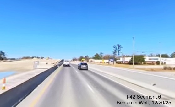
Approaching bridge construction for future Grantham Road interchange.
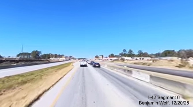
Construction progress at future Airport Road interchange.
More images below in the Segment 6 photo section.
The second project is Thurman Road to Havelock Bypass (R-5777C, 8.6 Miles)
including construction of service roads. The Letting date for the contract
was delayed in February 2020 from June to November 2020 due to design
issues and was then put on hold for 2 years more due to funding issues.
The project was let as a Design-Build contract on January 17, 2023,
delayed from August 16, 2022. On February 1, 2023 NCDOT posted a press
release indicating the $242 million contract had been awarded and that
after plans are designed and approved, construction could start in early
2024.36 Construction would then take an additional 4 years, to
June 2028. The project is listed as of April 28, 2026 as 32.2% complete, almost
1/3 complete after 2 years, obviously progress will have to pick up to meet the 2028 date.36 From the October video linked above much
work is now going on at the southern end near the Bypass. According to the press release, the interstate standard freeway
will have exits at Statley Pine Road, Fisher Avenue and Camp Kiro Road.
There was also a separate project to create
the Slocum Gate Interchange along US 70 at Cherry Point MCAS - this was completed in March 2020 but this exit is
located further east of the future start of the Havelock Bypass.
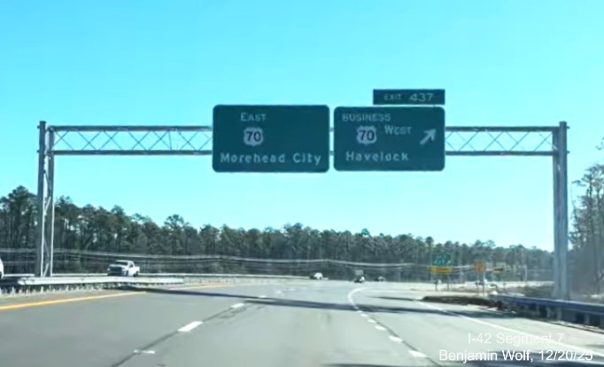
Segment 7 (Updated 12/22/25)
US 70 Havelock Bypass
Road Type: Freeway
Length: 8.5 (10.1 lane) Miles
Status: Complete Opened to
Traffic: December 19, 2025.
Bypass Location Map:32

Work started on August 30, 2019
and was opened to traffic on December 19, 2025.
NEW-Sign Images from the Havelock Bypass, from videos by Benjamin Wolf on Dec. 19 and 20, 2025:
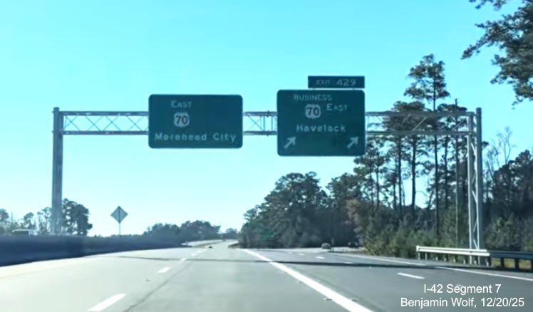
The new overhead signs at the western end of the Havelock Bypass,
heading east. The blank space on the right for a future I-42 shield (see sign plan section).
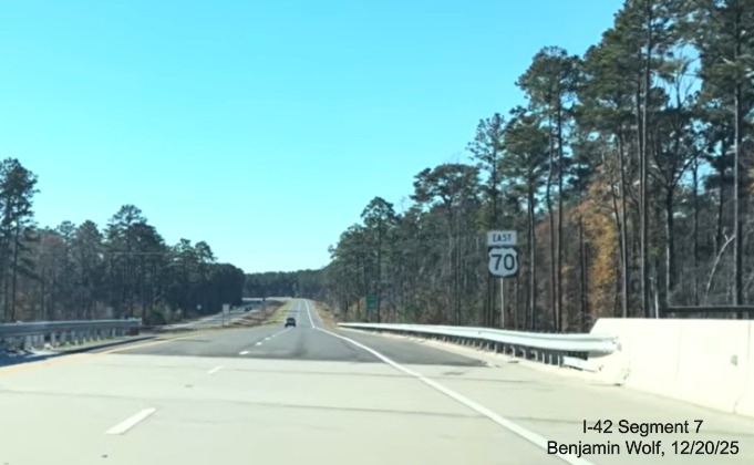
The first East US 70 reassurance marker on the Havelock Bypass,
all the route signs are on wooden posts.
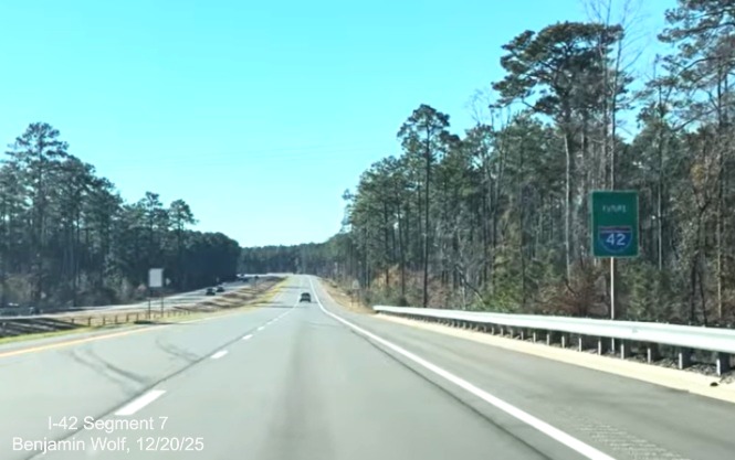
There are also Future I-42 signs posted along the Bypass as well.
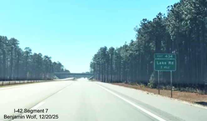
The 1 Mile advance sign for the only exit along the Bypass, Lake
Road.
The overhead signs at the end of the Bypass, not there is a space for
a future I-42 shield here as well.
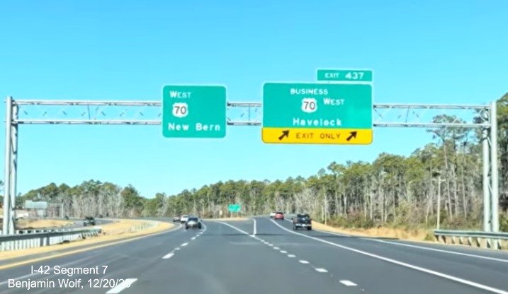
The overhead signs at the eastern end of the Bypass headed west.
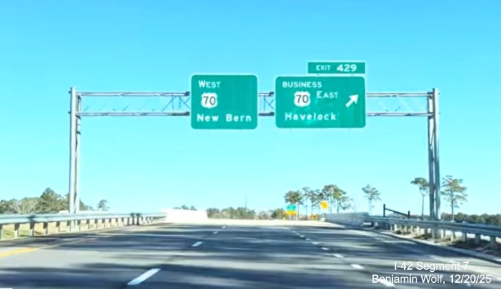
Finally, the overhead signage at the western end.
More images can be found in the Segment 7 section of the
photo gallery below.
Construction History
On August 1, 2019, NCDOT awarded the $167.2 million contract to build the Bypass to Balfour Beatty Infrastructure, Inc.
of Wilmington, NC. By February 2023 work to tie in the western end of the Bypass to the existing US 70 roadway caused temporary
closure of several roads.37 The original completion date was May 13, 2024, though the NCDOT project site was
updated in June 2024 to indicate the new opening date would be April 19, 2025.38 This was confirmed in an April 10,
2024 report on the WCTI website indicating NCDOT had delayed the opening to the spring of 2025 citing delays due to weather.37
In January 13, 2025 an article in the Triangle Business Journal indicated the project had again been postponed,
due this time to changes in design, to the summer of 2026. This was later confirmed on the NCDOT
project site.39 The work was apparently delayed
by a change in design of the original ramps at the northern end of the Bypass which had been designed for a 60 MPH speed,
instead of the 70 MPH speed for the Bypass and the future freeway from James City. The redesign increased
the cost of the project, estimated in early 2024 as $221.25 million.40Earlier, on June 20, 2024 the
US 70 East ramp over the future eastern end of the Bypass was opened, the news article then reported the
Bypass would not open until the fall of 2025.41 In November the alignment of US 70 East at the western end of
the Bypass was put in its final configuration (see the
October 17 video by Benjamin Wolf in video link below).
On December 10, 2025 it was announced the Bypass would open on December 19 after a ribbon cutting ceremony.42
Segment 8 (Updated 8/3/25)
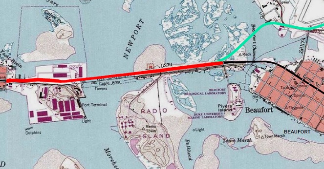
US 70 (or US 70/NC 101) from end of Havelock Bypass
to Morehead City or Beaufort
Road Type: Mostly 4-lane divided
Length: Approx. 11 Miles
Status: Need Upgrade to Interstate Freeway
There is some uncertainty as to the building of the last I-42 segment.
There were no projects beyond the Havelock Bypass listed in the 2024-2033
STIP released in June 2023. Some doubt I-42 will make it through the city
to the bridge due to the difficulty in constructing an interstate through
an urban area. There have been proposals though to create other possible
routes around it however. In 2020 Craven County released its Comprehensive
Transportation Plan (adopted in 2023).47 It suggested that I-42
use the proposed Northern Carteret Bypass (map below) that would meet US
70 at the eastern end of the Havelock Bypass [see Map in Segment 7] and
largely parallel NC 101 to Beaufort, northeast of Morehead City. A
feasibility study for the Bypass was published in 1999 with additional
alternatives studied in 2009. Despite it being given a STIP number,
R-4431, and supported in the Carteret County Comprehensive Traffic Plan in
2013 (a new report is pending), the project has not been funded since
being dropped from the 2012-2020 NCDOT STIP due to a low prioritization score.48

A news report by a public radio station in Morehead City in February
2023 indicated that due to the probable difficulty of building an
interstate highway through the city of Newport along US 70, the NC 101
corridor could be used, this would take the path of I-42 more to the north
east, ending it in Beaufort as well. Morehead City bound traffic could
then take US 70 West from the end of the interstate.50 This
proposal was discussed in the article by a planner for the East Carolina
Council, not by NCDOT, therefore it is unknown whether it is seriously
being considered by the state agency. Unless funded, it could not be
constructed for at least another 10 years.
In the Quantitative scores for potential 2026-2035 STIP funded projects
published in May 2024, both projects were included, indicating NCDOT is now
considering the North Carteret Bypass option. The original proposal is
described as: "Upgrade Existing US 70 from Havelock Bypass (currently under
construction) to McCabe Rd outside of Morehead City to interstate
standards. The upgrade would bring future Interstate 42 into Carteret
County and as close to the Port of Morehead City along the existing route
as possible. Portions of the roadway will require service roads to be
constructed, particularly through Newport." The project was
cataloged as H230309 on the score spreadsheet, but did not have an
official project number. The estimated cost is $1.32 Billion(!) and its
state mobility score is 57.61. The other entry is described as: "Upgrade
portions of US 70 and NC 101 to interstate standards and build new
interstate between the two north of Newport in Carteret County." Again
there is no official project number, the spreadsheet listing is H230310.
It is estimated to cost a slightly cheaper $1.15 Billion, but it has a
state mobility score of 71.87, meaning a greater likelihood of being
funded.18 Given the cost of either project though it was not a surprise that neither was
included in the Final 2026-2035 STIP released in July 2025. What was listed as a Future I-42
project was to create a temporary reduced conflict intersection on US 70 at the intersection with
Gladys Teasley Lane at a cost of $986,000 to start later in 2025.49
One project that was funded, rebuilding the Newport River Bridge from a 2-lane to 4-lane structure was to start in 2022,
however it was then removed from the STIP and did not reappear in the Final 2024-2033 released in June 2023. Map showing
the proposed location:46
Photos
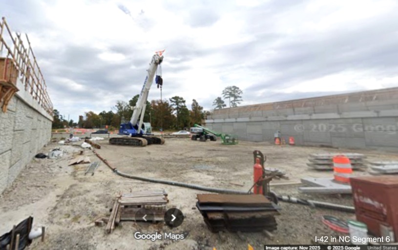
Segment 1 (Updated 6/23/25)
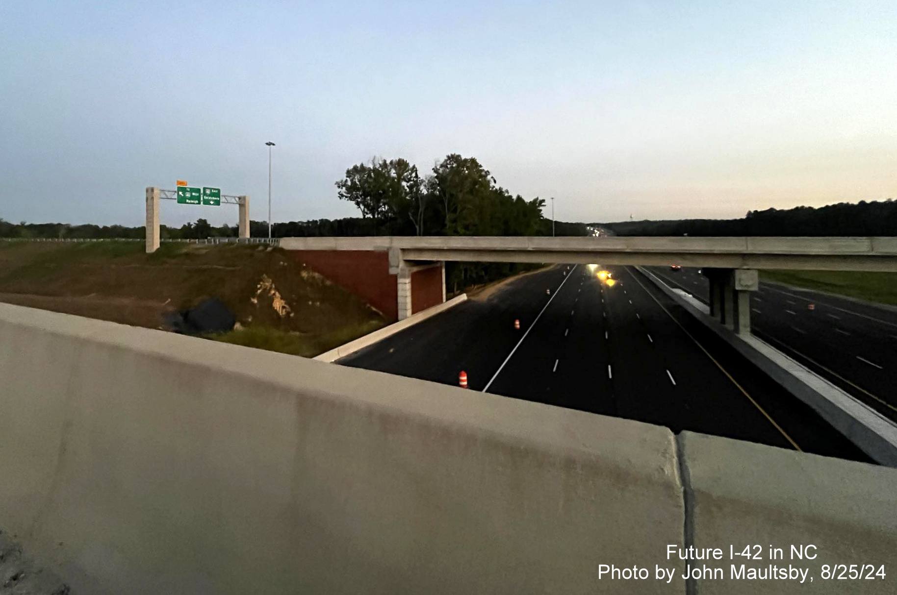
Photo by John Maultsby on June 19, 2025:
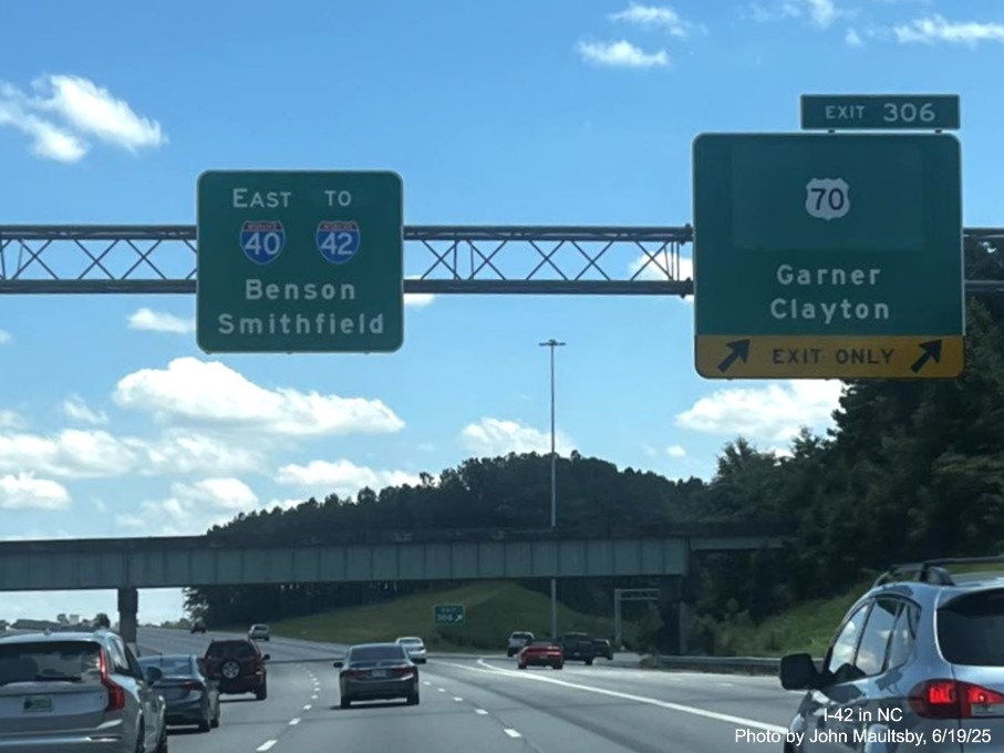
The revised overhead signage at the US 70 exit in Garner with new I-42 shield on the pull through sign on I-40 East.
Photos by Mark David Moore in May 2025:

The new NC 36 East trailblazer behind new I-42 trailblazers approaching the ramp on Veterans Blvd.

The new 4.5 Mile marker after the on-ramp from Veterans Blvd.

NC 36 shield replacing NC 42 at the new diverging diamond interchange at I-40.
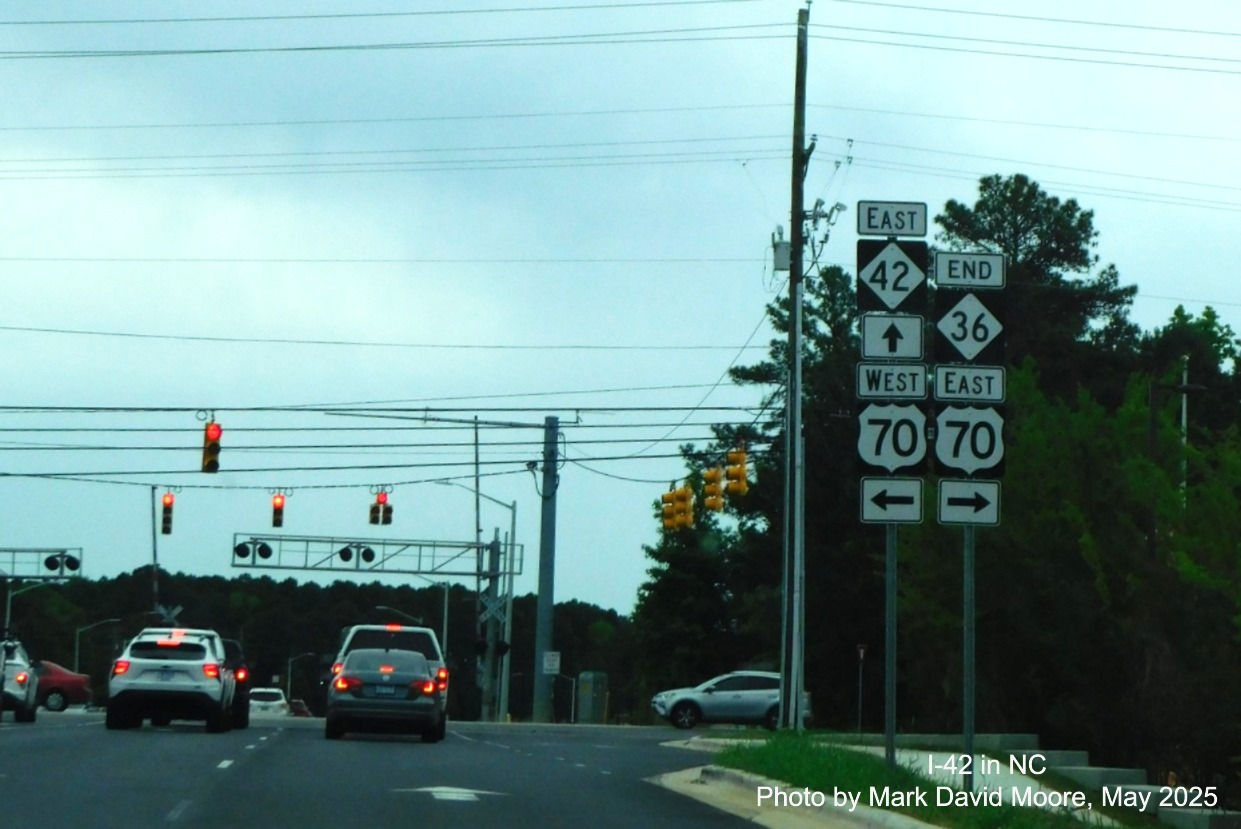
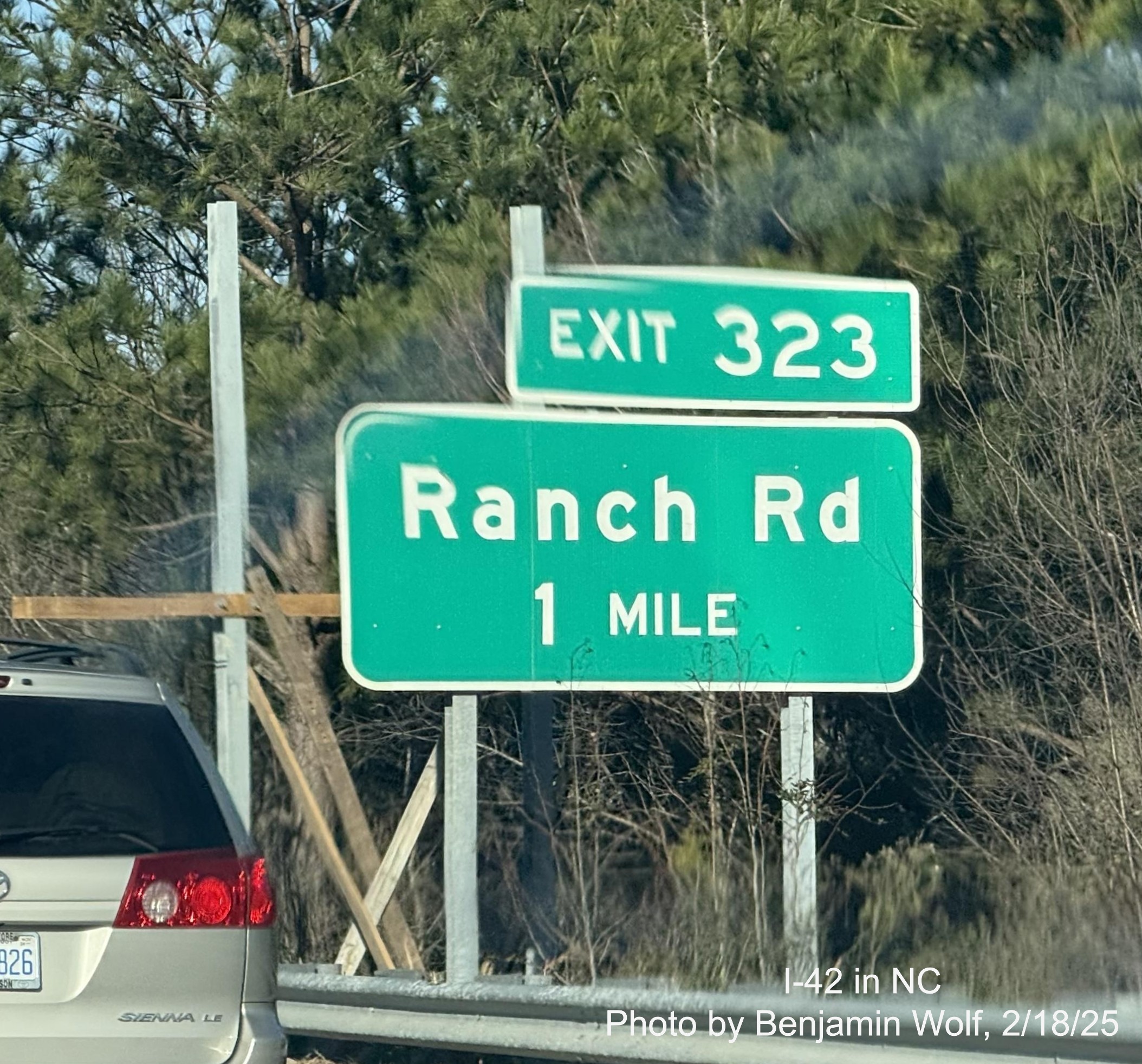
The new End NC 36 shield on Ranch Road in Clayton at the US 70 interchange, and the return on NC 42.
Photo of revised signage on US 70 East in Garner approaching I-40, photo by Troy Creasy on March 20, 2025:
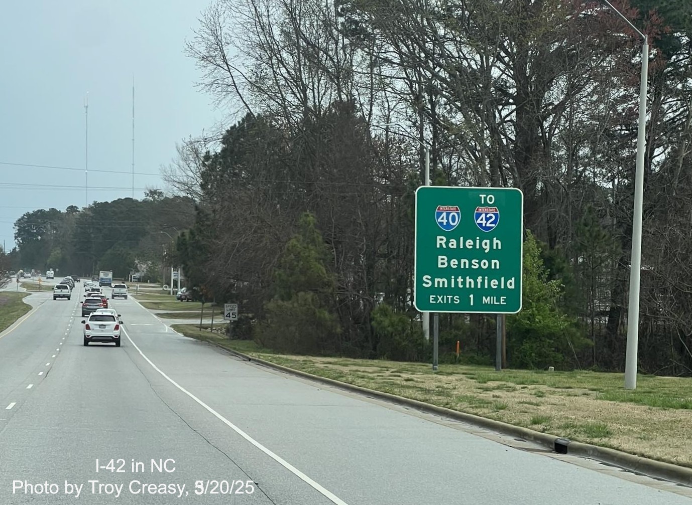
A revised 1 mile advance sign on US 70 East that has replaced East US 70 with To I-42.
Photos taken along the Clayton Bypass headed west by John Maultsby on March 8, 2025:
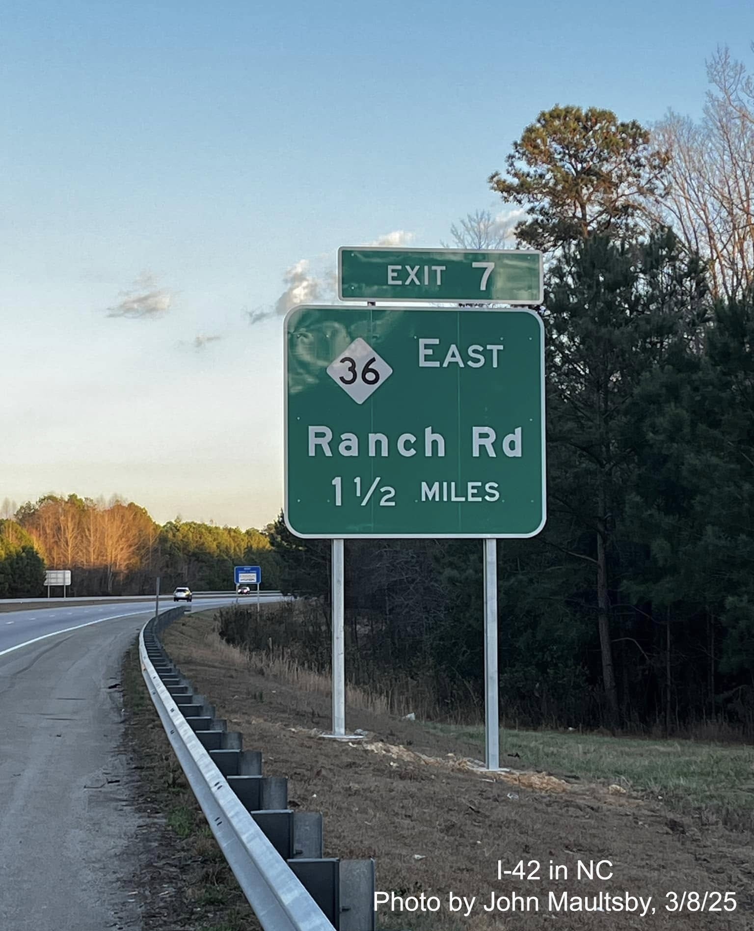
One of the new advance signs for the now NC 36 East exit on the Clayton Bypass.
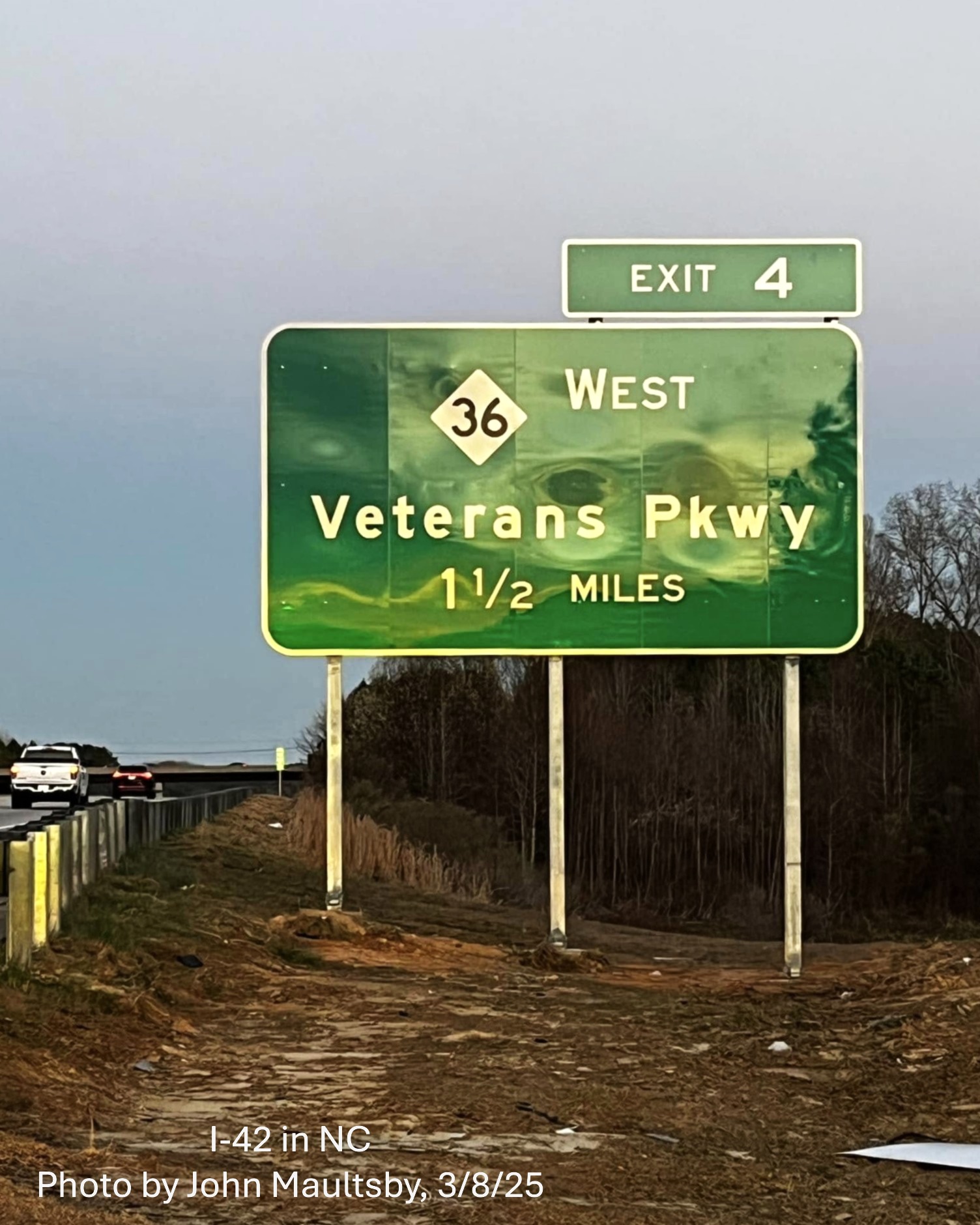
The new 1 1/2 mile advance sign for the now NC 36 West/Ranch Road exit on the Clayton Bypass.
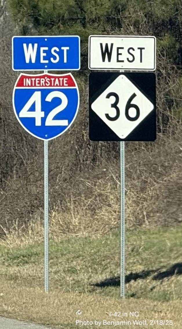
Photos taken along the Clayton Bypass headed west by Benjamin Wolf on February 18, 2025:
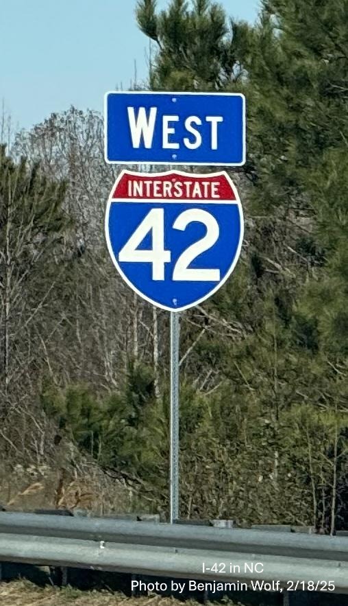
New West I-42 reassurance marker after US 70 exit.
Supports await new NC 36 East sign on I-42 West.
The new West I-42/ NC 36 reassurance marker after the current Ranch Road exit.
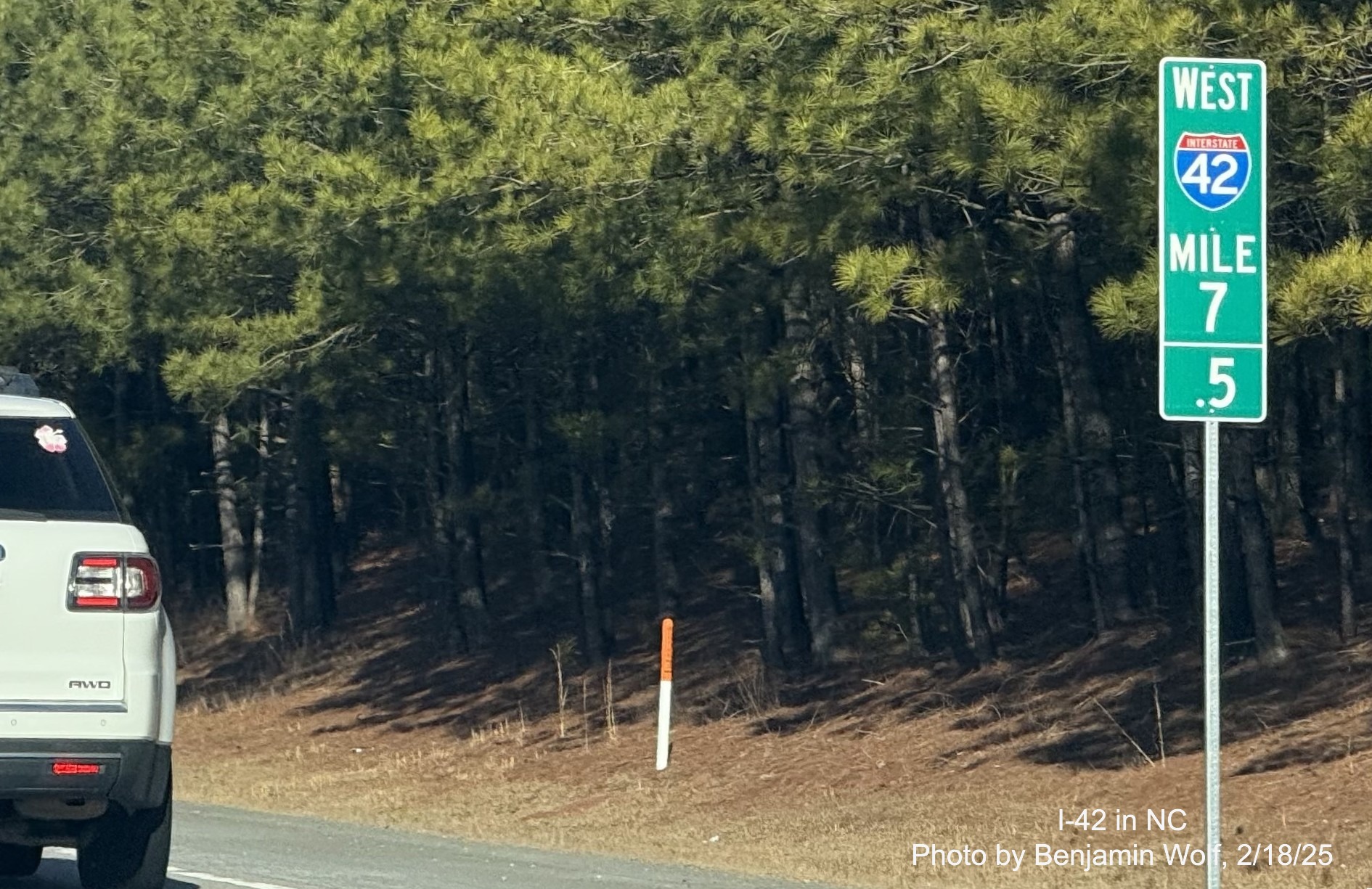
The new West I-42 Mile 7.5 marker near the current Ranch Road exit.
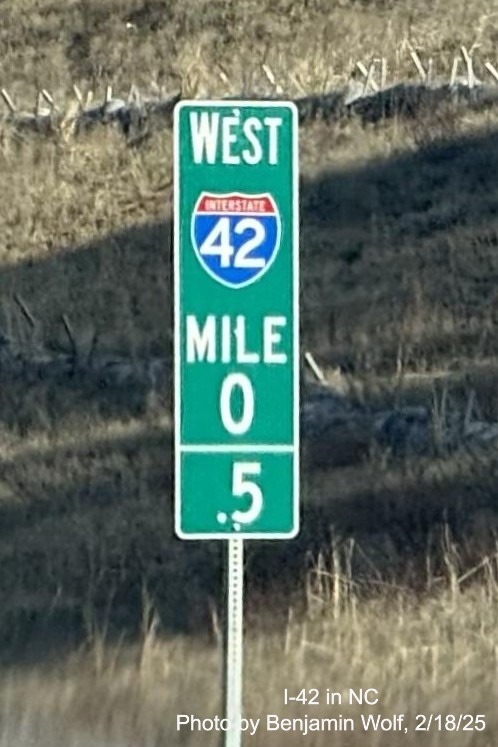
The new West I-42 0.5 mile marker, there were still several US 70 mile markers up at the time this was taken.
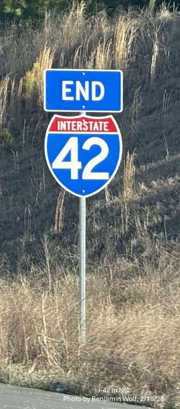
The new End I-42 sign at the western end of the Clayton Bypass.
Screen grab images from Google Maps Street View taken in December
2024 along I-40 West:
The Clayton Bypass 1/2 Mile advance sign with a
premature I-42 shield
Screen grab images from Google Maps Street View taken in November
2024 along US 70 West:
The new ground mounted 1/2 mile advance for the I-40/NC 540
turbine interchange on still US 70 West, but with an I-42 exit number.
Photo taken by
Benjamin Wolf heading west on the Clayton Bypass in November 2024:
The new sign for
the I-40 East/Toll NC 540 West exit also with the I-42 milepost based exit
number seen on the overhead signs at the interchange. The other exits on
the Clayton Bypass will have to wait until I-42 is completely signed
(see photo below). This will probably happen after Feb. 10, 2025.
Photos taken by
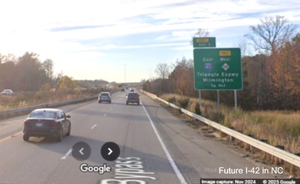
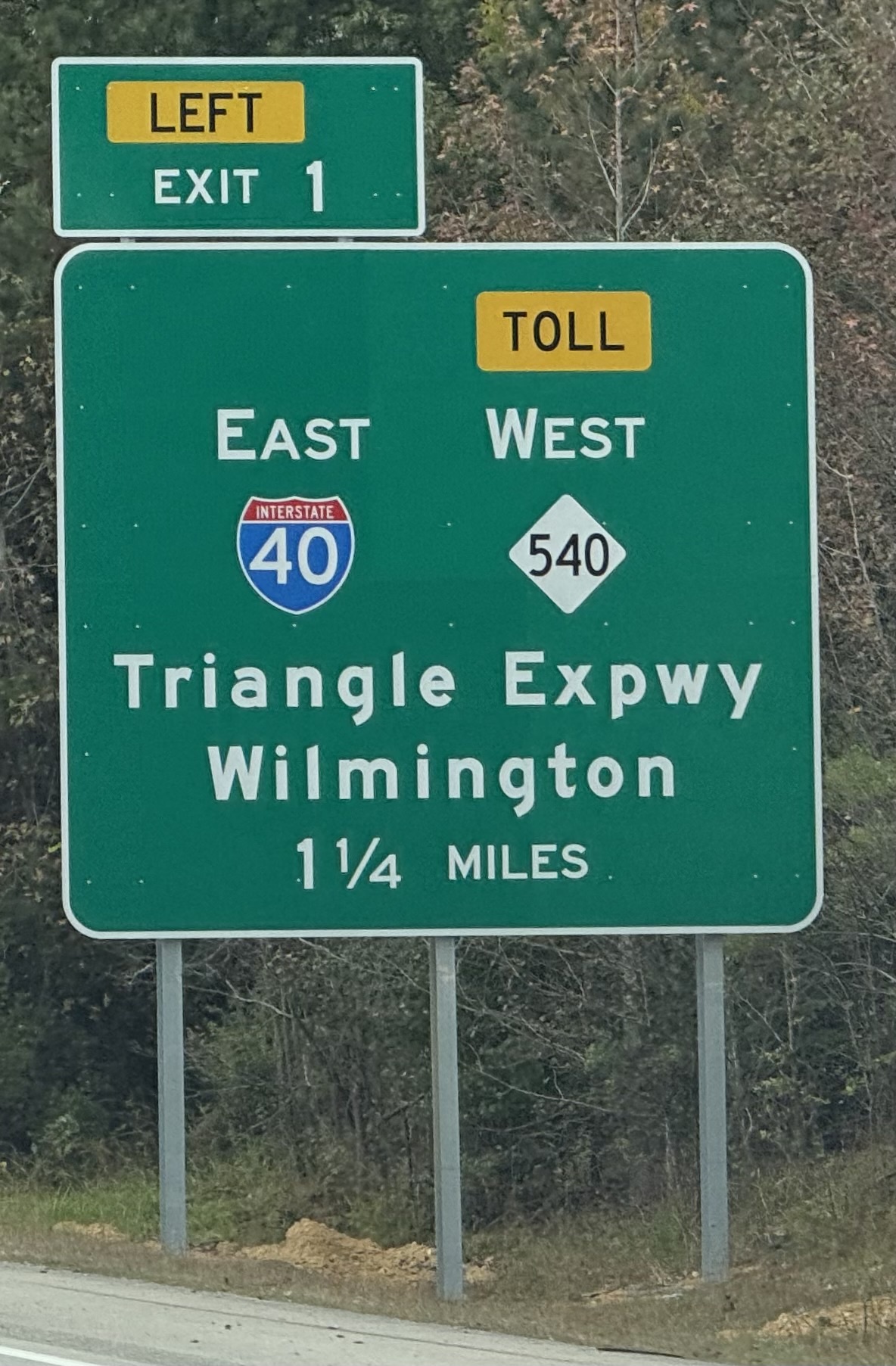
AARoads Forum member snowc on NC 540 East on October 18, 2024 showing
I-42 related signage:
The first I-42
shield seen on NC 540/Triangle Expressway East is at the NC 50 exit, the 2 Miles advance sign for the "Turbine Interchange"
at I-40.
The next I-42 shield was on the 1 Mile advance sign approaching
the current end of NC 540 East.
EARLIER in 2024:
Photos taken by
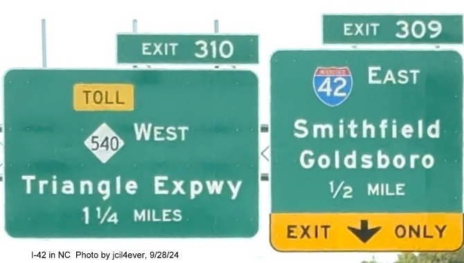
Seth Purvis on September 28, 2024 along newly opened NC 540/Triangle Expressway approaching I-40/I-42:
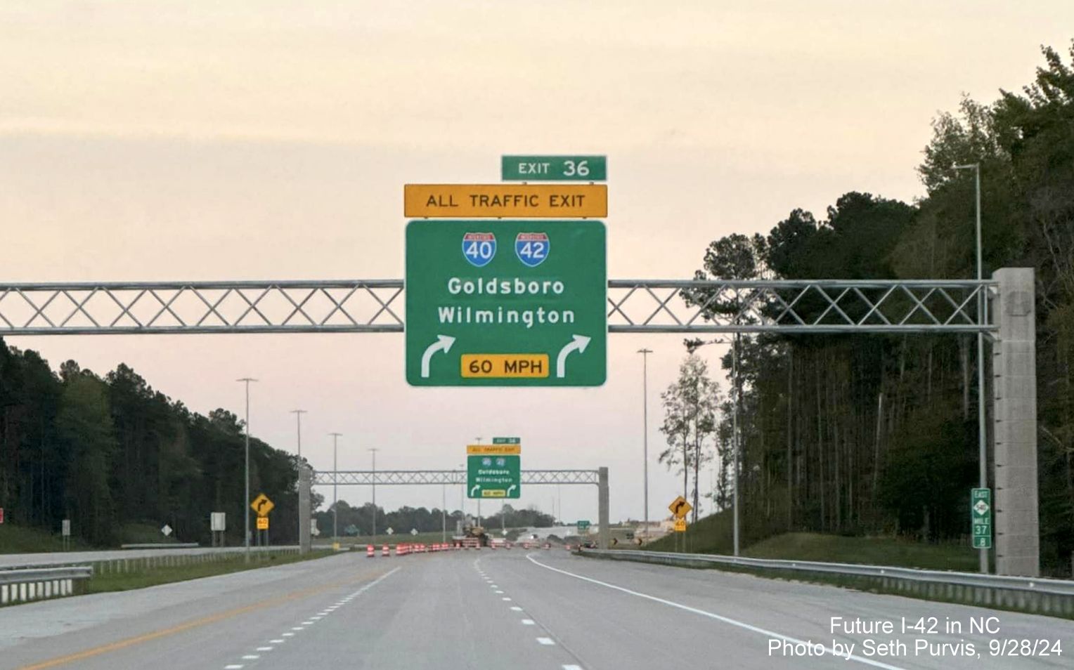
First of two
overhead signs with I-40 and I-42 shields approaching the current end of NC 540/Triangle Expressway.
Overhead
signs with I-40 and I-42 shields at ramp for I-40 East. The left sign labeled 'To I-40 West' since it reaches the end of
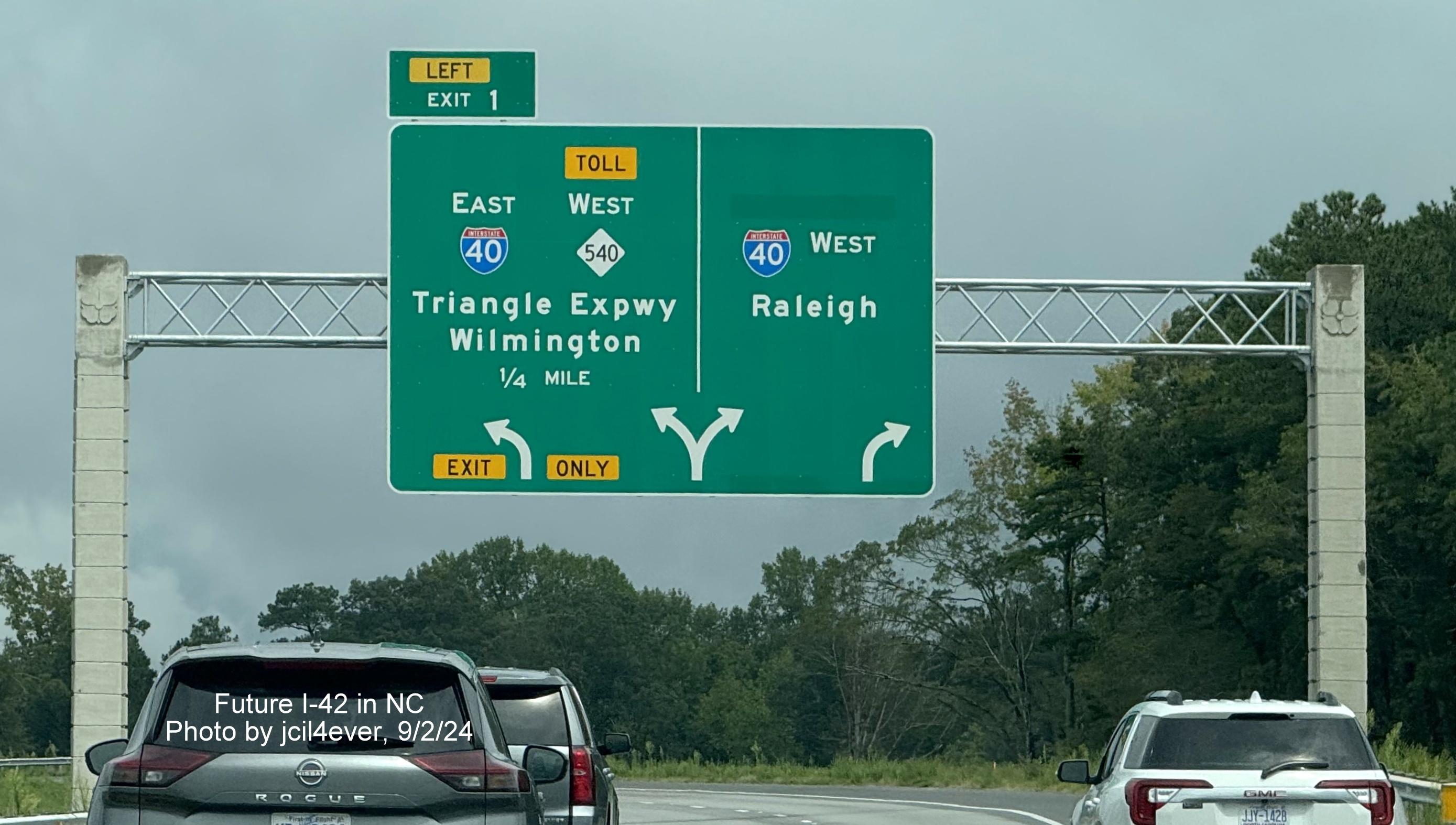
I-42 East first.
I-42 East pull through sign at ramp heading for I-40 West.
Here's a traffic
camera photo taken of the same sign seen in the first photo above:
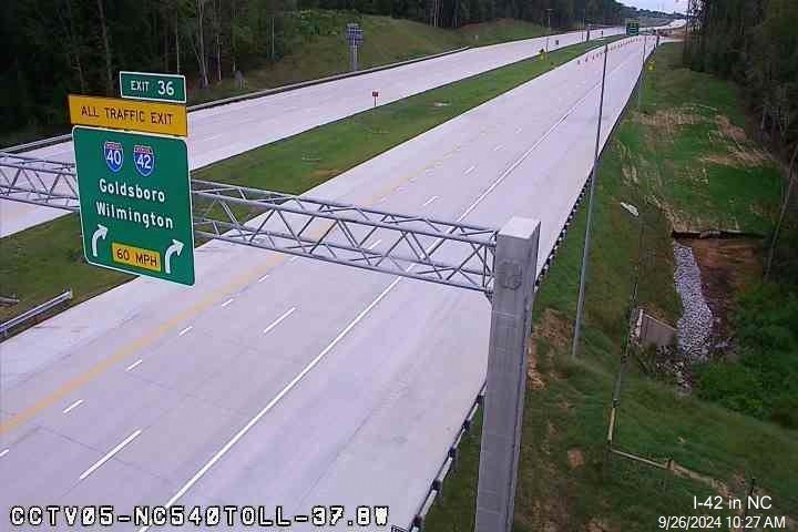
Photo taken by
Benjamin Wolf (AARoads member jcil4ever) on September 23, 2024:
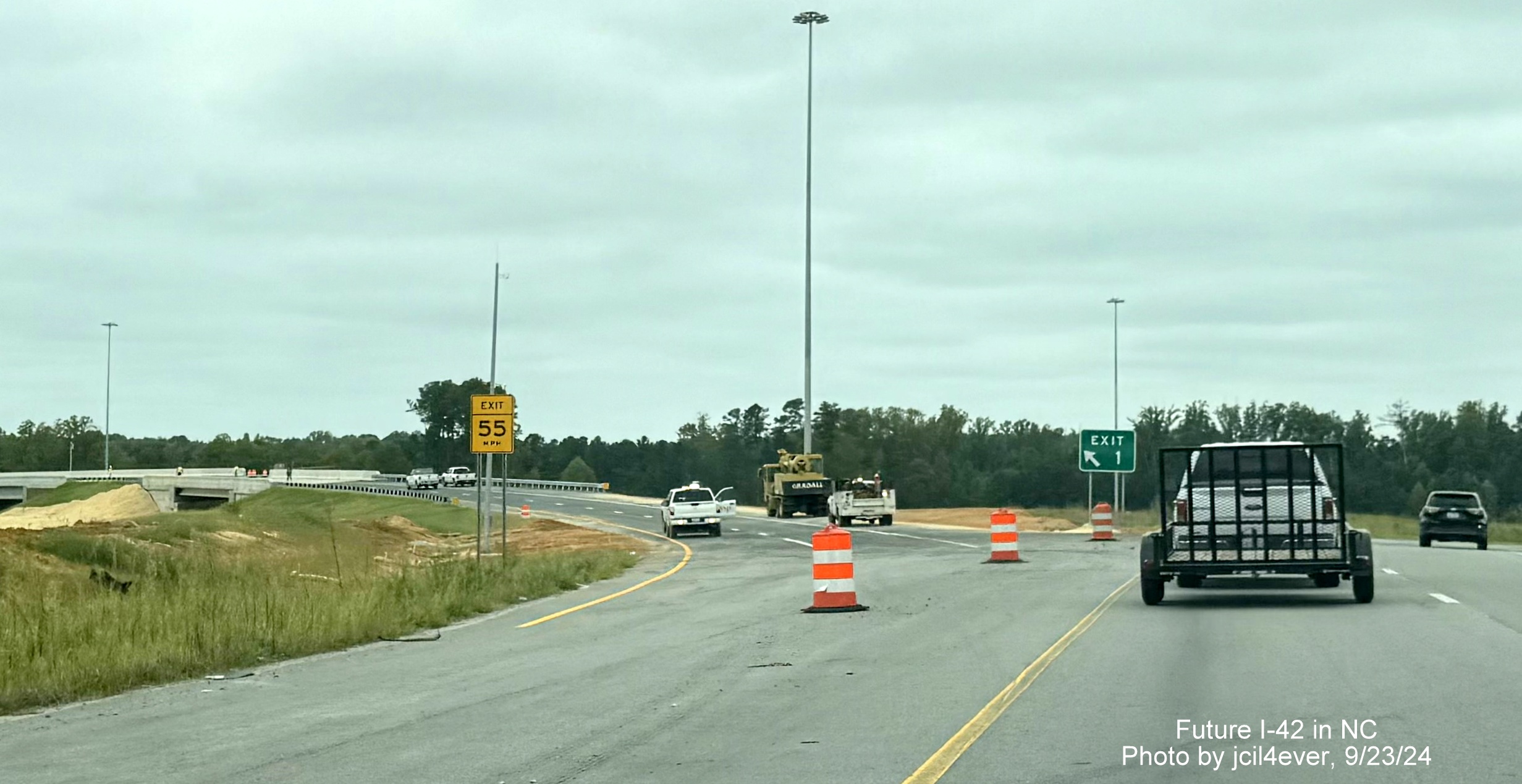
New Exit 1 gore sign for I-40 East/Toll NC 540 West with
lanes beyond being striped for September 25 opening of ramp.
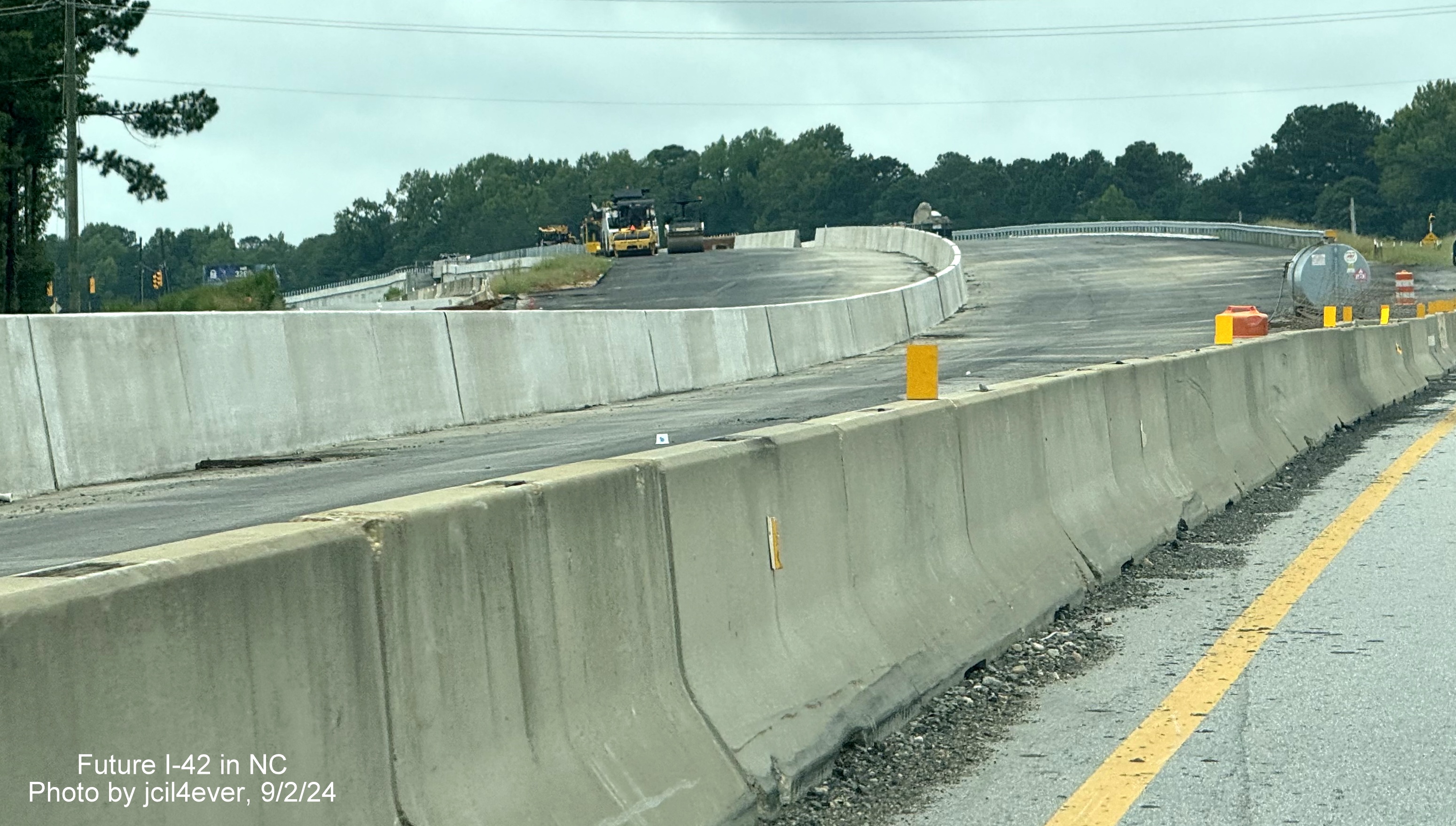
New I-42 exit signage taken by David Johnson on 9/2/24 prior
to the road's opening:
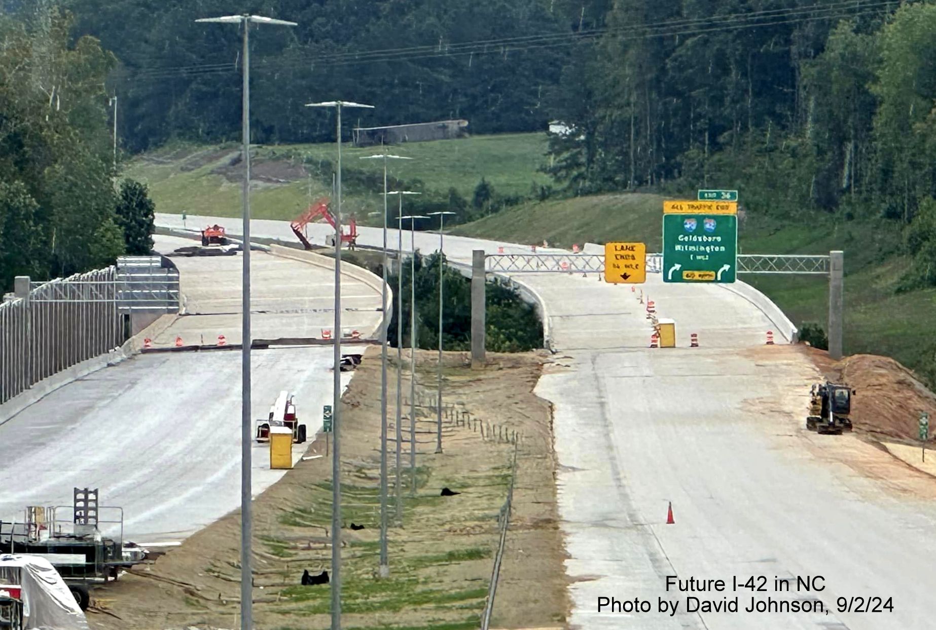
Recently placed 1 Mile advance sign for the I-40/I-42 "Turbine
Interchange" on the soon to open NC 540 East Triangle Expressway.
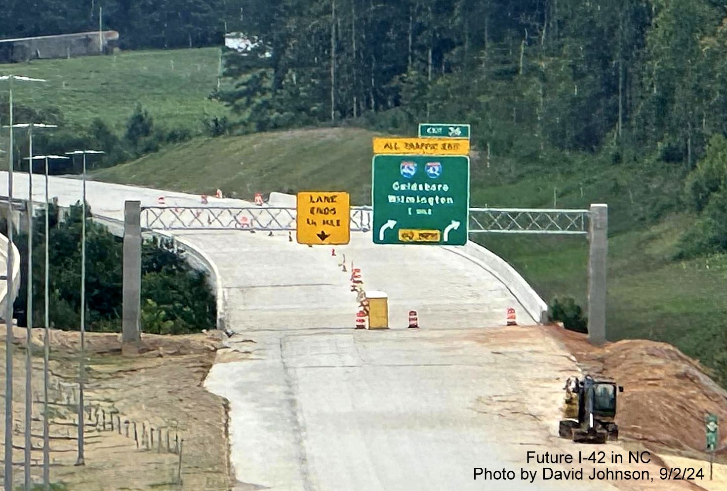
Closer view of the overhead signage. This may be somewhat
confusing to drivers at the time since NCDOT did not plan to sign I-42 along the Clayton Bypass until early 2025.
The reference to
NC 540 should have been covered over since the ramp did not open until September 25.
2024 PHOTOS
Screen grabs from Buckeye Drones video taken over NC 540
construction in the vicinity of the Future I-42/I-40 Turbine interchange in early July 2024 showing new
signs with US 70 shields, that were later replaced with I-42 shields:
View looking east at nearly completed NC 50 interchange showing
recently installed overhead signage at the bottom. The advance sign for the Future I-42 East/I-40 interchange has I-40 and
US 70 shields.
The next advance
sign for the Future I-42 East/I-40 interchange after the NC 50 exit.
The exit sign at
the Turbine interchange, plus a look at the complete interchange:
The ramp from Future I-42 West to I-40 East appears
almost complete.
Previous Photos from 5/11/24
Photos taken approaching I-40/Future NC 540 interchange
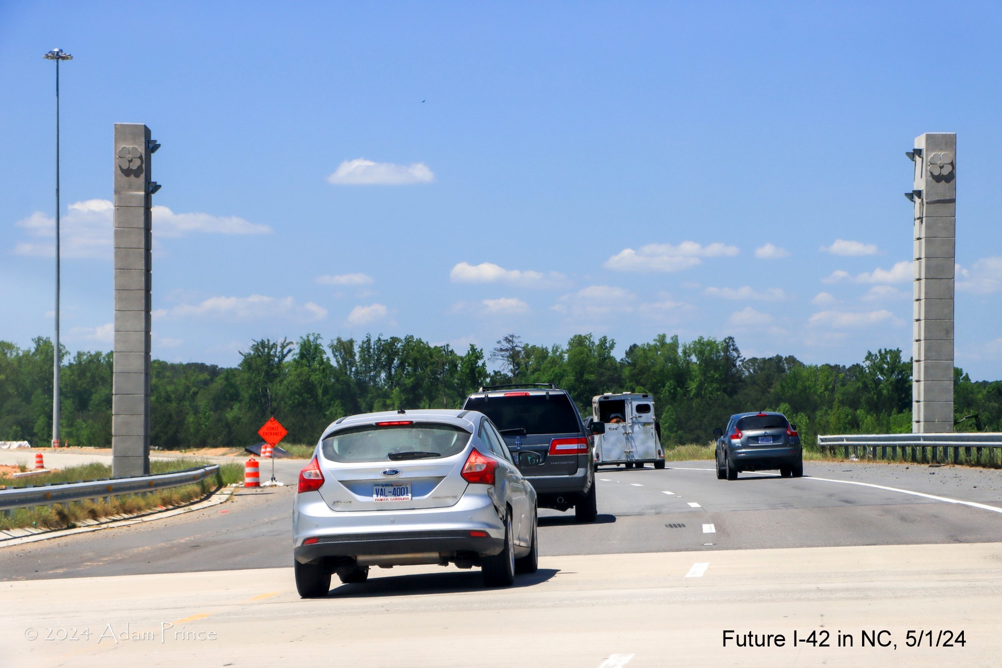
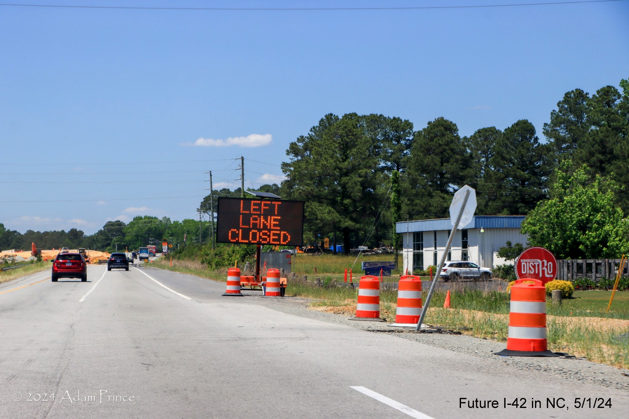
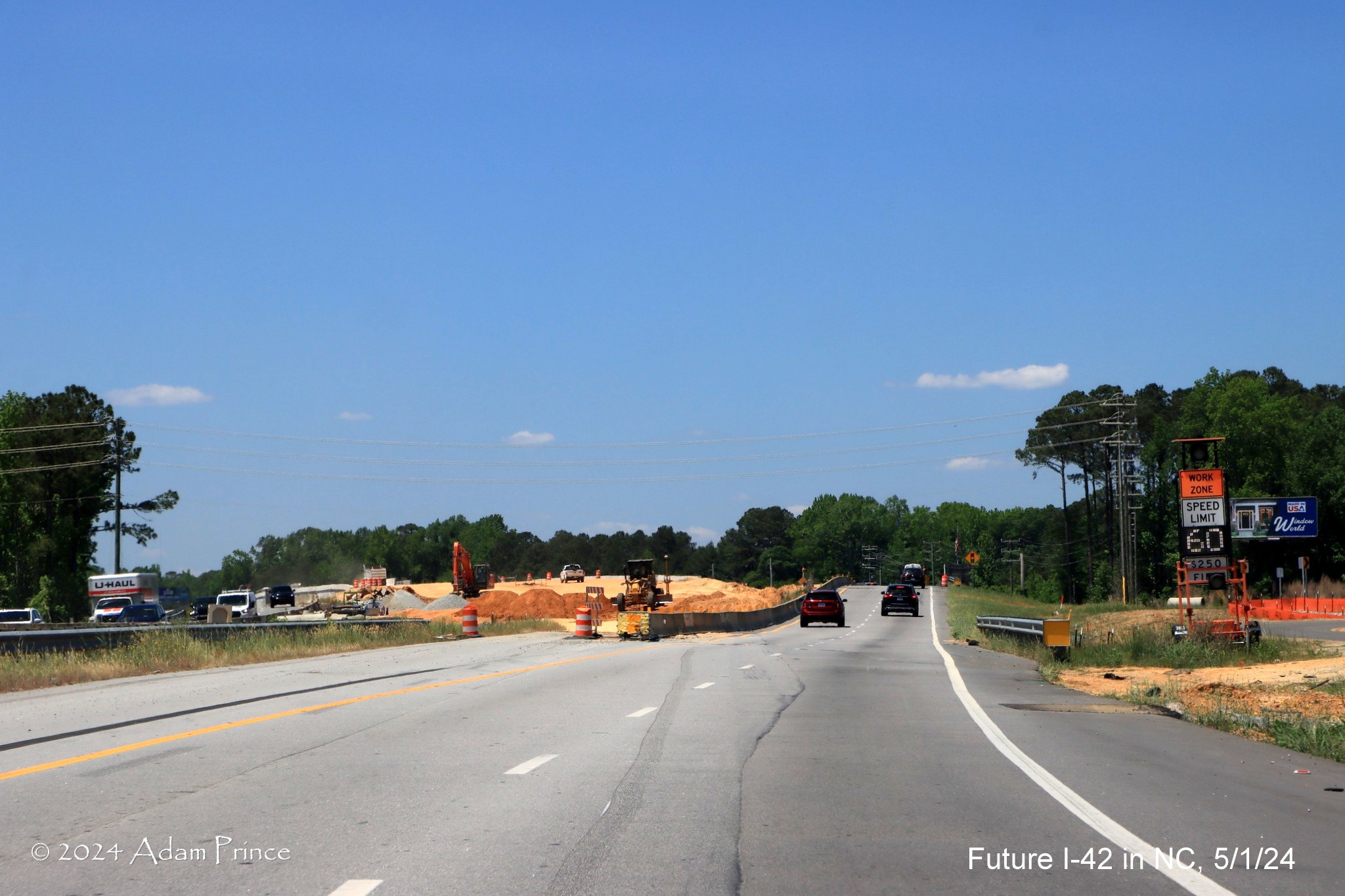
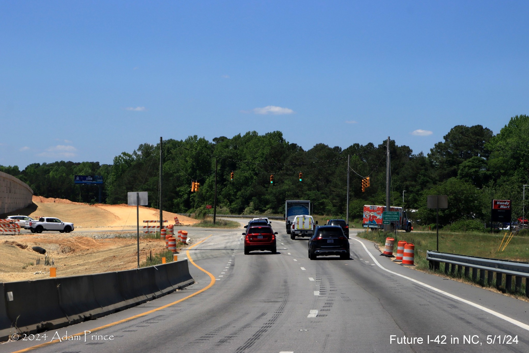
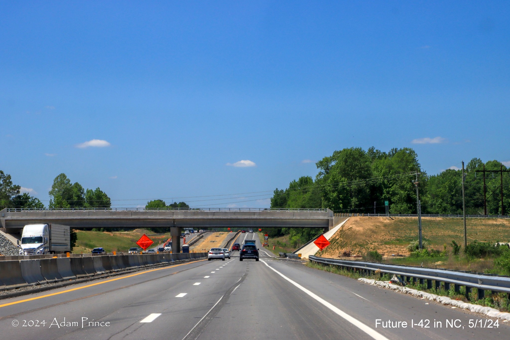
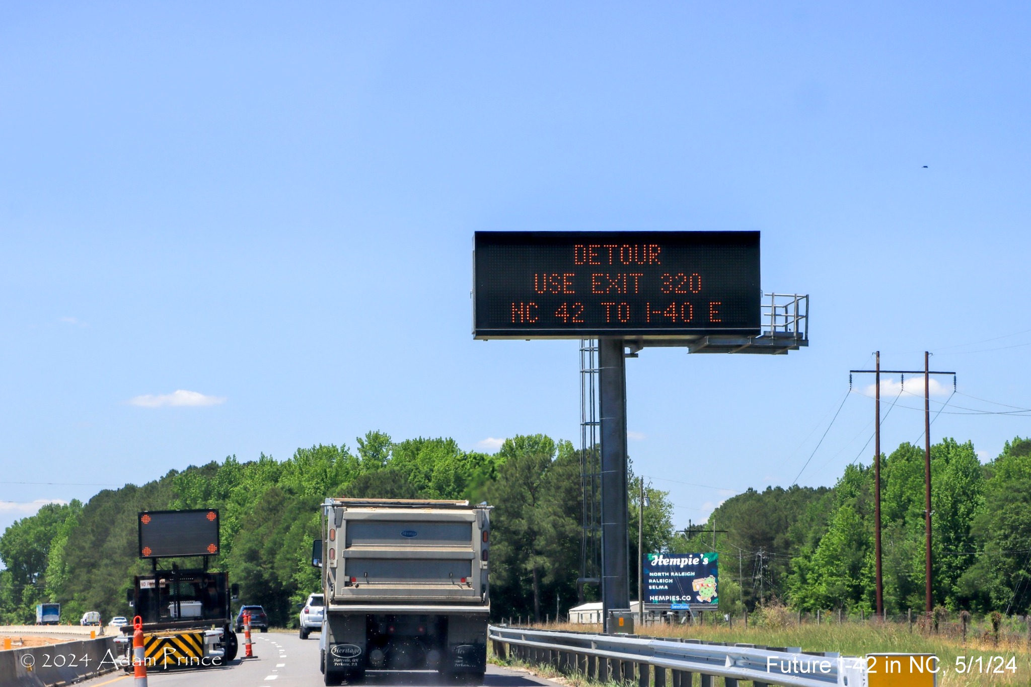
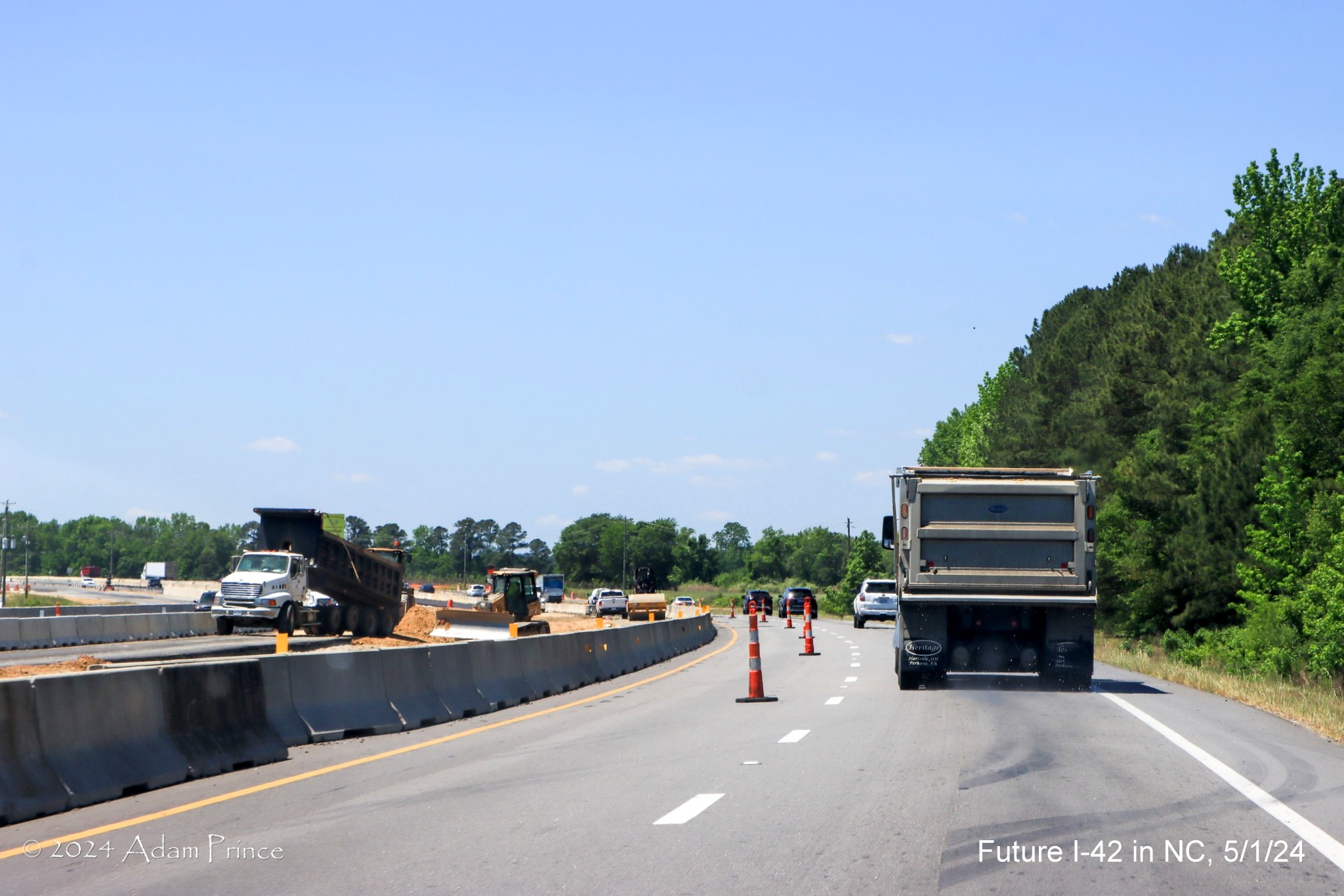
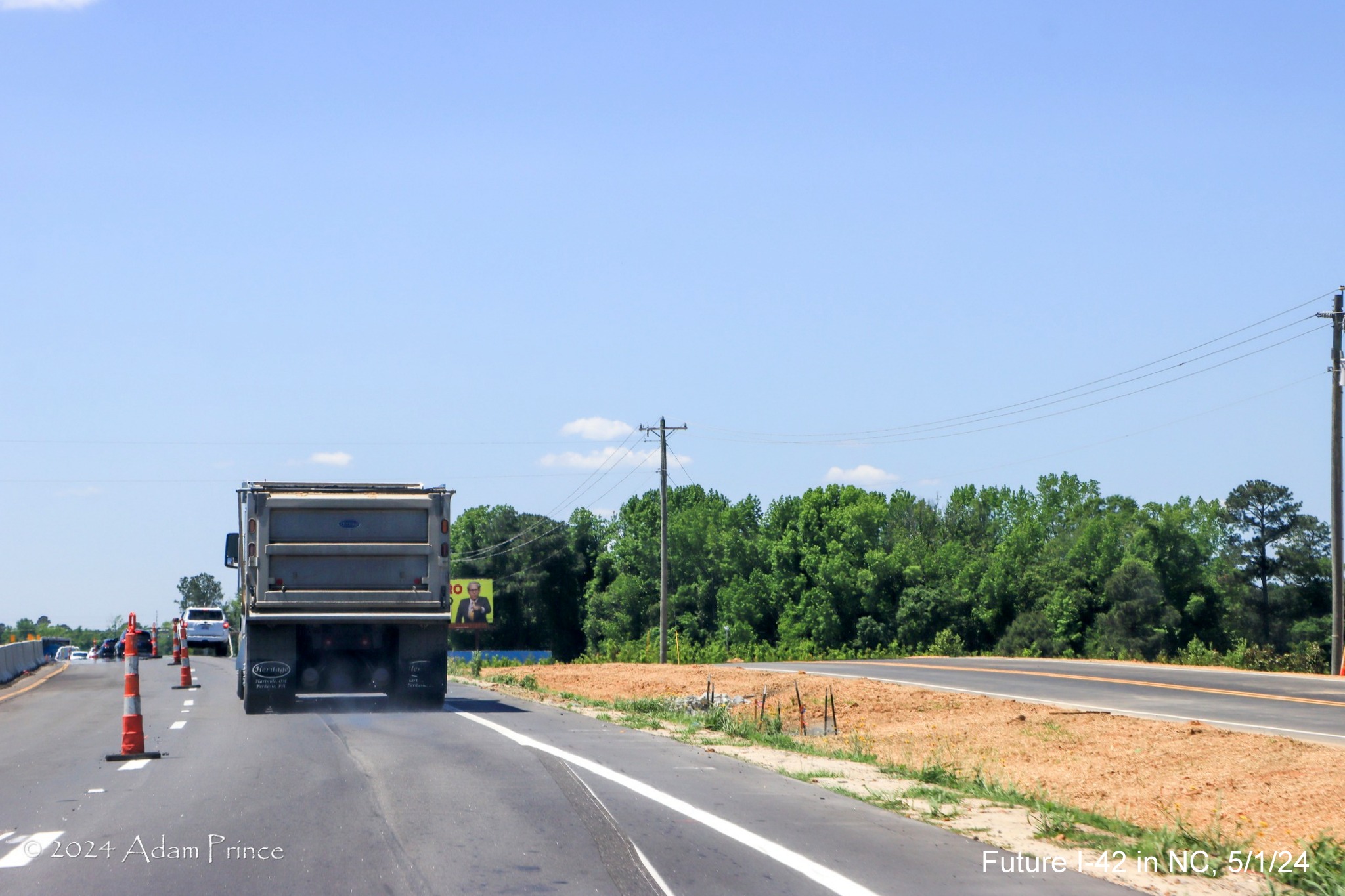
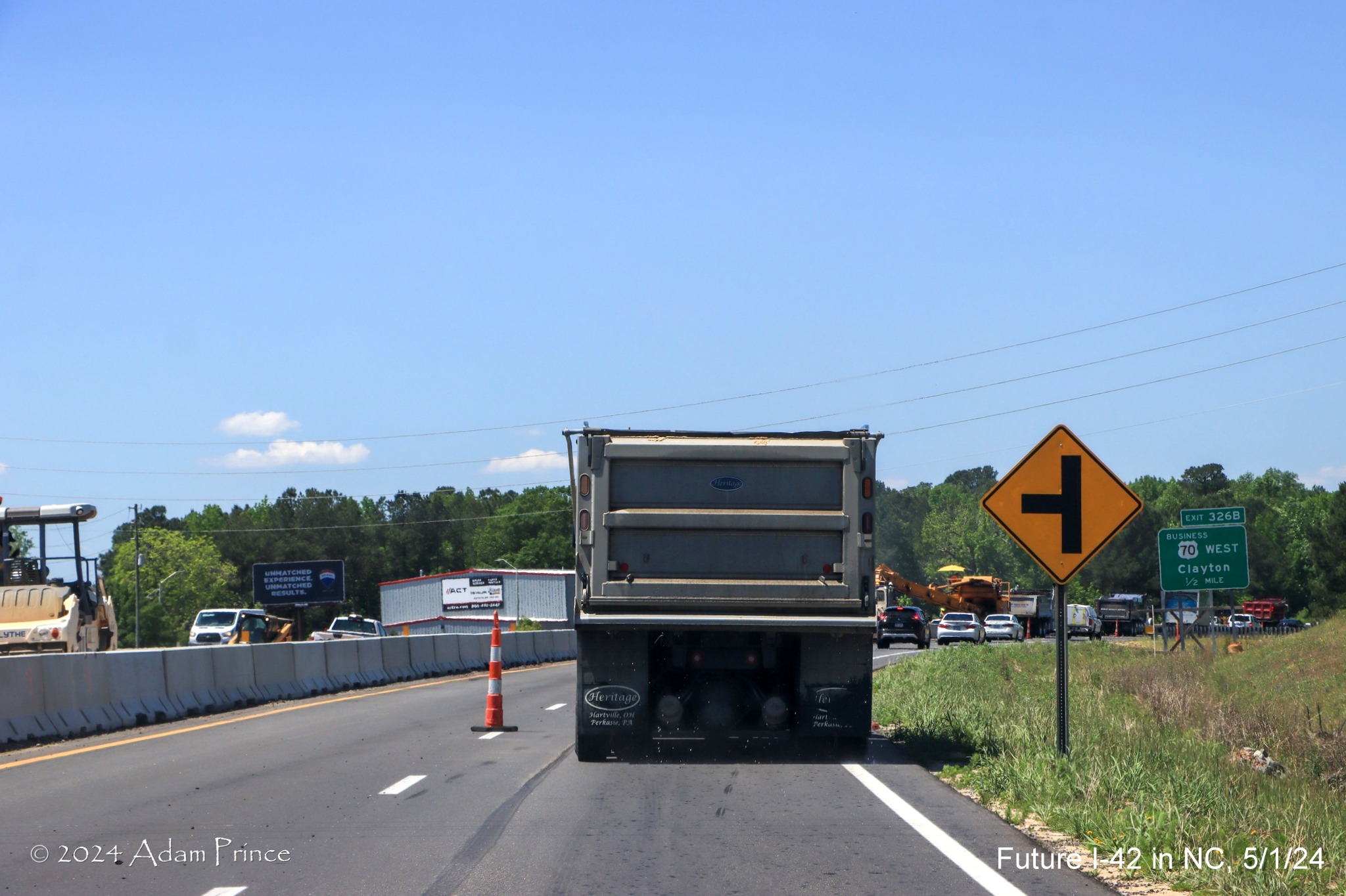
on US 70 West, taken by Adam Prince on May 1, 2024:
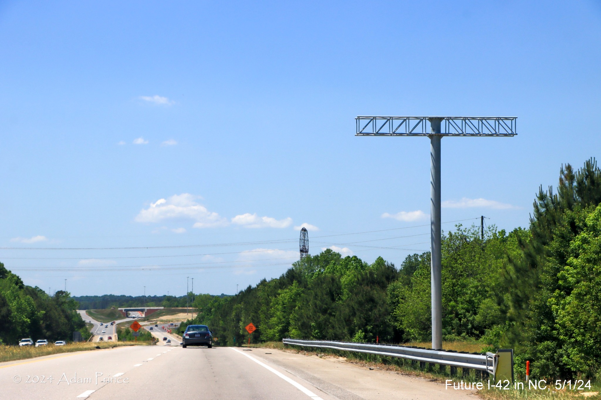
Support gantry for an overhead VMS not yet installed
approaching the I-40 interchange.
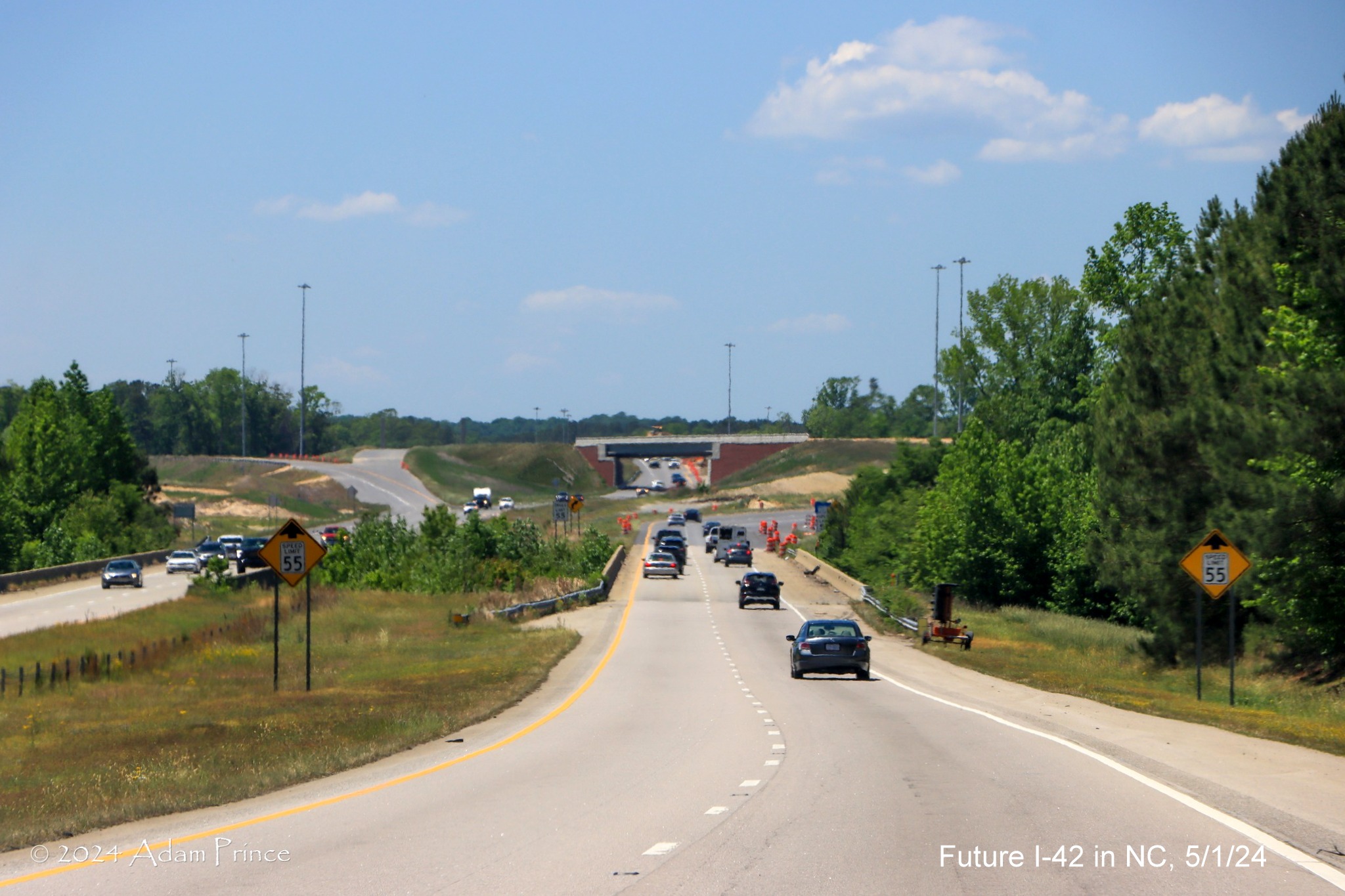
Now approaching
the I-40 interchange, all previous exit related signage in the area has been removed. The new turbine ramp for US
70 East heading under nearly completed NC 540 related ramp in the distance.
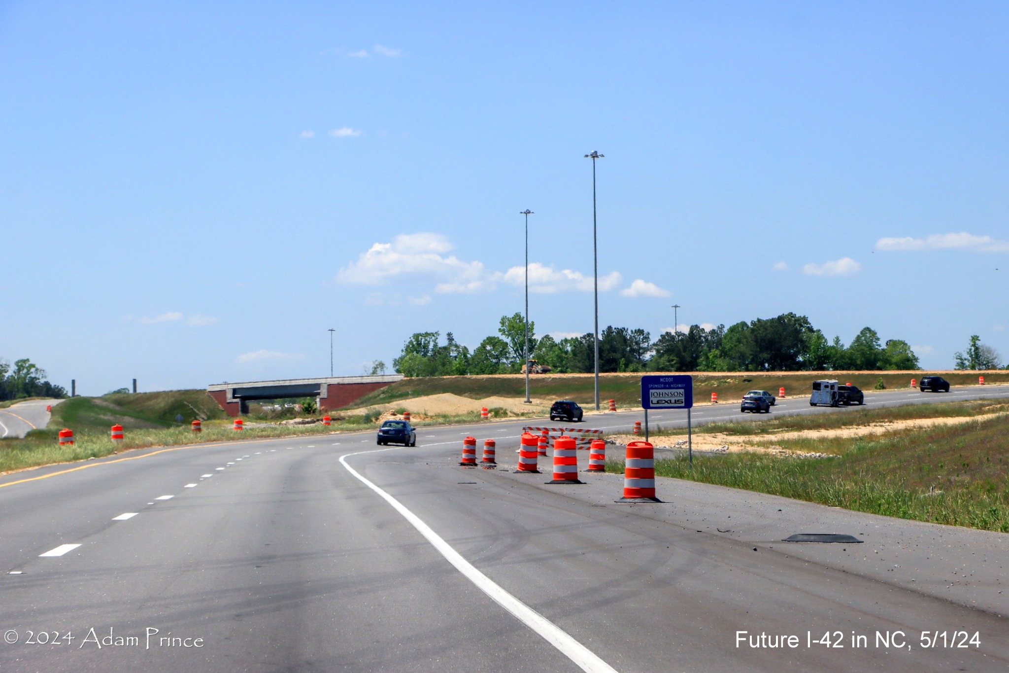
New US 70 (Future I-42) West lane approaching the turbine ramps
of the I-40/Future NC 540 interchange. I guess any future traffic jams will be brought to you by Johnson Lexus.
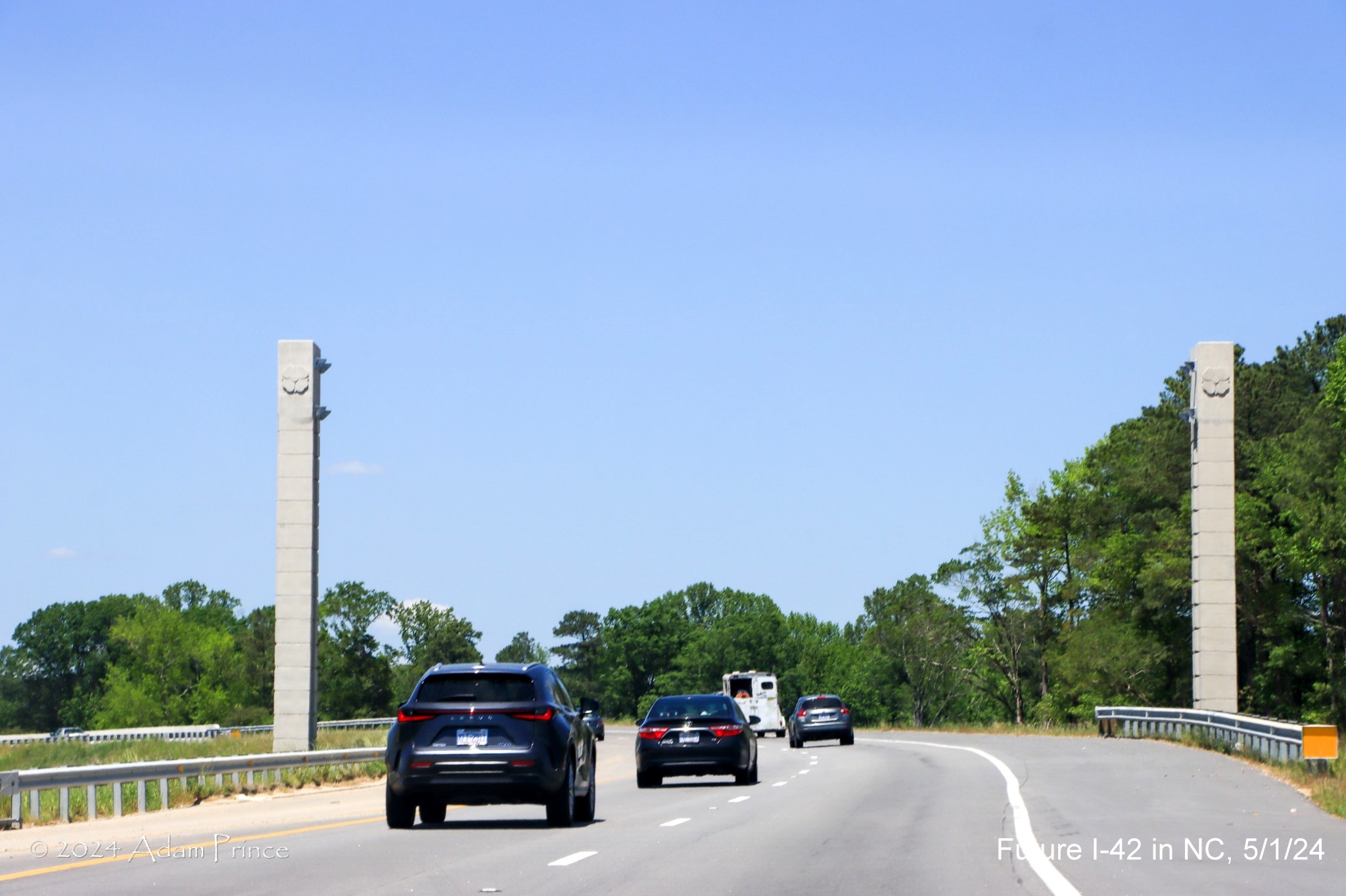
The first of two future overhead sign gantries for US 70 (Future
I-42) West traffic on the turbine ramps at the I-40/Future NC 540 interchange. Little change seen from last fall, see photos
below.
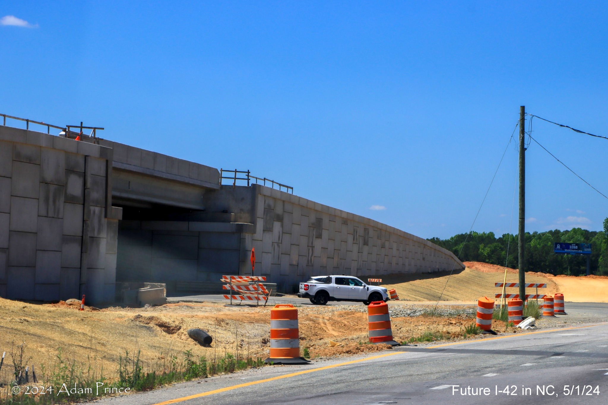
At the second of the future overhead signs along the turbine ramps
in the I-40/Future NC 540 interchange. Signs for the split of ramps
between traffic
heading for I-40 West and those continuing around to NC 540 West or I-40 East.
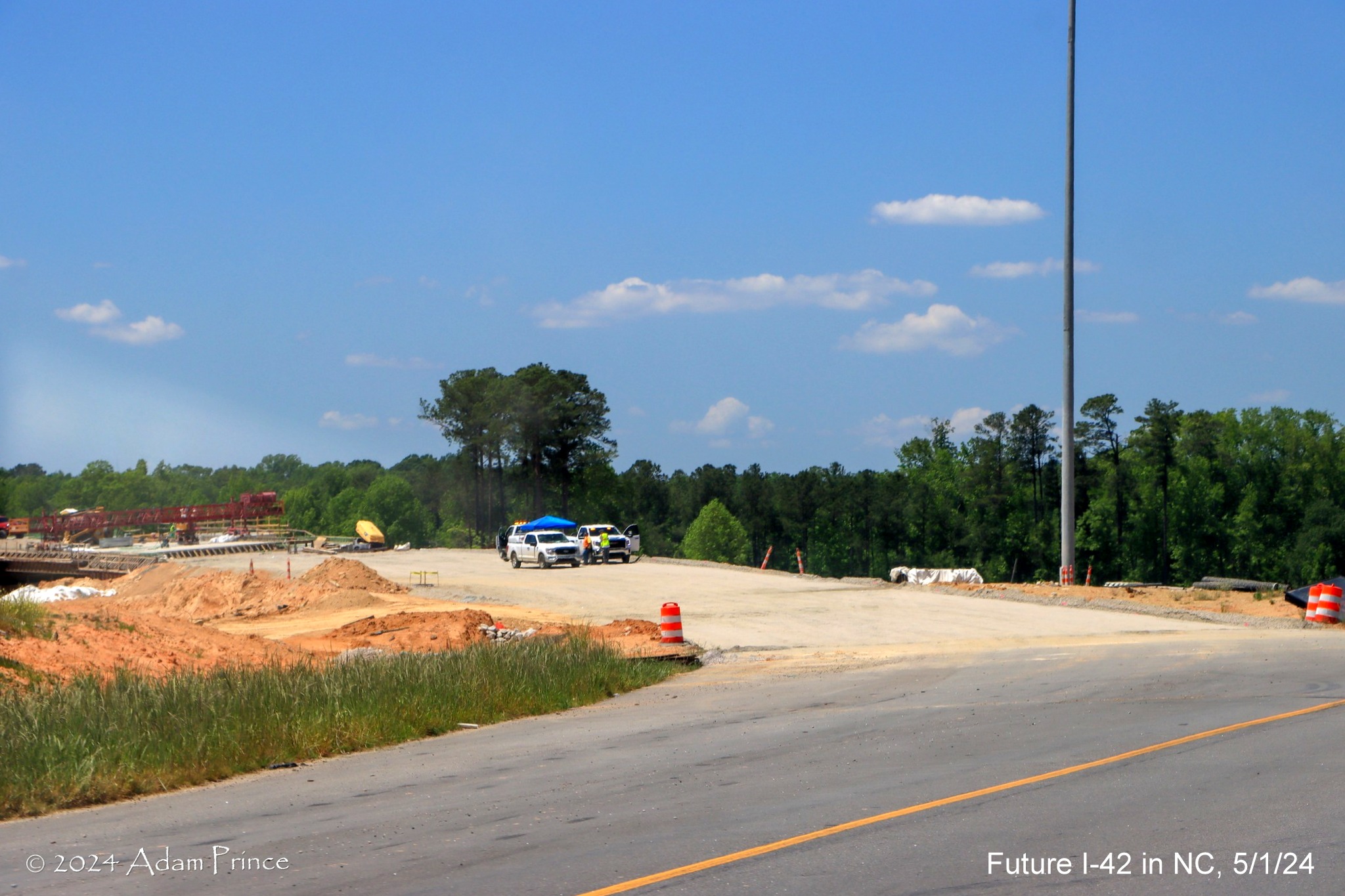
View of the incomplete future ramp to NC 540 West/Triangle
Expressway and I-40 East. The ramp was to open last fall but not much new construction can be seen between image taken last
fall (below) and this one in May.
Google Maps
Street View images taking the new Turbine Interchange ramp from I-40 East to I-42 East, September 2023:

The overhead exit
sign for the US 70 (Future I-42) East exit from I-40 East in Garner.

Ramp heading
under new bridge built as part of NC 540 Triangle Expressway extension project.

The start of the
new US 70 (Future I-42) East exit ramp, the old ramp went to the left.

View from the new ramp heading towards the future ramp to Toll
NC 540 West.

Triangle Expressway style supports for the future overhead
signs for split of the US 70 (Future I-42) East and Toll NC 540 West. The blocked off lane to
the left is the future ramp from I-42 East, still under construction.

The overhead exit
sign for the US 70 (Future I-42) East exit from I-40 East in Garner.

The US 70 (Future I-42) East ramp heading under the bridges for
Toll NC 540 still under construction.

Looking back
along the Future I-42 East ramp towards the NC 540 bridges under construction.

The US 70 (Future I-42) East ramp heading past the future turbine
ramp to I-40 East.

Now approaching the new bridge over I-40.

Crossing the new bridge over I-40.

The ramp now
approaching the new bridge over the ramp that will carry NC 540 Toll traffic to I-40 West.

Heading under the I-40 ramp bridge, traffic from NC 540 will merge
in from the left.

Now approaching
the new ramp from I-40 West to the Clayton Bypass.

The ramp reduced to 2 lanes after the merge with the I-40 West
ramp.
Google Maps Street View images along US 70 West Clayton Bypass
and I-40, September 2023

Recently placed Triangle Expressway overhead sign supports for
signs at the future split of I-40 East and West ramps at the end of I-42 West.

The future I-40
East turbine ramp from I-42 West under construction as seen across from I-40 West.

The turbine ramp
bridge from I-42 West under construction as seen along I-40 West.
Traffic camera
images of new Clayton Bypass signage on I-40, September to October 2023:

It will be simple
to change this new 2 Miles advance sign for the Clayton Bypass by replacing the US 70 shield with one for I-42.

Changes to the overhead signage at the current US 70 West/US 70
Business East exit ramp will be more complicated. Do they simply remove the East US 70 and East Business 70 references or
replace the new signs entirely? (The Answer, at least on I-40 East was both) Do the put up a 'To I-42' overlay on the pull
through sign? That answer was yes.
Google Maps Street View images of new signage along I-40 East
in June to September 2023:

The new overhead
exit sign for US 70 East/Clayton Bypass, to be changed to I-42 within the next year.

The new overhead
1 1/4 Miles advance sign for NC 42 within the NC 540 construction zone,
NCDOT plans to change the number to NC 36 prior to I-42 being signed.
Google Maps Street View images from May 2023 on US 70 (Future
I-42) West:

A Detour East
I-40 trailblazer stands next to the NC 42 exit sign indicating traffic needs to exit there due to closed ramp at the end of
the Bypass.

A covered 1 Mile advance sign for the I-40 East exit ramp, currently
closed due to NC 540/Triangle Expressway construction.

The covered over
1/2 Mile advance sign for I-40 East approaching the west end of the Bypass.

A new ramp is under construction for access to I-40 West to allow
for the building of the NC 540 Triangle Expressway "turbine" interchanges at the western end of the Bypass.

The covered over exit sign for East I-40 at the current ramp to
I-40 West (US 70 to be rerouted on current Business 70) at the end of the Bypass.
Taken along trip along the Clayton Bypass heading east, and
approaching on I-40 East, on October 16, 2022:

The 1 mile
advance sign for the Clayton Bypass (Future I-42 East) exit, this sign would be replaced by an overhead version as part of
the I-40 widening project later in the month:

The new sign does not have any room for an additional I-42 shield,
calling into question whether the planned signing of the Clayton Bypass as an interstate will
happen anytime soon, perhaps by the end of 2023.

The gantry for
the new 1 mile advance sign in the process of being put up.

The existing sign
for the Clayton Bypass (Future I-42 East) exit, this was also replaced by an overhead version later in the month.

Heading up the
ramp to the Clayton Bypass (Future I-42 East). Construction in the distance as part of the extension of NC 540/Triangle
Expressway toll road which has temporarily removed access from US 70 West to I-40 East.

The first Future
I-42 sign at the beginning of the Clayton Bypass, compare this with photo taken below of same sign in 2017:
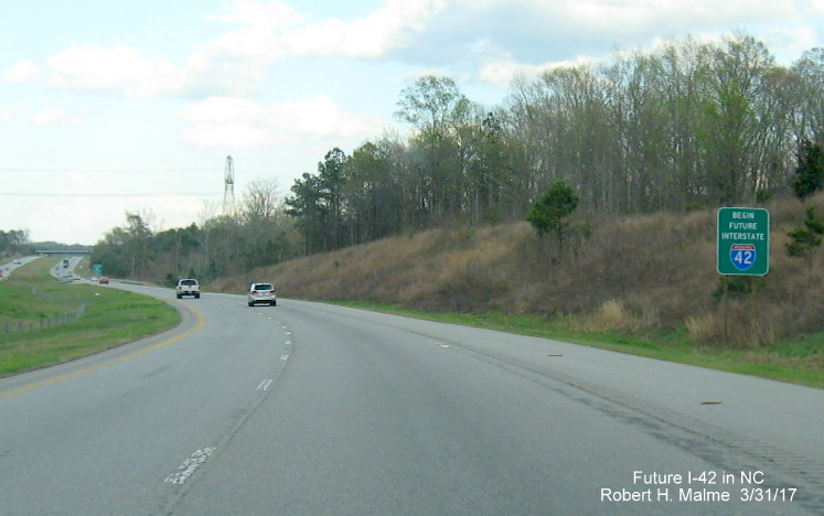
Notice that both
'Begin' and 'Interstate' have been removed, as well as the word 'Interstate' in the shield itself. Done presumably at the FHWA's
request, since only actual interstate routes can have the official shield. Of course, the FHWA has now approved the signing of
the Bypass as I-42 and the official shields are to be put up soon.

The first exit on
Future I-42/US 70 East is for NC 42 in Clayton. What confusion will this cause? Traffic on US 70 West heading for I-40
East must use this exit due to the closure of the ramp at I-40. This may be why the signing of
the Bypass as I-42 has been delayed. Perhaps NCDOT thought directing people to follow NC 42 from I-42 to I-40 would cause
to many problems. A new ramp would open later in the year.

The next exit, 3 miles further east, is for Ranch Road.

The last is for Business 70, another 3 miles further east.
Heading west on the Bypass in March 2017:
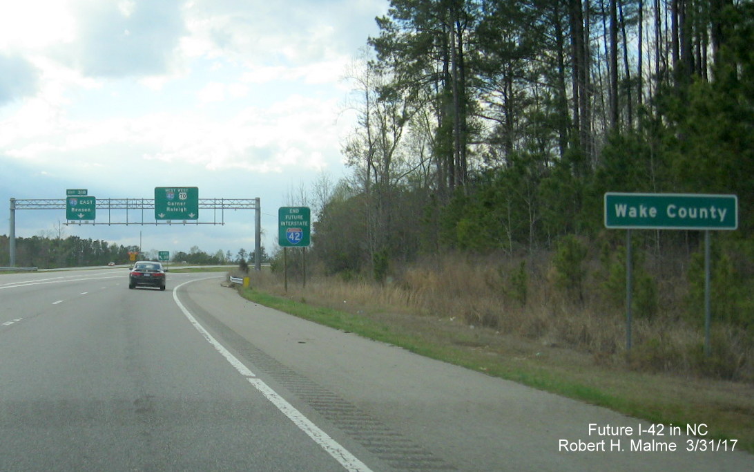
The End Future I-42 sign is after the (Entering) Wake County sign
at the western end of the US 70 Clayton Bypass. This sign was taken down after work started on the NC 540 Triangle Expressway
in 2022.
Segment 2
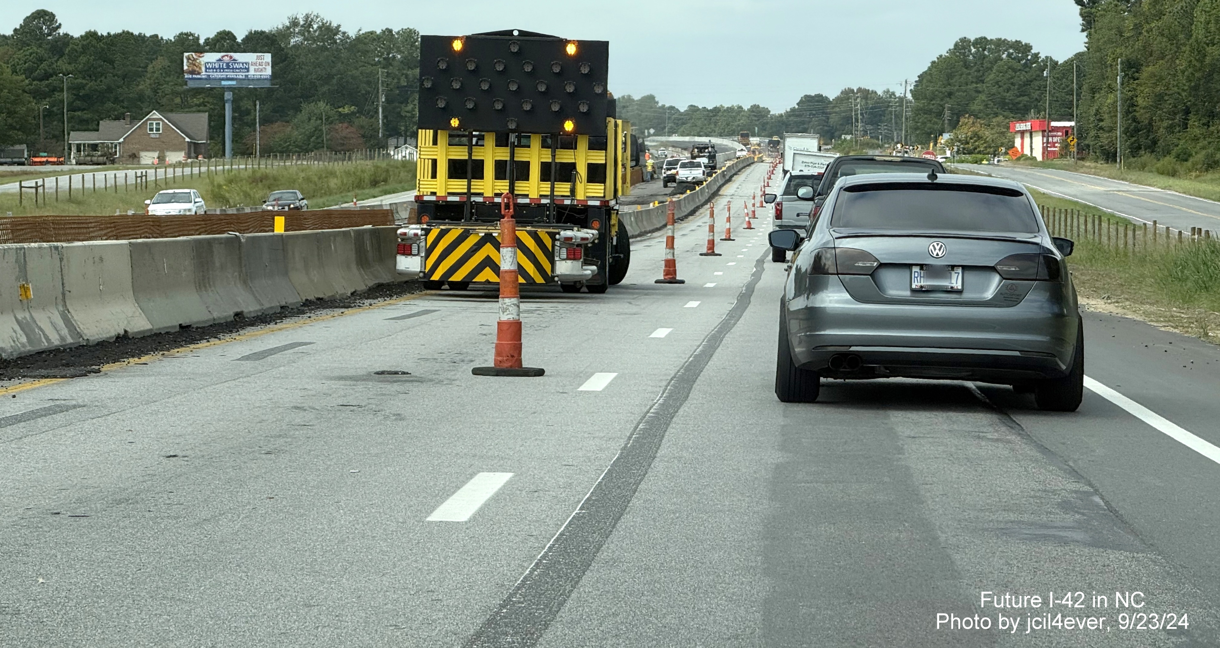
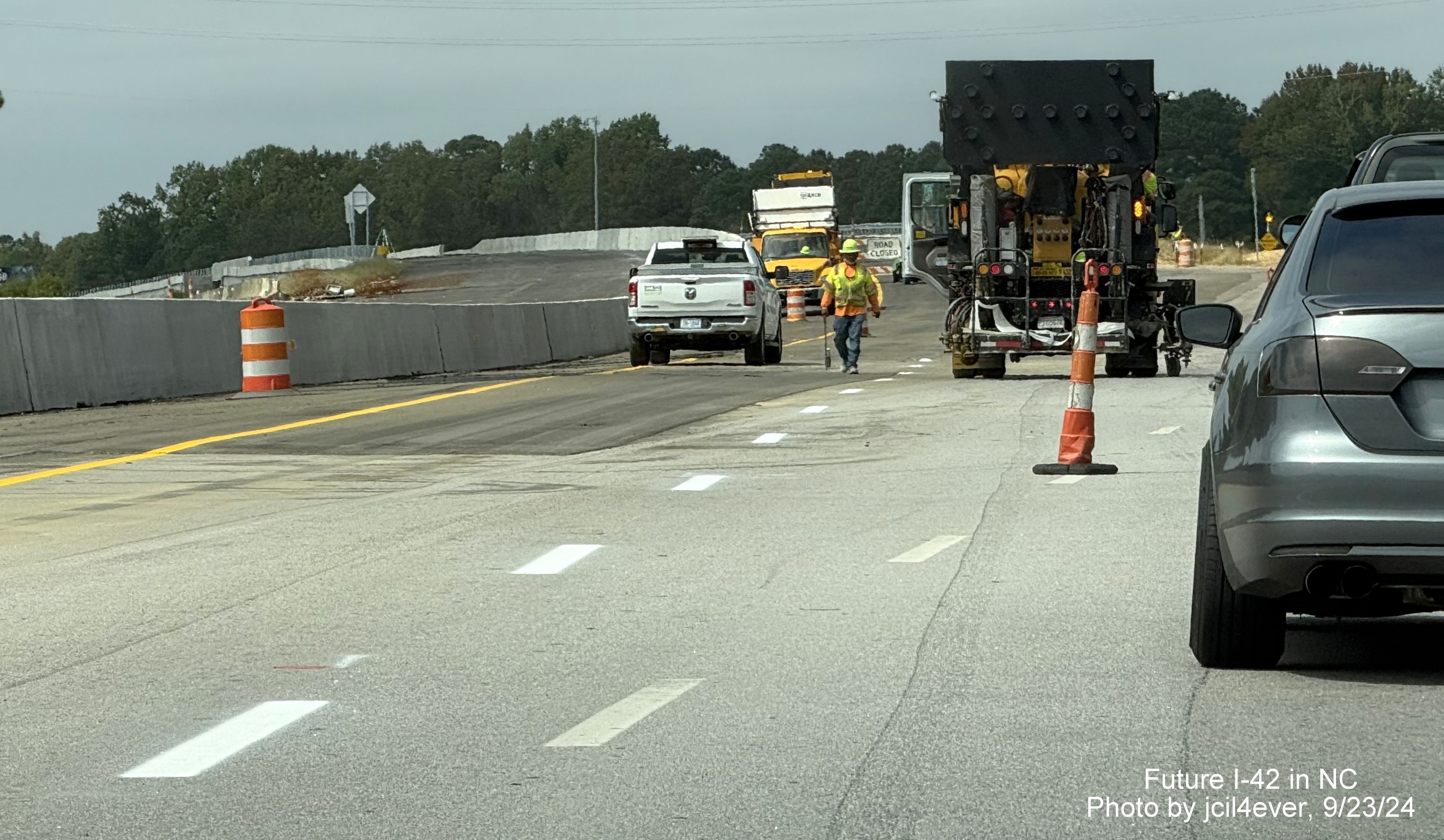
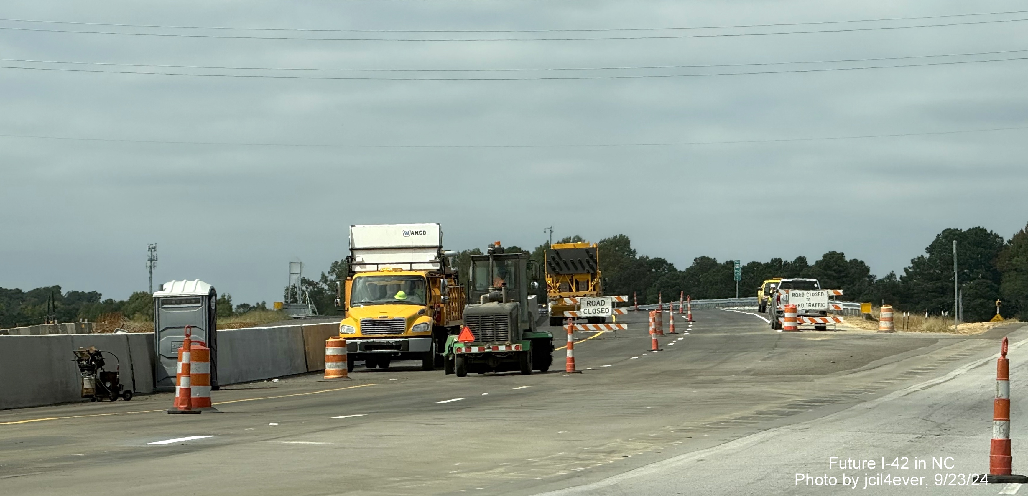
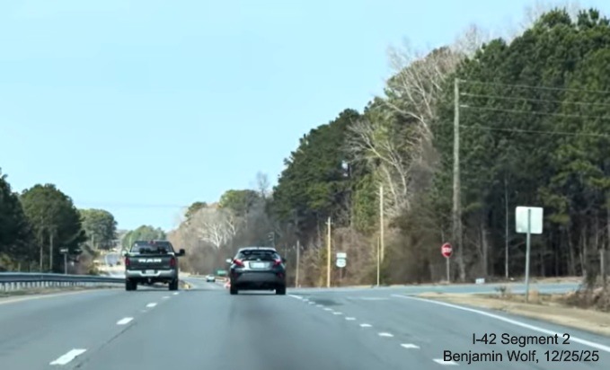
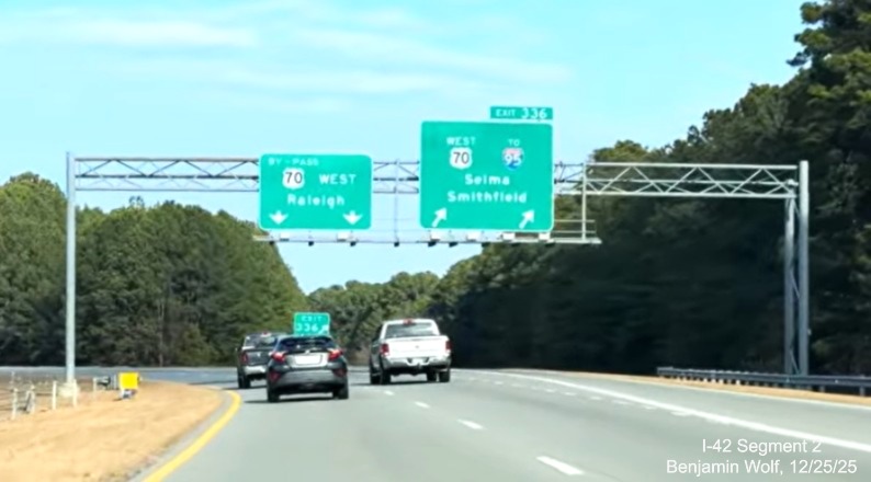
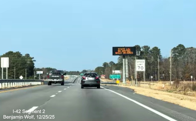
Screen grabs along US 70 West in Johnston County from Benjamin Wolf video, filmed on December 25, 2025:
Approaching the West US 70 to I-95 exit at the start of Bypass
US 70 West, note narrow shoulders.
Overhead signage at split of Bypass and US 70. I-42 will use the
Bypass and have no direct access to I-95, unless a new interchange is built.
The US 70 Bypass roadway heading west. For I-42 to be signed the
shoulders with need to be widened.
The 1 Mile advance for Buffalo Road on Bypass US 70. A rare sign that
includes the SR number of the intersecting roadway.
The Buffalo Road exit sign. If the exit number was based on I-42
mileage, it would be 17.
The last remaining at-grade intersection with West Oak Street on US
70 (or I-42) between I-95 and I-40. Will have to be closed or an interchange constructed to be signed as I-42.
The beginning of the US 70 (Future I-42) freeway after the Neuse
River Bridge. The shoulder though is not widened yet to interstate standards.
The widening of the shoulders and increase of speed to 70 MPH happens
after the 1 Mile advance sign for the Wilson's Mills Road exit. Will NCDOT be allowed to start I-42 here?
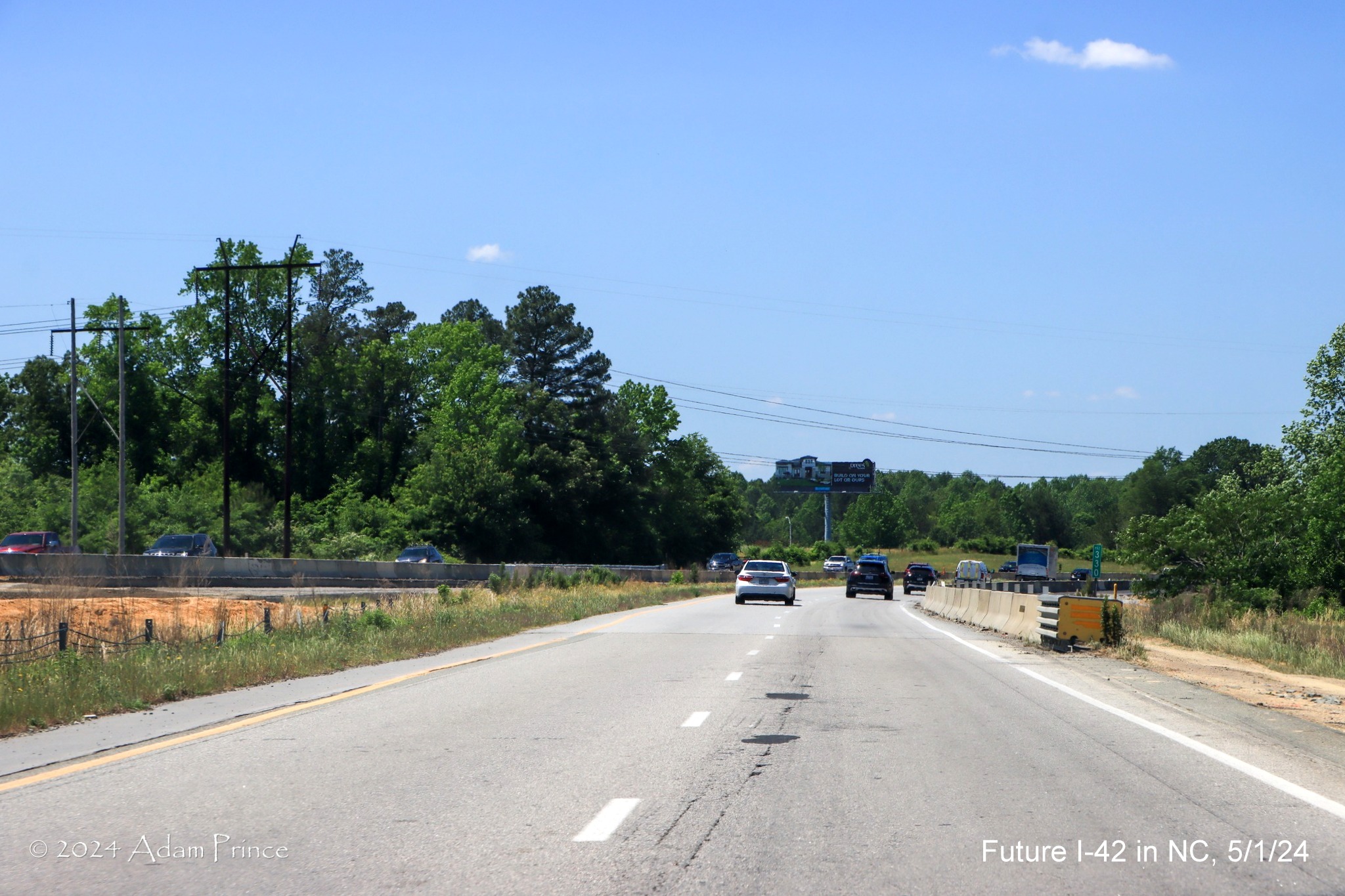
Photos of Johnston County construction along US 70 West by Adam Prince, taken on May 1, 2024:
Overhead signage at split of Bypass and US 70. I-42 will use the
Bypass and have no direct access to I-95, unless a new interchange is built.
Entering the
construction zone on US 70 West after the Neuse River bridge. Work continuing along shoulders approaching intersection with
Wilson's Mills Road.
Two-way frontage
road alongside US 70 West to the right appears completed, but not entirely open.
Closer to
Wilson's Mills Road, the former median turn-around has been closed while shoulder work continues.
VMS indicating left lane closure approaching Wilson's Mills
Road.
US 70 traffic
shifting to future exit ramp to Wilson's Mills Road while Future I-42 bridge construction work continues.
Approaching Wilson's Mills Road intersection along future I-42
ramps.
The nearly completed freeway bridge from the Wilson's Mills Road
intersection.
Not much in new
construction seen after the Wilson's Mills Road intersection heading towards Swift Creek Road.
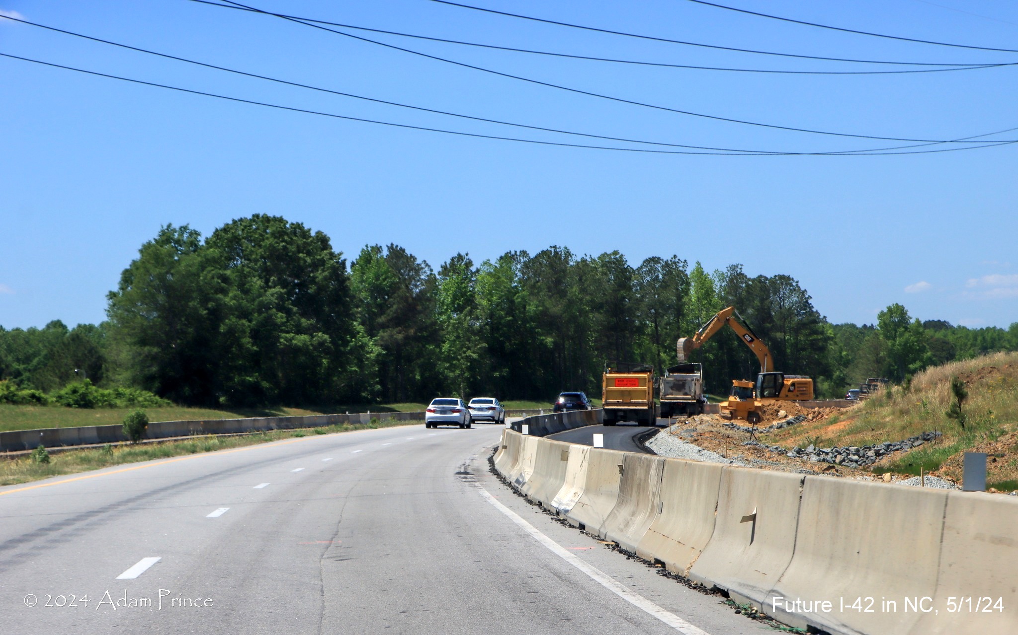
Some new shoulder construction is seen rounding the curve before
Swift Creek Road.
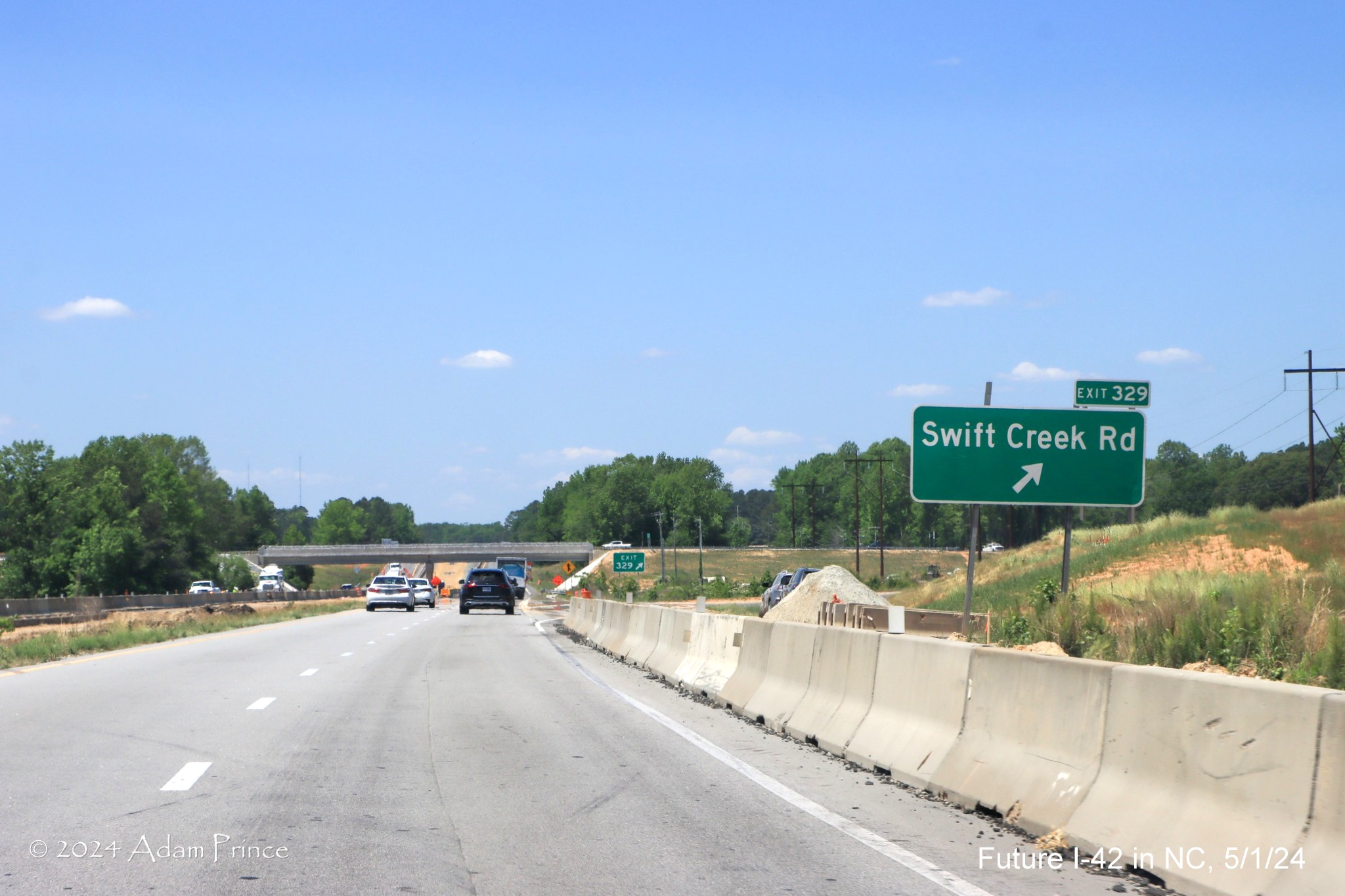
Apparently they have opened the new Swift Creek Road exit heading
west, the sign appears to be temporary being in the future right shoulder of the freeway.
The gore sign for the Swift Creek Road interchange, the eastbound
exit not open yet, with US 70 milepost number, it is unknown how long it may be before it gets an I-42 number.
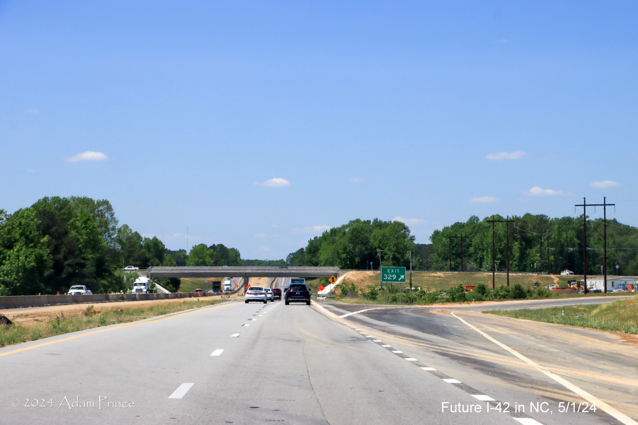
Closeup of the completed Swift Creek Road bridge, work is apparently
still proceeding in the median between here and the Strickland Road intersection.
The VMS sign after Strickland Road indicating the ramp from US 70
West to I-40 East is still closed on the Clayton Bypass. Has this message been up for nearly a year? US 70 in this location
was restricted to 1 lane in each direction.
Work on the future I-42 median continues between Strickland Road
and the start of the Clayton Bypass.
It appears the 2-lane frontage road along US 70 West approaching
the Clayton Bypass is complete.
The cross traffic sign for Sadisco Road still stands, despite the
intersection now being closed right before the start of the Clayton Bypass.
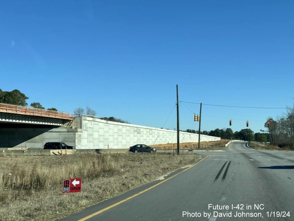
Driving East through Johnston County work zone, photos by David
Johnson, 1/19/24:

View at the start of the US 70 work zone beyond the Business 70
exit at the eastern end of the Clayton Bypass.

Approaching the still open Uzzie Industrial Drive intersection,
completed section of frontage road beyond which is now used for access to the NCDOT maintenance yard.

View of the Swift Creek Road bridge with deck now under
construction in Wilson's Mills.

Approaching the site of the future Wilson Mill's Road exit over
completed I-42 East roadbed.

US 70 traffic using future Wilson's Mills Road exit ramp to get
around I-42 bridge construction.

View of the
future I-42/US 70 roadway and bridge over Wilson's Mills Road to the left in the interchange construction zone.
Closer look along
the future Wilson's Mills Road exit ramp at current intersection with traffic lights.

Median construction underway beyond the current intersection with
Wilson's Mills Road.
Google Maps Street View images driving US 70 West through Johnston
County work zone, September 2023

The start of the work zone westbound is about 1/2 mile west of
the Neuse River bridge where the project is supposed to begin, the left intersection with Turnage Road is now permanently
closed.

The start of the
future frontage road beyond the still open intersection with Bear Farm Road in Wilson's Mills.

The westbound
frontage road continues beyond the next intersection.

A westbound
portable VMS about the NCDOT facility at the next left. This intersection was later closed in October, access now is by
the new frontage road along the eastbound roadway starting from Wilson's Mills Road.

The frontage road
will stop here at the next intersection with Bear Farm Road, allowing remaining businesses access from local roads.

Portable VMS warning drivers of the approaching traffic signal
at Wilson's Mills Road, bridge construction for the interchange on the left.

US 70 East traffic moves to the right around future I-42 lanes
heading for the Wilson's Mills Road bridge.

A closer view of the future I-42 roadway approaching the future
Wilson's Mills Road bridge.

Approaching the
traffic signal at Wilson's Mills Road, bridge construction continues on the left.

A view of Wilson's Mills Road heading through the bridge
construction for future I-42.

Work on the
future I-42 roadbed continues beyond Wilson's Mills Road, the dirt roadbed formally the US 70 East lanes, now on the
other side of the bridge construction.

Now approaching
construction related to the future Swift Creek Road interchange around the corner.

Approaching the future on-ramp to Swift Creek Road on US 70
West.

Grading of the future on-ramp to Swift Creek Road continues.

The bridge support for the future Swift Creek Road bridge is up in
the median.

Looking across the median at the support and bridge construction
for Swift Creek Road on US 70 East.

The roadway looks mostly completed to interstate standards after
Swift Creek Road.

The nearly completed roadway continues towards the Strickland Road
intersection.

US 70 approaches the Strickland Road intersection, little construction
has taken place here, there will be no interchange here.

The near
interstate standard roadway reappears after Strickland Road along with an activated permanent VMS.

A new frontage
road joins the westbound roadway approaching the Uzzle/Uzzle Industrial Road intersection, still open.

A closer look at the still open intersection with frontage road
continuing to the right.

A temporary barrier has been placed to separate the US 70 West
roadway from the frontage road being constructed to the right.

A permanent barrier is also being constructed further west.

The permanent barrier ends but the frontage road continues towards
the Sadisco Road intersection ahead.

Current 1/2 mile
advance sign for US 70 Business East (soon to be plain US 70) near the end of the project work zone.

The median opening exists at the Sadisco Road intersection though
the entrances have been closed in both directions at the western end of the work zone.
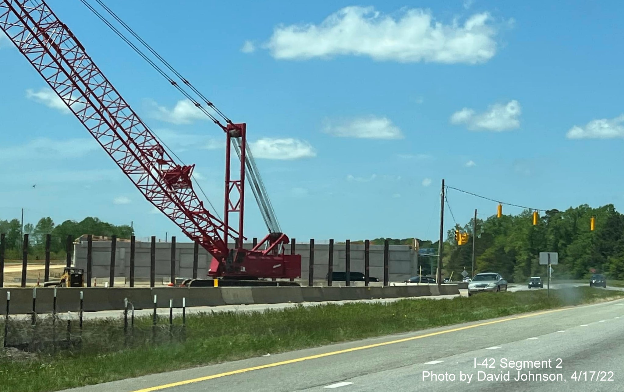
NCDOT Photo of Swift Creek Road bridge construction, October 2023

Looking north at
newly placed girders for the future Swift Creek Road bridge over US 70. Included in press release about the closure of direct
access from US 70 to the NCDOT maintenance yard on October 27. Access will now be from one of the new frontage roads built for
the upgrade of US 70 to I-42.
Construction
Project images from Google Maps Street View taken in April and May 2023:
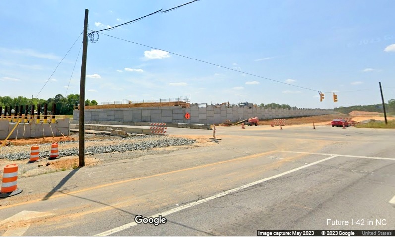
Business US 70 to Strickland Road

Work still under
way to grade and pave widened roadway just east of the Business 70 exit at the end of the Clayton Bypass.

Drainage work still underway along the future east roadway, while
grading continues on the westbound lanes.

Work continues approaching Uzzle Industrial Drive.

View of the East
US 70 intersection with Uzzle Industrial Drive, no sign of grade separation work at present.

The future I-42 East lanes are partially paved with the rest
graded.

The graded section turns into a future temporary roadway for
eastbound traffic to get around bridge construction at Strickland Road.

The current
intersection with Strickland Road, the highway reduces to 1 lane just before the traffic signals.
Strickland Road
to Wilson's Mills Road

US 70 East traffic using the future I-42 East shoulder following
Strickland Road.

Traffic gets
shifted on the Future I-42 East roadway to the right lane approaching Swift Creek Road.

Now looking west
on US 70 after Swift Creek Road showing eastbound work underway on the future interchange.

A pile of dirt is
all that is left for the former US 70 West intersection with Swift Creek
Road, a detour is now set up. Traffic has not been able to use the intersection since March.

The future exit ramp from US 70 (I-42) West to Swift Creek
Road.

Widening work
along US 70 West prior to the future Swift Creek Road exit.

Construction
along US 70 West between Wilson's Mills Road and Swift Creek Road, less work here than both to the east and west.

Construction in
the median for the future I-42 roadway bridge over Wilson's Mills Road.

Contractors busy
adding fill to future I-42 approach to Wilson's Mills road bridge as seen from US 70 West.
View of the Wilson's Mills Road bridge structure from the current
intersection with US 70.
Wilson's Mills Road to Neuse River Bridge

Construction in median east of Wilson's Mills Road for future I-42
roadway.

Construction work
mostly along US 70 West between Wilson's Mills Road and the end of the project at the Neuse River bridge.

Closer look of
construction along US 70 West at the eastern end of the improvement project.

These buildings
along US 70 West at Bear Farm Road appear to be in the way of the future freeway.

Little construction seen heading along US 70 East approaching
the Johnston County Correctional Institution and the Neuse River Bridge.
Earlier Photos
Construction Project Photos. Latest taken heading east on October
16, 2022:

Start of the construction zone on US 70 East after the Business 70
exit.

Concrete barrier separating future I-42 East lanes from current
East US 70 traffic.

Graded future I-42 East lanes continue along US 70 East.

These future lanes are not as far along.

More concrete barrier separating future I-42 East lanes from current
East US 70 traffic.

Site of future
bridge carrying Uzzie Industrial Drive over I-42/US 70.

More concrete barriers along with a variable Speed Limit sign.

Approaching the intersection at Strickland Road.

Site of future
Strickland Road bridge over I-42/US 70 and start of work on temporary detour roadway.

Temporary traffic signals, not yet activated, have been set up
at Strickland Road for US 70 traffic.

The concrete barrier returns after Strickland Road separating less
advanced future I-42 East lanes from current US 70 East traffic.

The barrier continues along US 70 East.

The construction
area along US 70 East widens approaching the future interchange with Swift Creek Road.

Some of the landscaping around the future bridge at Swift Creek
Road already in place.

Approaching the traffic lights at Swift Creek Road.

Some of the
future I-42 lanes, and shoulder and guardrail, are already in place after the Swift Creek Road intersection.

The completed shoulder and guardrail for Future I-42 East
continuing.
Approaching the traffic lights at Swift Creek Road.

The guardrail ends approaching Wilson's Mills Road.

More future I-42 lanes in place approaching the site of the
Wilson's Mills Road interchange.

A variable
Construction Zone Speed Limit sign shows 60 MPH ahead of the Wilson's Mills Road intersection.

Approaching the current traffic light at the Wilson's Mills
Road intersection.

The traffic signals whose days are numbered at the Wilson's
Mills Road intersection.

Freshly paved, perhaps future I-42 East lanes after the Wilson's
Mills Road intersection.

Freshly paved US 70 East lanes are joined by a possible future
frontage road heading toward the east end of the construction zone in Smithfield.

The future frontage road continues along the US 70 East
lanes.

Another concrete
barrier appears between US 70 lanes and the future frontage road.

The concrete barrier picks up again after the Turnage Road
intersection heading further east.

The barrier ends
just before the end of the construction zone in near the Johnston Correctional Institution.

Approaching the
prison entrance at the end of the future I-42 construction zone in Smithfield.
Taken at the Wilson Mills Road intersection by David Johnson
on April 17, 2022:
Bridge being constructed as seen from US 70 West.
Google Maps Street View images taken in September and
October 2021:
Heading west
toward Wilson Mills Road on US 70, clearing for future interchange underway.
The section between Wilson's Mills Road and Swift Creek Road
has been repaved, shoulder are not interstate standard yet, but clearing to the right of
the shoulder would allow for quick further widening in the future.
The current intersection between US 70 West and Swift Creek
Road, little construction was seen at the other future interchange site.
Sign Photos - Taken October 16, 2022:

The first advance
sign for the Buffalo Road exit on US 70 East after the Neuse River bridge.

The next sign is an advance for the US 70 exit at the beginning
of the US 70 Bypass around Smithfield prior to the Buffalo Road exit.

The Buffalo Road exit sign at the beginning of the Bypass
Freeway (Future I-42).

The US 70 East exit overhead at the beginning of the US 70
Bypass (Future I-42) around Smithfield, currently, Future I-42 traffic would have to leave the freeway to access I-95,
but this may change.

Signage I-42 traffic would currently have to follow to get
to I-95 on US 70 East.
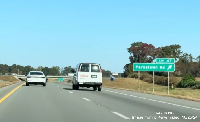
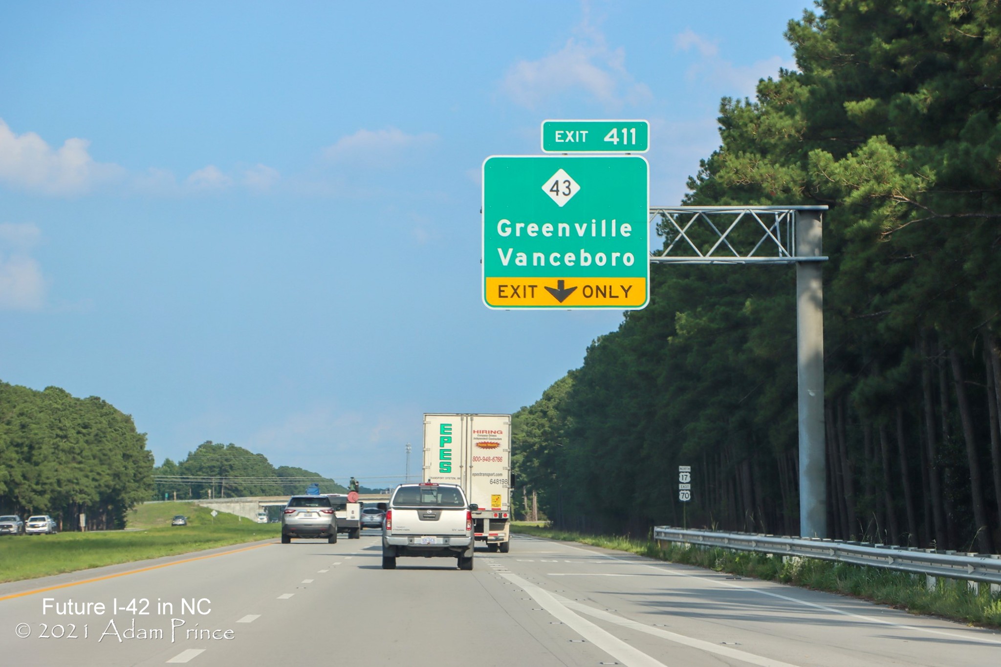
Segment 3>(Last Updated
5/25/25)
Screen grabs by Mileage Mike video of US 70 through Clayton, taken May 21, 2025:
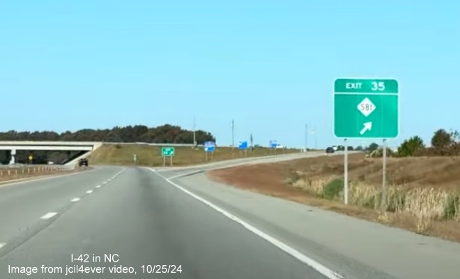
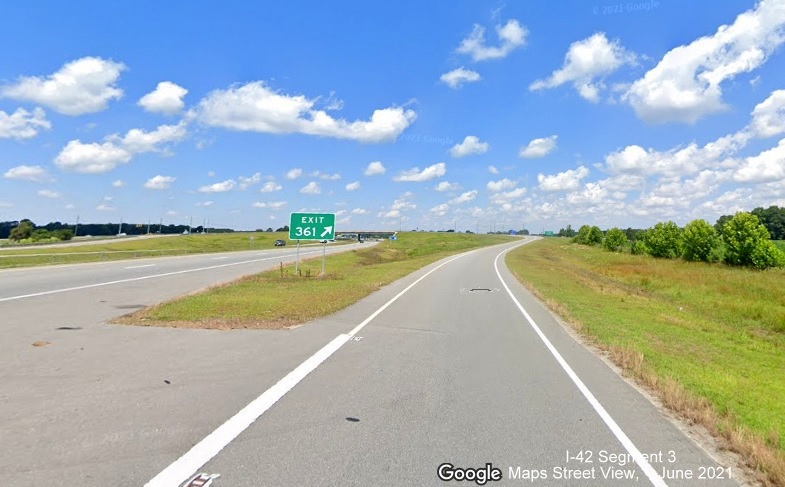
The 1/2 Mile advance sign for I-42 West at the southern end of the Goldsboro Bypass.

The overhead signs at the I-42 West ramp, US 70 West continuing straight.
Signage along the Bypass started going up the week of September
16 and was mostly completed a month later. Here are screen grabs from a video shot by
jcil4ever on October 25 showing the renumbered exits and new I-42 shields:
The first sign to have an I-42 shield, now with West I-42
reassurance marker behind it, but unchanged exit number for US 70 West exit.
The first sign to
have an I-42 shield, now with West I-42 reassurance marker behind it, but unchanged exit number for US 70 West exit.
The exit sign for
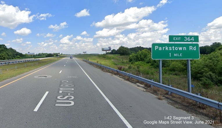
Parkstown Road with new exit number, though based on the new I-42 mile markers this is actually at mile 48.
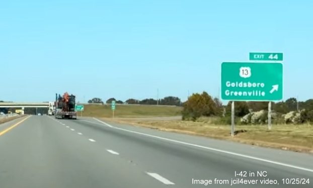
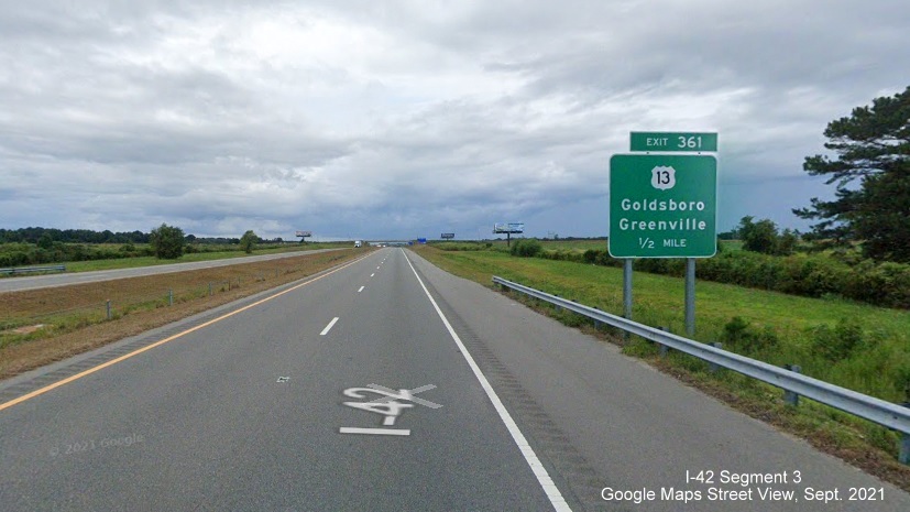
The renumbered exit sign for US 13 with I-42 mileage, though this
is also 1 off from the mile marker which indicated its Mile 45.
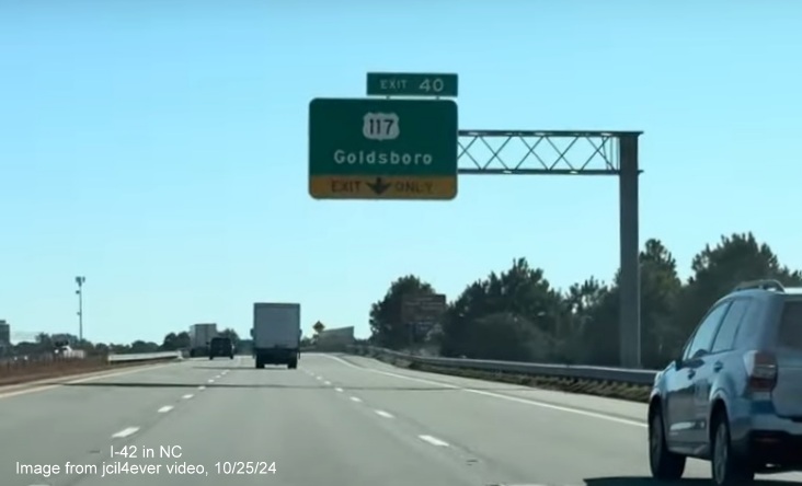
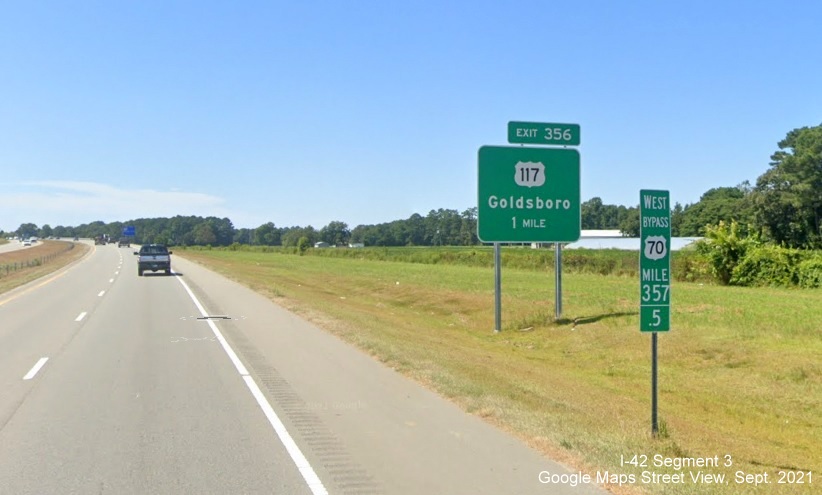
The renumbered
signs at the exit for US 117, these, and the rest westbound, match the new mile markers.
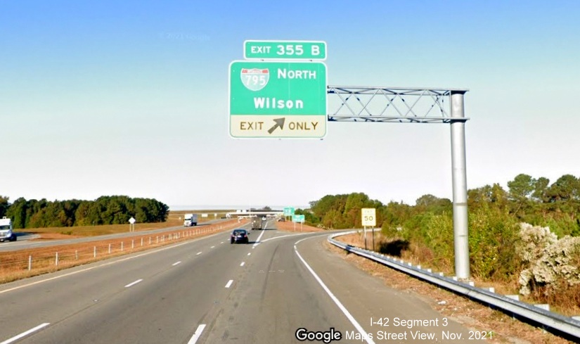
The renumbered
exit sign for I-795 North, and gore sign in distance, both beyond the Mile 39.5 marker.
The renumbered
exit sign for NC 581, the last exit on the Bypass in this direction. Turning around and heading east....
The exit sign for
US 70 East at the start of I-42 East, apparently the exit number won't be changed here for now.
The renumbered
exit sign for South I-795 headed east, no overhead sign in this direction.
The renumbered sign for US 117, not sharing a gantry in this
direction.
The final renumbered exit sign headed east for US 70 West.
The End East I-42 sign just before merging with the ramp carrying
US 70 East.
The back of the first East I-42 reassurance marker appears in this
traffic camera image taken September 26:
The
trailblazer at the NC 581 exit had been updated by the beginning of October:
NCDOT traffic camera image along NC 581 looking east.
Here
are some photos taken by AARoads Forum member jcil4ever in the days since:
One of the two I-42 Mile 42 markers, this one heading west on
the Goldboro Bypass.
This West I-42
reassurance marker appeared late in September next to the already standing To I-795 sign.
Newly renumbered gore sign with I-42 mileage for I-795 North exit,
on I-42 West, notice tab on I-795 South exit sign has not been changed.
Newly renumbered 1/2 mile advance sign with I-42 mileage for NC
581 exit.
Overlay with new
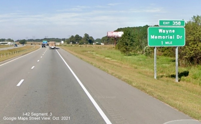
I-42 mileage number for gore sign for Wayne Memorial Drive exit, numbered 42.
This sign was put
up before any other I-42 signs were placed on the Bypass.
Here are some
Google Maps Street View images traveling west along the US 70 Bypass taken in the summer and fall of 2021:
A Future I-42
sign near the start of the Bypass heading west. This sign still remains after the I-42 signage was put up.
The 1 Mile
advance sign for the Parktown Road exit, will the exit numbers be changed when I-42 is signed?
The 1/2 Mile
advance sign for the US 13 exit, notice Street View already has this part of the Bypass listed as I-42.
The gore sign for the US 13 exit off of the Bypass.
The 1 Mile advance sign for the Wayne Memorial Drive exit.

A combination green auxiliary and blue Hospital Services sign for
the Wayne Memorial Drive exit, still on "I-42."
The 1 Mile advance sign for the US 117 exit, behind a Mile 357.5
marker that will be changed when it becomes I-42.
A post-interchange distance sign prior to the US 117 exit, showing
the near 20 mile distance US 70 will have to be upgraded between the end of the Goldsboro Bypass and I-95.

The overhead sign for the US 117 exit shares its cantilever support
with the 1 mile advance for I-795.
The overhead exit sign for the I-795 North exit, the first ramp of
the soon meeting between 2 interstates.
The ground mounted exit sign for the I-795 South exit, eventually
that interstate to end at I-40.

The 1 Mile advance sign for the NC 581 exit.
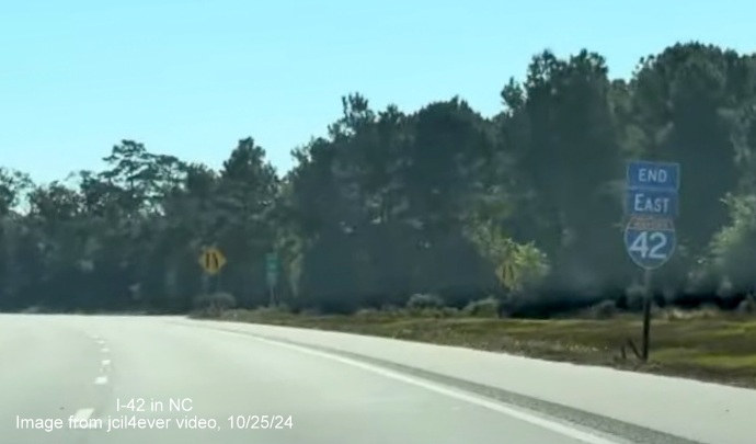
The future temporary end of I-42 West at the merge with US 70 West
at the end of the Goldsboro Bypass. Heading east...
The 1/2 Mile advance sign for the US 70 East exit at the start
of the Future I-42 Goldsboro Bypass.
Segment 5
Images taken in December 2022 by Google Maps Street View cameras
(Posted 3/19/23):

The Future I-42
sign at the start of the now interstate standard freeway west of New Bern.

Typical view
heading west along US 70 on interstate standard freeway toward Kinston.
(Taken by Adam Prince in July 2021)
One of the
several Future I-42 signs placed along US 70 at county lines, here
crossing into Craven County, to the right of the now interstate standard right shoulder headed east.
View of
Interstate standard shoulders now completed along US 70 in Craven County.
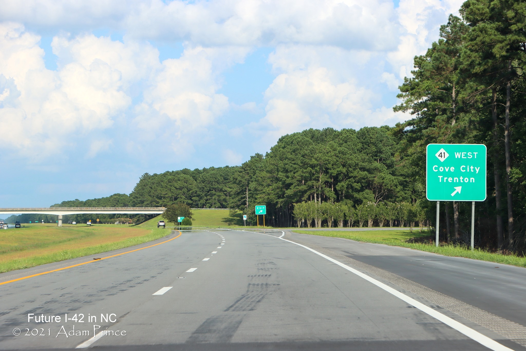
Exit sign for NC
41 near Cove City, next to now interstate standard right shoulder, currently no exit number.
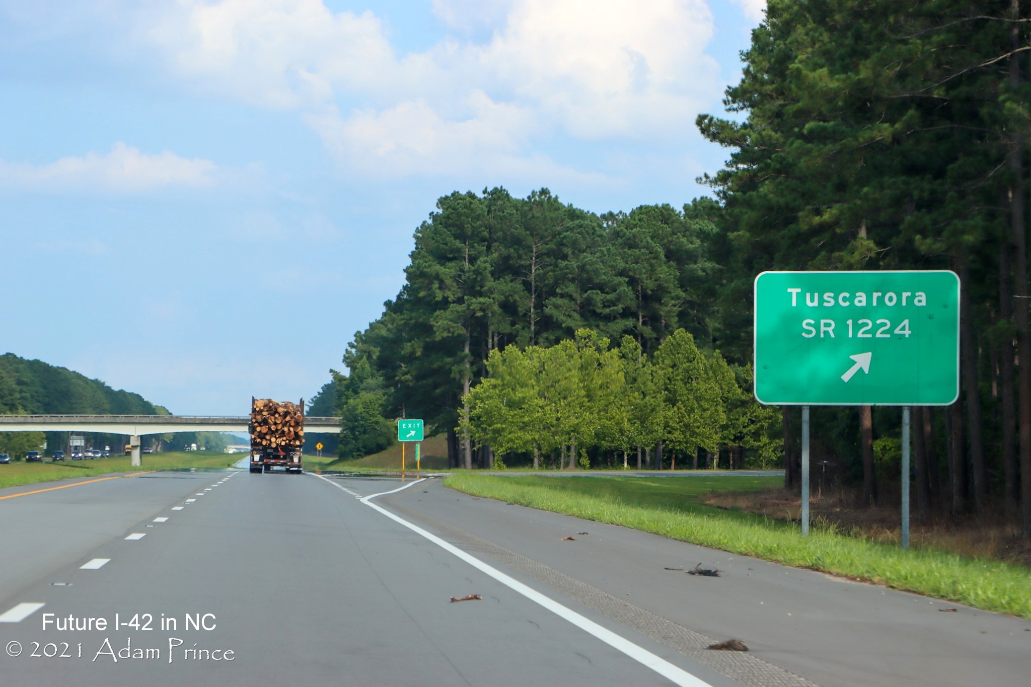
The sign for the
next exit for SR 1224, besides the interstate standard right shoulder.
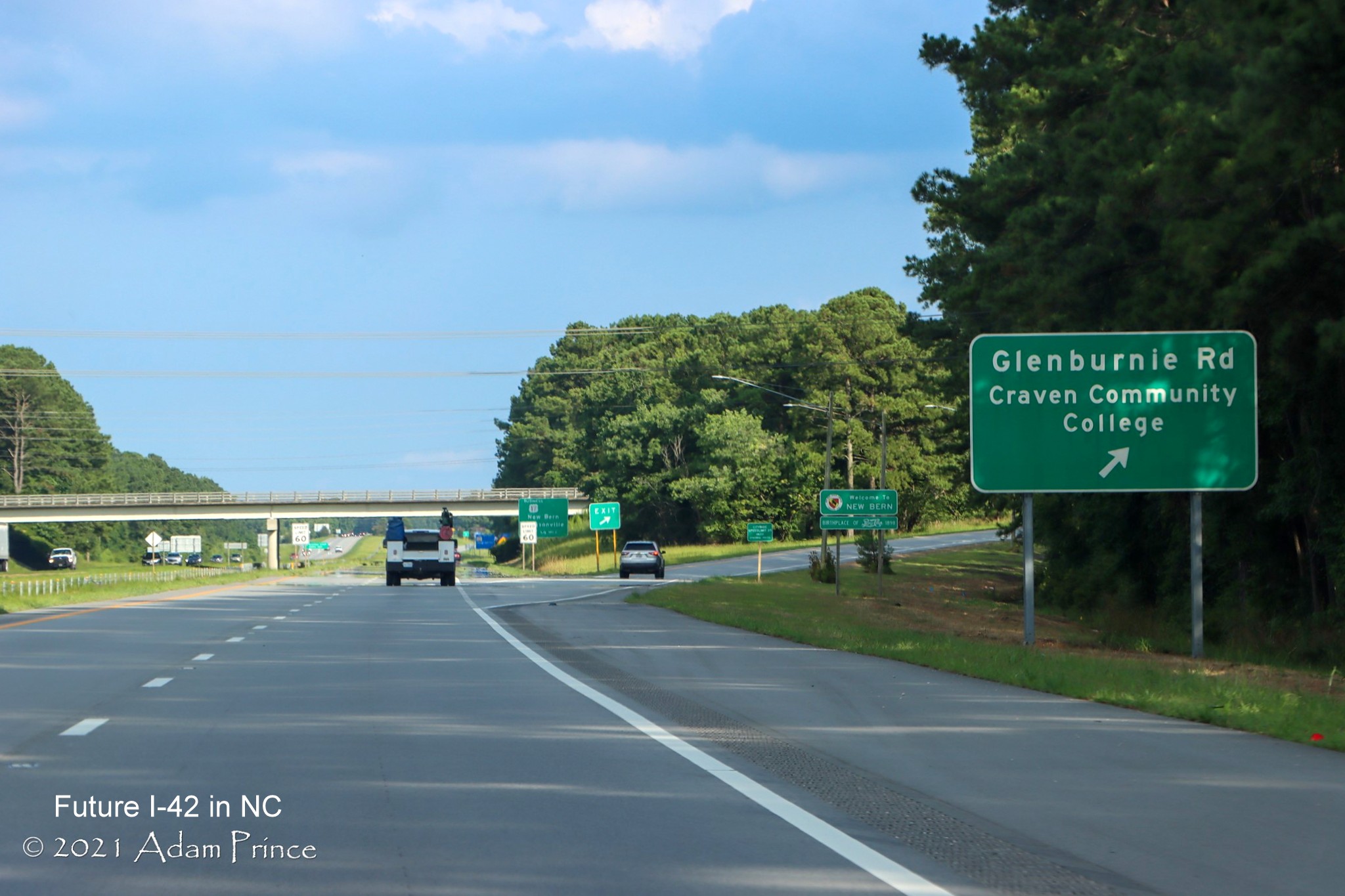
The sign for
Craven Community College exit, also still without exit number.
The 3/4 mile
advance for what will be the last exit sign without a number, Business 70, the blank space for US 17 South.
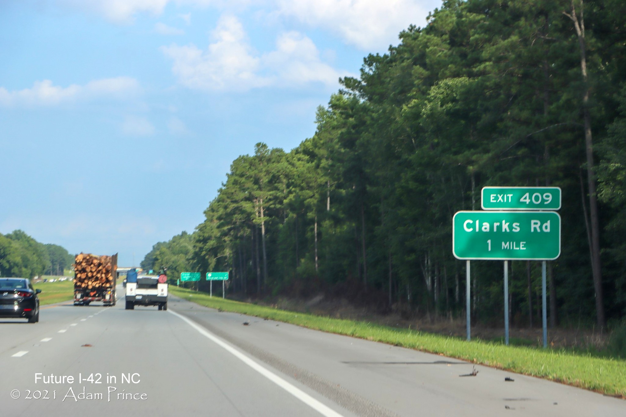
The exit sign for the Clarks Road exit, with exit number, next
to the widened right shoulder of Future I-42 East.
The overhead exit sign for the NC 43 exit on US 17 North/US
70 East approaching New Bern.
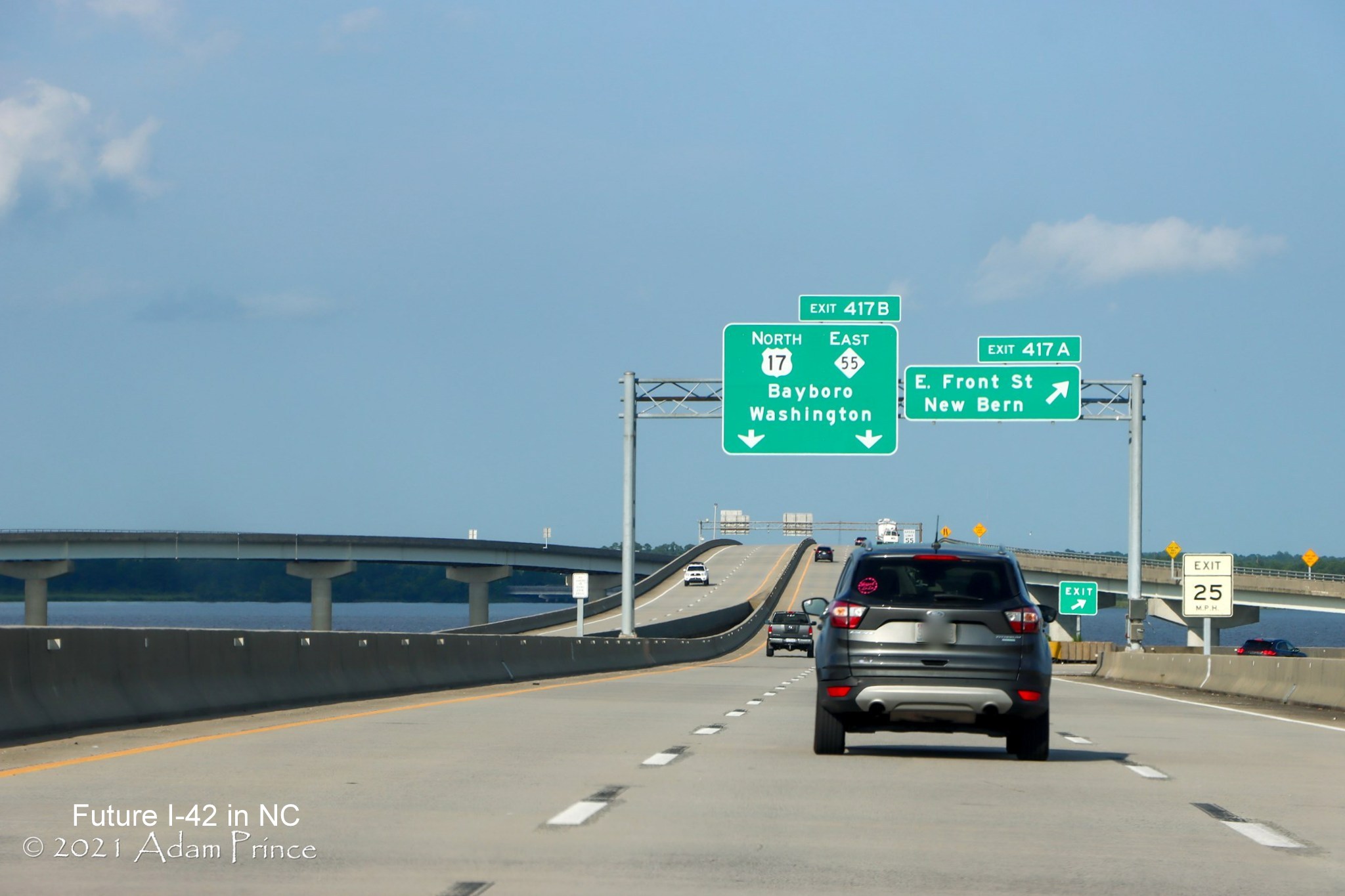
Overhead signage
for the East Front Street exit on US 17 North/US 70 East over the water in New Bern.
Exit signage for
US 17, on its way north to eventually becoming part of Future I-87 and NC 55 East, all the exit numbers in
the New Bern area originally overlapped those listed for the Havelock Bypass plans (see sign plans
below), this was corrected when the highway opened in 2025.
Segment 6 (New 12/28/25)
Images from Benjamin Wolf video along US 70 West taken
on December 20, 2025 showing construction between the Havelock Bypass and James City:
A distance sign marker the start of the work zone north to
Thurman Road in James City, much progress seen now at this end of the project.
Approaching the future site of the Stately Pine Road exit
with most of the trees cleared from the area.
Near the future site of the Fisher Avenue exit
with trees cleared from the westbound side.
More clearing approaching Camp Kiro Road where the next exit
will be built.
Approaching the future site of the Camp Kiro Road exit
not much construction seen to the west of here until approaching Thurman Road.
Approaching Thurman Road and the start of the James City
work zone.
Frontage Road work continues just after Thurman Road, no bridge
construction seen here yet.
New pavement along both sides of US 70 approaching Taberna
Way.
US 70 West traffic being shifted to the right approaching Taberna
Way.
The future ramp to Taberna Way seen on the right approaching
the current intersection.

US 70 traffic continues along future frontage road after the
Taberna Way interchange.
US 70 West at temporary turn around ramp for traffic wanting to
head east from Taberna Way.
Approaching temporary traffic signals on US 70 West for traffic
wanting to turn around from Grantham Road.
Approaching the bridge for the future US 70 (I-42) interchange
with Grantham Road.
Between the Grantham Road bridge abutments on US 70 West at site
of future interchange.

Now looking back from US 70 West at filling for future roadway
over Grantham Road.
Another temporary turnaround on US 70 West for traffic from
Grantham Road wanting to go east.
Approaching the Airport Road intersection on US 70 West, no bridge
construction yet at site of future interchange.
Paving has begun for the future Airport Road interchange on
the right.
Driving through the Airport Road intersection.
Now approaching the future site of the last new exit at Williams
Road on US 70 West, little progress seen here.
Noise wall construction on US 70 East can be seen after the
overhead sign for the US 17/NC 55 exit.
Looking back at the noise wall construction along US 70 East
prior to the US 17/NC 55 exit.
EARLIER PHOTOS
Images from Google Maps Street View taken during November 2025
showing James City construction along US 70:
A noise wall is being constructed at the northern end of
the James City construction zone, little progress otherwise at this end of the project.
Noise wall construction continues heading east approaching
the pedestrian bridge over US 70.
View from the Williams Road intersection along US 70 East.
Barriers are completed along future frontage road heading
east toward the Airport Road intersection.
Traffic being shifted to the right before the Airport Road
intersection.
Traffic still shifting approaching the Grantham Road bridge
construction area.
Bridge work continues on the left for the future Grantham
Road exit.
Fill is being placed along future US 70/I-42 roadway near
the future Grantham Road exit.
Traffic using the future off-ramp for Grantham Road with bridge
construction on the left.
Looking at the future Grantham Road that will pass under the
US 70 (Future I-42) bridge above.
Beyond Grantham Road are temporary trailblazers to direct West
US 70 to a turn around.
Traffic being redirected again ahead approaching the future
Taberna Way interchange, work started on building the bridge there later in November.
Barrier construction continues along US 70 East between Taberna
Way and Thurman Road at the end of the work zone.
Image of the now widened US 70 East roadway approaching Thurman
Road.
Image of frontage road being constructed for mall access prior
to Thurman Road.
Now heading westbound, another look at lack of progress in
creating the Future I-42 roadway at the northern end of the work zone in the vicinity of Williams Road.
Earlier Photos
Images from Google Maps Street View taken during March 2024
showing James City construction along US 70 East:

US 70 traffic sits behind traffic light at western end of
James City construction zone, showing little progress at this end of the project.

Pile of dirt has sat long enough to have grass growing in it
at the US 70 intersection with Williams Road.

Some progress seen along the opposite side of the road at the next traffic
light.

Some work seen on
the right along the future frontage road approaching the intersection with Airport Road.

More noticeable
frontage road construction seen after the Airport Road intersection and the future interchange.

Construction showing more progress approaching future interchange
with Grantham Road.

Frontage road work continues along US 70 East approaching Grantham
Road.

Site of the future Grantham Road exit ramp, roundabouts for
interchange traffic being constructed further to the right.

Frontage road work continues along US 70 East (Future I-42) after
Grantham Road.

Work along both
sides of US 70 near the eastern end of the project work zone.

More frontage road construction along US 70 East near Taberna Way.

Work along both sides of US 70 approaching Thurman Road.

The US 70 intersection with Thurman Road which is be the last
interchange built for the James City project.

While the roadbed has been rebuilt, construction has only recently
started on the future frontage road along US 70 East after Thurman Road.

The current end
for the frontage road along US 70 East near the eastern end of the
project work zone.

The end of the
James City project work zone on US 70 East, despite work starting on the design-build contract between here and the
Havelock Bypass, no construction was evident in the March Street View images.
Older Photos
Images from Google Maps Street View taken during August 2023
showing James City construction along US 70:

Paving of both US
70 East (right) and West (left) lanes has occurred along with shoulder
widening and the building of an adjacent frontage road.

Paving of the shoulders has not commenced further east where
construction of an adjacent frontage road continues at a still open intersection midway through the
construction zone. August 2023 Street View images at the north end of the project show no progress with upgrading an
existing railroad crossing and several signalized intersections.
Earlier Images
from Google Maps Street View taken during December 2022 showing James City construction:

Widening of the
shoulders along US 70 West as part of project converting highway to Interstate standard freeway.

One of several service roads being built to serve local
businesses currently along US 70 West.

Another service road under construction US 70 West further
east.

One of several areas cleared along US 70 West for drainage
work.

Piles of pipes and other construction equipment at the end of the
current work zone at Thurman Road.
Segment 7 (New 12/22/25)
Images from Benjamin Wolf videos driving the Havelock Bypass and
ramps on December 19-20, 2025
The 1/2 mile advance for the Business 70 exit heading east at the
western end of the new Bypass.
The overhead signage at the Business 70 exit ramp with space on
the right on the pull through (should be on the left) for an I-42 shield.
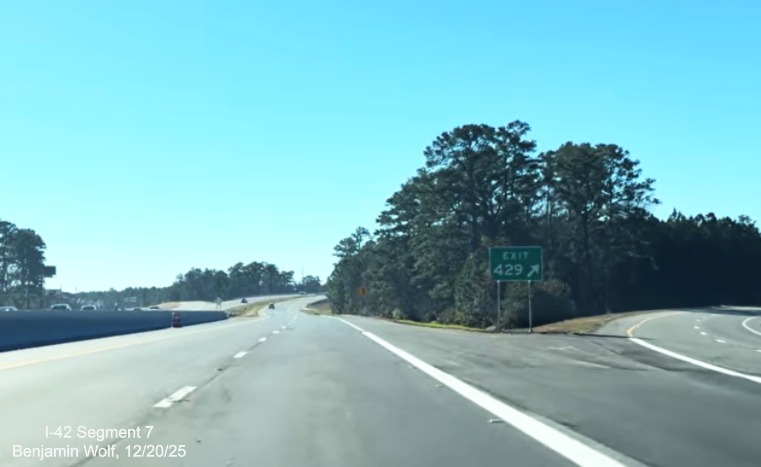
The gore sign for the East Business 70 exit at the start of the
Bypass.
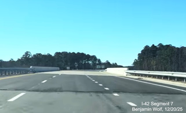
Crossing the bridge over US 70 East Business.
The first East US 70 reassurance marker after the bridge.
The first Future I-42 sign, with a wide shield.
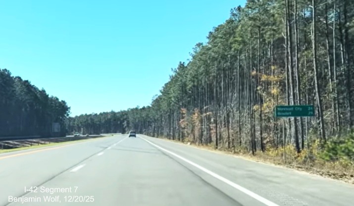
A distance sign for Morehead City and Beaufort.
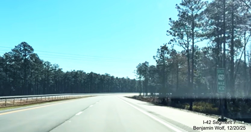
One of the East US 70 mile markers along the Bypass.
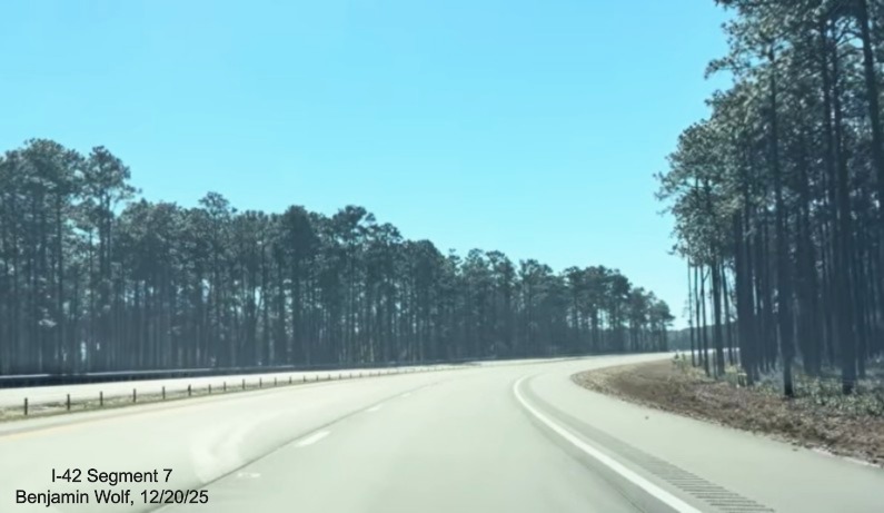
Typical scenery along the Bypass, pine trees on both sides of the
road.
The 1 Mile advance sign for the Lake Road exit.
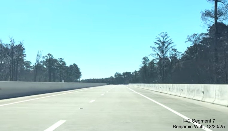
Driving over one of the longer bridges over a swampy are prior to
the Lake Road exit.
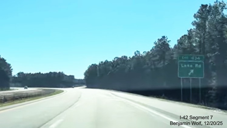
The Lake Road exit sign heading east.
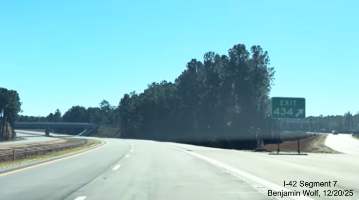
The gore sign for the Lake Road exit.
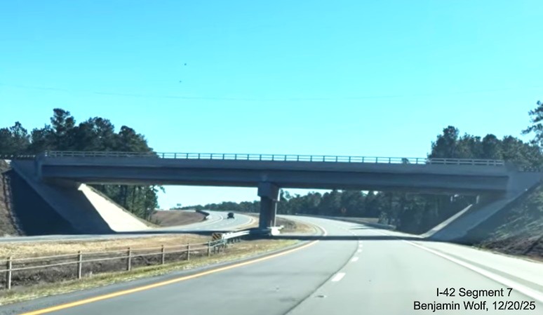
Driving under the Lake Road bridge.
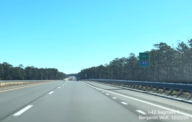
The Future I-42 sign after the Lake Road exit.
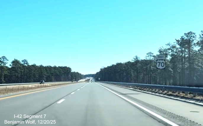
The next East US 70 reassurance marker.
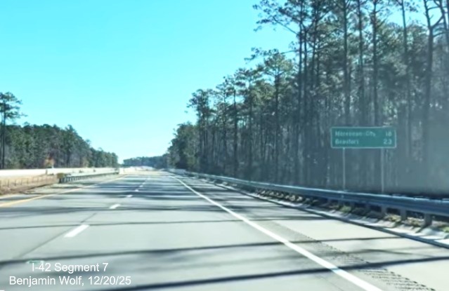
Another distance sign for Morehead City and Beaufort, now 6 miles
closer.
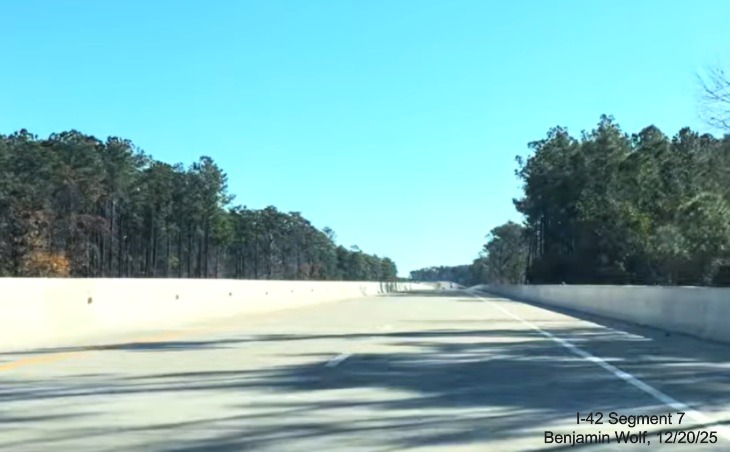
Driving over a longer bridge structure after the Lake Road exit.
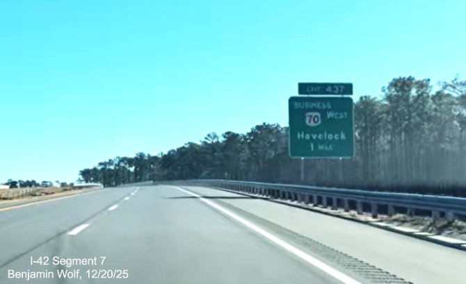
The 1 Mile advance sign for the Business 70 West exit at the
end of the Bypass.
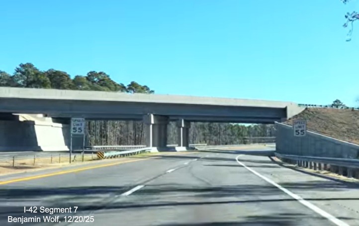
The speed drops to 55 MPH prior to passing under the Business 70
East bridge.
The overhead signs at the Business 70 West exit at the
end of the Bypass. A space is left for I-42 to continue in the future to Morehead City.
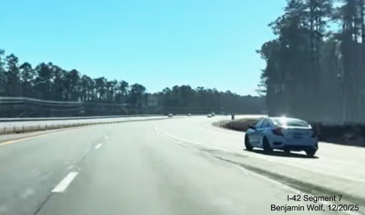
Traffic merging with Business 70 East at the end of the Bypass.
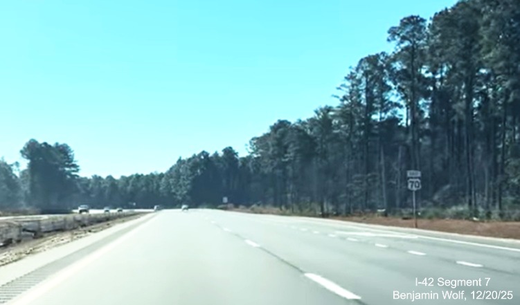
The interstate standard roadway ends just beyond the East US 70
reassurance marker.
Images from the Bypass heading west...(Added 12/23/25)
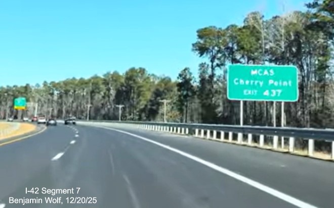
An auxiliary sign for MCAS Cherry Point prior to the start of
the West US 70 Bypass.
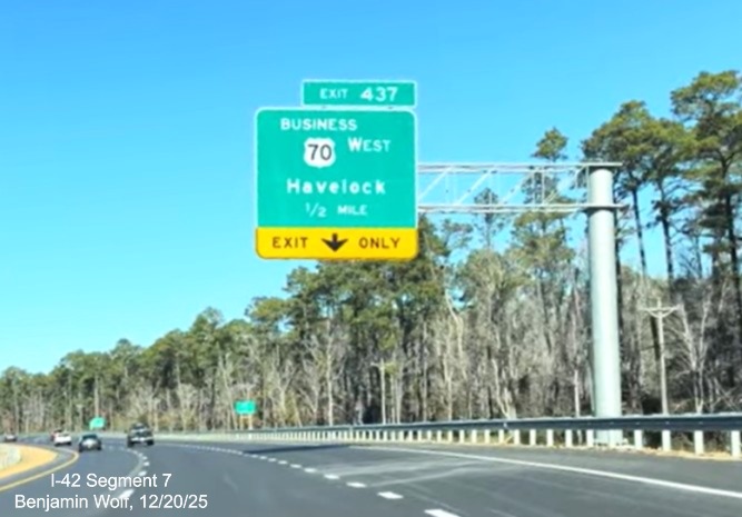
The 1/2 Mile advance for the Business 70 West exit.
The overhead signs at the Business 70 west exit. Another
blank space for a future I-42 shield.
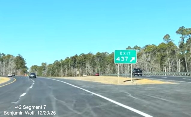
The gore sign at the Business 70 west exit. Despite the NCDOT
press release about the 10.5 mile bypass, there is only 8 miles until the end at Exit 429.
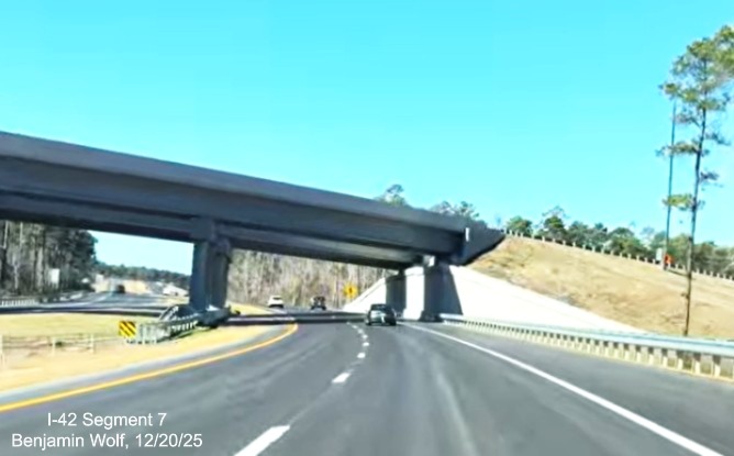
Passing under the bridge carrying East Business 70 at the start of
the Bypass.
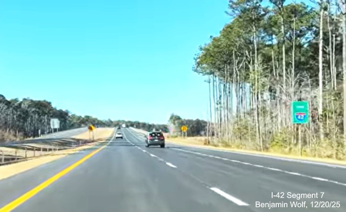
The first Future I-42 sign in this direction precedes the West
US reassurance marker.
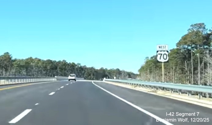
The first West US 70 reassurance marker.
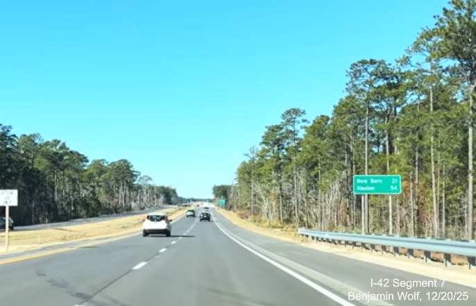
The distance sign in this direction has miles to New Bern and
Kinston.
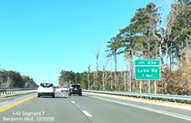
The 1 Mile advance for the Lake Road exit heading west.
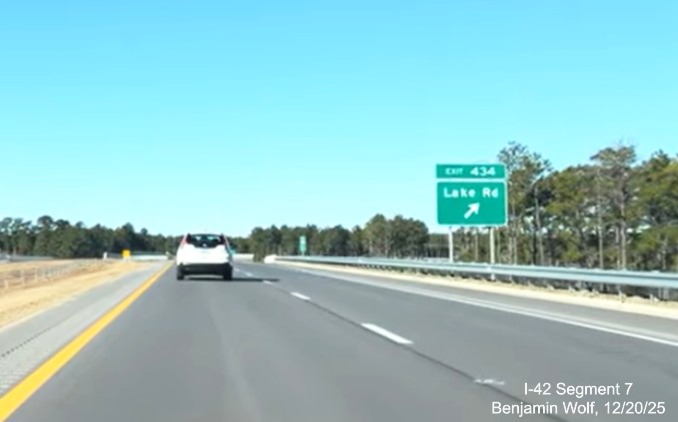
The exit sign for Lake Road.
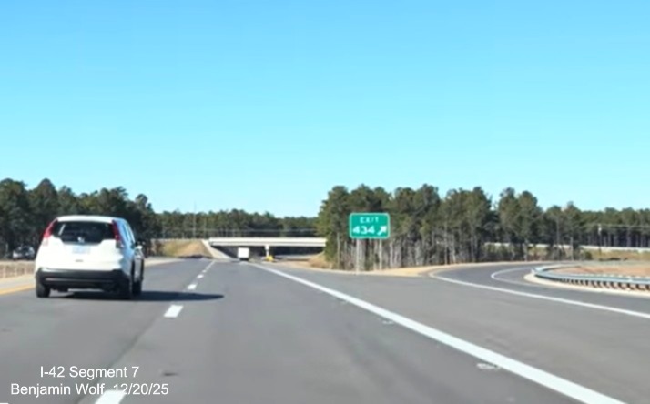
The gore sign for the Lake Road exit, almost halfway between
the two US 70 exits.
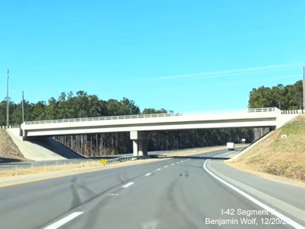
About to pass under the Lake Road bridge again.
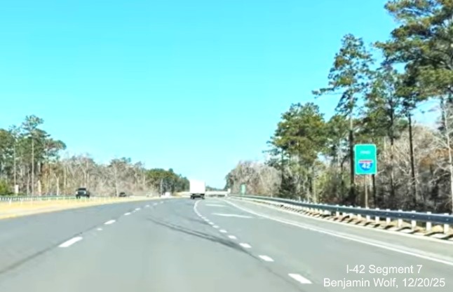
The second, and last, Future I-42 sign in this direction.
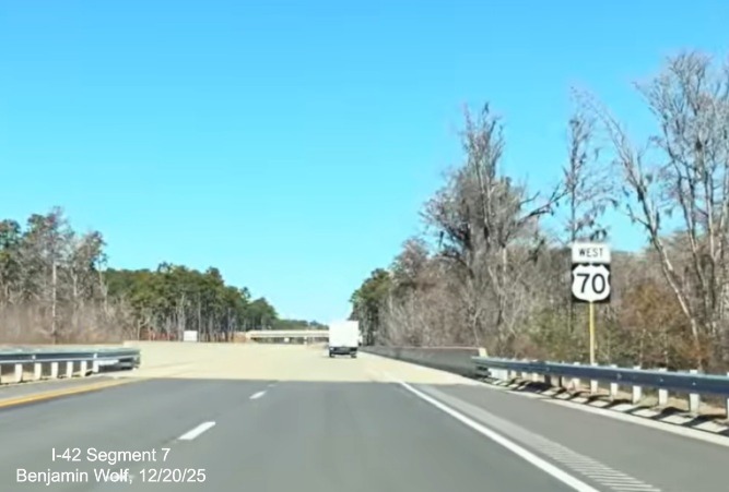
The second West US 70 reassurance marker on the Bypass.
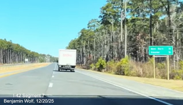
Another distance sign, this one has New Bern and Kinston 3 miles
closer.
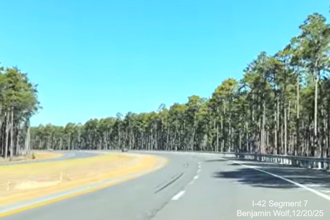
The Bypass taking a curve through the pine trees.
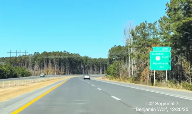
The 1 Mile advance sign for Business 70 East at the other end
of the Bypass.
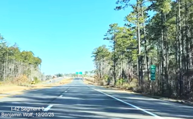
The last mile marker, Mile 430, on the Bypass.
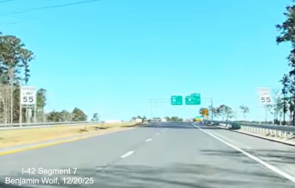
The speed drops to 55 MPH prior to the Business 70 exit.
The overhead signs at the end of the Bypass with space on the
pull through for I-42 shield.
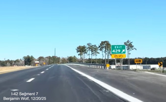
The gore sign for the East Business 70 exit, note the 25 MPH
advisory speed.
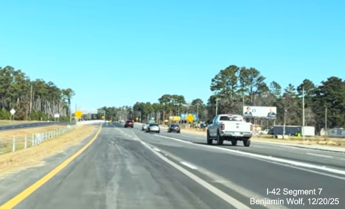
Bypass traffic merging with East Business 70 lanes.
Images of signage on Business 70 (12/24/25)
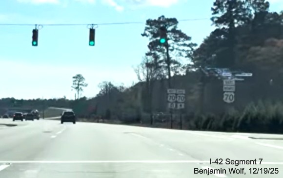
First East Business 70 reassurance marker along former US 70
alignment through Havelock, note signs beyond for reduced conflict intersection not changed yet.
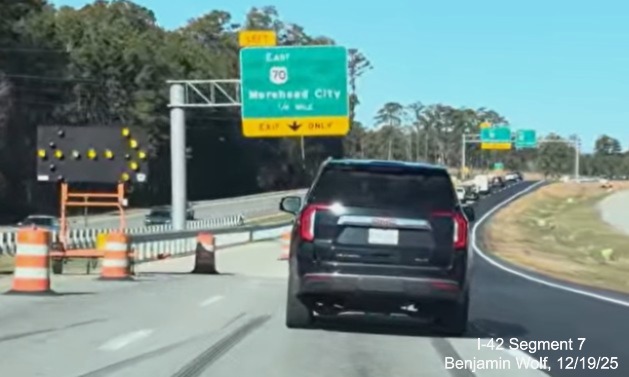
The first overhead sign for East US 70 nearing the end of West
Business 70 at the western end of the Havelock Bypass.
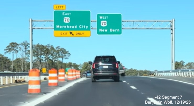
The overhead signs at the ramp to the Bypass east, still not
open when the video was taken, with another blank space for an I-42 shield in the pull through.
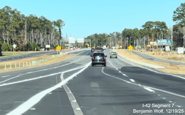
West Business 70 lanes merging with US 70 West at the end of the
Havelock Bypass.
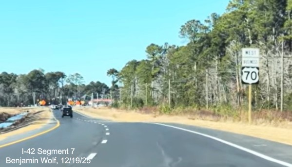
Here's the first West Business 70 reassurance marker along the
exit ramp at the east end of the Bypass.
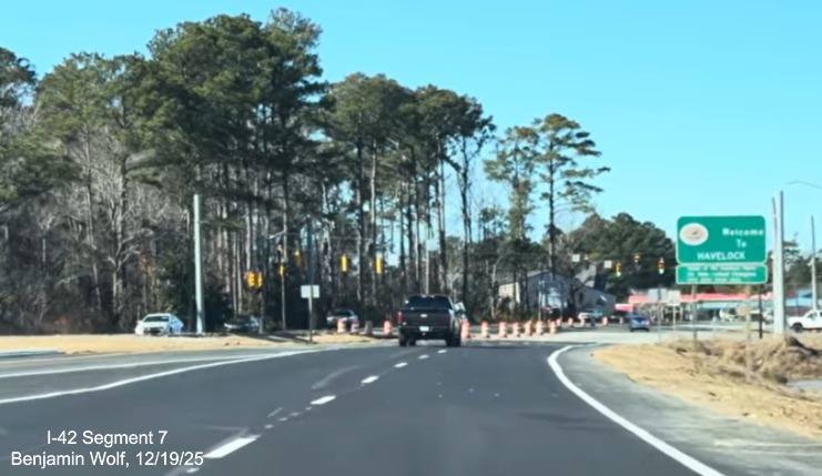
A new Welcome to Havelock sign at the end of the ramp to West
Business 70.
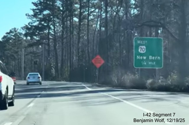
Now at the end of Business 70 East, here's an advance sign for the
Bypass heading west back to New Bern.

The overhead signs at the end of Business 70 East, both have
blank spaces for I-42 shields.

East Business 70 merging with US 70 lanes at Mile 438 at the east
end of the Bypass.

An East US 70 reassurance marker just prior to the end of the
interstate standard roadway that continues to Morehead City.
Images Taken at the Lake Road interchange:

The Jct US 70 trailblazer just prior to the Lake Road interchange,
heading north.

US 70 trailblazers at the Lake Road ramp for West US 70, not open
at the time and traffic signals were on flash mode.

An East US 70 trailblazer prior to crossing the Lake Road
bridge over the Bypass.

The last East US 70 trailblazer comes with a Morehead City control
city sign.

Turning around and heading south, here's the Jct US 70 trailblazer
in that direction.
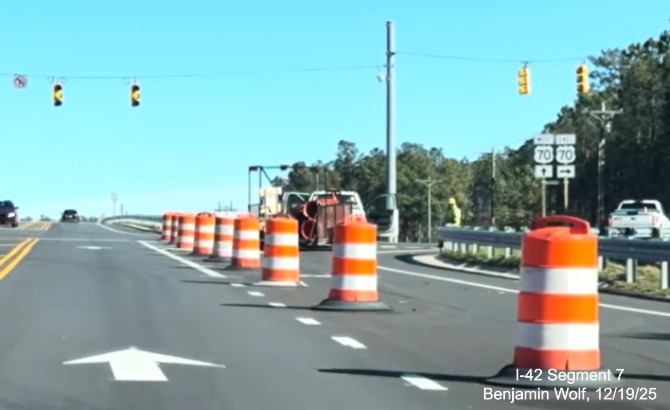
The pair of US 70 trailblazers at the eastbound ramp.
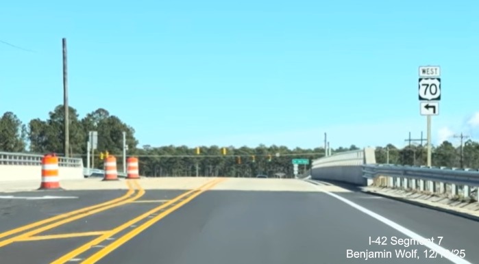
The West US 70 trailblazer prior to the Lake Road bridge.
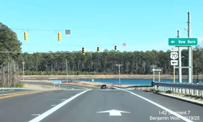
The West US 70 trailblazer at the ramp with a sign for New
Bern.
Google Maps Street View Images Taken in November 2025
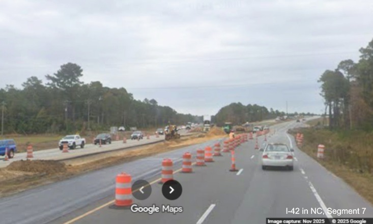
View from US 70 East approaching the future merge with the
Havelock Bypass at its eastern end.
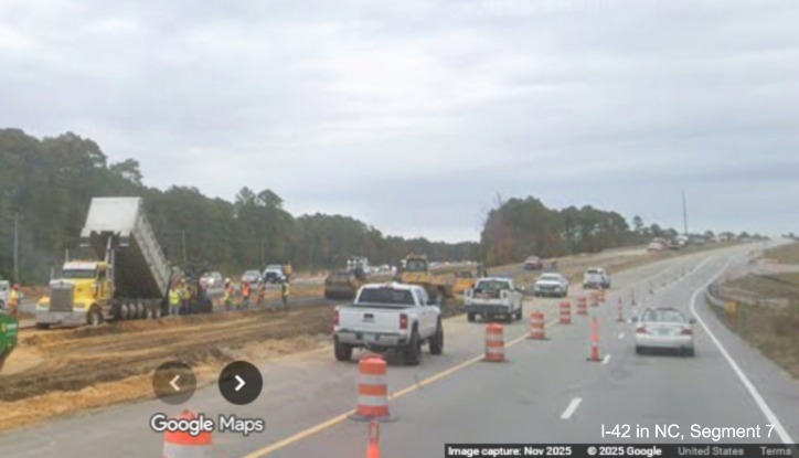
Work was still continuing on the westbound lanes and bridge.
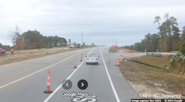
Approaching the future ramp to the westbound Bypass, traffic on
US 70 East restricted to 1 lane.
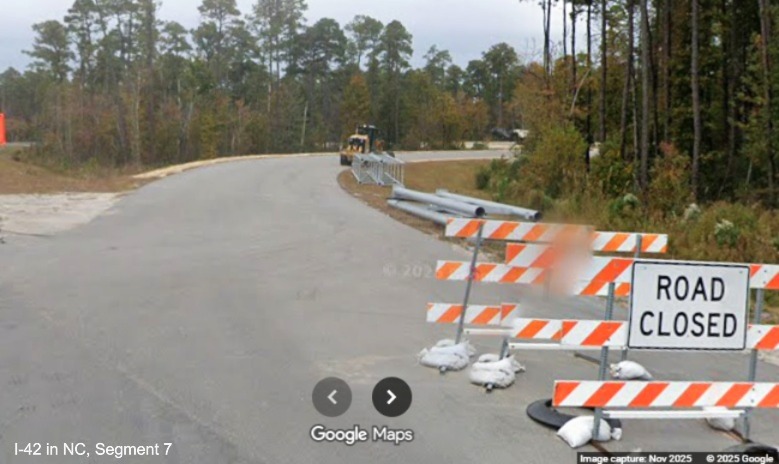
Sign supports and gantries being stored along the future westbound
Bypass ramp.
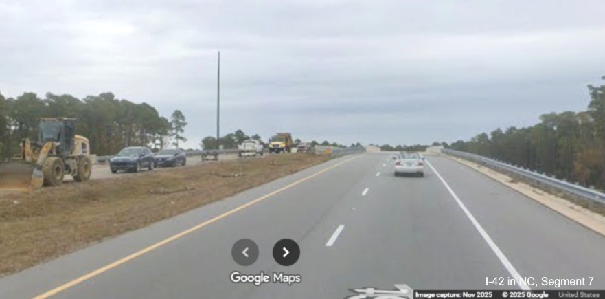
Heading towards the new bridge over the Bypass lanes, westbound
still under construction.
Crossing over the bridge.
Driving beyond the bridge, the westbound lanes look complete on
this side.
Heading towards the merge with the future end of the Havelock
Bypass.
Current US 70 about to merge with its former alignment, the orange
signs indicate you should slow to 40 MPH.
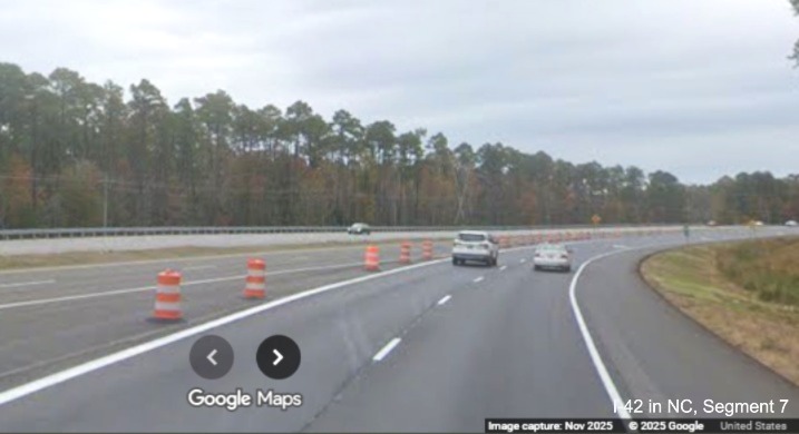
The future Havelock Bypass lanes currently blocked off by traffic
barrels.
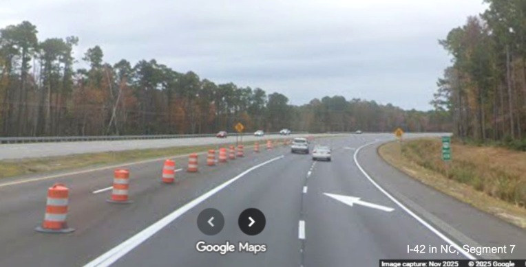
The mile marker at the lane merge is 438, this will probably be
the exit number for the Bypass on US 70 West (hopefully, since the sign plans have it as Exit 418).
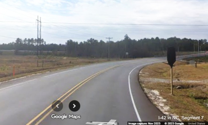
Now on Lake Road approaching the future interchange with the Havelock
Bypass. Notice the covered up Jct US 70 Bypass trailblazer.
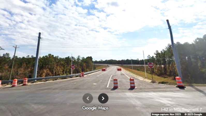
The partially blocked off future off-ramp from the Havelock
Bypass heading west to Lake Road with traffic signals partially installed.
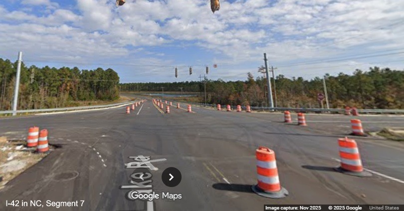
Looking back through the future interchange along Lake Road, showing
some installed traffic signals.
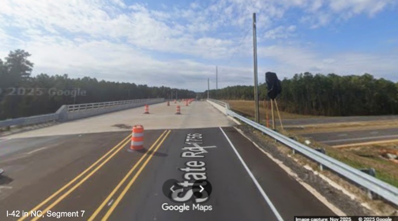
Driving on the completed Lake Road bridge over the future Havelock
Bypass and another covered up US 70 Bypass trailblazer.
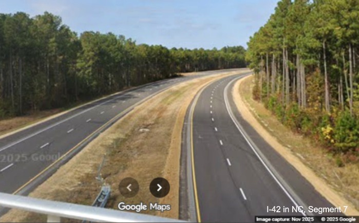
Looking north from the bridge over a seemingly completed section of
the Havelock Bypass with lane markings in place.
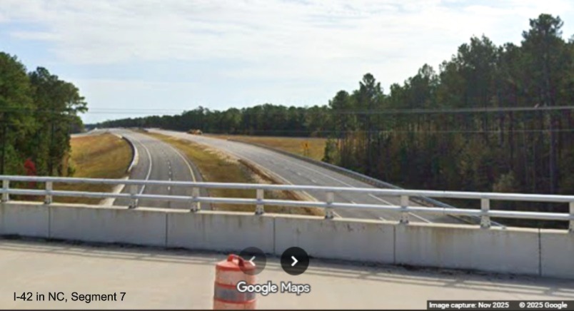
Now looking south towards the Lake Road off-ramp headed west, some
signage has been put in place.
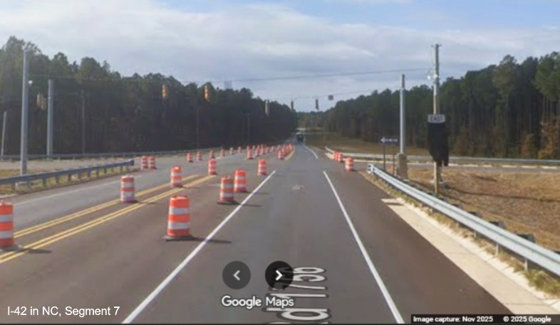
A partially cover East Bypass US 70 trailblazer at the future on-ramp
to the Havelock Bypass. More traffic signals in place.
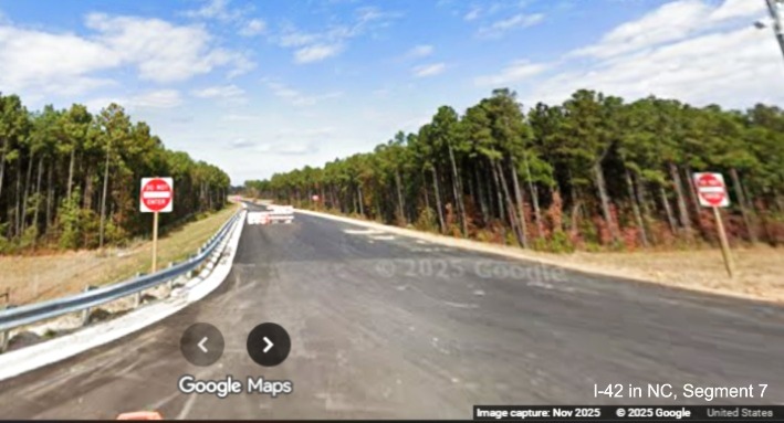
Looking down the future on-ramp to Lake Road from the eastbound
Bypass. Apparently the Do Not Enter signs are enough to dissuade drivers from entering the partially closed ramp.
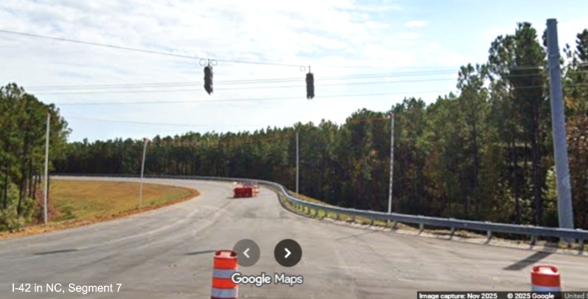
Now looking the other way at the future on-ramp to the Bypass
headed east, traffic signals waiting to be activated.
PHOTOS FROM 2024
Taken by AARoads Forum member jcil4ever, September 2024:
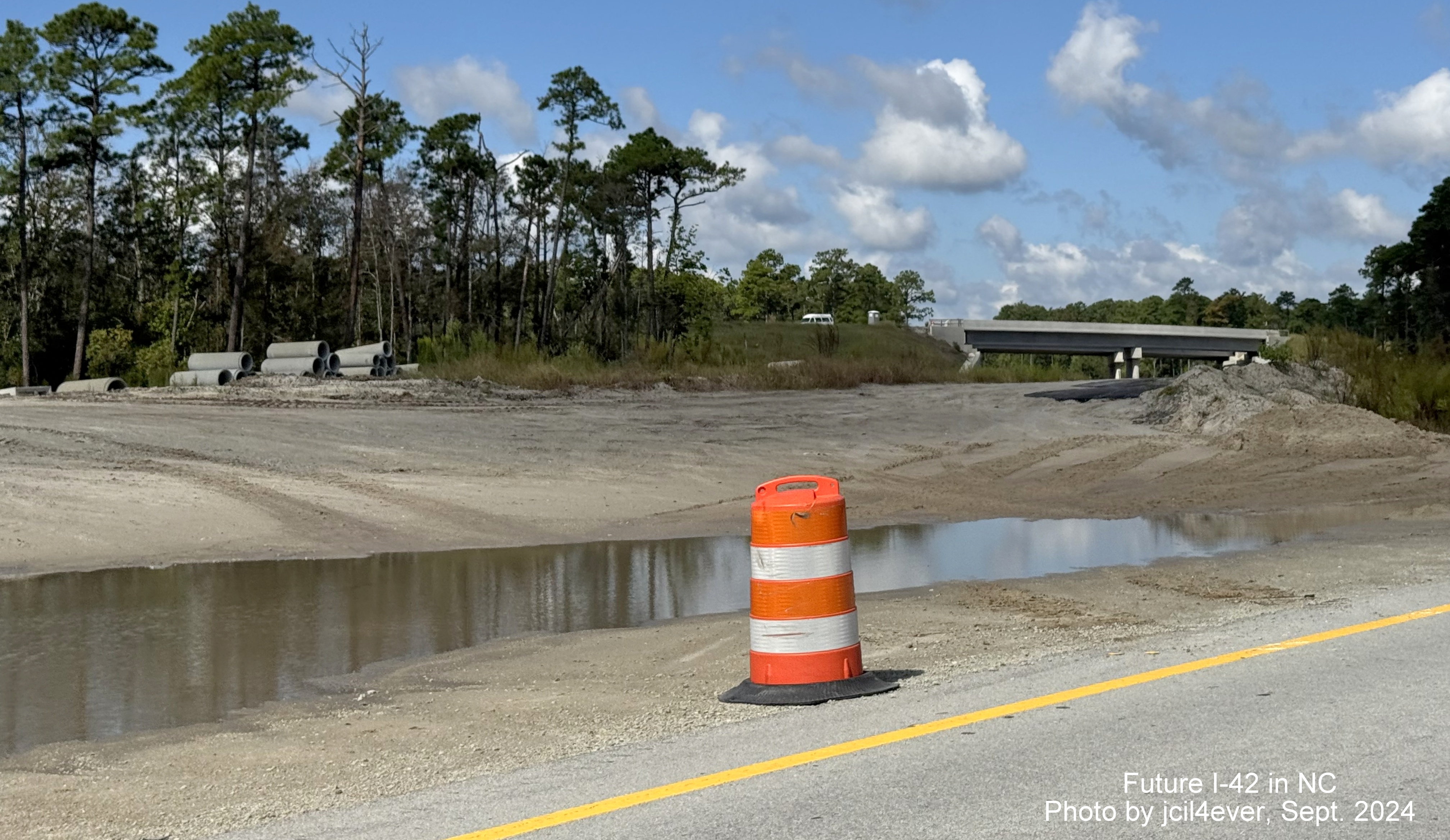
Grading work continues near the future bridge.
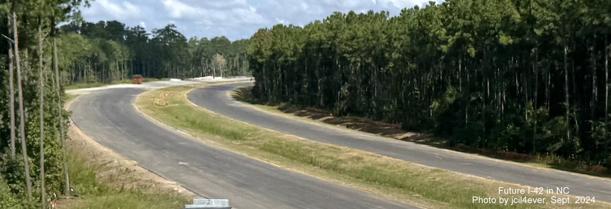
Section of the Bypass nearing completion looking west from Lake
Road Bridge.
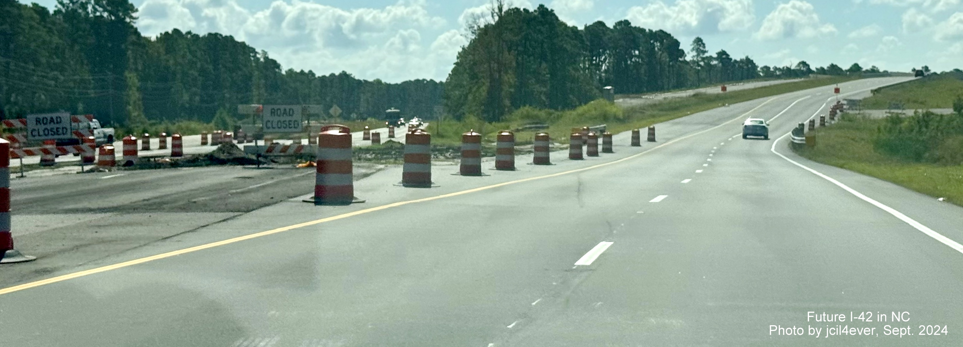
View of new
alignment of US 70 East heading towards bridge at the eastern end of the Bypass.
Screen images from Google Maps Street View coverage of US 70 of
the future western end of the Havelock Bypass from March 2024 (there are new Street View images along US 70 until NC 101
in Havelock):

The first new Street View images indicates probably why opening of
the Bypass was delayed, the future on-ramp from US 70 East is only partially graded.

A closer look at the future on-ramp from US 70 East to the Bypass.

Construction equipment along US 70 East in the Bypass construction
zone.

More on-ramps for the Bypass partially graded as seen from US
70 East.

Approaching the future on-ramp to US 70 East from the westbound
Bypass.

View of a pair of bridges near the end of the Bypass still not
complete.

A closer look at
the approaching merge of the future Bypass west ramp to US 70 East.

Closeup of the future Bypass ramp merging with US 70 East, also
only partially graded.

Approaching the
end of the Bypass work zone, 1/2 mile from the new exit ramp to the Cherry Point Marine Corps Air Station access
road (there apparently is no current plan to tie this access road to the Bypass).

Another view of
the northern end of the Bypass from US 70 West showing more construction needed.
NCDOT images of Havelock Bypass construction taken during the
summer of 2023:

Railroad bridge under construction over future Havelock Bypass
lanes.

Future Havelock
Bypass lanes initially paved at eastern end of construction zone.

Future Havelock
Bypass lanes as seen from future US 70 East bridge at the eastern end of the project.

View from future Havelock Bypass of US 70 bridges nearly
complete.
Images from Google Maps Street View taken during the August 2023
of Havelock Bypass construction along US 70 East:

Work continues in
constructing the on-ramp and bridges at the western end of the Havelock Bypass.

Looking back from
US 70 towards the ramp bridges being constructed at the western end of the Havelock Bypass.

Work continuing on the bridge that will take the Havelock
Bypass (Future I-42) lanes over the future alignment of US 70 East.

Looking back at future alignment of US 70 going under the
Havelock Bypass on left, current lanes on the right.

Merging of future
US 70 East lanes with current lanes at the end of the western Havelock Bypass construction zone.
Meanwhile, at the other end of the Bypass...

Construction of
future US 70 East lanes continues at the eastern end of Havelock Bypass.

Closer view of
grading of future US 70 East lanes heading over bridge over future Havelock Bypass lanes.

Looking back along current US 70 East toward future lanes
being graded.

Dirt piles remain
along US 70 East approaching the future ramp from the eastern end of Havelock Bypass.

Future site where the Havelock Bypass will merge into US 70 East.
Earlier images
from Google Maps Street View taken during the December 2022 of Havelock Bypass construction:

The start of the Bypass as seen from US 70 East.

A closer look at
the future ramp structure being build as part of the Bypass. Meanwhile, at the other end:
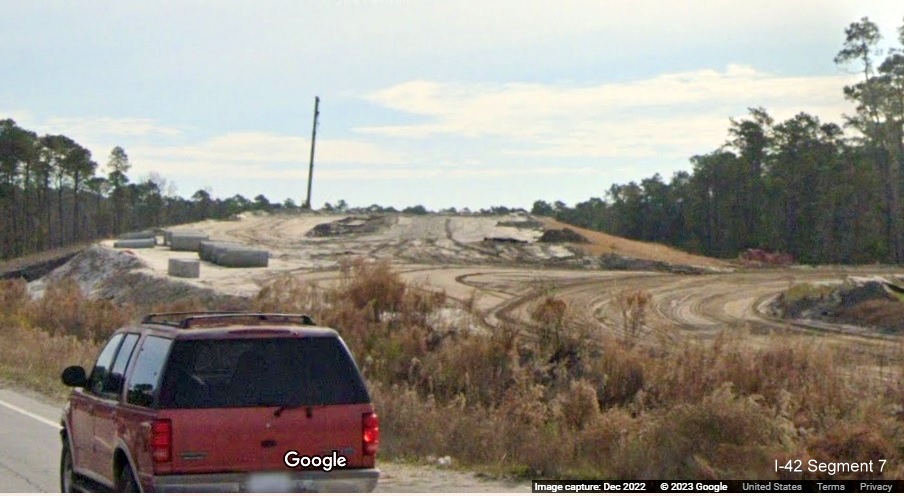
The future US 70 East lanes at the eastern end of the Bypass.

The future US 70 East bridge under construction over the eastern
end of the Bypass.

The future merge of the I-42 Bypass with US 70 East.
Earlier Street View images from July 2022:

View from US 70 East lanes showing beginning of Havelock Bypass.

Trucks and construction vehicles parked at the beginning of Havelock
Bypass.

View from US 70 East showing future I-42 East Havelock Bypass lanes
being constructed.

Future I-42 Havelock Bypass roadway paralleling current US 70 East.

View from US 70
West at the other end of the Havelock Bypass as it will merge back with the original roadway.

Additional Bypass construction seen from US 70 West lanes.
Want to
contribute photos for this site? Feel free to email me at rmalme7374 at gmail.com.
Videos
NEW Video posted June 12, 2026 by by Mileage Mike about the history
and progress of the I-42 Corridor.
Video taken February 8, 2026 by Roadwaywiz Driving the entire
I-42 Corridor heading East.
Video taken February 8, 2026 by Roadwaywiz Driving the entire
I-42 Corridor heading West.
Video taken February 8, 2026 by Roadwaywiz after the opening
of the Havelock Bypass Driving East.
Video taken February 8, 2026 by Roadwaywiz after the opening
of the Havelock Bypass Driving West.
Video taken December 19-20, 2025 by Benjamin Wolf after the opening
of the Havelock Bypass Driving both directions.
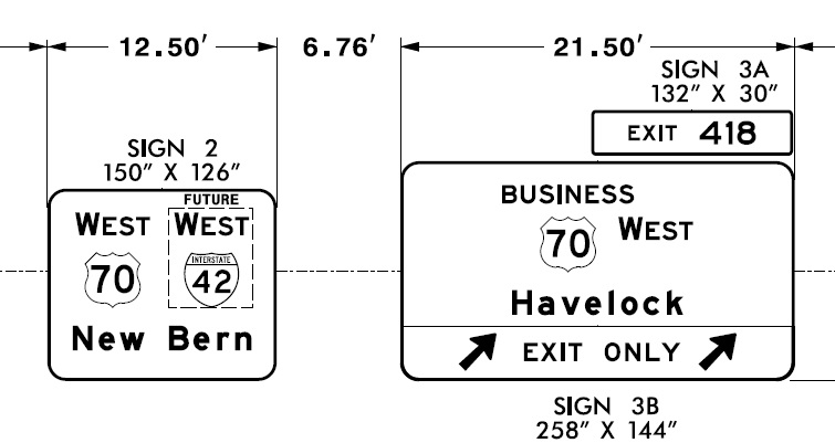
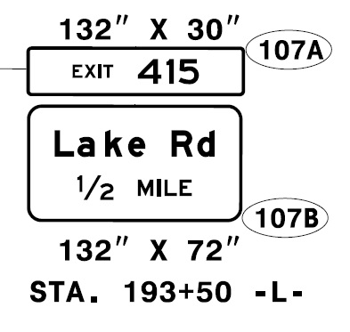


Here's an I-42 Shirt advertised on the Internet (no endorsement):

Notes
1. NCDOT. Future I-36 Corridor Map.
Downloaded from: https://connect.ncdot.gov/resources/safety/Route%20Changes/I-42%20Proposed%20Corridor%20Map%20160308.pdf,
July 8.
2. WITN. 2020. "Work underway for I-42 from Morehead City to Raleigh."
Downloaded from: https://www.witn.com/content/news/-Work-underway-for-I-42-from-Morehead-City-to-Raleigh-567281991.html,
Feb. 6.
3. NCDOT. 2022. "Interstate 42 Coming to Eastern N.C. Corridor." Press Release. March 16. Downloaded from:
https://www.ncdot.gov/news/press-releases/Pages/2022/2022-03-16-i-42-coming-us-70-corridor.aspx, March 16.
4. NCDOT. 2023. Response to personal inquiry as to timeline for I-42 signing, January 10.
5. NCDOT. 2023. Response from Renee B. Roach, PE, CPM, State Signing and Delineation Engineer, Mobility and Safety
Division, Signing and Delineation Unit to inquiry to NCDOT regarding the signing of I-42, Jan. 31.
6. Stradling, Richard. 2023. Will ’40/42’ be a thing of the past? NCDOT plans to rename NC 42 in Johnston County.
July 21. Downloaded from: https://www.newsobserver.com/news/local/article277460313.html, July 23, 2023.
7. Bolejack, Scott. 2024. "Roads will get new numbers — names too." Johnstonian News. April 4. Downloaded from:
https://restorationnewsmedia.com/articles/local-news-johnstonian/roads-will-get-new-numbers-names-too/, May 18.
8. AASHTO. 2023. Special Committee on US Route Numbering. Fall Meeting
Report to the Council on Highways and Streets, p. 3. Downloaded from:
https://transportation.org/route/wp-content/uploads/sites/6/2023/12/Final_Report_USRN_Fall_2023_R_1.pdf,
Dec. 4, 2023.
9. NCDOT. 2024. Construction Progress Report, Contract C204359, TIP No. W-5600. Information as of November 22. Downloaded from:
https://apps.ncdot.gov/traffictravel/progloc/ProgLocSearch.aspx, December 27, 2024.
10. Bolejack, Scott. 2020. Change Coming Soon to US 70. Johnstonian News. March 2.
Downloaded from: http://www.johnstoniannews.com/stories/change-coming-soon-to-us-70,202776,
March 7.
11. Stradling, Richard. 2025. "Future I-42: Stretch of Johnston County highway almost ready to become interstate." News &
Observer (Raleigh, NC), October 9. Downloaded from: https://www.newsobserver.com/news/local/article312431989.html#storylink=cpy, June 14, 2026.
12. AARoads Forum. 2026. Interstate 42(E) Thread. Post 1616. Downloaded from: https://www.aaroads.com/forum/index.php?topic=18287.1616,
June 14.
13. NCDOT. 2019. NC Board of Transportation, US 70 Work Group, US 70 Corridor Workshop, Division 4. April, p. 2.
Downloaded from: http://www.super70corridor.com/wp-content/uploads/April-2019-US-70-Workshop-Division-4.pdf,
July 10.
14. NCDOT. 2021. Signing Plans, Part 2. Contract C204359. January 16. Downloaded from:
https://xfer.services.ncdot.gov/dsplan/2021%20Highway%20Letting/03-16-21/Plans%20and%20Proposals/Johnston%20C204359/Standard%20PDF%20Files/,
Jan. 23, 2021.
15. NCDOT. 2019. NC Board of Transportation, US 70 Work Group, US 70 Corridor Workshop, Division 4. April, p. 4.
Downloaded from: http://www.super70corridor.com/wp-content/uploads/April-2019-US-70-Workshop-Division-4.pdf,
July 10.
16. NCDOT. 2026. Latest State Transportation Improvement Program (STIP). January 2026. Division 4, p. 50. Downloaded from:
https://connect.ncdot.gov/projects/planning/STIPDocuments1/NCDOT%20Current%20STIP.pdf, May 23.
17. NCDOT. 2019. NC Board of Transportation, US 70 Work Group, US 70 Corridor Workshop, Division 4. April, p. 6.
Downloaded from: http://www.super70corridor.com/wp-content/uploads/April-2019-US-70-Workshop-Division-4.pdf,
July 10.
18. NCDOT. 2024. P7 Quantitative Scores for All 2026-2035 STIP projects.
Downloaded from: https://connect.ncdot.gov/projects/planning/Prioritization%20Data/Prioritization%207.0%20(P7)/Results/P7%20Quantitative%20Scores%20-%20All%20Projects%205-24-24_For%20Transmittal.xlsx,
May 29.
19. NCDOT. Construction Plans. Contract C204333. Location: US 70 (Future I-42) from SR 1003 (Buffalo Road) to Wayne
County Line, pp. 2 and 5.
Downloaded from: https://xfer.services.ncdot.gov/dsplan/2019%20Highway%20Letting/05-21-19/Plans%20and%20Proposals/JOHNSTON_I-6044_4799.3.1_C204333/Sketch%20Map.pdf,
August.
20. US 70 Corridor Commission. 2019. Director's Update.
January/February, p. 4. Downloaded from: http://www.super70corridor.com/wp-content/uploads/Jan_Feb_2019-Directors-Report.pdf,
July 10.
21. Dunlop, Jim. 2021. Posting on AARoads Forum, Southeast Region, Oct. 8. Downloaded from:
https://www.aaroads.com/forum/index.php?topic=19189.425, October 9.
22. AASHTO. 2022. Special Committee on US Route Numbering, 2021 Fall Meeting Final Report, p. 3/5. Downloaded from:
https://route.transportation.org/wp-content/uploads/sites/50/2022/02/Final-Report-USRN-Application-Results-Fall-2021.pdf,
Feb. 14, 2022.
23. Nerdom. 2024. Post #1251 on Interstate 42 (E) thread on AARoads Forum, Southeast Region. Downloaded from:
https://www.aaroads.com/forum/index.php?topic=18287.msg2940726#msg2940726, August 31, 2024.
24. NCDOT. 2024. "Interstate 42 Coming to the U.S. 70 ‘Goldsboro’ Bypass." Press Release. September 13. Downloaded from:
https://www.ncdot.gov/news/press-releases/Pages/2024/2024-09-13-i-42-goldsboro-bypass.aspx, Sept. 13, 2024.
25. NCDOT. 2019. NC Board of Transportation, US 70 Work Group, US 70
Corridor Workshop, Division 2. April, p. 6. Downloaded from: http://www.super70corridor.com/wp-content/uploads/April-2019-US-70-Workshop-Division-2.pdf,
July 10.
26. NCDOT 2023. State Transportation Improvement Program, Final, June 2023. June 6. Division 2, p. 15. Downloaded from:
https://www.ncdot.gov/initiatives-policies/Transportation/stip/Pages/about.aspx, June 7.
27. NCDOT 2025. State Transportation Improvement Program, Final, July 8. Project Spreadsheet. Lenoir County.
Downloaded from: https://www.ncdot.gov/initiatives-policies/Transportation/stip/Pages/about.aspx, July 17.
28. NCDOT. 2020. "Route Selected for Future Kinston Bypass." Press
Release. February 20. Downloaded from: https://www.ncdot.gov/news/press-releases/Pages/2020/2020-02-20-kinston-bypass-route-selected.aspx,
February 20.
29. NCDOT. 2019. NC Board of Transportation, US 70 Work Group, US 70 Corridor Workshop, Division 2. April, p. 7.
Downloaded from: http://www.super70corridor.com/wp-content/uploads/April-2019-US-70-Workshop-Division-2.pdf,
July 10.
30. NCDOT. 2019. Five Miles of Craven County Highway to be Upgraded. Press Release. September 25. Downloaded from:
https://www.ncdot.gov/news/press-releases/Pages/2019/2019-09-25-craven-county-highway-upgrade-contract.aspx, Sept. 27.
31. NCDOT. 2026. Construction Progress Report, Contract No. C 204225,
TIP Nos. R-5777A, R-5777B, U-5713. Information as of April 22. Downloaded from:
https://apps.ncdot.gov/traffictravel/progloc/ProgLocSearch.aspx, May 23, 2026.
32. NCDOT. 2025. "Taberna Way Bridge Construction to Begin on James City Project." Press Release. Nov. 19. Downloaded
from: https://www.ncdot.gov/news/press-releases/Pages/2025/2025-11-19-taberna-way-bridge-construction-james-city.aspx,
Nov. 26, 2025.
33. NCDOT. "Update for Construction on U.S. 70 Improvements in James City." Press Release. Nov. 29. Downloaded from:
https://www.ncdot.gov/news/press-releases/Pages/2023/2023-11-29-craven-county-james-city-update.aspx, Dec. 6, 2023.
34. JDunlop. 2024. Comment to I-42 Thread in AARoads Forum, April 22, 2024. Downloaded from:
https://www.aaroads.com/forum/index.php?topic=18287.msg2920472 #msg2920472, April 22, 2024.
35. NCDOT. 2019. NC Board of Transportation, US 70 Work Group, US 70 Corridor Workshop, Division 2. April, p. 9.
Downloaded from:
http://www.super70corridor.com/wp-content/uploads/April-2019-US-70-Workshop-Division-2.pdf,
July 10.
36. NCDOT. 2023. "More of U.S. 70 in Craven County Will Be Upgraded." Press Release. February 1. Downloaded from:
https://www.ncdot.gov/news/press-releases/Pages/2023/2023-02-01-us-70-upgrade-craven-county.aspx, Feb. 1, 2023.
37. NCDOT. 2026. Construction Project Report, Contract No. C 204695, TIP No. R-5777C. Information as of Apr. 28.
Downloaded from: https://apps.ncdot.gov/traffictravel/progloc/ProgLocSearch.aspx, May 23, 2026.
38. Craven County. 2023. Craven County Comprehensive Transportation Plan, Highway Map, Inset B, p. 10. Downloaded from:
https://eccog.org/wp-content/uploads/2022/09/CravenCo_Full-Report_April-6-2020.pdf,
February 1, 2024.
39. NCDOT. 2026. Construction Project Report, Contract No. C 204177, TIP No. R-1015. Information as of February 22.
Downloaded from: https://apps.ncdot.gov/traffictravel/progloc/ProgLocSearch.aspx, April 7, 2026.
40. WCTI.com. 2024. "Havelock bypass construction delayed, city remains optimistic for spring 2025 opening." April 10.
Downloaded from:
https://wcti12.com/news/local/havelock-bypass-construction-delayed-city-remains-optimistic-for-spring-2025-opening#,
April 15, 2024.
41. Ohnesorge, Lauren. 2025. "Revamp of critical coastal highway delayed until 2026." Triangle Business Journal. January
13. Downloaded from: https://www.bizjournals.com/triangle/news/2025/01/13/ncdot-havelock-bypass-highway-construction.html,
April 3, 2025.
42. North, Brian and Michelle Pumphrey. 2025. "NCDOT to open Havelock Bypass with ceremony on December 19, part of future
I-42 project" WCTI 12 News.com. Downloaded from: https://wcti12.com/news/local/ncdot-to-open-havelock-bypass-with-ceremony-
on-december-19-part-of-future-i-42-project, Dec. 10, 2025.
43. Olson, Eric. 2024. "Portion of North Carolina's I-42 Reaches Last
Year of Work." Construction Equipment Guide, Southeast Edition. January 8. Downloaded from:
https://www.constructionequipmentguide.com/portion-of-north-carolinas-i-42-reaches-last-year-of-work/63526,
December 27, 2024.
44. Valentin, Caramia. 2024. "Overpass opens for traffic in Havelock, as part of new Havelock Bypass." June 21. Downloaded
from:https://www.newbernsj.com/news/overpass-opens-for-traffic-in-havelock-as-part-of-new-havelock-bypass/article_5f49e18d-6f77-5352-b53a-23d32a14d045.html,
June 22, 2024.
45. NCDOT. 2023. "U.S. 70 in Craven County Requires Temporary Lane Closures." Press Release. February 17. Downloaded from:
https://www.ncdot.gov/news/press-releases/Pages/2023/2023-02-17-lane-closures-craven-county.aspx, Feb. 19, 2023.
46. NCDOT. 2019. NC Board of Transportation, US 70 Work Group, US 70 Corridor Workshop, Division 2. April, p. 19.
Downloaded from: http://www.super70corridor.com/wp-content/uploads/April-2019-US-70-Workshop-Division-2.pdf,
July 10.
47. Craven County. 2020. Craven County Comprehensive Transportation Plan. p. 2-12. Downloaded from:
https://eccog.org/wp-content/uploads/2022/09/CravenCo_Full-Report_April-6-2020.pdf, Jan. 4, 2024.
48. Carteret County. 2014. Carteret County Comprehensive Transportation Plan, Sept., p. 2-21. Downloaded from:
https://eccog.org/wp-content/uploads/2022/09/Carteret-Co-CTP-Report-FINAL.pdf, Jan. 4, 2024.
49. NCDOT. 2025. State Transportation Improvement Program, Final, July 8. Project Spreadsheet. Carteret County.
Downloaded from: https://www.ncdot.gov/initiatives-policies/Transportation/stip/Pages/about.aspx, July 17.
50. Shaffer, Ryan. 2023. "What's next for the Hwy-70 upgrades in Craven,
Carteret Counties?" News report for Public Radio of Eastern North Carolina. February 24. Downloaded from:
https://www.publicradioeast.org/pre-news/2023-02-24/whats-next-for-the-hwy-70-upgrades-in-craven-carteret-counties,
July 23, 2023.
51. Plans from: Signing Plan, Craven and Carteret Counties, Location: US
70 Havelock Bypass from South of Carteret/Craven County Line to South of
SR 1176 (Carolina Pines Blvd.), NCDOT TIP R-1015, November 20, 2018. Available at:
https://xfer.services.ncdot.gov/dsplan/2019%20Highway%20Letting/02-19-19/Plans%20and%20Proposals/Craven_R-1015_C204177/Standard%20PDF%20Files/250%20Signing%20Plans.pdf
Site created:
July 10, 2019
Site Last Updated: June 15, 2026
(c) Robert H. Malme 2026
Return to  Future NC Interstates