Segment 1
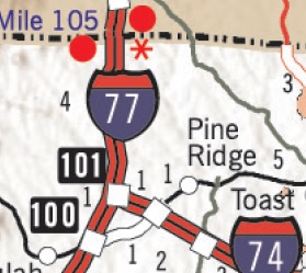 |
Where: I-77, Virginia Border to Exit 101, Surry CountyLength: 4.5 MilesStatus: COMPLETESigned as:
|
Segment 1|
|
Where: I-77, Virginia Border to Exit 101, Surry CountyLength: 4.5 MilesStatus: COMPLETESigned as:
|
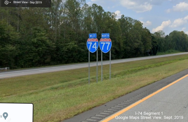
I-74 enters North Carolina signed with I-77 for its first four and 1/2 miles. This segment was completed easily in April 2001 with the addition of 2 I-74 signs, one each direction to what was previously just I-77 (see eastbound photo below). Signage at the I-77 interchange, both on I-77 North and I-74 West (including new 2021 sign plans for the Winston-Salem Northern Beltway section), implies I-74 goes as far as Wytheville, Virginia, (the termination point of the route according to AASHTO) but the interstate was, and is still not, signed north of the North Carolina border by Virginia. I-74 East leaves I-77 southbound as a left exit (see below).
Exit Renumbering?
In sign plans released for the letting of the final contract for the Eastern Section of the Winston-Salem Northern Beltway in August 2022, it appeared NCDOT wanted to change the exit number from one based on I-77 mileage, to that with I-74 mileage:
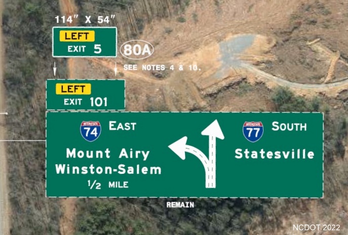
Sign plan showing proposed replacement of Exit 101 tab to Exit 5 tab for I-74 exit off of I-77.
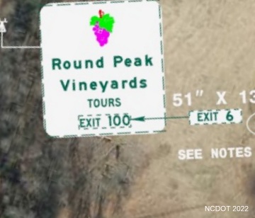
The auxiliary sign for the Vineyard Tours is to change its number to that on I-74.
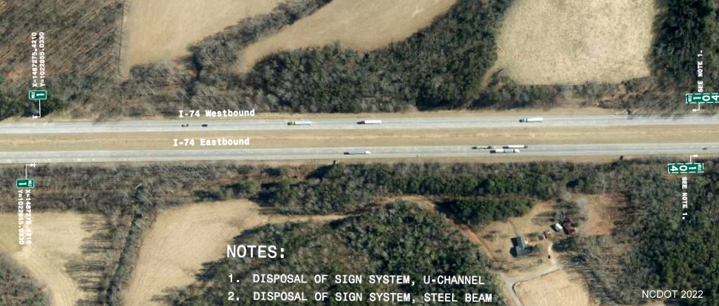
Proposed location for I-74 Mile 1 markers and removal of existing I-77 Mile 104 markers near Virginia border.
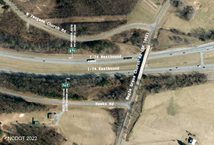
The proposed location for I-74 Mile 2 markers is just west/north of the Maple Grove Church Road bridge.
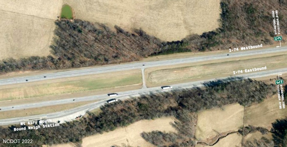
Proposed location for I-74 Mile 3 marker eastbound is beyond the state border weigh station.
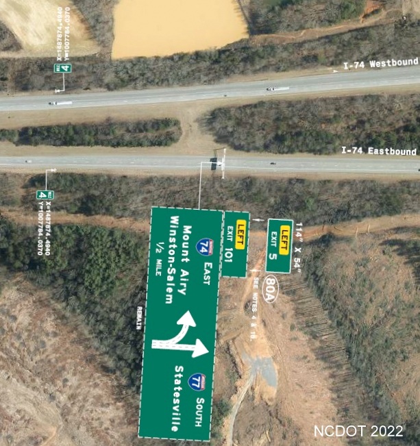
Proposed location for I-74 Mile 4 markers prior to the I-74/I-77 split headed east/south.
I-74 West: From Prior to I-77 South Exit Ramp (Dec. 2025)
I-74 East/I-77 South: From the Virginia/North Carolina Border (Sept.
2024)
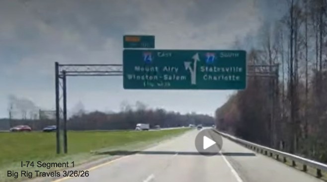
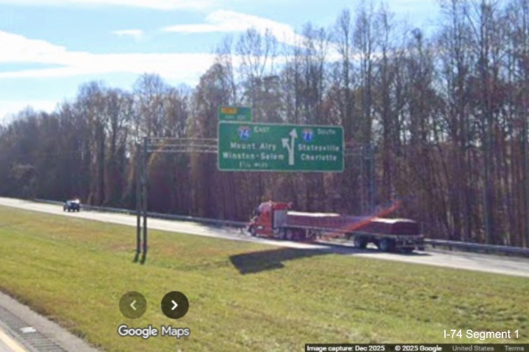
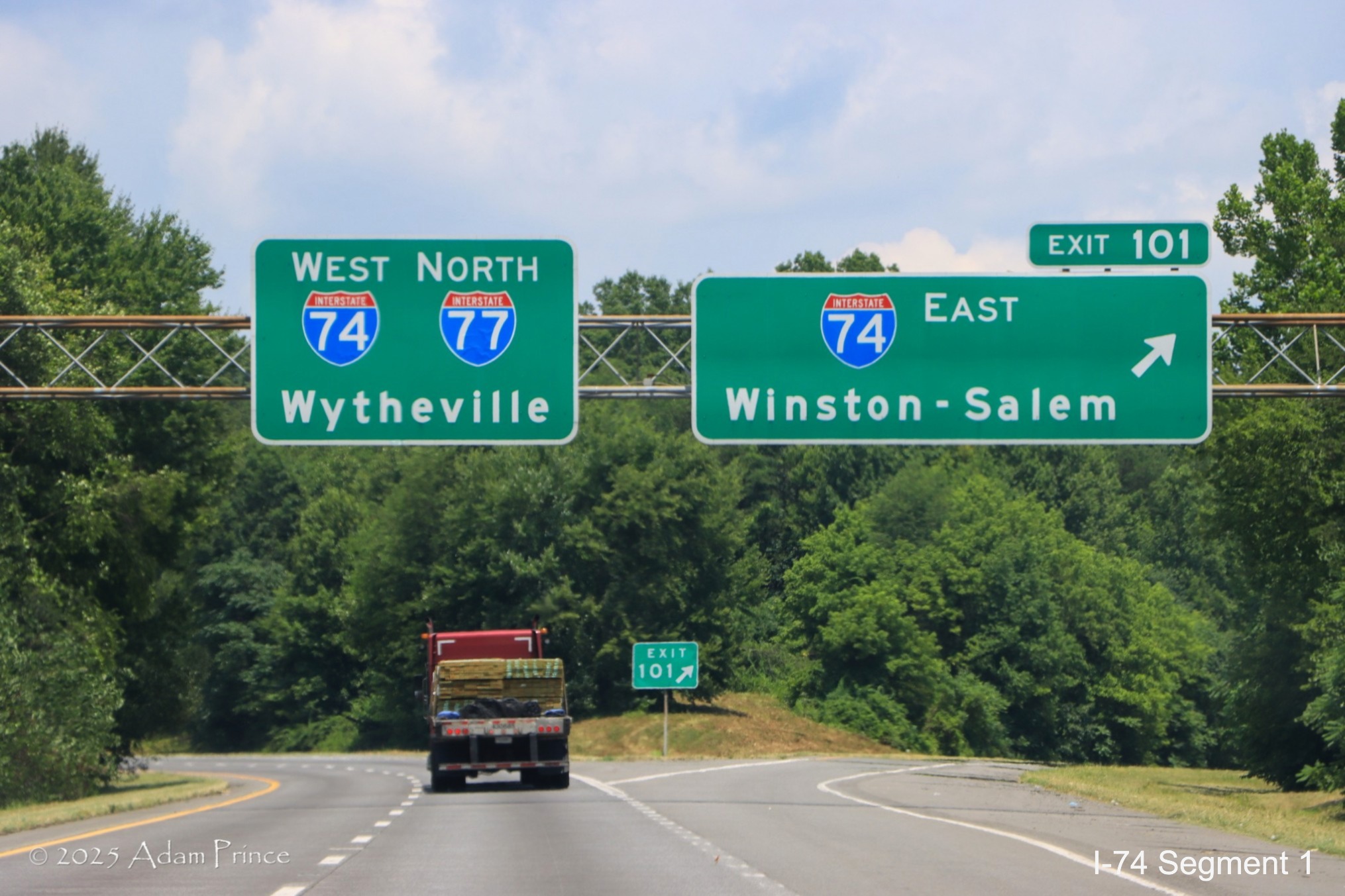
Unchanged exit number for I-74 East exit on 1 1/2 mile advance sign.
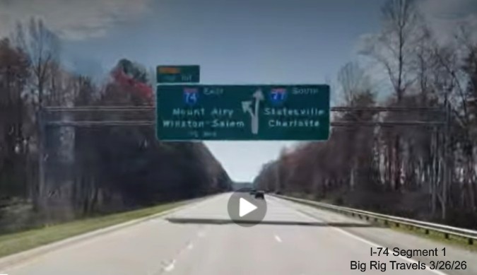
Unchanged exit number for I-74 East exit on 1/2 mile advance sign.
Unchanged exit number for I-74 East exit southbound seen from I-74 West/I-77 North.
Unchanged Mile 102 marker on I-74 West/I-77 North after the I-74 on-ramp.
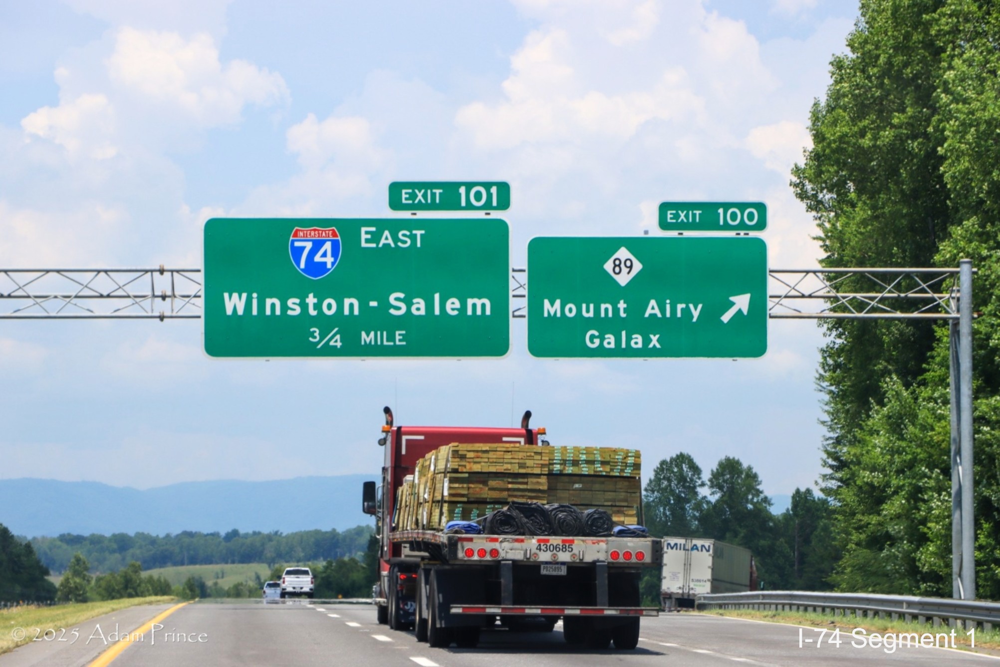
The 3/4 Mile advance sign for the I-74 East exit on I-77 North at NC 89.
There is a West I-74/North I-77 pull through sign at the I-74 East exit.
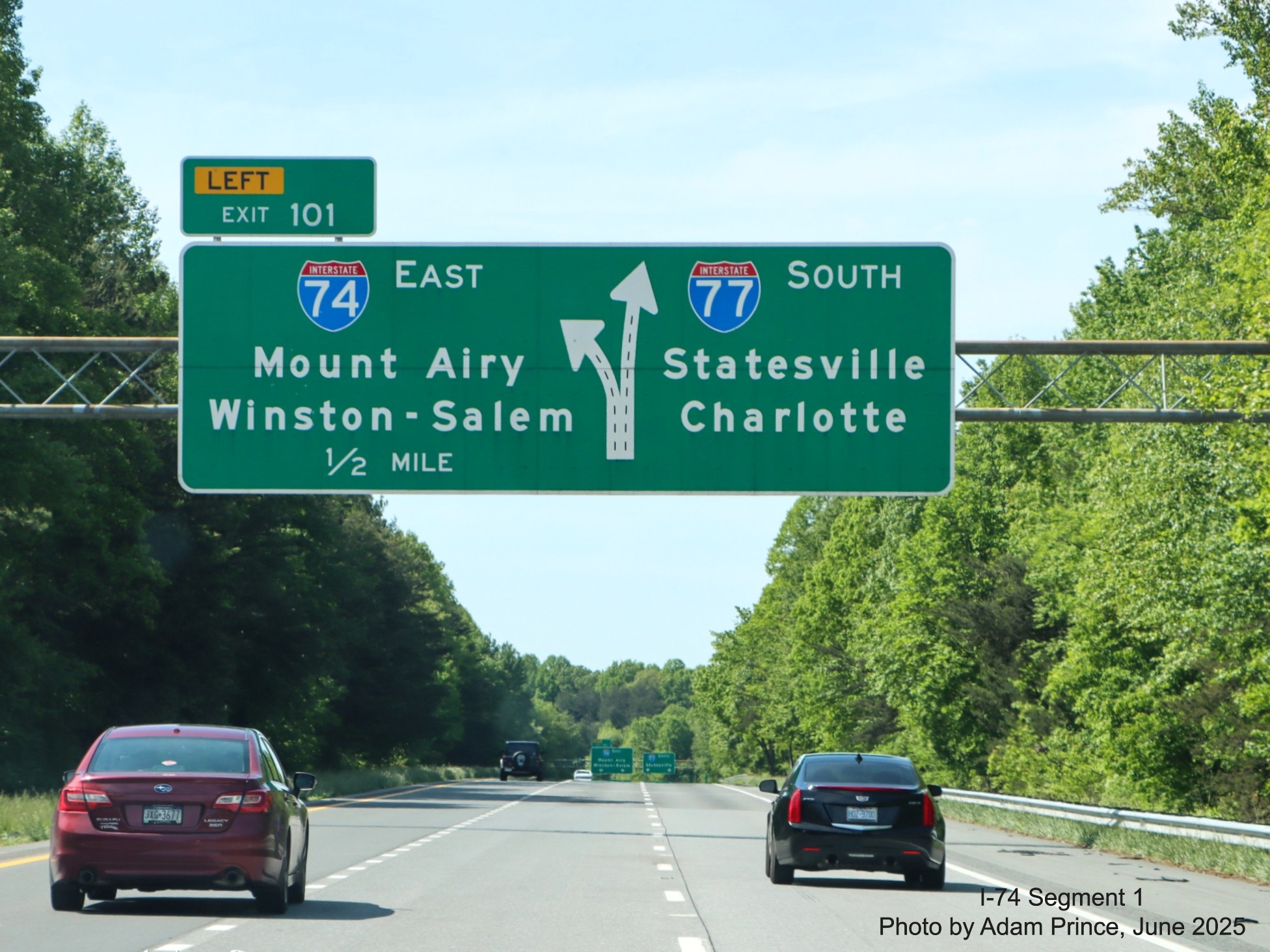
The 1/2 Mile advance sign for the I-74 East exit on I-77 South still has its old exit numbers.
 The original East I-74/South I-77 reassurance markers are still in place after the Rest Area on-ramp just
across the Virginia border, though the ones in the other direction were taken down, see photo below. Video taken during a
rainy day.
The original East I-74/South I-77 reassurance markers are still in place after the Rest Area on-ramp just
across the Virginia border, though the ones in the other direction were taken down, see photo below. Video taken during a
rainy day.
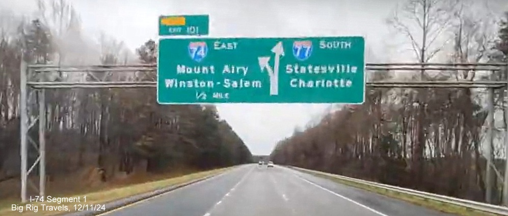 The exit signs for I-74, here for the 1/2 Mile advance, had not been changed to reflect
the sign plans above. Based on new signage seen in Segment 3 photos, this may not happen, if it all, until 2026.
The exit signs for I-74, here for the 1/2 Mile advance, had not been changed to reflect
the sign plans above. Based on new signage seen in Segment 3 photos, this may not happen, if it all, until 2026.
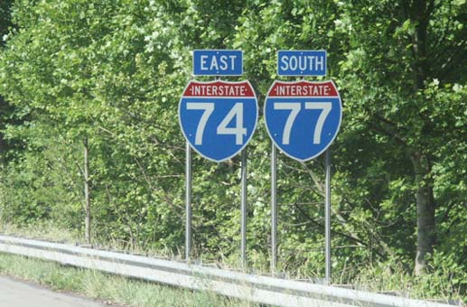 Image of large East I-74
and South I-77 shields after crossing into North Carolina, Photo courtesy of H.B. Elkins
Image of large East I-74
and South I-77 shields after crossing into North Carolina, Photo courtesy of H.B. Elkins
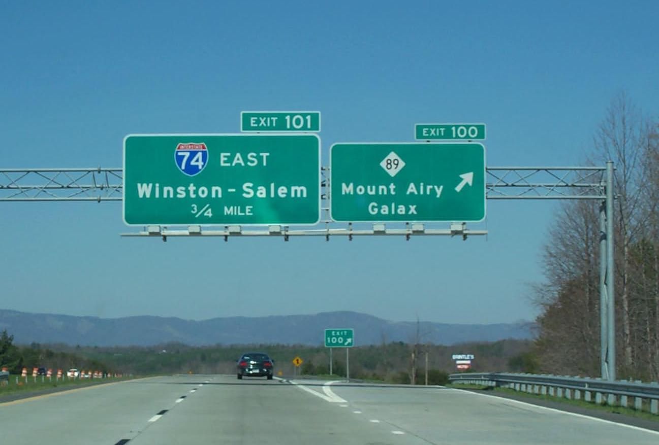 Signage along I-77 North Approaching the I-74 Exit (photo courtesy of Adam
Prince)
Signage along I-77 North Approaching the I-74 Exit (photo courtesy of Adam
Prince)
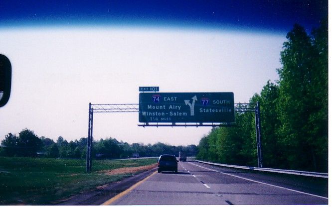 Approaching the split of I-74 East from I-77 South near Mt. Airy.