I-74 continues from the original US 311 freeway onto more recently
completed freeways from south of I-85 (Exit 75) to US 220, now I-73
near the town of Randleman. When this specific route was chosen in
1997 it disappointed many citizens and government officials in the area
since the route cuts a 1000 foot wide path directly through the city of
Sophia before meeting US 220. Despite many objections, NCDOT chose this
route, designated Corridor C, rather than the Corridor AA route
preferred by the public at June 1997 hearings, because it cost $7
million less, avoided a complicated interchange with US 220 (I-73), and
would send the least amount of pollution to the future Randleman
Reservoir, preventing potential environmental problems.1,2
The project was listed in the 2009-2015 NCDOT STIP as Number R-2606.3
Right-of-Way acquisition started on the western part of the route in
2003, with a total cost projected at $17.5 million. Construction on the
first section, $28.5 million of the total construction cost estimated at
$177 million, started on May 29, 2007.4 This section featured
many bridges and the building of an interchange at Cedar Square Road
(Exit 79) which would be the temporary end of I-74 while the remaining
segment was still under construction. When completed in 2008, US 311 was
temporarily routed west along Cedar Square Road for 1/2 mile back to its
original alignment.
The US 311 route from there westward (northward) was to be
re-designated US 311 Business, but in the Spring of 2009 High Point
officials asked that NCDOT remove the designation where it existed in
High Point, thus only a state secondary route now exists along Main
Street north of Glenola (see photo in Section 6).5 After the
freeway was opened in November 2010, workers removed all the US 311
signs to the north along its now former route.6 In 2018,
NCDOT announced, with the approval of High Point city officials, their
intent to truncate US 311 south of Winston-Salem to decrease motorist
confusion of having 2 routes with different directions. Signage would be
removed by the end of 2018.7 On May 21, 2018 the NCDOT
application to truncate US 311 was approved by AASHTO's Special
Committee on U.S. Route Numbering at their meeting in Franklin,
Tennessee.8 Despite the promise to remove the signs by the
end of 2018, US 311 signs still existed in Guilford County into 2021.
During the spring US 311 shields finally were removed from overhead
signs, along the freeway, and at exit ramps. However, US 311 still is
signed as of August 2021 in Randolph County (see photos below), due to
those signs being under a different NCDOT Division jurisdiction
(Division 8 vs. 7) and apparently no funds there, or knowledge of the
decommissioning, to complete the work.
Both parts of this segment had been dubbed the "Missing Link" by the
I-74 Piedmont Corridor Group (PCG), an organization of business people,
transportation officials, and others lobbying to complete I-74. They
created the term in 2003 to call attention to what they saw as NCDOT's
too drawn-out segmented plan to complete this portion of the highway,
long after many other sections of I-74 were then scheduled to be built.
The PGC hoped to put enough pressure on NCDOT to move up its
construction timetable for the entire section to match work starting on
Segment 6 to the west. Starting both projects
at once, supporters said, would be more efficient.9 This
effort eventually paid off. While start of construction was delayed from
October 2006 to May 2007, work on the first part, 5.3 miles from south
of I-85 near Archdale to north of Spencer Road (SR 1929) in Glenola10,
began at the same time as work was started on the remaining section of Segment 6.11 Also, whereas earlier
plans called for the proposed letting for the next part of the highway,
from Spencer Road to US 220 in Sophia, not to occur until after 2012 and
be completed in two parts, the final part not to begin a couple years
after that,12 the project instead got most of the funds
borrowed under the Garvee Bond Program to expedite a design-build
contract. The borrowed funds ($112 million) will be paid back out of the
highway fund accounts through 2019.3 Work started on this 7.9
mile segment in October 200813 with the Barnhill Contracting
Company responsible for the project. Construction was largely completed
by the end of 2012, but due to the need for additional paving that has
to wait for warmer weather the opening was held up until June 7, 2013.14
NCDOT officials had told the Winston-Salem Journal in April 2013 that
they hoped to have the highway by Memorial Day15, they were
about two weeks too early. While the route had originally been called
the US 311 Bypass, NCDOT decided to keep that route on its original
alignment east of where the new and old routes crossed near Sophia. For
the last 2 miles the freeway is just signed as I-74, the only place it
will be signed alone between Mt. Airy and Rockingham, see photos below.
A closer look at the northern part of the segment from the 2021-2022
State Transportation Map:
"Drive" This Segment with Videos by RoadwayWiz taken in the Summer of
2021
Photos taken from Google Maps Street View images in August and
September 2021
US 311 shields still standing in Randolph County
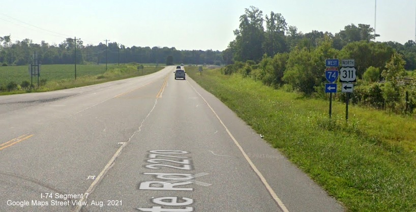
North US 311 trailblazer still standing at former ramp from
US 311 to I-74 West in Sophia.
South US 311 trailblazer at end of ramp from I-74 West.
North US 311 reassurance marker still standing after US 311
exit on I-74 West.
US 311 South still indicated on 1 mile advance sign for
Sophia exit on I-74 East.
South US 311 reassurance marker still standing after on
I-74 East just over the Randolph County line.
Properly
signed route after crossing Guilford County line:
A now standalone East I-74 reassurance marker after the
I-85 exit, compare to third photo in section below.
Photos along the completed portion of I-74 in 2012 (Hover over for
larger image)
Photo
of I-74/US 311 advance exit sign on I-85 South one mile prior to
interchange. (8/1/12)
Photo of
overhead signs at beginning of C/D ramps for I-74/US 311 on I-85 South.
(8/1/12)
Here's the first pair of
East I-74/South US 311 reassurance markers just beyond the Interstate 85
North on-ramp. (10/13/11)
Here's
one of the mileage signs placed on this stretch of highway, just prior
to the Tuttle Road bridge on I-74 East. (10/13/11)
Here's the one mile sign on I-74 East for the last exit,
for now, Cedar Square Road, note 'All Traffic Exit' tab. (10/13/11)
NCDOT
has place an 'End I-74' sign just prior to the temporary eastern end of
the freeway at Cedar Square Road. (6/10/12)
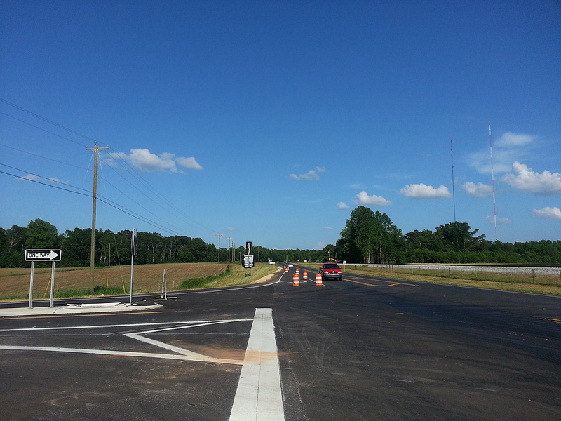
View approaching
the traffic barrels funneling vehicles onto the Cedar Square exit ramp,
looking beyond toward Spencer Road in Oct. 2011. (10/13/11)
West I-74/North US
311 signs under blank poles at the future on-ramp to I-74 East heading
east on Cedar Square Road. (10/13/11)
View
from the Cedar Square Rd bridge of the I-74 roadbed heading east toward
Spencer Road. This part of the freeway was paved under the contract for
the next section (10/13/11)
West I-74/North US 311
signage at the on-ramp, current beginning of I-74 West on Cedar Square
Road. (10/13/11)
I-85 exit signage on I-74
West approaching the curve before the Tuttle Road bridge in October
2011. (10/13/11)
I-85 exit signage on I-74
West approaching the off-ramp to I-85 North. (10/13/11)
I-74/US 311 exit signage
on I-85 South C/D ramp in the late afternoon in Oct. 2011. (10/13/11)
Here are some photos taken after the Eastern section was opened in
late June 2013 by site contributor, Adam Prince:
Here's
a photo of one of the exit signs for US 311 which leaves I-74 and ends
along its original alignment at US 220. (6/30/13)
Here's
another photo 2 miles down the road at the exit itself. (6/30/13)
Here's the first sign on I-74 East for the
I-73/ US 220 freeway and the joining of I-73 and I-74 heading south toward
Asheboro. (6/30/13) Here's
a photo of the I-73/US 220 interchange signs from the road itself
(6/30/13)
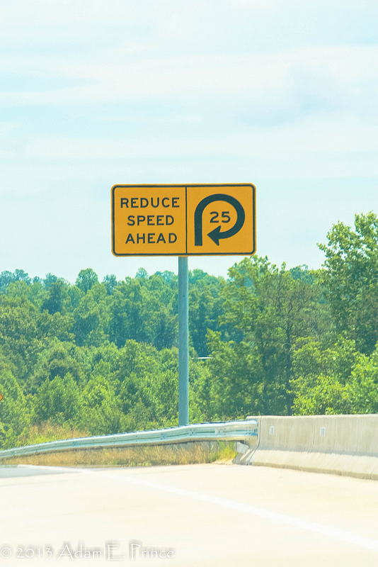
This is
the warning sign along the ramp from I-74 East to I-73/US 220 North as
they approach the sharp curve ahead. (6/30/13)
Here are some opening preview photos along the path of I-74 taken by
AARoads Forum Member MBHockey13 while jogging along the unopened highway
on May 30 and 31, 2013.
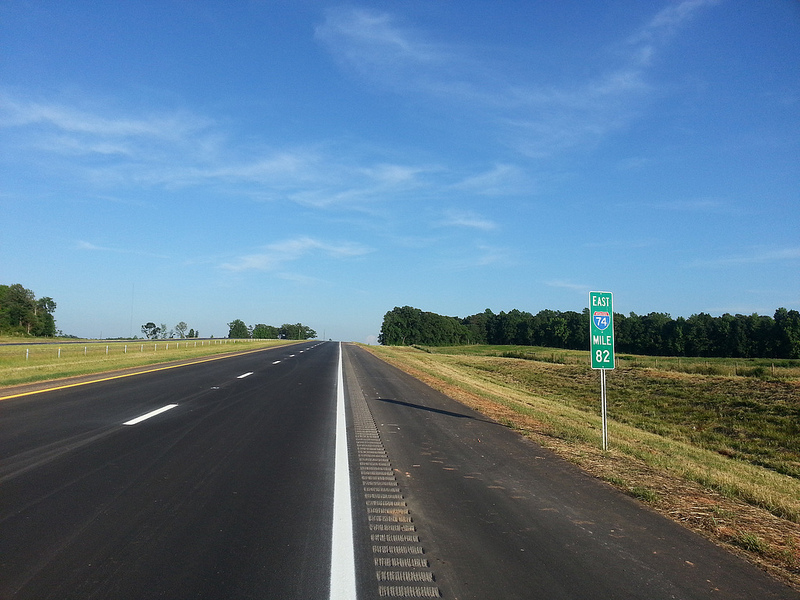
View looking east at Mile
Marker 82. Three miles east of Cedar Square Road, new pavement has
received line markings. (5/30/13)
View of 2 Mile advance
exit sign from US 311 South on I-74 East. It appears NCDOT wants to
encourage drivers heading to Randleman to exit here, and not go all the
way to US 220 (I-73) (the exit sign westbound does not include the city
name). (5/30/13)
The view on I-74 East at
Mile Marker 81 approaching the Banner Whitehead Rd bridge. (5/30/13)
View of newly place
mileage sign on I-74 East beyond the Cedar Square Rd exit, the distance
to Asheboro is 16 miles. (5/30/13)
Another view eastbound
with sign confirming the speed limit on this section of I-74/US 311 is
65 MPH. (5/30/13)
View of the newly placed
I-74 and US 311 reassurance markers just beyond the on-ramp from Cedar
Square Rd. (5/30/13)
View westbound of the exit
sign for Cedar Square Road. The 'All Traffic Exit' attached to the Cedar
Square Rd exit sign on I-74 east had been removed. (5/30/13)
View looking
eastbound along current US 311 at the new interchange with I-74. The
signs indicating I-74 and US 311 North are still covered over, awaiting
opening of the highway. (5/31/13)
View from the end of
the eastbound I-74 off-ramp showing the sign directing traffic for US
311 to go left at the intersection. (5/31/13)
View eastbound at the exit
ramp for the US 311 exit. Notice the use of another 'wimpy' exit number
on the gore sign. (5/31/13)
View westbound of the exit
sign for the US 311 exit. NCDOT apparently thinks traffic heading to
Randleman will stay on I-73 North, so no control city is used. (5/31/13)
View eastbound of stand
alone I-74 East shield. This is the first section of I-74 since Mount
Airy that does not carry another route designation. (5/31/13)
View eastbound of the
first exit sign for I-73/US 220. The sign is just after the US 311 exit,
with the sign for I-74 East beyond. (5/31/13)
View eastbound
looking under the US 311 and adjacent railroad bridge at the US 311
interchange. (5/31/13)
View west from US 311
bridge showing completed I-74 freeway and the interchange on and
off-ramps. (5/31/13)
View of the exit ramp to eastbound I-74 from US 311, signs are covered
over going north on US 311. (5/31/13)
 Segment 7
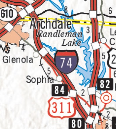

 d (To Exit 84)
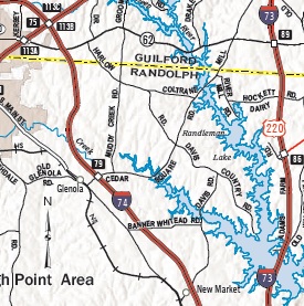
 North US 311 trailblazer still standing at former ramp from
US 311 to I-74 West in Sophia.
North US 311 trailblazer still standing at former ramp from
US 311 to I-74 West in Sophia.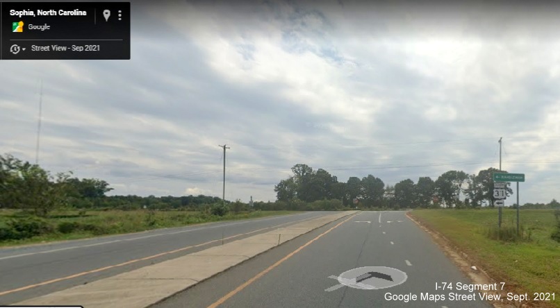 South US 311 trailblazer at end of ramp from I-74 West.
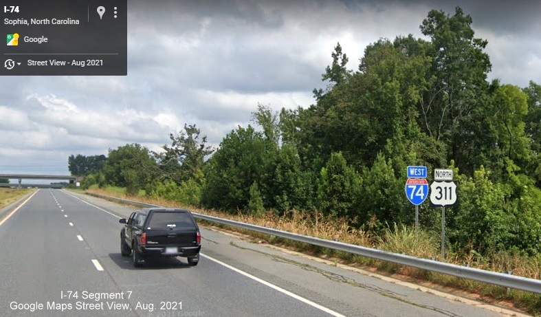 North US 311 reassurance marker still standing after US 311
exit on I-74 West.
North US 311 reassurance marker still standing after US 311
exit on I-74 West. US 311 South still indicated on 1 mile advance sign for
Sophia exit on I-74 East.
US 311 South still indicated on 1 mile advance sign for
Sophia exit on I-74 East.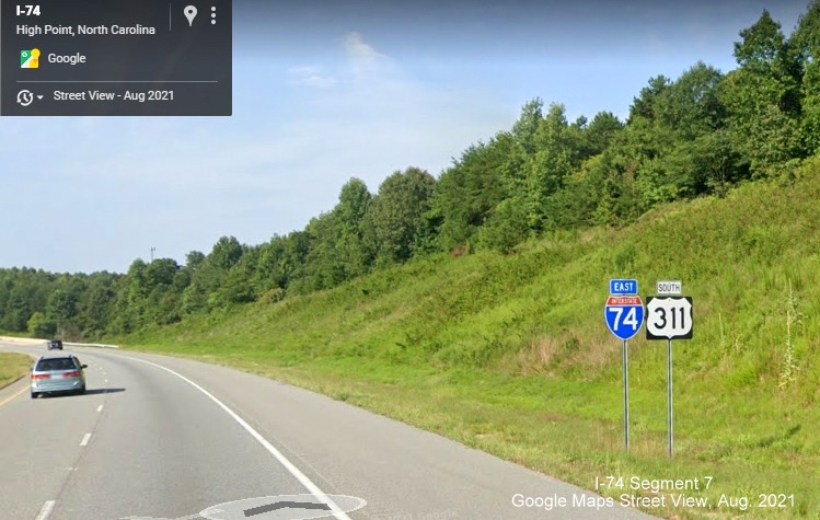 South US 311 reassurance marker still standing after on
I-74 East just over the Randolph County line.
South US 311 reassurance marker still standing after on
I-74 East just over the Randolph County line.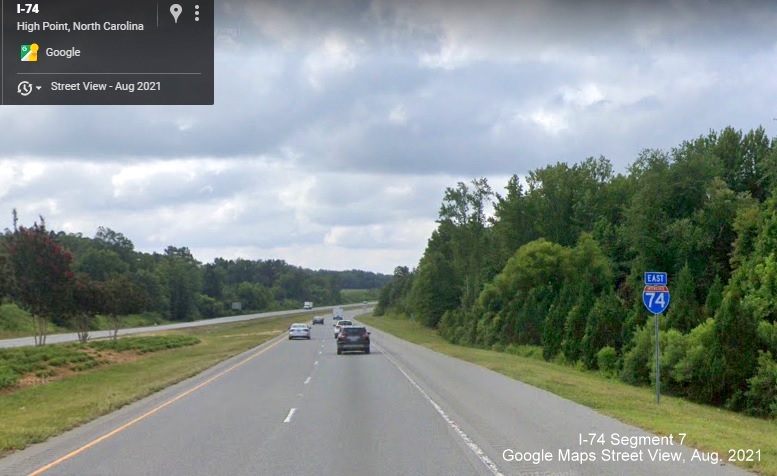 A now standalone East I-74 reassurance marker after the
I-85 exit, compare to third photo in section below.
A now standalone East I-74 reassurance marker after the
I-85 exit, compare to third photo in section below.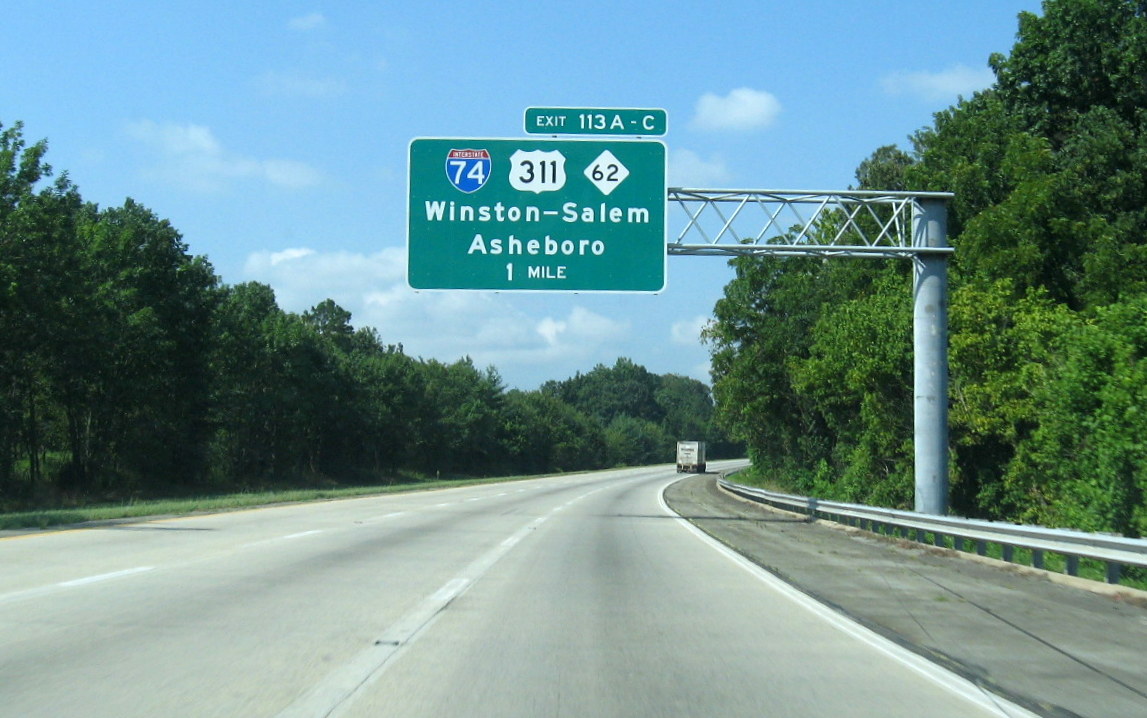 Photo
of I-74/US 311 advance exit sign on I-85 South one mile prior to
interchange. (8/1/12)
Photo
of I-74/US 311 advance exit sign on I-85 South one mile prior to
interchange. (8/1/12)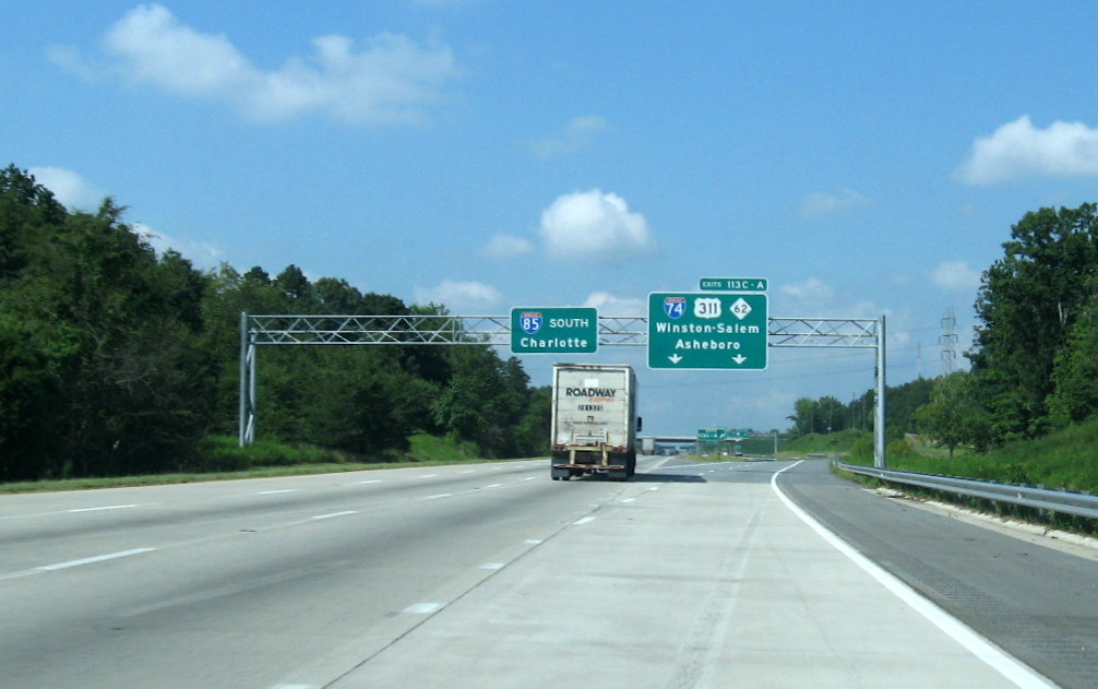 Photo of
overhead signs at beginning of C/D ramps for I-74/US 311 on I-85 South.
(8/1/12)
Photo of
overhead signs at beginning of C/D ramps for I-74/US 311 on I-85 South.
(8/1/12)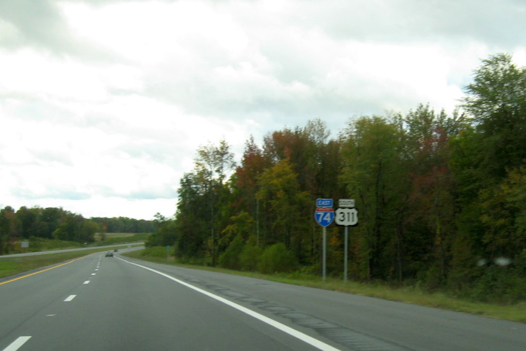 Here's the first pair of
East I-74/South US 311 reassurance markers just beyond the Interstate 85
North on-ramp. (10/13/11)
Here's the first pair of
East I-74/South US 311 reassurance markers just beyond the Interstate 85
North on-ramp. (10/13/11)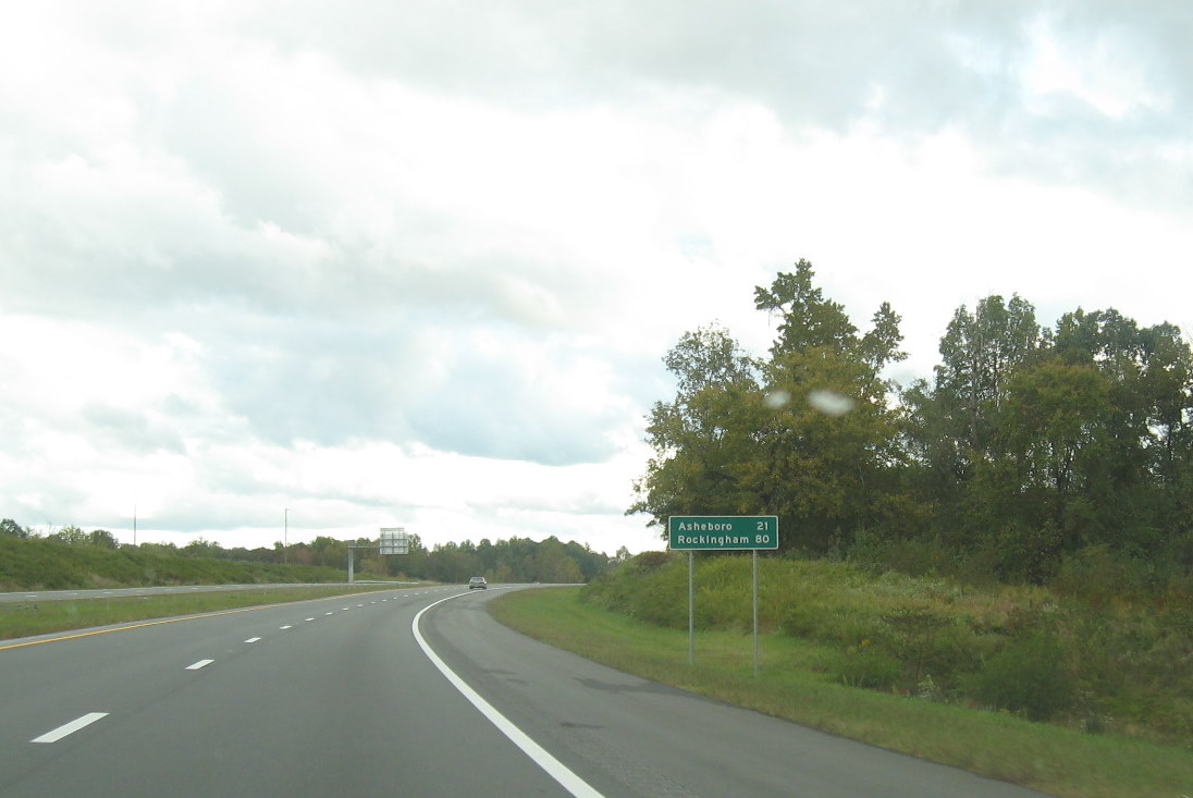 Here's
one of the mileage signs placed on this stretch of highway, just prior
to the Tuttle Road bridge on I-74 East. (10/13/11)
Here's
one of the mileage signs placed on this stretch of highway, just prior
to the Tuttle Road bridge on I-74 East. (10/13/11)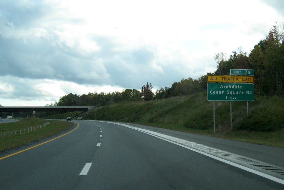 Here's the one mile sign on I-74 East for the last exit,
for now, Cedar Square Road, note 'All Traffic Exit' tab. (10/13/11)
Here's the one mile sign on I-74 East for the last exit,
for now, Cedar Square Road, note 'All Traffic Exit' tab. (10/13/11)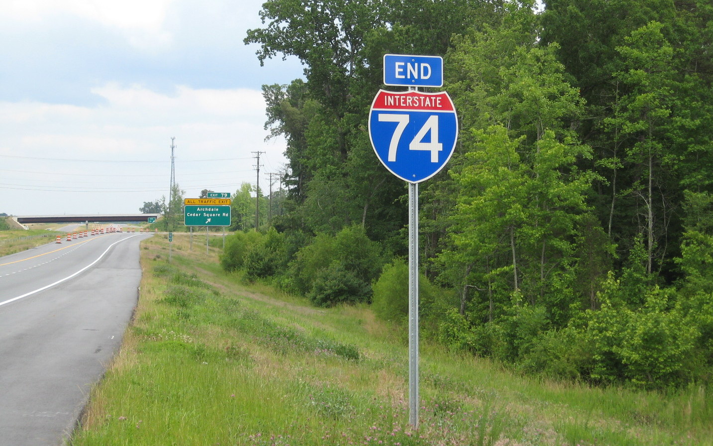 NCDOT
has place an 'End I-74' sign just prior to the temporary eastern end of
the freeway at Cedar Square Road. (6/10/12)
NCDOT
has place an 'End I-74' sign just prior to the temporary eastern end of
the freeway at Cedar Square Road. (6/10/12)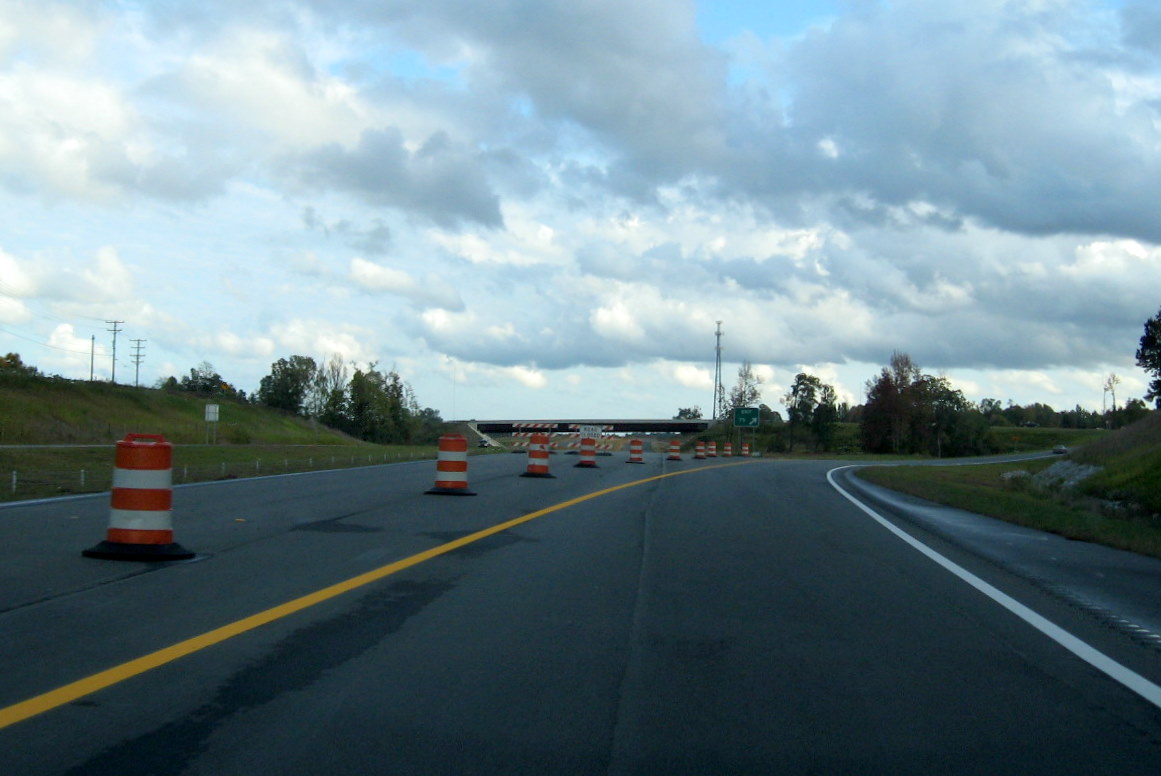 View approaching
the traffic barrels funneling vehicles onto the Cedar Square exit ramp,
looking beyond toward Spencer Road in Oct. 2011. (10/13/11)
View approaching
the traffic barrels funneling vehicles onto the Cedar Square exit ramp,
looking beyond toward Spencer Road in Oct. 2011. (10/13/11)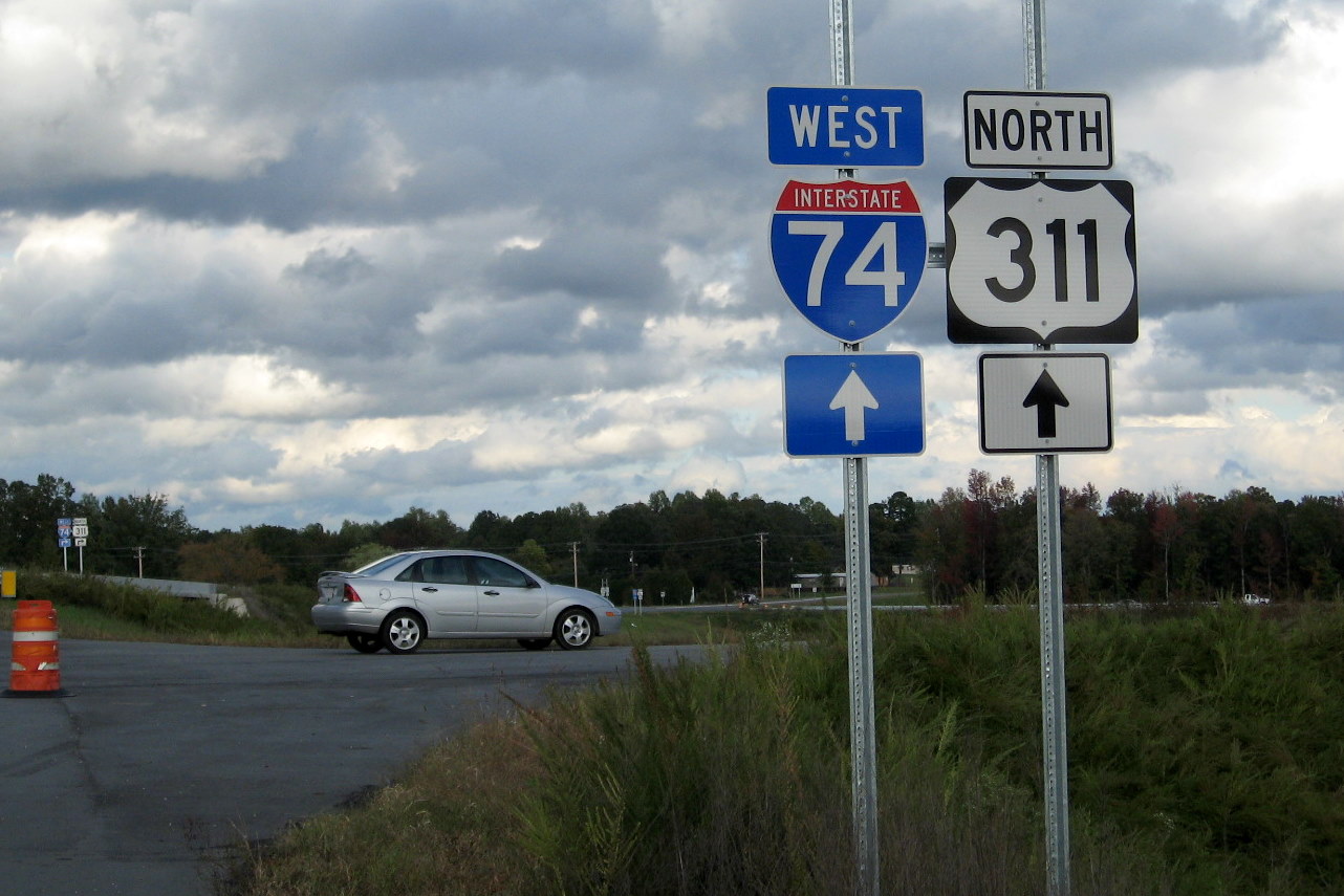 West I-74/North US
311 signs under blank poles at the future on-ramp to I-74 East heading
east on Cedar Square Road. (10/13/11)
West I-74/North US
311 signs under blank poles at the future on-ramp to I-74 East heading
east on Cedar Square Road. (10/13/11)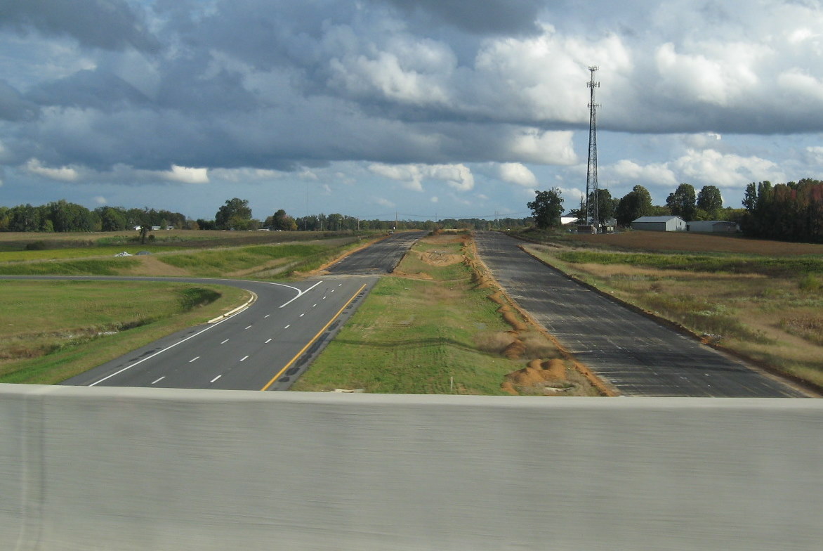 View
from the Cedar Square Rd bridge of the I-74 roadbed heading east toward
Spencer Road. This part of the freeway was paved under the contract for
the next section (10/13/11)
View
from the Cedar Square Rd bridge of the I-74 roadbed heading east toward
Spencer Road. This part of the freeway was paved under the contract for
the next section (10/13/11)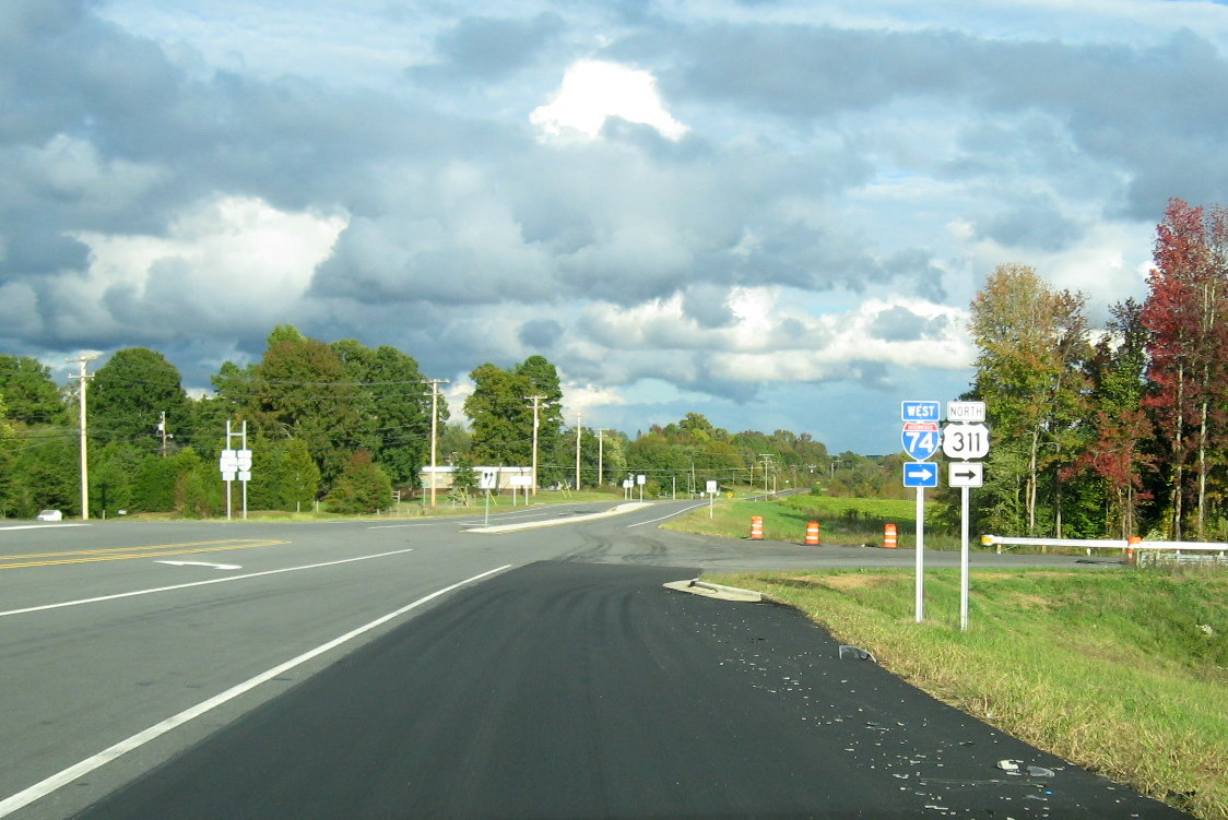 West I-74/North US 311
signage at the on-ramp, current beginning of I-74 West on Cedar Square
Road. (10/13/11)
West I-74/North US 311
signage at the on-ramp, current beginning of I-74 West on Cedar Square
Road. (10/13/11)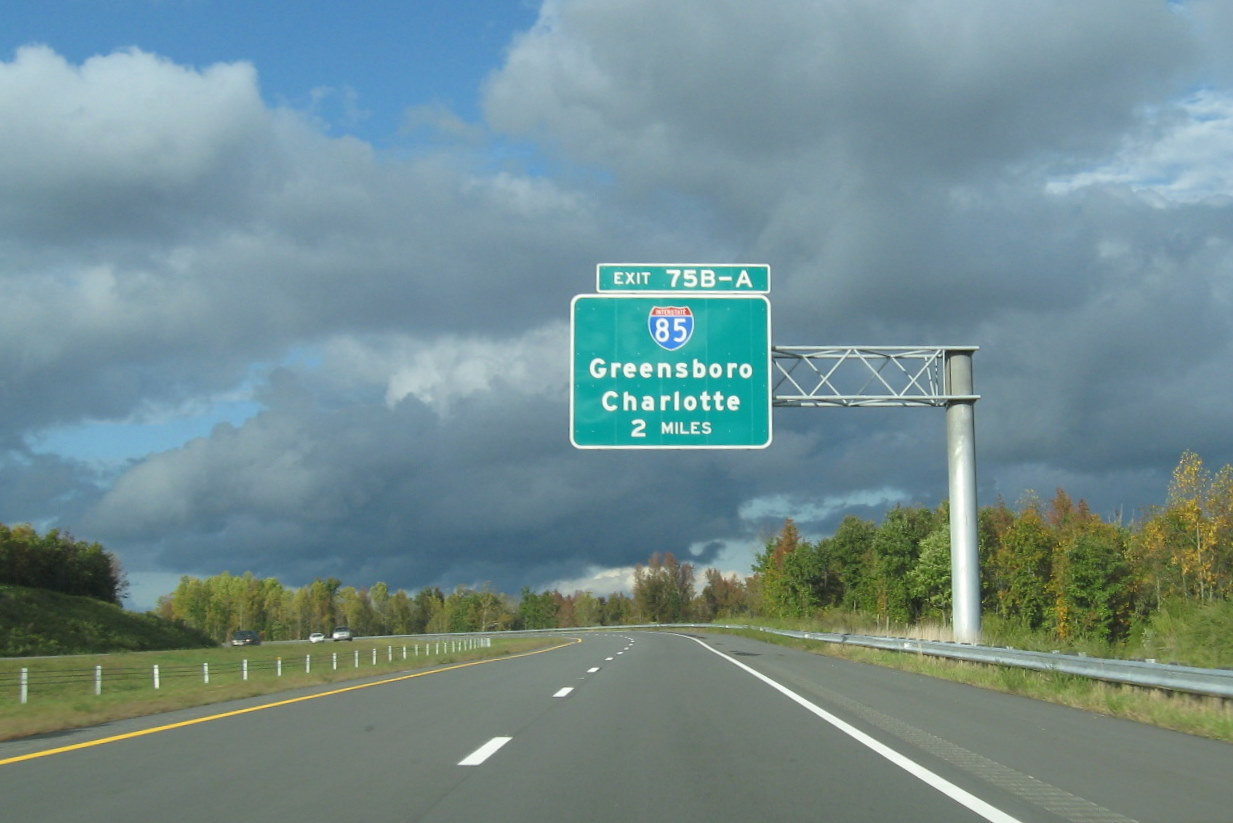 I-85 exit signage on I-74
West approaching the curve before the Tuttle Road bridge in October
2011. (10/13/11)
I-85 exit signage on I-74
West approaching the curve before the Tuttle Road bridge in October
2011. (10/13/11)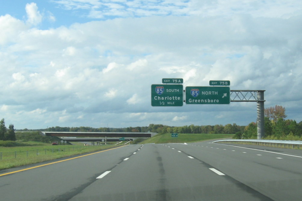 I-85 exit signage on I-74
West approaching the off-ramp to I-85 North. (10/13/11)
I-85 exit signage on I-74
West approaching the off-ramp to I-85 North. (10/13/11) I-74/US 311 exit signage
on I-85 South C/D ramp in the late afternoon in Oct. 2011. (10/13/11)
I-74/US 311 exit signage
on I-85 South C/D ramp in the late afternoon in Oct. 2011. (10/13/11) Here's
a photo of one of the exit signs for US 311 which leaves I-74 and ends
along its original alignment at US 220. (6/30/13)
Here's
a photo of one of the exit signs for US 311 which leaves I-74 and ends
along its original alignment at US 220. (6/30/13)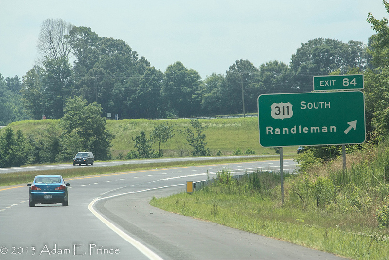 Here's
another photo 2 miles down the road at the exit itself. (6/30/13)
Here's
another photo 2 miles down the road at the exit itself. (6/30/13)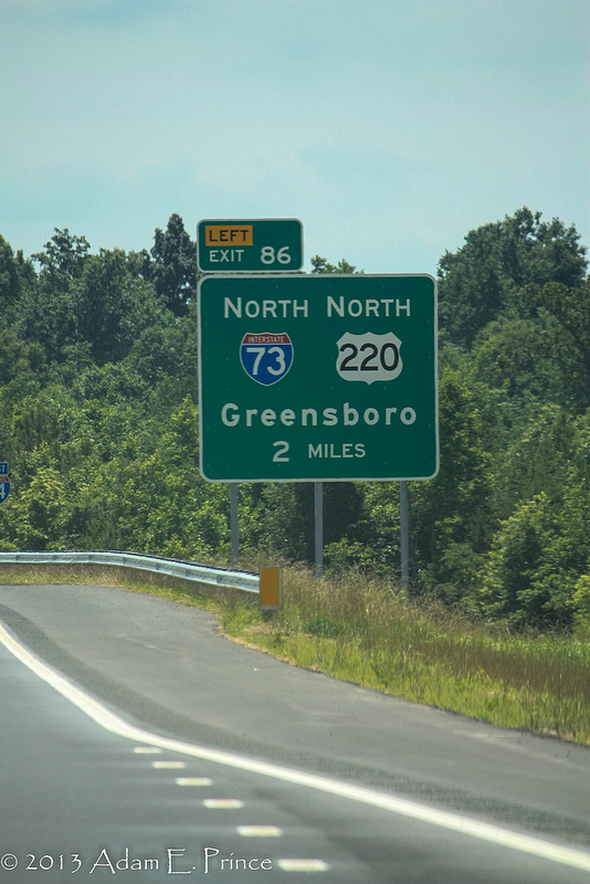 Here's the first sign on I-74 East for the
I-73/ US 220 freeway and the joining of I-73 and I-74 heading south toward
Asheboro. (6/30/13)
Here's the first sign on I-74 East for the
I-73/ US 220 freeway and the joining of I-73 and I-74 heading south toward
Asheboro. (6/30/13) 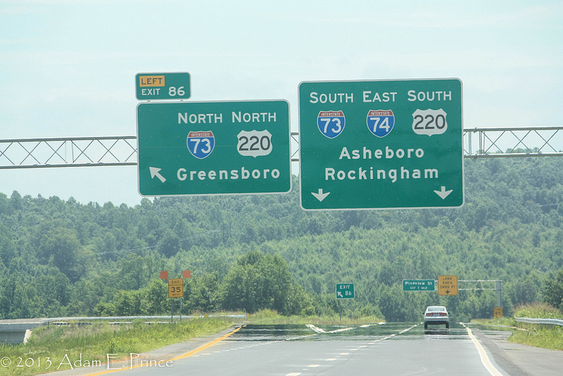 Here's
a photo of the I-73/US 220 interchange signs from the road itself
(6/30/13)
Here's
a photo of the I-73/US 220 interchange signs from the road itself
(6/30/13)
 This is
the warning sign along the ramp from I-74 East to I-73/US 220 North as
they approach the sharp curve ahead. (6/30/13)
This is
the warning sign along the ramp from I-74 East to I-73/US 220 North as
they approach the sharp curve ahead. (6/30/13)
 View looking east at Mile
Marker 82. Three miles east of Cedar Square Road, new pavement has
received line markings. (5/30/13)
View looking east at Mile
Marker 82. Three miles east of Cedar Square Road, new pavement has
received line markings. (5/30/13) View of 2 Mile advance
exit sign from US 311 South on I-74 East. It appears NCDOT wants to
encourage drivers heading to Randleman to exit here, and not go all the
way to US 220 (I-73) (the exit sign westbound does not include the city
name). (5/30/13)
View of 2 Mile advance
exit sign from US 311 South on I-74 East. It appears NCDOT wants to
encourage drivers heading to Randleman to exit here, and not go all the
way to US 220 (I-73) (the exit sign westbound does not include the city
name). (5/30/13)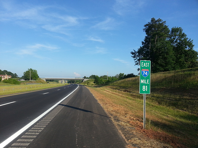 The view on I-74 East at
Mile Marker 81 approaching the Banner Whitehead Rd bridge. (5/30/13)
The view on I-74 East at
Mile Marker 81 approaching the Banner Whitehead Rd bridge. (5/30/13)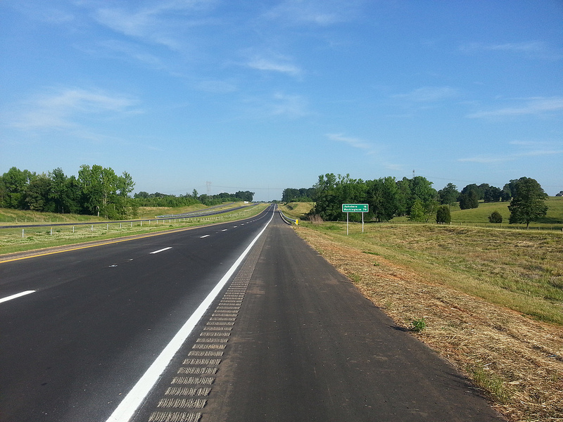 View of newly place
mileage sign on I-74 East beyond the Cedar Square Rd exit, the distance
to Asheboro is 16 miles. (5/30/13)
View of newly place
mileage sign on I-74 East beyond the Cedar Square Rd exit, the distance
to Asheboro is 16 miles. (5/30/13)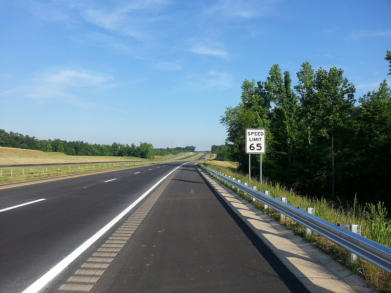 Another view eastbound
with sign confirming the speed limit on this section of I-74/US 311 is
65 MPH. (5/30/13)
Another view eastbound
with sign confirming the speed limit on this section of I-74/US 311 is
65 MPH. (5/30/13)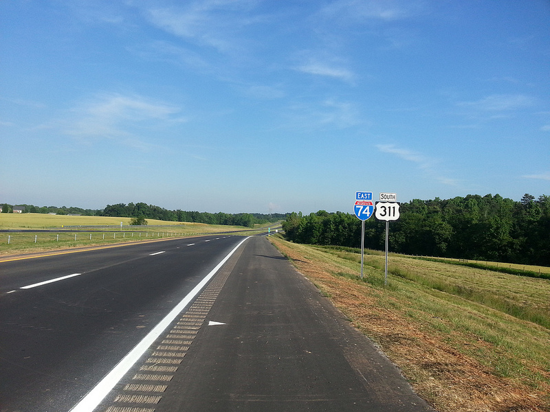 View of the newly placed
I-74 and US 311 reassurance markers just beyond the on-ramp from Cedar
Square Rd. (5/30/13)
View of the newly placed
I-74 and US 311 reassurance markers just beyond the on-ramp from Cedar
Square Rd. (5/30/13)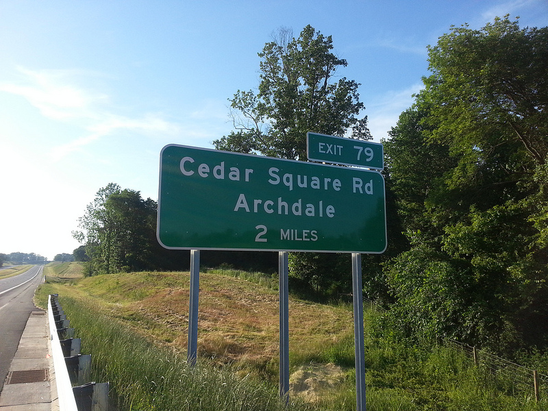 View westbound of the exit
sign for Cedar Square Road. The 'All Traffic Exit' attached to the Cedar
Square Rd exit sign on I-74 east had been removed. (5/30/13)
View westbound of the exit
sign for Cedar Square Road. The 'All Traffic Exit' attached to the Cedar
Square Rd exit sign on I-74 east had been removed. (5/30/13)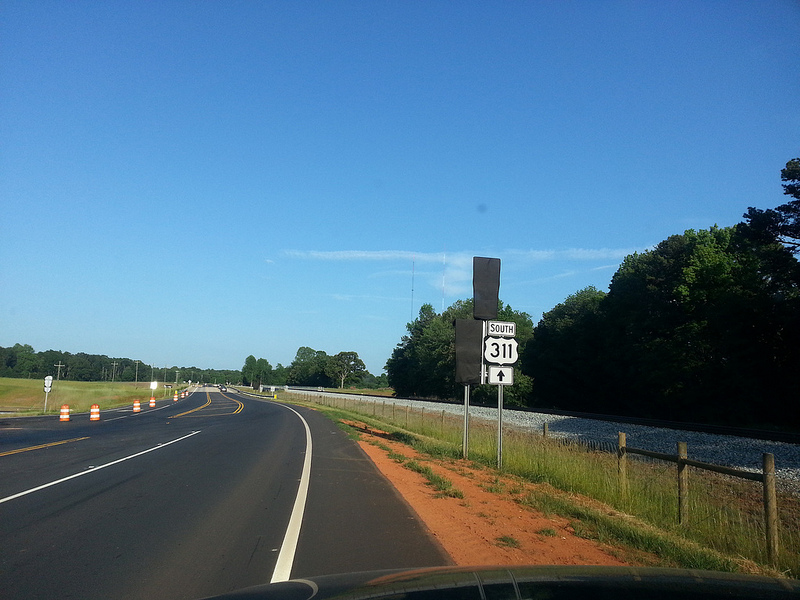 View looking
eastbound along current US 311 at the new interchange with I-74. The
signs indicating I-74 and US 311 North are still covered over, awaiting
opening of the highway. (5/31/13)
View looking
eastbound along current US 311 at the new interchange with I-74. The
signs indicating I-74 and US 311 North are still covered over, awaiting
opening of the highway. (5/31/13)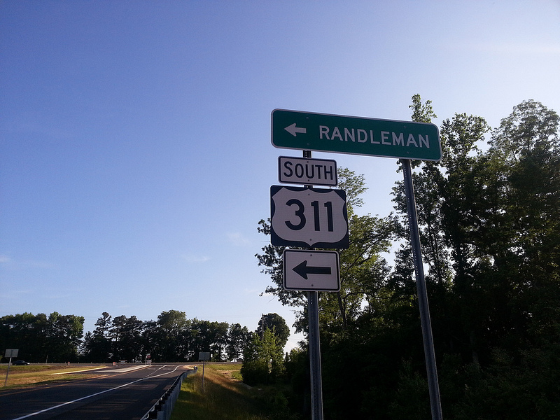 View from the end of
the eastbound I-74 off-ramp showing the sign directing traffic for US
311 to go left at the intersection. (5/31/13)
View from the end of
the eastbound I-74 off-ramp showing the sign directing traffic for US
311 to go left at the intersection. (5/31/13)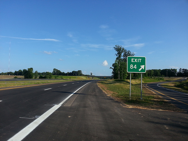 View eastbound at the exit
ramp for the US 311 exit. Notice the use of another 'wimpy' exit number
on the gore sign. (5/31/13)
View eastbound at the exit
ramp for the US 311 exit. Notice the use of another 'wimpy' exit number
on the gore sign. (5/31/13)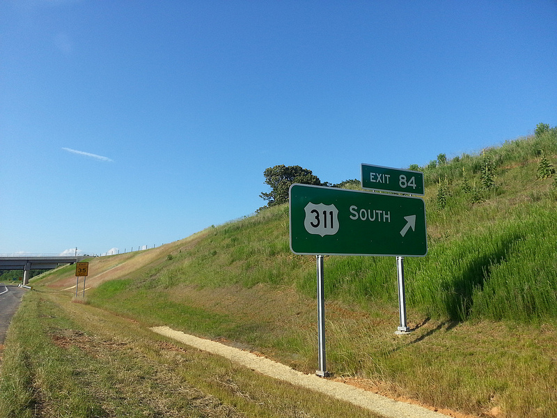 View westbound of the exit
sign for the US 311 exit. NCDOT apparently thinks traffic heading to
Randleman will stay on I-73 North, so no control city is used. (5/31/13)
View westbound of the exit
sign for the US 311 exit. NCDOT apparently thinks traffic heading to
Randleman will stay on I-73 North, so no control city is used. (5/31/13)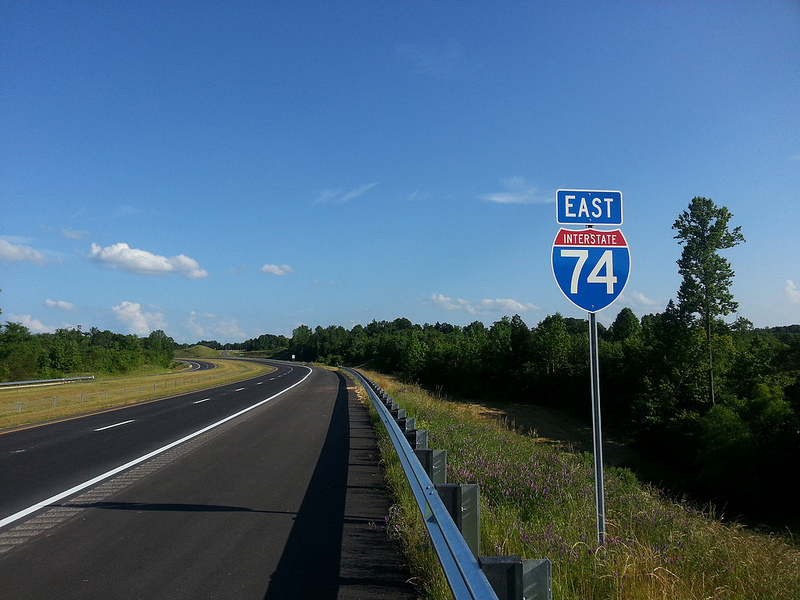 View eastbound of stand
alone I-74 East shield. This is the first section of I-74 since Mount
Airy that does not carry another route designation. (5/31/13)
View eastbound of stand
alone I-74 East shield. This is the first section of I-74 since Mount
Airy that does not carry another route designation. (5/31/13)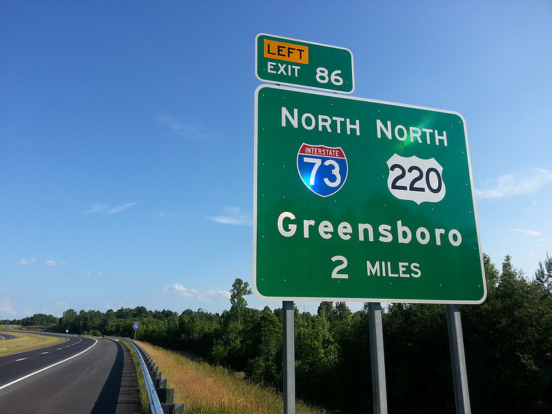 View eastbound of the
first exit sign for I-73/US 220. The sign is just after the US 311 exit,
with the sign for I-74 East beyond. (5/31/13)
View eastbound of the
first exit sign for I-73/US 220. The sign is just after the US 311 exit,
with the sign for I-74 East beyond. (5/31/13)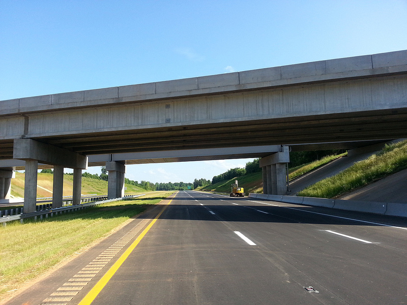 View eastbound
looking under the US 311 and adjacent railroad bridge at the US 311
interchange. (5/31/13)
View eastbound
looking under the US 311 and adjacent railroad bridge at the US 311
interchange. (5/31/13)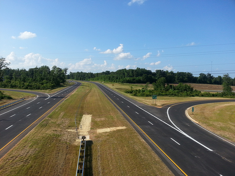 View west from US 311
bridge showing completed I-74 freeway and the interchange on and
off-ramps. (5/31/13)
View west from US 311
bridge showing completed I-74 freeway and the interchange on and
off-ramps. (5/31/13)