Segment 2
 |
Where: From I-77 Exit 101 to US 52 South of Mt. Airy, Surry CountyLength: 12 MilesStatus: COMPLETESigned as:
|
Segment 2|
|
Where: From I-77 Exit 101 to US 52 South of Mt. Airy, Surry CountyLength: 12 MilesStatus: COMPLETESigned as:
|
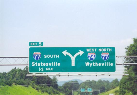
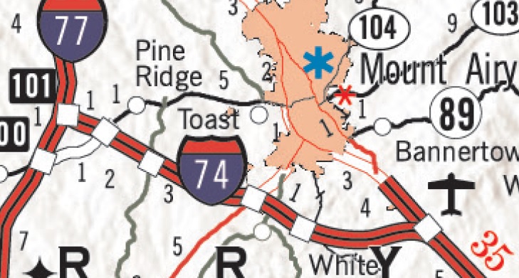
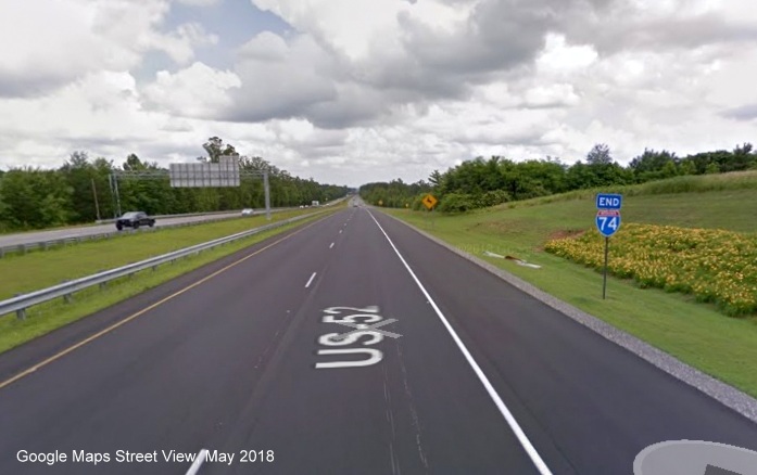
From I-77, I-74 travels by itself (one of now two portions of I-74 not signed with another route, the other a short stretch in Randolph County) to US 52. This segment was the second section of I-74 to be signed as a full Interstate. The entire route was fully opened to traffic on June 30, 1999. Work on this highway occurred in three segments starting in 1991. The first section from I-77 to NC 89, predates the I-74 designation, cost $10 million to build, and was signed as NC 752 when it opened in 1994. Work on the second section to extend the freeway to US 601 began in 1994 and cost $22.5 million. When this part of the highway was completed in 1998 the entire route was re-designated I-74. Travelers reaching the temporary eastern end at US 601 were directed back to US 52 South with, it turns out, very optimistic "To East Interstate 74" signs.1 The segment was completed with the construction of the remaining 5 miles from US 601 to US 52 at a cost of about $30 million.2 This segment was the first with exit numbers using I-74's mileage (numbers run from 5 to 17, see the I-74 Exit List for more information) until segments around High Point and later east of Rockingham got their own numbers. There is currently an end I-74 sign before merging with US 52 southbound (see last of the photos below). The only thing to have happened to this stretch of roadway since 1999 was a repaving job from I-77 to US 601 that was completed during the fall of 2007 and then in 2017-2018 and the replacing of exit signs for US 52 (see photos below).3
I-74 East, Exits 5 to 17 I-74 West, Exits 17 to 5
I-74 East at I-77: Approaching I-74 Off-Ramp from I-77 South (October 2024)
I-74 West from US 52: Using I-74 West Ramp from US 52 North (April 2024)
A Google Maps Street View image of the End I-74 sign in Mount Airy, from May 2018:
 Exit 6 (NC 89) signs
awaiting installation on I-74 East in early 1998 (photo courtesy of Adam
Prince)
Exit 6 (NC 89) signs
awaiting installation on I-74 East in early 1998 (photo courtesy of Adam
Prince)
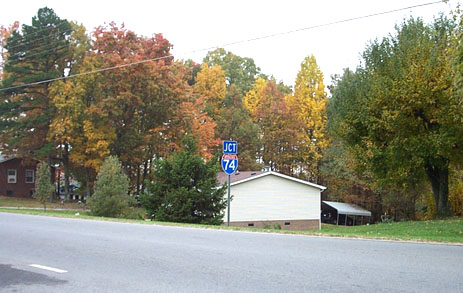
 Sign assembly at NC 86
interchange
Sign assembly at NC 86
interchange
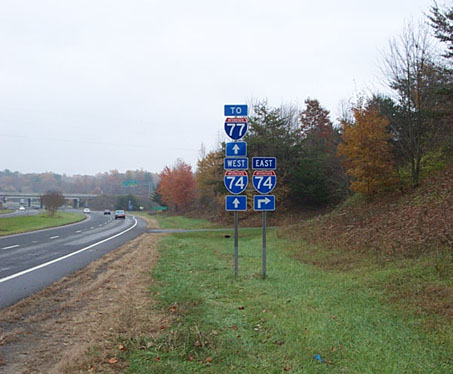
 Jct I-74 sign at Red Brush
Road interchange
Jct I-74 sign at Red Brush
Road interchange
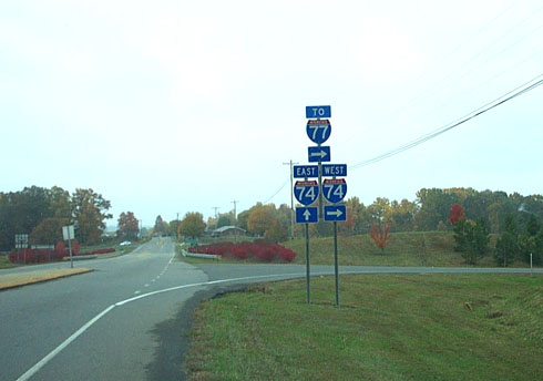 Sign assembly at Red Brush
Road West I-74 ramp
Sign assembly at Red Brush
Road West I-74 ramp
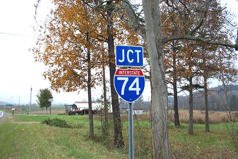 Jct I-74 sign at Park
Drive interchange
Jct I-74 sign at Park
Drive interchange
On I-74 East to mark (belatedly) the 10th anniversary of the highway's opening:
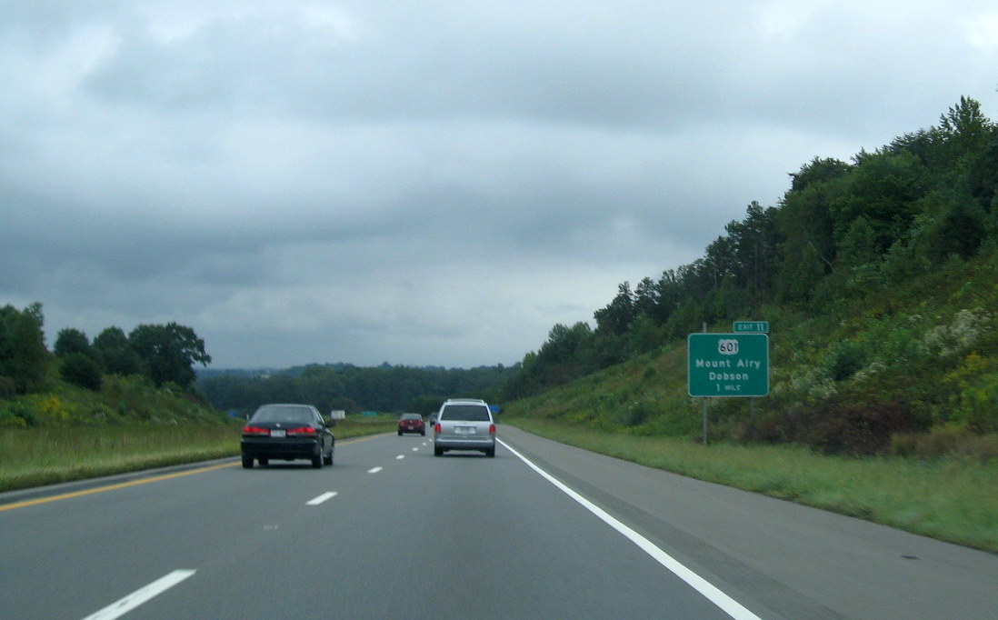
 Approaching the original
End of I-74 at US 601. (9/18/09)
Approaching the original
End of I-74 at US 601. (9/18/09)
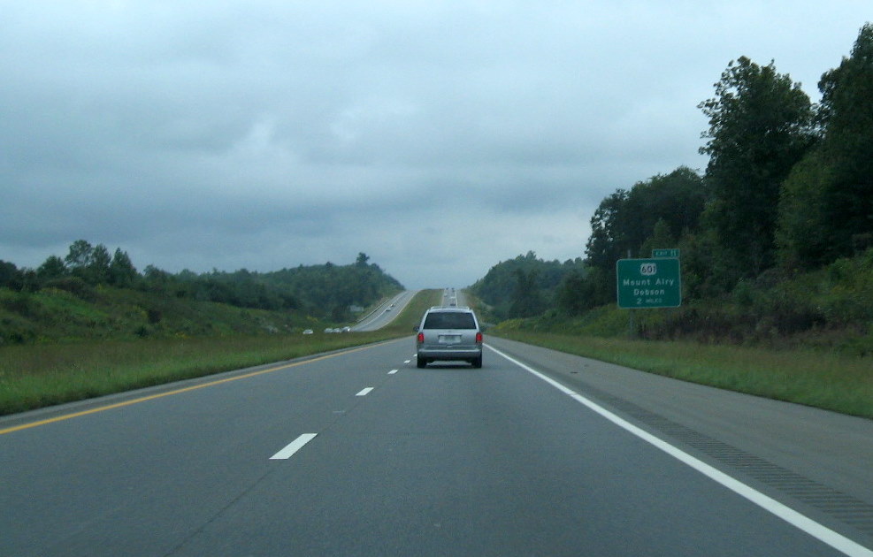
 The next Exit 11, US 601
sign. (9/18/09).
The next Exit 11, US 601
sign. (9/18/09).
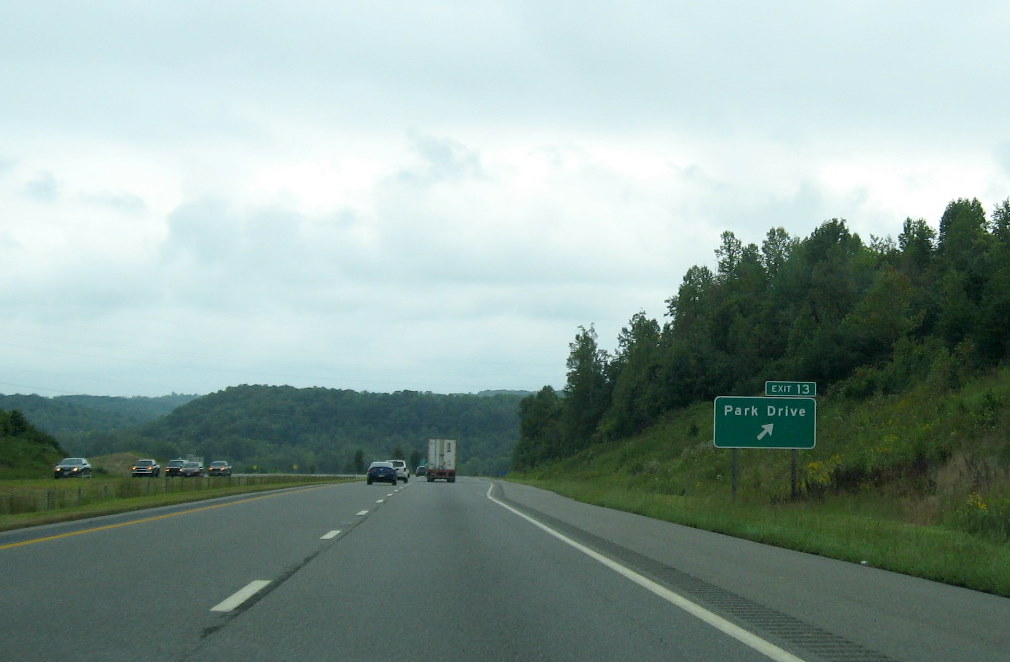 Now approaching Park
Drive, the next to last exit before reaching US 52. (9/18/09)
Now approaching Park
Drive, the next to last exit before reaching US 52. (9/18/09)
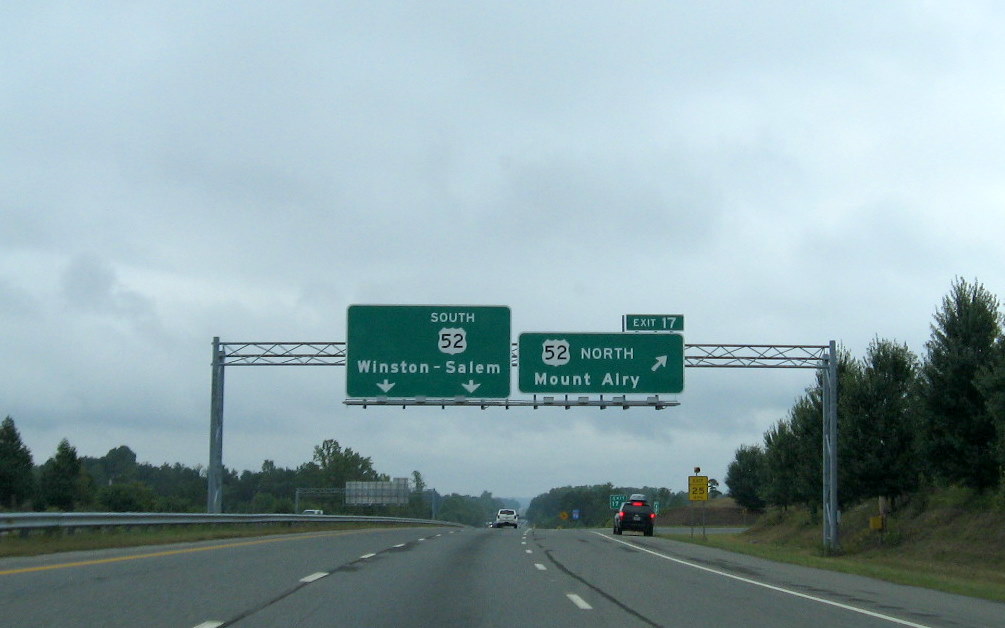
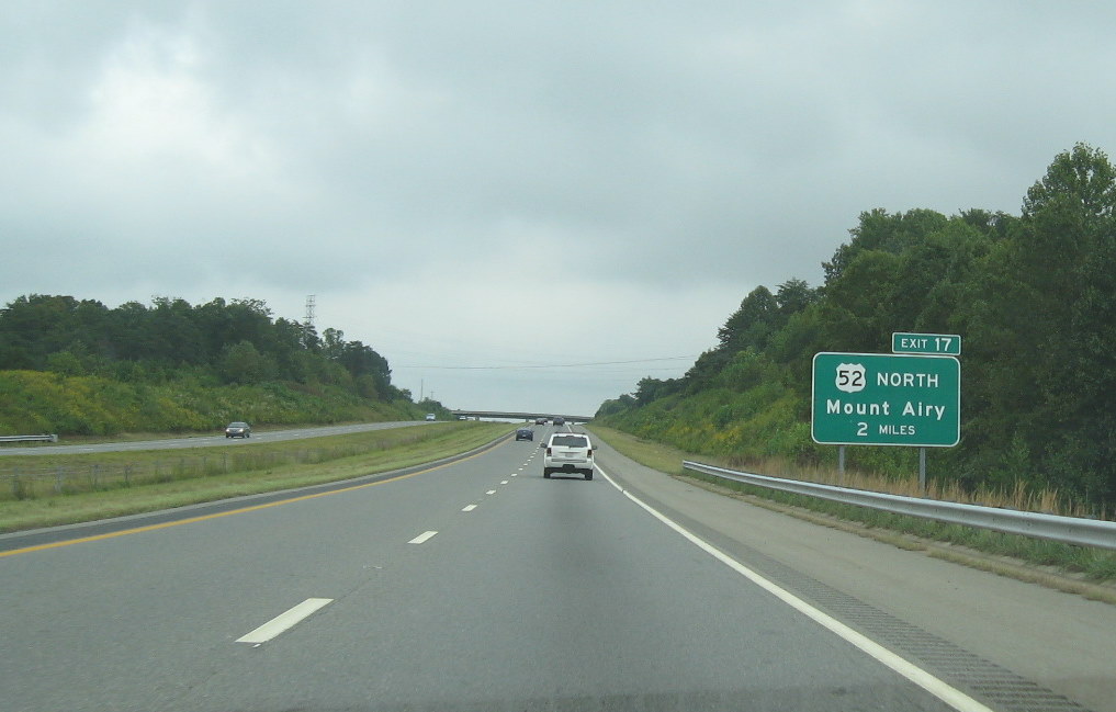 Approaching US 52. As with
most exit signs, the first one is 2 miles away. (9/18/09)
Approaching US 52. As with
most exit signs, the first one is 2 miles away. (9/18/09)
 The final exit sign
assembly for this section of I-74 put up in 1999, you can notice in the
distance an End I-74 sign (photo below). The gap in the overhead sign
reflected the unknown date at that time when I-74 would be signed along
US 52. (9/18/09)
The final exit sign
assembly for this section of I-74 put up in 1999, you can notice in the
distance an End I-74 sign (photo below). The gap in the overhead sign
reflected the unknown date at that time when I-74 would be signed along
US 52. (9/18/09)
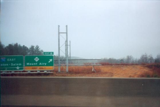
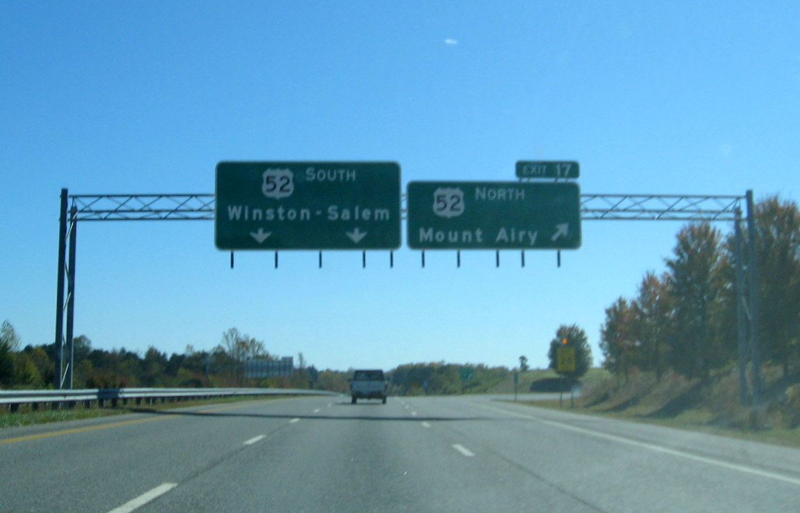 Same place as above. You
will notice, however, that this new sign put up during the Summer of
2010 dropped the space for I-74, a reaction to the delay in building the
Winston-Salem Beltway at that time? (see Segment 4). (10/24/10)
Same place as above. You
will notice, however, that this new sign put up during the Summer of
2010 dropped the space for I-74, a reaction to the delay in building the
Winston-Salem Beltway at that time? (see Segment 4). (10/24/10)
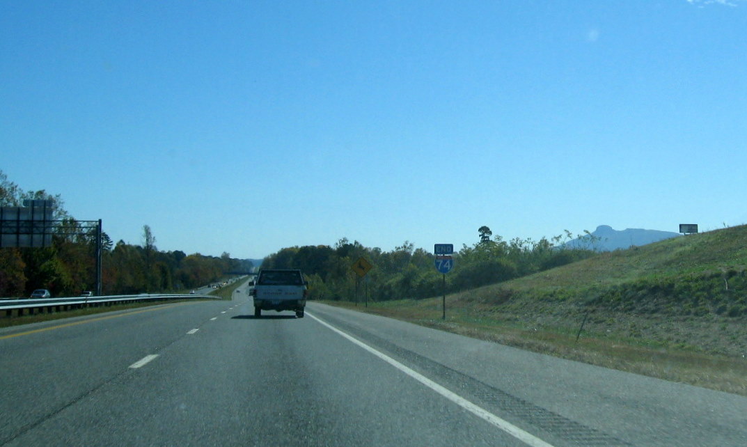 A closer view of the End
I-74 sign (10/24/10)
A closer view of the End
I-74 sign (10/24/10)